Condons And Clangibbon is a barony of County Cork, in the historical province of Munster (Irish: Condúnaigh agus Clann Ghiobúin), covering 318 km² of land. The barony records 555 NMS archaeological sites and 431 NIAH listed buildings, placing it at around the 45th percentile among 280 ROI baronies for sites per km². This means it is in the lower half of all baronies for sites per km². Dated archaeological evidence runs from the Mesolithic through to the Modern, spanning 9 of 9 archaeological periods, placing the barony in the 92nd percentile among 280 ROI baronies for chronological depth. This means it is in the top tenth of all baronies for chronological depth. The largest dated subset of recorded sites dates to the Early Medieval. Logainm flags 50 placenames in the barony as carrying a recognised heritage root; the largest share — around 70% — are names associated with early Christian church and monastic foundations.
Heritage at a glance
Percentile rankings throughout this profile compare each barony only against the other 279 Republic of Ireland baronies.
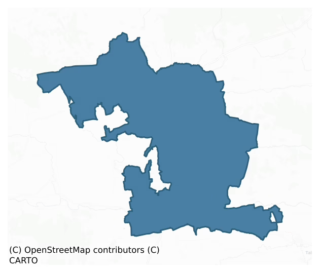
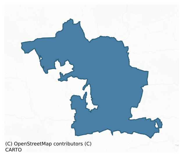
The recorded heritage of Condons And Clangibbon
The National Monuments Service Sites and Monuments Record (SMR) is the statutory inventory of archaeological sites for the Republic of Ireland, maintained by the Department of Tourism, Culture, Arts, Gaeltacht, Sport and Media. Sites recorded here include earthworks, ringforts, megalithic tombs, ecclesiastical remains, and post-medieval features; not every record is legally protected, but each is registered as a monument of archaeological interest.
The National Monuments Service records 555 archaeological sites in Condons And Clangibbon, putting it at the 45th percentile among 280 ROI baronies for sites per km². This means it is in the lower half of all baronies for sites per km². Of these, 496 (89%) fall within a recorded monument protection zone. The record is dominated by defensive sites — ringforts, enclosures, hillforts, and stone forts (181 sites, 33% of the total), with agricultural and prehistoric industrial sites forming a substantial secondary presence (94 sites, 17%). Ringfort – rath is the most prevalent type, making up 17% of the barony's recorded sites (95 records), broadly in line with the ROI average of 20% across all baronies where this type occurs. Ringfort – rath is an earthen ringfort enclosed by a bank and external ditch — the most common Early Medieval farmstead, broadly dated 500–1000 AD. Other significant types include Fulacht fia (89) and Enclosure (38). Fulacht fia is a horseshoe-shaped Bronze Age burnt mound built around a sunken trough beside a water source, traditionally interpreted as a cooking site; Enclosure is a banked or ditched feature of uncertain type, used as a catch-all where the original function cannot be determined from surface evidence. Across the barony's 318 km², this gives a recorded density of 1.75 sites per km².
Most common monument types
Hover or tap a monument type to see its definition.
| Type | Count |
|---|---|
| Ringfort – rath an earthen ringfort enclosed by a bank and external ditch — the most common Early Medieval farmstead, broadly dated 500–1000 AD | 95 |
| Fulacht fia a horseshoe-shaped Bronze Age burnt mound built around a sunken trough beside a water source, traditionally interpreted as a cooking site | 89 |
| Enclosure a banked or ditched feature of uncertain type, used as a catch-all where the original function cannot be determined from surface evidence | 38 |
| Church a building used for public Christian worship, of any date from c. 500 AD onwards | 29 |
| Graveyard a burial area associated with a church, in use from the medieval period onwards | 22 |
| Excavation – miscellaneous | 20 |
Chronological distribution
The dated archaeological record for Condons And Clangibbon spans from the Mesolithic through to the Modern, with activity attested across 9 of 9 archaeological periods. This places Condons And Clangibbon in the top 8% of ROI baronies for chronological depth — few baronies record evidence across as many distinct archaeological periods. Every period from earliest to latest is represented in the record — an unbroken sequence of dated activity across the full chronological span. Activity concentrates most heavily in the Early Medieval (99 sites, 26% of dated material), with the Iron Age forming a secondary peak (98 sites, 26%). A further 175 recorded sites (32% of the overall NMS register for the barony) carry no period attribution — appearing as 'Unknown' in the bar chart below. This typically reflects either records that pre-date the standardised period vocabulary or sites awaiting specialist dating review, rather than a genuine absence of chronological evidence.
Sample of recorded monuments
Show 25 sample monuments (of 555 total)
A representative sample of 25 recorded monuments drawn from the barony’s 555 total NMS entries. Sites within a recorded monument protection zone and rarer site types are prioritised so the list shows a meaningful cross-section rather than only the most common type. Each entry shows the official Sites and Monuments Record reference number and the description published by the National Monuments Service.
Mass-rock
In mountain scrubland, on steep S-facing slope on side of Carrigeenamronety (locally known as Quern Hill). Rectangular sandstone conglomerate slab (0.7m x 0.78m x 0.12m) propped upright by pile of support stones.…
In mountain scrubland, on steep S-facing slope on side of Carrigeenamronety (locally known as Quern Hill). Rectangular sandstone conglomerate slab (0.7m x 0.78m x 0.12m) propped upright by pile of support stones. Roughly shaped cross (shaft 0.38m; span 0.29m) carved in relief on S face. Known locally as mass rock.
The above description is derived from the published 'Archaeological Inventory of County Cork. Volume 4: North Cork' (Dublin: Stationery Office, 2000). In certain instances the entries have been revised and updated in the light of recent research.
Date of upload/revision: 14 January 2009
Cross
Formerly leaning upright in the SE corner of an early medieval church (CO010-003004). This small plain Latin cross is cut out of sandstone; the terminals are broken, the angles slightly curved. Described by Crawford…
Formerly leaning upright in the SE corner of an early medieval church (CO010-003004). This small plain Latin cross is cut out of sandstone; the terminals are broken, the angles slightly curved. Described by Crawford (1907, 204) as 'the upper part of a small plain Latin cross, 30 inches long'. According to Windele (Grove White 1905-25, vol. 1, 17), a 'brown stone cross' was resting on the covering stone of the Saint's Tomb, 'St Molaga's Bed' (CO010-003005-) in 1852, but had been 'injured and shortened' since an earlier visit. The cross was noted as present by the National Monuments and Historic Properties Service, Dúchas, in 1995, but reported missing by them in 1997.
The above description is derived from the published 'Archaeological Inventory of County Cork. Volume 4: North Cork' (Dublin: Stationery Office, 2000). In certain instances the entries have been revised and updated in the light of recent research.
Date of upload/revision: 14 January 2009
Cross-slab
In the centre of a graveyard (CO010-003002-), to the NE of an early-medieval church (CO010-003004-). This upright slab (H 1.7m; Wth 0.94m) bears a ringed cross in low relief on the W face, and a Latin cross, partially…
In the centre of a graveyard (CO010-003002-), to the NE of an early-medieval church (CO010-003004-). This upright slab (H 1.7m; Wth 0.94m) bears a ringed cross in low relief on the W face, and a Latin cross, partially inscribed and partially in relief, on the E face (Crawford 1912, 230). The ringed cross covers the full width of the slab, though there is a very short terminal outside the ring on the N side; the terminal at the top ends where the stone is broken off; the shaft (L 0.61m) extends below the present ground level. The width of the band forming the ring and cross shaft is c. 0.14m. The Latin cross on the E face (H 1.01m; Wth 0.8m; Wth of shaft c. 0.25m) is formed by the relatively crude hacking out of the angles of the cross to leave it in relief. The slab was re-set by the National Monuments Service in 1995. It was examined by Rose Cleary and its base excavated in 1995 (Cleary 2000, 40-1). She noted plough marks on the slab, suggesting that it was once recumbent in a nearby field. Cleary also noted that the Latin cross is similar to the cross incised on the back of a nearby gravestone, and concludes that it may be 'the result of 'folk art rather than an original early Christian period motif' (ibid.)
The above description is derived from the published 'Archaeological Inventory of County Cork. Volume 4: North Cork' (Dublin: Stationery Office, 2000). In certain instances the entries have been revised and updated in the light of recent research.
Date of uploa…
Urn burial
The location of two burials discovered in the townland of Labbamolaga East has been recently identified by local historian, Nioclàs Ó Duinnín. Discovered in 1948 during quarrying in a sand pit. Investigated by O'Kelly…
The location of two burials discovered in the townland of Labbamolaga East has been recently identified by local historian, Nioclàs Ó Duinnín. Discovered in 1948 during quarrying in a sand pit. Investigated by O'Kelly (1950, 15-20) who found pit cut into top W side of polygonal cist (CO010-00401-). Quarrying prior to investigation damaged simple bowl-shaped pit (diam. 2ft 6in; D 1ft 6in); this contained inverted Encrusted Urn (reconstructed H c. 16in) which originally covered cremated bones; these had been scattered and lost. Rim of urn rounded; internal bevel carries rows of short oblique incisions on narrow raised bands; externally ornamented with row of oblique strokes; remainder of external surface applied with lenticular bosses in staggered horizontal rows; a coarse ware, buff to red in colour (Kavanagh 1973, 537); Doody 1986, Cork No. 38; Waddell 1990, 61-2).
The above description is derived from the published 'Archaeological Inventory of County Cork. Volume 4: North Cork' (Dublin: Stationery Office, 2000). In certain instances the entries have been revised and updated in the light of recent research.
Compiled by: Denis Power
Revised by: Caimin O'Brien based on details provided by James O'Brien and Nioclàs Ó Duinnín
Date of revised upload: 22 February 2022
Mound
In pasture, on S-facing slope in NW quadrant of subcircular field. Grass-covered, circular mound (H 3m; diam. c. 24m) with two stones set on edge (Stone 1, H 0.6m; 0.5 x 0.53m: Stone 2, H 0.58m; 0.52m x 0.38m) on S…
In pasture, on S-facing slope in NW quadrant of subcircular field. Grass-covered, circular mound (H 3m; diam. c. 24m) with two stones set on edge (Stone 1, H 0.6m; 0.5 x 0.53m: Stone 2, H 0.58m; 0.52m x 0.38m) on S side. Bounded to N and E by disused roadways and to W by track.
The above description is derived from the published 'Archaeological Inventory of County Cork. Volume 4: North Cork' (Dublin: Stationery Office, 2000). In certain instances the entries have been revised and updated in the light of recent research.
Date of upload/revision: 14 January 2009
Flat cemetery
On gravel ridge, on E bank of Funshion River. Discovered in 1949 during gravel quarrying operations. Probable total of seventeen graves found, of which six investigated by Fahy (1954, 42-49, listed as graves A to F).…
On gravel ridge, on E bank of Funshion River. Discovered in 1949 during gravel quarrying operations. Probable total of seventeen graves found, of which six investigated by Fahy (1954, 42-49, listed as graves A to F).
Grave A: rectangular cist (0.88m x 0.39m; D 0.57m; long axis E-W); sandstone side slabs supporting capstone of limestone; contained disturbed cremation of young adult, probably female, mingled with 16 bronze rivets. Grave B: undisturbed polygonal cist (0.87m x 0.6m; D 0.5m; long axis N-S); packstones used atop side slabs to take limestone capstone; cremated bones of two children, 4 and 8-10 years of age, heaped on limestone basal slab. Two large boulders placed over capstone. Grave C: rectangular cist (0.95m x 0.52m; D 0.55m; long axis E-W); capstone and E sidestone removed; remaining sides and base made of sandstone slabs. Contained crouched inhumation of robust adult male, 25-50 years of age; one sherd of Food Vessel survived disturbance. Grave D: largely destroyed short cist; covering slab survived; also quantity of undiagnostic cremated bone. Grave E: pit burial (D 2.4m; diam. 2.4m) containing inhumation of tall adult male covered with boulders; rest of pit back-filled with gravel; skeleton accompanied by bronze dagger. Grave F: oval pit (0.85m x 0.55m; D 0.55m; long axis N-S) containing cremated bones of child, 2-7 years of age, deposited at deeper S end of pit; inverted Food Vessel Bowl at N end. Bowl described as tripartite, decorated with plain ribs…
Designed landscape – tree-ring
The Archaeological Survey of Ireland (ASI) is in the process of providing information on all monuments on The Historic Environment Viewer (HEV). Currently the information for this record has not been uploaded. To…
The Archaeological Survey of Ireland (ASI) is in the process of providing information on all monuments on The Historic Environment Viewer (HEV). Currently the information for this record has not been uploaded. To access available information for research purposes please make an appointment in advance with the Archive Unit (open Fridays 10.00 am – 5.00 pm), Department of Culture, Heritage and the Gaeltacht, The Custom House, Dublin 1 D01W6XO or email nmarchive@chg.gov.ie.
Hut site
In pasture overlooking Gradoge River to NW; quarry adjacent to SW. No visible surface trace of site. Described by OS (O Nualláin 1984, 46) as 'a double circle of small stones, almost flush with the ground, which may…
In pasture overlooking Gradoge River to NW; quarry adjacent to SW. No visible surface trace of site. Described by OS (O Nualláin 1984, 46) as 'a double circle of small stones, almost flush with the ground, which may mark the base of a hut.' Inspected by OPW in 1961 who concluded that hut 'does not appear to be ancient'; landowner given permission to demolish in 1961.
The above description is derived from the published 'Archaeological Inventory of County Cork. Volume 4: North Cork' (Dublin: Stationery Office, 2000). In certain instances the entries have been revised and updated in the light of recent research.
Date of upload/revision: 14 January 2009
Icehouse
In pasture, built into gentle N-facing slope, c. 800m W of Mitchelstown Castle (14317). Indicated on 1842 OS 6-inch map c. 200m W of lake. Circular brick-lined chamber (diam. c. 6-8m) covered by brick-domed roof (H c.…
In pasture, built into gentle N-facing slope, c. 800m W of Mitchelstown Castle (14317). Indicated on 1842 OS 6-inch map c. 200m W of lake. Circular brick-lined chamber (diam. c. 6-8m) covered by brick-domed roof (H c. 2m). Chamber sunken into ground (D c. 3.5m) with side walls tapering to base which is infilled with rubble. Curved brick vaulted passage (L c. 5m) at SW side, door ope at SW end. Circular chamber covered externally by grass-covered earthen mound (H c. 7m); buttress exposed on NW side, brickwork of dome exposed to WSW. Built probably around 1780 (B. Power, Avondhu 22/1/98).
The above description is derived from the published 'Archaeological Inventory of County Cork. Volume 4: North Cork' (Dublin: Stationery Office, 2000). In certain instances the entries have been revised and updated in the light of recent research.
Date of upload/revision: 14 January 2009
Round tower
Within SW quadrant of graveyard (14549). No visible surface trace of tower 'which stood 30 yards from the S.W. angle of the church, and fell, in the memory of several people' (Smith 1750, vol. 1, 346). According to…
Within SW quadrant of graveyard (14549). No visible surface trace of tower 'which stood 30 yards from the S.W. angle of the church, and fell, in the memory of several people' (Smith 1750, vol. 1, 346). According to Moore (1889, 225), 'this tower appears to have remained intact until the year 1720, when a violent storm overthrew the greater portion of it, leaving only a fragment 15 feet in height standing'. In 1807 base of tower, then reduced to ground level, removed to furnish stones for building of nearby glebe house (since demolished) (Brady 1863, 70). Tower seen to be resting on square foundation, at one corner of which was fragment of large stone, inscribed with three rows of letters: 'letters H, U, and O could be distinguished. A letter shaped like P was repeated more than once, as also C or G' (ibid.).
Moore (1889, 225) suggests that stones from round tower were 'built into the south-west angle of the wall surrounding the ruin and burial-ground, and are placed very near the ancient site of the tower…judging both by their shape and colour…they are twelve in number'. External SW corner of graveyard (14549) is rounded, built of large squared well-coursed stones of sandstone. Brigown described as having an ecclesiastical tower and a church when attacked and plundered by Norsemen in the year 839 (ibid., 222). The Crichad an Chaoille (Power 1932, 31, 52) mentions that Brigown had its own 'aistre', a minor ecclesiastical officer responsible for bell-ringing. (Barrow 19…
Hilltop enclosure
Within larger hilltop enclosure (CO019-09703-), enclosing top of hill and Caherdrinny Castle (CO019-09702-). Circular area (c. 62.5m N-S; c. 61.8m E-W) enclosed by low collapsing stone wall (int. H 0.25m-1.25m; ext. H…
Within larger hilltop enclosure (CO019-09703-), enclosing top of hill and Caherdrinny Castle (CO019-09702-). Circular area (c. 62.5m N-S; c. 61.8m E-W) enclosed by low collapsing stone wall (int. H 0.25m-1.25m; ext. H 0.5m – 2.55m). Wall is very ruinous N->S with some indications of structures built into it to NE and E; line of large sandstone blocks retains external wall face S->SSW; foundations of overgrown structure against outer wall face to NW. Entrance (Wth 2m) to S. Interior uneven with ruinous remains of radial walls running from inner wall face to castle; low foundations of rectangular building (max. H 0.5m; int. dims. 9.8m E-W, 3.85m N-S; wall Wth 0.9m) just inside wall in NW quadrant. Ruinous remains of radial walls run externally from outer wall face. Windele (Grove White 1905-25, vol. 3, 144), c. 1852 called it a 'Cahir' and noted wall '15 ft thick and 8 ft high' with exterior 'in tolerable condition…interior face much fallen in wherever it retains its perpendicularity.' He examined it for 'those flights of steps or stairs found in the Kerry Cahirs' but found none. Enclosure probably reused as bawn for tower house at centre; some of internal features may be contemporary with tower house.
The above description is derived from the published 'Archaeological Inventory of County Cork. Volume 4: North Cork' (Dublin: Stationery Office, 2000). In certain instances the entries have been revised and updated in the light of recent research.
Date of upload/revisio…
Almshouse
In Mitchelstown, enclosing N half of King's Square. Matching L-shaped 2-storey ranges, over basements, either side of C of I chapel. Each range 20-bays long (E-W) with 10-bay return (N-S). Random-rubble limestone…
In Mitchelstown, enclosing N half of King's Square. Matching L-shaped 2-storey ranges, over basements, either side of C of I chapel. Each range 20-bays long (E-W) with 10-bay return (N-S). Random-rubble limestone construction with brick-dressed sash windows and round-headed door opes; ashlar limestone arches carry steps up to front doors. Units at end of each range project slightly forward and are slightly higher than remainder with hipped roof. Wide arch ope in centre of N ranges with ashlar limestone surround and pediment supported by large console brackets; archways blocked and converted into apartments in 1880s when complex subdivided to make 31 units (B. Power, Avondhu, 9th Jan. 1997). Numerous hipped, 2-storey projections on rear elevations. Range of one-storey outhouses and garden plots to rear. C of I chapel in centre has rectangular nave (N-S) with chancel added to N; 3-storey tower with gabled roof and pediment to S; originally a porch stood on S side with cupola, but removed in late 18th century and replaced with tower for bell and clock (ibid.).
Complex built with funds made available in will of James, 4th Baron of Kingston (died 1764), to house poor elderly Protestants, mainly tenants from Mitchelstown estate (14918). Designed by John Morrison as terrace of 22 houses with chapel in centre; in 1770 project continued by Oliver Grace who added two additional end-houses; college opened1777 (Power 1996, 21). South half of square formed by similar L-shaped 2-storey…
Anomalous stone group
Group of nine boulders (0.5m – 0.7m max. dimensions) in area 3m x 2m, forming no apparent arrangement. OS records (1930) describe it as seven flat stones forming a circle. May be natural feature. According to Power…
Group of nine boulders (0.5m – 0.7m max. dimensions) in area 3m x 2m, forming no apparent arrangement. OS records (1930) describe it as seven flat stones forming a circle. May be natural feature. According to Power (1932, 82), '15 feet in diameter. At present the circle consists of seven stones which project about two feet above the surface'. (OS Memoranda A/63/16; O Nualláin 1984a, 46)
The above description is derived from the published 'Archaeological Inventory of County Cork. Volume 4: North Cork' (Dublin: Stationery Office, 2000). In certain instances the entries have been revised and updated in the light of recent research.
Date of upload/revision: 14 January 2009
Burial
Two inhumed burials laid side by side in a single grave and remains of a third were found under two gardens and adjoining road during road widening (UCC). Occupants of houses have found human remains in their gardens in…
Two inhumed burials laid side by side in a single grave and remains of a third were found under two gardens and adjoining road during road widening (UCC). Occupants of houses have found human remains in their gardens in the past. No further information available.
The above description is derived from the published 'Archaeological Inventory of County Cork. Volume 4: North Cork' (Dublin: Stationery Office, 2000). In certain instances the entries have been revised and updated in the light of recent research.
Date of upload/revision: 14 January 2009
Cliff-edge fort
In pasture, on edge of bluff above and on W side of stream, c. 100m to W of Araglin River. Depicted as hachured circular enclosure on 1842 OS 6-inch map; as hachured penannular enclosure, abutting straight fence to E on…
In pasture, on edge of bluff above and on W side of stream, c. 100m to W of Araglin River. Depicted as hachured circular enclosure on 1842 OS 6-inch map; as hachured penannular enclosure, abutting straight fence to E on 1905 and 1934 OS 6-inch maps. Roughly circular raised area (32m NNE-SSW; 30m NW-SE tocliff edge) defined by overgrown earthen bank (int. H 1.9m; ext. H 2.3m) to SSW->NNE; cliff forms edge to ESE. Bank highest to NW, decreasing in height approaching terminals at cliff edge. Shallow external fosse to NNE. Interior slopes down to SE and is used for grazing. Ballyderown Castle (CO028-016—) in view to SW.
The above description is derived from the published 'Archaeological Inventory of County Cork. Volume 4: North Cork' (Dublin: Stationery Office, 2000). In certain instances the entries have been revised and updated in the light of recent research.
Date of upload/revision: 14 January 2009
Castle – Anglo-Norman masonry castle
In level pasture, at base of steep S-facing slope. Rectangular area (c. 34.5m N-S; c. 36m E-W) enclosed by ivy-covered curtain walls (T 1.6m; H c. 4m). Remains of rectangular corner tower (int. 4m E-W) at SW corner, of…
In level pasture, at base of steep S-facing slope. Rectangular area (c. 34.5m N-S; c. 36m E-W) enclosed by ivy-covered curtain walls (T 1.6m; H c. 4m). Remains of rectangular corner tower (int. 4m E-W) at SW corner, of which only W wall (L 7.5m) and S wall (L c. 7m) now stand; connection of these to curtain walls collapsed, but walls of tower project in front of curtain walls c. 0.75m on W side and c. 2m on S side (see plan in Cotter 1994, 109).
In W wall of tower, at ground-floor level, is remains of double-splayed slit window. At same level, S wall of tower has pair of pointed-arch recesses (H 1.5m; Wth c.1.6m) containing small chambers with metal and wood doors, said locally to have been bee-boles; corresponding rebuilding on exterior wall-face indicates these were originally slit windows. South wall also has blocked ope at 1st-floor level, almost completely obscured by ivy.
Surviving sections of S curtain wall (L c. 22m) featureless; SE corner missing. Only features noted on W curtain wall are two lintelled windows in square-set arched embrasures set close together, close to NW corner. Near W end of N curtain wall is a square-set arched embrasure with window seats but missing its light. Mid-way along N wall, breach (Wth c. 4m) may have been entrance; traces of ingoing survives on W side. To E of this gap traces of covering arch probably remains of window embrasure. Further E is window of which only W ingoing survives. At E end of N wall is 2-bay shallow arcading on…
Building
Two ranges of abandoned farm buildings and residence, on S side of Kilworth hills. Indicated on 1842 OS 6-inch map as two ranges of buildings, on N and S side of yard, and named 'nursery'. Random-rubble sandstone…
Two ranges of abandoned farm buildings and residence, on S side of Kilworth hills. Indicated on 1842 OS 6-inch map as two ranges of buildings, on N and S side of yard, and named 'nursery'. Random-rubble sandstone construction with ashlar detail. Two-storey N range (long axis E-W), has central projecting 3-storey 2-bay block with wide ground floor arches, upper storeys weatherslated. Residential house at W end of N range with ornate weatherslating on W gable, inscribed with date "1834". Two-storey S range (long axis E-W) has series of fine sandstone arches; first floor arched opes on S side are at external ground level. Yard to S enclosed by walls, divided into two. Yard between N and S ranges enclosed by walls on E and W side, tall arched entrance in roadside wall to W. According to local information, it was 'home farm' for Cooke-Collis of Castle Cooke (see 14345, 14867), c. 1.5km to NW, using special modern farming techniques including S range cow byre where cattle could be fed from 1st-floor level.
The above description is derived from the published 'Archaeological Inventory of County Cork. Volume 4: North Cork' (Dublin: Stationery Office, 2000). In certain instances the entries have been revised and updated in the light of recent research.
Date of upload/revision: 14 January 2009
Sheela-na-gig
In the external face of the S wall of an outbuilding, c. 10m S of Castle Hyde (CO035-015—-). Discovered in 2002 when plaster was being removed from the outbuilding prior to demolition and redevelopment. A stone…
In the external face of the S wall of an outbuilding, c. 10m S of Castle Hyde (CO035-015—-). Discovered in 2002 when plaster was being removed from the outbuilding prior to demolition and redevelopment. A stone displaying the lower portion of a sheela-na-gig had been reused as a quoin in an inverted position close to the top of the outbuilding. The legs and lower abdomen of a figure, with the arms around the legs in a typical sheela-na-gig pose, were visible. The figure, which is surrounded by a raised frame, is carved in low relief. It is probable that the sheela-na-gig came from the ruins of a tower house (CO035-015—-). (Purcell 2002; pers. comm. Avril Purcell)
The above description is derived from 'The Archaeological Inventory of County Cork. Volume 5' (Dublin: Stationery Office, 2009).
Date of upload: 22 December 2009
Barrow – mound barrow
On bluff, on N bank of River Blackwater, within gardens of Ileclash House. Circular mound (diam. 42m; H 4.6m) with flat top; steps ascend to top on E and W sides; sides inaccessible due to heavy ornamental planting.…
On bluff, on N bank of River Blackwater, within gardens of Ileclash House. Circular mound (diam. 42m; H 4.6m) with flat top; steps ascend to top on E and W sides; sides inaccessible due to heavy ornamental planting. Hachured as stepped circular mound on 1905 OS 6-inch map.
The above description is derived from the published 'Archaeological Inventory of County Cork. Volume 4: North Cork' (Dublin: Stationery Office, 2000). In certain instances the entries have been revised and updated in the light of recent research.
Date of upload/revision: 14 January 2009
Religious house – Cistercian monks
On S bank of Blackwater River, within present town of Fermoy. Cistercian monastery located, according to Abbott (1928, 16), on S bank of Blackwater River 'west of the bridge'. Locally believed to have stood between…
On S bank of Blackwater River, within present town of Fermoy. Cistercian monastery located, according to Abbott (1928, 16), on S bank of Blackwater River 'west of the bridge'. Locally believed to have stood between Pearse Square and Abbey Street. No visible surface trace survives. Founded in 1170 by Donal Mor O'Brien (Stalley 1987, 244); in 1227 was the principal instigator in the Mellifont conspiracy (Gwynn and Hadcock 1988, 132). Dissolved in 1539-41, 'when most of its landed possessions were said to be waste' (Stalley ibid.). Later used as a parish church, when described as 'a mean Gothic building' (ibid.) Finally demolished in 1804 and materials used to construct present town; pointed stone arch incorporated into property boundary on N side of McCurtain Street, may be part of abbey (Lennon 1987, 1); font, thought to be from abbey, now in Fermoy C of I church (14704). (Zajac et al. 1995, 38)
The above description is derived from the published 'Archaeological Inventory of County Cork. Volume 4: North Cork' (Dublin: Stationery Office, 2000). In certain instances the entries have been revised and updated in the light of recent research.
Date of upload/revision: 14 January 2009
Boundary stone
On N side of Fermoy-Mallow road, set into wall. Stone (0.4m x 0.15m; H 1.1m) inscribed 'BOUNDARY BETWEEN THE BARONIES OF FERMOY AND CONDONS TOWNLAND OF CLOUGH PARISH OF LITTER'. Stone stands in barony of Condons and…
On N side of Fermoy-Mallow road, set into wall. Stone (0.4m x 0.15m; H 1.1m) inscribed 'BOUNDARY BETWEEN THE BARONIES OF FERMOY AND CONDONS TOWNLAND OF CLOUGH PARISH OF LITTER'. Stone stands in barony of Condons and Clangibbon c. 500m E of barony boundary; Fermoy barony to W; Litter parish is in Fermoy barony, E edge defined by barony boundary; no townland named Clough on OS 6-inch maps. This may, therefore, not be original location of stone.
The above description is derived from the published 'Archaeological Inventory of County Cork. Volume 4: North Cork' (Dublin: Stationery Office, 2000). In certain instances the entries have been revised and updated in the light of recent research.
Date of upload/revision: 14 January 2009
Prehistoric site – lithic scatter
On N side of Blackwater River. Identified during field-study project (1983-5). Open scatter of late-prehistoric flint (pers. comm. Prof. P.C. Woodman).
The above description is derived from the published…
On N side of Blackwater River. Identified during field-study project (1983-5). Open scatter of late-prehistoric flint (pers. comm. Prof. P.C. Woodman).
The above description is derived from the published 'Archaeological Inventory of County Cork. Volume 4: North Cork' (Dublin: Stationery Office, 2000). In certain instances the entries have been revised and updated in the light of recent research.
Date of upload/revision: 14 January 2009
Hospital
In Fermoy. Indicated on 1842 and 1902 OS 6-inch maps as T-shaped building, named 'Military Hospital', within 'Ordnance Ground', c. 200m NNW of military barracks (15197). Another building named 'Fever Ward' also shown…
In Fermoy. Indicated on 1842 and 1902 OS 6-inch maps as T-shaped building, named 'Military Hospital', within 'Ordnance Ground', c. 200m NNW of military barracks (15197). Another building named 'Fever Ward' also shown within grounds to NE on 1902 OS 6-inch map. None of these structures survives, but high enclosing stone-built walls does, with two entrances, flanked by tall piers, on W side; both flanked by 'ordnance stone'.
The above description is derived from the published 'Archaeological Inventory of County Cork. Volume 4: North Cork' (Dublin: Stationery Office, 2000). In certain instances the entries have been revised and updated in the light of recent research.
Date of upload/revision: 14 January 2009
Fish-pond
The Archaeological Survey of Ireland (ASI) is in the process of providing information on all monuments on The Historic Environment Viewer (HEV). Currently the information for this record has not been uploaded. To…
The Archaeological Survey of Ireland (ASI) is in the process of providing information on all monuments on The Historic Environment Viewer (HEV). Currently the information for this record has not been uploaded. To access available information for research purposes please make an appointment in advance with the Archive Unit (open Fridays 10.00 am – 5.00 pm), Department of Culture, Heritage and the Gaeltacht, The Custom House, Dublin 1 D01W6XO or email nmarchive@chg.gov.ie.
Ringfort – rath
In pasture, on break in S-facing slope. Roughly circular area (35m E-W; 32m N-S) enclosed by earthen bank (int. H 1.4m), with external fosse (D 0.5m) W->ENE. Bank stone faced, both internally and externally, similar to…
In pasture, on break in S-facing slope. Roughly circular area (35m E-W; 32m N-S) enclosed by earthen bank (int. H 1.4m), with external fosse (D 0.5m) W->ENE. Bank stone faced, both internally and externally, similar to surrounding field fences. Break in bank to NE blocked by stone wall.
The above description is derived from the published 'Archaeological Inventory of County Cork. Volume 4: North Cork' (Dublin: Stationery Office, 2000). In certain instances the entries have been revised and updated in the light of recent research.
Date of upload/revision: 14 January 2009
Listed buildings
The National Inventory of Architectural Heritage (NIAH) is a state survey appraising buildings of architectural, historical, archaeological, artistic, cultural, scientific, social, or technical interest. Each surveyed structure receives a rating from International (the highest, for buildings of European importance) through National, Regional, Local, and Record-Only.
The National Inventory of Architectural Heritage records 431 listed buildings in Condons And Clangibbon, placing it in the top 7% of ROI baronies for listed-building density. The highest-graded structures include 2 of National significance. The Republic holds 937 National-graded buildings in total, so this barony accounts for around 0% of the national total. Construction dates concentrate most heavily in the Victorian (1830-1900) period. The most-recorded building type is house (229 examples, 53% of the listed stock).
Terrain and environment
Mean elevation across the barony is 121m — the 74th percentile among 280 ROI baronies for elevation. This means it is in the top third of all baronies for elevation. This is a relatively elevated landscape by ROI standards. Elevation matters for heritage because higher-altitude baronies typically favour defensive monuments — ringforts and hilltop forts placed on prominent ground — while lowland baronies are more likely to carry the dense settlement and church networks of intensive agricultural landscapes. The barony reaches 351m at its highest point — a vertical span of more than 230m within its boundary, indicating significant topographic diversity. Mean slope is 4.5° — the 68th percentile among 280 ROI baronies for slope. This means it is in the top third of all baronies for slope. Slope is a key control on both land use and archaeological preservation: steep ground resists ploughing and tends to preserve earthworks intact, while gentle slopes favour intensive cultivation that damages or destroys surface archaeology over time. The Topographic Wetness Index averages 10.3, the 29th percentile among 280 ROI baronies for wetness. This means it is in the bottom third of all baronies for wetness. Drainage matters for heritage because poorly-drained ground preserves organic archaeology (wooden trackways, leather, textiles, and on rare occasions human remains) far better than free-draining soil; well-drained ground favours arable use but destroys organic material rapidly. The land cover is dominated by improved grassland (77%) and woodland (17%).
Terrain measurements
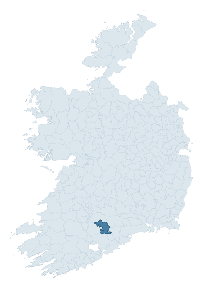
Where this barony sits in the Republic of Ireland
Geology and preservation
Bedrock geology shapes the landscape long before any settlement begins — controlling soil drainage, agricultural potential, the survival of upstanding monuments, and the preservation of buried archaeology. The figures below come from the Geological Survey Ireland 1:100,000 bedrock map.
The bedrock underlying Condons And Clangibbon is predominantly sandstone (41% of the barony by area), laid down during the Devonian period (58% by area, around 419 to 359 million years ago). Sandstone weathers to free-draining, moderately fertile soils that supported Early Medieval ringfort agriculture and later manorial estates. The rock itself is a major source of building stone — visible in churches, tower houses, and farm buildings across the barony's historic landscape. A substantial secondary geology of limestone (38%) adds further variety to the underlying landscape. The single largest mapped unit is the Knockmealdown Sandstone Formation (27% of the barony's bedrock). With 8 distinct rock types mapped, the barony sits in the top third of ROI baronies for geological diversity (79th percentile) — typically a sign of complex tectonic history or coastal mosaics of differing rock units.
Rock type composition
Largest mapped unit: Knockmealdown Sandstone Formation (27% of the barony)
Placename evidence
Logainm records 50 heritage-diagnostic placenames for Condons And Clangibbon, drawn from townland and civil-parish names across the barony. The dominant stratum is Early Christian ecclesiastical — cill-, teampall-, and domhnach-prefixed names that record the dense network of early church foundations established between the fifth and tenth centuries. The leading diagnostic roots are cill- (29 — church), dún- (4 — hilltop fort or promontory fort), and leaba- (4 — megalithic tomb). This is above the ROI average of 30.7 heritage placenames per barony. The presence of multiple heritage strata side by side indicates layered occupation of the landscape across successive prehistoric and historic periods. Logainm records 224 placenames for Condons And Clangibbon (predominantly townland names). Of these, 50 (22%) carry one of the diagnostic Gaelic roots tracked above; the remainder draw on more generic landscape vocabulary that does not encode a heritage period.
Pre-Christian / Early Medieval Defensive
| Root | Count | Meaning |
|---|---|---|
| dún- | 4 | hilltop or promontory fort |
| lios- | 2 | ringfort or enclosure |
| ráth- | 1 | earthen ringfort |
| caiseal- | 1 | stone ringfort |
| cathair- | 1 | stone fort |
Early Christian Ecclesiastical
| Root | Count | Meaning |
|---|---|---|
| cill- | 29 | church (early) |
| mainistir- | 2 | monastery |
| gráinseach- | 2 | monastic farm / grange |
| teampall- | 1 | church (later medieval) |
| cillín- | 1 | unconsecrated burial ground |
Burial, Ritual, and Norse-Contact
| Root | Count | Meaning |
|---|---|---|
| leaba- | 4 | megalithic tomb |
| sián- | 1 | fairy mound |
| uaimh- | 1 | cave / souterrain |
Other baronies in Cork
- Ibane And Barryroe
- Muskerry West
- Bantry
- Kerrycurrihy
- Kinalea
- Imokilly
- Carbery West (east Division)
- Fermoy
- Owney And Arra — Tipperary
- Eliogarty — Tipperary
See all 280 baronies in the Republic of Ireland Heritage Tool.

Explore further
Grounding History: 10 Maps of Northern Ireland’s Past
If you’re interested in Irish heritage more widely, the companion report for Northern Ireland brings together the analysis of all 462 NI wards into one place through 10 high-quality maps — covering monument density, archaeological periods, placename heritage, terrain, wetland, and the historic landscape at first survey. Take a look.
About this profile
Click any section below to expand.
What is a barony?
A barony is a historic administrative unit in Ireland, broadly equivalent to an English hundred. The 280 baronies used here are from the OSi 2019 National Statutory Boundaries (generalised 20m), covering the 26 counties of the Republic of Ireland. Baronies derive from the Norman period, were formalised in the 17th century, and have not been redrawn for statistical purposes. They vary enormously in area, from compact urban baronies in Dublin to vast upland baronies in Connacht, and should not be compared by raw site count without accounting for area differences.
What counts as a site?
This profile combines three distinct heritage registers, each with its own definition of what constitutes a recordable site:
- Archaeological sites (NMS). The National Monuments Service Sites and Monuments Record (SMR) catalogues every known archaeological monument or site of archaeological interest in the Republic, from prehistoric burial mounds and ringforts to medieval churches and post-medieval defensive works. Inclusion does not require legal protection — only that the site has been identified, surveyed, and assessed as having archaeological value. A separate subset of these sites lies within a recorded protection zone, which gives them statutory protection under the National Monuments Acts.
- Listed buildings (NIAH). The National Inventory of Architectural Heritage records buildings of architectural, historical, archaeological, artistic, cultural, scientific, social, or technical interest. Each surveyed structure is appraised on a five-tier scale: International, National, Regional, Local, and Record-Only. The NIAH appraisal is informational rather than strictly statutory, but it underpins local-authority Record of Protected Structures (RPS) listings.
- Heritage placenames (Logainm). Logainm is the authoritative database of Irish placenames maintained by the Placenames Branch. This profile applies a heritage-diagnostic classifier to the Irish-language form of each townland name, flagging roots that signal defensive sites (ráth-, lios-, dún-, caiseal-, cathair-), ecclesiastical foundations (cill-, teampall-, domhnach-, mainistir-), prehistoric burial-ritual features (tuaim-, carn-, leaba-), or Norse-contact settlement (gall-). Townlands without one of these diagnostic roots are not flagged here — they may still carry historical significance, but that significance is not encoded in the name itself.
Editorial principles
The narrative sections of this profile follow several explicit principles:
- Evidential. Every claim about this barony’s heritage character is anchored in the underlying register data. Where a site count, a placename count, or a percentile rank is cited, it is computed from the source datasets at export time, not estimated.
- Comparative. Counts and metrics are reported alongside their percentile rank against the other 279 ROI baronies. A barony with 50 ringforts in absolute terms could be unusually high or unusually low depending on its size and regional context; percentile ranking removes that ambiguity.
- Transparent on limits. Where a register has known coverage gaps, survey biases, or data-quality issues that affect this barony’s figures, the profile flags them rather than presenting the numbers as definitive.
- No interpretation beyond what the data supports. The narrative does not speculate about historical events, social dynamics, or cultural meaning beyond what the recorded heritage and placename evidence directly attests.
Data caveats and limits
- NMS Sites and Monuments Record is the product of survey campaigns conducted at different intensities across different counties and decades. Some baronies have been surveyed more thoroughly than others, and absolute counts should be read in that light. Sites destroyed by development before survey are typically not represented; sites in heavily forested or upland terrain are sometimes under-recorded.
- NIAH coverage is broadly complete for the Republic of Ireland but the survey was conducted on a rolling county-by-county basis, and the most recent appraisal date varies. Buildings demolished or substantially altered after their original survey may still appear in the register; conversely, recent buildings of merit may not yet have been appraised.
- Logainm classification applies a deliberately conservative pattern-matching approach to the Irish-language townland forms. The classifier prioritises true positives over recall: a townland may carry a heritage signal that the classifier doesn’t recognise, particularly where the diagnostic root has been heavily anglicised or where the townland name draws on a less common term. The 60,000+ townland records and ~9,800 classified placenames give a substantial signal at barony scale, but individual townland names should be checked against Logainm directly for definitive interpretation.
- Period attribution. The chronological distribution reflects only those NMS sites that carry a recognised period attribution in the source data. Sites listed as “Unknown” period are excluded from the dated subset.
- Boundary changes. Some baronies have undergone minor boundary adjustments since their 19th-century definition; the OSi 2019 generalised boundaries used here are the current statutory definition and may differ slightly from historical maps in border areas.
- Bedrock geology is mapped at 1:100,000 scale, which means local variation within a barony — small pockets of different rock type, mineral veins, alluvium overlying bedrock — is generalised. The dominant-system and rocktype figures are area-weighted, so a barony reading “70% Carboniferous limestone” may still contain small but archaeologically important pockets of older or younger rock. Around 3% of GSI polygons do not match the lexicon and contribute no rocktype or system attribution.
Data sources
- National Monuments Service — Sites and Monuments Record (SMR) https://data.gov.ie/dataset/national-monuments-service-archaeological-survey-of-ireland
- National Inventory of Architectural Heritage (NIAH) https://data.gov.ie/dataset/national-inventory-of-architectural-heritage-niah-national-dataset
- Logainm — Placenames Database of Ireland https://www.logainm.ie/
- Ordnance Survey Ireland — National Statutory Barony Boundaries 2019 https://data-osi.opendata.arcgis.com/
- EURODEM — European Digital Elevation Model https://www.mapsforeurope.org/datasets/euro-dem
- ESA WorldCover https://esa-worldcover.org/en
- Geological Survey Ireland — 1:100,000 Bedrock Geology https://www.gsi.ie/en-ie/data-and-maps/Pages/Bedrock.aspx
Explore more: Search any of the 280 ROI baronies, browse by historical province, or read the methodology and data sources for the full Republic of Ireland Heritage Tool.