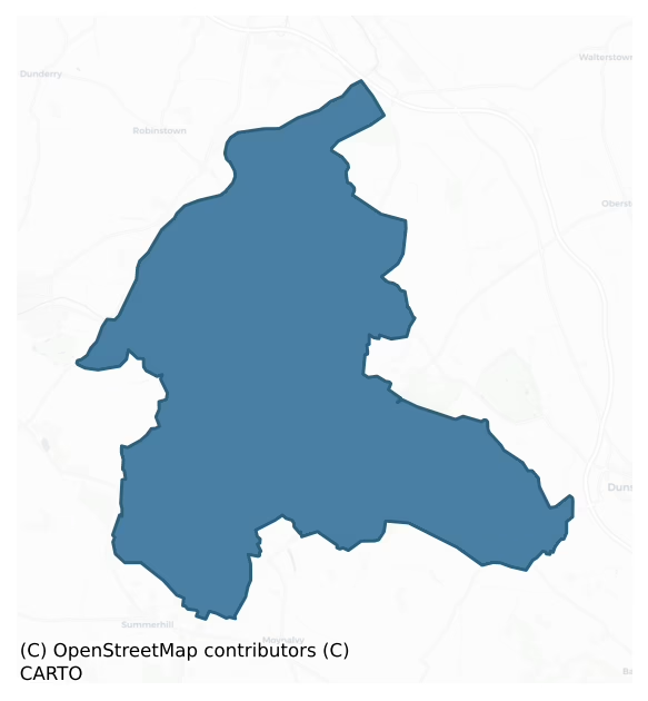
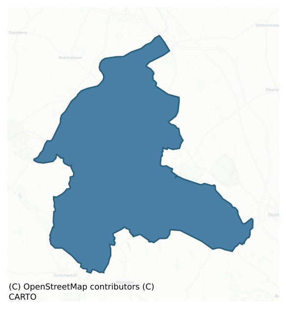
Deece Lower is a barony of County Meath, in the historical province of Leinster (Irish: Déise Íochtarach), covering 81 km² of land. The barony records 140 NMS archaeological sites and 24 NIAH listed buildings, placing it at around the 44th percentile among 280 ROI baronies for sites per km². This means it is in the lower half of all baronies for sites per km². Dated archaeological evidence runs from the Neolithic through to the Post Medieval, spanning 7 of 9 archaeological periods, placing the barony in the 29th percentile among 280 ROI baronies for chronological depth. This means it is in the bottom third of all baronies for chronological depth. The largest dated subset of recorded sites dates to the Iron Age.
Heritage at a glance
Percentile rankings throughout this profile compare each barony only against the other 279 Republic of Ireland baronies.
The recorded heritage of Deece Lower
The National Monuments Service Sites and Monuments Record (SMR) is the statutory inventory of archaeological sites for the Republic of Ireland, maintained by the Department of Tourism, Culture, Arts, Gaeltacht, Sport and Media. Sites recorded here include earthworks, ringforts, megalithic tombs, ecclesiastical remains, and post-medieval features; not every record is legally protected, but each is registered as a monument of archaeological interest.
The National Monuments Service records 140 archaeological sites in Deece Lower, putting it at the 44th percentile among 280 ROI baronies for sites per km². This means it is in the lower half of all baronies for sites per km². Protection coverage is near-universal — 126 sites (90%) fall within a recorded monument protection zone, indicating an extensively surveyed landscape. The record is dominated by defensive sites — ringforts, enclosures, hillforts, and stone forts (47 sites, 34% of the total), with burial and ritual monuments forming a substantial secondary presence (27 sites, 19%). Ring-ditch is the most prevalent type, making up 13% of the barony's recorded sites (18 records) — well above the ROI average of 6% across all baronies where this type occurs. Ring-ditch is a circular ditch under 20m across, often the ploughed-out remains of a barrow, ring-barrow or roundhouse. Other significant types include Ringfort – rath (16) and Enclosure (15). Ringfort – rath is an earthen ringfort enclosed by a bank and external ditch — the most common Early Medieval farmstead, broadly dated 500–1000 AD; Enclosure is a banked or ditched feature of uncertain type, used as a catch-all where the original function cannot be determined from surface evidence. Across the barony's 81 km², this gives a recorded density of 1.72 sites per km².
Most common monument types
Hover or tap a monument type to see its definition.
| Type | Count |
|---|---|
| Ring-ditch a circular ditch under 20m across, often the ploughed-out remains of a barrow, ring-barrow or roundhouse | 18 |
| Ringfort – rath an earthen ringfort enclosed by a bank and external ditch — the most common Early Medieval farmstead, broadly dated 500–1000 AD | 16 |
| Enclosure a banked or ditched feature of uncertain type, used as a catch-all where the original function cannot be determined from surface evidence | 15 |
| Church a building used for public Christian worship, of any date from c. 500 AD onwards | 9 |
| Fulacht fia a horseshoe-shaped Bronze Age burnt mound built around a sunken trough beside a water source, traditionally interpreted as a cooking site | 9 |
| Graveyard a burial area associated with a church, in use from the medieval period onwards | 9 |
| Field system a group of related fields forming a coherent agricultural landscape, of any date from the Neolithic onwards | 5 |
| Earthwork an unclassified earthen structure with no diagnostic features that allow a more specific classification | 5 |
Chronological distribution
The dated archaeological record for Deece Lower spans from the Neolithic through to the Post Medieval, with activity attested across 7 of 9 archaeological periods. Every period from earliest to latest is represented in the record — an unbroken sequence of dated activity across the full chronological span. Activity concentrates most heavily in the Iron Age (34 sites, 36% of dated material), with the Middle Late Bronze Age forming a secondary peak (18 sites, 19%). A further 46 recorded sites (33% of the overall NMS register for the barony) carry no period attribution — appearing as 'Unknown' in the bar chart below. This typically reflects either records that pre-date the standardised period vocabulary or sites awaiting specialist dating review, rather than a genuine absence of chronological evidence.
Sample of recorded monuments
Show 25 sample monuments (of 140 total)
A representative sample of 25 recorded monuments drawn from the barony’s 140 total NMS entries. Sites within a recorded monument protection zone and rarer site types are prioritised so the list shows a meaningful cross-section rather than only the most common type. Each entry shows the official Sites and Monuments Record reference number and the description published by the National Monuments Service.
Ceremonial enclosure
Located on top of a prominent hill. This is a large circular and slightly domed area (diam. c. 110m NW-SE; c. 105m NE-SW; H c. 1m) defined by an earthen bank (at SSE: Wth of base 13m; Wth of top 3.8m; int. H 1.3m)…
Located on top of a prominent hill. This is a large circular and slightly domed area (diam. c. 110m NW-SE; c. 105m NE-SW; H c. 1m) defined by an earthen bank (at SSE: Wth of base 13m; Wth of top 3.8m; int. H 1.3m) separated by a fosse (at SSE: Wth of top 10.5m; Wth of base 2m; ext. D 1m) from an outer bank (at SSE: Wth of base 5.3m; Wth of top 2m; ext. H 0.9m) which has an external facing of stones in places. There is a ditch or drain (Wth c. 2m; D 0.3m) inside the inner bank SE-S, and entrances through the inner bank at NE (Wth of base 2.75m) and SE (Wth of base 1.5m). There is also a gap (Wth of base 5m) at SE and gaps at NW (Wth of base 3m) and NNW (Wth of base 3m). The interior is planted with coniferous trees and there are deciduous trees on the outer bank. It is described as a defended enclosure or hillfort (Newman 1997, 198). Archaeological testing (18E0743) by D. Gallagher of an area (max. dims c. 160m WNW-ESE; c. 160m NNE-SSW) c. 50m to the W at the closest point produced no related material (excavations.ie 2019:691).
The above description is derived from the published 'Archaeological Inventory of County Meath' (Dublin: Stationery Office, 1987). In certain instances the entries have been revised and updated in the light of recent research.
Compiled by: Michael Moore
Date of revision: 21 August 2019
Amended: 5 February 2021
This monument is subject to a preservation order made under the National Monuments Acts 1930 to 2014 (PO no. 31/1976).
Barrow – unclassified
Located on a rise at the NW foot of Tullaghmedan Hill. It is depicted as a partially quarried mound described as ‘Croghan Crin’ in gothic script on the 1836 edition of the OS 6-inch map and as a gravel pit on the 1912…
Located on a rise at the NW foot of Tullaghmedan Hill. It is depicted as a partially quarried mound described as ‘Croghan Crin’ in gothic script on the 1836 edition of the OS 6-inch map and as a gravel pit on the 1912 edition. It was described in the mid-nineteenth century (Searake 1850) as an earthen mound ‘about twenty yards in diameter at the base (c. 7m) and raised above the level of the adjoining land about twelve feet (c. 3.6m) and was known as ‘Croghan Erin’. What appears to have been a slab-lined burial covered with a single large slab was in the body of the mound ‘seven feet (c. 2m) above the level of the base’. The inhumation was recorded as being in an upright position and an iron spearhead was recovered from it. In a pit beneath the inhumation with an urn and bronze sword ‘eighteen inches long (c. 0.45m)’ were unearthed. The artefacts were donated to the museum of the Royal Irish Academy. A disused sandpit was at the location in 1969 (SMR file).
The above description is derived from the published 'Archaeological Inventory of County Meath' (Dublin: Stationery Office, 1987). In certain instances the entries have been revised and updated in the light of recent research.
Compiled by: Michael Moore
Date of revision: 21 August 2019
Stone head
Two stone heads that had adorned St John’s holy Well (ME037-028001-) area still preserved at the location, set into the ground.
The above description is derived from the published 'Archaeological Inventory of County…
Two stone heads that had adorned St John’s holy Well (ME037-028001-) area still preserved at the location, set into the ground.
The above description is derived from the published 'Archaeological Inventory of County Meath' (Dublin: Stationery Office, 1987). In certain instances the entries have been revised and updated in the light of recent research.
Compiled by: Michael Moore
Date of revision: 21 August 2019
Pit-burial
Located on a rise at the NW foot of Tullaghmedan Hill. Beneath the barrow (ME037-027—-) and excavated about 4 feet (c. 1.2m) into the limestone gravel natural an urn and bronze sword ‘eighteen inches long (c. 0.45m)’…
Located on a rise at the NW foot of Tullaghmedan Hill. Beneath the barrow (ME037-027—-) and excavated about 4 feet (c. 1.2m) into the limestone gravel natural an urn and bronze sword ‘eighteen inches long (c. 0.45m)’ were unearthed but there is no record of a burial or cremation. The artefacts were donated to the museum of the Royal Irish Academy. (Searake 1850)
The above description is derived from the published 'Archaeological Inventory of County Meath' (Dublin: Stationery Office, 1987). In certain instances the entries have been revised and updated in the light of recent research.
Compiled by: Michael Moore
Date of revision: 21 August 2019
Souterrain
Situated on a hillock known as ‘Madden’s Hill’ which is part of an E-W esker. No feature is depicted on any OS map but in 1966 human remains and a furnace bottom came to light in a quarry, and excavation identified the…
Situated on a hillock known as ‘Madden’s Hill’ which is part of an E-W esker. No feature is depicted on any OS map but in 1966 human remains and a furnace bottom came to light in a quarry, and excavation identified the base of a passage (L 1.3m; Wth 0.55-0.75m; max. H 0.6m) and the beehive chamber (int. diam. 1.5-1.7m; max. H 0.6m) of a souterrain built into the silted fosse of rath (ME037-025—-) at E. (Rynne 1974, 268-70)
The above description is derived from the published 'Archaeological Inventory of County Meath' (Dublin: Stationery Office, 1987). In certain instances the entries have been revised and updated in the light of recent research.
Compiled by: Michael Moore
Date of revision: 21 August 2019
Bawn
Located on a low E-W ridge. The house (ME043-011—-) is situated at the NW angle of a large grass-covered enclosure or bawn (dims c. 50m N-S; c. 30m E-W) defined on all sides except the N by earthen banks (at W: Wth…
Located on a low E-W ridge. The house (ME043-011—-) is situated at the NW angle of a large grass-covered enclosure or bawn (dims c. 50m N-S; c. 30m E-W) defined on all sides except the N by earthen banks (at W: Wth 8m; H 0.8-1m) and external fosses or hollow ways (at S: Wth of top 5.5m; D 0.5m). The field system (ME043-012—-) extended around the house E-S-W but all the remains were removed c. 2013 (Bing).
Compiled by: Michael Moore
Date of upload: 10 June 2016
Burial
In 1935 the National Museum of Ireland received a report from Rev. Moran, Maynooth College, of burials visible on the banks of the river Boyne, c. two miles S of Trim.The burials were said to be located on either side…
In 1935 the National Museum of Ireland received a report from Rev. Moran, Maynooth College, of burials visible on the banks of the river Boyne, c. two miles S of Trim.The burials were said to be located on either side of a stream which runs between the graveyard on its W side and the church(ME037-010—-) on its east side very close to the Boyne river. It was not investigated and its precise location is not known. (Cahill, M. Sikora, 2011, vol. 2, 505)
Compiled by: Geraldine Stout
Date of upload: 11 March 2013
Amended: 25 July 2019
Cross
Wilde (1850, 88) mentions a cross in the graveyard of Scurlockstown parish church (ME037-010—-), and a disc-headed cross (visible H 0.3m; span 0.52m; T 0.13-0.16m) is almost buried c. 15m S of the SW angle of the…
Wilde (1850, 88) mentions a cross in the graveyard of Scurlockstown parish church (ME037-010—-), and a disc-headed cross (visible H 0.3m; span 0.52m; T 0.13-0.16m) is almost buried c. 15m S of the SW angle of the church.
Compiled by: Michael Moore
Date of upload: 10 March, 2015
Bullaun stone
Within the chancel of the parish church of Derrypatrick (ME043-010—-) is a bullaun stone (dims 0.55m x 0.55m; H 0.26m plus) set in the ground, with a single basin (diam. 0.31m; D 0.22m).
Compiled by: Michael…
Within the chancel of the parish church of Derrypatrick (ME043-010—-) is a bullaun stone (dims 0.55m x 0.55m; H 0.26m plus) set in the ground, with a single basin (diam. 0.31m; D 0.22m).
Compiled by: Michael Moore
Date of upload: 23 March, 2015
Stable
Situated in a slight fold on a gentle W-facing slope, and located c. 40m SW of the site of the tower house (ME037-022—-). Archaeological testing and excavation (01E0316) uncovered the foundations of a stable…
Situated in a slight fold on a gentle W-facing slope, and located c. 40m SW of the site of the tower house (ME037-022—-). Archaeological testing and excavation (01E0316) uncovered the foundations of a stable consisting of walls (Wth 0.6-0.9m) of one clay-bonded stone course creating a rectangular building (ext. dims c. 13m NE-SW; 7m NE-SW), the SW wall of which does not survive. It has a partly cobbled floor overlying some pits and gullies containing Leinster cooking ware. The entrance (Wth 1.6m) in the NW wall lacks door jambs and is approached by a cobbled path (Wth 1.6m) which continued across the building and may have exited through the SE wall. North of the path in the interior three stalls (dims 3.5m NE-SW; 1.6m NE-SW) were created by slot-trenches dug in the clay floor. South of the path in the interior there was a paved area in the S corner. Externally, there was a paved yard (dims 5m NE-SW; 3m NW-SE) immediately to the NW with a SW-NE covered drain that emptied into a SE-NW drain c. 1m N of the stable. Leinster cooling ware and Dublin glazed ware as well as horseshoe nails were found in ploughsoil and hillwash over the stable floors and cobbling. Some drystone walling SW of the stable could represent another structure. The foundation trench of a third structure with an oxidised clay floor was identified SE of the stable. The stable and associated features are preserved beneath a white geotextile and a covering of topsoil. (Hayden 2003, 7-9, 14)
An early SE-NW d…
Castle – unclassified
A roofed gabled structure is depicted at Balsoon on the Down Survey (1656-8) barony map of Deece (http://downsurvey.tcd.ie/). According to the Civil Survey (1654-6) Josaline Usher owned 169 acres there in 1640 and on…
A roofed gabled structure is depicted at Balsoon on the Down Survey (1656-8) barony map of Deece (http://downsurvey.tcd.ie/). According to the Civil Survey (1654-6) Josaline Usher owned 169 acres there in 1640 and on the premises were ‘a stone house and a church’ (Simington 1940, 135). It is depicted as an oblong structure on the 1908 ed. of the OS 6-inch map. It is situated on a level landscape with a SSE-NNW section of the River Boyne c. 80m to the W and the parish church of Balsoon (ME031-020—-) is c. 60m to the N. An oblong structure (int. dims 18.5m N-S; 3.28m E-W) has a barrel-vault with traces of wicker-centring. The vault is covered by an overgrown earthen mound and divided into 5 chambers by inserted walls. A lintelled doorway towards the N end of the E wall is the original entrance.
Compiled by: Michael Moore
Date of upload: 9 June 2016
House – 16th/17th century
The following description is derived from the published 'Archaeological Inventory of County Meath' (Dublin: Stationery Office, 1987). In certain instances the entries have been revised and updated in the light of recent…
The following description is derived from the published 'Archaeological Inventory of County Meath' (Dublin: Stationery Office, 1987). In certain instances the entries have been revised and updated in the light of recent research.
Date of upload/revision: 10 July 2007
Described as seventeenth century (JRSAI 1916, 57). Only SE end of wall with no distingusihing feature survives.
Mound
The following description is derived from the published 'Archaeological Inventory of County Meath' (Dublin: Stationery Office, 1987). In certain instances the entries have been revised and updated in the light of recent…
The following description is derived from the published 'Archaeological Inventory of County Meath' (Dublin: Stationery Office, 1987). In certain instances the entries have been revised and updated in the light of recent research.
Date of upload/revision: 10 July 2007
Small sub-rectangular mound (diam. 9m N-S, 9m E-W, H 1m) in centre of wood. Trees have since been cleared and spoil added to original mound making it oval (dims. 50m NW-SE, 40m NE-SW, H 2m)
Castle – unclassified
A roofless structure is depicted at Ballrisken on the Down Survey (1656-8) barony map of Deece (http://downsurvey.tcd.ie/). According to the Civil Survey (1654-6) Sir Edward Bolton owned 140 acres there in 1640 and on…
A roofless structure is depicted at Ballrisken on the Down Survey (1656-8) barony map of Deece (http://downsurvey.tcd.ie/). According to the Civil Survey (1654-6) Sir Edward Bolton owned 140 acres there in 1640 and on the premises was ‘a stone house’ (Simington 1940, 136). It is described as a ‘Castle’ on the 1836 and 1908 eds of the OS 6-inch map but with no precise location. This is a rectangular, grass-covered area (22m ENE-WSW, 14m NNW-SSE) defined by low banks (Wth c. 5m; int. H 0.3m; ext. H 0.6m) with a fosse (Wth c. 5m) running past the N edge of the area.
The above description is derived from the published 'Archaeological Inventory of County Meath' (Dublin: Stationery Office, 1987). In certain instances the entries have been revised and updated in the light of recent research.
Compiled by: Michael Moore
Date of upload/revision: 9 June 2016
Barrow – mound barrow
Situated on a fairly level landscape. It is not depicted on any map but this feature is visible on aerial photographs (GSIAP: N 92, 93) from the 1970s and later series. This is a subcircular grass-covered mound (dims…
Situated on a fairly level landscape. It is not depicted on any map but this feature is visible on aerial photographs (GSIAP: N 92, 93) from the 1970s and later series. This is a subcircular grass-covered mound (dims 17.5m NW-SE; 15.5m NE-SW; H 1.4-1.8m).
The above description is derived from the published 'Archaeological Inventory of County Meath' (Dublin: Stationery Office, 1987). In certain instances the entries have been revised and updated in the light of recent research.
Compiled by: Michael Moore
Date of revision: 21 August 2019
Barrow – mound barrow
Located at the summit of a N-S ridge. It is depicted as a mound and described as ‘Crockanshesh Moat’ on the 1836 and 1912 editions of the OS 6-inch map. This is a circular and grass-covered, though badly poached,…
Located at the summit of a N-S ridge. It is depicted as a mound and described as ‘Crockanshesh Moat’ on the 1836 and 1912 editions of the OS 6-inch map. This is a circular and grass-covered, though badly poached, earthen mound (diam. of base 20m; H 1.8m at NNW to 3m at SSE) with a rounded top (diam. c. 2m).
The above description is derived from the published 'Archaeological Inventory of County Meath' (Dublin: Stationery Office, 1987). In certain instances the entries have been revised and updated in the light of recent research.
Compiled by: Michael Moore
Date of revision: 21 August 2019
Enclosure – large enclosure
Located at the bottom of a gentle SW-facing slope. This is not depicted on any OS map. It is a large subrectangular and slightly domed grass-covered area (dims c. 100m N-S; c. 62m E-W) defined by scarps (H 0.6m at S to…
Located at the bottom of a gentle SW-facing slope. This is not depicted on any OS map. It is a large subrectangular and slightly domed grass-covered area (dims c. 100m N-S; c. 62m E-W) defined by scarps (H 0.6m at S to 1.2m at N), with an outer silted ditch (at W: Wth of top 4-5m; ext. D 0.3-0.4m) W-N. This ditch communicates with a silted drain extending W. An entrance was not identified, and the enclosure is probably part of a relict and probably not very ancient but unmapped field system.
The above description is derived from the published 'Archaeological Inventory of County Meath' (Dublin: Stationery Office, 1987). In certain instances the entries have been revised and updated in the light of recent research.
Compiled by: Michael Moore
Date of revision: 21 August 2019
House – 16th/17th century
A roofless gabled structure is depicted adjacent to the church at Dirpatrick (26) on the Down Survey (1656-8) barony map of Deece (http://downsurvey.tcd.ie/). According to the Civil Survey (1654-6) Walter Plunkett of…
A roofless gabled structure is depicted adjacent to the church at Dirpatrick (26) on the Down Survey (1656-8) barony map of Deece (http://downsurvey.tcd.ie/). According to the Civil Survey (1654-6) Walter Plunkett of Dirpatrick owned 175 acres there in 1640 including ‘an old stone house, a park of trees and some thatched houses’ (Simington 1940, 142). The house is depicted as an oblong structure (dims c. 15m NW-SE; c. 5m NE-SW) with a rectangular enclosure (dims c. 25m NE-SW; c. 25m NW-SE) attached to the NE on the 1836 ed. of the OS 6-inch map, and it is located on a low E-W ridge. A raised rectangular and grass-covered area (dims 8.5m E-W; 6.5m N-S; max. H c. 2m) marks the site of the house. It is situated at the NW angle of a large enclosure or bawn (dims c. 50m N-S; c. 30m E-W) defined on all sides except the N by earthen banks (at W: Wth 8m; H 0.8-1m) and external fosses or hollow ways (at S: Wth of top 5.5m; D 0.5m). The field system (ME043-012—-) extended around the house E-S-W but all the remains were removed c. 2013 (Bing). The parish church of Derrypatrick (ME043-010—-) is c. 60m to the N.
The above description is derived from the published 'Archaeological Inventory of County Meath' (Dublin: Stationery Office, 1987). In certain instances the entries have been revised and updated in the light of recent research.
Compiled by: Michael Moore
Date of revision: 10 June 2016
Ritual site – holy well
The Archaeological Survey of Ireland (ASI) is in the process of providing information on all monuments on The Historic Environment Viewer (HEV). Currently the information for this record has not been uploaded. To…
The Archaeological Survey of Ireland (ASI) is in the process of providing information on all monuments on The Historic Environment Viewer (HEV). Currently the information for this record has not been uploaded. To access available information for research purposes please make an appointment in advance with the Archive Unit (open Fridays 10.00 am – 5.00 pm), Department of Culture, Heritage and the Gaeltacht, The Custom House, Dublin 1 D01W6XO or email nmarchive@chg.gov.ie.
Mound
Situated on a gentle N-facing slope. It is depicted as an oval feature and described as ‘Knockmark Moat’ on the 1836 and 1908 editions of the OS 6-inch map. This is a circular grass-covered earthen mound (diam. of base…
Situated on a gentle N-facing slope. It is depicted as an oval feature and described as ‘Knockmark Moat’ on the 1836 and 1908 editions of the OS 6-inch map. This is a circular grass-covered earthen mound (diam. of base 14.4m E-W; 13.5m N-S; H 1.6m at S to 2.2m at NW) with some deciduous trees. It is within and towards the SE edge of an oval enclosure (dims 64m NW-SE; 32m NE-SW) defined by a slight scarp but with a large oval or crescent-shaped mound (L 24m NE-SW; Wth 16m NW-SE; H 2-2.4m) on the perimeter SE-S. The large enclosure is probably a tree-ring and the mound on the perimeter may be natural.
The above description is derived from the published 'Archaeological Inventory of County Meath' (Dublin: Stationery Office, 1987). In certain instances the entries have been revised and updated in the light of recent research.
Compiled by: Michael Moore
Date of upload: 10 July 2007
Amended: 22 November 2021
Barrow – embanked barrow
Located on a slight NE-facing slope. This monument is not depicted on any map but it can be seen on Google Earth (05/10/2009). It is a subcircular grass-covered area (dims 24m N-S; 21m E-W; int. diam. c. 10m) defined by…
Located on a slight NE-facing slope. This monument is not depicted on any map but it can be seen on Google Earth (05/10/2009). It is a subcircular grass-covered area (dims 24m N-S; 21m E-W; int. diam. c. 10m) defined by a wide earthen bank (at N: Wth of base 15m; int. H 0.5; ext. H 0.6m) which is reduced to an external scarp (H 0.5m) at S. There is no visible fosse or entrance (ext. dim. 35m E-W).
Compiled by: Michael Moore
Date of upload: 22 November 2021
Barrow – ring-barrow
The Archaeological Survey of Ireland (ASI) is in the process of providing information on all monuments on The Historic Environment Viewer (HEV). Currently the information for this record has not been uploaded. To…
The Archaeological Survey of Ireland (ASI) is in the process of providing information on all monuments on The Historic Environment Viewer (HEV). Currently the information for this record has not been uploaded. To access available information for research purposes please make an appointment in advance with the Archive Unit (open Fridays 10.00 am – 5.00 pm), Department of Culture, Heritage and the Gaeltacht, The Custom House, Dublin 1 D01W6XO or email nmarchive@chg.gov.ie.
Graveslab
Three fragments of the early 17th century Eliot graveslab (dims 1.03m x 0.95m) were recovered in the graveyard of Balsoon church (ME031-020—-) and are now just W of the inserted chancel wall (Ball-Wright 1887-8,…
Three fragments of the early 17th century Eliot graveslab (dims 1.03m x 0.95m) were recovered in the graveyard of Balsoon church (ME031-020—-) and are now just W of the inserted chancel wall (Ball-Wright 1887-8, 463-5). The Latin fragmentary inscription, deeply incised in gothic lettering, is running around the edge, with heraldic shields representing the Elliot, Smart, Might, Rochfort and Ussher families are at the centre. The graveslab was examined again by FitzGerald (1904-06, 590) who translates the inscription as: ‘..Baron of the Exchequer, and Ismay Rochfort his wife, erected this chapel. She died x..’ Ismay was married to Sir John Eliot who died in 1616.
Compiled by: Michael Moore
Date of upload: 9 January, 2015
Graveslab
Located within the graveyard of Knockmark parish church (ME044-001—-). This is a small coffin-shaped graveslab (H 0.7m; Wth 0.23-0.32m; T 0.1-0.15m) set up as a headstone, which has a bracelet-headed cross together…
Located within the graveyard of Knockmark parish church (ME044-001—-). This is a small coffin-shaped graveslab (H 0.7m; Wth 0.23-0.32m; T 0.1-0.15m) set up as a headstone, which has a bracelet-headed cross together with a sword carved in low relief on the E face.
See the attached image.
Compiled by: Michael Moore
Date of upload: 7 April, 2015
Ring-ditch
Situated on a NW-SE esker ridge. It was first identified by the Tara Project of the Discovery Programme. The cropmark of a circular enclosure (diam. c. 15m) defined by a fosse feature is visible on the OSI series of…
Situated on a NW-SE esker ridge. It was first identified by the Tara Project of the Discovery Programme. The cropmark of a circular enclosure (diam. c. 15m) defined by a fosse feature is visible on the OSI series of aerial images (2005). (Newman 1997, 340)
Compiled by: Michael Moore
Date of upload: 4 September, 2017
Listed buildings
The National Inventory of Architectural Heritage (NIAH) is a state survey appraising buildings of architectural, historical, archaeological, artistic, cultural, scientific, social, or technical interest. Each surveyed structure receives a rating from International (the highest, for buildings of European importance) through National, Regional, Local, and Record-Only.
The NIAH records only 24 listed buildings in Deece Lower, the 10th percentile across ROI baronies — a relatively thin architectural record. The highest-graded structure include 1 of National significance. The Republic holds 937 National-graded buildings in total, so this barony accounts for around 0% of the national total. Construction dates concentrate most heavily in the Victorian (1830-1900) period.
Terrain and environment
Mean elevation across the barony is 74m — the 36th percentile among 280 ROI baronies for elevation. This means it is in the lower half of all baronies for elevation. Elevation matters for heritage because higher-altitude baronies typically favour defensive monuments — ringforts and hilltop forts placed on prominent ground — while lowland baronies are more likely to carry the dense settlement and church networks of intensive agricultural landscapes. Mean slope is 2.5° — the 26th percentile among 280 ROI baronies for slope. This means it is in the bottom third of all baronies for slope. Slope is a key control on both land use and archaeological preservation: steep ground resists ploughing and tends to preserve earthworks intact, while gentle slopes favour intensive cultivation that damages or destroys surface archaeology over time. The Topographic Wetness Index averages 11.4, the 71st percentile among 280 ROI baronies for wetness. This means it is in the top third of all baronies for wetness. Drainage matters for heritage because poorly-drained ground preserves organic archaeology (wooden trackways, leather, textiles, and on rare occasions human remains) far better than free-draining soil; well-drained ground favours arable use but destroys organic material rapidly. The land-cover mosaic combines improved grassland (66%), arable farmland (23%), and woodland (10%), giving a mixed agricultural and semi-natural landscape.
Terrain measurements
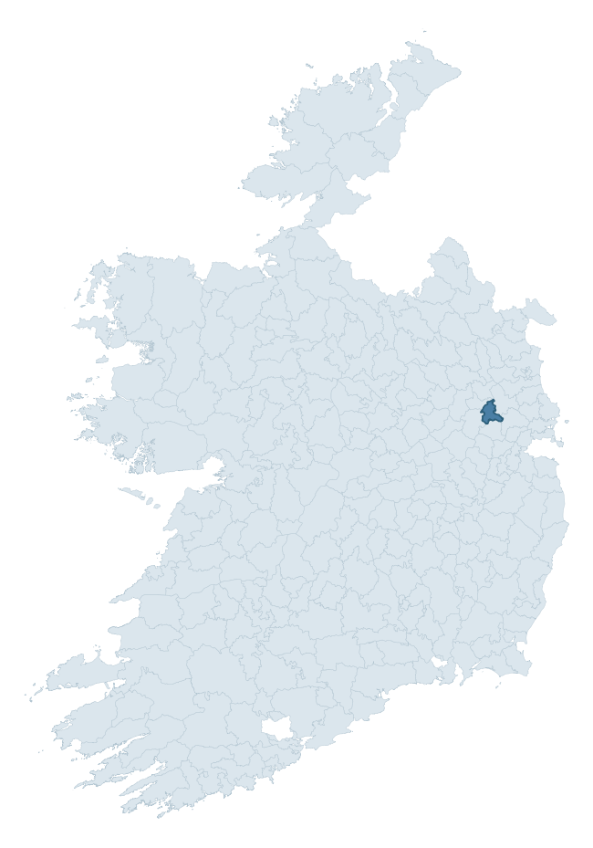
Where this barony sits in the Republic of Ireland
Geology and preservation
Bedrock geology shapes the landscape long before any settlement begins — controlling soil drainage, agricultural potential, the survival of upstanding monuments, and the preservation of buried archaeology. The figures below come from the Geological Survey Ireland 1:100,000 bedrock map.
The bedrock underlying Deece Lower is predominantly limestone (85% of the barony by area), laid down during the Carboniferous period (100% by area, around 359 to 299 million years ago). Limestone is the most heritage-rich bedrock in Ireland. It supports fertile, well-drained soils that favoured dense Early Medieval settlement and Norman manorial agriculture, and it weathers into karst features — sinkholes, caves, swallow holes, and souterrains — that frequently carry archaeology. Where peat overlies limestone, organic preservation can be exceptional. A substantial secondary geology of sandstone (15%) adds further variety to the underlying landscape. The single largest mapped unit is the Lucan Formation (73% of the barony's bedrock). With only 2 distinct rock types mapped, the barony is geologically uniform compared to the rest of the Republic (9th percentile for diversity) — a single coherent bedrock landscape.
Rock type composition
Largest mapped unit: Lucan Formation (73% of the barony)
Placename evidence
Logainm records 8 heritage-diagnostic placenames for Deece Lower, a modest sample drawn predominantly from the townland record. The dominant stratum is early christian ecclesiastical. The most frequent diagnostic roots are cill- (6) and gráinseach- (2). With a sample of this size the count should be treated as indicative rather than definitive.
Early Christian Ecclesiastical
| Root | Count | Meaning |
|---|---|---|
| cill- | 6 | church (early) |
| gráinseach- | 2 | monastic farm / grange |
Burial, Ritual, and Norse-Contact
| Root | Count | Meaning |
|---|---|---|
| gall- | 2 | foreigner — Norse settlement marker |
Other baronies in Meath
About this profile
Click any section below to expand.
What is a barony?
A barony is a historic administrative unit in Ireland, broadly equivalent to an English hundred. The 280 baronies used here are from the OSi 2019 National Statutory Boundaries (generalised 20m), covering the 26 counties of the Republic of Ireland. Baronies derive from the Norman period, were formalised in the 17th century, and have not been redrawn for statistical purposes. They vary enormously in area, from compact urban baronies in Dublin to vast upland baronies in Connacht, and should not be compared by raw site count without accounting for area differences.
What counts as a site?
This profile combines three distinct heritage registers, each with its own definition of what constitutes a recordable site:
- Archaeological sites (NMS). The National Monuments Service Sites and Monuments Record (SMR) catalogues every known archaeological monument or site of archaeological interest in the Republic, from prehistoric burial mounds and ringforts to medieval churches and post-medieval defensive works. Inclusion does not require legal protection — only that the site has been identified, surveyed, and assessed as having archaeological value. A separate subset of these sites lies within a recorded protection zone, which gives them statutory protection under the National Monuments Acts.
- Listed buildings (NIAH). The National Inventory of Architectural Heritage records buildings of architectural, historical, archaeological, artistic, cultural, scientific, social, or technical interest. Each surveyed structure is appraised on a five-tier scale: International, National, Regional, Local, and Record-Only. The NIAH appraisal is informational rather than strictly statutory, but it underpins local-authority Record of Protected Structures (RPS) listings.
- Heritage placenames (Logainm). Logainm is the authoritative database of Irish placenames maintained by the Placenames Branch. This profile applies a heritage-diagnostic classifier to the Irish-language form of each townland name, flagging roots that signal defensive sites (ráth-, lios-, dún-, caiseal-, cathair-), ecclesiastical foundations (cill-, teampall-, domhnach-, mainistir-), prehistoric burial-ritual features (tuaim-, carn-, leaba-), or Norse-contact settlement (gall-). Townlands without one of these diagnostic roots are not flagged here — they may still carry historical significance, but that significance is not encoded in the name itself.
Editorial principles
The narrative sections of this profile follow several explicit principles:
- Evidential. Every claim about this barony’s heritage character is anchored in the underlying register data. Where a site count, a placename count, or a percentile rank is cited, it is computed from the source datasets at export time, not estimated.
- Comparative. Counts and metrics are reported alongside their percentile rank against the other 279 ROI baronies. A barony with 50 ringforts in absolute terms could be unusually high or unusually low depending on its size and regional context; percentile ranking removes that ambiguity.
- Transparent on limits. Where a register has known coverage gaps, survey biases, or data-quality issues that affect this barony’s figures, the profile flags them rather than presenting the numbers as definitive.
- No interpretation beyond what the data supports. The narrative does not speculate about historical events, social dynamics, or cultural meaning beyond what the recorded heritage and placename evidence directly attests.
Data caveats and limits
- NMS Sites and Monuments Record is the product of survey campaigns conducted at different intensities across different counties and decades. Some baronies have been surveyed more thoroughly than others, and absolute counts should be read in that light. Sites destroyed by development before survey are typically not represented; sites in heavily forested or upland terrain are sometimes under-recorded.
- NIAH coverage is broadly complete for the Republic of Ireland but the survey was conducted on a rolling county-by-county basis, and the most recent appraisal date varies. Buildings demolished or substantially altered after their original survey may still appear in the register; conversely, recent buildings of merit may not yet have been appraised.
- Logainm classification applies a deliberately conservative pattern-matching approach to the Irish-language townland forms. The classifier prioritises true positives over recall: a townland may carry a heritage signal that the classifier doesn’t recognise, particularly where the diagnostic root has been heavily anglicised or where the townland name draws on a less common term. The 60,000+ townland records and ~9,800 classified placenames give a substantial signal at barony scale, but individual townland names should be checked against Logainm directly for definitive interpretation.
- Period attribution. The chronological distribution reflects only those NMS sites that carry a recognised period attribution in the source data. Sites listed as “Unknown” period are excluded from the dated subset.
- Boundary changes. Some baronies have undergone minor boundary adjustments since their 19th-century definition; the OSi 2019 generalised boundaries used here are the current statutory definition and may differ slightly from historical maps in border areas.
- Bedrock geology is mapped at 1:100,000 scale, which means local variation within a barony — small pockets of different rock type, mineral veins, alluvium overlying bedrock — is generalised. The dominant-system and rocktype figures are area-weighted, so a barony reading “70% Carboniferous limestone” may still contain small but archaeologically important pockets of older or younger rock. Around 3% of GSI polygons do not match the lexicon and contribute no rocktype or system attribution.
Data sources
- National Monuments Service — Sites and Monuments Record (SMR) https://data.gov.ie/dataset/national-monuments-service-archaeological-survey-of-ireland
- National Inventory of Architectural Heritage (NIAH) https://data.gov.ie/dataset/national-inventory-of-architectural-heritage-niah-national-dataset
- Logainm — Placenames Database of Ireland https://www.logainm.ie/
- Ordnance Survey Ireland — National Statutory Barony Boundaries 2019 https://data-osi.opendata.arcgis.com/
- EURODEM — European Digital Elevation Model https://www.mapsforeurope.org/datasets/euro-dem
- ESA WorldCover https://esa-worldcover.org/en
- Geological Survey Ireland — 1:100,000 Bedrock Geology https://www.gsi.ie/en-ie/data-and-maps/Pages/Bedrock.aspx
Explore more: Search any of the 280 ROI baronies, browse by historical province, or read the methodology and data sources for the full Republic of Ireland Heritage Tool.