
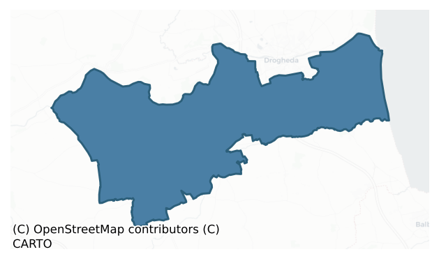
Duleek Lower is a barony of County Meath, in the historical province of Leinster (Irish: Damhliag Íochtarach), covering 150 km² of land. The barony records 384 NMS archaeological sites and 111 NIAH listed buildings, placing it at around the 72nd percentile among 280 ROI baronies for sites per km². This means it is in the top third of all baronies for sites per km². Dated archaeological evidence runs from the Middle-Late Bronze Age through to the Early Medieval, spanning 2 of 9 archaeological periods, placing the barony in the 0th percentile among 280 ROI baronies for chronological depth. This means it is in the bottom tenth of all baronies for chronological depth. The largest dated subset of recorded sites dates to the Early Medieval.
Heritage at a glance
Percentile rankings throughout this profile compare each barony only against the other 279 Republic of Ireland baronies.
The recorded heritage of Duleek Lower
The National Monuments Service Sites and Monuments Record (SMR) is the statutory inventory of archaeological sites for the Republic of Ireland, maintained by the Department of Tourism, Culture, Arts, Gaeltacht, Sport and Media. Sites recorded here include earthworks, ringforts, megalithic tombs, ecclesiastical remains, and post-medieval features; not every record is legally protected, but each is registered as a monument of archaeological interest.
The National Monuments Service records 384 archaeological sites in Duleek Lower, putting it at the 72nd percentile among 280 ROI baronies for sites per km². This means it is in the top third of all baronies for sites per km². Of these, 328 (85%) fall within a recorded monument protection zone. The record is dominated by defensive sites — ringforts, enclosures, hillforts, and stone forts (113 sites, 29% of the total), with burial and ritual monuments forming a substantial secondary presence (57 sites, 15%). The most diagnostically specific type is Ring-ditch (35 records, 9% of the barony's NMS total) — compared to an ROI average of 6% across all baronies where this type occurs. Ring-ditch is a circular ditch under 20m across, often the ploughed-out remains of a barrow, ring-barrow or roundhouse. The broader 'Enclosure' classification — which catches unclassified ringforts and field enclosures — accounts for a further 67 records (17%) and reflects the difficulty of sub-classifying degraded earthworks from surface evidence alone. Across the barony's 150 km², this gives a recorded density of 2.56 sites per km².
Most common monument types
Hover or tap a monument type to see its definition.
| Type | Count |
|---|---|
| Enclosure a banked or ditched feature of uncertain type, used as a catch-all where the original function cannot be determined from surface evidence | 67 |
| Ring-ditch a circular ditch under 20m across, often the ploughed-out remains of a barrow, ring-barrow or roundhouse | 35 |
| Excavation – miscellaneous | 32 |
| Ringfort – rath an earthen ringfort enclosed by a bank and external ditch — the most common Early Medieval farmstead, broadly dated 500–1000 AD | 25 |
| Church a building used for public Christian worship, of any date from c. 500 AD onwards | 15 |
| Graveyard a burial area associated with a church, in use from the medieval period onwards | 13 |
| Souterrain an underground stone-built passage and chamber, generally Early Medieval and often associated with ringforts as a defensive or storage feature | 11 |
| Fulacht fia a horseshoe-shaped Bronze Age burnt mound built around a sunken trough beside a water source, traditionally interpreted as a cooking site | 11 |
Chronological distribution
The dated archaeological record for Duleek Lower spans from the Middle-Late Bronze Age through to the Early Medieval, with activity attested across 2 of 9 archaeological periods. This is the 0th percentile across ROI baronies — a relatively narrow chronological band, with much of Irish prehistory not represented in the dated record. A further 3 recorded sites (60% of the overall NMS register for the barony) carry no period attribution — appearing as 'Unknown' in the bar chart below. This typically reflects either records that pre-date the standardised period vocabulary or sites awaiting specialist dating review, rather than a genuine absence of chronological evidence.
Sample of recorded monuments
Show 25 sample monuments (of 384 total)
A representative sample of 25 recorded monuments drawn from the barony’s 384 total NMS entries. Sites within a recorded monument protection zone and rarer site types are prioritised so the list shows a meaningful cross-section rather than only the most common type. Each entry shows the official Sites and Monuments Record reference number and the description published by the National Monuments Service.
Promontory fort – inland
The following description is derived from the published 'Archaeological Inventory of County Meath' (Dublin: Stationery Office, 1987). In certain instances the entries have been revised and updated in the light of recent…
The following description is derived from the published 'Archaeological Inventory of County Meath' (Dublin: Stationery Office, 1987). In certain instances the entries have been revised and updated in the light of recent research.
Date of upload/revision: 10 July 2007
Situated on top of rock outcrop and covering area of c. two acres. Banks and scarps define top of outcrop, and within this oval area is raised subcircular area (diam. c. 25m) and raised triangular area (dims. 29m E-W, 15m N-S).
Settlement deserted – medieval
The Archaeological Survey of Ireland (ASI) is in the process of providing information on all monuments on The Historic Environment Viewer (HEV). Currently the information for this record has not been uploaded. To…
The Archaeological Survey of Ireland (ASI) is in the process of providing information on all monuments on The Historic Environment Viewer (HEV). Currently the information for this record has not been uploaded. To access available information for research purposes please make an appointment in advance with the Archive Unit (open Fridays 10.00 am – 5.00 pm), Department of Culture, Heritage and the Gaeltacht, The Custom House, Dublin 1 D01W6XO or email nmarchive@chg.gov.ie.
Monumental structure
Built in the sand dunes on the S side of the estuary of the River Boyne. This masonry obelisk is known as the ‘Lady’s Finger’, and was undoubtedly built in conjunction with the Maiden Tower c. 70m to the E, probably…
Built in the sand dunes on the S side of the estuary of the River Boyne. This masonry obelisk is known as the ‘Lady’s Finger’, and was undoubtedly built in conjunction with the Maiden Tower c. 70m to the E, probably during the reign of Queen Elizabeth I. It remains unchanged since it was illustrated by William Wilde (1849, 263). This is a circular, tapering, masonry column (diam. of base c. 1.25m; H c. 8m) with a conical cap that is separated from the stem by a string course. The column rises from a square base (dims 1.6m x 1.5m; H c. 1m).
The above description is derived from the published 'Archaeological Inventory of County Meath' (Dublin: Stationery Office, 1987). In certain instances the entries have been revised and updated in the light of recent research.
Compiled by: Michael Moore
Date of revision: 21 September 2021
Watchtower
Built in the sand dunes on the S side of the estuary of the River Boyne. This medieval tower was built to provide advance notice of ships approaching the harbour of Drogheda, but there are no historical references to…
Built in the sand dunes on the S side of the estuary of the River Boyne. This medieval tower was built to provide advance notice of ships approaching the harbour of Drogheda, but there are no historical references to it. It is known as the ‘Maiden Tower’, probably because it was built during the reign of Queen Elizabeth I, and there is a record of a similar watchtower built in that reign at Poolbeg in Dublin (D’Alton 18444, vol. 2, 450-1). The tower hasn’t changed since it was first illustrated by William Wilde (1849, 263).
It is a square masonry structure (ext. dims 3.35m x 3.35m) as recorded by Kieran Campbell that tapers slightly towards the stepped battlements (H c. 19m). It was entered by a doorway on the N side that is 1.2m over the present ground, but this is permanently sealed now. A newel or spiral stairs, lit by plain lights, leads to the top which is covered by a barrel vault. A trapdoor in the roof allowed access onto the parapet, which it has been suggested was rebuilt in the nineteenth century (Casey and Rowan 1993).
The above description is derived from the published 'Archaeological Inventory of County Meath' (Dublin: Stationery Office, 1987). In certain instances the entries have been revised and updated in the light of recent research.
See the attached view from the W, courtesy of Kieran Campbell
Compiiled by: Michael Moore
Date of revision: 21 September 2021
Casey, C. and Rowan, A. J. 1993 North Leinster. Buildings of Ireland Series, Penguin
Barrow – unclassified
The following description is derived from the published 'Archaeological Inventory of County Meath' (Dublin: Stationery Office, 1987). In certain instances the entries have been revised and updated in the light of recent…
The following description is derived from the published 'Archaeological Inventory of County Meath' (Dublin: Stationery Office, 1987). In certain instances the entries have been revised and updated in the light of recent research.
Date of upload/revision: 10 July 2007
Cooper (Price 1942, 109) records the discovery of a 'clay urn with elegant beaded rim round it, containing calcinated bones', when a small mound was being destroyed. Half of mound survives (diam. 12m, max H 1.3m).
Religious house – Augustinian canons
Around 1180 Hugh de Lacy granted extensive lands in east Meath to the two Augustinian houses of Llanthony, in Monmothshire (Prima) and the second, in Gloucestershire (Seconda). Llanthony Seconda established a priory at…
Around 1180 Hugh de Lacy granted extensive lands in east Meath to the two Augustinian houses of Llanthony, in Monmothshire (Prima) and the second, in Gloucestershire (Seconda). Llanthony Seconda established a priory at Duleek around a church of St. Michael south of the ecclesiastical enclosure, which they ran as a grange or out-farm of the Gloucestershire house. A cartulary, or charter, of their lands made in 1381 describes the precinct in detail (Brooks 1953). The chapel of St. Michael had an extra territorial status and Mass could be celebrated there even if the whole of Ireland was under an interdict.
On the E side there was an old ruined hall with a closet or garderobe. Adjacent to the hall was the knight’s room with a pantry below, while under the hall was a stable for the proctor’s, or agent’s, horses. On the S of the court were a bakery with an oven and brew-house that had its own kiln and a loft for malt. A granary for storing ground corn and a trough for pouring out the malt were attached. At the end of the row was a pigsty, and all the structures were roofed with tiles. Attached on the W side was a stone gatehouse with a thatched room above, and beyond the gate lay a haggard where hay and corn were stacked and there was a kiln and a dovecote. Beside the gatehouse on the W side of the court or bawn was a granary with a pigsty for farrowing sows beneath it. Attached to the granary was a long, thatched byre for cattle. On the N side was a sheep-pen, a long thatche…
Historic town
The Archaeological Survey of Ireland (ASI) is in the process of providing information on all monuments on The Historic Environment Viewer (HEV). Currently the information for this record has not been uploaded. To…
The Archaeological Survey of Ireland (ASI) is in the process of providing information on all monuments on The Historic Environment Viewer (HEV). Currently the information for this record has not been uploaded. To access available information for research purposes please make an appointment in advance with the Archive Unit (open Fridays 10.00 am – 5.00 pm), Department of Culture, Heritage and the Gaeltacht, The Custom House, Dublin 1 D01W6XO or email nmarchive@chg.gov.ie.
Battery
The Archaeological Survey of Ireland (ASI) is in the process of providing information on all monuments on The Historic Environment Viewer (HEV). Currently the information for this record has not been uploaded. To…
The Archaeological Survey of Ireland (ASI) is in the process of providing information on all monuments on The Historic Environment Viewer (HEV). Currently the information for this record has not been uploaded. To access available information for research purposes please make an appointment in advance with the Archive Unit (open Fridays 10.00 am – 5.00 pm), Department of Culture, Heritage and the Gaeltacht, The Custom House, Dublin 1 D01W6XO or email nmarchive@chg.gov.ie.
Font (present location)
The font from Timloole church (ME032-013—-) was moved to the Roman Catholic church at Kentstown, c. 5km to the W, shortly after the Catholic church was built (Cogan 1862-70, 1, 346-7). The limestone octagonal font…
The font from Timloole church (ME032-013—-) was moved to the Roman Catholic church at Kentstown, c. 5km to the W, shortly after the Catholic church was built (Cogan 1862-70, 1, 346-7). The limestone octagonal font (ext. dim. 0.64m; H 0.46m) with chamfered under-panels and a circular flat-bottomed basin (int. diam. 0.48m; D 0.24m) is resting on an octagonal sandstone base (ext. dim. c. 0.5m; H 0.27m). The English inscription in roman letters running on all the sides below the rim reads: THIS / FANT / STONE WAS / BWYLDE / D BY ROBA / RE HOLI /WOD AN / DNI. 1597 / HE BEYN / GE RROCT /OR. (Roe 1968, 69-72)
The above description is derived from the published 'Archaeological Inventory of County Meath' (Dublin: Stationery Office, 1987). In certain instances the entries have been revised and updated in the light of recent research.
Compiled by: Michael Moore
Date of revision: 23 January 2015
Inscribed slab
Built into the inner face of the NW wall of St. Patrick's church (ME027-038001-) is an irregularly shaped limestone slab broken into four pieces (max. dims 1.65m x 0.85m). Centrally placed across the stone is a lightly…
Built into the inner face of the NW wall of St. Patrick's church (ME027-038001-) is an irregularly shaped limestone slab broken into four pieces (max. dims 1.65m x 0.85m). Centrally placed across the stone is a lightly incised inscription: ÓR DO SCANLA_N. (Anon. 1916, 205; Macalister 1949, 2, 33; Bradley 1980-1, 46)
Compiled by: Michael Moore
Date of upload: 14 August, 2014
Round tower
In 1147 the cloigteach or round tower at St. Cianáin’s church was struck by lightning (Cogan 1862-70, 36-7). It survived into the high middle ages and is visible now as a concave hollow (C 3.5m; H 14.3m) that tapers as…
In 1147 the cloigteach or round tower at St. Cianáin’s church was struck by lightning (Cogan 1862-70, 36-7). It survived into the high middle ages and is visible now as a concave hollow (C 3.5m; H 14.3m) that tapers as it rises on the N side of the tower at the W end of the parish church (ME0277-038003-). At the top a pointed doorway leads to the second floor of the church tower. (Leask 1960, 3, 25; Barrow 1979, 169-70)
Compiled by: Michael Moore
Date of upload: 14 August, 2014
Tomb – chest tomb (present location)
Lining the E side of the path up to the door of the present Church of Ireland church at Julianstown is the 'Apostle Stone', which is the limestone surround of a chest-tomb in three sections (total L 3.9m; H 0.6m). It is…
Lining the E side of the path up to the door of the present Church of Ireland church at Julianstown is the 'Apostle Stone', which is the limestone surround of a chest-tomb in three sections (total L 3.9m; H 0.6m). It is crudely executed and unfinished, probably dating from the 17th century. The head of each saint is surrounded by a cowl of uncut stone, indicating the unfinished state of the carving. All were to be represented as priests or monks with the two ends of girdles almost reaching the ground at the front of the pleated habits. All were bearded, but only three of the beards are pointed and only four are finished. Some saints can be identified (numbered from the left), but at least five are represented with open books floating above and sometimes below their hands, merely indicating their apostolic mission. Amongst those who can be identified is Thomas (1) with a set-square to represent the church he is said to have built in India with his own hands. St Peter (7) has a key almost as big as himself, Andrew (8) has a boat-hook (one of his symbols), and James (9) has a small satchel like a hand-bag, representing pilgrims as he is associated with the pilgrimage to Compostella in Spain. Saint No 5 is carrying weighing scales, which would indicate St Michael, who might be an Archangel but is not an Apostle. The stone is said to have come originally from Ballylehane castle, Co. Laois (LA025-023—-) and is associated with the Hovenden and ffolliot families.
See the atta…
Timber circle
The Archaeological Survey of Ireland (ASI) is in the process of providing information on all monuments on The Historic Environment Viewer (HEV). Currently the information for this record has not been uploaded. To…
The Archaeological Survey of Ireland (ASI) is in the process of providing information on all monuments on The Historic Environment Viewer (HEV). Currently the information for this record has not been uploaded. To access available information for research purposes please make an appointment in advance with the Archive Unit (open Fridays 10.00 am – 5.00 pm), Department of Culture, Heritage and the Gaeltacht, The Custom House, Dublin 1 D01W6XO or email nmarchive@chg.gov.ie.
House – Bronze Age
The Archaeological Survey of Ireland (ASI) is in the process of providing information on all monuments on The Historic Environment Viewer (HEV). Currently the information for this record has not been uploaded. To…
The Archaeological Survey of Ireland (ASI) is in the process of providing information on all monuments on The Historic Environment Viewer (HEV). Currently the information for this record has not been uploaded. To access available information for research purposes please make an appointment in advance with the Archive Unit (open Fridays 10.00 am – 5.00 pm), Department of Culture, Heritage and the Gaeltacht, The Custom House, Dublin 1 D01W6XO or email nmarchive@chg.gov.ie.
Road – road/trackway
The Archaeological Survey of Ireland (ASI) is in the process of providing information on all monuments on The Historic Environment Viewer (HEV). Currently the information for this record has not been uploaded. To…
The Archaeological Survey of Ireland (ASI) is in the process of providing information on all monuments on The Historic Environment Viewer (HEV). Currently the information for this record has not been uploaded. To access available information for research purposes please make an appointment in advance with the Archive Unit (open Fridays 10.00 am – 5.00 pm), Department of Culture, Heritage and the Gaeltacht, The Custom House, Dublin 1 D01W6XO or email nmarchive@chg.gov.ie.
Ecclesiastical enclosure
The daimhliagh or stone church of St. Cianán (ME027-038003-)was established within a large ecclesiastical enclosure (dims c. 325m N-S; 380m E-W) that has become fossilised in the street system, being bounded by Larrix…
The daimhliagh or stone church of St. Cianán (ME027-038003-)was established within a large ecclesiastical enclosure (dims c. 325m N-S; 380m E-W) that has become fossilised in the street system, being bounded by Larrix St. N-E, Main St. E-S-SW, and a curving lane connecting Main St. and Larrix St. SW-N (Swan 1983, 269).
Compiled by: Michael Moore
Date of upload: 14 August, 2014
Watercourse
The Archaeological Survey of Ireland (ASI) is in the process of providing information on all monuments on The Historic Environment Viewer (HEV). Currently the information for this record has not been uploaded. To…
The Archaeological Survey of Ireland (ASI) is in the process of providing information on all monuments on The Historic Environment Viewer (HEV). Currently the information for this record has not been uploaded. To access available information for research purposes please make an appointment in advance with the Archive Unit (open Fridays 10.00 am – 5.00 pm), Department of Culture, Heritage and the Gaeltacht, The Custom House, Dublin 1 D01W6XO or email nmarchive@chg.gov.ie.
Cross – High cross (present location)
The head of a 10th century sandstone high cross (H 0.64m; Wth 0.62m; T 0.20m) was excavated from the graveyard of the Church of Ireland church at Colp (ME021-012004-) by K. Campbell, and it is now displayed in the porch…
The head of a 10th century sandstone high cross (H 0.64m; Wth 0.62m; T 0.20m) was excavated from the graveyard of the Church of Ireland church at Colp (ME021-012004-) by K. Campbell, and it is now displayed in the porch of St Mary's Church of Ireland church at Julianstown. There is a roll-moulding on the edge of the cross-shaft and arms, with a narrower moulding inside it. There is a mortise-hole on top. At the centre of the head is a slightly domed boss, surrounded by two circular ribs. The arms are decorated with interlace. The shaft bears an irregular angular interlace. On the W face the centre is occupied by a crucified Christ clad in a short garment. Flanking Him are Stephaton and Longinus. Beneath each of Christ's feet there is a spiral, out of which two serpents unroll themselves (Harbison, P. 1992, 1, 59-60).
See attached image.
Compiled by: Geraldine Stout
Date of amended upload: 22 December, 2014
Armorial plaque
An armorial plaque dated to 1599 is mounted on the front of Smithstown House . It contains a coat of arms and a latin inscription(pers comm. Mr Colin Byrne, Briarleas, County Meath).
Compiled by Geraldine…
An armorial plaque dated to 1599 is mounted on the front of Smithstown House . It contains a coat of arms and a latin inscription(pers comm. Mr Colin Byrne, Briarleas, County Meath).
Compiled by Geraldine Stout
Date of upload: 13/03/2012
Chapel
Site known locally as the Chapel bank. There is a local tradition that mass was said here in Penal times. A nearby field called the 'watching park' is where people used to keep watch while mass was being said.…
Site known locally as the Chapel bank. There is a local tradition that mass was said here in Penal times. A nearby field called the 'watching park' is where people used to keep watch while mass was being said. Identified by Du Noyer (1866) on Geological Survey maps as 'site of ancient chapel' (pers. comm. Mr Colin Byrne, Briarleas, County Meath).
Compiled by Geraldine Stout
Date of upload: 13/03/2012
Cross-slab
A cross-slab that is described as rectangular (max. dims 1.35m x 0.39m; T 0.2m) with a double-ringed incised cross (Bradley and King 1985, 45), whose arms do not extend beyond the ring, has been removed for safe-keeping…
A cross-slab that is described as rectangular (max. dims 1.35m x 0.39m; T 0.2m) with a double-ringed incised cross (Bradley and King 1985, 45), whose arms do not extend beyond the ring, has been removed for safe-keeping from the graveyard (ME027-038029-) of St. Cianán's parish church (ME027-038013-) (O Boyle 2001, 129).
Compiled by: Michael Moore
Date of upload 19 August, 2014
Cross – Wayside cross (present location)
The Balrath wayside cross (ME032-010—-) was moved from its original position c. 270m to the ENE beside the old Kentstown to Duleek road and is now displayed at the SE angle of the Ballymagarvey graveyard…
The Balrath wayside cross (ME032-010—-) was moved from its original position c. 270m to the ENE beside the old Kentstown to Duleek road and is now displayed at the SE angle of the Ballymagarvey graveyard (ME032-009001-). It is a small Celtic cross (H 1.75m; span 0.55m) without a ring which has a Crucifixion (Harbison 2000, 40) on the W face and a Pietá on the E, executed in false relief. (King 1984, 105)
From King (1984, 105): A Celtic / Iona cross without ring, rectangular in section, decorated on all sides in relief, false relief and incision. Set on a rectangular damaged base. Broken in half, it was repaired by the insertion of two iron riveting bars which have caused damage to the S face. There is a small mortice hole in the upper shaft. A raised moulding outlines the figure sculpture on the E and partly on the W face. W: A Crucifixion. Christ is wearing a stylised perizonium with an elaborate knot above the right hip. Above and below there are a series of architectural motifs, a rosette, a bow, two triangles – one enclosing a triquetra – an ogee-arch, a trefoil, a round arch and a rectangular trefoil-headed panel. E: A Pietá. Below are two inscriptions, the upper in contracted Gothic Latin, crudely executed in false relief: ORATE P AIA / JHOANNIS / BROIN. The lower inscription is in incised Roman capitals: SR. ANDREW / AYLMER OF / MOVNTAYLMER / BART. & HIS LADY / CATHRINE / AYLMER HAD / THIS CORSS / BEAUTIFIED / A.D. 1727 / P. RH. SMITH /. N: A deeply incised…
Cairn – burial cairn
Situated on the summit of the NE-SW Redmountion ridge on the S bank of the Boyne River, with a wide view over the Brú na Bóinne passage tombs. It was first identified and recorded by Paul Duffy. This is a grass-covered…
Situated on the summit of the NE-SW Redmountion ridge on the S bank of the Boyne River, with a wide view over the Brú na Bóinne passage tombs. It was first identified and recorded by Paul Duffy. This is a grass-covered cairn (diam. c. 20m; H 0.4m at S to 1.8m at N) supporting four hawthorn trees, but the centre has been dug out. It may have had a trig. station (402 feet) which is no longer evident. A possible fragment of a saddle quern was recovered from the monument. (Duffy 2018)
Compiled by: Michael Moore
Date of upload: 23 October 2017
Linear earthwork
Situated on a slightly raised rib running roughly parallel with a SSW-NNE section of the River Nanny on its W bank. What might be a narrow roadway (Wth c. 3m) or a field bank defined by parallel ditch features on either…
Situated on a slightly raised rib running roughly parallel with a SSW-NNE section of the River Nanny on its W bank. What might be a narrow roadway (Wth c. 3m) or a field bank defined by parallel ditch features on either side is c. 30-90m distant from the river, the distance being greater at the S end. The road can be seen (L c. 220m) on Google Earth (12/072013) and on OSI images (1995).
Compiled by: Michael Moore
Date of upload: 15 August, 2018
Enclosure
The cropmark of a subrectangular enclosure (dims c. 30m E-W; c. 30m N-S) defined by fosse features on each side is visible on an aerial photograph (OSAP: 1995). (Pers. com. Colin Byrne)
See the attached enhanced view…
The cropmark of a subrectangular enclosure (dims c. 30m E-W; c. 30m N-S) defined by fosse features on each side is visible on an aerial photograph (OSAP: 1995). (Pers. com. Colin Byrne)
See the attached enhanced view from OSAP (1995)
Date of upload: 15 September, 2017
Listed buildings
The National Inventory of Architectural Heritage (NIAH) is a state survey appraising buildings of architectural, historical, archaeological, artistic, cultural, scientific, social, or technical interest. Each surveyed structure receives a rating from International (the highest, for buildings of European importance) through National, Regional, Local, and Record-Only.
The NIAH records 111 listed buildings in Duleek Lower (54th percentile across ROI baronies). All recorded buildings carry Regional or lower grading; the barony does not contain any structures appraised as being of National or International architectural importance. Construction dates concentrate most heavily in the Victorian (1830-1900) period. The most-recorded building type is house (26 examples, 23% of the listed stock).
Terrain and environment
Mean elevation across the barony is 31m — the 6th percentile among 280 ROI baronies for elevation. This means it is in the bottom tenth of all baronies for elevation. This is a relatively low-lying landscape by ROI standards. Elevation matters for heritage because higher-altitude baronies typically favour defensive monuments — ringforts and hilltop forts placed on prominent ground — while lowland baronies are more likely to carry the dense settlement and church networks of intensive agricultural landscapes. Mean slope is 3.3° — the 44th percentile among 280 ROI baronies for slope. This means it is in the lower half of all baronies for slope. Slope is a key control on both land use and archaeological preservation: steep ground resists ploughing and tends to preserve earthworks intact, while gentle slopes favour intensive cultivation that damages or destroys surface archaeology over time. The Topographic Wetness Index averages 11.1, the 60th percentile among 280 ROI baronies for wetness. This means it is in the upper half of all baronies for wetness. Drainage matters for heritage because poorly-drained ground preserves organic archaeology (wooden trackways, leather, textiles, and on rare occasions human remains) far better than free-draining soil; well-drained ground favours arable use but destroys organic material rapidly. Urban land covers 38% of the barony (the 100th percentile among 280 ROI baronies for urban cover. This means it is in the top tenth of all baronies for urban cover). Heavy urban coverage compresses heritage analysis: many archaeological features have been buried or destroyed by development, but the surviving record is concentrated in protected city-centre cores, and the NIAH listed-buildings count is typically high. The land-cover mosaic combines urban land (38%), improved grassland (29%), and woodland (25%), giving a mixed agricultural and semi-natural landscape.
Terrain measurements
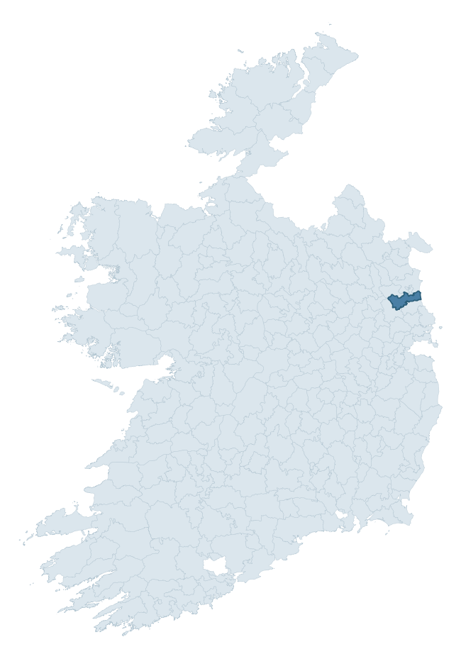
Where this barony sits in the Republic of Ireland
Geology and preservation
Bedrock geology shapes the landscape long before any settlement begins — controlling soil drainage, agricultural potential, the survival of upstanding monuments, and the preservation of buried archaeology. The figures below come from the Geological Survey Ireland 1:100,000 bedrock map.
The bedrock underlying Duleek Lower is predominantly limestone (66% of the barony by area), laid down during the Carboniferous period (98% by area, around 359 to 299 million years ago). Limestone is the most heritage-rich bedrock in Ireland. It supports fertile, well-drained soils that favoured dense Early Medieval settlement and Norman manorial agriculture, and it weathers into karst features — sinkholes, caves, swallow holes, and souterrains — that frequently carry archaeology. Where peat overlies limestone, organic preservation can be exceptional. A substantial secondary geology of sandstone (16%) and shale (15%) adds further variety to the underlying landscape.
Rock type composition
Largest mapped unit: Platin Formation (22% of the barony)
Placename evidence
Logainm records 11 heritage-diagnostic placenames for Duleek Lower, a modest sample drawn predominantly from the townland record. The dominant stratum is early christian ecclesiastical. The most frequent diagnostic roots are ráth- (3) and cill- (3). With a sample of this size the count should be treated as indicative rather than definitive.
Pre-Christian / Early Medieval Defensive
| Root | Count | Meaning |
|---|---|---|
| ráth- | 3 | earthen ringfort |
| dún- | 2 | hilltop or promontory fort |
Early Christian Ecclesiastical
| Root | Count | Meaning |
|---|---|---|
| cill- | 3 | church (early) |
| domhnach- | 2 | pre-Patrician or earliest Patrician church |
| gráinseach- | 1 | monastic farm / grange |
Burial, Ritual, and Norse-Contact
| Root | Count | Meaning |
|---|---|---|
| gall- | 1 | foreigner — Norse settlement marker |
Other baronies in Meath
About this profile
Click any section below to expand.
What is a barony?
A barony is a historic administrative unit in Ireland, broadly equivalent to an English hundred. The 280 baronies used here are from the OSi 2019 National Statutory Boundaries (generalised 20m), covering the 26 counties of the Republic of Ireland. Baronies derive from the Norman period, were formalised in the 17th century, and have not been redrawn for statistical purposes. They vary enormously in area, from compact urban baronies in Dublin to vast upland baronies in Connacht, and should not be compared by raw site count without accounting for area differences.
What counts as a site?
This profile combines three distinct heritage registers, each with its own definition of what constitutes a recordable site:
- Archaeological sites (NMS). The National Monuments Service Sites and Monuments Record (SMR) catalogues every known archaeological monument or site of archaeological interest in the Republic, from prehistoric burial mounds and ringforts to medieval churches and post-medieval defensive works. Inclusion does not require legal protection — only that the site has been identified, surveyed, and assessed as having archaeological value. A separate subset of these sites lies within a recorded protection zone, which gives them statutory protection under the National Monuments Acts.
- Listed buildings (NIAH). The National Inventory of Architectural Heritage records buildings of architectural, historical, archaeological, artistic, cultural, scientific, social, or technical interest. Each surveyed structure is appraised on a five-tier scale: International, National, Regional, Local, and Record-Only. The NIAH appraisal is informational rather than strictly statutory, but it underpins local-authority Record of Protected Structures (RPS) listings.
- Heritage placenames (Logainm). Logainm is the authoritative database of Irish placenames maintained by the Placenames Branch. This profile applies a heritage-diagnostic classifier to the Irish-language form of each townland name, flagging roots that signal defensive sites (ráth-, lios-, dún-, caiseal-, cathair-), ecclesiastical foundations (cill-, teampall-, domhnach-, mainistir-), prehistoric burial-ritual features (tuaim-, carn-, leaba-), or Norse-contact settlement (gall-). Townlands without one of these diagnostic roots are not flagged here — they may still carry historical significance, but that significance is not encoded in the name itself.
Editorial principles
The narrative sections of this profile follow several explicit principles:
- Evidential. Every claim about this barony’s heritage character is anchored in the underlying register data. Where a site count, a placename count, or a percentile rank is cited, it is computed from the source datasets at export time, not estimated.
- Comparative. Counts and metrics are reported alongside their percentile rank against the other 279 ROI baronies. A barony with 50 ringforts in absolute terms could be unusually high or unusually low depending on its size and regional context; percentile ranking removes that ambiguity.
- Transparent on limits. Where a register has known coverage gaps, survey biases, or data-quality issues that affect this barony’s figures, the profile flags them rather than presenting the numbers as definitive.
- No interpretation beyond what the data supports. The narrative does not speculate about historical events, social dynamics, or cultural meaning beyond what the recorded heritage and placename evidence directly attests.
Data caveats and limits
- NMS Sites and Monuments Record is the product of survey campaigns conducted at different intensities across different counties and decades. Some baronies have been surveyed more thoroughly than others, and absolute counts should be read in that light. Sites destroyed by development before survey are typically not represented; sites in heavily forested or upland terrain are sometimes under-recorded.
- NIAH coverage is broadly complete for the Republic of Ireland but the survey was conducted on a rolling county-by-county basis, and the most recent appraisal date varies. Buildings demolished or substantially altered after their original survey may still appear in the register; conversely, recent buildings of merit may not yet have been appraised.
- Logainm classification applies a deliberately conservative pattern-matching approach to the Irish-language townland forms. The classifier prioritises true positives over recall: a townland may carry a heritage signal that the classifier doesn’t recognise, particularly where the diagnostic root has been heavily anglicised or where the townland name draws on a less common term. The 60,000+ townland records and ~9,800 classified placenames give a substantial signal at barony scale, but individual townland names should be checked against Logainm directly for definitive interpretation.
- Period attribution. The chronological distribution reflects only those NMS sites that carry a recognised period attribution in the source data. Sites listed as “Unknown” period are excluded from the dated subset.
- Boundary changes. Some baronies have undergone minor boundary adjustments since their 19th-century definition; the OSi 2019 generalised boundaries used here are the current statutory definition and may differ slightly from historical maps in border areas.
- Bedrock geology is mapped at 1:100,000 scale, which means local variation within a barony — small pockets of different rock type, mineral veins, alluvium overlying bedrock — is generalised. The dominant-system and rocktype figures are area-weighted, so a barony reading “70% Carboniferous limestone” may still contain small but archaeologically important pockets of older or younger rock. Around 3% of GSI polygons do not match the lexicon and contribute no rocktype or system attribution.
Data sources
- National Monuments Service — Sites and Monuments Record (SMR) https://data.gov.ie/dataset/national-monuments-service-archaeological-survey-of-ireland
- National Inventory of Architectural Heritage (NIAH) https://data.gov.ie/dataset/national-inventory-of-architectural-heritage-niah-national-dataset
- Logainm — Placenames Database of Ireland https://www.logainm.ie/
- Ordnance Survey Ireland — National Statutory Barony Boundaries 2019 https://data-osi.opendata.arcgis.com/
- EURODEM — European Digital Elevation Model https://www.mapsforeurope.org/datasets/euro-dem
- ESA WorldCover https://esa-worldcover.org/en
- Geological Survey Ireland — 1:100,000 Bedrock Geology https://www.gsi.ie/en-ie/data-and-maps/Pages/Bedrock.aspx
Explore more: Search any of the 280 ROI baronies, browse by historical province, or read the methodology and data sources for the full Republic of Ireland Heritage Tool.