
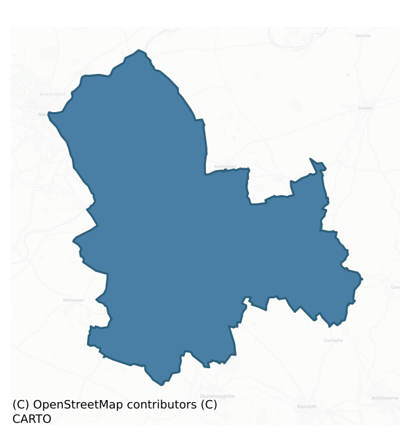
Skreen is a barony of County Meath, in the historical province of Leinster (Irish: An Scrín), covering 165 km² of land. The barony records 407 NMS archaeological sites and 65 NIAH listed buildings, placing it at around the 70th percentile among 280 ROI baronies for sites per km². This means it is in the top third of all baronies for sites per km². Dated archaeological evidence runs from the Neolithic through to the Medieval, spanning 6 of 9 archaeological periods, placing the barony in the 10th percentile among 280 ROI baronies for chronological depth. This means it is in the bottom fifth of all baronies for chronological depth. The largest dated subset of recorded sites dates to the Iron Age. Logainm flags 15 placenames in the barony as carrying a recognised heritage root; the largest share — around 47% — are names associated with early Christian church and monastic foundations.
Heritage at a glance
Percentile rankings throughout this profile compare each barony only against the other 279 Republic of Ireland baronies.
The recorded heritage of Skreen
The National Monuments Service Sites and Monuments Record (SMR) is the statutory inventory of archaeological sites for the Republic of Ireland, maintained by the Department of Tourism, Culture, Arts, Gaeltacht, Sport and Media. Sites recorded here include earthworks, ringforts, megalithic tombs, ecclesiastical remains, and post-medieval features; not every record is legally protected, but each is registered as a monument of archaeological interest.
The National Monuments Service records 407 archaeological sites in Skreen, putting it at the 70th percentile among 280 ROI baronies for sites per km². This means it is in the top third of all baronies for sites per km². Of these, 359 (88%) fall within a recorded monument protection zone. The record is dominated by defensive sites — ringforts, enclosures, hillforts, and stone forts (113 sites, 28% of the total), with burial and ritual monuments forming a substantial secondary presence (78 sites, 19%). The most diagnostically specific type is Ring-ditch (30 records, 7% of the barony's NMS total) — compared to an ROI average of 6% across all baronies where this type occurs. Ring-ditch is a circular ditch under 20m across, often the ploughed-out remains of a barrow, ring-barrow or roundhouse. The broader 'Enclosure' classification — which catches unclassified ringforts and field enclosures — accounts for a further 56 records (14%) and reflects the difficulty of sub-classifying degraded earthworks from surface evidence alone. Across the barony's 165 km², this gives a recorded density of 2.46 sites per km².
Most common monument types
Hover or tap a monument type to see its definition.
| Type | Count |
|---|---|
| Enclosure a banked or ditched feature of uncertain type, used as a catch-all where the original function cannot be determined from surface evidence | 56 |
| Ring-ditch a circular ditch under 20m across, often the ploughed-out remains of a barrow, ring-barrow or roundhouse | 30 |
| Church a building used for public Christian worship, of any date from c. 500 AD onwards | 22 |
| Graveyard a burial area associated with a church, in use from the medieval period onwards | 20 |
| Mound an artificial earthen elevation of unknown date and function that cannot be classified as another known monument type | 18 |
| Ringfort – rath an earthen ringfort enclosed by a bank and external ditch — the most common Early Medieval farmstead, broadly dated 500–1000 AD | 15 |
| Souterrain an underground stone-built passage and chamber, generally Early Medieval and often associated with ringforts as a defensive or storage feature | 14 |
Chronological distribution
The dated archaeological record for Skreen spans from the Neolithic through to the Medieval, with activity attested across 6 of 9 archaeological periods. This is the 10th percentile across ROI baronies — a relatively narrow chronological band, with much of Irish prehistory not represented in the dated record. Every period from earliest to latest is represented in the record — an unbroken sequence of dated activity across the full chronological span. Activity concentrates most heavily in the Iron Age (94 sites, 35% of dated material), with the Early Bronze Age forming a secondary peak (56 sites, 21%). A further 139 recorded sites (34% of the overall NMS register for the barony) carry no period attribution — appearing as 'Unknown' in the bar chart below. This typically reflects either records that pre-date the standardised period vocabulary or sites awaiting specialist dating review, rather than a genuine absence of chronological evidence.
Sample of recorded monuments
Show 25 sample monuments (of 407 total)
A representative sample of 25 recorded monuments drawn from the barony’s 407 total NMS entries. Sites within a recorded monument protection zone and rarer site types are prioritised so the list shows a meaningful cross-section rather than only the most common type. Each entry shows the official Sites and Monuments Record reference number and the description published by the National Monuments Service.
Bridge
Situated on a S-N section of the River Boyne (Wth c. 70m) just before its course changes to a W-E direction. A bridge known as ‘Babe’s Bridge’ or ‘Mabe’s Bridge’ is referred to from the thirteenth century when ‘pontus…
Situated on a S-N section of the River Boyne (Wth c. 70m) just before its course changes to a W-E direction. A bridge known as ‘Babe’s Bridge’ or ‘Mabe’s Bridge’ is referred to from the thirteenth century when ‘pontus Johannis le Baub’ is recorded in numerous land grants to St Thomas’ Augustinian abbey (DU018-020051-) that were witnessed by Simon de Rochford, bishop of Meath (1194-1224). Babe’s bridge was the only bridge on the River Boyne to withstand the severe flood of 1330. In 1463 it is recorded that a man called Babe had left six acres for the maintenance of the bridge but that this land had been taken into the King’s hands and the bridge was consequently in disrepair. As a result the Irish Parliament entrusted the land and the care of the bridge to the clergy of Donaghmore (ME025-015001-) and Dunmoe (ME025-018001-). It is not recorded in the Civil Survey (1655) or the on the Down Survey (1656-8) maps, so it must have been defunct by then. It may have been disused by 1550, by which time Kilcarn Bridge (ME025-039—-) on the more direct R147 road from Navan to Dunshaughlin and Dublin had been built.
In 1988 a single pointed segmental arch (Wth 5.2m; L 7.15m) survived on the E bank of the river which was repaired at that time. The pier is described as 15 feet by 6 feet 6 inches (dims 4.6m x 2m) with breakwaters that have pyramidal caps on both the upstream and downstream faces. Traces of at least two other piers are represented on the 1908 and the current OS maps. It…
Cairn – unclassified
The following description is derived from the published 'Archaeological Inventory of County Meath' (Dublin: Stationery Office, 1987). In certain instances the entries have been revised and updated in the light of recent…
The following description is derived from the published 'Archaeological Inventory of County Meath' (Dublin: Stationery Office, 1987). In certain instances the entries have been revised and updated in the light of recent research.
Date of upload/revision: 10 July 2007
Low circular mound of earth and stones (diam. 30m) with mound in centre (diam. 5m), perhaps erected for trigonometric station.
This monument is subject to a preservation order made under the National Monuments Acts 1930 to 2014 (PO no. 11/1976).
Hillfort
The following description is derived from the published 'Archaeological Inventory of County Meath' (Dublin: Stationery Office, 1987). In certain instances the entries have been revised and updated in the light of recent…
The following description is derived from the published 'Archaeological Inventory of County Meath' (Dublin: Stationery Office, 1987). In certain instances the entries have been revised and updated in the light of recent research.
Date of upload/revision: 10 July 2007
Roughly oval area, defined by earthen bank S-NW with internal fosse (dim. 118m N-S). Bank and ditch destroyed elsewhere. (MacAlister 1931, 12-18)
Standing stone (present location)
The following description is derived from the published 'Archaeological Inventory of County Meath' (Dublin: Stationery Office, 1987). In certain instances the entries have been revised and updated in the light of recent…
The following description is derived from the published 'Archaeological Inventory of County Meath' (Dublin: Stationery Office, 1987). In certain instances the entries have been revised and updated in the light of recent research.
Date of upload/revision: 10 July 2007
Now situated in centre of barrow (ME031-033010-), but originally beside passage-tomb (ME031-033007-). H 1.55m, 0.4m by 0.35m with rounded top. (Macalister 1931, 29-31)
Sheela-na-gig
Situated at the crest of the E-facing slope of Tara Hill and within the graveyard (ME031-033034-), with the church site (ME031-033071-) just to the S. Carved on the E face of an upright standing stone aligned N-S that…
Situated at the crest of the E-facing slope of Tara Hill and within the graveyard (ME031-033034-), with the church site (ME031-033071-) just to the S. Carved on the E face of an upright standing stone aligned N-S that has a rectangular cross-section (dims 0.58m x 0.26m; max. H 1.88m). The stone is dressed back on both sides as if it was meant to fit in an architectural structure (Andersen 1977, 152). The possible standing stone (ME031-033019-) is c. 2.5m to the ESE. It is described by Freitag (2004, 143) as a figure, ‘carved in high relief on lower half of stone, and because much worn difficult to interpret in detail. Big jug ears; facial features simple indentations. Arms in front of body, joined together in vaguely discernible gesture towards lower abdomen; left leg nearly straight, the other bent inwards.’
See attached screenshots of 3D model of Sheela-na-gig created by Digital Heritage Age. 3D model can be accessed on the Sketchfab website at: https://skfb.ly/6qPHs
The above description is derived from the published 'Archaeological Inventory of County Meath' (Dublin: Stationery Office, 1987). In certain instances the entries have been revised and updated in the light of recent research.
Date of revision: 27 January 2015
Standing stone
Situated at the crest of the E-facing slope of Tara Hill and within the graveyard (ME031-033034-), with the church site (ME031-033071-) just to the S. A shale stone with a subrectangular cross-section (dims 0.47m x…
Situated at the crest of the E-facing slope of Tara Hill and within the graveyard (ME031-033034-), with the church site (ME031-033071-) just to the S. A shale stone with a subrectangular cross-section (dims 0.47m x 0.32m) is roughly aligned ENE-WSW and has a rounded top (H 0.72m). The sheela-na-gig (ME0312-033018-) is on an upright stone 2.5m to the WNW. (Macalister 1931, 51)
The above description is derived from the published 'Archaeological Inventory of County Meath' (Dublin: Stationery Office, 1987). In certain instances the entries have been revised and updated in the light of recent research.
Date of revision: 27 January 2015
Barrow – bowl-barrow
The following description is derived from the published 'Archaeological Inventory of County Meath' (Dublin: Stationery Office, 1987). In certain instances the entries have been revised and updated in the light of recent…
The following description is derived from the published 'Archaeological Inventory of County Meath' (Dublin: Stationery Office, 1987). In certain instances the entries have been revised and updated in the light of recent research.
Date of upload/revision: 10 July 2007
Identified (TRIA 1839, Pl. 7) as 'Dumha na mBan-Amhus'. Swan (JRSAI 1978, 53, Figs 21, 22, 23b) can identify it from aerial photograph.
Barrow – ditch barrow
The Archaeological Survey of Ireland (ASI) is in the process of providing information on all monuments on The Historic Environment Viewer (HEV). Currently the information for this record has not been uploaded. To…
The Archaeological Survey of Ireland (ASI) is in the process of providing information on all monuments on The Historic Environment Viewer (HEV). Currently the information for this record has not been uploaded. To access available information for research purposes please make an appointment in advance with the Archive Unit (open Fridays 10.00 am – 5.00 pm), Department of Culture, Heritage and the Gaeltacht, The Custom House, Dublin 1 D01W6XO or email nmarchive@chg.gov.ie.
Religious house – Augustinian nuns
Augustinian nuns had a convent of the Holy Trinity at Lismullin (Hadcock 1964, 130). It was a joint foundation c. 1240 of a brother and sister, Richard and Avice de la Corner (Hall 2003, 60). The foundation of Lismullin…
Augustinian nuns had a convent of the Holy Trinity at Lismullin (Hadcock 1964, 130). It was a joint foundation c. 1240 of a brother and sister, Richard and Avice de la Corner (Hall 2003, 60). The foundation of Lismullin may have been part of Bishop Richard’s ambition to tighten episcopal control over the spiritualities of his diocese and it became one of the most successful of the nunneries in the medieval colony of Ireland (ibid. 86-7). The site of Lismullin itself was probably already church property before the arrival of the Anglo Normans, as land that could have been at Lismullin was included in possessions confirmed to the nunnery of Clonard (ME047-021—-) in 1195 (Brady 1960, 5). There are frequent notices of the enclosed state of the nuns at Lismullin (Kelly 1961, 54-5) and it may have been a double monastery up to c. 1300 where canons are recorded as conducting the temporal business of the convent, but thereafter attorneys were increasingly employed (Hall 1999, 60-2). In 1260 the nuns were described as being enclosed since their foundation (Hall 2003, 160). In 1427 the Archbishop of Armagh, while on visitation at the convent, ordered the nuns to observe the rules of enclosure, and the gates and other places in the convent were ordered shut (ibid. 161). A complex legal case involving ownership of land at Dunsink, Co. Dublin, where their opponents were the Benedictine house of Little Marvern in England and their priory at Castleknock (DU017-008001-), continued from…
Promontory fort – inland
The following description is derived from the published 'Archaeological Inventory of County Meath' (Dublin: Stationery Office, 1987). In certain instances the entries have been revised and updated in the light of recent…
The following description is derived from the published 'Archaeological Inventory of County Meath' (Dublin: Stationery Office, 1987). In certain instances the entries have been revised and updated in the light of recent research.
Date of upload/revision: 10 July 2007
Triangular promontory defined by steep scarps with bern at its foot on N and S, and cut off from high ground to W by remains of earthen bank and external fosse. No visible entrance.
Cross – Wayside cross (present location)
A late medieval cross fragment which originally came from the hill of Lismullin (ME032-066—-) (Cogan 1862-70, 1, 227), perhaps close to the site of Templekeeran church (ME032-022—-) is now set up outside St…
A late medieval cross fragment which originally came from the hill of Lismullin (ME032-066—-) (Cogan 1862-70, 1, 227), perhaps close to the site of Templekeeran church (ME032-022—-) is now set up outside St Colmcille's Roman Catholic church. It has been described by King (1984, 109) as:
The four fragments of this cross were lying in the R.C. churchyard at Skreen for many years. Re-erected there in 1983. Material: fossiliferous limestone. Dims.: shaft: H 0.64m; Wth 0.3m; D c. 0.16m; inscribed fragment: H 0.32m; Wth 0.26m; D 0.12.
The segments which survive are rectangular in section and have chamfered edges. Three fragments have figure sculpture; the fourth has an inscription in Roman lettering in relief. 1st: A Crucifixion. Christ on a raised Latin cross with two smaller crosses on either side. Above the crucifixion is an INRI with a rayed sun on the left and a moon and star on the right. 2nd : A rayed sun enclosing an IHS and cross. Below this a small gowned figure carrying a large Latin cross. Only a few letters of the inscription on the fourth fragment can be deciphered: …A / …RAN../…F ED../..ARD VI…/..O../.
This is probably the shaft referred to by Dean Cogan on the hill of Lismullin which had an inscription as follows: ‘Reader pray for the soul of Thomas Cusack, Knight, Lord Baron and Chancellor of Ireland in the reign of Edward VI who brought the Irish [obliterated] May God in his mercy take him to himself.’ The letters at present legible would fit in with…
Stone head
Three carved stone heads built into a wall. May originally have come from nearby church (ME032-044—-) (Hickey 1984, 112-13).
The above description is derived from the published 'Archaeological Inventory of County…
Three carved stone heads built into a wall. May originally have come from nearby church (ME032-044—-) (Hickey 1984, 112-13).
The above description is derived from the published 'Archaeological Inventory of County Meath' (Dublin: Stationery Office, 1987). In certain instances the entries have been revised and updated in the light of recent research.
Date of upload: 10 July 2007
Ritual site – pond
The Archaeological Survey of Ireland (ASI) is in the process of providing information on all monuments on The Historic Environment Viewer (HEV). Currently the information for this record has not been uploaded. To…
The Archaeological Survey of Ireland (ASI) is in the process of providing information on all monuments on The Historic Environment Viewer (HEV). Currently the information for this record has not been uploaded. To access available information for research purposes please make an appointment in advance with the Archive Unit (open Fridays 10.00 am – 5.00 pm), Department of Culture, Heritage and the Gaeltacht, The Custom House, Dublin 1 D01W6XO or email nmarchive@chg.gov.ie.
House – 18th/19th century
Situated on a slight SW-facing slope in the N interior Kilbrew ceremonial enclosure (ME038-010—-). The manor of Kilbrew was owned by Patrick Barnwall of Kilbrew in 1640 and on the 366 acres he owned was a destroyed…
Situated on a slight SW-facing slope in the N interior Kilbrew ceremonial enclosure (ME038-010—-). The manor of Kilbrew was owned by Patrick Barnwall of Kilbrew in 1640 and on the 366 acres he owned was a destroyed stone house, a stable and a barn in repair, an orchard, a church, a watermill and about 12 tenements (Simington 1940, 94), but his stone house is likely to be (ME038-029—-).
This house is depicted only on the 1908 edition of the OS 6-inch map as a roofless building. It is a rectangular structure (ext. dims 11.15m N-S; 11.05m E-W) of two storeys and attic constructed with masonry walls (T 0.6-0.8m) but with brick at the windows on the first floor. Only the E and W gables survive with a fireplace at the ground floor in the W gable and evidence of three fireplaces and an oven in the E gable at the ground floor. There are two small windows at the ground floor in the W gable, and the base of an entrance embrasure is in the S wall towards the W end. At the first floor there are two large windows with brick surrounds in the E gable and two in the W gable, which also has evidence of two round-backed fireplaces at the centre separated by a dividing wall. The house is probably eighteen century in date. There is one small attic window in the W gable but evidence of the roof does not survive.
The above description is derived from the published 'Archaeological Inventory of County Meath' (Dublin: Stationery Office, 1987). In certain instances the entries have bee…
Stone sculpture
A miniature sculpture of an ecclesiastic that was in the graveyard is now over the S doorway of the church (ME032-047003-) and is dated by Hunt (1974, 1, 213) to the 14th century. It is probably from the pier of a…
A miniature sculpture of an ecclesiastic that was in the graveyard is now over the S doorway of the church (ME032-047003-) and is dated by Hunt (1974, 1, 213) to the 14th century. It is probably from the pier of a cloister arcade. Hunt describes it as:
Built into the outside wall over the south door of the ruined church on the Hill of Skreen is the miniature effigy of a bishop. He seems to have stood within a niche with stepped buttressed sides protruding angularly outwards. He is vested in a chasuble over a dalmatic, tunicle and alb, the upstanding apparel of the amice being visible around his neck. He holds a crozier attired with a sudarium in his right hand and a crook in his left. The shaft of the crozier is broken away above the hand but the out-turned head remains. He is shown bare-headed, though traces of a ring of hair appear above the ears. Being of sandstone, much of the surface has flaked away, but from what remains, it can be seen that the figure appears to be good metropolitan work of the fourteenth century. It may have been either part of a tomb or have had an architectural use.
See attached image.
Compiled by: Michael Moore
Date of upload: 27 January, 2015
Field boundary
Situated towards the W edge of a fairly level landscape and c. 90m from the crest of a steep SW-facing slope down (H c. 12m) to a SSE-NNW portion of the River Boyne. Two portions of souterrain passages (ME025-049001-;…
Situated towards the W edge of a fairly level landscape and c. 90m from the crest of a steep SW-facing slope down (H c. 12m) to a SSE-NNW portion of the River Boyne. Two portions of souterrain passages (ME025-049001-; ME025-049002-) c. 15m apart were found in preparing and EIS in 1995, but archaeological testing (97E0322) of the wider development area (c. 7 ha) to the E and S by E. Sullivan (1998) produced no further material (excavations.ie 1997:424). Subsequently the two souterrains were excavated (98E0596) by C. Jones (1999) when one certain (ME025-049003-) and another possible portion (ME025-049004-) of souterrain passages came to light c. 30m and c. 75m to the NE (excavations.ie1999:701) of the original discoveries that were further investigated (07E0892) by J. Hession (excavations.ie 2007:1255). This possible souterrain (4) is c. 75m NE of the first two discovered and no habitation level or enclosing feature was associated with it, but it proved to be a wall.
It was first discovered by Jones (1999) in testing the wider area around the original discoveries and it was exposed only in the side of one trench within the habitation soils. It manifested as a drystone wall of three courses (L c. 1.5m; H c. 0.4m) with an uneven face that was set in a loamy clay immediately below the topsoil and was thought to be the hidden or rear edge of a souterrain wall. It was in a continuous layer in which archaeological trenching by Jones identified two hearths and many ditches that…
Pit-burial
The following description is derived from the published 'Archaeological Inventory of County Meath' (Dublin: Stationery Office, 1987). In certain instances the entries have been revised and updated in the light of recent…
The following description is derived from the published 'Archaeological Inventory of County Meath' (Dublin: Stationery Office, 1987). In certain instances the entries have been revised and updated in the light of recent research.
Date of upload/revision: 10 July 2007
At least eighteen pit burials recovered in excavation of mound of passage-tomb (ME031-033007-) (PPS 1955, 163-73). One contained a crouched inhumation with a necklace of amber, jet and bronze beads. In other burials the predominant rite was cremation (PPS 1955, 164) and grave goods included six Encrusted Urns (PRIA 1973, 555-8) and several Food Vessels were recovered with crouched burials in passage and chamber of the passage-tomb (PPS 1955, 167)
Mass-rock
A flat, lichen-covered block of stone, roughly rectangular in plan (L 1.2m; Wth 0.9m; D. 0.33m) located in a boggy hollow in a field of pasture. Known locally as a mass-rock (pers. comm. Rathfeigh Historical Society). A…
A flat, lichen-covered block of stone, roughly rectangular in plan (L 1.2m; Wth 0.9m; D. 0.33m) located in a boggy hollow in a field of pasture. Known locally as a mass-rock (pers. comm. Rathfeigh Historical Society). A holy well, known as 'Lady's well (ME032-059002-), is located alongside it.
Compiled by: Claire Breen
Date of upload: 11 December 2013
Timber circle
The Archaeological Survey of Ireland (ASI) is in the process of providing information on all monuments on The Historic Environment Viewer (HEV). Currently the information for this record has not been uploaded. To…
The Archaeological Survey of Ireland (ASI) is in the process of providing information on all monuments on The Historic Environment Viewer (HEV). Currently the information for this record has not been uploaded. To access available information for research purposes please make an appointment in advance with the Archive Unit (open Fridays 10.00 am – 5.00 pm), Department of Culture, Heritage and the Gaeltacht, The Custom House, Dublin 1 D01W6XO or email nmarchive@chg.gov.ie.
Passage tomb art
A large irregular split boulder with megalithic art was discovered incorporated into a souterrain (ME032-061—-) where it capped the second behive chamber. The decoration consists of two groups of concentric arcs,…
A large irregular split boulder with megalithic art was discovered incorporated into a souterrain (ME032-061—-) where it capped the second behive chamber. The decoration consists of two groups of concentric arcs, situated below an arrangement of nested chevrons with an associated U-motif. (O'Connell 2013, 36-40, 165-8)
Compiled by: Geraldine Stout, Paul Walsh
Date of upload: 14 March 2013
Battlefield
The Archaeological Survey of Ireland (ASI) is in the process of providing information on all monuments on The Historic Environment Viewer (HEV). Currently the information for this record has not been uploaded. To…
The Archaeological Survey of Ireland (ASI) is in the process of providing information on all monuments on The Historic Environment Viewer (HEV). Currently the information for this record has not been uploaded. To access available information for research purposes please make an appointment in advance with the Archive Unit (open Fridays 10.00 am – 5.00 pm), Department of Culture, Heritage and the Gaeltacht, The Custom House, Dublin 1 D01W6XO or email nmarchive@chg.gov.ie.
Bullaun stone
Located on the roadside, opposite the entrance to Dunsany castle. On the limestone base of the Dunsany cross (ME037-017—-), which is a rectilinear slab (L 0.86m, Wth 0.80m, T 0.08m) are a number of regular hollows.…
Located on the roadside, opposite the entrance to Dunsany castle. On the limestone base of the Dunsany cross (ME037-017—-), which is a rectilinear slab (L 0.86m, Wth 0.80m, T 0.08m) are a number of regular hollows. These form a cluster on the upper surface of the slab to the S of the cross shaft. There are three main circular, rounded, hollows, in the E (diam. 0.15m, D 0.09m); in the W ( diam, 0.17m, D 0.09m); the S example is smaller (diam. 0.03m, D 0.01m). To the S and E of these are a series of smaller shallow, artificial, cavities.
Compiled by: Geraldine Stout
Date of upload: 02 December 2013
The linked images of the bullaun stone were taken on 7 July 2013.
Cross-inscribed stone
In the graveyard of Kilcarn parish church (ME031-003—-), c. 8m N of the E end of the church, is a slab (Wth 0.2-0.3m; H 0.67m; T 0.1m) with a raised latin cross (H 0.32m; Span 0.23m) on one face. The stem is 4-5cm…
In the graveyard of Kilcarn parish church (ME031-003—-), c. 8m N of the E end of the church, is a slab (Wth 0.2-0.3m; H 0.67m; T 0.1m) with a raised latin cross (H 0.32m; Span 0.23m) on one face. The stem is 4-5cm wide.
Compiled by: Michael Moore
Date of upload: 9 January, 2015
Cross
Inside the church on the Hill of Tara is a limestone cross (H 0.31m; span 0.22m plus), which may have been a finial cross from the medieval parish church (ME031-033071-). It is missing one arm, and has octagonal…
Inside the church on the Hill of Tara is a limestone cross (H 0.31m; span 0.22m plus), which may have been a finial cross from the medieval parish church (ME031-033071-). It is missing one arm, and has octagonal cross-sections to the stem (dims 14cm x 8cm) and arm (dims 8cm x 8cm). It is decorated with a marigold at the end of its surviving arm.
Compiled by: Michael Moore
Date of upload: 9 January, 2015
Enclosure
Situated on a small S-N spur on the E-facing side of the N-S Tara ridge. The cropmarks of three enclosures defined by fosse features, and a field system also defined by fosses or ditches can be seen on oblique aerial…
Situated on a small S-N spur on the E-facing side of the N-S Tara ridge. The cropmarks of three enclosures defined by fosse features, and a field system also defined by fosses or ditches can be seen on oblique aerial photographs (CUCAP: ATC 33-37) from the 1970s. The interpretation of the features is overcomplicated by Newman (1997, 206-07), but the cropmarks do not appear on any other images. This enclosure (diam. c. 56m) is defined by a fosse feature with an inner fosse at E. An arc of an outer fosse extends from SE-W-NW as a form of annexe (ME037-002001-) (max. Wth c. 15m E-W). The enclosure (ME037-002002-) is attached to the NE, and the fields (ME037-002003-) are attached to the W of the annexe.
The above description is derived from the published 'Archaeological Inventory of County Meath' (Dublin: Stationery Office, 1987). In certain instances the entries have been revised and updated in the light of recent research.
Compiled by: Michael Moore
Date of revision: 27 August 2019
Listed buildings
The National Inventory of Architectural Heritage (NIAH) is a state survey appraising buildings of architectural, historical, archaeological, artistic, cultural, scientific, social, or technical interest. Each surveyed structure receives a rating from International (the highest, for buildings of European importance) through National, Regional, Local, and Record-Only.
The NIAH records 65 listed buildings in Skreen (34th percentile across ROI baronies). The highest-graded structures include 4 of National significance. The Republic holds 937 National-graded buildings in total, so this barony accounts for around 0% of the national total. Construction dates concentrate most heavily in the Victorian (1830-1900) period.
Terrain and environment
Mean elevation across the barony is 84m — the 45th percentile among 280 ROI baronies for elevation. This means it is in the lower half of all baronies for elevation. Elevation matters for heritage because higher-altitude baronies typically favour defensive monuments — ringforts and hilltop forts placed on prominent ground — while lowland baronies are more likely to carry the dense settlement and church networks of intensive agricultural landscapes. Mean slope is 2.8° — the 33rd percentile among 280 ROI baronies for slope. This means it is in the lower half of all baronies for slope. Slope is a key control on both land use and archaeological preservation: steep ground resists ploughing and tends to preserve earthworks intact, while gentle slopes favour intensive cultivation that damages or destroys surface archaeology over time. The Topographic Wetness Index averages 11.2, the 65th percentile among 280 ROI baronies for wetness. This means it is in the upper half of all baronies for wetness. Drainage matters for heritage because poorly-drained ground preserves organic archaeology (wooden trackways, leather, textiles, and on rare occasions human remains) far better than free-draining soil; well-drained ground favours arable use but destroys organic material rapidly. The land-cover mosaic combines improved grassland (64%), arable farmland (24%), and woodland (10%), giving a mixed agricultural and semi-natural landscape.
Terrain measurements
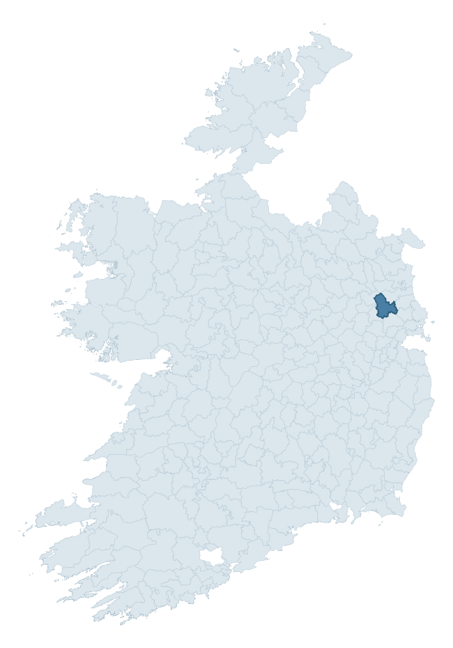
Where this barony sits in the Republic of Ireland
Geology and preservation
Bedrock geology shapes the landscape long before any settlement begins — controlling soil drainage, agricultural potential, the survival of upstanding monuments, and the preservation of buried archaeology. The figures below come from the Geological Survey Ireland 1:100,000 bedrock map.
The bedrock underlying Skreen is predominantly limestone (63% of the barony by area), laid down during the Carboniferous period (98% by area, around 359 to 299 million years ago). Limestone is the most heritage-rich bedrock in Ireland. It supports fertile, well-drained soils that favoured dense Early Medieval settlement and Norman manorial agriculture, and it weathers into karst features — sinkholes, caves, swallow holes, and souterrains — that frequently carry archaeology. Where peat overlies limestone, organic preservation can be exceptional. A substantial secondary geology of shale (24%) and sandstone (11%) adds further variety to the underlying landscape. The single largest mapped unit is the Loughshinny Formation (47% of the barony's bedrock).
Rock type composition
Largest mapped unit: Loughshinny Formation (47% of the barony)
Placename evidence
Logainm records 15 heritage-diagnostic placenames for Skreen, drawn from townland and civil-parish names across the barony. The dominant stratum is Early Christian ecclesiastical — cill-, teampall-, and domhnach-prefixed names that record the dense network of early church foundations established between the fifth and tenth centuries. The leading diagnostic roots are cill- (4 — church), ráth- (2 — earthen ringfort), and lios- (2 — ringfort or enclosure). This is below the ROI average of 30.7 heritage placenames per barony, suggesting either lighter survey coverage or a townland-naming tradition that draws more on generic landscape vocabulary. The presence of multiple heritage strata side by side indicates layered occupation of the landscape across successive prehistoric and historic periods. Logainm records 109 placenames for Skreen (predominantly townland names). Of these, 15 (14%) carry one of the diagnostic Gaelic roots tracked above; the remainder draw on more generic landscape vocabulary that does not encode a heritage period.
Pre-Christian / Early Medieval Defensive
| Root | Count | Meaning |
|---|---|---|
| ráth- | 2 | earthen ringfort |
| lios- | 2 | ringfort or enclosure |
| dún- | 2 | hilltop or promontory fort |
Early Christian Ecclesiastical
| Root | Count | Meaning |
|---|---|---|
| cill- | 4 | church (early) |
| cillín- | 2 | unconsecrated burial ground |
| teampall- | 1 | church (later medieval) |
Burial, Ritual, and Norse-Contact
| Root | Count | Meaning |
|---|---|---|
| carn- | 2 | cairn |
| gall- | 1 | foreigner — Norse settlement marker |
Other baronies in Meath
- Moyfenrath Lower
- Deece Lower
- Navan Lower
- Morgallion
- Slane Upper
- Ratoath
- Deece Upper
- Scarawalsh — Wexford
- Maryborough East — Laois
- Fartullagh — Westmeath
See all 280 baronies in the Republic of Ireland Heritage Tool.

Explore further
Grounding History: 10 Maps of Northern Ireland’s Past
If you’re interested in Irish heritage more widely, the companion report for Northern Ireland brings together the analysis of all 462 NI wards into one place through 10 high-quality maps — covering monument density, archaeological periods, placename heritage, terrain, wetland, and the historic landscape at first survey. Take a look.
About this profile
Click any section below to expand.
What is a barony?
A barony is a historic administrative unit in Ireland, broadly equivalent to an English hundred. The 280 baronies used here are from the OSi 2019 National Statutory Boundaries (generalised 20m), covering the 26 counties of the Republic of Ireland. Baronies derive from the Norman period, were formalised in the 17th century, and have not been redrawn for statistical purposes. They vary enormously in area, from compact urban baronies in Dublin to vast upland baronies in Connacht, and should not be compared by raw site count without accounting for area differences.
What counts as a site?
This profile combines three distinct heritage registers, each with its own definition of what constitutes a recordable site:
- Archaeological sites (NMS). The National Monuments Service Sites and Monuments Record (SMR) catalogues every known archaeological monument or site of archaeological interest in the Republic, from prehistoric burial mounds and ringforts to medieval churches and post-medieval defensive works. Inclusion does not require legal protection — only that the site has been identified, surveyed, and assessed as having archaeological value. A separate subset of these sites lies within a recorded protection zone, which gives them statutory protection under the National Monuments Acts.
- Listed buildings (NIAH). The National Inventory of Architectural Heritage records buildings of architectural, historical, archaeological, artistic, cultural, scientific, social, or technical interest. Each surveyed structure is appraised on a five-tier scale: International, National, Regional, Local, and Record-Only. The NIAH appraisal is informational rather than strictly statutory, but it underpins local-authority Record of Protected Structures (RPS) listings.
- Heritage placenames (Logainm). Logainm is the authoritative database of Irish placenames maintained by the Placenames Branch. This profile applies a heritage-diagnostic classifier to the Irish-language form of each townland name, flagging roots that signal defensive sites (ráth-, lios-, dún-, caiseal-, cathair-), ecclesiastical foundations (cill-, teampall-, domhnach-, mainistir-), prehistoric burial-ritual features (tuaim-, carn-, leaba-), or Norse-contact settlement (gall-). Townlands without one of these diagnostic roots are not flagged here — they may still carry historical significance, but that significance is not encoded in the name itself.
Editorial principles
The narrative sections of this profile follow several explicit principles:
- Evidential. Every claim about this barony’s heritage character is anchored in the underlying register data. Where a site count, a placename count, or a percentile rank is cited, it is computed from the source datasets at export time, not estimated.
- Comparative. Counts and metrics are reported alongside their percentile rank against the other 279 ROI baronies. A barony with 50 ringforts in absolute terms could be unusually high or unusually low depending on its size and regional context; percentile ranking removes that ambiguity.
- Transparent on limits. Where a register has known coverage gaps, survey biases, or data-quality issues that affect this barony’s figures, the profile flags them rather than presenting the numbers as definitive.
- No interpretation beyond what the data supports. The narrative does not speculate about historical events, social dynamics, or cultural meaning beyond what the recorded heritage and placename evidence directly attests.
Data caveats and limits
- NMS Sites and Monuments Record is the product of survey campaigns conducted at different intensities across different counties and decades. Some baronies have been surveyed more thoroughly than others, and absolute counts should be read in that light. Sites destroyed by development before survey are typically not represented; sites in heavily forested or upland terrain are sometimes under-recorded.
- NIAH coverage is broadly complete for the Republic of Ireland but the survey was conducted on a rolling county-by-county basis, and the most recent appraisal date varies. Buildings demolished or substantially altered after their original survey may still appear in the register; conversely, recent buildings of merit may not yet have been appraised.
- Logainm classification applies a deliberately conservative pattern-matching approach to the Irish-language townland forms. The classifier prioritises true positives over recall: a townland may carry a heritage signal that the classifier doesn’t recognise, particularly where the diagnostic root has been heavily anglicised or where the townland name draws on a less common term. The 60,000+ townland records and ~9,800 classified placenames give a substantial signal at barony scale, but individual townland names should be checked against Logainm directly for definitive interpretation.
- Period attribution. The chronological distribution reflects only those NMS sites that carry a recognised period attribution in the source data. Sites listed as “Unknown” period are excluded from the dated subset.
- Boundary changes. Some baronies have undergone minor boundary adjustments since their 19th-century definition; the OSi 2019 generalised boundaries used here are the current statutory definition and may differ slightly from historical maps in border areas.
- Bedrock geology is mapped at 1:100,000 scale, which means local variation within a barony — small pockets of different rock type, mineral veins, alluvium overlying bedrock — is generalised. The dominant-system and rocktype figures are area-weighted, so a barony reading “70% Carboniferous limestone” may still contain small but archaeologically important pockets of older or younger rock. Around 3% of GSI polygons do not match the lexicon and contribute no rocktype or system attribution.
Data sources
- National Monuments Service — Sites and Monuments Record (SMR) https://data.gov.ie/dataset/national-monuments-service-archaeological-survey-of-ireland
- National Inventory of Architectural Heritage (NIAH) https://data.gov.ie/dataset/national-inventory-of-architectural-heritage-niah-national-dataset
- Logainm — Placenames Database of Ireland https://www.logainm.ie/
- Ordnance Survey Ireland — National Statutory Barony Boundaries 2019 https://data-osi.opendata.arcgis.com/
- EURODEM — European Digital Elevation Model https://www.mapsforeurope.org/datasets/euro-dem
- ESA WorldCover https://esa-worldcover.org/en
- Geological Survey Ireland — 1:100,000 Bedrock Geology https://www.gsi.ie/en-ie/data-and-maps/Pages/Bedrock.aspx
Explore more: Search any of the 280 ROI baronies, browse by historical province, or read the methodology and data sources for the full Republic of Ireland Heritage Tool.