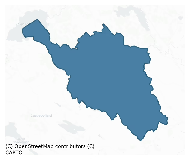
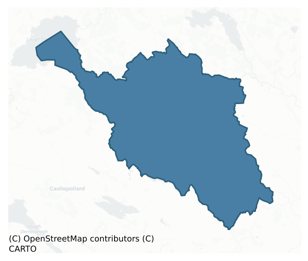
Fore is a barony of County Meath, in the historical province of Leinster (Irish: nan), covering 176 km² of land. The barony records 501 NMS archaeological sites and 126 NIAH listed buildings, placing it at around the 77th percentile among 280 ROI baronies for sites per km². This means it is in the top third of all baronies for sites per km². Dated archaeological evidence runs from the Mesolithic through to the Modern, spanning 9 of 9 archaeological periods, placing the barony in the 94th percentile among 280 ROI baronies for chronological depth. This means it is in the top tenth of all baronies for chronological depth. The largest dated subset of recorded sites dates to the Early Medieval.
Heritage at a glance
Percentile rankings throughout this profile compare each barony only against the other 279 Republic of Ireland baronies.
The recorded heritage of Fore
The National Monuments Service Sites and Monuments Record (SMR) is the statutory inventory of archaeological sites for the Republic of Ireland, maintained by the Department of Tourism, Culture, Arts, Gaeltacht, Sport and Media. Sites recorded here include earthworks, ringforts, megalithic tombs, ecclesiastical remains, and post-medieval features; not every record is legally protected, but each is registered as a monument of archaeological interest.
The National Monuments Service records 501 archaeological sites in Fore, putting it at the 77th percentile among 280 ROI baronies for sites per km². This means it is in the top third of all baronies for sites per km². Protection coverage is near-universal — 498 sites (99%) fall within a recorded monument protection zone, indicating an extensively surveyed landscape. The dominant category is defensive sites — ringforts, enclosures, hillforts, and stone forts (259 sites, 52% of the record). Ringfort – rath is the most prevalent type, making up 35% of the barony's recorded sites (176 records) — well above the ROI average of 20% across all baronies where this type occurs. Ringfort – rath is an earthen ringfort enclosed by a bank and external ditch — the most common Early Medieval farmstead, broadly dated 500–1000 AD. Other significant types include Enclosure (36) and House – indeterminate date (28). Enclosure is a banked or ditched feature of uncertain type, used as a catch-all where the original function cannot be determined from surface evidence; House – indeterminate date is a habitation building whose date cannot be determined from available evidence. Across the barony's 176 km², this gives a recorded density of 2.84 sites per km².
Most common monument types
Hover or tap a monument type to see its definition.
| Type | Count |
|---|---|
| Ringfort – rath an earthen ringfort enclosed by a bank and external ditch — the most common Early Medieval farmstead, broadly dated 500–1000 AD | 176 |
| Enclosure a banked or ditched feature of uncertain type, used as a catch-all where the original function cannot be determined from surface evidence | 36 |
| House – indeterminate date a habitation building whose date cannot be determined from available evidence | 28 |
| Standing stone a deliberately set upright stone, used variously as a Bronze/Iron Age burial marker, route marker or commemorative monument | 24 |
| Cairn – unclassified a stone mound that cannot be assigned to a specific cairn type | 19 |
| Rock art geometric and other motifs carved on earthfast boulders or rock outcrops, mainly Bronze Age but with possible Neolithic origins | 17 |
| Hut site a low stone or earthen foundation enclosing a small circular or oval area, generally interpreted as a former dwelling, of any date from prehistory to the medieval period | 15 |
Chronological distribution
The dated archaeological record for Fore spans from the Mesolithic through to the Modern, with activity attested across 9 of 9 archaeological periods. This places Fore in the top 6% of ROI baronies for chronological depth — few baronies record evidence across as many distinct archaeological periods. Every period from earliest to latest is represented in the record — an unbroken sequence of dated activity across the full chronological span. Activity concentrates most heavily in the Early Medieval (234 sites, 58% of dated material), with the Medieval forming a secondary peak (62 sites, 15%). A further 78 recorded sites (16% of the overall NMS register for the barony) carry no period attribution — appearing as 'Unknown' in the bar chart below. This typically reflects either records that pre-date the standardised period vocabulary or sites awaiting specialist dating review, rather than a genuine absence of chronological evidence.
Sample of recorded monuments
Show 25 sample monuments (of 501 total)
A representative sample of 25 recorded monuments drawn from the barony’s 501 total NMS entries. Sites within a recorded monument protection zone and rarer site types are prioritised so the list shows a meaningful cross-section rather than only the most common type. Each entry shows the official Sites and Monuments Record reference number and the description published by the National Monuments Service.
Font
There is a record from 1969 of a possible font from the graveyard attached to St Bridgid’s Roman Catholic at Ballinacree (SMR file). There are no dimensions and it had a concave basin, but no drain-hole. It is likely…
There is a record from 1969 of a possible font from the graveyard attached to St Bridgid’s Roman Catholic at Ballinacree (SMR file). There are no dimensions and it had a concave basin, but no drain-hole. It is likely to have been a stoup and it is no longer present.
Compiled by: Michael Moore
Date of upload: 14 January, 2015
Ecclesiastical enclosure
Situated on a rise in an undulating landscape and on the N side of the graveyard (ME008-035001-). An enclosure is depicted here on an estate map (21 F (30) 3) made in 1864, and a large D-shaped enclosure (dims. c. 100m…
Situated on a rise in an undulating landscape and on the N side of the graveyard (ME008-035001-). An enclosure is depicted here on an estate map (21 F (30) 3) made in 1864, and a large D-shaped enclosure (dims. c. 100m E-W; c. 60m N-S) defined by two earthen banks and an intervening fosse can be seen in the oblique aerial photograph (CUCAP: BGM, 53). No feature is visible now in improved pasture, but if the perimeter at W is extended SE to encompass the S and E sides of the graveyard creating a large circular enclosure (diam. c. 100m) around the church (ME008-035—-). There is no other evidence of an early date for the church.
The above description is derived from the published 'Archaeological Inventory of County Meath' (Dublin: Stationery Office, 1987). In certain instances the entries have been revised and updated in the light of recent research.
Compiled by: Michael Moore
Date of revision: 31 October 2018
Ringfort – unclassified
Located towards the bottom of a NW-facing slope. It is not depicted on any OS 6-inch map but a circular enclosure (diam. c. 35m), probably defined by a stone wall N-E-S is visible in the distance on oblique aerial…
Located towards the bottom of a NW-facing slope. It is not depicted on any OS 6-inch map but a circular enclosure (diam. c. 35m), probably defined by a stone wall N-E-S is visible in the distance on oblique aerial photographs (CUCAP: AHN 51, AJZ 83, APE 49), and it is also visible on the vertical aerial photographs (GSIAP: N 721-3). No archaeological feature is visible at ground level in improved pasture.
The above description is derived from the published 'Archaeological Inventory of County Meath' (Dublin: Stationery Office, 1987). In certain instances the entries have been revised and updated in the light of recent research.
Compiled by: Michael Moore
Date of revision: 1 November 2018
Stone circle
Situated on a broad plateau at the N foothills of Slieve na Calliagh ridge. It is not depicted on any edition of the OS 6-inch map. This is a circular grass-covered area (diam. 29m E-W; 27m N-S) with four large upright…
Situated on a broad plateau at the N foothills of Slieve na Calliagh ridge. It is not depicted on any edition of the OS 6-inch map. This is a circular grass-covered area (diam. 29m E-W; 27m N-S) with four large upright stones (dims 1.5-2m; x 0.4-0.9m; H c. 2m) on the perimeter and several smaller ones. There is an additional recumbent stone (dims 2.2m x 0.2-0.5m; H 0.3m) at NW.
The above description is derived from the published 'Archaeological Inventory of County Meath' (Dublin: Stationery Office, 1987). In certain instances the entries have been revised and updated in the light of recent research.
Compiled by: Michael Moore
Date of revision: 1 November 2018
Cursus
Located on an undulating landscape N of Slieve na Calliagh ridge. A possible cursus was identified in 1995 as two very low parallel banks, 15m apart, with internal fosses extending N-S (L 210m plus) but its full extent…
Located on an undulating landscape N of Slieve na Calliagh ridge. A possible cursus was identified in 1995 as two very low parallel banks, 15m apart, with internal fosses extending N-S (L 210m plus) but its full extent is not known (Newman 1995). A standing stone, lying prone at the point where it meets a wide NE-SW field wall, may mark its NW end. Aerial photographs (GB91.DD.37; GB91.DE.05) from 1991 show the banks cutting elements of field system (ME009-108—-) so it might be a late feature like a roadway. From its SE end another section could extend SW (L c. 290m), with a second standing stone (ME009-087001-) close to the turn. The course of this section is less certain, although it seems to terminate at a small, poorly-drained area.
Compiled by: Michael Moore
Date of upload: 2 November 2018
Platform
Located on a prominent rise at the bottom of the S-facing slope of Patrickstown Hill. It is not depicted on any OS 6-inch map but is visible on aerial photographs (GSIAP: N 307 / 657). This is a raised rectangular and…
Located on a prominent rise at the bottom of the S-facing slope of Patrickstown Hill. It is not depicted on any OS 6-inch map but is visible on aerial photographs (GSIAP: N 307 / 657). This is a raised rectangular and grass-covered area (dims 31-33m N-S; 29-33m E-W) defined by scarps (H 0.6m at E to 1.3m at N and 2.4m at SW). There is an entrance ramp (Wth 6m) at the centre of the S side. There is no evidence of a fosse or moat, but there are numerous old grass-covered quarries in the vicinity.
The above description is derived from the published 'Archaeological Inventory of County Meath' (Dublin: Stationery Office, 1987). In certain instances the entries have been revised and updated in the light of recent research.
Compiled by: Michael Moore
Date of revision: 8 January 2019
Concentric enclosure
Located on a slight rise at the bottom of the S-facing slope at the E end of the Slieve na Calliagh ridge. This is a raised circular and grass-covered platform (diam. 37m N-S; 36m E-W) defined by a scarp (H 1.2m at NE…
Located on a slight rise at the bottom of the S-facing slope at the E end of the Slieve na Calliagh ridge. This is a raised circular and grass-covered platform (diam. 37m N-S; 36m E-W) defined by a scarp (H 1.2m at NE to 2-2.2m generally) and an outer fosse (Wth of base c. 1.8-2m; ext. D 0.2-0.4m). This is separated by a berm (Wth 8.8m at NW to 18m at SE) from an outer fosse. There is an entrance (Wth of base 6m) through the bank of the inner enclosure and a causeway (Wth of top 3.6m; H 0.35m) across its fosse at NE, and there is a causeway (Wth of top 5m; H 0.3m) across the outer fosse at NE (max. ext. dims c. 80m NW-SE; c. 75m NE-SW).
The above description is derived from the published 'Archaeological Inventory of County Meath' (Dublin: Stationery Office, 1987). In certain instances the entries have been revised and updated in the light of recent research.
Compiled by: Michael Moore
Date of revision: 8 January 2018
Water mill – unclassified
Shown as ruined tower on MS maps 2754 (336) (38) and 1399 (50) (52) in NLI which were made in 1778. Situated on a level landscape at the bottom of a W-facing slope, and with a small S-N stream immediately to the E. A…
Shown as ruined tower on MS maps 2754 (336) (38) and 1399 (50) (52) in NLI which were made in 1778. Situated on a level landscape at the bottom of a W-facing slope, and with a small S-N stream immediately to the E. A rectangular structure (int. dims 8.05m E-W; 5m N-S) has a barrel-vault (H 4m) with wicker centering resting on the N and S walls which straddle an E-W laneway. The walls are fragmentary but at least three flat-arched embrasures are indicated, and there are beam-holes in the N and S walls below the vault. It is in a field called 'Old Mill Field' (see this web-page accessed on 13/06/2016: http://www.meathfieldnames.com/meath-fieldnames-fullscreen.html) It could be the Corn Mill attached to Loughcrew in the Civil Survey (16554-6) that was the property of John Plunkett in 1640 (Simington 1940, 264).
The above description is derived from the published 'Archaeological Inventory of County Meath' (Dublin: Stationery Office, 1987). In certain instances the entries have been revised and updated in the light of recent research.
Compiled by: Michael Moore
Date of revision: 13 June 2016
Cupmarked stone
A moss-covered stone (dims 1.5m x 0.9m; T 0.25-0.3m) set upright on its long side in the NW corner of the graveyard (ME015-056007-) of CLonabreaney has about 30-40 cup-marks (diam. 3-5cm) on one face (Moore and Kenny…
A moss-covered stone (dims 1.5m x 0.9m; T 0.25-0.3m) set upright on its long side in the NW corner of the graveyard (ME015-056007-) of CLonabreaney has about 30-40 cup-marks (diam. 3-5cm) on one face (Moore and Kenny 1976, 34) and may have had more as two shallow hollows probably represent damage. Eogan (2008, 5) tentatively suggests the this and other stones of megalithic proportions may have derived from a passage tomb.
The above description is derived from the published 'Archaeological Inventory of County Meath' (Dublin: Stationery Office, 1987). In certain instances the entries have been revised and updated in the light of recent research.
See the attached image.
Compiled by: Michael Moore
Date of upload: 7 August, 2014
Barrow – unclassified
Situated on a steep but local E-facing slope. This is a circular grass-covered area (diam. 25.5m N-S; 25m E-W) that slopes down to the E (H c. 1.5m) defined by a wide and low earthen bank (at W: Wth of base 10-10.5m;…
Situated on a steep but local E-facing slope. This is a circular grass-covered area (diam. 25.5m N-S; 25m E-W) that slopes down to the E (H c. 1.5m) defined by a wide and low earthen bank (at W: Wth of base 10-10.5m; int. H 0.5m; ext. H 0.2m) S-W-NNE that is largely reduced to an external scarp (at ESE: Wth 6.5m; H 1.8m) elsewhere. There is no visible fosse or entrance.
The above description is derived from the published 'Archaeological Inventory of County Meath' (Dublin: Stationery Office, 1987). In certain instances the entries have been revised and updated in the light of recent research.
Compiled by: Michael Moore
Date of revision: 9 January 2019
Settlement deserted – medieval
Located on a shelf towards the bottom of a N-facing slope. Just S of the castle (ME014-027—-) a subrectangular area (dims c. 90m ENE-WSW; c. 70m NNW-SSE) contains relict field banks or scarps creating small…
Located on a shelf towards the bottom of a N-facing slope. Just S of the castle (ME014-027—-) a subrectangular area (dims c. 90m ENE-WSW; c. 70m NNW-SSE) contains relict field banks or scarps creating small rectangular fields (dims c. 30m x c. 20m to c. 50m x c. 50m) amongst which are the foundations of at least two houses (dims c. 8m x 4m to 10.5m x 5m). A third structure (ext. dims 17.8m E-W; 7.2m N-S; int. dims 10m E-W; 4.4m) with a wide gap (Wth 4m) in the S wall is thought to be a church.
The above description is derived from the published 'Archaeological Inventory of County Meath' (Dublin: Stationery Office, 1987). In certain instances the entries have been revised and updated in the light of recent research.
Compiled by: Michael Moore
Date of revision: 22 November 2018
Amended: 15 December 2022
Road – road/trackway
Located on a fairly level landscape at the N foothills of Slieve na Calliagh ridge. Aerial photographs from 1991 (GB91.DD33; GB91DE05) shows a sunken feature (L c. 150m NE-SW) that might have an earthen bank on either…
Located on a fairly level landscape at the N foothills of Slieve na Calliagh ridge. Aerial photographs from 1991 (GB91.DD33; GB91DE05) shows a sunken feature (L c. 150m NE-SW) that might have an earthen bank on either side extending NE-SW. From its S end it enters a confused area with elements of the field system (ME009-108—) and relict furrows, but the N end of the possible cursus (ME009-087—-) is c. 100m S from it.
Compiled by: Michael Moore
Date of upload: 2 November 2018
Armorial plaque
An armorial crest is inserted over the S window of the transept of Lough Crew church (ME015-027—-) under a square hood-moulding. This may have come from another site as the complicated crest includes bearings of the…
An armorial crest is inserted over the S window of the transept of Lough Crew church (ME015-027—-) under a square hood-moulding. This may have come from another site as the complicated crest includes bearings of the Naper family, who were awarded the Plunkett lands in the 1650s, and what may be Barnwell. It is probably 17th century in date.
See the attached image.
Compiled by: Michael Moore
Date of upload: 12 December, 2014
Tomb – chest tomb
An altar tomb of Oliver Plunkett (d. 1581) and his wife Elizabeth Dillon (d. 1595) consisting of the top slab (dims 2.05m x 1.3m; T 0.15m) with a Latin inscription and the S side-slab (L 1.88m; H 0.69m) with three…
An altar tomb of Oliver Plunkett (d. 1581) and his wife Elizabeth Dillon (d. 1595) consisting of the top slab (dims 2.05m x 1.3m; T 0.15m) with a Latin inscription and the S side-slab (L 1.88m; H 0.69m) with three heraldic shields is in the centre of the graveyard. The most westerly shield has the arms of Plunkett and Dillon, and the other two shields have the symbols of the Passion (ibid. vol. 2, 322).
According to Cogan (1862-70, vol. 2, 322) the inscription reads: “Hic jacet corpus venerabilis viri Oliveri Plunkett generosi quondam huius Ecclesiae verus et indubitabilis Patronus quie huius mortalitatis diem clonavit extremum 5 die Junii et sepultus 7 eiusdem 1581, et Elizabeth Dillon eius uxoris quae obiit 11 die Septembris 1595. Nos Christopherus Plunkett filius et haeres praedicti Oliveri et Ann Reli filia dni et militis O’Reli hunc tumultum fieri fecimus.”
According to Moore and Kenny( 1975, 27) the translation reads: “Here lies the body of the venerable man Oliver Plunkett, Gentleman, formerly the true and undoubted patron of this church, who closed his last day of this mortality on the 5th day of June and was interred the 7th of the same in the year 1581 and of Elizabeth Dillon his wife who died the 11th day of September 1595. We Christopher Plunkett, son and heir of the aforesaid Oliver and Ann Reli, daughter of the Lord and soldier O’Reli has caused this tomb to be made. “
See the attached image.
Compiled by: Michael Moore
Date of upload: 3 June,…
Churchyard
The possible Penal church of Clonibreny (ME015-082—-) is within a rectangular enclosure (dims 35m N-S; 32m E-W) defined by grass-covered earthen banks (at N: Wth 3m; H 0.2-0.4m) and scarps (at S: H 1.5m) with an…
The possible Penal church of Clonibreny (ME015-082—-) is within a rectangular enclosure (dims 35m N-S; 32m E-W) defined by grass-covered earthen banks (at N: Wth 3m; H 0.2-0.4m) and scarps (at S: H 1.5m) with an entrance gap (Wth 6m) towards the W end of the bank at N. The perimeter at S extends c. 30m further W, but there is no evidence of burial in the grass-covered enclosure.
Date of upload: 3 June, 2014
Ritual site – holy tree/bush
Situated in a gently undulating landscape. St. Kevin’s Well (ME015-056011-) is across the road to the SW of the site of the early church of St. Caomhan Breac that became the parish church of Diamor (ME015-056001-). Six…
Situated in a gently undulating landscape. St. Kevin’s Well (ME015-056011-) is across the road to the SW of the site of the early church of St. Caomhan Breac that became the parish church of Diamor (ME015-056001-). Six steps lead down from the road to the well, and there is a young rag tree where the well emerges into a stream. This is a replacement for an old ash tree that fell in 1971 (Moore and Kenny 1976, 33).
Compiled by: Michael Moore
Date of upload: 17 June, 2014
Graveslab (present location)
The memorial of Philip Tuite from Drumsawry dated 1692 (Ball-Wright 1908-09), which was in the church at Lough Crew (ME015-027003-), is now set into the inside of the N wall of the tower at the ground floor. It is a…
The memorial of Philip Tuite from Drumsawry dated 1692 (Ball-Wright 1908-09), which was in the church at Lough Crew (ME015-027003-), is now set into the inside of the N wall of the tower at the ground floor. It is a sandstone slab (H 1.88m; Wth 0.8-0.9m) with the Latin inscription incised in roman lettering under a shield in relief that is quartered and retains traces of blue and red colours.
From Ball-Wright (1908-09): Monumentum Philippi Tuite, Dni de Fermor / & Newcastle quod in aeternam Patris sui / Memoriam Jacobus Tuite defuncti filius / proprio sumptu construxit et hoc carmine / inscribendum curavit. Anno Domini 1692
Hic jacet indigna consumptus morte Philippus / quem nimis ante diem sors inimica tulit, / quem vulgi obscuros virtus superextulit orbes / virtutisque comes non inhonora fides / quem labor et constans cunetis vigilantia rebus / principibus similem saepe dedere viris. / Filius Is tanti patris post fata superstes / struxerat impensis ista sepulchra suis / obit … 1688 aetatis suae 48.
Translation (by the late Sir Edmund T. Bewley) The monument of Sir Philip Tuite, lord of Fermor and Newcastle, which James Tuite, son of the deceased, erected at his own expense in perpetual memory of his father, and caused to be inscribed with the following lines. AD 1692.
Here lies Philip, cast down by cruel death, whom too unfriendly fate carried off before is time: whom valour exalted above the obscure realms of the common herd, and faith, the not unworthy associate…
Walled garden
Situated at the bottom of a S-facing slope on the SW foothills of the Lough Crew Hills. The Plunkett land at Loughcrew was acquired by the Naper family in the 1650s, and they built a house (ME015-119003-) close to the…
Situated at the bottom of a S-facing slope on the SW foothills of the Lough Crew Hills. The Plunkett land at Loughcrew was acquired by the Naper family in the 1650s, and they built a house (ME015-119003-) close to the church (ME015-027—-). A walled garden was also built and is marked on a map of 1778 where it is divided into four sections (Hanly 1965, Pl. 2). On the 1836 ed. of the OS 6-inch map it is divided into small rectangular and triangular sections, probably for vegetables. It is now a grass-covered rectangular area (dims c. 140m N-S; c. 140m E-W) defined by high masonry walls (H c. 4m). When the Naper house was removed after 1778 a gateway from the house was built into the centre of the S side of the garden as an ornamental gateway, and was in place by 1836. It has recently been restored with the gardens. It is a rounded limestone arch (Wth 1.66m; H c. 3m) with two mouldings on the arch that do not descend to the ground but stop c. 2m over it. On either side rectangular piers are attached to the wall (H c. 2m) and these support columns with Ionian capitals, which in turn support a frieze that is surmounted by a stone with the date 1673. Outside the pillars there are two recesses in the wall of the garden.
Compiled by: Michael Moore
Date of upload: 12 December, 2014
Gateway (present location)
When the Naper house (ME015-119003-) was removed after 1778 a gateway from it was built into the centre of the S side of the garden as an ornamental gateway, and was in place by 1836. It has recently been restored with…
When the Naper house (ME015-119003-) was removed after 1778 a gateway from it was built into the centre of the S side of the garden as an ornamental gateway, and was in place by 1836. It has recently been restored with the gardens. It is a rounded limestone arch (Wth 1.66m; H c. 3m) with two mouldings on the arch that do not descend to the ground but stop c. 2m over it. On either side rectangular piers are attached to the wall (H c. 2m) and these support columns with Ionian capitals, which in turn support a frieze that is surmounted by a stone with the date 1673. Outside the pillars there are two recesses in the wall of the garden.
See the attached image.
Compiled by: Michael Moore
Date of upload: 12 December, 2014
Memorial stone
Standing of the N side of a minor E-W road and on the E side of an abandoned entrance to an avenue. This memorial stone (H c. 1m; Wth 0.4m; T 0.1m) was first identified and recorded by Paul Gosling. It is set…
Standing of the N side of a minor E-W road and on the E side of an abandoned entrance to an avenue. This memorial stone (H c. 1m; Wth 0.4m; T 0.1m) was first identified and recorded by Paul Gosling. It is set perpendicular to the road wall and is protected by an iron railing. Its E and W sides have inscriptions and are recorded by Gosling as E face: IHS / [pra]y for the / [soul] of Owen / Reilly who / died January / 28th 173 [5] aged / 63 also of / his wife Marga / ret Reilly wh / o died 9ber 18 / Erect by ——- Reilly 1753. The W face reads: you who go / this road / as we often / did say / your prayer / for the dea / d or if you / be in hast / say that / they may / rest in peace.
See the attached views courtesy of Paul Gosling; _1 from W; _2 from E
Compiled by: Michael Moore
Date of upload: 25 July, 2017
Sweathouse
Just 2m N of the hut-site (ME009-092001-) at the centre of cashel (ME009-092—-) is the probable base of a sweat-house evident as a circular area (int. diam. 1.2m) defined by an internal stone face and with an opening…
Just 2m N of the hut-site (ME009-092001-) at the centre of cashel (ME009-092—-) is the probable base of a sweat-house evident as a circular area (int. diam. 1.2m) defined by an internal stone face and with an opening at E.
Compiled by: Michael Moore
Date of upload: 2 November 2018
Ring-ditch
Located on a gentle SE-facing slope. The cropmark of a small enclosure (diam. c. 3m) defined by a single fosse is visible on Apple Maps (2018). It is also faintly visible on OSi images (1995), and it was first reported…
Located on a gentle SE-facing slope. The cropmark of a small enclosure (diam. c. 3m) defined by a single fosse is visible on Apple Maps (2018). It is also faintly visible on OSi images (1995), and it was first reported by Jean Charles Caillere.
See the attached enhanced view from Apple Maps (2018)
Compiled by: Michael Moore
Date of upload: 24 June 2021
Castle – tower house
A castle at Newcastle (58) in Killeagh parish and Fore barony is not marked on the Down Survey (1656-8) barony or parish maps (http://downsurvey.tcd.ie/). According to the Civil Survey (1654-6) Thomas Neugent of Rosse…
A castle at Newcastle (58) in Killeagh parish and Fore barony is not marked on the Down Survey (1656-8) barony or parish maps (http://downsurvey.tcd.ie/). According to the Civil Survey (1654-6) Thomas Neugent of Rosse owned 280 acres there in 1640 and on the premises was ‘an unroofed castle and bawn, 20 cabins and a fishing wear’ (Simington 1940, 271). It is described as ‘Ross Castle’ in gothic lettering on the 1836 and 1908 eds of the OS 6-inch map. This is a four storey restored and occupied tower house (ext. dims 8m NNE-SSW; 7m WNW-ESE) with a base-batter and parapet, but only the W half is original. There are good quoins and the windows on the W side are narrow pointed opes with chamfered jambs. It is within a subcircular enclosure (diam. c. 44-50m) defined by masonry walls that appear to be modern, and there is a modern one storey structure just NE of the tower. Archaeological testing (18E0203) by P. D. Sweetman within c. 5m to the N produced no related material (excavations.ie 2018:610).
The above description is derived from the published 'Archaeological Inventory of County Meath' (Dublin: Stationery Office, 1987). In certain instances the entries have been revised and updated in the light of recent research.
Compiled by: Michael Moore
Date of revision: 10 June 2016
Amended: 29 April, 2021
Standing stone – pair
Situated on a slight NE-SW ridge. Two standing stones, one now prone, have a rich folklore (Martin 1921) where ‘the speaking stones’ as they were called provided advice on many matters as long as they were asked only…
Situated on a slight NE-SW ridge. Two standing stones, one now prone, have a rich folklore (Martin 1921) where ‘the speaking stones’ as they were called provided advice on many matters as long as they were asked only once. This injunction was broken time out of mind, and they are now mute. The upright stone (dims 1.7m x 0.2m; H 2m) is orientated NNE-SSW and leans slightly to the W. The fallen stone (L 2.4m; Wth 1.3m; T c. 0.2m) is 8m to the SW, and the rath (ME008-006—-) is c. 140m to the WSW.
The above description is derived from the published 'Archaeological Inventory of County Meath' (Dublin: Stationery Office, 1987). In certain instances the entries have been revised and updated in the light of recent research.
Date of upload/revision: 10 July 2007
Ringfort – rath
Situated on a W-facing slope. This was described in 1969 as an overgrown circular area (diam. 47m N-S; 47m E-W) defined by an earthen bank (at W: Wth of base 3.5m; int. H 0.3m; ext. H 0.9m) on top of a natural scarp (at…
Situated on a W-facing slope. This was described in 1969 as an overgrown circular area (diam. 47m N-S; 47m E-W) defined by an earthen bank (at W: Wth of base 3.5m; int. H 0.3m; ext. H 0.9m) on top of a natural scarp (at W: Wth 2.5m; H 1.6m) with a slight fosse (at W: Wth 3.5m; ext. D 0.4m) at its base separated by a berm (at W: Wth 2.5m) from an outer bank (at W: Wth of base 4.5m; int. H 0.4m; ext. H 1.4m). Outside this is another berm (at W: Wth 3m) and an outer field bank (at W: Wth 1.5m; H 0.2-0.3m). The inner berm and features outside it had been removed by a NW-SE road bank NNW-E. There is an entrance through the inner (Wth of base 2.5m), middle (Wth of base 2.8m) and outer (Wth of base c. 4.3m) at SSW. The growth in the interior had been removed by 1995 (OSAP).
The above description is derived from the published 'Archaeological Inventory of County Meath' (Dublin: Stationery Office, 1987). In certain instances the entries have been revised and updated in the light of recent research.
Compiled by: Michael Moore
Date of revision: 31 October 2018
Listed buildings
The National Inventory of Architectural Heritage (NIAH) is a state survey appraising buildings of architectural, historical, archaeological, artistic, cultural, scientific, social, or technical interest. Each surveyed structure receives a rating from International (the highest, for buildings of European importance) through National, Regional, Local, and Record-Only.
The NIAH records 126 listed buildings in Fore (60th percentile across ROI baronies). All recorded buildings carry Regional or lower grading; the barony does not contain any structures appraised as being of National or International architectural importance. Construction dates concentrate most heavily in the Victorian (1830-1900) period. The most-recorded building type is house (27 examples, 21% of the listed stock).
Terrain and environment
Mean elevation across the barony is 94m — the 54th percentile among 280 ROI baronies for elevation. This means it is in the upper half of all baronies for elevation. Elevation matters for heritage because higher-altitude baronies typically favour defensive monuments — ringforts and hilltop forts placed on prominent ground — while lowland baronies are more likely to carry the dense settlement and church networks of intensive agricultural landscapes. A maximum elevation of 257m gives the barony meaningful vertical relief. Mean slope is 4.0° — the 58th percentile among 280 ROI baronies for slope. This means it is in the upper half of all baronies for slope. Slope is a key control on both land use and archaeological preservation: steep ground resists ploughing and tends to preserve earthworks intact, while gentle slopes favour intensive cultivation that damages or destroys surface archaeology over time. The Topographic Wetness Index averages 10.7, the 45th percentile among 280 ROI baronies for wetness. This means it is in the lower half of all baronies for wetness. Drainage matters for heritage because poorly-drained ground preserves organic archaeology (wooden trackways, leather, textiles, and on rare occasions human remains) far better than free-draining soil; well-drained ground favours arable use but destroys organic material rapidly. The land-cover mosaic combines improved grassland (71%), woodland (20%), and open water (6%), giving a mixed agricultural and semi-natural landscape.
Terrain measurements
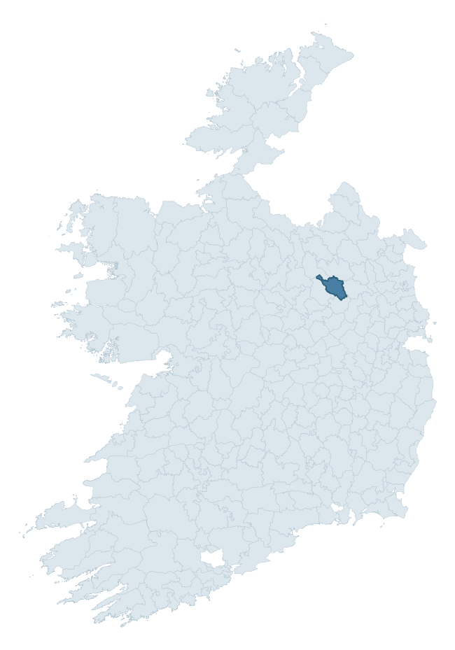
Where this barony sits in the Republic of Ireland
Geology and preservation
Bedrock geology shapes the landscape long before any settlement begins — controlling soil drainage, agricultural potential, the survival of upstanding monuments, and the preservation of buried archaeology. The figures below come from the Geological Survey Ireland 1:100,000 bedrock map.
The bedrock underlying Fore is predominantly limestone (61% of the barony by area), laid down during the Carboniferous period (88% by area, around 359 to 299 million years ago). Limestone is the most heritage-rich bedrock in Ireland. It supports fertile, well-drained soils that favoured dense Early Medieval settlement and Norman manorial agriculture, and it weathers into karst features — sinkholes, caves, swallow holes, and souterrains — that frequently carry archaeology. Where peat overlies limestone, organic preservation can be exceptional. The single largest mapped unit is the Lucan Formation (51% of the barony's bedrock). With 7 distinct rock types mapped, the barony sits in the top third of ROI baronies for geological diversity (74th percentile) — typically a sign of complex tectonic history or coastal mosaics of differing rock units.
Rock type composition
Largest mapped unit: Lucan Formation (51% of the barony)
Placename evidence
Logainm records 10 heritage-diagnostic placenames for Fore, a modest sample drawn predominantly from the townland record. The dominant stratum is early christian ecclesiastical. The most frequent diagnostic roots are cill- (5) and ráth- (3). With a sample of this size the count should be treated as indicative rather than definitive.
Pre-Christian / Early Medieval Defensive
| Root | Count | Meaning |
|---|---|---|
| ráth- | 3 | earthen ringfort |
| dún- | 1 | hilltop or promontory fort |
Early Christian Ecclesiastical
| Root | Count | Meaning |
|---|---|---|
| cill- | 5 | church (early) |
Burial, Ritual, and Norse-Contact
| Root | Count | Meaning |
|---|---|---|
| carn- | 1 | cairn |
| gall- | 1 | foreigner — Norse settlement marker |
Other baronies in Meath
About this profile
Click any section below to expand.
What is a barony?
A barony is a historic administrative unit in Ireland, broadly equivalent to an English hundred. The 280 baronies used here are from the OSi 2019 National Statutory Boundaries (generalised 20m), covering the 26 counties of the Republic of Ireland. Baronies derive from the Norman period, were formalised in the 17th century, and have not been redrawn for statistical purposes. They vary enormously in area, from compact urban baronies in Dublin to vast upland baronies in Connacht, and should not be compared by raw site count without accounting for area differences.
What counts as a site?
This profile combines three distinct heritage registers, each with its own definition of what constitutes a recordable site:
- Archaeological sites (NMS). The National Monuments Service Sites and Monuments Record (SMR) catalogues every known archaeological monument or site of archaeological interest in the Republic, from prehistoric burial mounds and ringforts to medieval churches and post-medieval defensive works. Inclusion does not require legal protection — only that the site has been identified, surveyed, and assessed as having archaeological value. A separate subset of these sites lies within a recorded protection zone, which gives them statutory protection under the National Monuments Acts.
- Listed buildings (NIAH). The National Inventory of Architectural Heritage records buildings of architectural, historical, archaeological, artistic, cultural, scientific, social, or technical interest. Each surveyed structure is appraised on a five-tier scale: International, National, Regional, Local, and Record-Only. The NIAH appraisal is informational rather than strictly statutory, but it underpins local-authority Record of Protected Structures (RPS) listings.
- Heritage placenames (Logainm). Logainm is the authoritative database of Irish placenames maintained by the Placenames Branch. This profile applies a heritage-diagnostic classifier to the Irish-language form of each townland name, flagging roots that signal defensive sites (ráth-, lios-, dún-, caiseal-, cathair-), ecclesiastical foundations (cill-, teampall-, domhnach-, mainistir-), prehistoric burial-ritual features (tuaim-, carn-, leaba-), or Norse-contact settlement (gall-). Townlands without one of these diagnostic roots are not flagged here — they may still carry historical significance, but that significance is not encoded in the name itself.
Editorial principles
The narrative sections of this profile follow several explicit principles:
- Evidential. Every claim about this barony’s heritage character is anchored in the underlying register data. Where a site count, a placename count, or a percentile rank is cited, it is computed from the source datasets at export time, not estimated.
- Comparative. Counts and metrics are reported alongside their percentile rank against the other 279 ROI baronies. A barony with 50 ringforts in absolute terms could be unusually high or unusually low depending on its size and regional context; percentile ranking removes that ambiguity.
- Transparent on limits. Where a register has known coverage gaps, survey biases, or data-quality issues that affect this barony’s figures, the profile flags them rather than presenting the numbers as definitive.
- No interpretation beyond what the data supports. The narrative does not speculate about historical events, social dynamics, or cultural meaning beyond what the recorded heritage and placename evidence directly attests.
Data caveats and limits
- NMS Sites and Monuments Record is the product of survey campaigns conducted at different intensities across different counties and decades. Some baronies have been surveyed more thoroughly than others, and absolute counts should be read in that light. Sites destroyed by development before survey are typically not represented; sites in heavily forested or upland terrain are sometimes under-recorded.
- NIAH coverage is broadly complete for the Republic of Ireland but the survey was conducted on a rolling county-by-county basis, and the most recent appraisal date varies. Buildings demolished or substantially altered after their original survey may still appear in the register; conversely, recent buildings of merit may not yet have been appraised.
- Logainm classification applies a deliberately conservative pattern-matching approach to the Irish-language townland forms. The classifier prioritises true positives over recall: a townland may carry a heritage signal that the classifier doesn’t recognise, particularly where the diagnostic root has been heavily anglicised or where the townland name draws on a less common term. The 60,000+ townland records and ~9,800 classified placenames give a substantial signal at barony scale, but individual townland names should be checked against Logainm directly for definitive interpretation.
- Period attribution. The chronological distribution reflects only those NMS sites that carry a recognised period attribution in the source data. Sites listed as “Unknown” period are excluded from the dated subset.
- Boundary changes. Some baronies have undergone minor boundary adjustments since their 19th-century definition; the OSi 2019 generalised boundaries used here are the current statutory definition and may differ slightly from historical maps in border areas.
- Bedrock geology is mapped at 1:100,000 scale, which means local variation within a barony — small pockets of different rock type, mineral veins, alluvium overlying bedrock — is generalised. The dominant-system and rocktype figures are area-weighted, so a barony reading “70% Carboniferous limestone” may still contain small but archaeologically important pockets of older or younger rock. Around 3% of GSI polygons do not match the lexicon and contribute no rocktype or system attribution.
Data sources
- National Monuments Service — Sites and Monuments Record (SMR) https://data.gov.ie/dataset/national-monuments-service-archaeological-survey-of-ireland
- National Inventory of Architectural Heritage (NIAH) https://data.gov.ie/dataset/national-inventory-of-architectural-heritage-niah-national-dataset
- Logainm — Placenames Database of Ireland https://www.logainm.ie/
- Ordnance Survey Ireland — National Statutory Barony Boundaries 2019 https://data-osi.opendata.arcgis.com/
- EURODEM — European Digital Elevation Model https://www.mapsforeurope.org/datasets/euro-dem
- ESA WorldCover https://esa-worldcover.org/en
- Geological Survey Ireland — 1:100,000 Bedrock Geology https://www.gsi.ie/en-ie/data-and-maps/Pages/Bedrock.aspx
Explore more: Search any of the 280 ROI baronies, browse by historical province, or read the methodology and data sources for the full Republic of Ireland Heritage Tool.