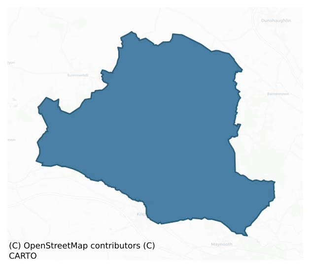
Deece Upper is a barony of County Meath, in the historical province of Leinster (Irish: Déise Uachtarach), covering 116 km² of land. The barony records 135 NMS archaeological sites and 16 NIAH listed buildings, placing it at around the 18th percentile among 280 ROI baronies for sites per km². This means it is in the bottom fifth of all baronies for sites per km². Dated archaeological evidence runs from the Early Bronze Age through to the Medieval, spanning 5 of 9 archaeological periods, placing the barony in the 8th percentile among 280 ROI baronies for chronological depth. This means it is in the bottom tenth of all baronies for chronological depth. The largest dated subset of recorded sites dates to the Iron Age.
Heritage at a glance
Percentile rankings throughout this profile compare each barony only against the other 279 Republic of Ireland baronies.
The recorded heritage of Deece Upper
The National Monuments Service Sites and Monuments Record (SMR) is the statutory inventory of archaeological sites for the Republic of Ireland, maintained by the Department of Tourism, Culture, Arts, Gaeltacht, Sport and Media. Sites recorded here include earthworks, ringforts, megalithic tombs, ecclesiastical remains, and post-medieval features; not every record is legally protected, but each is registered as a monument of archaeological interest.
The National Monuments Service records 135 archaeological sites in Deece Upper, putting it at the 18th percentile among 280 ROI baronies for sites per km². This means it is in the bottom fifth of all baronies for sites per km². Protection coverage is near-universal — 124 sites (92%) fall within a recorded monument protection zone, indicating an extensively surveyed landscape. The record is dominated by defensive sites — ringforts, enclosures, hillforts, and stone forts (44 sites, 33% of the total), with ecclesiastical sites forming a substantial secondary presence (27 sites, 20%). Ringfort – rath is the most prevalent type, making up 18% of the barony's recorded sites (24 records), broadly in line with the ROI average of 20% across all baronies where this type occurs. Ringfort – rath is an earthen ringfort enclosed by a bank and external ditch — the most common Early Medieval farmstead, broadly dated 500–1000 AD. Other significant types include Field system (12) and Church (11). Field system is a group of related fields forming a coherent agricultural landscape, of any date from the Neolithic onwards; Church is a building used for public Christian worship, of any date from c. 500 AD onwards. Across the barony's 116 km², this gives a recorded density of 1.17 sites per km².
Most common monument types
Hover or tap a monument type to see its definition.
| Type | Count |
|---|---|
| Ringfort – rath an earthen ringfort enclosed by a bank and external ditch — the most common Early Medieval farmstead, broadly dated 500–1000 AD | 24 |
| Field system a group of related fields forming a coherent agricultural landscape, of any date from the Neolithic onwards | 12 |
| Church a building used for public Christian worship, of any date from c. 500 AD onwards | 11 |
| Graveyard a burial area associated with a church, in use from the medieval period onwards | 11 |
| Enclosure a banked or ditched feature of uncertain type, used as a catch-all where the original function cannot be determined from surface evidence | 10 |
| Ring-ditch a circular ditch under 20m across, often the ploughed-out remains of a barrow, ring-barrow or roundhouse | 6 |
| Moated site | 3 |
Chronological distribution
The dated archaeological record for Deece Upper spans from the Early Bronze Age through to the Medieval, with activity attested across 5 of 9 archaeological periods. This is the 8th percentile across ROI baronies — a relatively narrow chronological band, with much of Irish prehistory not represented in the dated record. Every period from earliest to latest is represented in the record — an unbroken sequence of dated activity across the full chronological span. Activity concentrates most heavily in the Iron Age (35 sites, 33% of dated material), with the Medieval forming a secondary peak (24 sites, 23%). A further 30 recorded sites (22% of the overall NMS register for the barony) carry no period attribution — appearing as 'Unknown' in the bar chart below. This typically reflects either records that pre-date the standardised period vocabulary or sites awaiting specialist dating review, rather than a genuine absence of chronological evidence.
Sample of recorded monuments
Show 25 sample monuments (of 135 total)
A representative sample of 25 recorded monuments drawn from the barony’s 135 total NMS entries. Sites within a recorded monument protection zone and rarer site types are prioritised so the list shows a meaningful cross-section rather than only the most common type. Each entry shows the official Sites and Monuments Record reference number and the description published by the National Monuments Service.
Castle – unclassified
Situated on a slight SW-facing slope with Arodstown church (ME043-015—-) c. 150m to the W. According to the Civil Survey (1654-6) Peter Barnwall of Arrottstown in Kilmore parish owned 305 acres there in 1640, and on…
Situated on a slight SW-facing slope with Arodstown church (ME043-015—-) c. 150m to the W. According to the Civil Survey (1654-6) Peter Barnwall of Arrottstown in Kilmore parish owned 305 acres there in 1640, and on the premises were ‘a castle and some cottages’ (Simington 1940, 149). This was a rectangular structure (ext. dims 10.6m plus NW-SE; 8.7m NE-SW) with a projecting square tower (ext. dims c. 3.5m NE-SW; 2.75m NW-SE) at the S angle. There was a modern doorway in the SE wall and two double-splay lights on the NE wall at the ground floor. The ceiling was supported on corbels in the long walls. A lintelled doorway (Wth 0.7m) leads from the main chamber to the S tower (int. dims 2.6m NW-SE; 2m NE-SW) that had a low barrel-vault with a single double-splay light in the SE wall. The first floor under the NW-SE barrel-vault may have been a loft as it has no features except a round-headed doorway leading to the S tower, which also has a barrel-vault. The S tower has a double-splay light in the SE wall and a large opening in the NE wall that could have provided the main entrance to the structure. There was no trace of any upper floors and it appears to have been removed since 1969 (Bing c. 2013).
The above description is derived from the published 'Archaeological Inventory of County Meath' (Dublin: Stationery Office, 1987). In certain instances the entries have been revised and updated in the light of recent research.
Compiled by: Michael Moore
Date of revision:…
Building
Located on the summit of Culmullin hill and built into the SW side of the motte (ME043-018—-). A large two storey house, probably with a return, is represented on the Down Survey (1658) barony map of Deece at…
Located on the summit of Culmullin hill and built into the SW side of the motte (ME043-018—-). A large two storey house, probably with a return, is represented on the Down Survey (1658) barony map of Deece at Culmullin close to the church. According to the Civil Survey (1654) 332 acres at Culmullin were owned by the Lord of Slane and there was on the land a stone house and a church, both ruined (Simington 1940, 146).
This is a rectangular masonry structure (dims c. 14m NW-SE; c. 6m NE-SW) reduced to one storey with a vault that is now divided in two by an inserted wall. Each chamber has a lintelled doorway and splayed rectangular window in the SW wall and there is a narrow light in an embrasure in the NW wall. There is a small vaulted alcove off the NE wall of the SE chamber, which is built into the mound of the motte.
Compiled by: Michael Moore
29 March 2019
Settlement deserted – medieval
The Parys family of Agher or Agherpallis are recorded from the fourteenth century and in 1385 Edward Perers possessed two carucates at Agher. In 1534 Christopher Parys was implicated in the rebellion of Silken Thomas,…
The Parys family of Agher or Agherpallis are recorded from the fourteenth century and in 1385 Edward Perers possessed two carucates at Agher. In 1534 Christopher Parys was implicated in the rebellion of Silken Thomas, but if they suffered forfeiture they had recovered Agher by the middle of the century. However, the involvement of George Parys in conspiracies with O’Connor of Offaly resulted in the confiscation of Agher c. 1550. Although Parys was reconciled to the Crown by 1552, Agher had already been granted to a George Gernon of Louth, who managed to retain it, and Parys received no compensation. In 1567 Gernon secured a lease for 21 years of ‘the castle of Agher, Ballintogher and Trubly’.
In 1621 Anthony Gernon held from the King ‘one castle, five messuages, seven cottages, 240 acres of arable land and 200 acres of moor in the town of Agher’ (Devitt 1909-11, 214-21). According to the Civil Survey (1656-8) George Gernon of Agherpallice, owned 425 acres at Agherpallice and on the premises were ‘a castle, a church, a pigeon house and some cabins’. He also held 50 acres at Ballintogher in the same parish (Simington 1940, 156). After the Cromwellian period Agher was acquired ultimately by Benjamin Pratt from Leicestershire, but in the mid-eighteenth century it passed through marriage to the Winter family, who were the principal family in the parish into the nineteenth century (Lewis 1837, 1, 18). They probably built Agherpalis House, now removed, and established the lands…
Castle – motte and bailey
The Parys family of Agher or Agherpallis are recorded from the fourteenth century and in 1385 Edward Perers possessed two carucates at Agher. In 1534 Christopher Parys was implicated in the rebellion of Silken Thomas,…
The Parys family of Agher or Agherpallis are recorded from the fourteenth century and in 1385 Edward Perers possessed two carucates at Agher. In 1534 Christopher Parys was implicated in the rebellion of Silken Thomas, but if they suffered forfeiture they had recovered Agher by the middle of the century. However, the involvement of George Parys in conspiracies with O’Connor of Offaly resulted in the confiscation of Agher c. 1550. Although Parys was reconciled to the Crown by 1552, Agher had already been granted to a George Gernon of Louth, who managed to retain it, and Parys received no compensation. In 1567 Gernon secured a lease for 21 years of ‘the castle of Agher, Ballintogher and Trubly’.
In 1621 Anthony Gernon held from the King ‘one castle, five messuages, seven cottages, 240 acres of arable land and 200 acres of moor in the town of Agher’ (Devitt 1909-11, 214-21). According to the Civil Survey (1656-8) George Gernon of Agherpallice, owned 425 acres at Agherpallice and on the premises were ‘a castle, a church, a pigeon house and some cabins’. He also held 50 acres at Ballintogher in the same parish (Simington 1940, 156). After the Cromwellian period Agher was acquired ultimately by Benjamin Pratt from Leicestershire, but in the mid-eighteenth century it passed through marriage to the Winter family, who were the principal family in the parish into the nineteenth century (Lewis 1837, 1, 18). They probably built Agherpalis House, now removed, and established the lands…
Mound
Marked on the 1837 ed. of the OS 6-inch map as a small feature and described in gothic lettering as a ‘Mound’. It was described as a circular mound (diam. 24m E-W, H 1.6m) truncated by ditch at S and with the holy well…
Marked on the 1837 ed. of the OS 6-inch map as a small feature and described in gothic lettering as a ‘Mound’. It was described as a circular mound (diam. 24m E-W, H 1.6m) truncated by ditch at S and with the holy well (ME049-014001-) at the centre (Moore 1987, 34), but the well has been conserved since 1985, and the mound is no longer prominent.
The above description is derived from the published 'Archaeological Inventory of County Meath' (Dublin: Stationery Office, 1987). In certain instances the entries have been revised and updated in the light of recent research.
Compiled by: Michael Moore
Date of revision: 11 September, 2015
Concentric enclosure
Located on a fairly level low-lying landscape. In 1970 (SMR file) this was a raised and circular grass-covered area (diam. 30m NNW-SSE; 28m NE-SW) defined by the lip of an earthen bank (at NNW: Wth of base 11.5m; int. H…
Located on a fairly level low-lying landscape. In 1970 (SMR file) this was a raised and circular grass-covered area (diam. 30m NNW-SSE; 28m NE-SW) defined by the lip of an earthen bank (at NNW: Wth of base 11.5m; int. H 0.4m; ext. H 3.1m) largely reduced to an external scarp (at SSE: Wth 4m; H 2.1m) that is separated by a fosse (Wth of top 7.5-12m; Wth of base 2m; ext. D 0.6m at SSE to 1.9m at NNW) from a slight counterscarp bank (at NNW: Wth of base 5.8m; ext. H 0.2m) that only survives NW-N. This is separated by a berm (at NNW: Wth 14.5) from an earthen bank (at NNW: Wth of base 6m; int. H 0.6m; ext. H 1m) that is separated by a fosse (at NNW: Wth of top 9m; Wth of base 1m; ext. D 0.7m) from a levelled outer bank (at NNW: Wth of base 10m; Wth of top 4m; ext. H 0.5m) that only survived in 1970 WNW-E-SE but this perimeter could be incorporated into a curved farm lane and field banks SW-WNW. All the banks were covered in bushes in 1970 and there was an entrance through the inner (Wth of base 2m) bank and a causeway (Wth of top 10m; H 0.5m) at NNE. On the other side of the berm there is a gap in the middle (Wth 4m) and outer banks (Wth 2m) at N.
Relict field banks and drains connected the outer enclosure with the inner at ESE, WSW and WNW. In the interior of the inner enclosure there was a sunken area (L 6.5m; Wth 1.5m; D 0.3m) N-S with a spur (L 6.3m; Wth 1.5m; D 0.4m) extending NE from its N end, which could be a souterrain except that the spoil on the E side formed a gr…
Barrow – ring-barrow
Located in a fairly level landscape. A small embanked enclosure (ext. diam. c. 25m) is depicted only on the 1836 edition of the OS 6-inch map where it is described as a ‘Fort’. This is a circular grass-covered area…
Located in a fairly level landscape. A small embanked enclosure (ext. diam. c. 25m) is depicted only on the 1836 edition of the OS 6-inch map where it is described as a ‘Fort’. This is a circular grass-covered area (diam. 9m) defined by two concentric fosses and outer banks (max. ext. diam. 25m). It is faintly visible on Google Earth (28/06/2018).
The above description is derived from the published 'Archaeological Inventory of County Meath' (Dublin: Stationery Office, 1987). In certain instances the entries have been revised and updated in the light of recent research.
Compiled by: Michael Moore
Date of revision: 27 August 2019
House – 16th/17th century
Situated at the W edge of a small N-S valley, with the stream c. 30m to the E, and the site of the parish church of Moyglare (ME049A002—-) is c. 150m to the S. According to the Civil Survey (1654-6) Sir George…
Situated at the W edge of a small N-S valley, with the stream c. 30m to the E, and the site of the parish church of Moyglare (ME049A002—-) is c. 150m to the S. According to the Civil Survey (1654-6) Sir George Wentworth, a Protestant, owned 487 acres at Moyglare in 1640, and on the property were ‘a large stone house, a Mill, a pigeon house and two farme houses’ (Simington 1940, 153). He also owned almost 1100 acres elsewhere in the parish, amounting to almost all of it (ibid. 153-6). Fragments of the NW (L 6.65m plus; T 1.05m) and SE (L 4m plus; T 1m) walls placed 3.5m apart survive to the first floor, but there is no indication of vaulting. The remnants of the NE wall have traces of a base-batter and there is a fireplace in the NW wall at the first floor, which is recessed to support the floor, but at the second floor the joists were set into the wall. Just N of the masonry remains is a raised platform (dims of top 9m E-W; 8m N-S; max. H 1m at N), and a scarp (L 26m; H up to 1.5m) extends S from the masonry remains with some stone exposed.
The above description is derived from the published 'Archaeological Inventory of County Meath' (Dublin: Stationery Office, 1987). In certain instances the entries have been revised and updated in the light of recent research.
Compiled by: Michael Moore
Date of revision: 13 July 2016
Barrow – stepped barrow
Situated on a slight S-facing slope. This is a raised circular and grass-covered area (diam. 55.5m ENE-WSW; 51.5m NNW-SSE) defined by a fosse (Wth of top 8m at ENE to 15m at S; int. D 1.6-2m; ext. D 0.7m at ENE to 1.6m…
Situated on a slight S-facing slope. This is a raised circular and grass-covered area (diam. 55.5m ENE-WSW; 51.5m NNW-SSE) defined by a fosse (Wth of top 8m at ENE to 15m at S; int. D 1.6-2m; ext. D 0.7m at ENE to 1.6m at S) and an outer bank (Wth of base 10m at WSW to 15m at ENE; Wth of top 1m at S to 12m at ENE; ext. H 1.8m at WSW to 2.3m at ENE-S) and a slight outer fosse (Wth of top 9-13m; Wth of base 2m; ext. D 0.3-0.5m). A field bank (Wth of base 6m; int. H 0.5m; ext. H 2.3m) is built on the outer edge of the bank and forms the townland boundary with Killowen to the E from NE-ESE where the outer fosse is transformed into a drain (Wth of top 6.5m; Wth of base 1m; ext. D 2m) (max. ext. diam. 107m ENE-WSW). There is an entrance in the bank with the remains of a causeway across the fosse is at E.
The above description is derived from the published 'Archaeological Inventory of County Meath' (Dublin: Stationery Office, 1987). In certain instances the entries have been revised and updated in the light of recent research.
Compiled by: Michael Moore
Date of upload: 10 July 2007
Amended: 29 October 2021, 24 March 2023
Wall monument
This carved stone is set on the ground and just inside the boundary wall immediately E of the entrance to Gallow graveyard (ME049-004001-). It is trapezoidal in profile and measures 0.67m L at the base 0.125 at the top…
This carved stone is set on the ground and just inside the boundary wall immediately E of the entrance to Gallow graveyard (ME049-004001-). It is trapezoidal in profile and measures 0.67m L at the base 0.125 at the top and is 0.31m H: its thickness varies from 0.15m to 0.2m. The top of the stone has a small projecting tenon (85mm x 35mm and 20mm H) and this clearly was intended to fit into the mortise of some additional feature, possibly a cross. The stone, as currently positioned, is carved on the W face: the E face, or back, is not dressed in any significant manner and, inasmuch as the stone varies in thickness, it does not seem likely that it was originally intended for this face to be visible. Rather, it is possible that it was set into a wall or formed part of a wall-monument. The original province of the stone is unknown and it more than likely came from the church (ME049-004—-). The W face of the stone is divided into three panels with false relief carving. The central vertical panel corresponds in width with the top of the trapezoid. It bears a fine carving of the seated figure of Christ who is shown bound and is accompanied by various crucifixion symbols (hammer, nails, ladder and spear). This scene is flanked on either side by two triangular panels each of which contains a winged robed figure – clearly angels – holding stylized palm branches in each hand, the stems of which curve beneath them in the manner of a skipping rope; possibly based on Revelations (7:9)…
Cross-slab
This, the lower portion of a cross-slab, stands 6.6m S of the church (ME049-004—-) in Gallow graveyard (ME049-004001-). The stone leans to the east, measures 0.24m wide by 0.10m thick and, if erect, would be 0.75m…
This, the lower portion of a cross-slab, stands 6.6m S of the church (ME049-004—-) in Gallow graveyard (ME049-004001-). The stone leans to the east, measures 0.24m wide by 0.10m thick and, if erect, would be 0.75m high. The E face is carved with the lower part of a cross shaft (height 0.15m) with a T-shaped terminal. Below this is a hole where the stone has been pierced through (diam. c. 0.04m).
Compiled by: Paul Walsh
Date of upload: 22 July 2013
Ecclesiastical enclosure
Situated on a slight E-facing slope. The parish church of Drumlargan (ME043-037—-) and it s graveyard (ME043-037001-) are within a larger ecclesiastical enclosure (diam. c. 170m) defined by a scarp and slight traces…
Situated on a slight E-facing slope. The parish church of Drumlargan (ME043-037—-) and it s graveyard (ME043-037001-) are within a larger ecclesiastical enclosure (diam. c. 170m) defined by a scarp and slight traces of an external ditch E-S, and by a curving road NW-NE, but it has been curtailed by a NW-SE field bank at SW. Burials were found in the W part of the larger enclosure in 1982 (SMR file). Archaeological testing (04E0745) on the line of the perimeter at NE failed to produce any related material (Duffy 2007).
Compiled by: Michael Moore
Date of upload: 24 March, 2014
Graveslab
Within the graveyard at Kilmore parish church (ME043-042—-). The graveslab (L 1.73m; Wth 0.46-0.66m; T 0.1m), which has a raised Crucifixion (Harbison 2000, 55) and an inscription in false relief commemorating Rory…
Within the graveyard at Kilmore parish church (ME043-042—-). The graveslab (L 1.73m; Wth 0.46-0.66m; T 0.1m), which has a raised Crucifixion (Harbison 2000, 55) and an inscription in false relief commemorating Rory Buí McMahon in Latin and Irish, is displayed just S of the church. It was found in the graveyard and has the the date 1575 (FitzGerald 1907-09; Hunt 1974, 210).
It is described by FitzGerlad as: This is a slab which, in my opinion, is unique; it is dated 1575; down the centre is the outline of a plain cross bearing a small figure of our Lord crucified at the upper end; the date in Arabic numerals, 1575, is carved under the left arm of the cross; an inscription in several lines covers the remainder of the slab; on the left side and lower end of the slab it is in Latin, and the rest is in Irish. The whole inscription is in relief, the Latin portion in broad capitals and the Irish portion in neatly cut Celtic letters with rounded limbs; it is in a very fair state of preservation, though covered with lichen. The Latin inscription reads: NEMINEM CONSTRISTARI MORTE D / EBERE CVM SIT IN VIVENDO LABOR / ET PERICVLUM IN MORIENDO PAX ET / RESVRGENDI SECVRITAS. ORTATE PRO ANIMA RVGER (I) MAC M / AHVNA QVI ME FE.
Translation: No one ought to be grieved at death, since in living there is labour and danger, while in dying there is peace and the assurance of resurrection. Pray for the soul of Rory MacMahon who made me.
The Irish inscription fortunately is legible; it…
Road – road/trackway
Located on a level landscape just N of the graveyard of Kilmore parish church (ME043-042—-). A section of road (L c. 65m), evident as a berm (Wth 7.5m) defined by the scarp of the graveyard (H 1m) at S and a ditch…
Located on a level landscape just N of the graveyard of Kilmore parish church (ME043-042—-). A section of road (L c. 65m), evident as a berm (Wth 7.5m) defined by the scarp of the graveyard (H 1m) at S and a ditch (Wth of top 5m; D at S 0.4m) and outer bank (Wth 3m; H at S 1; H at N 0.5m) at N survives where the original Dunboyne to Summerhill road ran (Moore 1975, 38). The road extended further E (L c. 75m) on the 1836 ed. of the OS 6-inch map, while the present road, which pre-dates 1836, lies c. 10m S of the graveyard.
Compiled by: Michael Moore
Date of upload: 24 March, 2015
Cross-inscribed stone
Within the graveyard of Kilmore parish church (ME043-042—-). A slab (dims c. 0.5m x c. 0.2-0.35m; T 0.1m) with a deeply incised cross (H c. 0.2m; span c. 0.2m) that has expanding terminals (Wth of lines c. 2cm) was…
Within the graveyard of Kilmore parish church (ME043-042—-). A slab (dims c. 0.5m x c. 0.2-0.35m; T 0.1m) with a deeply incised cross (H c. 0.2m; span c. 0.2m) that has expanding terminals (Wth of lines c. 2cm) was found c. 1970 (Moore 1975, 43, No. 23), but it is not now visible in the graveyard.
Compiled by: Michael Moore
Date of upload: 7 April, 2015
Armorial plaque
A small crest (dims c. 0.4m x c. 0.3m) carved in false relief depicting three gorgets or crescents and a fess or horizontal bar is now in the garden of a nearby house. It has ‘Beati Pacilis’ (blessings of peace?)…
A small crest (dims c. 0.4m x c. 0.3m) carved in false relief depicting three gorgets or crescents and a fess or horizontal bar is now in the garden of a nearby house. It has ‘Beati Pacilis’ (blessings of peace?) inscribed in a cursive script on a ribbon around a dove with an olive branch above the crest, which most resembles the arms of the Dillon family.
Compiled by: Michael Moore
Date of upload: 13 July, 2016
Barrow – unclassified
The Archaeological Survey of Ireland (ASI) is in the process of providing information on all monuments on The Historic Environment Viewer (HEV). Currently the information for this record has not been uploaded. To…
The Archaeological Survey of Ireland (ASI) is in the process of providing information on all monuments on The Historic Environment Viewer (HEV). Currently the information for this record has not been uploaded. To access available information for research purposes please make an appointment in advance with the Archive Unit (open Fridays 10.00 am – 5.00 pm), Department of Culture, Heritage and the Gaeltacht, The Custom House, Dublin 1 D01W6XO or email nmarchive@chg.gov.ie.
Stoup (present location)
Located in the farmyard of Culmullin House is a rectangular stone stoup (ext. dims 0.35m x 0.35m; H c. 0.25m) with the date 1616 crudely incised into one side. Its original find spot is not known.
Compiled by:…
Located in the farmyard of Culmullin House is a rectangular stone stoup (ext. dims 0.35m x 0.35m; H c. 0.25m) with the date 1616 crudely incised into one side. Its original find spot is not known.
Compiled by: Michael Moore
Date of upload: 29 March 2019
Font (present location)
This font was located inside the medieval parish church of Culmullin (ME043-017—-) (Cogan 1862-70, 2, 351), but it was moved to a place by the path through the graveyard (Roe 1968, 112-3) and later it was on the lawn…
This font was located inside the medieval parish church of Culmullin (ME043-017—-) (Cogan 1862-70, 2, 351), but it was moved to a place by the path through the graveyard (Roe 1968, 112-3) and later it was on the lawn of Culmullin House (ME043-018001-) (Moore 1987, 151). The font is now in St Martin’s Roman Catholic church at Culmullin. It is a plain octagonal font with an irregular shape (ext. dims 0.55m x 0.46m; H 0.56m). The sides are of uneven length (L 0.18-0.29m) and this creates an oval basin (int. dims 0.43m x 0.36m; max. D 0.21m) that has a wave-like rim from wear. The lower panels (H 0.32m) are set slightly back from the upper but they are vertical, although some are damaged, and the central drain-hole is blocked.
Compiled by: Michael Moore
Date of upload: 29 March, 2019
House – indeterminate date
Situated on a slight E-facing slope of a broad N-S ridge within the field system (ME049-007—-) and c. 30m N of enclosure (ME049-008—-). This is a slightly raised grass-covered platform (dims 4m x 2.5m) defined by a…
Situated on a slight E-facing slope of a broad N-S ridge within the field system (ME049-007—-) and c. 30m N of enclosure (ME049-008—-). This is a slightly raised grass-covered platform (dims 4m x 2.5m) defined by a slight hollow.
Compiled by: Michael Moore
Date of upload: 27 August, 2019
Habitation site
Situated on a rise of a gentle S-facing slope and on the W side of the NW-SE R158 road, across from the parish church of Balfeaghan (ME049-017—-). Archaeological testing (06E1231) by A. Collins in advance of a…
Situated on a rise of a gentle S-facing slope and on the W side of the NW-SE R158 road, across from the parish church of Balfeaghan (ME049-017—-). Archaeological testing (06E1231) by A. Collins in advance of a realignment of the road identified archaeological features (Collins 2008, 19-20) that were subsequently excavated (07E0295) as Site 14 by the same archaeologist (excavations.ie 2007:1256). The glebe, represented only on the 1836 edition of the OS 6-inch map, is not specifically recorded in documentary sources until the mid to late seventeenth century when Bishop Henry Jones (1661-82) records ‘a house and garden with one acre glebe’ at Balfeaghan, and Bishop Dopping records ‘no glebe, a house and garden’ in 1682-5 (Ellison 1972, 5-8). The glebe is not specifically mentioned thereafter, which may mean that it was no longer economically significant or that the Church no longer owned the land, although as a feature of the landscape it persists into the nineteenth century (Collins 2009, 11-13).
The earliest excavated feature is a NW-SE drain (Wth 1.45m; max. D 1m; L 27m plus) on the line of the NE boundary of the small glebe (dims c. 75m NW-SE; c. 35m NE-SW) depicted on the 1836 edition of the OS 6-inch map. The ditch contained three fills but no artefacts were recovered. A sample of carbonised grain from a secondary fill yielded a C14 determination of 660-780 cal. AD, which could suggest that the church and its glebe may have an early medieval origin, but it is more…
Burial mound
Located just off the summit of a small hillock. It is not depicted on any map but was described in 1969 (SMR file) as a subcircular platform (dims of base 20m NW-SE; 11m NE-SW) defined by a scarp (at SW: Wth 1.4m; H…
Located just off the summit of a small hillock. It is not depicted on any map but was described in 1969 (SMR file) as a subcircular platform (dims of base 20m NW-SE; 11m NE-SW) defined by a scarp (at SW: Wth 1.4m; H 0.55m). It is known locally and was thought to be a burial ground from 1798. Its visible profile seems to have been removed by 1995 (OSAP).
The above description is derived from the published 'Archaeological Inventory of County Meath' (Dublin: Stationery Office, 1987). In certain instances the entries have been revised and updated in the light of recent research.
Compiled by: Michael Moore
Date of revision: 21 August 2019
Castle – motte
Situated on top of a hill. This is a flat-topped earthen mound (diam. of top c. 20-25m; H c. 4-6m) overgrown in mixed woodland. It has no visible fosse and the building (ME043-018002-) is built into the perimeter at SW.…
Situated on top of a hill. This is a flat-topped earthen mound (diam. of top c. 20-25m; H c. 4-6m) overgrown in mixed woodland. It has no visible fosse and the building (ME043-018002-) is built into the perimeter at SW. Culmullin parish church (ME043-017—-) is c. 265m to the NNW.
The above description is derived from the published 'Archaeological Inventory of County Meath' (Dublin: Stationery Office, 1987). In certain instances the entries have been revised and updated in the light of recent research.
Compiled by: Michael Moore
Date of revision: 27 August 2019
Barrow – mound barrow
Located on a slight rise towards the bottom of a gentle N-facing slope with a small NW-SE canalised stream known as the Derrypatrick River c. 110m to the N. It is described as ‘Culmullin Mote’ on the 1836 and 1912…
Located on a slight rise towards the bottom of a gentle N-facing slope with a small NW-SE canalised stream known as the Derrypatrick River c. 110m to the N. It is described as ‘Culmullin Mote’ on the 1836 and 1912 editions of the OS 6-inch map. This is a subcirsular and grass-covered earthen mound (dims of base 18m NNE-SSW; 16m WNW-ESE: H 2m at S to 2.7m at N) with a rounded top.
The above description is derived from the published 'Archaeological Inventory of County Meath' (Dublin: Stationery Office, 1987). In certain instances the entries have been revised and updated in the light of recent research.
Compiled by: Michael Moore
Date of revision: 21 August 2019
Ringfort – rath
Located on a NE-facing slope of Arodstown Hill. It was described in 1969 (SMR file) as a subcircular grass-covered area (dims 44m E-W; 36.5m N-S) that sloped down to the N (H 1.5m). It was defined by an earthen bank…
Located on a NE-facing slope of Arodstown Hill. It was described in 1969 (SMR file) as a subcircular grass-covered area (dims 44m E-W; 36.5m N-S) that sloped down to the N (H 1.5m). It was defined by an earthen bank (Wth of base 5.5-6m; int. H 0.1m at N to 0.6m at S; ext. H 1.1m at S to 1.5m at N) with some bushes separated by a rounded fosse (Wth of top 5-5.5m; ext. D 0.3m at N to 0.7m at S) from an outer bank at N (Wth of base 3.5m; ext. H 0.5m) and ESE-SSE (Wth of base 4.3m; int. H 075m; ext. H 0.5m). The original entrance was not recognised but it may have been between NNE and ESE where the inner bank was damaged. The visible profile of the monument had been removed by 1995 (OSAP).
The above description is derived from the published 'Archaeological Inventory of County Meath' (Dublin: Stationery Office, 1987). In certain instances the entries have been revised and updated in the light of recent research.
Compiled by: Michael Moore
Date of revision: 21 August 2019
Listed buildings
The National Inventory of Architectural Heritage (NIAH) is a state survey appraising buildings of architectural, historical, archaeological, artistic, cultural, scientific, social, or technical interest. Each surveyed structure receives a rating from International (the highest, for buildings of European importance) through National, Regional, Local, and Record-Only.
The NIAH records only 16 listed buildings in Deece Upper, the 5th percentile across ROI baronies — a relatively thin architectural record. All recorded buildings carry Regional or lower grading; the barony does not contain any structures appraised as being of National or International architectural importance. Construction dates concentrate most heavily in the Late Georgian (1800-1830) period. The most-recorded building type is church/chapel (4 examples, 25% of the listed stock).
Terrain and environment
Mean elevation across the barony is 94m — the 56th percentile among 280 ROI baronies for elevation. This means it is in the upper half of all baronies for elevation. Elevation matters for heritage because higher-altitude baronies typically favour defensive monuments — ringforts and hilltop forts placed on prominent ground — while lowland baronies are more likely to carry the dense settlement and church networks of intensive agricultural landscapes. Mean slope is 2.2° — the 15th percentile among 280 ROI baronies for slope. This means it is in the bottom fifth of all baronies for slope. This is broadly flat terrain, the kind of landscape best suited to intensive agriculture. Slope is a key control on both land use and archaeological preservation: steep ground resists ploughing and tends to preserve earthworks intact, while gentle slopes favour intensive cultivation that damages or destroys surface archaeology over time. The Topographic Wetness Index averages 11.7, the 82nd percentile among 280 ROI baronies for wetness. This means it is in the top fifth of all baronies for wetness. This is wet, slow-draining ground by ROI standards — the kind of landscape that may carry waterlogged archaeological sites of unusual preservation value. Drainage matters for heritage because poorly-drained ground preserves organic archaeology (wooden trackways, leather, textiles, and on rare occasions human remains) far better than free-draining soil; well-drained ground favours arable use but destroys organic material rapidly. The land-cover mosaic combines improved grassland (81%), arable farmland (10%), and woodland (8%), giving a mixed agricultural and semi-natural landscape.
Terrain measurements
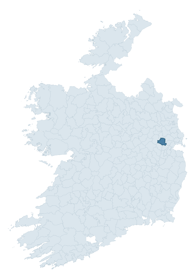
Where this barony sits in the Republic of Ireland
Geology and preservation
Bedrock geology shapes the landscape long before any settlement begins — controlling soil drainage, agricultural potential, the survival of upstanding monuments, and the preservation of buried archaeology. The figures below come from the Geological Survey Ireland 1:100,000 bedrock map.
The bedrock underlying Deece Upper is predominantly sandstone (50% of the barony by area), laid down during the Carboniferous period (100% by area, around 359 to 299 million years ago). Sandstone weathers to free-draining, moderately fertile soils that supported Early Medieval ringfort agriculture and later manorial estates. The rock itself is a major source of building stone — visible in churches, tower houses, and farm buildings across the barony's historic landscape. A substantial secondary geology of limestone (49%) adds further variety to the underlying landscape. The single largest mapped unit is the Namurian (undifferentiated) (50% of the barony's bedrock). With only 2 distinct rock types mapped, the barony is geologically uniform compared to the rest of the Republic (18th percentile for diversity) — a single coherent bedrock landscape.
Rock type composition
Largest mapped unit: Namurian (undifferentiated) (50% of the barony)
Placename evidence
Logainm records 8 heritage-diagnostic placenames for Deece Upper, a modest sample drawn predominantly from the townland record. The dominant stratum is early christian ecclesiastical. The most frequent diagnostic roots are cill- (8) and gall- (2). With a sample of this size the count should be treated as indicative rather than definitive.
Early Christian Ecclesiastical
| Root | Count | Meaning |
|---|---|---|
| cill- | 8 | church (early) |
Burial, Ritual, and Norse-Contact
| Root | Count | Meaning |
|---|---|---|
| gall- | 2 | foreigner — Norse settlement marker |
Other baronies in Meath
About this profile
Click any section below to expand.
What is a barony?
A barony is a historic administrative unit in Ireland, broadly equivalent to an English hundred. The 280 baronies used here are from the OSi 2019 National Statutory Boundaries (generalised 20m), covering the 26 counties of the Republic of Ireland. Baronies derive from the Norman period, were formalised in the 17th century, and have not been redrawn for statistical purposes. They vary enormously in area, from compact urban baronies in Dublin to vast upland baronies in Connacht, and should not be compared by raw site count without accounting for area differences.
What counts as a site?
This profile combines three distinct heritage registers, each with its own definition of what constitutes a recordable site:
- Archaeological sites (NMS). The National Monuments Service Sites and Monuments Record (SMR) catalogues every known archaeological monument or site of archaeological interest in the Republic, from prehistoric burial mounds and ringforts to medieval churches and post-medieval defensive works. Inclusion does not require legal protection — only that the site has been identified, surveyed, and assessed as having archaeological value. A separate subset of these sites lies within a recorded protection zone, which gives them statutory protection under the National Monuments Acts.
- Listed buildings (NIAH). The National Inventory of Architectural Heritage records buildings of architectural, historical, archaeological, artistic, cultural, scientific, social, or technical interest. Each surveyed structure is appraised on a five-tier scale: International, National, Regional, Local, and Record-Only. The NIAH appraisal is informational rather than strictly statutory, but it underpins local-authority Record of Protected Structures (RPS) listings.
- Heritage placenames (Logainm). Logainm is the authoritative database of Irish placenames maintained by the Placenames Branch. This profile applies a heritage-diagnostic classifier to the Irish-language form of each townland name, flagging roots that signal defensive sites (ráth-, lios-, dún-, caiseal-, cathair-), ecclesiastical foundations (cill-, teampall-, domhnach-, mainistir-), prehistoric burial-ritual features (tuaim-, carn-, leaba-), or Norse-contact settlement (gall-). Townlands without one of these diagnostic roots are not flagged here — they may still carry historical significance, but that significance is not encoded in the name itself.
Editorial principles
The narrative sections of this profile follow several explicit principles:
- Evidential. Every claim about this barony’s heritage character is anchored in the underlying register data. Where a site count, a placename count, or a percentile rank is cited, it is computed from the source datasets at export time, not estimated.
- Comparative. Counts and metrics are reported alongside their percentile rank against the other 279 ROI baronies. A barony with 50 ringforts in absolute terms could be unusually high or unusually low depending on its size and regional context; percentile ranking removes that ambiguity.
- Transparent on limits. Where a register has known coverage gaps, survey biases, or data-quality issues that affect this barony’s figures, the profile flags them rather than presenting the numbers as definitive.
- No interpretation beyond what the data supports. The narrative does not speculate about historical events, social dynamics, or cultural meaning beyond what the recorded heritage and placename evidence directly attests.
Data caveats and limits
- NMS Sites and Monuments Record is the product of survey campaigns conducted at different intensities across different counties and decades. Some baronies have been surveyed more thoroughly than others, and absolute counts should be read in that light. Sites destroyed by development before survey are typically not represented; sites in heavily forested or upland terrain are sometimes under-recorded.
- NIAH coverage is broadly complete for the Republic of Ireland but the survey was conducted on a rolling county-by-county basis, and the most recent appraisal date varies. Buildings demolished or substantially altered after their original survey may still appear in the register; conversely, recent buildings of merit may not yet have been appraised.
- Logainm classification applies a deliberately conservative pattern-matching approach to the Irish-language townland forms. The classifier prioritises true positives over recall: a townland may carry a heritage signal that the classifier doesn’t recognise, particularly where the diagnostic root has been heavily anglicised or where the townland name draws on a less common term. The 60,000+ townland records and ~9,800 classified placenames give a substantial signal at barony scale, but individual townland names should be checked against Logainm directly for definitive interpretation.
- Period attribution. The chronological distribution reflects only those NMS sites that carry a recognised period attribution in the source data. Sites listed as “Unknown” period are excluded from the dated subset.
- Boundary changes. Some baronies have undergone minor boundary adjustments since their 19th-century definition; the OSi 2019 generalised boundaries used here are the current statutory definition and may differ slightly from historical maps in border areas.
- Bedrock geology is mapped at 1:100,000 scale, which means local variation within a barony — small pockets of different rock type, mineral veins, alluvium overlying bedrock — is generalised. The dominant-system and rocktype figures are area-weighted, so a barony reading “70% Carboniferous limestone” may still contain small but archaeologically important pockets of older or younger rock. Around 3% of GSI polygons do not match the lexicon and contribute no rocktype or system attribution.
Data sources
- National Monuments Service — Sites and Monuments Record (SMR) https://data.gov.ie/dataset/national-monuments-service-archaeological-survey-of-ireland
- National Inventory of Architectural Heritage (NIAH) https://data.gov.ie/dataset/national-inventory-of-architectural-heritage-niah-national-dataset
- Logainm — Placenames Database of Ireland https://www.logainm.ie/
- Ordnance Survey Ireland — National Statutory Barony Boundaries 2019 https://data-osi.opendata.arcgis.com/
- EURODEM — European Digital Elevation Model https://www.mapsforeurope.org/datasets/euro-dem
- ESA WorldCover https://esa-worldcover.org/en
- Geological Survey Ireland — 1:100,000 Bedrock Geology https://www.gsi.ie/en-ie/data-and-maps/Pages/Bedrock.aspx
Explore more: Search any of the 280 ROI baronies, browse by historical province, or read the methodology and data sources for the full Republic of Ireland Heritage Tool.