
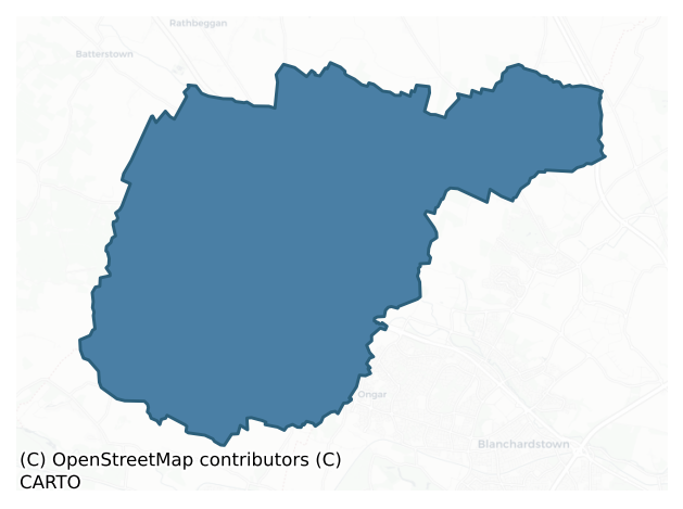
Dunboyne is a barony of County Meath, in the historical province of Leinster (Irish: Dún Búinne), covering 68 km² of land. The barony records 177 NMS archaeological sites and 21 NIAH listed buildings, placing it at around the 73rd percentile among 280 ROI baronies for sites per km². This means it is in the top third of all baronies for sites per km². Dated archaeological evidence runs from the Early Bronze Age through to the Modern, spanning 6 of 9 archaeological periods, placing the barony in the 21st percentile among 280 ROI baronies for chronological depth. This means it is in the bottom third of all baronies for chronological depth. The largest dated subset of recorded sites dates to the Iron Age.
Heritage at a glance
Percentile rankings throughout this profile compare each barony only against the other 279 Republic of Ireland baronies.
The recorded heritage of Dunboyne
The National Monuments Service Sites and Monuments Record (SMR) is the statutory inventory of archaeological sites for the Republic of Ireland, maintained by the Department of Tourism, Culture, Arts, Gaeltacht, Sport and Media. Sites recorded here include earthworks, ringforts, megalithic tombs, ecclesiastical remains, and post-medieval features; not every record is legally protected, but each is registered as a monument of archaeological interest.
The National Monuments Service records 177 archaeological sites in Dunboyne, putting it at the 73rd percentile among 280 ROI baronies for sites per km². This means it is in the top third of all baronies for sites per km². Of these, 96 (54%) fall within a recorded monument protection zone. The dominant category is burial and ritual monuments — barrows, cairns, and megalithic tombs (58 sites, 33% of the record). Pit is the most prevalent type, making up 16% of the barony's recorded sites (29 records) — well above the ROI average of 4% across all baronies where this type occurs. Pit is a circular or sub-circular cropmark, soil-mark or excavated cavity, of any date from prehistory onwards. Other significant types include Ring-ditch (26) and Enclosure (13). Ring-ditch is a circular ditch under 20m across, often the ploughed-out remains of a barrow, ring-barrow or roundhouse; Enclosure is a banked or ditched feature of uncertain type, used as a catch-all where the original function cannot be determined from surface evidence. Across the barony's 68 km², this gives a recorded density of 2.61 sites per km².
Most common monument types
Hover or tap a monument type to see its definition.
| Type | Count |
|---|---|
| Pit a circular or sub-circular cropmark, soil-mark or excavated cavity, of any date from prehistory onwards | 29 |
| Ring-ditch a circular ditch under 20m across, often the ploughed-out remains of a barrow, ring-barrow or roundhouse | 26 |
| Enclosure a banked or ditched feature of uncertain type, used as a catch-all where the original function cannot be determined from surface evidence | 13 |
| Excavation – miscellaneous | 10 |
| Fulacht fia a horseshoe-shaped Bronze Age burnt mound built around a sunken trough beside a water source, traditionally interpreted as a cooking site | 10 |
| Church a building used for public Christian worship, of any date from c. 500 AD onwards | 9 |
| Graveyard a burial area associated with a church, in use from the medieval period onwards | 7 |
Chronological distribution
The dated archaeological record for Dunboyne spans from the Early Bronze Age through to the Modern, with activity attested across 6 of 9 archaeological periods. This is the 21st percentile across ROI baronies — a relatively narrow chronological band, with much of Irish prehistory not represented in the dated record. The record is near-continuous, with only the Post Medieval period falling inside the span without any recorded sites. Activity concentrates most heavily in the Iron Age (49 sites, 53% of dated material), with the Middle Late Bronze Age forming a secondary peak (20 sites, 22%). A further 85 recorded sites (48% of the overall NMS register for the barony) carry no period attribution — appearing as 'Unknown' in the bar chart below. This typically reflects either records that pre-date the standardised period vocabulary or sites awaiting specialist dating review, rather than a genuine absence of chronological evidence.
Sample of recorded monuments
Show 25 sample monuments (of 177 total)
A representative sample of 25 recorded monuments drawn from the barony’s 177 total NMS entries. Sites within a recorded monument protection zone and rarer site types are prioritised so the list shows a meaningful cross-section rather than only the most common type. Each entry shows the official Sites and Monuments Record reference number and the description published by the National Monuments Service.
Castle – unclassified
A castle at Vesingstowne (29) in Dunboyne parish and barony is marked on the Down Survey (1656-8) barony and parish maps (http://downsurvey.tcd.ie/). It is represented as a large structure with towers, a chimney, and a…
A castle at Vesingstowne (29) in Dunboyne parish and barony is marked on the Down Survey (1656-8) barony and parish maps (http://downsurvey.tcd.ie/). It is represented as a large structure with towers, a chimney, and a large gateway. According to the Civil Survey (1654-6) Robert Rochford of Kilbride parish owned 170 acres there in 1640 including ‘an old Ruinous Castle, a decayed chaple and ten tenements’ (Simington 1940, 126). Within the large parish he also owned land at Ballymacolly (73 acres), Castletown (Caulstown 96 acres), and Cornellstowne (110 acres) (ibid. , 117, 126). The castle is depicted as a fragment of a wall (L c. 5m E-W) on the 1836 ed. of the OS 6-inch map. Banks and scarps, some connected with field drainage and a piece of fallen masonry are the only indication of the monument.
The above description is derived from the published 'Archaeological Inventory of County Meath' (Dublin: Stationery Office, 1987). In certain instances the entries have been revised and updated in the light of recent research.
Compiled by: Michael Moore
Date of revision: 10 June 2016
Mound
Located on a slight N-facing slope, and on what was the demesne of Ballymacoll House, the site of which is on higher ground c. 120m to the N. The mound is depicted and annotated in gothic lettering as ‘Mound’ on the…
Located on a slight N-facing slope, and on what was the demesne of Ballymacoll House, the site of which is on higher ground c. 120m to the N. The mound is depicted and annotated in gothic lettering as ‘Mound’ on the 1836 and 1908 editions of the OS 6-inch map. This is a circular scrub-covered mound (diam. of base c. 12m; diam. of top 6m; H 2m) with some trees. It is defined by a fosse (Wth of base 4-5m; D c. 0.8m) with a causeway (Wth 2m) across it at NW. The top of the mound is occupied by the base of the masonry walls (Wth 1m) of a circular structure that was probably a gazebo or tea-house.
The above description is derived from the published 'Archaeological Inventory of County Meath' (Dublin: Stationery Office, 1987). In certain instances the entries have been revised and updated in the light of recent research.
Compiled by: Michael Moore
Date of upload: 10 July 2007
Amended: 29 October 2021
Settlement cluster
Situated on a fairly level landscape with a small WNW-ESE stream S of the settlement, known as the Castle Stream, and the site of the castle is on a rise on the S bank c. 100m from the stream. The name ‘Dunboyne’…
Situated on a fairly level landscape with a small WNW-ESE stream S of the settlement, known as the Castle Stream, and the site of the castle is on a rise on the S bank c. 100m from the stream. The name ‘Dunboyne’ includes the Gaelic Dún meaning a fort or strong point, and an element that is variously interpreted as the proper name Beithin (Joyce 1996, 44), Boinne from the River Boyne by the Ordinance Survey (Herity 2001, 114) or Buinne, meaning ‘Yellow River’ (Cogan 1862, vol. 1, 188). No early saint is associated with it, and the medieval parish church was dedicated to St. Peter. The barony of Dunboyne was granted by Hugh de Lacy about 1172 to Willaim le Petit, whose caput or principal manor was at Mullingar, Co. Westmeath (WM019-089005-). In 1227 Ralph Petit, bishop of Meath, established the Augustinian priory of the Blessed Virgin at Mullingar (WM019-089009-) and endowed it with the land at Kilbrena (Kilbraynan), now absorbed in the NW part of Dunboyne townland, and the ecclesiastical properties of Dunboyne parish, one of only two in the barony, the other being Kilbride. An early church at Dunboyne is more likely to have been at Kilbraynan (ME050-029—-) than where the high medieval settlement developed around the castle, possibly on the site of an earlier rath, and the church. During the reign of Edward II (1307-27) Thomas Butler, the brother of the Earl of Ormonde, married Sinolda, the heiress of Sir William Petit, baron of Dunboyne and Mullingar, and the title of Du…
Concentric enclosure
Located on a fairly level landscape. This is an oval grass-covered enclosure (dims 37m E-W; 25m N-S) defined by an earthen bank (Wth of base 3-6m; int. H 0.6-0.8m; ext. H 1.6m at E), with an external fosse (at E: Wth…
Located on a fairly level landscape. This is an oval grass-covered enclosure (dims 37m E-W; 25m N-S) defined by an earthen bank (Wth of base 3-6m; int. H 0.6-0.8m; ext. H 1.6m at E), with an external fosse (at E: Wth 3m; ext. D 0.8m) WNW-E which continues S from the E point while the bank completes the enclosure to SW. There is a wide entrance gap (Wth 16m) in the earthen bank at W. This enclosure is within a large circular enclosure (diam. c. 90m) defined by a field bank and outer fosse (at ENE: Wth of top 5m; int. D 0.8m) NW-ENE, with a low bank and external fosse ENE-S-WNW. An entrance is not identified in the outer enclosure, but the interior is cut by smaller silted ditches connecting with the fosse of the inner enclosure.
The above description is derived from the published 'Archaeological Inventory of County Meath' (Dublin: Stationery Office, 1987). In certain instances the entries have been revised and updated in the light of recent research.
Compiled by: Michael Moore
Date of upload: 10 July 2007
Amended: 29 October 2021
House – 17th/18th century
Located on a level landscape. The Civil Survey (1654) records ‘two thatched houses’, the property of a Mr. Plunkett of Dunshaughlin in 1640, in Upper Gunockes townland (Simington 1943, 121). Upper and Lower Gunnoggs are…
Located on a level landscape. The Civil Survey (1654) records ‘two thatched houses’, the property of a Mr. Plunkett of Dunshaughlin in 1640, in Upper Gunockes townland (Simington 1943, 121). Upper and Lower Gunnoggs are represented on the Dunboyne barony and parish maps from the Down Survey (1656-8) but no castle or substantial house is represented in either. Bence-Jones (1978) notes that the present two storey, three bay Gunnocks House was built by Laurence Ward in 1806 onto a structure that was originally thatched.
Compiled by: Michael Moore
Date of upload: 5 November 2021
Architectural fragment
Architectural fragments kept in the porch of the present Church of Ireland church suggest a 15th or 16th century date for much of the medieval church (ME050-021001-). (Bradley and King 1985, 56-7)
Compiled by:…
Architectural fragments kept in the porch of the present Church of Ireland church suggest a 15th or 16th century date for much of the medieval church (ME050-021001-). (Bradley and King 1985, 56-7)
Compiled by: Michael Moore
Date of upload: 13, April, 2015
Ritual site – holy well
Situated on a slight rise on a level landscape and within the graveyard (ME051-006001-). Cogan (1862-70, 1, 190) records that devotions at St. Michael’s well within the graveyard had been discontinued since c. 1810, but…
Situated on a slight rise on a level landscape and within the graveyard (ME051-006001-). Cogan (1862-70, 1, 190) records that devotions at St. Michael’s well within the graveyard had been discontinued since c. 1810, but the well remains as a rectangular sunken area (dims 1.1m x 1.1m; D 1m) retained by drystone walling and with a grass-covered mound (Wth 1-1.5m; H 0.2-0.4m) around it on every side, except the W. There is no evidence of veneration, but traditionally it had a cure for toothache and the customary offerings were pins (IFC, Schools Collection, 689, 11, 24). (French 2012, 90-1)
Compiled by: Michael Moore
Date of revised upload: 24 April, 2019
Castle – ringwork
)Situated on a rise in a fairly level landscape, with the WNW-ESE Castle River c. 100m to the N. Following Hugh de Lacy’s grant of Dunboyne to William le Petit the latter established this ringwork castle, perhaps…
)Situated on a rise in a fairly level landscape, with the WNW-ESE Castle River c. 100m to the N. Following Hugh de Lacy’s grant of Dunboyne to William le Petit the latter established this ringwork castle, perhaps adapting an older rath, on the S side of the stream as the caput or centre of the manor of Dunboyne. It was replaced by the stone tower house (ME050-021005-) built after 1475. Archaeological testing (01E0875) by S. Johnston in the area S of the eighteenth century house uncovered evidence of a wide, water-logged ditch (Wth of top 5m plus; D 2.5m plus) SE and SW of the house. It was filled with silts and clays that produced some animal bone but no dateable artefacts. The inner edge of this feature was not exposed but it was sealed by layers containing post-medieval wares and was centred on a point around the SW angle of the house. (Johnston 2001)
Further archaeological testing (04E1040) by C. Cotter managed to sample a section of the U-shaped ditch at SW (Wth of top 8m; D 4.5m) that was filled with waterlogged silt deposits, including layers of brushwood and worked and unworked timbers at its base. These were beneath dried out silt and clay layers with coarse ceramics suggesting a twelfth or thirteenth century date. The topmost fill was similar although with less pottery, but it was cut by numerous pits and trenches. The interior of the enclosure appears to have been fairly large with habitation deposits that were severely truncated by the digging of cellars associ…
Metalworking site
Situated on a low E-W ridge. Centre-line testing (04E0485) by R. O’Hara (2004) of two fields in Testing area 1 of the Dunboyne link road (R157) to the M3 (excavations.ie 2004:1198) confirmed the presence of…
Situated on a low E-W ridge. Centre-line testing (04E0485) by R. O’Hara (2004) of two fields in Testing area 1 of the Dunboyne link road (R157) to the M3 (excavations.ie 2004:1198) confirmed the presence of archaeological features where magnetic susceptibility and gradiometer surveys (06R0038) by J. Nicholls (2006) had already identified numerous anomalies. The area within the road-take was completely excavated (E003023) by A. O’Connell (O’Connell and Clark 2009) who uncovered a complex of monuments dating from at least the Early Bronze Age up to the high medieval period (excavations.ie: 2005: AD5; 2006:1525).
Three bowl furnaces, one inside the inner fosse of the large enclosure at N, the others between the two fosses at SW and WNW, were recorded. The furnaces (dims 0.36m x 0.34m; D 0.06m to 0.99m x 0.96m; D 0.13m) had fills of oxidised clays and charcoal, and a sample of charcoal provided a C14 date of 565-666 cal. AD. (O'Connell 2009; O’Connell and Clark 2009, 30)
The product of the charcoal-making pit, located just inside the inner fosse of the large enclosure at NW, would have been used in metalworking, but this example is later in date than the bowl furnaces recovered. The pit (dims 3m x 1.07-1.4m; D 0.28-0.37m) had an oxidised base and was filled with alternate layers of ash and charcoal covered by three backfilled deposits. A sample of charcoal provided a C14 date of 1035-1225 cal. AD (ibid. 30-31).
See the attached image:
_1 Post-excavation plan of the l…
Castle – motte
Located at the N end of a NE-SW ridge and c. 400m SW of the medieval parish church of Kilbride (ME045-025—-). It is depicted as a circular feature (diam. c. 20m) and described in gothic lettering as ‘Kilbride Moat’ on…
Located at the N end of a NE-SW ridge and c. 400m SW of the medieval parish church of Kilbride (ME045-025—-). It is depicted as a circular feature (diam. c. 20m) and described in gothic lettering as ‘Kilbride Moat’ on the 1835 and 1908 editions of the OS 6-inch map. It was described in 1942 (SMR file) as a tumulus ’20 feet (c. 6m) high by 50 feet (c. 15m) in diameter surrounded by a circular rath 50 yards (c. 45m) in diameter.’ Its profile had been removed by 1969 as the result of a quarry encroaching from the SW and even the outer enclosure, which was probably on the outer edge of a fosse, was no longer evident. Archaeological testing (99E0580) by F. O'Carroll c. 200m to the W produced no related material (excavations 1999:691).
The above description is derived from the published 'Archaeological Inventory of County Meath' (Dublin: Stationery Office, 1987). In certain instances the entries have been revised and updated in the light of recent research.
Compiled by: Michael Moore
Date of upload: 10 July 2007
Amended: 5 November 2021
Castle – tower house
Situated on a level landscape, with the church at Salestown (ME050-025—-) c. 600m to the NW. According to the Civil Survey (1654-6) 173 acres at Salestown in Dunboyne parish were owned by a Mr. De la Sale in 1640, and…
Situated on a level landscape, with the church at Salestown (ME050-025—-) c. 600m to the NW. According to the Civil Survey (1654-6) 173 acres at Salestown in Dunboyne parish were owned by a Mr. De la Sale in 1640, and on the premises was ‘one small castle, one decayed chaple and nine tenements’ (Simington 1940, 125). This is a rectangular structure (ext. dims 7.2m NW-SE; 6.1m NE-SW) surviving to the top of the vault with almost all the dressed stone removed. It is entered through a round-headed doorway towards the N end of the NW wall, which is probably the inner doorway from a lobby that has been destroyed. The doorway leads directly into a ground floor chamber with two arched recesses in the SW wall, probably for lights that are now closed and obscured, and one on the NE wall that has traces of a chimney flue. Much of the NW and the SE walls are damaged but, there is a single light towards the E end of the SE wall. The first floor is under a NW-SE barrel-vault with wicker-centring and was supported on corbels in the NE and SW walls. It has a light in the SE wall, but the NW wall is destroyed and if there was a stairs at the N angle there is no evidence of it now. Any upper floors do not survive and the top of the vault is completely overgrown.
The above description is derived from the published 'Archaeological Inventory of County Meath' (Dublin: Stationery Office, 1987). In certain instances the entries have been revised and updated in the light of recent resear…
Castle – motte
This is a circular, flat-topped and completely overgrown mound (diam. of top c. 20m; diam. of base c. 30m; H 2-3m), although the growth is now removed (Bing c. 2013). There is no visible fosse or entrance and it was…
This is a circular, flat-topped and completely overgrown mound (diam. of top c. 20m; diam. of base c. 30m; H 2-3m), although the growth is now removed (Bing c. 2013). There is no visible fosse or entrance and it was known locally as 'The Moat'.
The above description is derived from the published 'Archaeological Inventory of County Meath' (Dublin: Stationery Office, 1987). In certain instances the entries have been revised and updated in the light of recent research.
Date of upload: 10 July 2007
Font
The late 16th century limestone font from the parish church of Dunboyne (ME050-021001-), which was first described by Butler c. 1749 (1892, 15-16), is still functioning in the present Church of Ireland church (Roe 1968,…
The late 16th century limestone font from the parish church of Dunboyne (ME050-021001-), which was first described by Butler c. 1749 (1892, 15-16), is still functioning in the present Church of Ireland church (Roe 1968, 46-8). It is octagonal (ext. dim. 0.68m; H 0.51m) with a flat-bottomed basin (int. diam. 0.48m; D 0.22m) and chamfered under-panels. The shaft (H 0.34m) is octagonal on top with plain stops on four of its sides merging into a rectangle at the bottom (dims 0.4m x 0.4m), which rests on a modern base (total H 1.05m). The inscription in initials is in false relief and runs across four of the upper panels. It reads: S.W. / C.E.B. / I. (or J) W. / 1579. A second font (ME050-021006-) is kept in the porch.
Compiled by: Michael Moore
Date of upload: 13, April, 2015
Castle – tower house
Situated on a rise in a fairly level landscape, with the WNW-ESE Castle River c. 100m to the N. Following Hugh de Lacy’s grant of Dunboyne to William le Petit the latter established a ringwork castle (ME050-021007-),…
Situated on a rise in a fairly level landscape, with the WNW-ESE Castle River c. 100m to the N. Following Hugh de Lacy’s grant of Dunboyne to William le Petit the latter established a ringwork castle (ME050-021007-), perhaps adapting an older rath, on the S side of the stream, but this would not suffice for very long and may have been rebuilt at some stage in stone. A stone castle was mandated in 1475-6 when Edward IV ‘Purposes by the grace of God to commence to erect a castle anew at Dunboyne’ to be completed in one year (Connolly 2002). This was probably a tower house and possibly located on a new site. One stone house owned by Lord Dunboyne is recorded in the Civil Survey (1654), and the Down Survey (1656-8) barony map depicts a two storey gabled and probably then roofless structure on the S bank of the stream. The present Dunboyne Castle was built by the tenth or eleventh Baron of Dunboyne in the 1770s or 1780s with further work conducted in the 1830s (Bence-Jones 1988, 114).
Archaeological testing (01E0875) by S. Johnston on the N side of the eighteenth century house recorded modern disturbance over a cobbled surface that is probably associated with the eighteenth century building. Beneath the cobbles mixed layers produced seventeenth century gravel-tempered wares and beneath these was the base of a NNE-SSW wall (Wth 1.8m; max. H 1.6m) with an associated stone floor on its W side. The wall is likely to be medieval, and probably from the castle mentioned in the Statut…
Burial
Located on the S side of the Main Street of Clonee village. In July 1965 human remains were discovered on a building site. There was no evidence for stones that might have formed the grave lining and the graves appeared…
Located on the S side of the Main Street of Clonee village. In July 1965 human remains were discovered on a building site. There was no evidence for stones that might have formed the grave lining and the graves appeared to be simple dug graves. A number of clay pipe stems were found in the fill. They were thought to be post-seventeenth-century in date (Cahill & Sikora 2011, vol. 2, 283-284) but may be connected with the medieval chapel (ME051-007—-) and its graveyard (ME051-007001-).
Compiled by: Geraldine Stout
Date of upload: 12 March 2013
Font
A plain font is kept in the porch of the present church on the site of the medieval church of Dunboyne (ME050-021001-). It is rectangular (ext. dims 0.54m; H 0.4m) with a circular, flat-bottomed basin (int. diam. 0.4m;…
A plain font is kept in the porch of the present church on the site of the medieval church of Dunboyne (ME050-021001-). It is rectangular (ext. dims 0.54m; H 0.4m) with a circular, flat-bottomed basin (int. diam. 0.4m; D 0.17m plus). It has hollow chamfers at the angles, so it appears octagonal from above and the form morphs to circular at the bottom (diam. c. 0.4m). (Roe 1968, 115)
Building
Situated on a rise in a fairly level landscape, with the WNW-ESE Castle River c. 100m to the N. Archaeological testing (04E1040) by C. Cotter during 2005 uncovered the foundations of this structure just outside the…
Situated on a rise in a fairly level landscape, with the WNW-ESE Castle River c. 100m to the N. Archaeological testing (04E1040) by C. Cotter during 2005 uncovered the foundations of this structure just outside the outer edge of the fosse of the medieval ring-work castle (ME050-021007-) at E (excavations.ie 2005:1175). Parts of the W and S walls (Wth 1m) with the NW and SW angles of a rectangular building (ext. dims 8.65m plus E-W; c. 8m N-S) were recorded. The battered base of the W wall (H 0.6m) extended into the top of the enclosure fosse but it was not properly aligned with the ditch edge, indicating that the latter was fully backfilled when the wall was built. A blue/white jug, imported from the Low Countries and dating from the sixteenth century at the earliest is associated with this building as were two mid-sixteenth century coins. (Cotter 2008, 291)
Compiled by: Michael Moore
Date of upload: 29 October 2021
Barrow – mound barrow
Situated on a gentle SW-facing slope, this feature is described as a ‘Moat’ on the 1836 and 1908 editions of the OS 6-inch map. This is a subcircular grass-covered mound (diam. of base 24m NE-SW; diam. of top 11.5m N-S;…
Situated on a gentle SW-facing slope, this feature is described as a ‘Moat’ on the 1836 and 1908 editions of the OS 6-inch map. This is a subcircular grass-covered mound (diam. of base 24m NE-SW; diam. of top 11.5m N-S; 11.3m E-W; ext. H 1.2m at NE to 1.8m at SW), with a slight outer bank (Wth c. 2m; H 0.2m) at NE. A magnetic gradiometer survey (19R0268) in the field to the SE produced no evidence of archaeological features except for two possible fosses outside the barrow at E (Elliott 2019). Archaeological testing (20E0014) by P. D. Sweetman (2020) in an area (dims c. 80m NW-SE; c. 80m NE-SW) immediately S of the monument failed to produce any related material.
The above description is derived from the published 'Archaeological Inventory of County Meath' (Dublin: Stationery Office, 1987). In certain instances the entries have been revised and updated in the light of recent research.
Date of upload: 10 July 2007
Revised: 26 October 2021
Barrow – mound barrow
Located on a slight S-facing slope. It is described as a ‘Mote’ on the 1836 and 1912 editions of the OS 6-inch map. This was described in 1969 (SMR file) as a circular grass-covered mound (diam. of base c. 25m; diam. of…
Located on a slight S-facing slope. It is described as a ‘Mote’ on the 1836 and 1912 editions of the OS 6-inch map. This was described in 1969 (SMR file) as a circular grass-covered mound (diam. of base c. 25m; diam. of top 14m NNE-SSW; H 0.8-1m generally to 1.8m at S). It had no kerb or visible fosse. It is visible as a subrectangular cropmark (int. dims c. 15m NW-SE; c. 12m NE-SW) with rounded corners defined by a single fosse feature on Google Earth (24/06/2018). The ring-ditch (ME050-004001-) is c. 5m to the E.
The above description is derived from the published 'Archaeological Inventory of County Meath' (Dublin: Stationery Office, 1987). In certain instances the entries have been revised and updated in the light of recent research.
Revised by: Michael Moore
Date of revision: 20 February 2019
Barrow – mound barrow
Situated on a slight S-facing slope in a fairly level landscape, with a NNW-SSE arm of the Tolka River c. 60m to the NE and a smaller NW-SE arm of the same river c. 250m to the SW. The two streams converge c. 500m to…
Situated on a slight S-facing slope in a fairly level landscape, with a NNW-SSE arm of the Tolka River c. 60m to the NE and a smaller NW-SE arm of the same river c. 250m to the SW. The two streams converge c. 500m to the SE. This is described as the site of Piercetown Castle on the 1836 and 1908 editions of the OS 6-inch map, probably because the Down Survey (1656-8) barony and parish maps of Dunboyne depict a tower at Piercetown in the angle formed by the rivers. However, the site of the castle is likely to be where Piercetown House is located c. 100m to the NNW.
This mound is not the castle. Human remains were discovered c. 1m below its surface in 1955 when an attempt was being made to remove the mound. It was investigated by the National Museum of Ireland, and at that time it was described as a circular mound (diam. of base 22-23m; H 1.5m), although it was already reduced in size. The burials were described locally as supine inhumations aligned W-E with the heads at W (Cahill and Sikora 2011, vol. 2, 504). In 1969 it is described (SMR file) as a grass-covered, earth and stone mound (diam. of base 12.5m N-S) with a flat top (diam. 6.5m N-S; H 1m) that slopes down (H 0.4m) to the S.
The above description is derived from the published 'Archaeological Inventory of County Meath' (Dublin: Stationery Office, 1987). In certain instances the entries have been revised and updated in the light of recent research.
Compiled by: Michael Moore
Date of upload: 10 July 2007…
Structure
Situated on a slight rise in a generally level landscape. Archaeological testing (04E0487) by R. O’Hara on the link-road (R157) for Dunboyne set aside this area for resolution as Dunboyne 4 (excavations. ie 2004:1229).…
Situated on a slight rise in a generally level landscape. Archaeological testing (04E0487) by R. O’Hara on the link-road (R157) for Dunboyne set aside this area for resolution as Dunboyne 4 (excavations. ie 2004:1229). Archaeological excavation (E003024) by R. Elliott (excavations.ie 2004:1554) recorded elements of the field system (ME050-030—-) as well as this prehistoric structure and the possible kiln (ME050-062002-). Nineteenth century quarrying, the importation of soils and subsequent ploughing severely truncated most of the archaeological features.
Thirty one stake and post-holes were recorded in one area, and twenty three of these create a long narrow structure (dims 13m plus ENE-WSW; 3.5m NNW-SSE) extending outside the road-take to the WSW. A strictly regular pattern is not discernible but two post-holes just outside the S line towards the E end have ramps from the S, and a C14 date of 2117-1779 cal. BC was returned from one of these. A large post-hole at the E edge also has a ramp at the E edge. This produced two sherds of Middle-Late Bronze Age pottery together with cremated bone, from which a C14 date of 971-804 cal. BC was returned. A sample of charcoal from another post-hole yielded a date of 1115-853 cal. BC. The nature of this structure is uncertain, but it has neither slot-trenches nor a hearth, and the fairly even distribution of the post-holes suggests that it could be a post-alignment, except that its scale is reduced.
See the attached plan from…
Kiln
Situated on a gentle NW-facing slope in the flood-plain of the NW-SE Tolka River which is c. 300m to the N. Archaeological monitoring (08E0605) by C. McCarthy of topsoil stripping over an extensive area (max. dims c.…
Situated on a gentle NW-facing slope in the flood-plain of the NW-SE Tolka River which is c. 300m to the N. Archaeological monitoring (08E0605) by C. McCarthy of topsoil stripping over an extensive area (max. dims c. 450m N-S; c. 350m E-W) identified five areas with archaeological deposits and features (excavations.ie 2008:943). One was post-medieval, and three of the others were resolved under a different licence (08E0840) by the same archaeologist.
This is Area 5, which is preserved in situ under the re-constituted ground (dims c. 40m N-S; c. 35m E-W) where extensive archaeological deposits were uncovered. Numerous features such as pits, linear features, cereal-drying kilns and furrows were identified overlying deeper deposits. A large spread of charcoal-rich soil is probably related to a kiln and there were thick spreads of silty clay containing charcoal, animal bones and pottery. Three possible kilns were identified as figure-of-eight spreads (dims 2.5m x 0.7m to 5.5m x 1.5-2.9m) with high volumes of charred material including nuts and seeds. Some post-medieval furrows and drainage ditches run NNE-SSW across the area, but three large ditches (Wth 2.5m; D 0.95m plus; Wth 4.5m; D 0.75m plus; Wth 3.9m; D 1m plus) with plentiful large stones were also sampled. The complex is probably medieval in date, and a smaller area of drainage ditches further to the S was also encountered. (McCarthy and Mitchell 2008, 16-19)
Compiled by: Michael Moore
Date of upload: 9 Novemb…
Ringfort – rath
Situated on a slight rise in a fairly level landscape. This is a subcircular grass-covered area (dims 33m N-S; 29m E-W) defined by an earthen bank (at NNE: Wth of base 8m; int. H 0.5m; ext. H 2.3m) with some bushes and…
Situated on a slight rise in a fairly level landscape. This is a subcircular grass-covered area (dims 33m N-S; 29m E-W) defined by an earthen bank (at NNE: Wth of base 8m; int. H 0.5m; ext. H 2.3m) with some bushes and an outer fosse (at NNE: Wth of top 9.6m; Wth of base 2m; ext. D 1m) NW-E-SW, but the bank is incorporated into a field bank and townland boundary with Ballymacoll Little, and the fosse is converted into a field drain SW-NW. There is a modern entrance at NNW but the original entrance is a slight gap (Wth of base 2.5m) at ESE. The fosse has probably been re-cut (at SSW: Wth of top 9m; Wth of base 1.7m; int. D 3m; ext. D 1.6m) NE-E-SW.
(Feeley 2001, 35-6, No. 14)
The above description is derived from the published 'Archaeological Inventory of County Meath' (Dublin: Stationery Office, 1987). In certain instances the entries have been revised and updated in the light of recent research.
Compiled by: Michael Moore
Date of upload: 10 July 2007
Amended: 17 December 2021
This monument is subject to a preservation order made under the National Monuments Acts 1930 to 2014 (PO no. 2/1959).
Ringfort – rath
Situated on a level landscape with a N-S section of the Pinkeen River c. 75m to the W. This was described in 1969 (SMR file) as a slightly raised and grass-covered circular area (diam. 42m NW-SE; 39m NE-SW) defined by…
Situated on a level landscape with a N-S section of the Pinkeen River c. 75m to the W. This was described in 1969 (SMR file) as a slightly raised and grass-covered circular area (diam. 42m NW-SE; 39m NE-SW) defined by an earthen bank (at SE: Wth of base 5.2m; int. H 0.2m; ext. H 1.2m; at NW: Wth of base 9m; int. H 0.9m; ext. H 1.9m), with an external fosse ENE-SE and NW-N (at NW: Wth 2.2m; ext. D 0.3m). There were modern gaps at SW and N but the original entrance (Wth 2m) was at E. Its visible profile had been removed by 1995 (OSAP).
The above description is derived from the published 'Archaeological Inventory of County Meath' (Dublin: Stationery Office, 1987). In certain instances the entries have been revised and updated in the light of recent research.
Compiled by: Michael Moore
Date of upload: 10 July 2007
Amended: 5 November 2021
Pit
Situated on a slight E-facing slope. A gradiometer survey (06R0083) of a large area (c. 48 ha) in Piercetown and Craddockstown townlands identified areas with potential archaeological features, including two large…
Situated on a slight E-facing slope. A gradiometer survey (06R0083) of a large area (c. 48 ha) in Piercetown and Craddockstown townlands identified areas with potential archaeological features, including two large enclosures in Piercetown and a smaller one in Craddockstown (Harrison 2006). Targeted archaeological testing (06E0635) by T. Bolger (2006) confirmed the presence of the two larger features but the smaller one was shown to be non-archaeological, although three other smaller concentrations of archaeological features were identified (excavations.ie 2006:1621).
Systematic archaeological testing (16E0451) by Deirdre Murphy of the development area within Piercetown explored the larger enclosures (excavations.ie 2016:463). This programme also identified a third enclosure and three other potential, but smaller, archaeological areas. Site 4 is an area (dims c. 25m NE-SW; c. 15m NW-SE) with evidence of two ditches (Wth of top 0.48m; 0.5m), a pit (dims 1.8m x 1.6m), an oval spread (dims 0.45m x 0.4m) of oxidised clay and two possible boundary ditches. These features will be preserved as a green area. (Murphy 2016, 15)
Compiled by: Michael Moore
Date of upload: 3 November 2021
Listed buildings
The National Inventory of Architectural Heritage (NIAH) is a state survey appraising buildings of architectural, historical, archaeological, artistic, cultural, scientific, social, or technical interest. Each surveyed structure receives a rating from International (the highest, for buildings of European importance) through National, Regional, Local, and Record-Only.
The NIAH records only 21 listed buildings in Dunboyne, the 8th percentile across ROI baronies — a relatively thin architectural record. All recorded buildings carry Regional or lower grading; the barony does not contain any structures appraised as being of National or International architectural importance. Construction dates concentrate most heavily in the Victorian (1830-1900) period. The most-recorded building type is house (5 examples, 24% of the listed stock).
Terrain and environment
Mean elevation across the barony is 74m — the 36th percentile among 280 ROI baronies for elevation. This means it is in the lower half of all baronies for elevation. Elevation matters for heritage because higher-altitude baronies typically favour defensive monuments — ringforts and hilltop forts placed on prominent ground — while lowland baronies are more likely to carry the dense settlement and church networks of intensive agricultural landscapes. Mean slope is 1.9° — the 5th percentile among 280 ROI baronies for slope. This means it is in the bottom tenth of all baronies for slope. This is broadly flat terrain, the kind of landscape best suited to intensive agriculture. Slope is a key control on both land use and archaeological preservation: steep ground resists ploughing and tends to preserve earthworks intact, while gentle slopes favour intensive cultivation that damages or destroys surface archaeology over time. The Topographic Wetness Index averages 11.9, the 97th percentile among 280 ROI baronies for wetness. This means it is in the top tenth of all baronies for wetness. This is wet, slow-draining ground by ROI standards — the kind of landscape that may carry waterlogged archaeological sites of unusual preservation value. Drainage matters for heritage because poorly-drained ground preserves organic archaeology (wooden trackways, leather, textiles, and on rare occasions human remains) far better than free-draining soil; well-drained ground favours arable use but destroys organic material rapidly. The land-cover mosaic combines improved grassland (57%), arable farmland (30%), and woodland (9%), giving a mixed agricultural and semi-natural landscape.
Terrain measurements
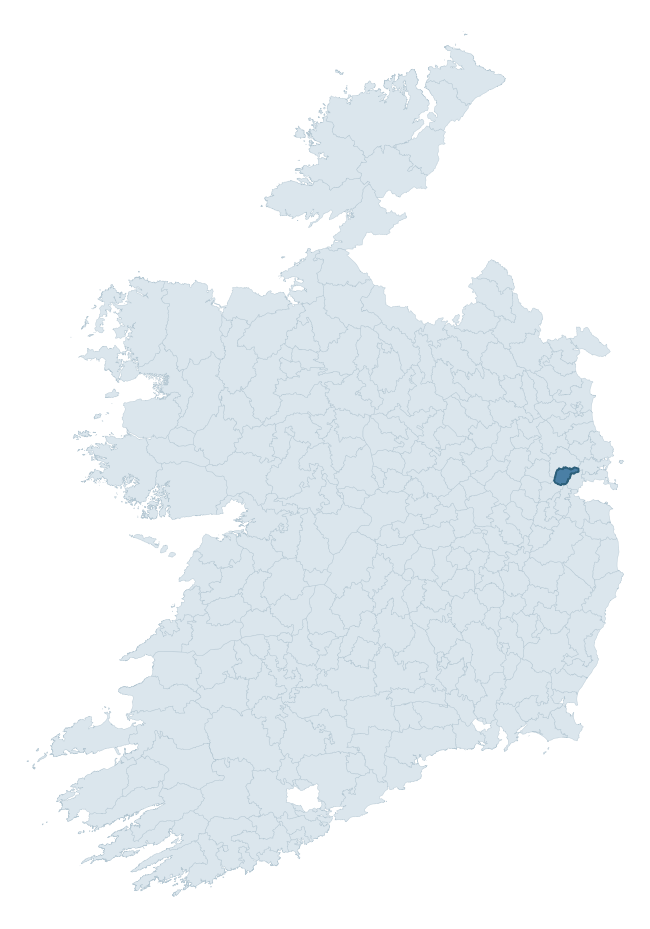
Where this barony sits in the Republic of Ireland
Geology and preservation
Bedrock geology shapes the landscape long before any settlement begins — controlling soil drainage, agricultural potential, the survival of upstanding monuments, and the preservation of buried archaeology. The figures below come from the Geological Survey Ireland 1:100,000 bedrock map.
The bedrock underlying Dunboyne is predominantly limestone (98% of the barony by area), laid down during the Carboniferous period (100% by area, around 359 to 299 million years ago). Limestone is the most heritage-rich bedrock in Ireland. It supports fertile, well-drained soils that favoured dense Early Medieval settlement and Norman manorial agriculture, and it weathers into karst features — sinkholes, caves, swallow holes, and souterrains — that frequently carry archaeology. Where peat overlies limestone, organic preservation can be exceptional. The single largest mapped unit is the Lucan Formation (97% of the barony's bedrock). With only 2 distinct rock types mapped, the barony is geologically uniform compared to the rest of the Republic (18th percentile for diversity) — a single coherent bedrock landscape.
Rock type composition
Largest mapped unit: Lucan Formation (97% of the barony)
Placename evidence
Logainm records 5 heritage-diagnostic placenames for Dunboyne, a modest sample drawn predominantly from the townland record. The dominant stratum is pre-christian defensive. The most frequent diagnostic roots are dún- (2) and cill- (1). With a sample of this size the count should be treated as indicative rather than definitive.
Pre-Christian / Early Medieval Defensive
| Root | Count | Meaning |
|---|---|---|
| dún- | 2 | hilltop or promontory fort |
Early Christian Ecclesiastical
| Root | Count | Meaning |
|---|---|---|
| cill- | 1 | church (early) |
| gráinseach- | 1 | monastic farm / grange |
Burial, Ritual, and Norse-Contact
| Root | Count | Meaning |
|---|---|---|
| carn- | 1 | cairn |
Other baronies in Meath
About this profile
Click any section below to expand.
What is a barony?
A barony is a historic administrative unit in Ireland, broadly equivalent to an English hundred. The 280 baronies used here are from the OSi 2019 National Statutory Boundaries (generalised 20m), covering the 26 counties of the Republic of Ireland. Baronies derive from the Norman period, were formalised in the 17th century, and have not been redrawn for statistical purposes. They vary enormously in area, from compact urban baronies in Dublin to vast upland baronies in Connacht, and should not be compared by raw site count without accounting for area differences.
What counts as a site?
This profile combines three distinct heritage registers, each with its own definition of what constitutes a recordable site:
- Archaeological sites (NMS). The National Monuments Service Sites and Monuments Record (SMR) catalogues every known archaeological monument or site of archaeological interest in the Republic, from prehistoric burial mounds and ringforts to medieval churches and post-medieval defensive works. Inclusion does not require legal protection — only that the site has been identified, surveyed, and assessed as having archaeological value. A separate subset of these sites lies within a recorded protection zone, which gives them statutory protection under the National Monuments Acts.
- Listed buildings (NIAH). The National Inventory of Architectural Heritage records buildings of architectural, historical, archaeological, artistic, cultural, scientific, social, or technical interest. Each surveyed structure is appraised on a five-tier scale: International, National, Regional, Local, and Record-Only. The NIAH appraisal is informational rather than strictly statutory, but it underpins local-authority Record of Protected Structures (RPS) listings.
- Heritage placenames (Logainm). Logainm is the authoritative database of Irish placenames maintained by the Placenames Branch. This profile applies a heritage-diagnostic classifier to the Irish-language form of each townland name, flagging roots that signal defensive sites (ráth-, lios-, dún-, caiseal-, cathair-), ecclesiastical foundations (cill-, teampall-, domhnach-, mainistir-), prehistoric burial-ritual features (tuaim-, carn-, leaba-), or Norse-contact settlement (gall-). Townlands without one of these diagnostic roots are not flagged here — they may still carry historical significance, but that significance is not encoded in the name itself.
Editorial principles
The narrative sections of this profile follow several explicit principles:
- Evidential. Every claim about this barony’s heritage character is anchored in the underlying register data. Where a site count, a placename count, or a percentile rank is cited, it is computed from the source datasets at export time, not estimated.
- Comparative. Counts and metrics are reported alongside their percentile rank against the other 279 ROI baronies. A barony with 50 ringforts in absolute terms could be unusually high or unusually low depending on its size and regional context; percentile ranking removes that ambiguity.
- Transparent on limits. Where a register has known coverage gaps, survey biases, or data-quality issues that affect this barony’s figures, the profile flags them rather than presenting the numbers as definitive.
- No interpretation beyond what the data supports. The narrative does not speculate about historical events, social dynamics, or cultural meaning beyond what the recorded heritage and placename evidence directly attests.
Data caveats and limits
- NMS Sites and Monuments Record is the product of survey campaigns conducted at different intensities across different counties and decades. Some baronies have been surveyed more thoroughly than others, and absolute counts should be read in that light. Sites destroyed by development before survey are typically not represented; sites in heavily forested or upland terrain are sometimes under-recorded.
- NIAH coverage is broadly complete for the Republic of Ireland but the survey was conducted on a rolling county-by-county basis, and the most recent appraisal date varies. Buildings demolished or substantially altered after their original survey may still appear in the register; conversely, recent buildings of merit may not yet have been appraised.
- Logainm classification applies a deliberately conservative pattern-matching approach to the Irish-language townland forms. The classifier prioritises true positives over recall: a townland may carry a heritage signal that the classifier doesn’t recognise, particularly where the diagnostic root has been heavily anglicised or where the townland name draws on a less common term. The 60,000+ townland records and ~9,800 classified placenames give a substantial signal at barony scale, but individual townland names should be checked against Logainm directly for definitive interpretation.
- Period attribution. The chronological distribution reflects only those NMS sites that carry a recognised period attribution in the source data. Sites listed as “Unknown” period are excluded from the dated subset.
- Boundary changes. Some baronies have undergone minor boundary adjustments since their 19th-century definition; the OSi 2019 generalised boundaries used here are the current statutory definition and may differ slightly from historical maps in border areas.
- Bedrock geology is mapped at 1:100,000 scale, which means local variation within a barony — small pockets of different rock type, mineral veins, alluvium overlying bedrock — is generalised. The dominant-system and rocktype figures are area-weighted, so a barony reading “70% Carboniferous limestone” may still contain small but archaeologically important pockets of older or younger rock. Around 3% of GSI polygons do not match the lexicon and contribute no rocktype or system attribution.
Data sources
- National Monuments Service — Sites and Monuments Record (SMR) https://data.gov.ie/dataset/national-monuments-service-archaeological-survey-of-ireland
- National Inventory of Architectural Heritage (NIAH) https://data.gov.ie/dataset/national-inventory-of-architectural-heritage-niah-national-dataset
- Logainm — Placenames Database of Ireland https://www.logainm.ie/
- Ordnance Survey Ireland — National Statutory Barony Boundaries 2019 https://data-osi.opendata.arcgis.com/
- EURODEM — European Digital Elevation Model https://www.mapsforeurope.org/datasets/euro-dem
- ESA WorldCover https://esa-worldcover.org/en
- Geological Survey Ireland — 1:100,000 Bedrock Geology https://www.gsi.ie/en-ie/data-and-maps/Pages/Bedrock.aspx
Explore more: Search any of the 280 ROI baronies, browse by historical province, or read the methodology and data sources for the full Republic of Ireland Heritage Tool.