
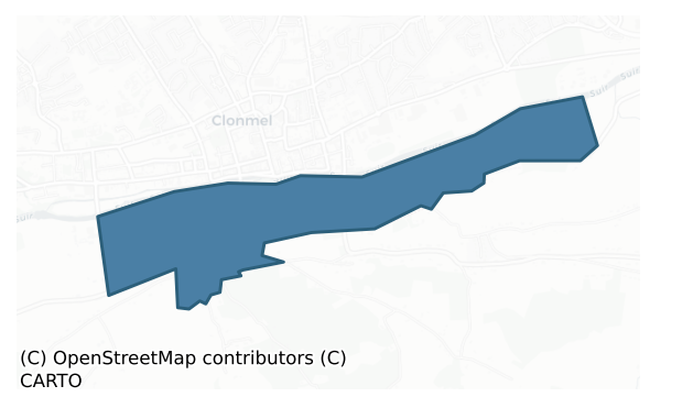
Glenahiry is a barony of County Tipperary, in the historical province of Munster (Irish: Gleann na hUidhre), a small barony covering less than 5 km² of land. The barony records 6 NMS archaeological sites and 20 NIAH listed buildings, placing it at around the 95th percentile among 280 ROI baronies for sites per km². This means it is in the top tenth of all baronies for sites per km². Dated archaeological evidence runs from the Early Bronze Age through to the Modern, spanning 6 of 9 archaeological periods, placing the barony in the 8th percentile among 280 ROI baronies for chronological depth. This means it is in the bottom tenth of all baronies for chronological depth. The largest dated subset of recorded sites dates to the Iron Age.
Heritage at a glance
Percentile rankings throughout this profile compare each barony only against the other 279 Republic of Ireland baronies.
The recorded heritage of Glenahiry
The National Monuments Service Sites and Monuments Record (SMR) is the statutory inventory of archaeological sites for the Republic of Ireland, maintained by the Department of Tourism, Culture, Arts, Gaeltacht, Sport and Media. Sites recorded here include earthworks, ringforts, megalithic tombs, ecclesiastical remains, and post-medieval features; not every record is legally protected, but each is registered as a monument of archaeological interest.
The National Monuments Service records 6 archaeological sites in Glenahiry, putting it at the 95th percentile among 280 ROI baronies for sites per km². This means it is in the top tenth of all baronies for sites per km². Of these, 4 (67%) fall within a recorded monument protection zone. The record is dominated by ecclesiastical sites — churches, graveyards, and holy wells (2 sites, 33% of the total), with prehistoric ritual monuments forming a substantial secondary presence (1 sites, 17%). Church is the most prevalent type, making up 17% of the barony's recorded sites (1 records) — well above the ROI average of 4% across all baronies where this type occurs. Church is a building used for public Christian worship, of any date from c. 500 AD onwards. Other significant types include Graveyard (1) and Standing stone (1). Graveyard is a burial area associated with a church, in use from the medieval period onwards; Standing stone is a deliberately set upright stone, used variously as a Bronze/Iron Age burial marker, route marker or commemorative monument.
Most common monument types
Hover or tap a monument type to see its definition.
| Type | Count |
|---|---|
| Church a building used for public Christian worship, of any date from c. 500 AD onwards | 1 |
| Graveyard a burial area associated with a church, in use from the medieval period onwards | 1 |
| Standing stone a deliberately set upright stone, used variously as a Bronze/Iron Age burial marker, route marker or commemorative monument | 1 |
Chronological distribution
The dated archaeological record for Glenahiry spans from the Early Bronze Age through to the Modern, with activity attested across 6 of 9 archaeological periods. This is the 8th percentile across ROI baronies — a relatively narrow chronological band, with much of Irish prehistory not represented in the dated record. The record is near-continuous, with only the Post Medieval period falling inside the span without any recorded sites. Activity concentrates most heavily in the Iron Age (40 sites, 33% of dated material), with the Early Medieval forming a secondary peak (33 sites, 28%). A further 27 recorded sites (18% of the overall NMS register for the barony) carry no period attribution — appearing as 'Unknown' in the bar chart below. This typically reflects either records that pre-date the standardised period vocabulary or sites awaiting specialist dating review, rather than a genuine absence of chronological evidence.
Sample of recorded monuments
Show all 6 recorded monuments
All 6 recorded monuments in the barony. Each entry shows the official Sites and Monuments Record reference number and the description published by the National Monuments Service.
Church
St. Nicholas' church is situated S of the medieval town of Clonmel (TS083-019—-), across the River Suir, in open ground on a gentle W-facing slope between St. Nicholas' Lane to the N and Whitening Stream to the S and…
St. Nicholas' church is situated S of the medieval town of Clonmel (TS083-019—-), across the River Suir, in open ground on a gentle W-facing slope between St. Nicholas' Lane to the N and Whitening Stream to the S and W, in the Old Bridge quarter of the town. The church is located in the NW quadrant of a sub-rectangular graveyard (TS083-020001-). The popular name for the church is Tempull na Plaighe, the church of the plague, due to the large numbers of plague victims who were buried here from the 14th to the 17th century (Lee 1966, 12-26). The church was in use as late as 1669 and was one of only two churches used for Catholic worship in Clonmel in the post-Restoration period (Lyons 1952, 28). This small church (int. dims. 7.85m x 4.47m; wall T 0.9m) is constructed of randomly coursed sandstone rubble. It was badly overgrown at time of inspection, with graffiti and evidence of burning on the internal W gable. The church was entered through a pointed doorway at the W end of the N wall. There are two single-light windows, one in the W gable and a larger example in the E. There are two small aumbrys, one in the NW angle, the other S of the E window. The W gable, which is surmounted by an ivy-clad bellcote, is in a precarious condition. Lyons (1952, 25) noted the remains of an apparently modern building at the SE angle of the church, co-terminous with the glebe boundary, and suggested it was on the site of a conventual domestic building. This is no longer visible. (Farrelly…
Graveyard
St. Nicholas' church (TS083-020—-) is situated S of the town wall, in open ground on a gentle W-facing slope between St. Nicholas' Lane to the N and Whitening Stream to the S and W, in the Old Bridge quarter of the…
St. Nicholas' church (TS083-020—-) is situated S of the town wall, in open ground on a gentle W-facing slope between St. Nicholas' Lane to the N and Whitening Stream to the S and W, in the Old Bridge quarter of the town. The church is located in the NW quadrant of a sub-rectangular graveyard (dims. 25m N-S; 29m E-W) which is delimited by a low, ruined stone wall. The earliest noted gravestones were of 18th-century date. (Farrelly and FitzPatrick 1993, 66-7).
Compiled by: Jean Farrelly
Date of revised upload: 20 January 2015
Standing stone
Near the N edge of a roughly E-W running ridge, c. 60m S of the River Suir which runs parallel to the ridge, in pasture. There is a field boundary immediately E of the standing stone with a factory complex on the other…
Near the N edge of a roughly E-W running ridge, c. 60m S of the River Suir which runs parallel to the ridge, in pasture. There is a field boundary immediately E of the standing stone with a factory complex on the other side to the E. A sandstone standing stone (max. 0.38m x 0.26m; H 1.23m) rectangular in plan and orientated NNE-SSW. The stone tapers to a point. It is broadest in the middle and narrows to a rectangular base (0.29m x 0.23m). The surface is spawled, though both broad faces are fairly flat. There are several large fractures and evidence of where stone has fractured off at the SW and NW angles, towards the base. There is also a bad crack 0.5m above ground level on the S face, the W end of which rises up through the stone. There are some grass clumps around the base of the stone but no evidence of any packing stones.
Compiled by: Jean Farrelly
Date of upload: 12 November 2013
Weir – regulating
Less than a mile E of Clonmel, immediately S of the River Suir, in an area formerly in Co. Waterford. Lyons (1942, 72-3) speculates that the weir in the Suir, N of Millbrook House, was 'a Franciscan salmon-weir,…
Less than a mile E of Clonmel, immediately S of the River Suir, in an area formerly in Co. Waterford. Lyons (1942, 72-3) speculates that the weir in the Suir, N of Millbrook House, was 'a Franciscan salmon-weir, amplified by an extension westward in late times by the Dudley family who built the contiguous corn-mill-finished in 1782'. The associated mill complex, Suir Mill, dates from the 18th-century. The weir extended from the Suirville mill complex westward, crossing the river obliquely for c. 260m. The weir (Wth at top c. 1-1.25m) is constructed of limestone walling with rubble infill (Withers 2006, 13). The eastern portion of the weir included an exit sluice with a brick arch (ibid., 10). Several gaps (Wth from 5m to 20m) in the weir had been artificially broken through by fishermen during the course of the 20th century to facilitate access into quieter fishing waters (ibid. 11). In these cases only the upper courses of the weir, to just below the water level, were tumbled to allow through passage (ibid.). It is likely that the weir dates to the late 18th century and was constructed in tandem with Suirville mill. There is insufficient evidence to substantiate Lyon’s claim that the weir has an earlier function as a fish weir.
Compiled by: Jean Farrelly
Date of revised upload: 20 January 2015
Mill – unclassified
Less than a mile E of Clonmel, immediately S of the River Suir. According to Lyons (1942, 72-3) c. 140m SW of the mill pond there was an ‘ancient mill site’, which is indicated on a sketch plan by Lyons. He speculates…
Less than a mile E of Clonmel, immediately S of the River Suir. According to Lyons (1942, 72-3) c. 140m SW of the mill pond there was an ‘ancient mill site’, which is indicated on a sketch plan by Lyons. He speculates that the ‘corn-mill, presumably of the Franciscans, seems to have been located as shown in the plan, as here a current to work the water-wheel was available. A ruined building at the spot seems to be a part of the mill. The lodge at the spot is quite modern, and it can be shown that there was no road here in medieval times’. Lyons suggests that the mill utilised the water channel which fed the mill ponds, which he interpreted as medieval fish-ponds (TS083-021003-). The mill race, feeding the mill pond, is shown on the 1st (1840-41) and and 1950-51 ed. OS 6-inch map. There is insufficient evidence to suggest that there was a pre-1700 mill at the location suggested by Lyons.
Compiled by: Jean Farrelly
Date of revised upload: 20 January 2015
Weir – regulating
Lyons (1936, 292) suggests that a mill weir S of the Suir Islands and SE of Suir Island House 'anciently may have been a fishing weir'. The weir is not indicated on the 1st (1840-41) ed. OS 6-inch map which suggests…
Lyons (1936, 292) suggests that a mill weir S of the Suir Islands and SE of Suir Island House 'anciently may have been a fishing weir'. The weir is not indicated on the 1st (1840-41) ed. OS 6-inch map which suggests that it's construction post-dates 1840-41. The evidence does not warrant its inclusion as an archaeological monument.
Compiled by: Jean Farrelly
Date of revised upload: 26 January 2015
Listed buildings
The National Inventory of Architectural Heritage (NIAH) is a state survey appraising buildings of architectural, historical, archaeological, artistic, cultural, scientific, social, or technical interest. Each surveyed structure receives a rating from International (the highest, for buildings of European importance) through National, Regional, Local, and Record-Only.
The NIAH records only 20 listed buildings in Glenahiry, the 6th percentile across ROI baronies — a relatively thin architectural record. All recorded buildings carry Regional or lower grading; the barony does not contain any structures appraised as being of National or International architectural importance. Construction dates concentrate most heavily in the Victorian (1830-1900) period. The most-recorded building type is house (11 examples, 55% of the listed stock).
Terrain and environment
Mean elevation across the barony is 224m — the 97th percentile among 280 ROI baronies for elevation. This means it is in the top tenth of all baronies for elevation. This is a relatively elevated landscape by ROI standards. Elevation matters for heritage because higher-altitude baronies typically favour defensive monuments — ringforts and hilltop forts placed on prominent ground — while lowland baronies are more likely to carry the dense settlement and church networks of intensive agricultural landscapes. The barony reaches 746m at its highest point — a vertical span of more than 522m within its boundary, indicating significant topographic diversity. Mean slope is 8.3° — the 94th percentile among 280 ROI baronies for slope. This means it is in the top tenth of all baronies for slope. This is consistently steep terrain by ROI standards, the kind of landscape that tends to preserve upstanding archaeological features well. Slope is a key control on both land use and archaeological preservation: steep ground resists ploughing and tends to preserve earthworks intact, while gentle slopes favour intensive cultivation that damages or destroys surface archaeology over time. The Topographic Wetness Index averages 9.0, the 4th percentile among 280 ROI baronies for wetness. This means it is in the bottom tenth of all baronies for wetness. This is well-drained ground by ROI standards — typical of upland or steeply-sloping country that sheds water rapidly. Drainage matters for heritage because poorly-drained ground preserves organic archaeology (wooden trackways, leather, textiles, and on rare occasions human remains) far better than free-draining soil; well-drained ground favours arable use but destroys organic material rapidly. The land cover is dominated by improved grassland (70%) and woodland (26%). In overall character, this is an upland landscape of steep, elevated terrain, with land use dominated by improved grassland.
Terrain measurements
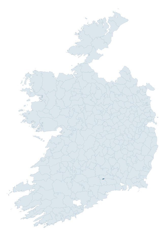
Where this barony sits in the Republic of Ireland
Geology and preservation
Bedrock geology shapes the landscape long before any settlement begins — controlling soil drainage, agricultural potential, the survival of upstanding monuments, and the preservation of buried archaeology. The figures below come from the Geological Survey Ireland 1:100,000 bedrock map.
The bedrock underlying Glenahiry is predominantly limestone (84% of the barony by area), laid down during the Carboniferous period (84% by area, around 359 to 299 million years ago). Limestone is the most heritage-rich bedrock in Ireland. It supports fertile, well-drained soils that favoured dense Early Medieval settlement and Norman manorial agriculture, and it weathers into karst features — sinkholes, caves, swallow holes, and souterrains — that frequently carry archaeology. Where peat overlies limestone, organic preservation can be exceptional. A substantial secondary geology of sandstone (16%) adds further variety to the underlying landscape. The single largest mapped unit is the Ballysteen Formation (84% of the barony's bedrock). With only 2 distinct rock types mapped, the barony is geologically uniform compared to the rest of the Republic (5th percentile for diversity) — a single coherent bedrock landscape.
Rock type composition
Largest mapped unit: Ballysteen Formation (84% of the barony)
Placename evidence
The Logainm record for Glenahiry contains only 2 heritage-diagnostic placenames — 2 cill-names. With this few records, the count should be read as indicative rather than as a firm characterisation of the linguistic heritage layers; a larger sample would be needed to reliably distinguish defensive, ecclesiastical, or other stratigraphic signals from chance occurrence.
Early Christian Ecclesiastical
| Root | Count | Meaning |
|---|---|---|
| cill- | 2 | church (early) |
Other baronies in Tipperary
- Eliogarty
- Ormond Upper
- Ikerrin
- Kilnamanagh Lower
- Clanwilliam
- Kilnamanagh Upper
- Middlethird
- Coshma — Limerick
- Coshlea — Limerick
- Eliogarty
See all 280 baronies in the Republic of Ireland Heritage Tool.

Explore further
Grounding History: 10 Maps of Northern Ireland’s Past
If you’re interested in Irish heritage more widely, the companion report for Northern Ireland brings together the analysis of all 462 NI wards into one place through 10 high-quality maps — covering monument density, archaeological periods, placename heritage, terrain, wetland, and the historic landscape at first survey. Take a look.
About this profile
Click any section below to expand.
What is a barony?
A barony is a historic administrative unit in Ireland, broadly equivalent to an English hundred. The 280 baronies used here are from the OSi 2019 National Statutory Boundaries (generalised 20m), covering the 26 counties of the Republic of Ireland. Baronies derive from the Norman period, were formalised in the 17th century, and have not been redrawn for statistical purposes. They vary enormously in area, from compact urban baronies in Dublin to vast upland baronies in Connacht, and should not be compared by raw site count without accounting for area differences.
What counts as a site?
This profile combines three distinct heritage registers, each with its own definition of what constitutes a recordable site:
- Archaeological sites (NMS). The National Monuments Service Sites and Monuments Record (SMR) catalogues every known archaeological monument or site of archaeological interest in the Republic, from prehistoric burial mounds and ringforts to medieval churches and post-medieval defensive works. Inclusion does not require legal protection — only that the site has been identified, surveyed, and assessed as having archaeological value. A separate subset of these sites lies within a recorded protection zone, which gives them statutory protection under the National Monuments Acts.
- Listed buildings (NIAH). The National Inventory of Architectural Heritage records buildings of architectural, historical, archaeological, artistic, cultural, scientific, social, or technical interest. Each surveyed structure is appraised on a five-tier scale: International, National, Regional, Local, and Record-Only. The NIAH appraisal is informational rather than strictly statutory, but it underpins local-authority Record of Protected Structures (RPS) listings.
- Heritage placenames (Logainm). Logainm is the authoritative database of Irish placenames maintained by the Placenames Branch. This profile applies a heritage-diagnostic classifier to the Irish-language form of each townland name, flagging roots that signal defensive sites (ráth-, lios-, dún-, caiseal-, cathair-), ecclesiastical foundations (cill-, teampall-, domhnach-, mainistir-), prehistoric burial-ritual features (tuaim-, carn-, leaba-), or Norse-contact settlement (gall-). Townlands without one of these diagnostic roots are not flagged here — they may still carry historical significance, but that significance is not encoded in the name itself.
Editorial principles
The narrative sections of this profile follow several explicit principles:
- Evidential. Every claim about this barony’s heritage character is anchored in the underlying register data. Where a site count, a placename count, or a percentile rank is cited, it is computed from the source datasets at export time, not estimated.
- Comparative. Counts and metrics are reported alongside their percentile rank against the other 279 ROI baronies. A barony with 50 ringforts in absolute terms could be unusually high or unusually low depending on its size and regional context; percentile ranking removes that ambiguity.
- Transparent on limits. Where a register has known coverage gaps, survey biases, or data-quality issues that affect this barony’s figures, the profile flags them rather than presenting the numbers as definitive.
- No interpretation beyond what the data supports. The narrative does not speculate about historical events, social dynamics, or cultural meaning beyond what the recorded heritage and placename evidence directly attests.
Data caveats and limits
- NMS Sites and Monuments Record is the product of survey campaigns conducted at different intensities across different counties and decades. Some baronies have been surveyed more thoroughly than others, and absolute counts should be read in that light. Sites destroyed by development before survey are typically not represented; sites in heavily forested or upland terrain are sometimes under-recorded.
- NIAH coverage is broadly complete for the Republic of Ireland but the survey was conducted on a rolling county-by-county basis, and the most recent appraisal date varies. Buildings demolished or substantially altered after their original survey may still appear in the register; conversely, recent buildings of merit may not yet have been appraised.
- Logainm classification applies a deliberately conservative pattern-matching approach to the Irish-language townland forms. The classifier prioritises true positives over recall: a townland may carry a heritage signal that the classifier doesn’t recognise, particularly where the diagnostic root has been heavily anglicised or where the townland name draws on a less common term. The 60,000+ townland records and ~9,800 classified placenames give a substantial signal at barony scale, but individual townland names should be checked against Logainm directly for definitive interpretation.
- Period attribution. The chronological distribution reflects only those NMS sites that carry a recognised period attribution in the source data. Sites listed as “Unknown” period are excluded from the dated subset.
- Boundary changes. Some baronies have undergone minor boundary adjustments since their 19th-century definition; the OSi 2019 generalised boundaries used here are the current statutory definition and may differ slightly from historical maps in border areas.
- Bedrock geology is mapped at 1:100,000 scale, which means local variation within a barony — small pockets of different rock type, mineral veins, alluvium overlying bedrock — is generalised. The dominant-system and rocktype figures are area-weighted, so a barony reading “70% Carboniferous limestone” may still contain small but archaeologically important pockets of older or younger rock. Around 3% of GSI polygons do not match the lexicon and contribute no rocktype or system attribution.
Data sources
- National Monuments Service — Sites and Monuments Record (SMR) https://data.gov.ie/dataset/national-monuments-service-archaeological-survey-of-ireland
- National Inventory of Architectural Heritage (NIAH) https://data.gov.ie/dataset/national-inventory-of-architectural-heritage-niah-national-dataset
- Logainm — Placenames Database of Ireland https://www.logainm.ie/
- Ordnance Survey Ireland — National Statutory Barony Boundaries 2019 https://data-osi.opendata.arcgis.com/
- EURODEM — European Digital Elevation Model https://www.mapsforeurope.org/datasets/euro-dem
- ESA WorldCover https://esa-worldcover.org/en
- Geological Survey Ireland — 1:100,000 Bedrock Geology https://www.gsi.ie/en-ie/data-and-maps/Pages/Bedrock.aspx
Explore more: Search any of the 280 ROI baronies, browse by historical province, or read the methodology and data sources for the full Republic of Ireland Heritage Tool.