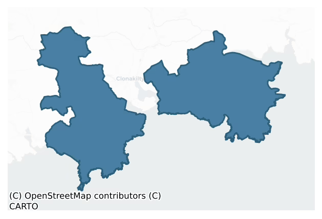
Ibane And Barryroe is a barony of County Cork, in the historical province of Munster (Irish: Uí Bhána agus Barraigh Rua), covering 145 km² of land. The barony records 421 NMS archaeological sites and 111 NIAH listed buildings, placing it at around the 79th percentile among 280 ROI baronies for sites per km². This means it is in the top third of all baronies for sites per km². Dated archaeological evidence runs from the Neolithic through to the Modern, spanning 8 of 9 archaeological periods, placing the barony in the 49th percentile among 280 ROI baronies for chronological depth. This means it is in the lower half of all baronies for chronological depth. The largest dated subset of recorded sites dates to the Early Medieval. Logainm flags 38 placenames in the barony as carrying a recognised heritage root; the largest share — around 53% — are names associated with pre-christian defensive.
Heritage at a glance
Percentile rankings throughout this profile compare each barony only against the other 279 Republic of Ireland baronies.
The recorded heritage of Ibane And Barryroe
The National Monuments Service Sites and Monuments Record (SMR) is the statutory inventory of archaeological sites for the Republic of Ireland, maintained by the Department of Tourism, Culture, Arts, Gaeltacht, Sport and Media. Sites recorded here include earthworks, ringforts, megalithic tombs, ecclesiastical remains, and post-medieval features; not every record is legally protected, but each is registered as a monument of archaeological interest.
The National Monuments Service records 421 archaeological sites in Ibane And Barryroe, putting it at the 79th percentile among 280 ROI baronies for sites per km². This means it is in the top third of all baronies for sites per km². Protection coverage is near-universal — 394 sites (94%) fall within a recorded monument protection zone, indicating an extensively surveyed landscape. The dominant category is defensive sites — ringforts, enclosures, hillforts, and stone forts (218 sites, 52% of the record). Ringfort – rath is the most prevalent type, making up 35% of the barony's recorded sites (147 records) — well above the ROI average of 20% across all baronies where this type occurs. Ringfort – rath is an earthen ringfort enclosed by a bank and external ditch — the most common Early Medieval farmstead, broadly dated 500–1000 AD. Other significant types include Souterrain (36) and Fulacht fia (26). Souterrain is an underground stone-built passage and chamber, generally Early Medieval and often associated with ringforts as a defensive or storage feature; Fulacht fia is a horseshoe-shaped Bronze Age burnt mound built around a sunken trough beside a water source, traditionally interpreted as a cooking site. Across the barony's 145 km², this gives a recorded density of 2.89 sites per km².
Most common monument types
Hover or tap a monument type to see its definition.
| Type | Count |
|---|---|
| Ringfort – rath an earthen ringfort enclosed by a bank and external ditch — the most common Early Medieval farmstead, broadly dated 500–1000 AD | 147 |
| Souterrain an underground stone-built passage and chamber, generally Early Medieval and often associated with ringforts as a defensive or storage feature | 36 |
| Fulacht fia a horseshoe-shaped Bronze Age burnt mound built around a sunken trough beside a water source, traditionally interpreted as a cooking site | 26 |
| Church a building used for public Christian worship, of any date from c. 500 AD onwards | 20 |
| Standing stone a deliberately set upright stone, used variously as a Bronze/Iron Age burial marker, route marker or commemorative monument | 20 |
| Burial ground an area set apart for burial that is not associated with a church, in use from the medieval period onwards | 19 |
| Enclosure a banked or ditched feature of uncertain type, used as a catch-all where the original function cannot be determined from surface evidence | 14 |
Chronological distribution
The dated archaeological record for Ibane And Barryroe spans from the Neolithic through to the Modern, with activity attested across 8 of 9 archaeological periods. Every period from earliest to latest is represented in the record — an unbroken sequence of dated activity across the full chronological span. Activity concentrates most heavily in the Early Medieval (168 sites, 53% of dated material), with the Iron Age forming a secondary peak (72 sites, 23%). A further 103 recorded sites (24% of the overall NMS register for the barony) carry no period attribution — appearing as 'Unknown' in the bar chart below. This typically reflects either records that pre-date the standardised period vocabulary or sites awaiting specialist dating review, rather than a genuine absence of chronological evidence.
Sample of recorded monuments
Show 25 sample monuments (of 421 total)
A representative sample of 25 recorded monuments drawn from the barony’s 421 total NMS entries. Sites within a recorded monument protection zone and rarer site types are prioritised so the list shows a meaningful cross-section rather than only the most common type. Each entry shows the official Sites and Monuments Record reference number and the description published by the National Monuments Service.
Stone row
On N-facing slope overlooking Argideen and Ihernagh rivers. Two upright stones, aligned NE-SW, and one prostrate slab. NE stone is 0.7m L, 0.5m T and 0.9m H. Next stone, 1.1m to SW, is 1m L, 0.7m T and 1.2m H. Prostrate…
On N-facing slope overlooking Argideen and Ihernagh rivers. Two upright stones, aligned NE-SW, and one prostrate slab. NE stone is 0.7m L, 0.5m T and 0.9m H. Next stone, 1.1m to SW, is 1m L, 0.7m T and 1.2m H. Prostrate slab lies 3.6m to W; it measures 3.55m x 1.2m and is 0.7m T. Beside this at E is stone leaning markedly to S. It is 0.7m L, 0.4m T and, if erect, would have stood 0.8m H; its function is unclear. (O Nualláin 1988, 237, no. 51)
The above description is derived from the published 'Archaeological Inventory of County Cork. Volume 1: West Cork' (Dublin: Stationery Office, 1992). In certain instances the entries have been revised and updated in the light of recent research.
Date of upload/revision: 14 January 2009
Religious house – Franciscan friars
On W bank of Argideen river where it discharges into Courtmacsherry estuary; ruins of Franciscan friary whose exact date of foundation is unclear (Gwynn and Hadcock 1988, 259) but, according to Conlon (1988, 143) was…
On W bank of Argideen river where it discharges into Courtmacsherry estuary; ruins of Franciscan friary whose exact date of foundation is unclear (Gwynn and Hadcock 1988, 259) but, according to Conlon (1988, 143) was established before 1316 by either Donal Glas Mac Carthy of William de Barry. Remains consist of church with ranges of domestic buildings around cloister to N. The buildings show 'considerable changes and alterations' (Cochrane 1912, 14) in what Leask (1978 Vol 3, 107) describes as 'a growth of several centuries which defies concise description'. The church consists of nave and choir separated by tower; on S side of nave transept with chapel, and L-shaped aisle to nave and transept. The E window has three pointed lights, the centre one slightly higher, separated by mullions. By comparison with the E window in Kilkenny friary (Leask Vol 2, 119; Conlan 1988, 98) would date c. 1300. Contemporary with this are four tall deeply splayed window embrasures in both N and S walls of choir; only third window from E in S wall appears to contain original light (twin pointed lights separated by mullions). Unusual feature of choir are mural passages which connect N and S walls through E wall, at level of base and top of window embrasures. The tall narrow tower is an inserted feature blocking window embrasures in N and S walls of choir. Nave separated from aisle and by arcade of six arches; Cochrane (1912, 14) considered nave extended westwards from third arch where the arches…
Cupmarked stone
In tillage, on gentle NE-facing slope. Large recumbent boulder partially embedded in ground. A total of thirty cup-marks (max. diam. 0.07m) noted, occurring on E and W faces of stone.
The above description is derived…
In tillage, on gentle NE-facing slope. Large recumbent boulder partially embedded in ground. A total of thirty cup-marks (max. diam. 0.07m) noted, occurring on E and W faces of stone.
The above description is derived from the published 'Archaeological Inventory of County Cork. Volume 1: West Cork' (Dublin: Stationery Office, 1992). In certain instances the entries have been revised and updated in the light of recent research.
Date of upload/revision: 14 January 2009
Ecclesiastical enclosure
In pasture, on SW-facing slope, with view over sea to S. Circular area (diam. 100m) enclosed by field fence N->E; low earthen bank (H 0.5m) E->SSW. Levelled bank SSW->N depicted as field fence on OS 6-inch map (1903)…
In pasture, on SW-facing slope, with view over sea to S. Circular area (diam. 100m) enclosed by field fence N->E; low earthen bank (H 0.5m) E->SSW. Levelled bank SSW->N depicted as field fence on OS 6-inch map (1903) and now visible as crop mark in aerial photograph (CASAP). At centre of interior are foundations of rectangular house site (11m NE-SW; 5.6m NW-SW) (CO134-080005-) defined by low grass-covered wall. Extension of NW wall (H 0.4m) runs W for c.16m. Circular, partially grass-covered cairn (diam. 2.3m; H 0.9m) (CO134-080004-) lies 6.7m E of house site; depression in centre filled with fist-size stones, some metal slag found. According to the landowner "church" said to be located here. 'Site of ancient burial ground' according to O'Donoghue (1986, 121). Souterrain (CO134-08002-) in SW quadrant.
The above description is derived from the published 'Archaeological Inventory of County Cork. Volume 1: West Cork' (Dublin: Stationery Office, 1992). In certain instances the entries have been revised and updated in the light of recent research.
Date of upload/revision: 14 January 2009
Water mill – horizontal-wheeled
In boggy pasture, to the E of a stream, in the S portion of an irregularly shaped field. The remains of a horizontal-wheeled mill were discovered during reclamation work carried out here in 1990. The remains comprised a…
In boggy pasture, to the E of a stream, in the S portion of an irregularly shaped field. The remains of a horizontal-wheeled mill were discovered during reclamation work carried out here in 1990. The remains comprised a well-preserved wooden penstock (L 3.5m; max. Wth 0.7m; H 0.5m) and an irregularly shaped wooden plank (L 1.3m; max. Wth 0.3m) with three evenly spaced bores situated lengthwise towards one end. The penstock was rebated along both sides, possibly indicating that the penstock was covered with a lid. Some damage had occurred to the splayed end of the penstock, probably during the drainage work. A small area of ground by the waters edge was covered by a large number of cobbles that appeared to be deliberately laid.
The above description is derived from 'The Archaeological Inventory of County Cork. Volume 5' (Dublin: Stationery Office, 2009).
Date of upload: 22 December 2009
Mound
In pasture on NW-facing slope. Shown on OS 6-inch map (1943) as semicircular mound on W side field fence. No visible surface trace.
The above description is derived from the published 'Archaeological Inventory of…
In pasture on NW-facing slope. Shown on OS 6-inch map (1943) as semicircular mound on W side field fence. No visible surface trace.
The above description is derived from the published 'Archaeological Inventory of County Cork. Volume 1: West Cork' (Dublin: Stationery Office, 1992). In certain instances the entries have been revised and updated in the light of recent research.
Date of upload/revision: 14 January 2009
Boundary stone
Rectangular flat-topped block of stone (H 1.4m; L 3m; Wth 2m) known locally as Bishop's Rock. Solution holes on upper surface, traditionally regarded as holy water font. Stone removed from original position on parish…
Rectangular flat-topped block of stone (H 1.4m; L 3m; Wth 2m) known locally as Bishop's Rock. Solution holes on upper surface, traditionally regarded as holy water font. Stone removed from original position on parish boundary c. 40 years ago. It now lies c. 60m to NE.
The above description is derived from the published 'Archaeological Inventory of County Cork. Volume 1: West Cork' (Dublin: Stationery Office, 1992). In certain instances the entries have been revised and updated in the light of recent research.
Date of upload/revision: 14 January 2009
Megalithic structure
In pasture just SE of Kilkerranmore Church (CO135-084003-) and graveyard (CO135-084001-). Large sub-rectangular boulder (H 0.75m; 2.15m SE-NW; 1.5m NE-SW) atop bed of small stones (H 0.25m). Two small upright stones at…
In pasture just SE of Kilkerranmore Church (CO135-084003-) and graveyard (CO135-084001-). Large sub-rectangular boulder (H 0.75m; 2.15m SE-NW; 1.5m NE-SW) atop bed of small stones (H 0.25m). Two small upright stones at SE end (H 0.42m; 0.6m; 0.3m: H 0.26m; 0.5m; 0.3m).
The above description is derived from the published 'Archaeological Inventory of County Cork. Volume 1: West Cork' (Dublin: Stationery Office, 1992). In certain instances the entries have been revised and updated in the light of recent research.
Date of upload/revision: 14 January 2009
Font
Rectangular stone (H 0.4m; 0.28m x 0.27m) with circular hollow (diam. 0.25m; D 0.12m), in roadside field fence ; said to have come from nearby Kilkerranmore Church (CO135-085003-). Known locally as "the wart…
Rectangular stone (H 0.4m; 0.28m x 0.27m) with circular hollow (diam. 0.25m; D 0.12m), in roadside field fence ; said to have come from nearby Kilkerranmore Church (CO135-085003-). Known locally as "the wart well".
The above description is derived from the published 'Archaeological Inventory of County Cork. Volume 1: West Cork' (Dublin: Stationery Office, 1992). In certain instances the entries have been revised and updated in the light of recent research.
Date of upload/revision: 14 January 2009
Standing stone – pair
On sloping pasture c. 1km SW of mouth of Argideen river. Stones, aligned NNE-SSW, stand 2.2m apart. Overall length is 4.5m. NE stone is 0.55m L, 0.5m T and 1.2m H. SW stone is 1.8m L, 0.7m T and 2.65m H. Anamalous stone…
On sloping pasture c. 1km SW of mouth of Argideen river. Stones, aligned NNE-SSW, stand 2.2m apart. Overall length is 4.5m. NE stone is 0.55m L, 0.5m T and 1.2m H. SW stone is 1.8m L, 0.7m T and 2.65m H. Anamalous stone group (CO136-017002-) 48m to NNE. (O Nualláin 1988, 248, no. 139)
The above description is derived from the published 'Archaeological Inventory of County Cork. Volume 1: West Cork' (Dublin: Stationery Office, 1992). In certain instances the entries have been revised and updated in the light of recent research.
Date of upload/revision: 14 January 2009
Anomalous stone group
In pasture, on gentle NE-facing slope. Two stones standing 1.83m apart. Taller stone to W (H 1.63m; 1.07m x 0.65m); long axis NE-SW. Second stone (H 1.6m; 0.8m x 0.3m) leans heavily to SW. Stone pair (CO136-017001-)…
In pasture, on gentle NE-facing slope. Two stones standing 1.83m apart. Taller stone to W (H 1.63m; 1.07m x 0.65m); long axis NE-SW. Second stone (H 1.6m; 0.8m x 0.3m) leans heavily to SW. Stone pair (CO136-017001-) lies 44m to SW. According to local information, the group was accidentally knocked by machinery in 2017. The taller stone has fallen to the east and is practically recumbent resting slightly on the smaller stone.
The above description is derived from the published 'Archaeological Inventory of County Cork. Volume 1: West Cork' (Dublin: Stationery Office, 1992). In certain instances the entries have been revised and updated in the light of recent research.
Date of upload/revision: 11 September 2018
Midden
Layer of shells (D 6 in) discovered c. 3 feet under ground while digging farmyard drain at Barryshall Ho. (CO136-016—). According to landowner, mostly oyster shells.
The above description is derived from the…
Layer of shells (D 6 in) discovered c. 3 feet under ground while digging farmyard drain at Barryshall Ho. (CO136-016—). According to landowner, mostly oyster shells.
The above description is derived from the published 'Archaeological Inventory of County Cork. Volume 1: West Cork' (Dublin: Stationery Office, 1992). In certain instances the entries have been revised and updated in the light of recent research.
Date of upload/revision: 14 January 2009
Designed landscape – belvedere
Remains of tower on high ground to E of Court Macsherry house; commanding good view over Courtmacsherry Bay. N portion of structure survives forming three sides of octagon; central section set back. External string…
Remains of tower on high ground to E of Court Macsherry house; commanding good view over Courtmacsherry Bay. N portion of structure survives forming three sides of octagon; central section set back. External string course between ground and 1st floor.
The above description is derived from the published 'Archaeological Inventory of County Cork. Volume 1: West Cork' (Dublin: Stationery Office, 1992). In certain instances the entries have been revised and updated in the light of recent research.
Date of upload/revision: 14 January 2009
Designed landscape – tree-ring
The Archaeological Survey of Ireland (ASI) is in the process of providing information on all monuments on The Historic Environment Viewer (HEV). Currently the information for this record has not been uploaded. To…
The Archaeological Survey of Ireland (ASI) is in the process of providing information on all monuments on The Historic Environment Viewer (HEV). Currently the information for this record has not been uploaded. To access available information for research purposes please make an appointment in advance with the Archive Unit (open Fridays 10.00 am – 5.00 pm), Department of Culture, Heritage and the Gaeltacht, The Custom House, Dublin 1 D01W6XO or email nmarchive@chg.gov.ie.
Megalithic tomb – portal tomb
On small platform, near top of hillside, overlooking valley of Ownahinchy River; tomb well preserved. Entrance to chamber (L c. 1.5m; Wth c. 1.1m) at E marked by two tall portal-stones; S portal leans against the N.…
On small platform, near top of hillside, overlooking valley of Ownahinchy River; tomb well preserved. Entrance to chamber (L c. 1.5m; Wth c. 1.1m) at E marked by two tall portal-stones; S portal leans against the N. Sides and back of chamber are each formed of single stones. Two slabs lean against S side of chamber, three small stones lean against N portal; function unclear. Chamber covered by high-pitched roofstone resting on portals and two large pad-stones to W. In front of each portal, orthostat forms inner end of funnel-shaped approach; line of S orthostat continued 2.5m to E by two pairs of overlapping slabs. (de Valera and O Nualláin 1982, 37-8, Co.55; Roberts 1988, ch. 1, no. 35)
The above description is derived from the published 'Archaeological Inventory of County Cork. Volume 1: West Cork' (Dublin: Stationery Office, 1992). In certain instances the entries have been revised and updated in the light of recent research.
Date of upload/revision: 14 January 2009
See linked document with details from Ruaidhrí de Valera and Seán Ó Nualláin, Survey of the Megalithic Tombs of Ireland. Volume IV. Counties Cork, Kerry, Limerick, Tipperary. (Dublin: Stationery Office, 1982)
Stone sculpture
Base of cross immediately outside and to NE of burial ground (CO143-041001-). Rectangular stone (H 0.35m) with inclined sides (at base: 0.82m x 0.42m; at top: 0.3m x 0.21m). Flat top with central mortice hole (D 0.21m;…
Base of cross immediately outside and to NE of burial ground (CO143-041001-). Rectangular stone (H 0.35m) with inclined sides (at base: 0.82m x 0.42m; at top: 0.3m x 0.21m). Flat top with central mortice hole (D 0.21m; 0.17m x 0.12m). Rope moulding along vertical edges.
The above description is derived from the published 'Archaeological Inventory of County Cork. Volume 1: West Cork' (Dublin: Stationery Office, 1992). In certain instances the entries have been revised and updated in the light of recent research.
Date of upload/revision: 14 January 2009
Cross
The Archaeological Survey of Ireland (ASI) is in the process of providing information on all monuments on The Historic Environment Viewer (HEV). Currently the information for this record has not been uploaded. To…
The Archaeological Survey of Ireland (ASI) is in the process of providing information on all monuments on The Historic Environment Viewer (HEV). Currently the information for this record has not been uploaded. To access available information for research purposes please make an appointment in advance with the Archive Unit (open Fridays 10.00 am – 5.00 pm), Department of Culture, Heritage and the Gaeltacht, The Custom House, Dublin 1 D01W6XO or email nmarchive@chg.gov.ie.
Designed landscape feature
The Archaeological Survey of Ireland (ASI) is in the process of providing information on all monuments on The Historic Environment Viewer (HEV). Currently the information for this record has not been uploaded. To…
The Archaeological Survey of Ireland (ASI) is in the process of providing information on all monuments on The Historic Environment Viewer (HEV). Currently the information for this record has not been uploaded. To access available information for research purposes please make an appointment in advance with the Archive Unit (open Fridays 10.00 am – 5.00 pm), Department of Culture, Heritage and the Gaeltacht, The Custom House, Dublin 1 D01W6XO or email nmarchive@chg.gov.ie.
Burial
According to Westropp (1914, 106) a decayed human skeleton was found under a slab at Dunowen Castle (CO144-041002-).
The above description is derived from the published 'Archaeological Inventory of County Cork.…
According to Westropp (1914, 106) a decayed human skeleton was found under a slab at Dunowen Castle (CO144-041002-).
The above description is derived from the published 'Archaeological Inventory of County Cork. Volume 1: West Cork' (Dublin: Stationery Office, 1992). In certain instances the entries have been revised and updated in the light of recent research.
Date of upload/revision: 14 January 2009
Cairn – unclassified
Circular, partially grass-covered cairn (diam. 2.3m; H 0.9m) in interior of ecclesiastical enclosure (CO134-080001-).
The above description is derived from the published 'Archaeological Inventory of County Cork.…
Circular, partially grass-covered cairn (diam. 2.3m; H 0.9m) in interior of ecclesiastical enclosure (CO134-080001-).
The above description is derived from the published 'Archaeological Inventory of County Cork. Volume 1: West Cork' (Dublin: Stationery Office, 1992). In certain instances the entries have been revised and updated in the light of recent research.
Date of upload/revision: 14 January 2009
House – 18th/19th century
This is the birthplace of Michael Collins (1890 -1922), Irish revolutionary, politician, Chairman of the Provisional Government and Commander in Chief of the National Army. The building to the rear of the site is the…
This is the birthplace of Michael Collins (1890 -1922), Irish revolutionary, politician, Chairman of the Provisional Government and Commander in Chief of the National Army. The building to the rear of the site is the original dwelling house where he was born on the 16th of October 1890. Around 1900 the family moved to a new house and the old dwelling was utilised as a farm out-building. Close to the entrance is the footprint of a farmhouse which was burned by the Essex Regiment during the War of Independence in April 1921. Michael Collins was killed by anti-treaty forces on 22nd August 1922 in an ambush at Béal na Bláth, Co. Cork, during the Civil War. The family homestead and farm was sold in 1923. It was purchased by the State and opened to the public in 1990. It was vested in the Commissioners of Public Works in 1991 as a national monument (no. 634).
Compiled by: Paul Walsh
Date of upload: 7 March 2017
Slab-lined burial
Discovered in 1966. Remains consisted of a slab-lined grave (L 1.8m; Wth 0.48m; H 0.36m) covered by lintels containing an extended inhumation of an adult male. There were no accompanying artefacts. A radiocarbon date…
Discovered in 1966. Remains consisted of a slab-lined grave (L 1.8m; Wth 0.48m; H 0.36m) covered by lintels containing an extended inhumation of an adult male. There were no accompanying artefacts. A radiocarbon date for the burial ranges from 545-664 AD calibrated (NMI files).
Compiled by: Paul Walsh
Date of upload: 20 January 2010
An account of this monument has been published in: Cahill, M. & Sikora, M. (2011) Breaking ground, finding graves- reports on the excavations of burials by the National Museum of Ireland, 1927-2006. vol. 2, 15-18.
House – indeterminate date
The Archaeological Survey of Ireland (ASI) is in the process of providing information on all monuments on The Historic Environment Viewer (HEV). Currently the information for this record has not been uploaded. To…
The Archaeological Survey of Ireland (ASI) is in the process of providing information on all monuments on The Historic Environment Viewer (HEV). Currently the information for this record has not been uploaded. To access available information for research purposes please make an appointment in advance with the Archive Unit (open Fridays 10.00 am – 5.00 pm), Department of Culture, Heritage and the Gaeltacht, The Custom House, Dublin 1 D01W6XO or email nmarchive@chg.gov.ie.
Stone circle – multiple-stone
In pasture, just off crest of hill which overlooks headwaters of Argideenriver. Circle incomplete, contains considerable amount of field clearance.Three stones survive including axial stone, S entrance stone and…
In pasture, just off crest of hill which overlooks headwaters of Argideenriver. Circle incomplete, contains considerable amount of field clearance.Three stones survive including axial stone, S entrance stone and anotherflanking it to S. Orthostats are 0.45m to 0.77m L, 0.15m to 0.37m T and 0.47m to 1.35m H. Internal measurement along main axis, aligned NE-SW, is 7m. (Roberts 1988, Ch. 1, no. 20)
The above description is derived from the published 'Archaeological Inventory of County Cork. Volume 1: West Cork' (Dublin: Stationery Office, 1992). In certain instances the entries have been revised and updated in the light of recent research.
Date of upload/revision: 14 January 2009
Ringfort – rath
In pasture, on S-facing slope. Marked as circular enclosure on OS 6-inch map (1842). Slight scarp on downslope survives; no other visible surface traces.
The above description is derived from the published…
In pasture, on S-facing slope. Marked as circular enclosure on OS 6-inch map (1842). Slight scarp on downslope survives; no other visible surface traces.
The above description is derived from the published 'Archaeological Inventory of County Cork. Volume 1: West Cork' (Dublin: Stationery Office, 1992). In certain instances the entries have been revised and updated in the light of recent research.
Date of upload/revision: 14 January 2009
Listed buildings
The National Inventory of Architectural Heritage (NIAH) is a state survey appraising buildings of architectural, historical, archaeological, artistic, cultural, scientific, social, or technical interest. Each surveyed structure receives a rating from International (the highest, for buildings of European importance) through National, Regional, Local, and Record-Only.
The NIAH records 111 listed buildings in Ibane And Barryroe (54th percentile across ROI baronies). The highest-graded structure include 1 of National significance. The Republic holds 937 National-graded buildings in total, so this barony accounts for around 0% of the national total. Construction dates concentrate most heavily in the Late Georgian (1800-1830) period. The most-recorded building type is house (43 examples, 39% of the listed stock).
Terrain and environment
Mean elevation across the barony is 54m — the 18th percentile among 280 ROI baronies for elevation. This means it is in the bottom fifth of all baronies for elevation. This is a relatively low-lying landscape by ROI standards. Elevation matters for heritage because higher-altitude baronies typically favour defensive monuments — ringforts and hilltop forts placed on prominent ground — while lowland baronies are more likely to carry the dense settlement and church networks of intensive agricultural landscapes. Mean slope is 5.0° — the 73rd percentile among 280 ROI baronies for slope. This means it is in the top third of all baronies for slope. Slope is a key control on both land use and archaeological preservation: steep ground resists ploughing and tends to preserve earthworks intact, while gentle slopes favour intensive cultivation that damages or destroys surface archaeology over time. The Topographic Wetness Index averages 10.1, the 24th percentile among 280 ROI baronies for wetness. This means it is in the bottom third of all baronies for wetness. This is well-drained ground by ROI standards — typical of upland or steeply-sloping country that sheds water rapidly. Drainage matters for heritage because poorly-drained ground preserves organic archaeology (wooden trackways, leather, textiles, and on rare occasions human remains) far better than free-draining soil; well-drained ground favours arable use but destroys organic material rapidly. The land-cover mosaic combines improved grassland (81%), woodland (9%), and arable farmland (8%), giving a mixed agricultural and semi-natural landscape.
Terrain measurements
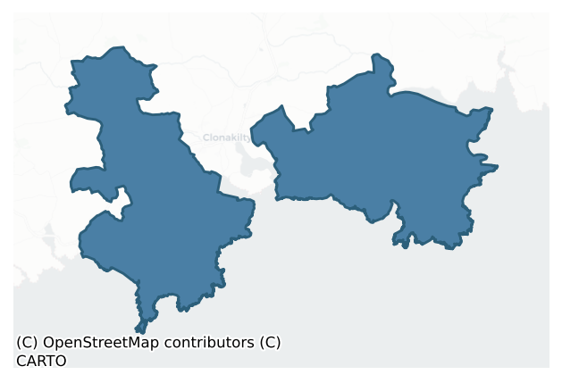
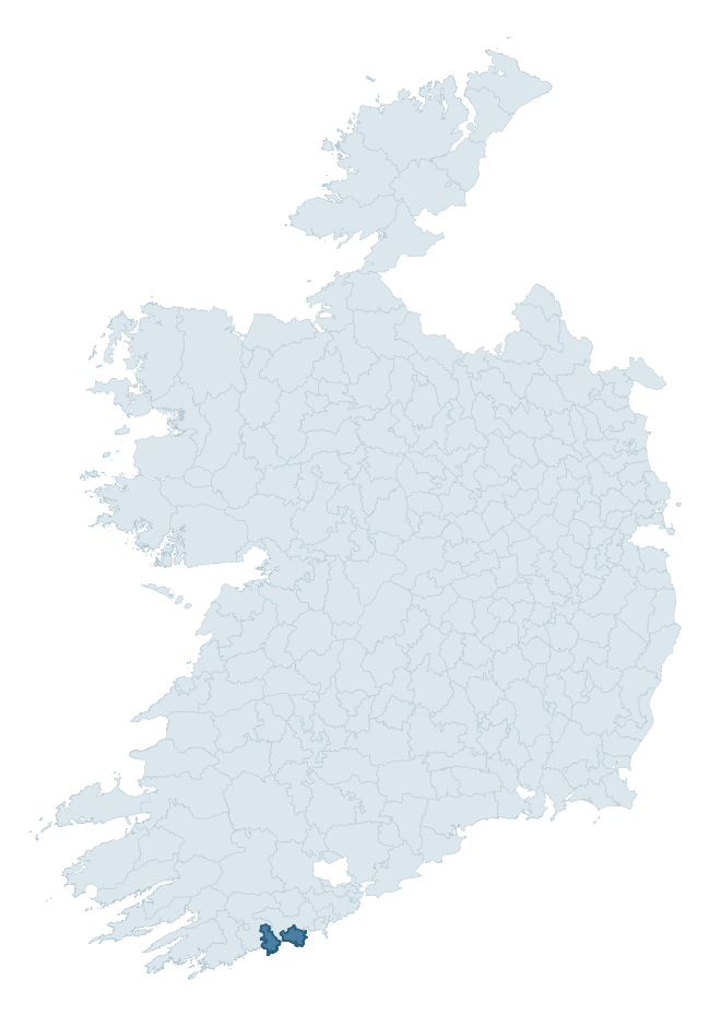
Where this barony sits in the Republic of Ireland
Geology and preservation
Bedrock geology shapes the landscape long before any settlement begins — controlling soil drainage, agricultural potential, the survival of upstanding monuments, and the preservation of buried archaeology. The figures below come from the Geological Survey Ireland 1:100,000 bedrock map.
The bedrock underlying Ibane And Barryroe is predominantly sandstone (47% of the barony by area), laid down during the Devonian period (64% by area, around 419 to 359 million years ago). Sandstone weathers to free-draining, moderately fertile soils that supported Early Medieval ringfort agriculture and later manorial estates. The rock itself is a major source of building stone — visible in churches, tower houses, and farm buildings across the barony's historic landscape. A substantial secondary geology of mudstone (33%) and siltstone (19%) adds further variety to the underlying landscape. The single largest mapped unit is the Old Head Sandstone Formation (33% of the barony's bedrock).
Rock type composition
Largest mapped unit: Old Head Sandstone Formation (33% of the barony)
Placename evidence
Logainm records 38 heritage-diagnostic placenames for Ibane And Barryroe, drawn from townland and civil-parish names across the barony. The dominant stratum is pre-Christian and Early Medieval defensive — ráth-, lios-, dún-, and caiseal-prefixed names that mark Iron Age and early historic settlement. The leading diagnostic roots are dún- (7 — hilltop fort or promontory fort), cill- (7 — church), and ráth- (5 — earthen ringfort). This is broadly in line with the ROI average of 30.7 heritage placenames per barony. Logainm records 182 placenames for Ibane And Barryroe (predominantly townland names). Of these, 38 (21%) carry one of the diagnostic Gaelic roots tracked above; the remainder draw on more generic landscape vocabulary that does not encode a heritage period.
Pre-Christian / Early Medieval Defensive
| Root | Count | Meaning |
|---|---|---|
| dún- | 7 | hilltop or promontory fort |
| ráth- | 5 | earthen ringfort |
| lios- | 5 | ringfort or enclosure |
| caiseal- | 2 | stone ringfort |
| cathair- | 1 | stone fort |
Early Christian Ecclesiastical
| Root | Count | Meaning |
|---|---|---|
| cill- | 7 | church (early) |
| teampall- | 4 | church (later medieval) |
| domhnach- | 2 | pre-Patrician or earliest Patrician church |
| mainistir- | 2 | monastery |
| gráinseach- | 2 | monastic farm / grange |
| díseart- | 1 | hermitage |
Other baronies in Cork
- Kinsale
- Kerrycurrihy
- Cork
- Carbery West (east Division)
- Bantry
- Carbery East (east Division)
- Barrymore
- Glanarought — Kerry
- Iffa And Offa East — Tipperary
- Decies Without Drum — Waterford
See all 280 baronies in the Republic of Ireland Heritage Tool.

Explore further
Grounding History: 10 Maps of Northern Ireland’s Past
If you’re interested in Irish heritage more widely, the companion report for Northern Ireland brings together the analysis of all 462 NI wards into one place through 10 high-quality maps — covering monument density, archaeological periods, placename heritage, terrain, wetland, and the historic landscape at first survey. Take a look.
About this profile
Click any section below to expand.
What is a barony?
A barony is a historic administrative unit in Ireland, broadly equivalent to an English hundred. The 280 baronies used here are from the OSi 2019 National Statutory Boundaries (generalised 20m), covering the 26 counties of the Republic of Ireland. Baronies derive from the Norman period, were formalised in the 17th century, and have not been redrawn for statistical purposes. They vary enormously in area, from compact urban baronies in Dublin to vast upland baronies in Connacht, and should not be compared by raw site count without accounting for area differences.
What counts as a site?
This profile combines three distinct heritage registers, each with its own definition of what constitutes a recordable site:
- Archaeological sites (NMS). The National Monuments Service Sites and Monuments Record (SMR) catalogues every known archaeological monument or site of archaeological interest in the Republic, from prehistoric burial mounds and ringforts to medieval churches and post-medieval defensive works. Inclusion does not require legal protection — only that the site has been identified, surveyed, and assessed as having archaeological value. A separate subset of these sites lies within a recorded protection zone, which gives them statutory protection under the National Monuments Acts.
- Listed buildings (NIAH). The National Inventory of Architectural Heritage records buildings of architectural, historical, archaeological, artistic, cultural, scientific, social, or technical interest. Each surveyed structure is appraised on a five-tier scale: International, National, Regional, Local, and Record-Only. The NIAH appraisal is informational rather than strictly statutory, but it underpins local-authority Record of Protected Structures (RPS) listings.
- Heritage placenames (Logainm). Logainm is the authoritative database of Irish placenames maintained by the Placenames Branch. This profile applies a heritage-diagnostic classifier to the Irish-language form of each townland name, flagging roots that signal defensive sites (ráth-, lios-, dún-, caiseal-, cathair-), ecclesiastical foundations (cill-, teampall-, domhnach-, mainistir-), prehistoric burial-ritual features (tuaim-, carn-, leaba-), or Norse-contact settlement (gall-). Townlands without one of these diagnostic roots are not flagged here — they may still carry historical significance, but that significance is not encoded in the name itself.
Editorial principles
The narrative sections of this profile follow several explicit principles:
- Evidential. Every claim about this barony’s heritage character is anchored in the underlying register data. Where a site count, a placename count, or a percentile rank is cited, it is computed from the source datasets at export time, not estimated.
- Comparative. Counts and metrics are reported alongside their percentile rank against the other 279 ROI baronies. A barony with 50 ringforts in absolute terms could be unusually high or unusually low depending on its size and regional context; percentile ranking removes that ambiguity.
- Transparent on limits. Where a register has known coverage gaps, survey biases, or data-quality issues that affect this barony’s figures, the profile flags them rather than presenting the numbers as definitive.
- No interpretation beyond what the data supports. The narrative does not speculate about historical events, social dynamics, or cultural meaning beyond what the recorded heritage and placename evidence directly attests.
Data caveats and limits
- NMS Sites and Monuments Record is the product of survey campaigns conducted at different intensities across different counties and decades. Some baronies have been surveyed more thoroughly than others, and absolute counts should be read in that light. Sites destroyed by development before survey are typically not represented; sites in heavily forested or upland terrain are sometimes under-recorded.
- NIAH coverage is broadly complete for the Republic of Ireland but the survey was conducted on a rolling county-by-county basis, and the most recent appraisal date varies. Buildings demolished or substantially altered after their original survey may still appear in the register; conversely, recent buildings of merit may not yet have been appraised.
- Logainm classification applies a deliberately conservative pattern-matching approach to the Irish-language townland forms. The classifier prioritises true positives over recall: a townland may carry a heritage signal that the classifier doesn’t recognise, particularly where the diagnostic root has been heavily anglicised or where the townland name draws on a less common term. The 60,000+ townland records and ~9,800 classified placenames give a substantial signal at barony scale, but individual townland names should be checked against Logainm directly for definitive interpretation.
- Period attribution. The chronological distribution reflects only those NMS sites that carry a recognised period attribution in the source data. Sites listed as “Unknown” period are excluded from the dated subset.
- Boundary changes. Some baronies have undergone minor boundary adjustments since their 19th-century definition; the OSi 2019 generalised boundaries used here are the current statutory definition and may differ slightly from historical maps in border areas.
- Bedrock geology is mapped at 1:100,000 scale, which means local variation within a barony — small pockets of different rock type, mineral veins, alluvium overlying bedrock — is generalised. The dominant-system and rocktype figures are area-weighted, so a barony reading “70% Carboniferous limestone” may still contain small but archaeologically important pockets of older or younger rock. Around 3% of GSI polygons do not match the lexicon and contribute no rocktype or system attribution.
Data sources
- National Monuments Service — Sites and Monuments Record (SMR) https://data.gov.ie/dataset/national-monuments-service-archaeological-survey-of-ireland
- National Inventory of Architectural Heritage (NIAH) https://data.gov.ie/dataset/national-inventory-of-architectural-heritage-niah-national-dataset
- Logainm — Placenames Database of Ireland https://www.logainm.ie/
- Ordnance Survey Ireland — National Statutory Barony Boundaries 2019 https://data-osi.opendata.arcgis.com/
- EURODEM — European Digital Elevation Model https://www.mapsforeurope.org/datasets/euro-dem
- ESA WorldCover https://esa-worldcover.org/en
- Geological Survey Ireland — 1:100,000 Bedrock Geology https://www.gsi.ie/en-ie/data-and-maps/Pages/Bedrock.aspx
Explore more: Search any of the 280 ROI baronies, browse by historical province, or read the methodology and data sources for the full Republic of Ireland Heritage Tool.