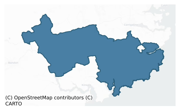
Kinalea is a barony of County Cork, in the historical province of Munster (Irish: Cineál Aodha), covering 207 km² of land. The barony records 288 NMS archaeological sites and 119 NIAH listed buildings, placing it at around the 28th percentile among 280 ROI baronies for sites per km². This means it is in the bottom third of all baronies for sites per km². Dated archaeological evidence runs from the Early Bronze Age through to the Modern, spanning 7 of 9 archaeological periods, placing the barony in the 33rd percentile among 280 ROI baronies for chronological depth. This means it is in the lower half of all baronies for chronological depth. The largest dated subset of recorded sites dates to the Early Medieval. Logainm flags 29 placenames in the barony as carrying a recognised heritage root; the largest share — around 52% — are names associated with pre-christian defensive.

Heritage at a glance
Percentile rankings throughout this profile compare each barony only against the other 279 Republic of Ireland baronies.
The recorded heritage of Kinalea
The National Monuments Service Sites and Monuments Record (SMR) is the statutory inventory of archaeological sites for the Republic of Ireland, maintained by the Department of Tourism, Culture, Arts, Gaeltacht, Sport and Media. Sites recorded here include earthworks, ringforts, megalithic tombs, ecclesiastical remains, and post-medieval features; not every record is legally protected, but each is registered as a monument of archaeological interest.
The National Monuments Service records 288 archaeological sites in Kinalea, putting it at the 28th percentile among 280 ROI baronies for sites per km². This means it is in the bottom third of all baronies for sites per km². Protection coverage is near-universal — 273 sites (95%) fall within a recorded monument protection zone, indicating an extensively surveyed landscape. The record is dominated by defensive sites — ringforts, enclosures, hillforts, and stone forts (109 sites, 38% of the total), with ecclesiastical sites forming a substantial secondary presence (47 sites, 16%). Ringfort – rath is the most prevalent type, making up 24% of the barony's recorded sites (69 records), broadly in line with the ROI average of 20% across all baronies where this type occurs. Ringfort – rath is an earthen ringfort enclosed by a bank and external ditch — the most common Early Medieval farmstead, broadly dated 500–1000 AD. Other significant types include Fulacht fia (28) and Church (21). Fulacht fia is a horseshoe-shaped Bronze Age burnt mound built around a sunken trough beside a water source, traditionally interpreted as a cooking site; Church is a building used for public Christian worship, of any date from c. 500 AD onwards. Across the barony's 207 km², this gives a recorded density of 1.39 sites per km².
Most common monument types
Hover or tap a monument type to see its definition.
| Type | Count |
|---|---|
| Ringfort – rath an earthen ringfort enclosed by a bank and external ditch — the most common Early Medieval farmstead, broadly dated 500–1000 AD | 69 |
| Fulacht fia a horseshoe-shaped Bronze Age burnt mound built around a sunken trough beside a water source, traditionally interpreted as a cooking site | 28 |
| Church a building used for public Christian worship, of any date from c. 500 AD onwards | 21 |
| Graveyard a burial area associated with a church, in use from the medieval period onwards | 18 |
| Standing stone a deliberately set upright stone, used variously as a Bronze/Iron Age burial marker, route marker or commemorative monument | 17 |
| Enclosure a banked or ditched feature of uncertain type, used as a catch-all where the original function cannot be determined from surface evidence | 16 |
| Burial ground an area set apart for burial that is not associated with a church, in use from the medieval period onwards | 7 |
Chronological distribution
The dated archaeological record for Kinalea spans from the Early Bronze Age through to the Modern, with activity attested across 7 of 9 archaeological periods. Every period from earliest to latest is represented in the record — an unbroken sequence of dated activity across the full chronological span. Activity concentrates most heavily in the Early Medieval (73 sites, 36% of dated material), with the Iron Age forming a secondary peak (58 sites, 29%). A further 85 recorded sites (30% of the overall NMS register for the barony) carry no period attribution — appearing as 'Unknown' in the bar chart below. This typically reflects either records that pre-date the standardised period vocabulary or sites awaiting specialist dating review, rather than a genuine absence of chronological evidence.
Sample of recorded monuments
Show 25 sample monuments (of 288 total)
A representative sample of 25 recorded monuments drawn from the barony’s 288 total NMS entries. Sites within a recorded monument protection zone and rarer site types are prioritised so the list shows a meaningful cross-section rather than only the most common type. Each entry shows the official Sites and Monuments Record reference number and the description published by the National Monuments Service.
Hillfort
In commanding position, enclosing hill-top on E-W ridge. Bordered to N by barony boundary between E Muskerry and Kinalea; barony of Kinalmeaky c. 1km to W; barony of East Carbery (East div.) c. 2.25km to S. Oval area…
In commanding position, enclosing hill-top on E-W ridge. Bordered to N by barony boundary between E Muskerry and Kinalea; barony of Kinalmeaky c. 1km to W; barony of East Carbery (East div.) c. 2.25km to S. Oval area (c. 250m E-W; c. 200m N-S) enclosed by pair of earth and stone banks (H 0.7m) with intervening fosse (D 1.6m). Ó Ríordáin (1935, 49) noted stone facing on outer side of fosse. Second line of fortification c. 48m outside; externally stone faced earthen bank (H 2.45m) described by Ó Ríordáin as stone-faced on both sides with a 'slight depression or trench inside'. Four radial field fences connect outer and inner fortifications; eight in Ó Ríordáin's time. Interior overgrown with gorse; some areas between fortifications in pasture, remainder overgrown.
See Excavations 2004, p. 48, no. 219.
The above description is derived from the published 'Archaeological Inventory of County Cork. Volume 2: East and South Cork' (Dublin: Stationery Office, 1994). In certain instances the entries have been revised and updated in the light of recent research.
Date of upload/revision: 14 January 2009
Inscribed stone
To the rear of a corn mill (CO096-056001-) is an inscribed stone with the following inscription: 'To the prosperity of Nash 1776 D.H. Bulle' . The stone was removed from Brinny house, which stood immediately to SE,…
To the rear of a corn mill (CO096-056001-) is an inscribed stone with the following inscription: 'To the prosperity of Nash 1776 D.H. Bulle' . The stone was removed from Brinny house, which stood immediately to SE, during its demolition in 1982.
The above description is derived from the published 'Archaeological Inventory of County Cork. Volume 2: East and South Cork' (Dublin: Stationery Office, 1994). In certain instances the entries have been revised and updated in the light of recent research.
Date of upload/revision: 14 January 2009
Castle – Anglo-Norman masonry castle
Straddling terrace between steep drop to stream on S side and rising S-facing slope to N; rectangular area (40m E-W; 35m N-S) enclosed by fosse (Wth 7.5m; D 3m) on W, N and E sides, steep drop on S side; causeway at NW…
Straddling terrace between steep drop to stream on S side and rising S-facing slope to N; rectangular area (40m E-W; 35m N-S) enclosed by fosse (Wth 7.5m; D 3m) on W, N and E sides, steep drop on S side; causeway at NW corner (Wth 7m). N of centre is overgrown fragmentary ruin of rectangular structure (8m E-W; 6m N-S). Walls now stand only to one storey, NE and SW corners fallen. Tower at least one floor higher as upper parts of N and S walls incline inwards as the springings for a vault now fallen. Broken remains of three double-splayed window opes in W, S and E walls. Part of wall (L c. 1.5m) runs N from E end of N wall. Ruin stands in cairn of fallen masonry. Barry Oge castle (Collins 1940, 45); tower probably late medieval in date but enclosing fosse is more typical of 13th/14th century moated site.
The above description is derived from the published 'Archaeological Inventory of County Cork. Volume 2: East and South Cork' (Dublin: Stationery Office, 1994). In certain instances the entries have been revised and updated in the light of recent research.
Date of upload/revision: 14 January 2009
Industrial chimney
The Archaeological Survey of Ireland (ASI) is in the process of providing information on all monuments on The Historic Environment Viewer (HEV). Currently the information for this record has not been uploaded. To…
The Archaeological Survey of Ireland (ASI) is in the process of providing information on all monuments on The Historic Environment Viewer (HEV). Currently the information for this record has not been uploaded. To access available information for research purposes please make an appointment in advance with the Archive Unit (open Fridays 10.00 am – 5.00 pm), Department of Culture, Heritage and the Gaeltacht, The Custom House, Dublin 1 D01W6XO or email nmarchive@chg.gov.ie.
Mill – bleaching
The Archaeological Survey of Ireland (ASI) is in the process of providing information on all monuments on The Historic Environment Viewer (HEV). Currently the information for this record has not been uploaded. To…
The Archaeological Survey of Ireland (ASI) is in the process of providing information on all monuments on The Historic Environment Viewer (HEV). Currently the information for this record has not been uploaded. To access available information for research purposes please make an appointment in advance with the Archive Unit (open Fridays 10.00 am – 5.00 pm), Department of Culture, Heritage and the Gaeltacht, The Custom House, Dublin 1 D01W6XO or email nmarchive@chg.gov.ie.
Market-house
At E end of Inishannon; rectangular (long axis E-W) 1-storey sandstone-built structure; now used as store. Hipped roof. Front (N) has 3-bay arcading with cut limestone keystones; cut limestone cornice and quoins.
The…
At E end of Inishannon; rectangular (long axis E-W) 1-storey sandstone-built structure; now used as store. Hipped roof. Front (N) has 3-bay arcading with cut limestone keystones; cut limestone cornice and quoins.
The above description is derived from the published 'Archaeological Inventory of County Cork. Volume 2: East and South Cork' (Dublin: Stationery Office, 1994). In certain instances the entries have been revised and updated in the light of recent research.
Date of upload/revision: 14 January 2009
Bridge
At E end of Inishannon village; road bridge (Wth 15.2m) over tributary to Bandon river. Two low segmental arches with roughly cut voussoirs; pointed breakwater.
The above description is derived from the published…
At E end of Inishannon village; road bridge (Wth 15.2m) over tributary to Bandon river. Two low segmental arches with roughly cut voussoirs; pointed breakwater.
The above description is derived from the published 'Archaeological Inventory of County Cork. Volume 2: East and South Cork' (Dublin: Stationery Office, 1994). In certain instances the entries have been revised and updated in the light of recent research.
Date of upload/revision: 14 January 2009
Historic town
In a wooded valley on the N bank of the Bandon River, at the head of the estuary leading into Kinsale Harbour. Smith (1750, vol. 1, 211-13) refers to Inishannon as 'formerly walled and a place of some note, as appears…
In a wooded valley on the N bank of the Bandon River, at the head of the estuary leading into Kinsale Harbour. Smith (1750, vol. 1, 211-13) refers to Inishannon as 'formerly walled and a place of some note, as appears by the foundations of several castles and large buildings discovered in it.' Thomas (1992, vol. 2, 243) noted that Inishannon, which was part of the de Barry lands, was from medieval times a ferry point on the Bandon River and received a market and fair grant in 1256. Eighteenth-century houses (vol. 2, 5931-2) front onto Main Street. There are now no recognisable upstanding remains of a town wall here. The site of the medieval parish church of Inishannon at the E end of the town, is occupied by the ruins of a mid-18th-century church (vol. 2, 5901).
The above description is derived from 'The Archaeological Inventory of County Cork. Volume 5' (Dublin: Stationery Office, 2009).
Date of upload: 22 December 2009
House – vernacular house
The Archaeological Survey of Ireland (ASI) is in the process of providing information on all monuments on The Historic Environment Viewer (HEV). Currently the information for this record has not been uploaded. To…
The Archaeological Survey of Ireland (ASI) is in the process of providing information on all monuments on The Historic Environment Viewer (HEV). Currently the information for this record has not been uploaded. To access available information for research purposes please make an appointment in advance with the Archive Unit (open Fridays 10.00 am – 5.00 pm), Department of Culture, Heritage and the Gaeltacht, The Custom House, Dublin 1 D01W6XO or email nmarchive@chg.gov.ie.
Ecclesiastical enclosure
In tillage, on N-facing slope. Oval aea (430m NW-SE; 250m NE-SW) enclosed by earthen bank (H 1.5m) with some traces of stone facing; shallow external fosse. In centre, graveyard (CO098-037002-) which contained medieval…
In tillage, on N-facing slope. Oval aea (430m NW-SE; 250m NE-SW) enclosed by earthen bank (H 1.5m) with some traces of stone facing; shallow external fosse. In centre, graveyard (CO098-037002-) which contained medieval parish church of Cullen and recently demolished church of Ireland. E-W road divides interior in two.
The above description is derived from the published 'Archaeological Inventory of County Cork. Volume 2: East and South Cork' (Dublin: Stationery Office, 1994). In certain instances the entries have been revised and updated in the light of recent research.
Date of upload/revision: 14 January 2009
Cairn – unclassified
In commanding position atop Doolieve. Circular cairn (diam 12m; H 0.75m) with trigonometrical station in centre.
The above description is derived from the published 'Archaeological Inventory of County Cork. Volume 2:…
In commanding position atop Doolieve. Circular cairn (diam 12m; H 0.75m) with trigonometrical station in centre.
The above description is derived from the published 'Archaeological Inventory of County Cork. Volume 2: East and South Cork' (Dublin: Stationery Office, 1994). In certain instances the entries have been revised and updated in the light of recent research.
Date of upload/revision: 14 January 2009
Stone row
On SE-facing slope of Doolieve Hill; monument is heavily overgrown with gorse. Row of four stones, aligned NE-SW, 6.9m in overall length. NE stone, inclined to NE, is 0.8m L, 0.3m T and c. 1.1m H if erect. Next stone…
On SE-facing slope of Doolieve Hill; monument is heavily overgrown with gorse. Row of four stones, aligned NE-SW, 6.9m in overall length. NE stone, inclined to NE, is 0.8m L, 0.3m T and c. 1.1m H if erect. Next stone leaning against last and c. 0.5m to SW, is 0.9m L, 0.9m T and c. 2m H if erect. Third stone, 2.1m to SW, is 1m L, 0.4m T and 1.8m H. SW and tallest stone, 0.3m from last and leaning against it, is 1m L, 0.8m T and 2m H. (O Nualláin 1988, 235, No. 37)
The above description is derived from the published 'Archaeological Inventory of County Cork. Volume 2: East and South Cork' (Dublin: Stationery Office, 1994). In certain instances the entries have been revised and updated in the light of recent research.
Date of upload/revision: 14 January 2009
Cist
Atkinson (1879-82) records that, in 1862, removal of a capstone (2 feet square) revealed 'a small cavity or kistvaen, containing three or four little cups, and a bronze ring which was placed in the middle'. Cups were…
Atkinson (1879-82) records that, in 1862, removal of a capstone (2 feet square) revealed 'a small cavity or kistvaen, containing three or four little cups, and a bronze ring which was placed in the middle'. Cups were subsequently smashed and ring retained by landowner; as no mention of bones in report, Waddell (1990, 58) wonders if 'burial or hoard'.
The above description is derived from the published 'Archaeological Inventory of County Cork. Volume 2: East and South Cork' (Dublin: Stationery Office, 1994). In certain instances the entries have been revised and updated in the light of recent research.
Date of upload/revision: 14 January 2009
Religious house – Cistercian monks
No upstanding remains appear to survive of Cistercian abbey of Tracton founded in 1225 by Odo de Barry and colonised from the Welsh abbey of Whitland (O'Sullivan 1939, 1-15; Gwynn and Hadcock 1988, 143-4; Stalley 1987,…
No upstanding remains appear to survive of Cistercian abbey of Tracton founded in 1225 by Odo de Barry and colonised from the Welsh abbey of Whitland (O'Sullivan 1939, 1-15; Gwynn and Hadcock 1988, 143-4; Stalley 1987, 249-50). Suppressed in 1640-1, 'the jurors reported that the abbey church had been the parish church from time immemorial and that all other buildings on the 2-acre site were necessary for the farmer' (Gwynn and Hadcock ibid.). Abbey remains pulled down in 17th century having been occupied by the Daunt family for two generations, who then built a new house 'presumably with its materials' (Power 1929, 29). Apparently C of I church, built in 1819 (CO099-043001-), occupies site of abbey church (Stalley ibid). However, Power (ibid, 27) describes 'a piece of very ancient wall (about 20ft in length by 8ft high) which probably was portion of the church (eastern gable)'. This stood at 'eastern boundary' (ibid.) of garden of Tracton Abbey house (5-bay, 2-storey gable-ended, late 18th/early19th century house) and immediately S of C of I church. This garden was trenched by the owner, Mr Coveney, in early part of this century, and 'quantities of carved stones, chamfered and moulded arch heads, sections of columns and broken window mullions' (ibid.) were uncovered. He also made 'an excavation … to the original floor level and from the collected archivolt and voissoir [sic] fragments a small pointed arch (as if a sedilia) and around-headed arch (as if a founder's tomb)…
Burial
On cliff-edge over Ringabella strand. Human skull found by O Ríordáin (1934, 86-9). Remainder of body removed by erosion of cliff-face. Position of skull indicated probably crouched posture of body, lying E-W on…
On cliff-edge over Ringabella strand. Human skull found by O Ríordáin (1934, 86-9). Remainder of body removed by erosion of cliff-face. Position of skull indicated probably crouched posture of body, lying E-W on itsside. No evidence of grave-construction found. Dog whelk shell broken in characteristic manner for extraction of dye, and 'some pieces of burnt clay' recovered from soil above skull. O Ríordáin concludes skull is of an 'early type' and may be burial-plate of kitchen-midden dweller.
The above description is derived from the published 'Archaeological Inventory of County Cork. Volume 2: East and South Cork' (Dublin: Stationery Office, 1994). In certain instances the entries have been revised and updated in the light of recent research.
Date of upload/revision: 14 January 2009
School
Early 19th century rectangular 2-storey structure (long axis N-S). Front (W) of 3 bays; central 1-bay pedimented breakfront; off-central doorway to right approached by steps; hood moulding over ground floor opes. Stone…
Early 19th century rectangular 2-storey structure (long axis N-S). Front (W) of 3 bays; central 1-bay pedimented breakfront; off-central doorway to right approached by steps; hood moulding over ground floor opes. Stone steps at SE corner gives access to 1st floor. Hipped roof; central chimneyat rear. Oval plaque in pediment inscribed 'National School'.
The above description is derived from the published 'Archaeological Inventory of County Cork. Volume 2: East and South Cork' (Dublin: Stationery Office, 1994). In certain instances the entries have been revised and updated in the light of recent research.
Date of upload/revision: 14 January 2009
Sheela-na-gig
Found at site of Cistercian abbey of Tracton (CO099-04303-) and now in Cork Public Museum (CO074-169—-). Sandstone block '141/2in in height, 12in in width and 8in in thickness' with curved section cut from lower left…
Found at site of Cistercian abbey of Tracton (CO099-04303-) and now in Cork Public Museum (CO074-169—-). Sandstone block '141/2in in height, 12in in width and 8in in thickness' with curved section cut from lower left hand corner, which formed 'the side of a doorway or window, probably the latter' (O Ríordáin 1944, 56). Standing female figure, draped in cloak, carved on surface; triangular shaped face; hands hanging at sides of body; legs splayed exposing genital area described by Andersen (1977, 152) as 'very open and quaintly carved'. O Ríordáin (ibid, 57) noted 'the suggestion of a sword' on the figure and states that this (and the cloak) 'takes considerably from its hitherto accepted Sheela-na-Gig character'. No. 61 is Cherry (1992, 6) catalogue.
The above description is derived from the published 'Archaeological Inventory of County Cork. Volume 2: East and South Cork' (Dublin: Stationery Office, 1994). In certain instances the entries have been revised and updated in the light of recent research.
Date of revision: 16 December 2009
Revised by: Mary Tunney
Mine – lead
Nineteenth century mining complex on N-facing slope, S of Ringabella Bay.Three shafts placed close together cut into rock; revetting walls built at top to hold back soil. At depth of 10m entry can be gained to upper…
Nineteenth century mining complex on N-facing slope, S of Ringabella Bay.Three shafts placed close together cut into rock; revetting walls built at top to hold back soil. At depth of 10m entry can be gained to upper galleries; there are two lower levels of workings, one which ends as an adit on shore of Ringabella creek (pers. comm. Dr. D.D.C. Pochin Mould). Shaft surrounded by extensive spoil; area heavily overgrown. According to Lewis (vol. 2, 1837, 639) 'at Ringabella are very extensive works, conducted by an English company of miners, and employing upwards of 400 persons'. Ore is an argentiferous galena lead sulphide (pers. comm. Dr. D.D.C. Pochin Mould).
The above description is derived from the published 'Archaeological Inventory of County Cork. Volume 2: East and South Cork' (Dublin: Stationery Office, 1994). In certain instances the entries have been revised and updated in the light of recent research.
Date of upload/revision: 14 January 2009
Castle – tower house
On steeply-sloping E bank of Bandon river; road skirts structure on E side from which ground falls steeply to river's edge, ground level on E side at same height as 1st floor on W side. All accessible opes blocked;…
On steeply-sloping E bank of Bandon river; road skirts structure on E side from which ground falls steeply to river's edge, ground level on E side at same height as 1st floor on W side. All accessible opes blocked; access to interior not gained. Rectangular tower (10.4m E-W; 8m N-S) with circular turret attached at NE corner (diam. c. 4m). Photo of c. 1907 (Fuller 1907, facing 2) shows tower standing to full height, of apparently 5 storeys, with gable atop W wall. Upper part now fallen so that walls stand to roughly 2nd floor level. Ground floor door near S end W wall; surround in two plain orders with pointed arch, yett hole through N jamb; lobby inside door now blocked by tip of fallen rubble. At ground level on E side two blocked opes, probably doors but surrounds gone. Roughly at centre of N and S walls, at 1st floor level, single window lights with ogee heads. At same level on W wall broken ope, probably remains of 'handsome bay window' mentioned by Bennett (1869, 210); only N side of similar window ope survives directly above at 2nd floor level. Directly above door in W wall, at 1st floor level, single tapering corbel; all that now remains of bartizan at SW corner (see photo O'Neil 1940, facing 112).
Opes at three levels on circular turret. Just above present ground level are three double-splayed lintelled opes (external opening: H c. 0.65m; Wth c. 0.9m; at narrowest point H c. 0.15m; Wth 0.15m; depth of splay externally c. 0.7m); gun ports for cannon of mid-16th c…
Mill – unclassified
In Belgooly, indicated as large flour mill on 1842 OS 6-inch map immediately NW of Starch mill (which no longer survives). Flour mill erected in 1832. Incorporated into distillery in late 1870s when it was converted to…
In Belgooly, indicated as large flour mill on 1842 OS 6-inch map immediately NW of Starch mill (which no longer survives). Flour mill erected in 1832. Incorporated into distillery in late 1870s when it was converted to corn store. Distillery closed in late 1880s and fittings scrapped (Kinsale Newsletter 1989). Single large 6-storey mill survives, similar in L-shaped plan to mill shown on 1842 OS 6-inch map. Half-hipped roof removed; front elevation (S) collapsed. Rock-cut wheel-pit (Wth c. 4m) along E elevation.
The above description is derived from the published 'Archaeological Inventory of County Cork. Volume 2: East and South Cork' (Dublin: Stationery Office, 1994). In certain instances the entries have been revised and updated in the light of recent research.
Date of upload/revision: 14 January 2009
House – fortified house
On E foreshore of Oyster Haven creek; 3-storey house with attic. Rectangular block (int.: 11.85m N-S; 6.65m E-W) with square towers at each corner; W wall of main block and most of NW and SW towers have collapsed,…
On E foreshore of Oyster Haven creek; 3-storey house with attic. Rectangular block (int.: 11.85m N-S; 6.65m E-W) with square towers at each corner; W wall of main block and most of NW and SW towers have collapsed, otherwise walls stand to full height. Gables atop each elevation of main block and towers; string course on all elevations between floor levels. Rectangular chimney stacks atop N gable of SE tower and S gable of NE tower. Entered by central door in E wall of main block at ground floor level. Door covered by large lintel with elliptical arch, in two orders, cut on underside; N jamb gone and walling over lintel also missing; similar lintel lying on ground to W may have covered central door in W wall of main block (this section of wall now fallen). All window and door embrasures covered by wooden lintels, a number of which survive in situ, some showing signs of burning. All windows have square or rectangular lights, most divided by a mullion; largest windows at 1st floor level in main block: light divided by two mullions and a transom. Most windows have external hood mouldings with stepped terminals.
Corner towers have single room at each level, entered by lintelled door from main block. No fireplaces survive in main block but fireplaces survive in N wall of SW tower at 1st and 2nd floor levels; in S wall of NE tower at attic level and in N wall of SE tower at ground, 1st and 2nd floor levels. Fireplace surround in SE tower at 2nd floor level has elliptical arch c…
Cliff-edge fort
On edge of sheer cliff-face overlooking sea; severely damaged by sea erosion; around half site in existence on 1842 OS 6-inch map; diam c. 60m. Remaining interior D-shaped, almost completely fallen into sea; enclosed by…
On edge of sheer cliff-face overlooking sea; severely damaged by sea erosion; around half site in existence on 1842 OS 6-inch map; diam c. 60m. Remaining interior D-shaped, almost completely fallen into sea; enclosed by two earthen banks (H 5m) with intervening flat-based fosse (D c. 1m). External fosse infilled but visible in cliff-face. Erosion still taking place here. Site was much less eroded when inspected by Westropp (1914, 97).
The above description is derived from the published 'Archaeological Inventory of County Cork. Volume 2: East and South Cork' (Dublin: Stationery Office, 1994). In certain instances the entries have been revised and updated in the light of recent research.
Date of upload/revision: 14 January 2009
House – 16th/17th century
In pasture, on an E-W ridge in an area of undulating farmland. According to local tradition, Edward Riggs, a Cromwellian officer, built a house in a field now known as 'Páircín a' Tí Rig' (SMR file). According to local…
In pasture, on an E-W ridge in an area of undulating farmland. According to local tradition, Edward Riggs, a Cromwellian officer, built a house in a field now known as 'Páircín a' Tí Rig' (SMR file). According to local information 'ploughing still reveals a large rectangular reddish patch of broken bricks and tiles' in this field (SMR file).
The above description is derived from 'The Archaeological Inventory of County Cork. Volume 5' (Dublin: Stationery Office, 2009).
Date of upload: 22 December 2009
Cross-inscribed stone (present location)
On the external face of the E wall of a farm building to the NW of Riverstick. A stone slab (H 0.65m; Wth 0.31m), with damaged edges, has a Latin cross (H 0.45m; Wth 0.25m) in relief (H 0.02m). According to local…
On the external face of the E wall of a farm building to the NW of Riverstick. A stone slab (H 0.65m; Wth 0.31m), with damaged edges, has a Latin cross (H 0.45m; Wth 0.25m) in relief (H 0.02m). According to local information, this cross-inscribed stone was formerly located (CO098-086—-) at a mass-rock (CO098-082—-) c. 400m to the SW.
The above description is derived from 'The Archaeological Inventory of County Cork. Volume 5' (Dublin: Stationery Office, 2009).
Date of upload: 22 December 2009
Ringfort – rath
In pasture, atop hill. Oval area (46.5m E-W; 38m N-S) enclosed by earthen bank (max. H 2m) with external fosse (D 1m) to N and S. Gap in bank to E (Wth 2.3m), SSE (Wth 2.7m) and WNW (Wth 4m). Silage shed built outside…
In pasture, atop hill. Oval area (46.5m E-W; 38m N-S) enclosed by earthen bank (max. H 2m) with external fosse (D 1m) to N and S. Gap in bank to E (Wth 2.3m), SSE (Wth 2.7m) and WNW (Wth 4m). Silage shed built outside bank to NE. Possible souterrain (CO085-118—) in N half of interior.
The above description is derived from the published 'Archaeological Inventory of County Cork. Volume 2: East and South Cork' (Dublin: Stationery Office, 1994). In certain instances the entries have been revised and updated in the light of recent research.
Date of upload/revision: 14 January 2009
Listed buildings
The National Inventory of Architectural Heritage (NIAH) is a state survey appraising buildings of architectural, historical, archaeological, artistic, cultural, scientific, social, or technical interest. Each surveyed structure receives a rating from International (the highest, for buildings of European importance) through National, Regional, Local, and Record-Only.
The NIAH records 119 listed buildings in Kinalea (57th percentile across ROI baronies). The highest-graded structure include 1 of National significance. The Republic holds 937 National-graded buildings in total, so this barony accounts for around 0% of the national total. Construction dates concentrate most heavily in the Victorian (1830-1900) period. The most-recorded building type is house (38 examples, 32% of the listed stock).
Terrain and environment
Mean elevation across the barony is 70m — the 32nd percentile among 280 ROI baronies for elevation. This means it is in the bottom third of all baronies for elevation. Elevation matters for heritage because higher-altitude baronies typically favour defensive monuments — ringforts and hilltop forts placed on prominent ground — while lowland baronies are more likely to carry the dense settlement and church networks of intensive agricultural landscapes. A maximum elevation of 189m gives the barony meaningful vertical relief. Mean slope is 4.9° — the 72nd percentile among 280 ROI baronies for slope. This means it is in the top third of all baronies for slope. Slope is a key control on both land use and archaeological preservation: steep ground resists ploughing and tends to preserve earthworks intact, while gentle slopes favour intensive cultivation that damages or destroys surface archaeology over time. The Topographic Wetness Index averages 10.1, the 25th percentile among 280 ROI baronies for wetness. This means it is in the bottom third of all baronies for wetness. Drainage matters for heritage because poorly-drained ground preserves organic archaeology (wooden trackways, leather, textiles, and on rare occasions human remains) far better than free-draining soil; well-drained ground favours arable use but destroys organic material rapidly. The land-cover mosaic combines improved grassland (66%), arable farmland (19%), and woodland (13%), giving a mixed agricultural and semi-natural landscape.
Terrain measurements
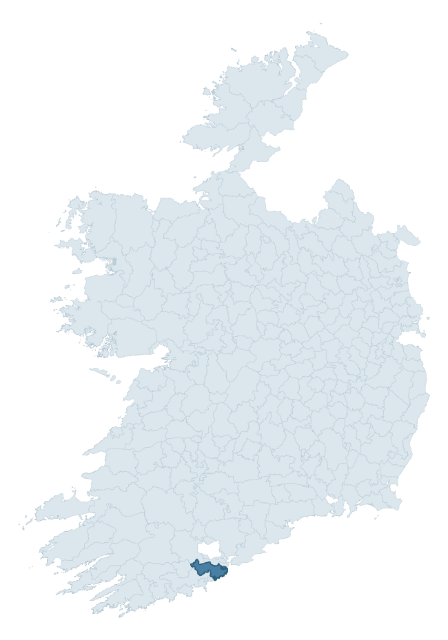
Where this barony sits in the Republic of Ireland
Geology and preservation
Bedrock geology shapes the landscape long before any settlement begins — controlling soil drainage, agricultural potential, the survival of upstanding monuments, and the preservation of buried archaeology. The figures below come from the Geological Survey Ireland 1:100,000 bedrock map.
The bedrock underlying Kinalea is predominantly mudstone (65% of the barony by area), laid down during the Carboniferous period (84% by area, around 359 to 299 million years ago). Mudstone breaks down into heavy, often poorly-drained clay soils that historically limited intensive arable use. The lower density of ploughing tends to preserve subsurface archaeology better than in sandstone or limestone terrain, though waterlogging can be a factor for site survival. A substantial secondary geology of sandstone (35%) adds further variety to the underlying landscape. The single largest mapped unit is the Kinsale Formation (31% of the barony's bedrock). With only 2 distinct rock types mapped, the barony is geologically uniform compared to the rest of the Republic (11th percentile for diversity) — a single coherent bedrock landscape.
Rock type composition
Largest mapped unit: Kinsale Formation (31% of the barony)
Placename evidence
Logainm records 29 heritage-diagnostic placenames for Kinalea, drawn from townland and civil-parish names across the barony. The dominant stratum is pre-Christian and Early Medieval defensive — ráth-, lios-, dún-, and caiseal-prefixed names that mark Iron Age and early historic settlement. The leading diagnostic roots are cill- (9 — church), ráth- (5 — earthen ringfort), and lios- (5 — ringfort or enclosure). This is broadly in line with the ROI average of 30.7 heritage placenames per barony. The presence of multiple heritage strata side by side indicates layered occupation of the landscape across successive prehistoric and historic periods. Logainm records 192 placenames for Kinalea (predominantly townland names). Of these, 29 (15%) carry one of the diagnostic Gaelic roots tracked above; the remainder draw on more generic landscape vocabulary that does not encode a heritage period.
Pre-Christian / Early Medieval Defensive
| Root | Count | Meaning |
|---|---|---|
| ráth- | 5 | earthen ringfort |
| lios- | 5 | ringfort or enclosure |
| dún- | 5 | hilltop or promontory fort |
Early Christian Ecclesiastical
| Root | Count | Meaning |
|---|---|---|
| cill- | 9 | church (early) |
| teampall- | 1 | church (later medieval) |
| domhnach- | 1 | pre-Patrician or earliest Patrician church |
| cillín- | 1 | unconsecrated burial ground |
Burial, Ritual, and Norse-Contact
| Root | Count | Meaning |
|---|---|---|
| feart- | 1 | grave mound |
| uaimh- | 1 | cave / souterrain |
| gall- | 1 | foreigner — Norse settlement marker |
Other baronies in Cork
- Imokilly
- Carbery East (east Division)
- Bear
- Bantry
- Kinatalloon
- Orrery And Kilmore
- Barrymore
- Bunratty Lower — Clare
- Clanmaurice — Kerry
- Muskerry West
See all 280 baronies in the Republic of Ireland Heritage Tool.

Explore further
Grounding History: 10 Maps of Northern Ireland’s Past
If you’re interested in Irish heritage more widely, the companion report for Northern Ireland brings together the analysis of all 462 NI wards into one place through 10 high-quality maps — covering monument density, archaeological periods, placename heritage, terrain, wetland, and the historic landscape at first survey. Take a look.
About this profile
Click any section below to expand.
What is a barony?
A barony is a historic administrative unit in Ireland, broadly equivalent to an English hundred. The 280 baronies used here are from the OSi 2019 National Statutory Boundaries (generalised 20m), covering the 26 counties of the Republic of Ireland. Baronies derive from the Norman period, were formalised in the 17th century, and have not been redrawn for statistical purposes. They vary enormously in area, from compact urban baronies in Dublin to vast upland baronies in Connacht, and should not be compared by raw site count without accounting for area differences.
What counts as a site?
This profile combines three distinct heritage registers, each with its own definition of what constitutes a recordable site:
- Archaeological sites (NMS). The National Monuments Service Sites and Monuments Record (SMR) catalogues every known archaeological monument or site of archaeological interest in the Republic, from prehistoric burial mounds and ringforts to medieval churches and post-medieval defensive works. Inclusion does not require legal protection — only that the site has been identified, surveyed, and assessed as having archaeological value. A separate subset of these sites lies within a recorded protection zone, which gives them statutory protection under the National Monuments Acts.
- Listed buildings (NIAH). The National Inventory of Architectural Heritage records buildings of architectural, historical, archaeological, artistic, cultural, scientific, social, or technical interest. Each surveyed structure is appraised on a five-tier scale: International, National, Regional, Local, and Record-Only. The NIAH appraisal is informational rather than strictly statutory, but it underpins local-authority Record of Protected Structures (RPS) listings.
- Heritage placenames (Logainm). Logainm is the authoritative database of Irish placenames maintained by the Placenames Branch. This profile applies a heritage-diagnostic classifier to the Irish-language form of each townland name, flagging roots that signal defensive sites (ráth-, lios-, dún-, caiseal-, cathair-), ecclesiastical foundations (cill-, teampall-, domhnach-, mainistir-), prehistoric burial-ritual features (tuaim-, carn-, leaba-), or Norse-contact settlement (gall-). Townlands without one of these diagnostic roots are not flagged here — they may still carry historical significance, but that significance is not encoded in the name itself.
Editorial principles
The narrative sections of this profile follow several explicit principles:
- Evidential. Every claim about this barony’s heritage character is anchored in the underlying register data. Where a site count, a placename count, or a percentile rank is cited, it is computed from the source datasets at export time, not estimated.
- Comparative. Counts and metrics are reported alongside their percentile rank against the other 279 ROI baronies. A barony with 50 ringforts in absolute terms could be unusually high or unusually low depending on its size and regional context; percentile ranking removes that ambiguity.
- Transparent on limits. Where a register has known coverage gaps, survey biases, or data-quality issues that affect this barony’s figures, the profile flags them rather than presenting the numbers as definitive.
- No interpretation beyond what the data supports. The narrative does not speculate about historical events, social dynamics, or cultural meaning beyond what the recorded heritage and placename evidence directly attests.
Data caveats and limits
- NMS Sites and Monuments Record is the product of survey campaigns conducted at different intensities across different counties and decades. Some baronies have been surveyed more thoroughly than others, and absolute counts should be read in that light. Sites destroyed by development before survey are typically not represented; sites in heavily forested or upland terrain are sometimes under-recorded.
- NIAH coverage is broadly complete for the Republic of Ireland but the survey was conducted on a rolling county-by-county basis, and the most recent appraisal date varies. Buildings demolished or substantially altered after their original survey may still appear in the register; conversely, recent buildings of merit may not yet have been appraised.
- Logainm classification applies a deliberately conservative pattern-matching approach to the Irish-language townland forms. The classifier prioritises true positives over recall: a townland may carry a heritage signal that the classifier doesn’t recognise, particularly where the diagnostic root has been heavily anglicised or where the townland name draws on a less common term. The 60,000+ townland records and ~9,800 classified placenames give a substantial signal at barony scale, but individual townland names should be checked against Logainm directly for definitive interpretation.
- Period attribution. The chronological distribution reflects only those NMS sites that carry a recognised period attribution in the source data. Sites listed as “Unknown” period are excluded from the dated subset.
- Boundary changes. Some baronies have undergone minor boundary adjustments since their 19th-century definition; the OSi 2019 generalised boundaries used here are the current statutory definition and may differ slightly from historical maps in border areas.
- Bedrock geology is mapped at 1:100,000 scale, which means local variation within a barony — small pockets of different rock type, mineral veins, alluvium overlying bedrock — is generalised. The dominant-system and rocktype figures are area-weighted, so a barony reading “70% Carboniferous limestone” may still contain small but archaeologically important pockets of older or younger rock. Around 3% of GSI polygons do not match the lexicon and contribute no rocktype or system attribution.
Data sources
- National Monuments Service — Sites and Monuments Record (SMR) https://data.gov.ie/dataset/national-monuments-service-archaeological-survey-of-ireland
- National Inventory of Architectural Heritage (NIAH) https://data.gov.ie/dataset/national-inventory-of-architectural-heritage-niah-national-dataset
- Logainm — Placenames Database of Ireland https://www.logainm.ie/
- Ordnance Survey Ireland — National Statutory Barony Boundaries 2019 https://data-osi.opendata.arcgis.com/
- EURODEM — European Digital Elevation Model https://www.mapsforeurope.org/datasets/euro-dem
- ESA WorldCover https://esa-worldcover.org/en
- Geological Survey Ireland — 1:100,000 Bedrock Geology https://www.gsi.ie/en-ie/data-and-maps/Pages/Bedrock.aspx
Explore more: Search any of the 280 ROI baronies, browse by historical province, or read the methodology and data sources for the full Republic of Ireland Heritage Tool.