
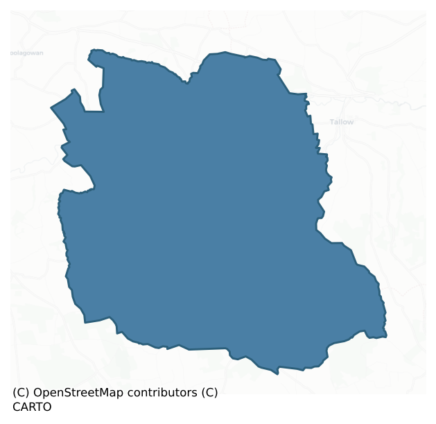
Kinatalloon is a barony of County Cork, in the historical province of Munster (Irish: Coill na Talún), covering 112 km² of land. The barony records 218 NMS archaeological sites and 47 NIAH listed buildings, placing it at around the 53rd percentile among 280 ROI baronies for sites per km². This means it is in the upper half of all baronies for sites per km². Dated archaeological evidence runs from the Neolithic through to the Modern, spanning 8 of 9 archaeological periods, placing the barony in the 50th percentile among 280 ROI baronies for chronological depth. This means it is in the upper half of all baronies for chronological depth. The largest dated subset of recorded sites dates to the Early Medieval.
Heritage at a glance
Percentile rankings throughout this profile compare each barony only against the other 279 Republic of Ireland baronies.
The recorded heritage of Kinatalloon
The National Monuments Service Sites and Monuments Record (SMR) is the statutory inventory of archaeological sites for the Republic of Ireland, maintained by the Department of Tourism, Culture, Arts, Gaeltacht, Sport and Media. Sites recorded here include earthworks, ringforts, megalithic tombs, ecclesiastical remains, and post-medieval features; not every record is legally protected, but each is registered as a monument of archaeological interest.
The National Monuments Service records 218 archaeological sites in Kinatalloon, putting it at the 53rd percentile among 280 ROI baronies for sites per km². This means it is in the upper half of all baronies for sites per km². Protection coverage is near-universal — 213 sites (98%) fall within a recorded monument protection zone, indicating an extensively surveyed landscape. The dominant category is defensive sites — ringforts, enclosures, hillforts, and stone forts (104 sites, 48% of the record). Ringfort – rath is the most prevalent type, making up 30% of the barony's recorded sites (66 records) — well above the ROI average of 20% across all baronies where this type occurs. Ringfort – rath is an earthen ringfort enclosed by a bank and external ditch — the most common Early Medieval farmstead, broadly dated 500–1000 AD. Other significant types include Standing stone (20) and Fulacht fia (20). Standing stone is a deliberately set upright stone, used variously as a Bronze/Iron Age burial marker, route marker or commemorative monument; Fulacht fia is a horseshoe-shaped Bronze Age burnt mound built around a sunken trough beside a water source, traditionally interpreted as a cooking site. Across the barony's 112 km², this gives a recorded density of 1.94 sites per km².
Most common monument types
Hover or tap a monument type to see its definition.
| Type | Count |
|---|---|
| Ringfort – rath an earthen ringfort enclosed by a bank and external ditch — the most common Early Medieval farmstead, broadly dated 500–1000 AD | 66 |
| Standing stone a deliberately set upright stone, used variously as a Bronze/Iron Age burial marker, route marker or commemorative monument | 20 |
| Fulacht fia a horseshoe-shaped Bronze Age burnt mound built around a sunken trough beside a water source, traditionally interpreted as a cooking site | 20 |
| Enclosure a banked or ditched feature of uncertain type, used as a catch-all where the original function cannot be determined from surface evidence | 18 |
| Ogham stone a stone bearing an inscription in Ogham script, used as a memorial or boundary marker between the late 4th and early 8th centuries AD | 15 |
| Souterrain an underground stone-built passage and chamber, generally Early Medieval and often associated with ringforts as a defensive or storage feature | 12 |
| Church a building used for public Christian worship, of any date from c. 500 AD onwards | 9 |
Chronological distribution
The dated archaeological record for Kinatalloon spans from the Neolithic through to the Modern, with activity attested across 8 of 9 archaeological periods. Every period from earliest to latest is represented in the record — an unbroken sequence of dated activity across the full chronological span. Activity concentrates most heavily in the Early Medieval (76 sites, 43% of dated material), with the Iron Age forming a secondary peak (47 sites, 27%). A further 41 recorded sites (19% of the overall NMS register for the barony) carry no period attribution — appearing as 'Unknown' in the bar chart below. This typically reflects either records that pre-date the standardised period vocabulary or sites awaiting specialist dating review, rather than a genuine absence of chronological evidence.
Sample of recorded monuments
Show 25 sample monuments (of 218 total)
A representative sample of 25 recorded monuments drawn from the barony’s 218 total NMS entries. Sites within a recorded monument protection zone and rarer site types are prioritised so the list shows a meaningful cross-section rather than only the most common type. Each entry shows the official Sites and Monuments Record reference number and the description published by the National Monuments Service.
Castle – Anglo-Norman masonry castle
On S shoulder of river Bride flood plain; partially built on rock outcrop. Roughly square area (c. 46m E-W; c. 44m N-S) enclosed by partially surviving bawn wall; interior now used as farmyard with concrete yard and two…
On S shoulder of river Bride flood plain; partially built on rock outcrop. Roughly square area (c. 46m E-W; c. 44m N-S) enclosed by partially surviving bawn wall; interior now used as farmyard with concrete yard and two recent galvanised-roofed sheds, also in yard a number of abandoned 19th century farmbuildings and cottage. Bawn wall best preserved to W (H c. 4m)and N (H c. 5m); S half of E wall and central part of S wall removed. W wall has lean-to farmbuilding (formerly milking parlour) built against its inside face. Parallel to N wall, and c. 1.8m inside it, is gabled one-storey cottage (only internal structure shown on 1842 OS 6-inch map), no longer inhabited.
At SW corner traces of rectangular structure (c. 17m E-W; c. 10m N-S), surviving in two portions, now separated by redundant 19th century gateway into farmyard at SW corner. End wall to W is extension of W bawn wall but at slightly inturned angle; at approximately ground and 1st floor level wall notably thicker than surviving 2nd floor section, which appears to be later addition. Also addition is shell of spiral stairs, built against N end.
Section to E consists of part of S wall (L c. 11m) and short return of E wall, with rectangular projection at E end of S wall (3.2m N-S; 4m E-W). These form back and side walls for farmbuilding, with lean-to roof, which extends 5.2m (to N) into yard. Part of S wall stands above line of lean-to roof, showing window embrasure near E end; light entirely gone and blocked-up,…
Castle – tower house
On top of a steep-sided rock outcrop, overlooking the river Bride to the N. This five-storey tower house (13.6m E-W; 9.6m N-S), survives to full height. According to Flood (1915, 195) Conna Castle was 'built by Sir…
On top of a steep-sided rock outcrop, overlooking the river Bride to the N. This five-storey tower house (13.6m E-W; 9.6m N-S), survives to full height. According to Flood (1915, 195) Conna Castle was 'built by Sir Thomas Ruadh Fitzgerald about the year 1560'; he was the eldest son of the 14th Earl of Desmond and died at the castle in 1595. The castle was repaired by Richard Boyleabout 1620 (ibid., 196), unsuccessfully assaulted by James Fitz Morris of Macollop in 1642 before falling to Lord Castlehaven in 1645 (ibid.); it was accidentally burnt in 1653 (ibid), killing three daughters of the steward, Edward Germaine. Grose depicts it in the early 19th century (Stalley 1991, 122) with the W gable intact, without merlons, and possibly roofed. The castle was repaired by A.G.L. L'Estrange in the latter part of the 19th century; it eventually passed to the state.
It is entered by a door in the E wall at ground level, of which the door surround is rebuilt but the yett-hole is evident on the S side (the yett was an iron grille or gate that hung outside the timber door, protecting it). A short lobby gives access to the main ground floor chamber (8m E-W; 5.8m N-S), and to the base of a spiral stone staircase in the SE corner, which rises to the 4th floor level. The main ground floor chamber is lit by windows in the E, N and W walls and by a pair in the S wall, all of similar design with two-part embrasures: the inner square-set embrasure is covered by a wicker-centred vault, the…
Anomalous stone group
In rough grazing on NW-facing slope. 'Cluster of large stones which looklike collapsed megalithic. Known locally as "Druid's Altar" (UCC). Removed; stones pushed into field boundary.
The above description is derived…
In rough grazing on NW-facing slope. 'Cluster of large stones which looklike collapsed megalithic. Known locally as "Druid's Altar" (UCC). Removed; stones pushed into field boundary.
The above description is derived from the published 'Archaeological Inventory of County Cork. Volume 2: East and South Cork' (Dublin: Stationery Office, 1994). In certain instances the entries have been revised and updated in the light of recent research.
Date of upload/revision: 14 January 2009
Standing stone (present location)
In pasture. Stone (L 1.8m; 1.1m x 0.3m) lies next to field fence, in SW corner of field c. 35m SSW of original position (CO046-082—-). According to local information, removed c. 1981 to present location.
The above…
In pasture. Stone (L 1.8m; 1.1m x 0.3m) lies next to field fence, in SW corner of field c. 35m SSW of original position (CO046-082—-). According to local information, removed c. 1981 to present location.
The above description is derived from the published 'Archaeological Inventory of County Cork. Volume 2: East and South Cork' (Dublin: Stationery Office, 1994). In certain instances the entries have been revised and updated in the light of recent research.
Date of revision: 17 December 2009
Revised by: Mary Tunney
Water mill – horizontal-wheeled
On W side of stream. Oaken mill-flume (L 3.32m; Wth 0.8m) unearthed by mechanical digger in 1976 (Rynne 1988, 330). Dendrochronologically dated to c. 827 AD.
The above description is derived from the published…
On W side of stream. Oaken mill-flume (L 3.32m; Wth 0.8m) unearthed by mechanical digger in 1976 (Rynne 1988, 330). Dendrochronologically dated to c. 827 AD.
The above description is derived from the published 'Archaeological Inventory of County Cork. Volume 2: East and South Cork' (Dublin: Stationery Office, 1994). In certain instances the entries have been revised and updated in the light of recent research.
Date of upload/revision: 14 January 2009
Building
On grounds of Newtown House which no longer survives. Two-storey structure of 11 bays, with 3-bay central breakfront (long axis E-W). Hipped roof; most eastern bay has subsidiary gable on N-S axis. Date plaque, in…
On grounds of Newtown House which no longer survives. Two-storey structure of 11 bays, with 3-bay central breakfront (long axis E-W). Hipped roof; most eastern bay has subsidiary gable on N-S axis. Date plaque, in breakfront, inscribed 1793. Now used as residential building.
The above description is derived from the published 'Archaeological Inventory of County Cork. Volume 2: East and South Cork' (Dublin: Stationery Office, 1994). In certain instances the entries have been revised and updated in the light of recent research.
Date of upload/revision: 14 January 2009
Burial ground
In tillage, on S-facing slope. Sub-rectangular platform defined by low scarp. At W side two upright stones (H 1.45m; 0.95m x 0.26m: H 1.1m; 1.06mx 0.23m) flank low rectangular stone with subrectangular socket (D…
In tillage, on S-facing slope. Sub-rectangular platform defined by low scarp. At W side two upright stones (H 1.45m; 0.95m x 0.26m: H 1.1m; 1.06mx 0.23m) flank low rectangular stone with subrectangular socket (D 0.03m;0.16m x 0.12m) on top surface. 'Small cross-head (H 10 ins) with plinth', axe-mould and arc of 'outer rampart enclosing two-three acres' noted by Power (1951, 59). No surface evidence for burials or outer enclosure. Stones removed and cillín levelled c. 1990.
The above description is derived from the published 'Archaeological Inventory of County Cork. Volume 2: East and South Cork' (Dublin: Stationery Office, 1994). In certain instances the entries have been revised and updated in the light of recent research.
Date of upload/revision: 14 January 2009
Stone row
Situated on flat pasture overlooking headwaters of Kiltha river to E. Row of three stones, aligned NE-SW, 4.9m in overall length. NE stone is 0.8m L, 0.2m T and 0.55m H. Next stone, 0.65m to SW, is 0.8m L, 0.35m T and…
Situated on flat pasture overlooking headwaters of Kiltha river to E. Row of three stones, aligned NE-SW, 4.9m in overall length. NE stone is 0.8m L, 0.2m T and 0.55m H. Next stone, 0.65m to SW, is 0.8m L, 0.35m T and 1.15m H. SW and tallest stone, 0.9m from last, is 1.6m L, 0. 35m T and 1.4m H. Packing stones exposed around base of all three; NE stone is loose. (Crowley 1977, 49, No. 2; O Nualláin 1988, 252, No. 174)
The above description is derived from the published 'Archaeological Inventory of County Cork. Volume 2: East and South Cork' (Dublin: Stationery Office, 1994). In certain instances the entries have been revised and updated in the light of recent research.
Date of upload/revision: 14 January 2009
Ritual site – holy well
At edge of forest with good view of Galtee Mountains to N. Spring enclosed by clochan-type structure; crowned with wooden cross. Still in holy use.
The above description is derived from the published 'Archaeological…
At edge of forest with good view of Galtee Mountains to N. Spring enclosed by clochan-type structure; crowned with wooden cross. Still in holy use.
The above description is derived from the published 'Archaeological Inventory of County Cork. Volume 2: East and South Cork' (Dublin: Stationery Office, 1994). In certain instances the entries have been revised and updated in the light of recent research.
Date of upload/revision: 14 January 2009
Bullaun stone
Outside NE wall of holy well (CO055-016001-). Sandstone block embedded in ground with central depression (L 0.45m; Wth 0.4m; D 0.1m).
The above description is derived from the published 'Archaeological Inventory of…
Outside NE wall of holy well (CO055-016001-). Sandstone block embedded in ground with central depression (L 0.45m; Wth 0.4m; D 0.1m).
The above description is derived from the published 'Archaeological Inventory of County Cork. Volume 2: East and South Cork' (Dublin: Stationery Office, 1994). In certain instances the entries have been revised and updated in the light of recent research.
Date of upload/revision: 14 January 2009
Cross
A fragment of the head of a small stone cross was found within the chancel of Ballynoe church (CO046-033002-) during the course of an archaeological excavation in 1995 (Cotter 1996, 6). The excavation was part of a…
A fragment of the head of a small stone cross was found within the chancel of Ballynoe church (CO046-033002-) during the course of an archaeological excavation in 1995 (Cotter 1996, 6). The excavation was part of a programme of phased conservation work undertaken by Cork County Council (see Cotter 1997, 10; 2000a, 21; 2002c, 105-34). The following description is based on Cronin (2002, 124-6). The cross fragment (H 0.22m; Wth 0.165m; T 0.11m) is of green sandstone and is unringed with rounded angles. One face, which has a plain flat moulding (Wth 0.02m), bears a human figure, presumably a representation of Christ. Though much weathered, part of the head, an outstretched arm and part of the torso are discernible. The end of what appears to be a sleeve is visible on the arm suggesting that the figure is robed. The reverse face of the fragment is undecorated apart from a simple chamfer on its outer edge. On stylistic grounds, the cross fragment is dated no later than the mid-12th century (Cotter 2002c, 121). The fragment is currently in the NMI (pers. comm. Eamon Cotter).
The above description is derived from 'The Archaeological Inventory of County Cork. Volume 5' (Dublin: Stationery Office, 2009).
Date of upload: 22 December 2009
Bridge
Humped back road bridge (Wth c. 4m) over River Bride, to N of Mogeely castle (CO037-008—). Six semi-circular arches, central arch repaired, course voussoirs. Stone water spouts project at base of parapet wall.
The…
Humped back road bridge (Wth c. 4m) over River Bride, to N of Mogeely castle (CO037-008—). Six semi-circular arches, central arch repaired, course voussoirs. Stone water spouts project at base of parapet wall.
The above description is derived from the published 'Archaeological Inventory of County Cork. Volume 2: East and South Cork' (Dublin: Stationery Office, 1994). In certain instances the entries have been revised and updated in the light of recent research.
Date of upload/revision: 14 January 2009
Bridge
Slightly hump-backed road bridge (Wth c. 4.2m) over Bride river. Five semi-circular arches gently increasing in height towards centre; rough voussoirs; low pointed breakwaters. Vertical stone coping on parapet wall.…
Slightly hump-backed road bridge (Wth c. 4.2m) over Bride river. Five semi-circular arches gently increasing in height towards centre; rough voussoirs; low pointed breakwaters. Vertical stone coping on parapet wall. Like Bride bridge (CO045-052—), widened in late 18th/early 19th century on upstream side (W) by a further 2.4m. Arches similar to earlier bridge: cut limestone voussoirs; low pointed breakwaters. Large horizontal slabs with intervening vertical stones form coping of parapet wall on upstream side. Central arch repaired.
The above description is derived from the published 'Archaeological Inventory of County Cork. Volume 2: East and South Cork' (Dublin: Stationery Office, 1994). In certain instances the entries have been revised and updated in the light of recent research.
Date of upload/revision: 14 January 2009
Field system
Faint traces of linear features showing as cropmarks in field fence to E of Conna castle (CO046-001—-). Appears to be a large subrectangular enclosure; circular cropmark (CO046-062—-) abuts external SW corner;…
Faint traces of linear features showing as cropmarks in field fence to E of Conna castle (CO046-001—-). Appears to be a large subrectangular enclosure; circular cropmark (CO046-062—-) abuts external SW corner; smaller circular cropmark (CO046-063—-) abuts S edge internally. Series of apparent internal sub divisions in NE quadrant; difficult to interpret and possibly including a third small circular cropmark.
The above description is derived from the published 'Archaeological Inventory of County Cork. Volume 2: East and South Cork' (Dublin: Stationery Office, 1994). In certain instances the entries have been revised and updated in the light of recent research.
Date of upload/revision: 14 January 2009
Field system
In tillage. Cropmark (CASAP) to E and S of bivallate subcircular cropmark (CO046-059—). S of enclosure, two roughly E-W trending linear features, the S line more curving and discontinuous, seems, with another curving…
In tillage. Cropmark (CASAP) to E and S of bivallate subcircular cropmark (CO046-059—). S of enclosure, two roughly E-W trending linear features, the S line more curving and discontinuous, seems, with another curving and discontinuous line to S, to delineate a small field-sized enclosure. Traces of further N-S linear features and a possible small subrectangular enclosure further to E in same field.
The above description is derived from the published 'Archaeological Inventory of County Cork. Volume 2: East and South Cork' (Dublin: Stationery Office, 1994). In certain instances the entries have been revised and updated in the light of recent research.
Date of upload/revision: 14 January 2009
Ecclesiastical enclosure
On slight terrace on NE-facing slope, in pasture. Sub-oval area (79m N-S; 49m E-W) enclosed by overgrown earthen bank (H c. 1.5m) similar to surrounding field fences; bank levelled SW->NW, but slight undulation marks…
On slight terrace on NE-facing slope, in pasture. Sub-oval area (79m N-S; 49m E-W) enclosed by overgrown earthen bank (H c. 1.5m) similar to surrounding field fences; bank levelled SW->NW, but slight undulation marks line. Interior featureless except for graveyard (CO054-057002-) in SW quadrant. Probably site of 'St. Lasser's Church' marked on 1936 OS 6-inch map beside megalithic structure (CO054-056001-) c. 300m to SSW.
The above description is derived from the published 'Archaeological Inventory of County Cork. Volume 2: East and South Cork' (Dublin: Stationery Office, 1994). In certain instances the entries have been revised and updated in the light of recent research.
Date of upload/revision: 14 January 2009
Designed landscape – tree-ring
The Archaeological Survey of Ireland (ASI) is in the process of providing information on all monuments on The Historic Environment Viewer (HEV). Currently the information for this record has not been uploaded. To…
The Archaeological Survey of Ireland (ASI) is in the process of providing information on all monuments on The Historic Environment Viewer (HEV). Currently the information for this record has not been uploaded. To access available information for research purposes please make an appointment in advance with the Archive Unit (open Fridays 10.00 am – 5.00 pm), Department of Culture, Heritage and the Gaeltacht, The Custom House, Dublin 1 D01W6XO or email nmarchive@chg.gov.ie.
Ecclesiastical enclosure
A U-shaped fosse (Wth 3.3m at top; Wth 0.8m at base; D 1.6m) was found at Ballynoe church (vol. 2, no. 5613) during the course of an archaeological excavation in 1996 (Cotter 1997, 10; 2002c, 105-34). The excavation was…
A U-shaped fosse (Wth 3.3m at top; Wth 0.8m at base; D 1.6m) was found at Ballynoe church (vol. 2, no. 5613) during the course of an archaeological excavation in 1996 (Cotter 1997, 10; 2002c, 105-34). The excavation was part of a programme of phased conservation work undertaken by Cork County Council (see also Cotter 1996a, 6; 2000a, 21). The fosse extended to the NW in an arc from under the wall of the sacristy which is on the N side of the chancel. The excavator concluded that this fosse is likely to have been the enclosing element of an early ecclesiastical enclosure (Cotter 2002c, 121).
The above description is derived from 'The Archaeological Inventory of County Cork. Volume 5' (Dublin: Stationery Office, 2009).
Date of upload: 22 December 2009
Moated site
In tillage, on level ground. A square enclosure named 'Danish Fort' is indicated on a 1774 map (no. 5) of the manors of Lismore, Lisfinny, Mogeely and Curraglass by B. Scalé (NLI MSS 7216-18). This possible moated site…
In tillage, on level ground. A square enclosure named 'Danish Fort' is indicated on a 1774 map (no. 5) of the manors of Lismore, Lisfinny, Mogeely and Curraglass by B. Scalé (NLI MSS 7216-18). This possible moated site is not visible at ground level. A castle is indicated in this area on the Down Survey (1655-6) barony map . Another possible moated site (CO036-063—-) lies c. 300m to the S.
The above description is derived from 'The Archaeological Inventory of County Cork. Volume 5' (Dublin: Stationery Office, 2009).
Date of upload: 22 December 2009
Moated site
In pasture, on a gentle SW-facing slope. A square enclosure named 'Danish Fort' is indicated on a 1774 map (no. 3) of the manors of Lismore, Lisfinny, Mogeely and Curraglass by B. Scalé (NLI MSS 7216-18). This possible…
In pasture, on a gentle SW-facing slope. A square enclosure named 'Danish Fort' is indicated on a 1774 map (no. 3) of the manors of Lismore, Lisfinny, Mogeely and Curraglass by B. Scalé (NLI MSS 7216-18). This possible moated site is not visible at ground level. Another possible moated site (CO036-061—-) lies c. 300m to the N.
The above description is derived from 'The Archaeological Inventory of County Cork. Volume 5' (Dublin: Stationery Office, 2009).
Date of upload: 22 December 2009
Moated site
In pasture, on low-lying level ground between two E-W ridges and close to the base of the S ridge. A square enclosure named 'Danish Fort' is indicated on a 1774 map (no. 1) of the manors of Lismore, Lisfinny, Mogeely…
In pasture, on low-lying level ground between two E-W ridges and close to the base of the S ridge. A square enclosure named 'Danish Fort' is indicated on a 1774 map (no. 1) of the manors of Lismore, Lisfinny, Mogeely and Curraglass by B. Scalé (NLI MSS 7216-18). The remains of this moated site consist of a slightly raised square area (46m E-W; 45m N-S) in the SE corner of the field. The interior is defined by a scarp which is topped by a low bank along the S half of the E side and on the S side. There is an external fosse on the E and S sides. The scarp (H 0.7m) on the W, N and along the N half of the E side is low and grass-covered. Elsewhere the scarp (H 1.4m) is topped by a low earthen bank (H 0.4m) which is incorporated into the field boundary system. The fosse (Wth 6m; D 0.8m) along the N half of the E side is defined externally by an earthen bank (int. H 1.4m; ext. H 0.8m). An earthen bank crossing the fosse at an angle joins this bank with the low bank (H 0.2m) topping the scarp along the S half of the E side. The fosse (D 0.4m) along the S half of the E side and along the S side has been recut to act as a drainage ditch. The interior is grass covered and no internal features were noted. According to local information, this moated site formerly consisted of a square area surrounded by a high earthen bank and a deep waterlogged fosse but it was partially levelled in the 1970s by filling the bank into the fosse on the N and W sides.
The above description is derived…
Country house
Abandoned 2-storey house over basement; gable ended with brick chimneys on gables. Entrance front (S) of 5 bays; central round-headed door ope with cut limestone surround; central wide window ope at 1st floor. Centra…
Abandoned 2-storey house over basement; gable ended with brick chimneys on gables. Entrance front (S) of 5 bays; central round-headed door ope with cut limestone surround; central wide window ope at 1st floor. Centra l2-storey gable-ended projection to rear. Curtain wall connects gable ends to gable of farmbuilding to W (which extends back into farmyard to rear) and gate pier to E.
The above description is derived from the published 'Archaeological Inventory of County Cork. Volume 2: East and South Cork' (Dublin: Stationery Office, 1994). In certain instances the entries have been revised and updated in the light of recent research.
Date of upload/revision: 14 January 2009
Castle – unclassified
Close to N bank of river Bride, 200M W of Aghern bridge; remains consist of two towers connected by later wall; attached on N side to Aghern house and coachyard, both of 19th century date. Tower to E is L-shaped:…
Close to N bank of river Bride, 200M W of Aghern bridge; remains consist of two towers connected by later wall; attached on N side to Aghern house and coachyard, both of 19th century date. Tower to E is L-shaped: rectangular block (8.5m E-W; 6.8m N-S) with projection on W side of S wall (5.5m E-W;1.15m N-S). According to Waters (1916, 166) lived in until early 19th century, but about 1850 'a considerable portion was taken down, being considered unsafe' (ibid). It now stands to 1st/2nd floor level; top of walls overgrown but appear to be topped by shallow cornice; atop W wall short section of walling with pointed-arch ope, possibly once farmyard bellcote. Recent lean-to building abuts full width of N wall, connecting tower to house. Door, with bluntly-pointed arch, set in shallow (D 0.25m) rectangular frame, in S wall of projection; approached by two steps. Inside, short passage leads to spiral stairs, lit by slit windows in S and W walls; no through access to ground floor chamber which appears to have been entered by doorway at E end of N wall, now blocked. At 1st floor level short passage from stairs leads to lintelled door into main chamber (c. 3.8m N-S; 5.45m E-W). The wooden floor is gone; overhead covered by wicker-centered pointed vault (axis N-S). Lit by single window in E, S andW walls: splayed and lintelled embrasures with narrow rectangular lights. In external S wall, immediately on E side of ground floor door, gap in wall facing (Wth c. 1.5m, rising from ground…
Ringfort – rath
In pasture, on SE-facing slope, lying to NE of ringfort (CO036-027—). Hachured as circular enclosure (diam. c. 30m) on OS 6-inch map. No visible surface trace.
The above description is derived from the published…
In pasture, on SE-facing slope, lying to NE of ringfort (CO036-027—). Hachured as circular enclosure (diam. c. 30m) on OS 6-inch map. No visible surface trace.
The above description is derived from the published 'Archaeological Inventory of County Cork. Volume 2: East and South Cork' (Dublin: Stationery Office, 1994). In certain instances the entries have been revised and updated in the light of recent research.
Date of upload/revision: 14 January 2009
Listed buildings
The National Inventory of Architectural Heritage (NIAH) is a state survey appraising buildings of architectural, historical, archaeological, artistic, cultural, scientific, social, or technical interest. Each surveyed structure receives a rating from International (the highest, for buildings of European importance) through National, Regional, Local, and Record-Only.
The NIAH records 47 listed buildings in Kinatalloon (22nd percentile across ROI baronies). All recorded buildings carry Regional or lower grading; the barony does not contain any structures appraised as being of National or International architectural importance. Construction dates concentrate most heavily in the Late Georgian (1800-1830) period. The most-recorded building type is house (17 examples, 36% of the listed stock).
Terrain and environment
Mean elevation across the barony is 105m — the 62nd percentile among 280 ROI baronies for elevation. This means it is in the upper half of all baronies for elevation. Elevation matters for heritage because higher-altitude baronies typically favour defensive monuments — ringforts and hilltop forts placed on prominent ground — while lowland baronies are more likely to carry the dense settlement and church networks of intensive agricultural landscapes. A maximum elevation of 249m gives the barony meaningful vertical relief. Mean slope is 4.4° — the 66th percentile among 280 ROI baronies for slope. This means it is in the upper half of all baronies for slope. Slope is a key control on both land use and archaeological preservation: steep ground resists ploughing and tends to preserve earthworks intact, while gentle slopes favour intensive cultivation that damages or destroys surface archaeology over time. The Topographic Wetness Index averages 10.3, the 29th percentile among 280 ROI baronies for wetness. This means it is in the bottom third of all baronies for wetness. Drainage matters for heritage because poorly-drained ground preserves organic archaeology (wooden trackways, leather, textiles, and on rare occasions human remains) far better than free-draining soil; well-drained ground favours arable use but destroys organic material rapidly. The land-cover mosaic combines improved grassland (69%), woodland (21%), and arable farmland (9%), giving a mixed agricultural and semi-natural landscape.
Terrain measurements
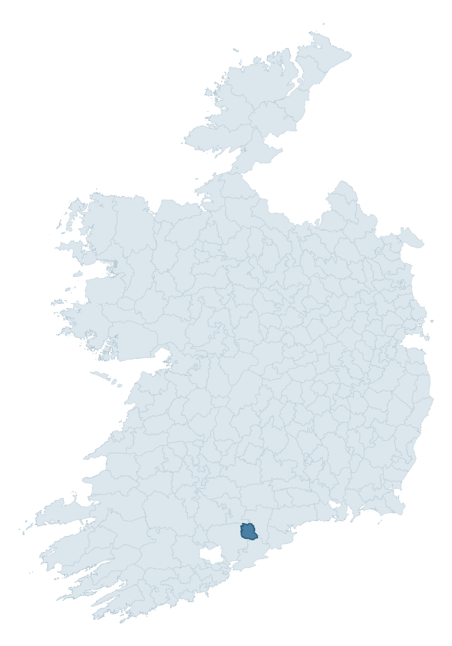
Where this barony sits in the Republic of Ireland
Geology and preservation
Bedrock geology shapes the landscape long before any settlement begins — controlling soil drainage, agricultural potential, the survival of upstanding monuments, and the preservation of buried archaeology. The figures below come from the Geological Survey Ireland 1:100,000 bedrock map.
The bedrock underlying Kinatalloon is predominantly mudstone (62% of the barony by area), laid down during the Devonian period (84% by area, around 419 to 359 million years ago). Mudstone breaks down into heavy, often poorly-drained clay soils that historically limited intensive arable use. The lower density of ploughing tends to preserve subsurface archaeology better than in sandstone or limestone terrain, though waterlogging can be a factor for site survival. The single largest mapped unit is the Ballytrasna Formation (62% of the barony's bedrock).
Rock type composition
Largest mapped unit: Ballytrasna Formation (62% of the barony)
Placename evidence
There were no placename matches for Kinatalloon based on the data available within the Logainm dataset.
Other baronies in Cork
- Cork
- Carbery West (east Division)
- Orrery And Kilmore
- Kinalea
- Carbery East (west Division)
- Carbery East (east Division)
- Imokilly
- Glenahiry — Tipperary
- Kenry — Limerick
- Coshma — Limerick
See all 280 baronies in the Republic of Ireland Heritage Tool.

Explore further
Grounding History: 10 Maps of Northern Ireland’s Past
If you’re interested in Irish heritage more widely, the companion report for Northern Ireland brings together the analysis of all 462 NI wards into one place through 10 high-quality maps — covering monument density, archaeological periods, placename heritage, terrain, wetland, and the historic landscape at first survey. Take a look.
About this profile
Click any section below to expand.
What is a barony?
A barony is a historic administrative unit in Ireland, broadly equivalent to an English hundred. The 280 baronies used here are from the OSi 2019 National Statutory Boundaries (generalised 20m), covering the 26 counties of the Republic of Ireland. Baronies derive from the Norman period, were formalised in the 17th century, and have not been redrawn for statistical purposes. They vary enormously in area, from compact urban baronies in Dublin to vast upland baronies in Connacht, and should not be compared by raw site count without accounting for area differences.
What counts as a site?
This profile combines three distinct heritage registers, each with its own definition of what constitutes a recordable site:
- Archaeological sites (NMS). The National Monuments Service Sites and Monuments Record (SMR) catalogues every known archaeological monument or site of archaeological interest in the Republic, from prehistoric burial mounds and ringforts to medieval churches and post-medieval defensive works. Inclusion does not require legal protection — only that the site has been identified, surveyed, and assessed as having archaeological value. A separate subset of these sites lies within a recorded protection zone, which gives them statutory protection under the National Monuments Acts.
- Listed buildings (NIAH). The National Inventory of Architectural Heritage records buildings of architectural, historical, archaeological, artistic, cultural, scientific, social, or technical interest. Each surveyed structure is appraised on a five-tier scale: International, National, Regional, Local, and Record-Only. The NIAH appraisal is informational rather than strictly statutory, but it underpins local-authority Record of Protected Structures (RPS) listings.
- Heritage placenames (Logainm). Logainm is the authoritative database of Irish placenames maintained by the Placenames Branch. This profile applies a heritage-diagnostic classifier to the Irish-language form of each townland name, flagging roots that signal defensive sites (ráth-, lios-, dún-, caiseal-, cathair-), ecclesiastical foundations (cill-, teampall-, domhnach-, mainistir-), prehistoric burial-ritual features (tuaim-, carn-, leaba-), or Norse-contact settlement (gall-). Townlands without one of these diagnostic roots are not flagged here — they may still carry historical significance, but that significance is not encoded in the name itself.
Editorial principles
The narrative sections of this profile follow several explicit principles:
- Evidential. Every claim about this barony’s heritage character is anchored in the underlying register data. Where a site count, a placename count, or a percentile rank is cited, it is computed from the source datasets at export time, not estimated.
- Comparative. Counts and metrics are reported alongside their percentile rank against the other 279 ROI baronies. A barony with 50 ringforts in absolute terms could be unusually high or unusually low depending on its size and regional context; percentile ranking removes that ambiguity.
- Transparent on limits. Where a register has known coverage gaps, survey biases, or data-quality issues that affect this barony’s figures, the profile flags them rather than presenting the numbers as definitive.
- No interpretation beyond what the data supports. The narrative does not speculate about historical events, social dynamics, or cultural meaning beyond what the recorded heritage and placename evidence directly attests.
Data caveats and limits
- NMS Sites and Monuments Record is the product of survey campaigns conducted at different intensities across different counties and decades. Some baronies have been surveyed more thoroughly than others, and absolute counts should be read in that light. Sites destroyed by development before survey are typically not represented; sites in heavily forested or upland terrain are sometimes under-recorded.
- NIAH coverage is broadly complete for the Republic of Ireland but the survey was conducted on a rolling county-by-county basis, and the most recent appraisal date varies. Buildings demolished or substantially altered after their original survey may still appear in the register; conversely, recent buildings of merit may not yet have been appraised.
- Logainm classification applies a deliberately conservative pattern-matching approach to the Irish-language townland forms. The classifier prioritises true positives over recall: a townland may carry a heritage signal that the classifier doesn’t recognise, particularly where the diagnostic root has been heavily anglicised or where the townland name draws on a less common term. The 60,000+ townland records and ~9,800 classified placenames give a substantial signal at barony scale, but individual townland names should be checked against Logainm directly for definitive interpretation.
- Period attribution. The chronological distribution reflects only those NMS sites that carry a recognised period attribution in the source data. Sites listed as “Unknown” period are excluded from the dated subset.
- Boundary changes. Some baronies have undergone minor boundary adjustments since their 19th-century definition; the OSi 2019 generalised boundaries used here are the current statutory definition and may differ slightly from historical maps in border areas.
- Bedrock geology is mapped at 1:100,000 scale, which means local variation within a barony — small pockets of different rock type, mineral veins, alluvium overlying bedrock — is generalised. The dominant-system and rocktype figures are area-weighted, so a barony reading “70% Carboniferous limestone” may still contain small but archaeologically important pockets of older or younger rock. Around 3% of GSI polygons do not match the lexicon and contribute no rocktype or system attribution.
Data sources
- National Monuments Service — Sites and Monuments Record (SMR) https://data.gov.ie/dataset/national-monuments-service-archaeological-survey-of-ireland
- National Inventory of Architectural Heritage (NIAH) https://data.gov.ie/dataset/national-inventory-of-architectural-heritage-niah-national-dataset
- Logainm — Placenames Database of Ireland https://www.logainm.ie/
- Ordnance Survey Ireland — National Statutory Barony Boundaries 2019 https://data-osi.opendata.arcgis.com/
- EURODEM — European Digital Elevation Model https://www.mapsforeurope.org/datasets/euro-dem
- ESA WorldCover https://esa-worldcover.org/en
- Geological Survey Ireland — 1:100,000 Bedrock Geology https://www.gsi.ie/en-ie/data-and-maps/Pages/Bedrock.aspx
Explore more: Search any of the 280 ROI baronies, browse by historical province, or read the methodology and data sources for the full Republic of Ireland Heritage Tool.