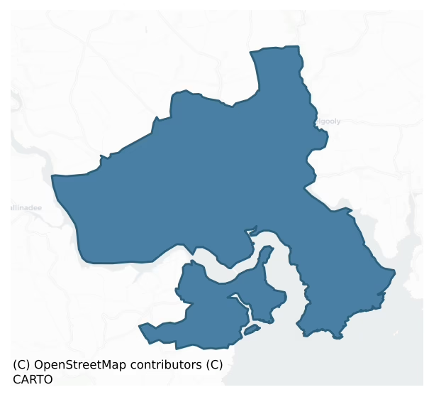
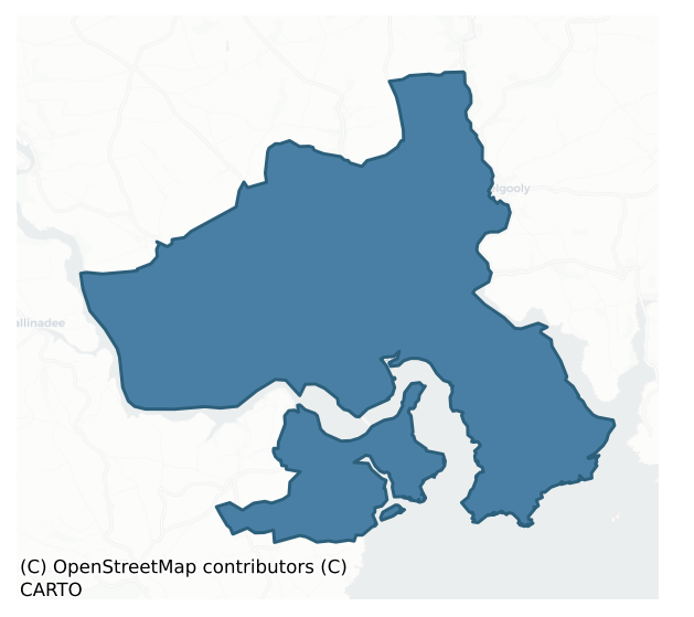
Kinsale is a barony of County Cork, in the historical province of Munster (Irish: Cionn tSáile), covering 53 km² of land. The barony records 137 NMS archaeological sites and 218 NIAH listed buildings, placing it at around the 72nd percentile among 280 ROI baronies for sites per km². This means it is in the top third of all baronies for sites per km². Dated archaeological evidence runs from the Neolithic through to the Post Medieval, spanning 7 of 9 archaeological periods, placing the barony in the 33rd percentile among 280 ROI baronies for chronological depth. This means it is in the lower half of all baronies for chronological depth. The largest dated subset of recorded sites dates to the Early Medieval. Logainm flags 16 placenames in the barony as carrying a recognised heritage root; the largest share — around 69% — are names associated with pre-christian defensive.
Heritage at a glance
Percentile rankings throughout this profile compare each barony only against the other 279 Republic of Ireland baronies.
The recorded heritage of Kinsale
The National Monuments Service Sites and Monuments Record (SMR) is the statutory inventory of archaeological sites for the Republic of Ireland, maintained by the Department of Tourism, Culture, Arts, Gaeltacht, Sport and Media. Sites recorded here include earthworks, ringforts, megalithic tombs, ecclesiastical remains, and post-medieval features; not every record is legally protected, but each is registered as a monument of archaeological interest.
The National Monuments Service records 137 archaeological sites in Kinsale, putting it at the 72nd percentile among 280 ROI baronies for sites per km². This means it is in the top third of all baronies for sites per km². Protection coverage is near-universal — 128 sites (93%) fall within a recorded monument protection zone, indicating an extensively surveyed landscape. The record is dominated by defensive sites — ringforts, enclosures, hillforts, and stone forts (31 sites, 23% of the total), with agricultural and prehistoric industrial sites forming a substantial secondary presence (23 sites, 17%). Fulacht fia is the most prevalent type, making up 15% of the barony's recorded sites (21 records) — well above the ROI average of 6% across all baronies where this type occurs. Fulacht fia is a horseshoe-shaped Bronze Age burnt mound built around a sunken trough beside a water source, traditionally interpreted as a cooking site. Other significant types include Ringfort – rath (18) and Church (9). Ringfort – rath is an earthen ringfort enclosed by a bank and external ditch — the most common Early Medieval farmstead, broadly dated 500–1000 AD; Church is a building used for public Christian worship, of any date from c. 500 AD onwards. Across the barony's 53 km², this gives a recorded density of 2.59 sites per km².
Most common monument types
Hover or tap a monument type to see its definition.
| Type | Count |
|---|---|
| Fulacht fia a horseshoe-shaped Bronze Age burnt mound built around a sunken trough beside a water source, traditionally interpreted as a cooking site | 21 |
| Ringfort – rath an earthen ringfort enclosed by a bank and external ditch — the most common Early Medieval farmstead, broadly dated 500–1000 AD | 18 |
| Church a building used for public Christian worship, of any date from c. 500 AD onwards | 9 |
| Graveyard a burial area associated with a church, in use from the medieval period onwards | 7 |
| Souterrain an underground stone-built passage and chamber, generally Early Medieval and often associated with ringforts as a defensive or storage feature | 6 |
| Burial ground an area set apart for burial that is not associated with a church, in use from the medieval period onwards | 5 |
| Enclosure a banked or ditched feature of uncertain type, used as a catch-all where the original function cannot be determined from surface evidence | 4 |
Chronological distribution
The dated archaeological record for Kinsale spans from the Neolithic through to the Post Medieval, with activity attested across 7 of 9 archaeological periods. Every period from earliest to latest is represented in the record — an unbroken sequence of dated activity across the full chronological span. Activity concentrates most heavily in the Early Medieval (29 sites, 32% of dated material), with the Middle Late Bronze Age forming a secondary peak (23 sites, 25%). A further 46 recorded sites (34% of the overall NMS register for the barony) carry no period attribution — appearing as 'Unknown' in the bar chart below. This typically reflects either records that pre-date the standardised period vocabulary or sites awaiting specialist dating review, rather than a genuine absence of chronological evidence.
Sample of recorded monuments
Show 25 sample monuments (of 137 total)
A representative sample of 25 recorded monuments drawn from the barony’s 137 total NMS entries. Sites within a recorded monument protection zone and rarer site types are prioritised so the list shows a meaningful cross-section rather than only the most common type. Each entry shows the official Sites and Monuments Record reference number and the description published by the National Monuments Service.
Earthwork
On small headland on N side of Doon Creek off Bandon river. Oval earthen mound (92.4m N-S; 119m E-W) rising in two stages to height of 7m. Top of mound level (28.6m N-S; 28.2m E-W) and planted with trees. Site of…
On small headland on N side of Doon Creek off Bandon river. Oval earthen mound (92.4m N-S; 119m E-W) rising in two stages to height of 7m. Top of mound level (28.6m N-S; 28.2m E-W) and planted with trees. Site of souterrain (CO111-06602-) on SE face of mound, according to local information.
The above description is derived from the published 'Archaeological Inventory of County Cork. Volume 2: East and South Cork' (Dublin: Stationery Office, 1994). In certain instances the entries have been revised and updated in the light of recent research.
Date of upload/revision: 14 January 2009
House – fortified house
In pasture, sloping down to SE, near head of Whitecastle creek; only part of W wall (L 9m) and short return of S wall (L 1.8m) now stand to 2nd floorlevel. In W wall lintelled gun loop at ground level; fireplace at 2nd…
In pasture, sloping down to SE, near head of Whitecastle creek; only part of W wall (L 9m) and short return of S wall (L 1.8m) now stand to 2nd floorlevel. In W wall lintelled gun loop at ground level; fireplace at 2nd floorlevel. Atop SW corner bartizan supported by three tapering corbels. Appearance of house built in early decades of 17th century; also known as Ardcloyne Castle, probably built by Roches of Kinsale (Fuller 1907, 15).
The above description is derived from the published 'Archaeological Inventory of County Cork. Volume 2: East and South Cork' (Dublin: Stationery Office, 1994). In certain instances the entries have been revised and updated in the light of recent research.
Date of upload/revision: 14 January 2009
Watchman's hut – burial ground
At N side of road, on W side of Whitecastle creek; subrectangular graveyard (c. 70m E-W; c. 40m N-S) enclosed by stone wall to W and S and elsewhere by stone-faced earthen bank. In occasional use. Earliest inscribed…
At N side of road, on W side of Whitecastle creek; subrectangular graveyard (c. 70m E-W; c. 40m N-S) enclosed by stone wall to W and S and elsewhere by stone-faced earthen bank. In occasional use. Earliest inscribed headstone dated 1740 (Henchion 1970, 143-57). Near NW corner, roofless sub-rectangular ruin (4.35m E-W; 3.75m N-S) named 'Watch House' (CO111-075002-) on 1939 OS 6-inch map; erected between 1792 and 1842 according to Henchion (ibid., 156); lintelled door in S wall, windows in S and W wall, fireplace in W wall (see plan and elevations, ibid., 157). No visible surface trace of Tisaxon parish church (CO111-075003-) which was in ruins by 1615 (Brunicardi 1913, 75).
The above description is derived from the published 'Archaeological Inventory of County Cork. Volume 2: East and South Cork' (Dublin: Stationery Office, 1994). In certain instances the entries have been revised and updated in the light of recent research.
Date of upload/revision: 14 January 2009
Water mill – vertical-wheeled
Archaeological excavation, to the N and S of a stream known as Whitecastle creek, was undertaken in 1996 on the wheel-house section of a vertical-wheeled water mill. The remains consisted of a S soleplate (L 3.72m…
Archaeological excavation, to the N and S of a stream known as Whitecastle creek, was undertaken in 1996 on the wheel-house section of a vertical-wheeled water mill. The remains consisted of a S soleplate (L 3.72m NE-SW; max. Wth 0.33m; T 0.37m; H 0.4m) which formed the basal section of the frame of the wheel-house and a flume support beam (L 2.63m NW-SE; max. Wth 0.25m; T 0.35m; H c. 0.35m). Three irregularly spaced mortises (av. L. 0.32m; av. Wth 0.13m; av. D 0.1m) were cut into the upper face of the soleplate. The N soleplate (L 4m) was recorded in situ in 1995 but had become dislodged prior to excavation in 1996. The E edge of the tailrace, which was constructed on line with the pit dug for the wheel-house, was also excavated. A number of timbers were on, and partially embedded, in the fill of the tailrace. Many of the other structural timbers had been removed from the site prior to excavation. A dendrochronology date of AD 787±9 was obtained from the flume support beam. (Cleary 1997b, 10; 1999b, 37-58)
The above description is derived from 'The Archaeological Inventory of County Cork. Volume 5' (Dublin: Stationery Office, 2009).
Date of upload: 22 December 2009
Bridge
Road bridge (Wth 8.1m) over stream; built at skew to stream. Three low segmental arches; low pointed breakwaters on upstream side.
The above description is derived from the published 'Archaeological Inventory of…
Road bridge (Wth 8.1m) over stream; built at skew to stream. Three low segmental arches; low pointed breakwaters on upstream side.
The above description is derived from the published 'Archaeological Inventory of County Cork. Volume 2: East and South Cork' (Dublin: Stationery Office, 1994). In certain instances the entries have been revised and updated in the light of recent research.
Date of upload/revision: 14 January 2009
Religious house – Carmelite friars
In centre of graveyard (CO112-03302-); St. Mary's Carmelite priory, founded by Robert fitz Richard Balrain in 1334; in 1541 jurors reported the existence of 'church with belfry, cloister, hall and other buildings'…
In centre of graveyard (CO112-03302-); St. Mary's Carmelite priory, founded by Robert fitz Richard Balrain in 1334; in 1541 jurors reported the existence of 'church with belfry, cloister, hall and other buildings' (Gwynn and Hadcock 1988, 290). Extensively damaged in 1601 during siege of Kinsale; temporary chapel erected 1633 but abandoned 1653 (Gillan and Hurley 1978, 33); convent 'was existing c. 1737' (Gwynn and Hadcock ibid) and the Prior made Town almoner in 1741 (Mulcahy 1968, 12). A 'few fragmentary walls' (Garner 1980, 36) survive.
The above description is derived from the published 'Archaeological Inventory of County Cork. Volume 2: East and South Cork' (Dublin: Stationery Office, 1994). In certain instances the entries have been revised and updated in the light of recent research.
Date of upload/revision: 14 January 2009
Historic town
On or near site of early Christian monastery (CO112-085—-); established as trading post by Vikings (Jefferies 1986, 34) and settled by Anglo-Normans c. 1200 (Garner 1980, 1). Received first charter relatively late in…
On or near site of early Christian monastery (CO112-085—-); established as trading post by Vikings (Jefferies 1986, 34) and settled by Anglo-Normans c. 1200 (Garner 1980, 1). Received first charter relatively late in 1333-4; murage grant to repair town walls in 1348 (CO112-03402-); market grant of 1226 seems to confirm presence of town at that date (Thomas 1992, 138). Town was 'of little importance throughout the medieval period' (Garner ibid) but featured in siege during Battle of Kinsale in 1601 (Mulcahy 1968, 54-67). Town's defences strengthened in 17th century by construction of James Fort (CO112-036—) in 1604 and Charles Fort in 1670 (CO125-007—),but taken by Williamite forces in 1690 (Mulcahy ibid, 30) when much damage done to town walls. The town continued to grow and prosper to some extent in 18th and 19th centuries, with a heavy reliance on the fishing industry (Gillen and Hurley 1978, 11).
The above description is derived from the published 'Archaeological Inventory of County Cork. Volume 2: East and South Cork' (Dublin: Stationery Office, 1994). In certain instances the entries have been revised and updated in the light of recent research.
Date of upload/revision: 14 January 2009
Town defences
Town of Kinsale given 1st charter in 1333-4 which states that 'the walls are ruinous, and the burgesses not able to repair them'; possibly walled from mid-13th century; murage grant to repair walls in 1348 (Thomas…
Town of Kinsale given 1st charter in 1333-4 which states that 'the walls are ruinous, and the burgesses not able to repair them'; possibly walled from mid-13th century; murage grant to repair walls in 1348 (Thomas 1992,138). Walls probably battlemented with internal rampart, external fosse, c.15 towers; 4 gates and internal gate Upper town, 2 in Base town (Thomas ibid). Damaged during Battle of Kinsale in 1601 (Mulcahy 1968, 17); according to Lewis (1837, vol. 2, 234), town walls largely destroyed during siege of 1690, though subject to some repairs in 18th century (McSwiney 1938, 82-5 & 92-3). Three remaining gates removed by 1805 (Lewis ibid). McSwiney (ibid., 81) traces layout of walls which enclosed what Bradley (1985, 452) describes as 'forked-linear' street pattern. Thomas (ibid) suggests that walling of Base town, which continues linear pattern to SE, may be later, possibly late 16th century. At most, only fragmentary remains of town's defences survive above ground level (McSwiney ibid, 92); according to Thomas (ibid., 137) 'much of N wall survives in reduced form as a field boundary … no other remains'.
The above description is derived from the published 'Archaeological Inventory of County Cork. Volume 2: East and South Cork' (Dublin: Stationery Office, 1994). In certain instances the entries have been revised and updated in the light of recent research.
Date of upload/revision: 14 January 2009
Market-house
Built c. 1600 as market house, originally accessible by water (Bence-Jones 1970, 295). Altered in 1706 for use as court house; 5-bay, 2-storey with attic; ground floor arcading with outer arches blocked; weather-slated…
Built c. 1600 as market house, originally accessible by water (Bence-Jones 1970, 295). Altered in 1706 for use as court house; 5-bay, 2-storey with attic; ground floor arcading with outer arches blocked; weather-slated 1st floor with central venetian window; attic storey of 3 weather-slated curvilinear gables (Garner 1980, 16). Similar to the Exchange in Youghal, as depicted by Dineley in 1681 (Beharrel 1977, 181). Now Kinsale Museum.
The above description is derived from the published 'Archaeological Inventory of County Cork. Volume 2: East and South Cork' (Dublin: Stationery Office, 1994). In certain instances the entries have been revised and updated in the light of recent research.
Date of upload/revision: 14 January 2009
Almshouse
Located to the south of the medieval town on a high terrace of land with commanding views to the N and E. The site is referred to locally as the Southwell Gift Houses after Sir Robert Southwell who erected the buildings…
Located to the south of the medieval town on a high terrace of land with commanding views to the N and E. The site is referred to locally as the Southwell Gift Houses after Sir Robert Southwell who erected the buildings in 1682 'for 8 old people' (Power et al. 1994, 285).
The Almshouses were restored to their original use from 1965 to 1970, and extensively refurbished in 1968: https://www.rte.ie/archives/2017/0206/850574-kinsale-houses-restored/. During this refurbishment, all buildings were re-roofed with salvaged slate, the interiors modified and the external walls repointed. In 2015 the houses were put for sale on behalf of the Church of Ireland, Bishop of Cork, Cloyne and Ross due to the need to completely restore the buildings. They are now in private ownership, and a conservation and refurbishment project to make them fit to use as houses again was approved in 2017 (Planning Report 2017).
The site is comprised of a detached three-bay, two-storey, gable fronted house, facing the entrance, within its own grounds with a garden extending to the W, and an enclosed courtyard to the E, flanked by two rows of paired single-storey houses with dormer attics and windows. (Garner 1980, 69). The almshouses comprise three bay facades with dormer and ground floor windows flanking a central double-leaf timber battened doorway with decorative door furniture. The windows are attractive timber framed, quarry glazed cast-iron windows, with stone lintels and sills; the dormer wi…
Custom house
Built in early 18th century as Custom House. House of L-shaped plan with 5 bay, 2-storey front; central three bays form shallow breakfront. Gibbs surround to round-headed front doorcase. Two bays added to left with…
Built in early 18th century as Custom House. House of L-shaped plan with 5 bay, 2-storey front; central three bays form shallow breakfront. Gibbs surround to round-headed front doorcase. Two bays added to left with archway at ground level. Interior has 'good eighteenth-century, raised fielded-panel shutters', shouldered architraves and panelling (Garner 1980, 60-1).
The above description is derived from the published 'Archaeological Inventory of County Cork. Volume 2: East and South Cork' (Dublin: Stationery Office, 1994). In certain instances the entries have been revised and updated in the light of recent research.
Date of upload/revision: 14 January 2009
Fish palace
Went (1946, 140) records site of pilchard press at Scilly in Kinsale. No visible surface trace. 1842 OS 6-inch map shows two parallel rectangular structures (long axes NE-SW) in area known locally as "the palace";…
Went (1946, 140) records site of pilchard press at Scilly in Kinsale. No visible surface trace. 1842 OS 6-inch map shows two parallel rectangular structures (long axes NE-SW) in area known locally as "the palace"; ruined residential structure may be remains of these. Immediately to SW, ruined rectangular 2-storey, 11-bay structure (long axis N-S) to SW, date plaque inscribed "1840", is known locally as "fish factory".
The above description is derived from the published 'Archaeological Inventory of County Cork. Volume 2: East and South Cork' (Dublin: Stationery Office, 1994). In certain instances the entries have been revised and updated in the light of recent research.
Date of upload/revision: 14 January 2009
Blockhouse
At the NE tip of Castlepark promontory in Kinsale harbour. The remains of this blockhouse are approached from the W by a covered way from James' Fort (CO112-036—). It was built on a rock outcrop just above the…
At the NE tip of Castlepark promontory in Kinsale harbour. The remains of this blockhouse are approached from the W by a covered way from James' Fort (CO112-036—). It was built on a rock outcrop just above the high-tide mark. According to O'Neil (1940, 113), the earliest part of the structure dates to the 16th century, however, O'Sullivan (1916, 99) gives a 1604 account for the construction of James Fort which includes £50 for a 'Blockhouse at the point of the land'. It is shown on a 1625 map (Hayes-McCoy 1964, 33) and clearly depicted in Phillips's 'prospect' of 1685 (Kerrigan 1977-9). Whatever its date, the structure appears to be the remains of a shore-level battery of at least eight guns, with a magazine and accommodation as part of the complex.
The remains consist of a roofless ruin, modified in recent times when it was used as a 'store for fish boxes' (O'Sullivan 1916, 100). The covered way leads to a downward sloping ramp passing between two rectangular structures and through wide doorway onto the level platform (17.8m E-W; 17m N-S), enclosed by straight walls to the N, S and W and by a three-sided wall to the E. The ground floor wall is pierced by a series of double splayed opes, all modified recently to take window frames; the 1st floor wall was added in recent times. The double splayed opes are probably gun ports. In the NW corner a passage leads to a domed magazine (6.1m E-W; 4.6m N-S), approached through a small ante chamber. In the N wall of the passage t…
Designed landscape – belvedere
Overgrown 2-storey tower, to SE of 19th century house. Rectangular in plan with pointed door on N side. Bee boles (CO112-077—) to W.
The above description is derived from the published 'Archaeological Inventory of…
Overgrown 2-storey tower, to SE of 19th century house. Rectangular in plan with pointed door on N side. Bee boles (CO112-077—) to W.
The above description is derived from the published 'Archaeological Inventory of County Cork. Volume 2: East and South Cork' (Dublin: Stationery Office, 1994). In certain instances the entries have been revised and updated in the light of recent research.
Date of upload/revision: 14 January 2009
Ecclesiastical enclosure
In pasture, on SE-facing slope. Located directly outside site of W wall of medieval town of Kinsale (CO112-03402- and CO112-03401-). According to local information (pers. comm. E. Gillen) site of early ecclesiastical…
In pasture, on SE-facing slope. Located directly outside site of W wall of medieval town of Kinsale (CO112-03402- and CO112-03401-). According to local information (pers. comm. E. Gillen) site of early ecclesiastical settlement of St. Multose founded in the 6th century (Gwynn and Hadcock 1988, 396). No visible surface trace. It is also possible that site is that now occupied by St Multose' Church (CO112-03404-).
The above description is derived from the published 'Archaeological Inventory of County Cork. Volume 2: East and South Cork' (Dublin: Stationery Office, 1994). In certain instances the entries have been revised and updated in the light of recent research.
Date of upload/revision: 14 January 2009
Mound
In pasture, atop E-W ridge known as Compass Hill, overlooking Kinsale to NE. Low, roughly circular mound (15m N-S; 16m E-W; H 0.5m); very faint depression on NE side (wth c. 15m; running c. 40m to field fence). Marked…
In pasture, atop E-W ridge known as Compass Hill, overlooking Kinsale to NE. Low, roughly circular mound (15m N-S; 16m E-W; H 0.5m); very faint depression on NE side (wth c. 15m; running c. 40m to field fence). Marked as 'the mound upon the Hill' on 1601 map (O'Neil 1940, facing 111); used as observation post and firing platform by Spanish during siege of Kinsale in 1601. O'Neil (ibid.) suggests this 'appears to be a round barrow' but current visible form too eroded to identify original form.
The above description is derived from the published 'Archaeological Inventory of County Cork. Volume 2: East and South Cork' (Dublin: Stationery Office, 1994). In certain instances the entries have been revised and updated in the light of recent research.
Date of upload/revision: 14 January 2009
Decorated stone
The Archaeological Survey of Ireland (ASI) is in the process of providing information on all monuments on The Historic Environment Viewer (HEV). Currently the information for this record has not been uploaded. To…
The Archaeological Survey of Ireland (ASI) is in the process of providing information on all monuments on The Historic Environment Viewer (HEV). Currently the information for this record has not been uploaded. To access available information for research purposes please make an appointment in advance with the Archive Unit (open Fridays 10.00 am – 5.00 pm), Department of Culture, Heritage and the Gaeltacht, The Custom House, Dublin 1 D01W6XO or email nmarchive@chg.gov.ie.
Boulder-burial
In pasture. Quartz boulder (2.64m x 1.68m; 1.45m T) resting on support stone to W and on bed of smaller stones; quartz stone lies under E side. Standing stone (CO0125-025—) once stood close by.
The above…
In pasture. Quartz boulder (2.64m x 1.68m; 1.45m T) resting on support stone to W and on bed of smaller stones; quartz stone lies under E side. Standing stone (CO0125-025—) once stood close by.
The above description is derived from the published 'Archaeological Inventory of County Cork. Volume 2: East and South Cork' (Dublin: Stationery Office, 1994). In certain instances the entries have been revised and updated in the light of recent research.
Date of upload/revision: 14 January 2009
Megalithic tomb – unclassified
Situated at edge of steep slope above cliff at Ballymacus Point. Monument consists of oblong cairn (L 8.5m; Wth 2.5m) with oblong depression, abutting old fence. Remains of gallery, at W end (L 3.6m), aligned E-W;…
Situated at edge of steep slope above cliff at Ballymacus Point. Monument consists of oblong cairn (L 8.5m; Wth 2.5m) with oblong depression, abutting old fence. Remains of gallery, at W end (L 3.6m), aligned E-W; represented by three orthostats and a prostrate slab to S, single orthostat to W. Cremen (1924, 73) records that, in 1872, a party of soldiers dug into the monument and removed a 'covering slab'. The remains appear to be last vestiges of a megalithic tomb.
The above description is derived from the published 'Archaeological Inventory of County Cork. Volume 2: East and South Cork' (Dublin: Stationery Office, 1994). In certain instances the entries have been revised and updated in the light of recent research.
Date of upload/revision: 14 January 2009
Standing stone (present location)
In pasture, on S-facing slope. Quartz stone (H 1.74m; 1.32m x 0.95m) stands 100m S of original position (CO125-012—-), next to field boundary.
The above description is derived from the published 'Archaeological…
In pasture, on S-facing slope. Quartz stone (H 1.74m; 1.32m x 0.95m) stands 100m S of original position (CO125-012—-), next to field boundary.
The above description is derived from the published 'Archaeological Inventory of County Cork. Volume 2: East and South Cork' (Dublin: Stationery Office, 1994). In certain instances the entries have been revised and updated in the light of recent research.
Date of upload/revision: 14 January 2009
Stone sculpture
In Kinsale; C of I parish church of St. Multose (CO112-034005-), 'one of the few medieval parish churches in Ireland still in use' (Leask 1966, vol. 2, 149-50). Church much altered 1730 and again 1759-60, but major…
In Kinsale; C of I parish church of St. Multose (CO112-034005-), 'one of the few medieval parish churches in Ireland still in use' (Leask 1966, vol. 2, 149-50). Church much altered 1730 and again 1759-60, but major renovations, including replacing N nave and chancel arcade and complete re-roofing, took place 1835-7; 'sweeping alterations' again made 1856-8 (Darling ibid, 16-9). Chancel given new ceiling in 1951 (Garner 1980, 11). Existence of sheela-na-gig inside St. Multose church is recorded as being located ‘on a stone in St. Multose church’(http://jillschubert.com/ireland.htm accessed 22 May 2012). This figure is not a sheela-na-gig, but is a carving of the ‘outline of a child with paddle hands. The folklore is that the fishwives would rub this stone for good luck while their men were at sea. The other side of the stone has been used as an 18th century gravestone’(http://www.irelands-sheelanagigs.org/archive/index-42071.php.html accessed 22 May 2012). This stone is currently located inside St. Multose Church.
The above description is derived from the published 'Archaeological Inventory of County Cork. Volume 2: East and South Cork' (Dublin: Stationery Office, 1994). In certain instances the entries have been revised and updated in the light of recent research.
Compiled by: Caimin O’Brien
Date of upload: 22 May 2012
House – medieval
The Archaeological Survey of Ireland (ASI) is in the process of providing information on all monuments on The Historic Environment Viewer (HEV). Currently the information for this record has not been uploaded. To…
The Archaeological Survey of Ireland (ASI) is in the process of providing information on all monuments on The Historic Environment Viewer (HEV). Currently the information for this record has not been uploaded. To access available information for research purposes please make an appointment in advance with the Archive Unit (open Fridays 10.00 am – 5.00 pm), Department of Culture, Heritage and the Gaeltacht, The Custom House, Dublin 1 D01W6XO or email nmarchive@chg.gov.ie.
Burnt spread
In pasture field, c. 145m NNW of tower house (CO111-071-). Black soil with heat shattered stone visible. Extent of spread not visible due to grass growth.
Compiled by: Mary Sleeman
Date of upload/revision: 1…
In pasture field, c. 145m NNW of tower house (CO111-071-). Black soil with heat shattered stone visible. Extent of spread not visible due to grass growth.
Compiled by: Mary Sleeman
Date of upload/revision: 1 December 2022
Armorial plaque
The Archaeological Survey of Ireland (ASI) is in the process of providing information on all monuments on The Historic Environment Viewer (HEV). Currently the information for this record has not been uploaded. To access…
The Archaeological Survey of Ireland (ASI) is in the process of providing information on all monuments on The Historic Environment Viewer (HEV). Currently the information for this record has not been uploaded. To access available information for research purposes please make an appointment in advance with the Archive Unit (open Fridays 10.00 am – 5.00 pm), Department of Culture, Heritage and the Gaeltacht, The Custom House, Dublin 1 D01W6XO or email nmarchive@chg.gov.ie.
Fulacht fia
In reclaimed land to E of stream. No visible surface trace.
The above description is derived from the published 'Archaeological Inventory of County Cork. Volume 2: East and South Cork' (Dublin: Stationery Office,…
In reclaimed land to E of stream. No visible surface trace.
The above description is derived from the published 'Archaeological Inventory of County Cork. Volume 2: East and South Cork' (Dublin: Stationery Office, 1994). In certain instances the entries have been revised and updated in the light of recent research.
Date of upload/revision: 14 January 2009
Listed buildings
The National Inventory of Architectural Heritage (NIAH) is a state survey appraising buildings of architectural, historical, archaeological, artistic, cultural, scientific, social, or technical interest. Each surveyed structure receives a rating from International (the highest, for buildings of European importance) through National, Regional, Local, and Record-Only.
The NIAH records 218 listed buildings in Kinsale, the 81st percentile across ROI baronies for listed-building density. Among these, 6 are graded National — buildings of interest to the whole of Ireland rather than only its region. The Republic holds 937 National-graded buildings in total, so this barony accounts for around 1% of the national total. Construction dates concentrate most heavily in the Late Georgian (1800-1830) period. The most-recorded building type is house (135 examples, 62% of the listed stock).
Terrain and environment
Mean elevation across the barony is 45m — the 14th percentile among 280 ROI baronies for elevation. This means it is in the bottom fifth of all baronies for elevation. This is a relatively low-lying landscape by ROI standards. Elevation matters for heritage because higher-altitude baronies typically favour defensive monuments — ringforts and hilltop forts placed on prominent ground — while lowland baronies are more likely to carry the dense settlement and church networks of intensive agricultural landscapes. Mean slope is 5.9° — the 82nd percentile among 280 ROI baronies for slope. This means it is in the top fifth of all baronies for slope. This is consistently steep terrain by ROI standards, the kind of landscape that tends to preserve upstanding archaeological features well. Slope is a key control on both land use and archaeological preservation: steep ground resists ploughing and tends to preserve earthworks intact, while gentle slopes favour intensive cultivation that damages or destroys surface archaeology over time. Localised maximum slopes reach 16°, typical of stream-cut valleys, escarpments, or coastal bluffs within the wider landscape. The Topographic Wetness Index averages 9.8, the 18th percentile among 280 ROI baronies for wetness. This means it is in the bottom fifth of all baronies for wetness. This is well-drained ground by ROI standards — typical of upland or steeply-sloping country that sheds water rapidly. Drainage matters for heritage because poorly-drained ground preserves organic archaeology (wooden trackways, leather, textiles, and on rare occasions human remains) far better than free-draining soil; well-drained ground favours arable use but destroys organic material rapidly. The land-cover mosaic combines improved grassland (52%), arable farmland (27%), and woodland (14%), giving a mixed agricultural and semi-natural landscape. In overall character, this is steeply-sloping terrain at modest elevation, with land use dominated by improved grassland.
Terrain measurements
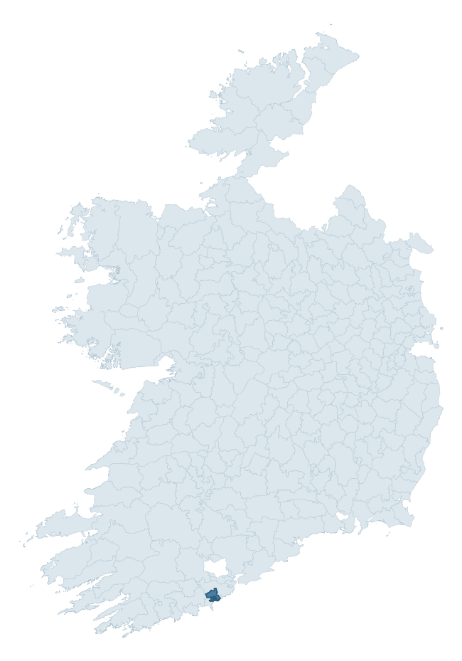
Where this barony sits in the Republic of Ireland
Geology and preservation
Bedrock geology shapes the landscape long before any settlement begins — controlling soil drainage, agricultural potential, the survival of upstanding monuments, and the preservation of buried archaeology. The figures below come from the Geological Survey Ireland 1:100,000 bedrock map.
The bedrock underlying Kinsale is predominantly mudstone (95% of the barony by area), laid down during the Carboniferous period (100% by area, around 359 to 299 million years ago). Mudstone breaks down into heavy, often poorly-drained clay soils that historically limited intensive arable use. The lower density of ploughing tends to preserve subsurface archaeology better than in sandstone or limestone terrain, though waterlogging can be a factor for site survival. The single largest mapped unit is the Kinsale Formation (68% of the barony's bedrock). With only 2 distinct rock types mapped, the barony is geologically uniform compared to the rest of the Republic (12th percentile for diversity) — a single coherent bedrock landscape.
Rock type composition
Largest mapped unit: Kinsale Formation (68% of the barony)
Placename evidence
Logainm records 16 heritage-diagnostic placenames for Kinsale, drawn from townland and civil-parish names across the barony. The dominant stratum is pre-Christian and Early Medieval defensive — ráth-, lios-, dún-, and caiseal-prefixed names that mark Iron Age and early historic settlement. The leading diagnostic roots are cill- (5 — church), ráth- (4 — earthen ringfort), and lios- (3 — ringfort or enclosure). This is below the ROI average of 30.7 heritage placenames per barony, suggesting either lighter survey coverage or a townland-naming tradition that draws more on generic landscape vocabulary. Logainm records 99 placenames for Kinsale (predominantly townland names). Of these, 16 (16%) carry one of the diagnostic Gaelic roots tracked above; the remainder draw on more generic landscape vocabulary that does not encode a heritage period.
Pre-Christian / Early Medieval Defensive
| Root | Count | Meaning |
|---|---|---|
| ráth- | 4 | earthen ringfort |
| lios- | 3 | ringfort or enclosure |
| dún- | 3 | hilltop or promontory fort |
Early Christian Ecclesiastical
| Root | Count | Meaning |
|---|---|---|
| cill- | 5 | church (early) |
Other baronies in Cork
- Condons And Clangibbon
- Courceys
- Kinatalloon
- Bantry
- Carbery East (east Division)
- Barrymore
- Barretts
- Orrery And Kilmore
- Slievardagh — Tipperary
- Gaultiere — Waterford
See all 280 baronies in the Republic of Ireland Heritage Tool.

Explore further
Grounding History: 10 Maps of Northern Ireland’s Past
If you’re interested in Irish heritage more widely, the companion report for Northern Ireland brings together the analysis of all 462 NI wards into one place through 10 high-quality maps — covering monument density, archaeological periods, placename heritage, terrain, wetland, and the historic landscape at first survey. Take a look.
About this profile
Click any section below to expand.
What is a barony?
A barony is a historic administrative unit in Ireland, broadly equivalent to an English hundred. The 280 baronies used here are from the OSi 2019 National Statutory Boundaries (generalised 20m), covering the 26 counties of the Republic of Ireland. Baronies derive from the Norman period, were formalised in the 17th century, and have not been redrawn for statistical purposes. They vary enormously in area, from compact urban baronies in Dublin to vast upland baronies in Connacht, and should not be compared by raw site count without accounting for area differences.
What counts as a site?
This profile combines three distinct heritage registers, each with its own definition of what constitutes a recordable site:
- Archaeological sites (NMS). The National Monuments Service Sites and Monuments Record (SMR) catalogues every known archaeological monument or site of archaeological interest in the Republic, from prehistoric burial mounds and ringforts to medieval churches and post-medieval defensive works. Inclusion does not require legal protection — only that the site has been identified, surveyed, and assessed as having archaeological value. A separate subset of these sites lies within a recorded protection zone, which gives them statutory protection under the National Monuments Acts.
- Listed buildings (NIAH). The National Inventory of Architectural Heritage records buildings of architectural, historical, archaeological, artistic, cultural, scientific, social, or technical interest. Each surveyed structure is appraised on a five-tier scale: International, National, Regional, Local, and Record-Only. The NIAH appraisal is informational rather than strictly statutory, but it underpins local-authority Record of Protected Structures (RPS) listings.
- Heritage placenames (Logainm). Logainm is the authoritative database of Irish placenames maintained by the Placenames Branch. This profile applies a heritage-diagnostic classifier to the Irish-language form of each townland name, flagging roots that signal defensive sites (ráth-, lios-, dún-, caiseal-, cathair-), ecclesiastical foundations (cill-, teampall-, domhnach-, mainistir-), prehistoric burial-ritual features (tuaim-, carn-, leaba-), or Norse-contact settlement (gall-). Townlands without one of these diagnostic roots are not flagged here — they may still carry historical significance, but that significance is not encoded in the name itself.
Editorial principles
The narrative sections of this profile follow several explicit principles:
- Evidential. Every claim about this barony’s heritage character is anchored in the underlying register data. Where a site count, a placename count, or a percentile rank is cited, it is computed from the source datasets at export time, not estimated.
- Comparative. Counts and metrics are reported alongside their percentile rank against the other 279 ROI baronies. A barony with 50 ringforts in absolute terms could be unusually high or unusually low depending on its size and regional context; percentile ranking removes that ambiguity.
- Transparent on limits. Where a register has known coverage gaps, survey biases, or data-quality issues that affect this barony’s figures, the profile flags them rather than presenting the numbers as definitive.
- No interpretation beyond what the data supports. The narrative does not speculate about historical events, social dynamics, or cultural meaning beyond what the recorded heritage and placename evidence directly attests.
Data caveats and limits
- NMS Sites and Monuments Record is the product of survey campaigns conducted at different intensities across different counties and decades. Some baronies have been surveyed more thoroughly than others, and absolute counts should be read in that light. Sites destroyed by development before survey are typically not represented; sites in heavily forested or upland terrain are sometimes under-recorded.
- NIAH coverage is broadly complete for the Republic of Ireland but the survey was conducted on a rolling county-by-county basis, and the most recent appraisal date varies. Buildings demolished or substantially altered after their original survey may still appear in the register; conversely, recent buildings of merit may not yet have been appraised.
- Logainm classification applies a deliberately conservative pattern-matching approach to the Irish-language townland forms. The classifier prioritises true positives over recall: a townland may carry a heritage signal that the classifier doesn’t recognise, particularly where the diagnostic root has been heavily anglicised or where the townland name draws on a less common term. The 60,000+ townland records and ~9,800 classified placenames give a substantial signal at barony scale, but individual townland names should be checked against Logainm directly for definitive interpretation.
- Period attribution. The chronological distribution reflects only those NMS sites that carry a recognised period attribution in the source data. Sites listed as “Unknown” period are excluded from the dated subset.
- Boundary changes. Some baronies have undergone minor boundary adjustments since their 19th-century definition; the OSi 2019 generalised boundaries used here are the current statutory definition and may differ slightly from historical maps in border areas.
- Bedrock geology is mapped at 1:100,000 scale, which means local variation within a barony — small pockets of different rock type, mineral veins, alluvium overlying bedrock — is generalised. The dominant-system and rocktype figures are area-weighted, so a barony reading “70% Carboniferous limestone” may still contain small but archaeologically important pockets of older or younger rock. Around 3% of GSI polygons do not match the lexicon and contribute no rocktype or system attribution.
Data sources
- National Monuments Service — Sites and Monuments Record (SMR) https://data.gov.ie/dataset/national-monuments-service-archaeological-survey-of-ireland
- National Inventory of Architectural Heritage (NIAH) https://data.gov.ie/dataset/national-inventory-of-architectural-heritage-niah-national-dataset
- Logainm — Placenames Database of Ireland https://www.logainm.ie/
- Ordnance Survey Ireland — National Statutory Barony Boundaries 2019 https://data-osi.opendata.arcgis.com/
- EURODEM — European Digital Elevation Model https://www.mapsforeurope.org/datasets/euro-dem
- ESA WorldCover https://esa-worldcover.org/en
- Geological Survey Ireland — 1:100,000 Bedrock Geology https://www.gsi.ie/en-ie/data-and-maps/Pages/Bedrock.aspx
Explore more: Search any of the 280 ROI baronies, browse by historical province, or read the methodology and data sources for the full Republic of Ireland Heritage Tool.