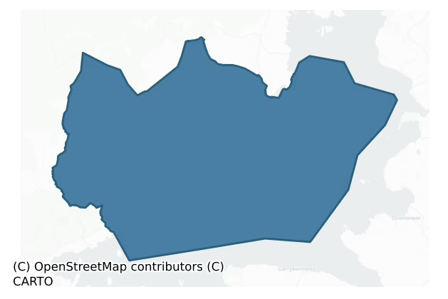
Leitrim is a barony of County Clare, in the historical province of Munster (Irish: Liatroim), covering 94 km² of land. The barony records 246 NMS archaeological sites and 9 NIAH listed buildings, placing it at around the 74th percentile among 280 ROI baronies for sites per km². This means it is in the top third of all baronies for sites per km². Dated archaeological evidence runs from the Neolithic through to the Modern, spanning 8 of 9 archaeological periods, placing the barony in the 69th percentile among 280 ROI baronies for chronological depth. This means it is in the top third of all baronies for chronological depth. The largest dated subset of recorded sites dates to the Early Medieval.
Heritage at a glance
Percentile rankings throughout this profile compare each barony only against the other 279 Republic of Ireland baronies.
The recorded heritage of Leitrim
The National Monuments Service Sites and Monuments Record (SMR) is the statutory inventory of archaeological sites for the Republic of Ireland, maintained by the Department of Tourism, Culture, Arts, Gaeltacht, Sport and Media. Sites recorded here include earthworks, ringforts, megalithic tombs, ecclesiastical remains, and post-medieval features; not every record is legally protected, but each is registered as a monument of archaeological interest.
The National Monuments Service records 246 archaeological sites in Leitrim, putting it at the 74th percentile among 280 ROI baronies for sites per km². This means it is in the top third of all baronies for sites per km². Protection coverage is near-universal — 240 sites (98%) fall within a recorded monument protection zone, indicating an extensively surveyed landscape. The dominant category is ecclesiastical sites — churches, graveyards, and holy wells (158 sites, 64% of the record). Cross-slab is the most prevalent type, making up 29% of the barony's recorded sites (72 records) — well above the ROI average of 5% across all baronies where this type occurs. Cross-slab is a stone slab inscribed with a cross, used as a grave-marker or memorial, dated pre-1200 AD. Other significant types include Graveslab (51) and Bullaun stone (9). Graveslab is a recumbent grave-marking slab, dated 1200–1700 AD; Bullaun stone is a boulder or rock outcrop with hemispherical hollows ('bulláin'), commonly associated with ecclesiastical sites and holy wells. Across the barony's 94 km², this gives a recorded density of 2.61 sites per km².
Most common monument types
Hover or tap a monument type to see its definition.
| Type | Count |
|---|---|
| Cross-slab a stone slab inscribed with a cross, used as a grave-marker or memorial, dated pre-1200 AD | 72 |
| Graveslab a recumbent grave-marking slab, dated 1200–1700 AD | 51 |
| Bullaun stone a boulder or rock outcrop with hemispherical hollows ('bulláin'), commonly associated with ecclesiastical sites and holy wells | 9 |
| Church a building used for public Christian worship, of any date from c. 500 AD onwards | 8 |
| Graveyard a burial area associated with a church, in use from the medieval period onwards | 8 |
| Enclosure a banked or ditched feature of uncertain type, used as a catch-all where the original function cannot be determined from surface evidence | 8 |
Chronological distribution
The dated archaeological record for Leitrim spans from the Neolithic through to the Modern, with activity attested across 8 of 9 archaeological periods. Every period from earliest to latest is represented in the record — an unbroken sequence of dated activity across the full chronological span. Activity concentrates most heavily in the Early Medieval (208 sites, 60% of dated material), with the Iron Age forming a secondary peak (80 sites, 23%). A further 249 recorded sites (42% of the overall NMS register for the barony) carry no period attribution — appearing as 'Unknown' in the bar chart below. This typically reflects either records that pre-date the standardised period vocabulary or sites awaiting specialist dating review, rather than a genuine absence of chronological evidence.
Sample of recorded monuments
Show 25 sample monuments (of 246 total)
A representative sample of 25 recorded monuments drawn from the barony’s 246 total NMS entries. Sites within a recorded monument protection zone and rarer site types are prioritised so the list shows a meaningful cross-section rather than only the most common type. Each entry shows the official Sites and Monuments Record reference number and the description published by the National Monuments Service.
Megalithic tomb – wedge tomb
See linked document with details from Ruaidhrí de Valera and Seán Ó Nualláin, Survey of the Megalithic Tombs of Ireland. Volume I. County Clare. (Dublin: Stationery Office, 1961)
Date of upload: 28 December 2011
Ringfort – cashel
The Archaeological Survey of Ireland (ASI) is in the process of providing information on all monuments on The Historic Environment Viewer (HEV). Currently the information for this record has not been uploaded. To…
The Archaeological Survey of Ireland (ASI) is in the process of providing information on all monuments on The Historic Environment Viewer (HEV). Currently the information for this record has not been uploaded. To access available information for research purposes please make an appointment in advance with the Archive Unit (open Fridays 10.00 am – 5.00 pm), Department of Culture, Heritage and the Gaeltacht, The Custom House, Dublin 1 D01W6XO or email nmarchive@chg.gov.ie.
Megalithic tomb – unclassified
The Archaeological Survey of Ireland (ASI) is in the process of providing information on all monuments on The Historic Environment Viewer (HEV). Currently the information for this record has not been uploaded. To…
The Archaeological Survey of Ireland (ASI) is in the process of providing information on all monuments on The Historic Environment Viewer (HEV). Currently the information for this record has not been uploaded. To access available information for research purposes please make an appointment in advance with the Archive Unit (open Fridays 10.00 am – 5.00 pm), Department of Culture, Heritage and the Gaeltacht, The Custom House, Dublin 1 D01W6XO or email nmarchive@chg.gov.ie.
Earthwork
The Archaeological Survey of Ireland (ASI) is in the process of providing information on all monuments on The Historic Environment Viewer (HEV). Currently the information for this record has not been uploaded. To…
The Archaeological Survey of Ireland (ASI) is in the process of providing information on all monuments on The Historic Environment Viewer (HEV). Currently the information for this record has not been uploaded. To access available information for research purposes please make an appointment in advance with the Archive Unit (open Fridays 10.00 am – 5.00 pm), Department of Culture, Heritage and the Gaeltacht, The Custom House, Dublin 1 D01W6XO or email nmarchive@chg.gov.ie.
Religious house – unclassified
The Archaeological Survey of Ireland (ASI) is in the process of providing information on all monuments on The Historic Environment Viewer (HEV). Currently the information for this record has not been uploaded. To…
The Archaeological Survey of Ireland (ASI) is in the process of providing information on all monuments on The Historic Environment Viewer (HEV). Currently the information for this record has not been uploaded. To access available information for research purposes please make an appointment in advance with the Archive Unit (open Fridays 10.00 am – 5.00 pm), Department of Culture, Heritage and the Gaeltacht, The Custom House, Dublin 1 D01W6XO or email nmarchive@chg.gov.ie.
Field system
This record was listed as 'Earthwork complex' in the RMP (1996). There are several subdivisions of the land around the monastic remains on the island of Inis Cealtra (Holy Island). Between St.Caimin’s church…
This record was listed as 'Earthwork complex' in the RMP (1996). There are several subdivisions of the land around the monastic remains on the island of Inis Cealtra (Holy Island). Between St.Caimin’s church (CL029-009011-) on the E side of the island and the D-shaped enclosure (CL029-009131-) centrally placed, there are a number of subrectangular areas defined by double banks or roadways. According to de Paor (2013, 45) rough drystone walls were erected to form small enclosures and these were linked by equally rough paved ways in a network which covered the monastic quadrant. These were essentially a layout for the performance of pilgrimage ‘rounds’ (although they also probably served for the formation of small tillage plots and paddocks). Pathways linking different sites for pilgrims began as early as the late 13th century but the main development was later continuing until the late 17th or possibly the 18th century. In the later phases a broad paved road (max. Wth 9m; int. H 0.2m; ext. H 1.5m) connected St. Caimin’s Church (CL029-009011-) with St. Mary’s (CL029-009008-). Another pathway (max. Wth 6.3m; H 0.15-0.8m) connects the northern tip of the island near one of the landing points with the main ecclesiastical complex. Excavation revealed that a bank-and-ditch system extending S to St. Brigid’s church (CL029-009006-) from the central D-shaped enclosure (CL029-009131-) and the peripheral bank running into the S boundary of St Brigid’s enclosure (max. Wth 2.7m; H 0.1-0…
Round tower
Situated on a low hill 12m SW of St. Caimin’s church (CL029-009011-) on Inis Cealtra. A well-built round tower with a flat top. The stonework is well coursed with exceptionally large stones in the base. The wall is…
Situated on a low hill 12m SW of St. Caimin’s church (CL029-009011-) on Inis Cealtra. A well-built round tower with a flat top. The stonework is well coursed with exceptionally large stones in the base. The wall is offset 0.1m at the base 0.3m above ground. Excavations in 1976 revealed this course to be 0.4m deep with a thin layer of small stones and natural rock below that (Barrow 1985, 61). The diameter at base is 4.58m and at the doorway at ENE it is 4.5m. The interior is dug out to 0.6m above the external offset. Large stones project from the wall corresponding to the large stones in the external wall. There is a rough offset for a floor 2m above the ground. The second floor is formed by a number of large corbels and flagstones projecting from the wall and higher up there are three more offsets. The door at ENE is round-headed (Wth 0.64m at base; H 1.6m to soffit; T 1.05m). The top of the door is cut out of three stones carried right through the wall and the sill, likewise, is a single slab. A large, finely dressed, angle-headed window faces N above the second floor level and three more square-headed windows face ENE, SSW and NW in ascending order. The excavation revealed careful preparation in advance of construction. A large oval disc of puddled clay studded with small boulders and stones was laid down, ringed by small drain-trenches. A short sequence of post-holes concentric with the tower at NW were interpreted as marking the end of a stairway which rose to the sil…
Cross – High cross
A wheeled high cross, the upper portion of which is mounted on the S wall of the nave of St. Caimin’s church (CL029-009011-) on Inis Cealtra, 7.82m from the E end. The shaft is mounted on a cross-base 5m W of the round…
A wheeled high cross, the upper portion of which is mounted on the S wall of the nave of St. Caimin’s church (CL029-009011-) on Inis Cealtra, 7.82m from the E end. The shaft is mounted on a cross-base 5m W of the round tower (CL029-009010-). Described by Macalister (1916-17, 150) as ‘a large elaborate cross (H 6ft 3in [1.9m], arms 2ft 7.5in [0.8m] across, T 6in [0.15m]) broken into many pieces, restored with cement and fastened to the wall of the church… The cross has five bosses, one in each arm and one in the middle and these were decorated with basketwork… The background, confined within the heavy frame that surrounds the edge of the face, is covered with a minute interlacing pattern. On the dexter side … the arm end bears a representation of Adam and Eve. On the sinister side is a key pattern; there was a figured panel on the arm-end on this side also, but it is broken, and only about half remains. The surviving part seems to bear a figure walking, holding a long staff, but the intention of the sculptor can no longer be recovered’. The shaft, which at that stage was with the top in the church, bore a plait. The base (H 1m) is oval in plan (1m x 0.5m) with its sides curved in outline and tapering to 0.55m at the top. Macalister (ibid., 147) described the socket as 1ft 2in by 9in (0.35m x 0.22m) with a depth of 9in (0.22m) and estimated that no cross on the island would fit it. The shaft of the cross was mounted on the base by the OPW at a later date. De Paor (2013, 44)…
Slipway
Indicated and named ‘Landing stage’ on the 1920 OS 6-inch map and listed in the RMP (1996) as 'Potential site – name'. Described by Macalister (1916-17, 139) as a boat-pier of large undressed blocks of stone,…
Indicated and named ‘Landing stage’ on the 1920 OS 6-inch map and listed in the RMP (1996) as 'Potential site – name'. Described by Macalister (1916-17, 139) as a boat-pier of large undressed blocks of stone, rectangular in plan (L 49ft (14.9m); H towards the lake edge 3ft3in (0.99m)). A possible penitential station (CL029-009018-) was apparently on the inner end of this landing stage. This area as indicated on the OS map is completely overgrown and inaccessible.
Compiled by: Mary Tunney
Date of upload: 22 June 2016
Monumental structure
The Archaeological Survey of Ireland (ASI) is in the process of providing information on all monuments on The Historic Environment Viewer (HEV). Currently the information for this record has not been uploaded. To…
The Archaeological Survey of Ireland (ASI) is in the process of providing information on all monuments on The Historic Environment Viewer (HEV). Currently the information for this record has not been uploaded. To access available information for research purposes please make an appointment in advance with the Archive Unit (open Fridays 10.00 am – 5.00 pm), Department of Culture, Heritage and the Gaeltacht, The Custom House, Dublin 1 D01W6XO or email nmarchive@chg.gov.ie.
Gateway
The Archaeological Survey of Ireland (ASI) is in the process of providing information on all monuments on The Historic Environment Viewer (HEV). Currently the information for this record has not been uploaded. To…
The Archaeological Survey of Ireland (ASI) is in the process of providing information on all monuments on The Historic Environment Viewer (HEV). Currently the information for this record has not been uploaded. To access available information for research purposes please make an appointment in advance with the Archive Unit (open Fridays 10.00 am – 5.00 pm), Department of Culture, Heritage and the Gaeltacht, The Custom House, Dublin 1 D01W6XO or email nmarchive@chg.gov.ie.
Architectural fragment
The Archaeological Survey of Ireland (ASI) is in the process of providing information on all monuments on The Historic Environment Viewer (HEV). Currently the information for this record has not been uploaded. To…
The Archaeological Survey of Ireland (ASI) is in the process of providing information on all monuments on The Historic Environment Viewer (HEV). Currently the information for this record has not been uploaded. To access available information for research purposes please make an appointment in advance with the Archive Unit (open Fridays 10.00 am – 5.00 pm), Department of Culture, Heritage and the Gaeltacht, The Custom House, Dublin 1 D01W6XO or email nmarchive@chg.gov.ie.
Mass-rock
The Archaeological Survey of Ireland (ASI) is in the process of providing information on all monuments on The Historic Environment Viewer (HEV). Currently the information for this record has not been uploaded. To…
The Archaeological Survey of Ireland (ASI) is in the process of providing information on all monuments on The Historic Environment Viewer (HEV). Currently the information for this record has not been uploaded. To access available information for research purposes please make an appointment in advance with the Archive Unit (open Fridays 10.00 am – 5.00 pm), Department of Culture, Heritage and the Gaeltacht, The Custom House, Dublin 1 D01W6XO or email nmarchive@chg.gov.ie.
Ritual site – holy/saint's stone
The Archaeological Survey of Ireland (ASI) is in the process of providing information on all monuments on The Historic Environment Viewer (HEV). Currently the information for this record has not been uploaded. To…
The Archaeological Survey of Ireland (ASI) is in the process of providing information on all monuments on The Historic Environment Viewer (HEV). Currently the information for this record has not been uploaded. To access available information for research purposes please make an appointment in advance with the Archive Unit (open Fridays 10.00 am – 5.00 pm), Department of Culture, Heritage and the Gaeltacht, The Custom House, Dublin 1 D01W6XO or email nmarchive@chg.gov.ie.
House – 18th/19th century
Near the E shore of Inis Cealtra in Lough Derg c. 40m NE of the ‘Saint’s Graveyard’ (CL029-009030-). The foundations of a small two-roomed building excavated by de Paor in 1970 (Licence no. E000180, report 2, Area 2,…
Near the E shore of Inis Cealtra in Lough Derg c. 40m NE of the ‘Saint’s Graveyard’ (CL029-009030-). The foundations of a small two-roomed building excavated by de Paor in 1970 (Licence no. E000180, report 2, Area 2, 49-51). Described by Macalister (1916-17, 140) as a structure (34ft (10.3m) by 18ft (5.4m)) of drystone masonry, very roughly built (wall T 2ft 6in (0.76m); H 3ft (0.91m)) with a central chimney and back-to-back fireplaces. In spite of being cleared out by the Board of Works in 1879-80 it was clear that the floor had sloped steeply. The interior of the cottage and a small area around it was excavated. Finds were few and seemed to relate to the occupation of the building. Two fragments of querns were found inside, one to the W of the fireplace and one near the SE corner. A whetstone was found E of the chimney. Once the building had fallen into ruin it was used as a rubbish dump. This was referred to as a church at one time but that may have been in an effort to increase the number of churches on the island to seven (Macalister 1916-17, 140-41). Macalister also suggests that this is the ‘one house’ mentioned in an early 17th-century report by a Bishop Rider but on the basis of the few finds from excavation de Paor estimates a mid-18th century date. On inspection in 2016 this area was found to be completely overgrown and inaccessible. (de Paor 2013, 28, 30-31)
Compiled by: Mary Tunney
Date of upload: 27 June 2016
Sundial
Not listed in the SMR (1992) or the 1996 RMP. This record is for the original location of a sundial that according to Macalister (1916-17, 167, no. 92, and plate XXIV) was on the S wall of the nave of St. Caimin’s…
Not listed in the SMR (1992) or the 1996 RMP. This record is for the original location of a sundial that according to Macalister (1916-17, 167, no. 92, and plate XXIV) was on the S wall of the nave of St. Caimin’s church (CL029-009011-) on Inis Cealtra (Holy Island), Co. Clare. It is now in the OPW depot in Athenry, Co. Galway where it has SMR number (GA084-151008-) (L 1.46m; Wth at top 0.4m; Wth at base 0.36m; T 0.1m). Macalister (ibid.) described the sundial as a slab with a hole for the gnomon, pierced through the stone, and a semicircle with five rays below it.’
Compiled by: Mary Tunney
Date of upload: 22 July 2015
Leacht
Situated within the graveyard (CL029-009030-) E of St. Caimin’s church on Inis Cealtra. According to the Ordnance Survey Letters (O’Flanagan 1927, vol. 2, 226) a grave, lying a few yards from the SE corner of St…
Situated within the graveyard (CL029-009030-) E of St. Caimin’s church on Inis Cealtra. According to the Ordnance Survey Letters (O’Flanagan 1927, vol. 2, 226) a grave, lying a few yards from the SE corner of St Caimin’s church (CL029-009011-) marked the burials of ‘the twelve saints’ who founded the churches on the island. He noted an uninscribed upright stone marking the location of a horizontal one that covered the grave. Many recumbent graveslabs are still in situ in the graveyard but it is not known which of them marked this ‘Saint’s grave’. A sketch in Petrie and Stokes 1878 (vol. 2, 41) shows four upright stones towards the SE corner of the saint’s graveyard which were not to be seen in Macalister’s time but which may have been associated. (Macalister 1916, 163, no. 85)
Compiled by: Mary Tunney
Date of upload: 3 November 2015
Tomb – chest tomb
Mounted against the S wall of the nave of St. Caimin’s church (CL029-009011-) on Inis Cealtra and 4.55m from the E end. A possible chest-tomb slab (Wth 1.29m; H 0.78m; T 0.1m) dated by Macalister (1916-17, 167, no. 90)…
Mounted against the S wall of the nave of St. Caimin’s church (CL029-009011-) on Inis Cealtra and 4.55m from the E end. A possible chest-tomb slab (Wth 1.29m; H 0.78m; T 0.1m) dated by Macalister (1916-17, 167, no. 90) to between 1680 and 1750. It bears the letters 'IHS' surmounted by a cross within a rectangular panel with the two upper corners cut off obliquely. This slab may have been associated with the wall monument (CL029-009124-) higher up on the S wall.
Compiled by: Mary Tunney
Date of upload: 3 November 2015
Headstone
Situated in the SW corner of the ‘Saint’s Graveyard’ (CL029-009030-) on Inis Cealtra and named ‘Mod. Stone’ on Macalister’s plan (1916-17, pl. XV). A low, thin, roughly rectangular, earthfast limestone gravemarker (H…
Situated in the SW corner of the ‘Saint’s Graveyard’ (CL029-009030-) on Inis Cealtra and named ‘Mod. Stone’ on Macalister’s plan (1916-17, pl. XV). A low, thin, roughly rectangular, earthfast limestone gravemarker (H 0.49m; L 0.53m; T 0.06m). There is no visible decoration or inscription and the date of this gravemarker is uncertain.
Compiled by: Mary Tunney
Date of upload: 3 November 2015
Furnace
Situated to the W of the doorway of St. Brigid’s church (CL029-009006-) and within the surrounding enclosure/graveyard (CL029-099007-). Excavation by de Paor in 1970-72 (E000180) revealed a copper worker’s furnace in…
Situated to the W of the doorway of St. Brigid’s church (CL029-009006-) and within the surrounding enclosure/graveyard (CL029-099007-). Excavation by de Paor in 1970-72 (E000180) revealed a copper worker’s furnace in the form of a pit in which an ovoid structure of clay had been constructed. This structure bore small splashes of copper and traces of intense heat. (de Paor 1997, 55-6; 2013, 33)
Compiled by: Mary Tunney
Date of upload: 3 November 2015
Pillar stone
Lying loose against the W wall of St. Caimin’s graveyard (CL029-009012-) on Inis Cealtra. A tall, slightly tapering stone with a sloping top (L 1.12m; Wth at base 0.12m; Wth in middle 0.2m; Wth at top 0.16m; T 0.14 at…
Lying loose against the W wall of St. Caimin’s graveyard (CL029-009012-) on Inis Cealtra. A tall, slightly tapering stone with a sloping top (L 1.12m; Wth at base 0.12m; Wth in middle 0.2m; Wth at top 0.16m; T 0.14 at base and 0.12m at the top). The lowest 0.2m is rough and may have been under ground. One face is worked smooth and flat with 5 small depressions (diam. 0.02m (smallest) to 0.04m (largest)), some circular and some oval, arranged in serpentine fashion 0.34-0.5m up from the base. No other markings are evident. The precise original location of this stone is unknown.
Compiled by: Mary Tunney
Date of upload: 17 November 2015
Excavation – miscellaneous
Situated N of the round tower (CL029-009010-) on Inis Cealtra. Excavations took place in this area (licence no. E000180) in the 1970s (de Paor 2013). Post excavation work in 2015 resulted in a radiocarbon date of Cal AD…
Situated N of the round tower (CL029-009010-) on Inis Cealtra. Excavations took place in this area (licence no. E000180) in the 1970s (de Paor 2013). Post excavation work in 2015 resulted in a radiocarbon date of Cal AD 551-639 (UBA-30514) from a ‘trench’ or ditch showing the presence of features dating from the reputed foundation of the ecclesiastical site. (de Paor 2013, 58; Seaver and O’Sullivan 2015, 11-13)
Compiled by: Mary Tunney
Date of upload: 19 July 2016
Cairn – unclassified
The Archaeological Survey of Ireland (ASI) is in the process of providing information on all monuments on The Historic Environment Viewer (HEV). Currently the information for this record has not been uploaded. To…
The Archaeological Survey of Ireland (ASI) is in the process of providing information on all monuments on The Historic Environment Viewer (HEV). Currently the information for this record has not been uploaded. To access available information for research purposes please make an appointment in advance with the Archive Unit (open Fridays 10.00 am – 5.00 pm), Department of Culture, Heritage and the Gaeltacht, The Custom House, Dublin 1 D01W6XO or email nmarchive@chg.gov.ie.
Cist
The Archaeological Survey of Ireland (ASI) is in the process of providing information on all monuments on The Historic Environment Viewer (HEV). Currently the information for this record has not been uploaded. To…
The Archaeological Survey of Ireland (ASI) is in the process of providing information on all monuments on The Historic Environment Viewer (HEV). Currently the information for this record has not been uploaded. To access available information for research purposes please make an appointment in advance with the Archive Unit (open Fridays 10.00 am – 5.00 pm), Department of Culture, Heritage and the Gaeltacht, The Custom House, Dublin 1 D01W6XO or email nmarchive@chg.gov.ie.
Cross-slab
Not listed in the SMR (1992) or the 1996 RMP. This record is for the original location of a cross-slab that according to Macalister (1916-17, 151, no. 21, and plate XVI) was on the N wall of the chancel of St. Caimin's…
Not listed in the SMR (1992) or the 1996 RMP. This record is for the original location of a cross-slab that according to Macalister (1916-17, 151, no. 21, and plate XVI) was on the N wall of the chancel of St. Caimin's church (CL029-009011-), on Inis Cealtra (Holy Island), Co. Clare. It was noted by de Paor in the 1970s (SMR file) on the S wall of the nave of the church. It is now in the OPW depot in Athenry, Co. Galway where it has SMR number (GA084-151006-). Macalister (ibid.) described the slab as of 'Eighth-century type'… ‘A stone, measuring 1 foot 7 inches by 1 foot 1 inch by 3 inches [0.48m by 0.33m by 0.07m]. Within a circle of two lines, a cross formed of four arcs of circles, interlacing at the intersection; the ends of the arcs are terminated with a spiral treatment. In the cantons are triskeles of one line.’
Compiled by: Mary Tunney
Date of upload: 22 July 2015
Listed buildings
The National Inventory of Architectural Heritage (NIAH) is a state survey appraising buildings of architectural, historical, archaeological, artistic, cultural, scientific, social, or technical interest. Each surveyed structure receives a rating from International (the highest, for buildings of European importance) through National, Regional, Local, and Record-Only.
The NIAH records only 9 listed buildings in Leitrim, the 1st percentile across ROI baronies — a relatively thin architectural record. All recorded buildings carry Regional or lower grading; the barony does not contain any structures appraised as being of National or International architectural importance.
Terrain and environment
Mean elevation across the barony is 95m — the 57th percentile among 280 ROI baronies for elevation. This means it is in the upper half of all baronies for elevation. Elevation matters for heritage because higher-altitude baronies typically favour defensive monuments — ringforts and hilltop forts placed on prominent ground — while lowland baronies are more likely to carry the dense settlement and church networks of intensive agricultural landscapes. The barony reaches 324m at its highest point — a vertical span of more than 229m within its boundary, indicating significant topographic diversity. Mean slope is 3.2° — the 42nd percentile among 280 ROI baronies for slope. This means it is in the lower half of all baronies for slope. Slope is a key control on both land use and archaeological preservation: steep ground resists ploughing and tends to preserve earthworks intact, while gentle slopes favour intensive cultivation that damages or destroys surface archaeology over time. The Topographic Wetness Index averages 11.0, the 59th percentile among 280 ROI baronies for wetness. This means it is in the upper half of all baronies for wetness. Drainage matters for heritage because poorly-drained ground preserves organic archaeology (wooden trackways, leather, textiles, and on rare occasions human remains) far better than free-draining soil; well-drained ground favours arable use but destroys organic material rapidly. The land cover is dominated by improved grassland (65%) and woodland (30%).
Terrain measurements
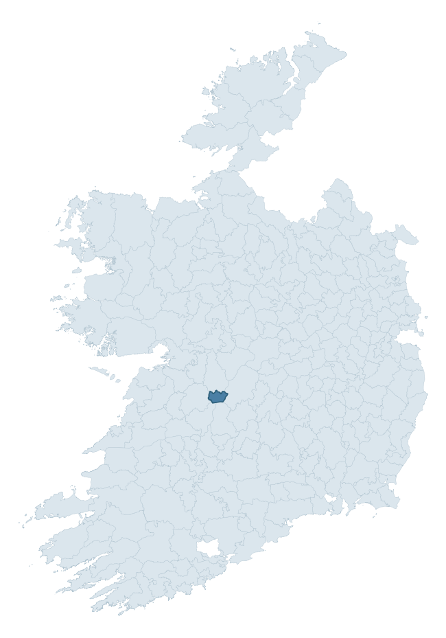
Where this barony sits in the Republic of Ireland
Geology and preservation
Bedrock geology shapes the landscape long before any settlement begins — controlling soil drainage, agricultural potential, the survival of upstanding monuments, and the preservation of buried archaeology. The figures below come from the Geological Survey Ireland 1:100,000 bedrock map.
The bedrock underlying Leitrim is predominantly limestone (52% of the barony by area), laid down during the Carboniferous period (56% by area, around 359 to 299 million years ago). Limestone is the most heritage-rich bedrock in Ireland. It supports fertile, well-drained soils that favoured dense Early Medieval settlement and Norman manorial agriculture, and it weathers into karst features — sinkholes, caves, swallow holes, and souterrains — that frequently carry archaeology. Where peat overlies limestone, organic preservation can be exceptional. A substantial secondary geology of mudstone, siltstone, conglomerate (33%) and greywacke, siltstone and shale (10%) adds further variety to the underlying landscape. The single largest mapped unit is the Ballysteen Formation (52% of the barony's bedrock).
Rock type composition
Largest mapped unit: Ballysteen Formation (52% of the barony)
Placename evidence
Logainm records 6 heritage-diagnostic placenames for Leitrim, a modest sample drawn predominantly from the townland record. The dominant stratum is early christian ecclesiastical. The most frequent diagnostic roots are cill- (4) and ráth- (2). With a sample of this size the count should be treated as indicative rather than definitive.
Pre-Christian / Early Medieval Defensive
| Root | Count | Meaning |
|---|---|---|
| ráth- | 2 | earthen ringfort |
Early Christian Ecclesiastical
| Root | Count | Meaning |
|---|---|---|
| cill- | 4 | church (early) |
Other baronies in Clare
- Corcomroe
- Bunratty Lower
- Ibrickan
- Bunratty Upper
- Clonderalaw
- Burren
- Tulla Lower
- Middlethird — Waterford
- Tulla Upper
- Bantry — Cork
See all 280 baronies in the Republic of Ireland Heritage Tool.

Explore further
Grounding History: 10 Maps of Northern Ireland’s Past
If you’re interested in Irish heritage more widely, the companion report for Northern Ireland brings together the analysis of all 462 NI wards into one place through 10 high-quality maps — covering monument density, archaeological periods, placename heritage, terrain, wetland, and the historic landscape at first survey. Take a look.
About this profile
Click any section below to expand.
What is a barony?
A barony is a historic administrative unit in Ireland, broadly equivalent to an English hundred. The 280 baronies used here are from the OSi 2019 National Statutory Boundaries (generalised 20m), covering the 26 counties of the Republic of Ireland. Baronies derive from the Norman period, were formalised in the 17th century, and have not been redrawn for statistical purposes. They vary enormously in area, from compact urban baronies in Dublin to vast upland baronies in Connacht, and should not be compared by raw site count without accounting for area differences.
What counts as a site?
This profile combines three distinct heritage registers, each with its own definition of what constitutes a recordable site:
- Archaeological sites (NMS). The National Monuments Service Sites and Monuments Record (SMR) catalogues every known archaeological monument or site of archaeological interest in the Republic, from prehistoric burial mounds and ringforts to medieval churches and post-medieval defensive works. Inclusion does not require legal protection — only that the site has been identified, surveyed, and assessed as having archaeological value. A separate subset of these sites lies within a recorded protection zone, which gives them statutory protection under the National Monuments Acts.
- Listed buildings (NIAH). The National Inventory of Architectural Heritage records buildings of architectural, historical, archaeological, artistic, cultural, scientific, social, or technical interest. Each surveyed structure is appraised on a five-tier scale: International, National, Regional, Local, and Record-Only. The NIAH appraisal is informational rather than strictly statutory, but it underpins local-authority Record of Protected Structures (RPS) listings.
- Heritage placenames (Logainm). Logainm is the authoritative database of Irish placenames maintained by the Placenames Branch. This profile applies a heritage-diagnostic classifier to the Irish-language form of each townland name, flagging roots that signal defensive sites (ráth-, lios-, dún-, caiseal-, cathair-), ecclesiastical foundations (cill-, teampall-, domhnach-, mainistir-), prehistoric burial-ritual features (tuaim-, carn-, leaba-), or Norse-contact settlement (gall-). Townlands without one of these diagnostic roots are not flagged here — they may still carry historical significance, but that significance is not encoded in the name itself.
Editorial principles
The narrative sections of this profile follow several explicit principles:
- Evidential. Every claim about this barony’s heritage character is anchored in the underlying register data. Where a site count, a placename count, or a percentile rank is cited, it is computed from the source datasets at export time, not estimated.
- Comparative. Counts and metrics are reported alongside their percentile rank against the other 279 ROI baronies. A barony with 50 ringforts in absolute terms could be unusually high or unusually low depending on its size and regional context; percentile ranking removes that ambiguity.
- Transparent on limits. Where a register has known coverage gaps, survey biases, or data-quality issues that affect this barony’s figures, the profile flags them rather than presenting the numbers as definitive.
- No interpretation beyond what the data supports. The narrative does not speculate about historical events, social dynamics, or cultural meaning beyond what the recorded heritage and placename evidence directly attests.
Data caveats and limits
- NMS Sites and Monuments Record is the product of survey campaigns conducted at different intensities across different counties and decades. Some baronies have been surveyed more thoroughly than others, and absolute counts should be read in that light. Sites destroyed by development before survey are typically not represented; sites in heavily forested or upland terrain are sometimes under-recorded.
- NIAH coverage is broadly complete for the Republic of Ireland but the survey was conducted on a rolling county-by-county basis, and the most recent appraisal date varies. Buildings demolished or substantially altered after their original survey may still appear in the register; conversely, recent buildings of merit may not yet have been appraised.
- Logainm classification applies a deliberately conservative pattern-matching approach to the Irish-language townland forms. The classifier prioritises true positives over recall: a townland may carry a heritage signal that the classifier doesn’t recognise, particularly where the diagnostic root has been heavily anglicised or where the townland name draws on a less common term. The 60,000+ townland records and ~9,800 classified placenames give a substantial signal at barony scale, but individual townland names should be checked against Logainm directly for definitive interpretation.
- Period attribution. The chronological distribution reflects only those NMS sites that carry a recognised period attribution in the source data. Sites listed as “Unknown” period are excluded from the dated subset.
- Boundary changes. Some baronies have undergone minor boundary adjustments since their 19th-century definition; the OSi 2019 generalised boundaries used here are the current statutory definition and may differ slightly from historical maps in border areas.
- Bedrock geology is mapped at 1:100,000 scale, which means local variation within a barony — small pockets of different rock type, mineral veins, alluvium overlying bedrock — is generalised. The dominant-system and rocktype figures are area-weighted, so a barony reading “70% Carboniferous limestone” may still contain small but archaeologically important pockets of older or younger rock. Around 3% of GSI polygons do not match the lexicon and contribute no rocktype or system attribution.
Data sources
- National Monuments Service — Sites and Monuments Record (SMR) https://data.gov.ie/dataset/national-monuments-service-archaeological-survey-of-ireland
- National Inventory of Architectural Heritage (NIAH) https://data.gov.ie/dataset/national-inventory-of-architectural-heritage-niah-national-dataset
- Logainm — Placenames Database of Ireland https://www.logainm.ie/
- Ordnance Survey Ireland — National Statutory Barony Boundaries 2019 https://data-osi.opendata.arcgis.com/
- EURODEM — European Digital Elevation Model https://www.mapsforeurope.org/datasets/euro-dem
- ESA WorldCover https://esa-worldcover.org/en
- Geological Survey Ireland — 1:100,000 Bedrock Geology https://www.gsi.ie/en-ie/data-and-maps/Pages/Bedrock.aspx
Explore more: Search any of the 280 ROI baronies, browse by historical province, or read the methodology and data sources for the full Republic of Ireland Heritage Tool.