
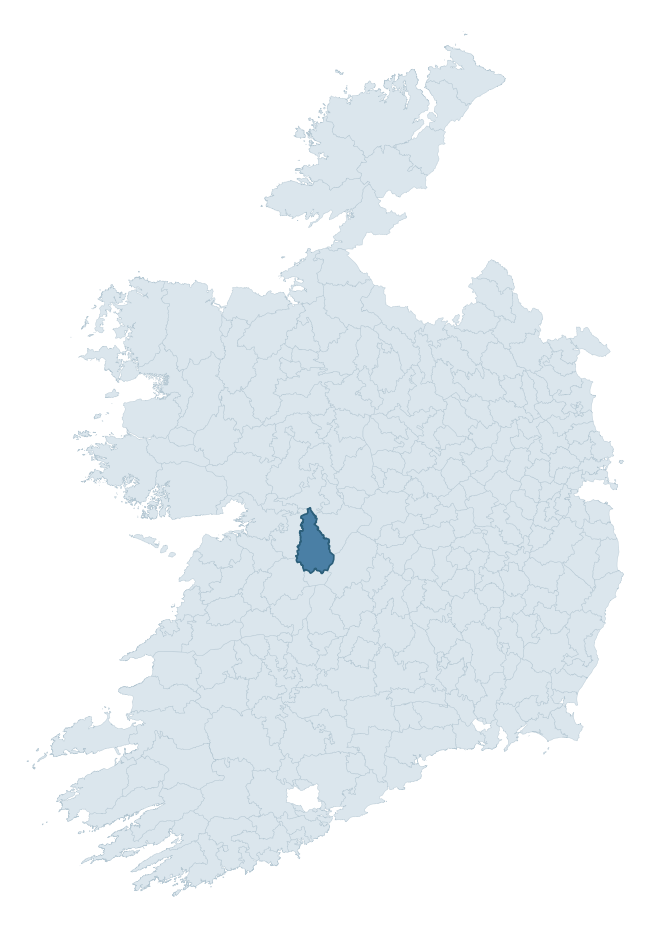
Leitrim is a barony of County Galway, in the historical province of Connacht (Irish: Liatroim), covering 392 km² of land. The barony records 597 NMS archaeological sites and 73 NIAH listed buildings, placing it at around the 34th percentile among 280 ROI baronies for sites per km². This means it is in the lower half of all baronies for sites per km². Dated archaeological evidence runs from the Neolithic through to the Modern, spanning 8 of 9 archaeological periods, placing the barony in the 73rd percentile among 280 ROI baronies for chronological depth. This means it is in the top third of all baronies for chronological depth. The largest dated subset of recorded sites dates to the Early Medieval. Logainm flags 43 placenames in the barony as carrying a recognised heritage root; the largest share — around 47% — are names associated with pre-christian defensive.

Heritage at a glance
Percentile rankings throughout this profile compare each barony only against the other 279 Republic of Ireland baronies.
The recorded heritage of Leitrim
The National Monuments Service Sites and Monuments Record (SMR) is the statutory inventory of archaeological sites for the Republic of Ireland, maintained by the Department of Tourism, Culture, Arts, Gaeltacht, Sport and Media. Sites recorded here include earthworks, ringforts, megalithic tombs, ecclesiastical remains, and post-medieval features; not every record is legally protected, but each is registered as a monument of archaeological interest.
The National Monuments Service records 597 archaeological sites in Leitrim, putting it at the 34th percentile among 280 ROI baronies for sites per km². This means it is in the lower half of all baronies for sites per km². Of these, 422 (71%) fall within a recorded monument protection zone. The record is dominated by defensive sites — ringforts, enclosures, hillforts, and stone forts (237 sites, 40% of the total), with industrial sites forming a substantial secondary presence (105 sites, 18%). Ringfort – rath is the most prevalent type, making up 22% of the barony's recorded sites (131 records), broadly in line with the ROI average of 20% across all baronies where this type occurs. Ringfort – rath is an earthen ringfort enclosed by a bank and external ditch — the most common Early Medieval farmstead, broadly dated 500–1000 AD. Other significant types include Quarry (104) and Souterrain (42). Quarry is a place where stone, sand, gravel or clay was extracted; Souterrain is an underground stone-built passage and chamber, generally Early Medieval and often associated with ringforts as a defensive or storage feature. Across the barony's 392 km², this gives a recorded density of 1.52 sites per km².
Most common monument types
Hover or tap a monument type to see its definition.
| Type | Count |
|---|---|
| Ringfort – rath an earthen ringfort enclosed by a bank and external ditch — the most common Early Medieval farmstead, broadly dated 500–1000 AD | 131 |
| Quarry a place where stone, sand, gravel or clay was extracted | 104 |
| Souterrain an underground stone-built passage and chamber, generally Early Medieval and often associated with ringforts as a defensive or storage feature | 42 |
| Enclosure a banked or ditched feature of uncertain type, used as a catch-all where the original function cannot be determined from surface evidence | 29 |
| Children's burial ground an unconsecrated medieval and early-modern burial ground for unbaptised or stillborn children, often called a cillín or ceallúnach | 23 |
| Church a building used for public Christian worship, of any date from c. 500 AD onwards | 22 |
| Ritual site – holy well a well or spring traditionally associated with a saint, often credited with healing properties; many trace earlier ritual origins but devotion is documented from the medieval period onwards | 21 |
Chronological distribution
The dated archaeological record for Leitrim spans from the Neolithic through to the Modern, with activity attested across 8 of 9 archaeological periods. This is the 73rd percentile across ROI baronies for chronological depth — an above-average span. Every period from earliest to latest is represented in the record — an unbroken sequence of dated activity across the full chronological span. Activity concentrates most heavily in the Early Medieval (208 sites, 60% of dated material), with the Iron Age forming a secondary peak (80 sites, 23%). A further 249 recorded sites (42% of the overall NMS register for the barony) carry no period attribution — appearing as 'Unknown' in the bar chart below. This typically reflects either records that pre-date the standardised period vocabulary or sites awaiting specialist dating review, rather than a genuine absence of chronological evidence.
Sample of recorded monuments
Show 25 sample monuments (of 597 total)
A representative sample of 25 recorded monuments drawn from the barony’s 597 total NMS entries. Sites within a recorded monument protection zone and rarer site types are prioritised so the list shows a meaningful cross-section rather than only the most common type. Each entry shows the official Sites and Monuments Record reference number and the description published by the National Monuments Service.
Cross
In pastureland, to the SE of a stream. Shown on the 1837 edition of the OS 6-inch map as being located to the SW of two holy wells (GA098-068002- and GA098-068003-); a third holy well (GA098-068001-) lay to its W.…
In pastureland, to the SE of a stream. Shown on the 1837 edition of the OS 6-inch map as being located to the SW of two holy wells (GA098-068002- and GA098-068003-); a third holy well (GA098-068001-) lay to its W. Described in the OS Letters (O’Flanagan 1927, Vol. 2, 80) as ‘a cross and a heap of stones near [the holy wells] at which the pilgrims pray’. Evidently removed by the time of the 1933 edition of the map when the words ‘Site of’ were appended. Apart from a moss-covered pile of stones, no visible surface trace survives.
Compiled by: Galway Archaeological Survey, UCG
Date of upload: 21 November 2022
Barrow – ring-barrow
In low-lying pastureland immediately to the SSW of a rath (GA098-078001-). This circular ring-barrow (diam. 24m), in fair condition, comprises a low central mound (diam. 5.3m; max. H 0.47m) encircled by a fosse and…
In low-lying pastureland immediately to the SSW of a rath (GA098-078001-). This circular ring-barrow (diam. 24m), in fair condition, comprises a low central mound (diam. 5.3m; max. H 0.47m) encircled by a fosse and external bank. A trackway abuts the bank at N.
Compiled by: Galway Archaeological Survey, UCG
Date of upload: 12 August 2019
Religious house – Franciscan Third Order Regular
On a hillock in gently undulating pastureland and occupying the E half of an associated graveyard (GA098-111001-). A nunnery was founded here by St Patrick for his sister St Richella. By 1563 it was occupied by…
On a hillock in gently undulating pastureland and occupying the E half of an associated graveyard (GA098-111001-). A nunnery was founded here by St Patrick for his sister St Richella. By 1563 it was occupied by Franciscan monks (Gwynn and Hadcock 1970, 271). What survives is a multiphase medieval church, in fair condition, consisting of a rectangular nave (21.8m E-W; 6.25m N-S) with a S transept (7.7m N-S; 5.6m E-W). The 1838 and 1933 editions of the OS 6-inch map also show a lateral extension to the N at the E end of the church; it was possibly the sacristy. All that now survives of this is the low foundation line (L 5.7m) of its W wall. Of the church, which is heavily overgrown with ivy, the W gable, the W half of the N wall and most of the S wall survive but the E gable has been levelled and only the foundation line of the E half of the N wall is visible. The S wall is in a much-collapsed state to the E of the transept; all the walls of the latter structure survive; it appears to be a later addition as its E wall is not bonded into the nave. The main surviving architectural features in the nave include a pointed-arch doorway in the W gable with a beautiful font in its S jamb and a round-headed single-light window set off-centre above it, a piscina and two rectangular windows in the S wall, one of which is blocked up. In the transept there is a fine pointed two-light window with a quatrefoil in the S gable and a rectangular window in the E wall; a modern graveslab has be…
House – fortified house
The Archaeological Survey of Ireland (ASI) is in the process of providing information on all monuments on The Historic Environment Viewer (HEV). Currently the information for this record has not been uploaded. To…
The Archaeological Survey of Ireland (ASI) is in the process of providing information on all monuments on The Historic Environment Viewer (HEV). Currently the information for this record has not been uploaded. To access available information for research purposes please make an appointment in advance with the Archive Unit (open Fridays 10.00 am – 5.00 pm), Department of Culture, Heritage and the Gaeltacht, The Custom House, Dublin 1 D01W6XO or email nmarchive@chg.gov.ie.
Ringfort – unclassified
The Archaeological Survey of Ireland (ASI) is in the process of providing information on all monuments on The Historic Environment Viewer (HEV). Currently the information for this record has not been uploaded. To…
The Archaeological Survey of Ireland (ASI) is in the process of providing information on all monuments on The Historic Environment Viewer (HEV). Currently the information for this record has not been uploaded. To access available information for research purposes please make an appointment in advance with the Archive Unit (open Fridays 10.00 am – 5.00 pm), Department of Culture, Heritage and the Gaeltacht, The Custom House, Dublin 1 D01W6XO or email nmarchive@chg.gov.ie.
Leacht
On the NE-facing slope of a hill in pastureland. Named on the OS 6-inch maps and described in OS Letters as 'a mound of earth and stones [called] Leacht Liocáin' (O'Flanagan 1927a, Vol. 1, 494). It consists of a…
On the NE-facing slope of a hill in pastureland. Named on the OS 6-inch maps and described in OS Letters as 'a mound of earth and stones [called] Leacht Liocáin' (O'Flanagan 1927a, Vol. 1, 494). It consists of a collapsed subrectangular stone structure (c. 4m N-S; c. 3.8m; E-W; H c. 0.5m) delimited by the foundations of a drystone wall (Wth 1.1m). The interior is littered with stone. An enclosure (GA106-104001-) may be associated.
Compiled by: Galway Archaeological Survey, UCG
Date of upload: 28 March 2019
Leacht cuimhne
In level grassland. This poorly preserved mortared rubble core of a rectangular leacht-style monument
(H 1.9m; c. 1.5m N-S; c. 1.35m E-W) is now robbed of any facing stones or dedicatory inscription. While very…
In level grassland. This poorly preserved mortared rubble core of a rectangular leacht-style monument
(H 1.9m; c. 1.5m N-S; c. 1.35m E-W) is now robbed of any facing stones or dedicatory inscription. While very irregular in outline, four faces can be identified.
Compiled by: Galway Archaeological Survey, UCG
Date of upload: 14 January 2020
Bridge
The Archaeological Survey of Ireland (ASI) is in the process of providing information on all monuments on The Historic Environment Viewer (HEV). Currently the information for this record has not been uploaded. To…
The Archaeological Survey of Ireland (ASI) is in the process of providing information on all monuments on The Historic Environment Viewer (HEV). Currently the information for this record has not been uploaded. To access available information for research purposes please make an appointment in advance with the Archive Unit (open Fridays 10.00 am – 5.00 pm), Department of Culture, Heritage and the Gaeltacht, The Custom House, Dublin 1 D01W6XO or email nmarchive@chg.gov.ie.
Castle – motte and bailey
On a prominent hillock in pastureland c. 1km to the SSE of Duniry village. This motte and bailey is defined by a low circular mound (diam. c. 20m) that is destroyed at S, and a D-shaped bailey (c. 35m E-W) which adjoins…
On a prominent hillock in pastureland c. 1km to the SSE of Duniry village. This motte and bailey is defined by a low circular mound (diam. c. 20m) that is destroyed at S, and a D-shaped bailey (c. 35m E-W) which adjoins it to the S. The latter is defined by a scarp (H 1.7m) which is steepest from NE to SW. A fosse (Wth 2m) and outer bank surround the bailey from SE to NW. The field boundary curving from ENE to ESE may mirror the line of the bank. The entire monument is then delimited by the natural scarp of the hillock. A castle (GA116-029001-) occupied the top of the motte. (O’Flanagan 1927, Vol. 2, 490)
Compiled by: Galway Archaeological Survey, UCG
Date of upload: 9 December 2019
Water mill – vertical-wheeled
The Archaeological Survey of Ireland (ASI) is in the process of providing information on all monuments on The Historic Environment Viewer (HEV). Currently the information for this record has not been uploaded. To…
The Archaeological Survey of Ireland (ASI) is in the process of providing information on all monuments on The Historic Environment Viewer (HEV). Currently the information for this record has not been uploaded. To access available information for research purposes please make an appointment in advance with the Archive Unit (open Fridays 10.00 am – 5.00 pm), Department of Culture, Heritage and the Gaeltacht, The Custom House, Dublin 1 D01W6XO or email nmarchive@chg.gov.ie.
Enclosure – large enclosure
In level grassland. Poorly preserved roughly D-shaped enclosure (E-W 87m; N-S 70m) defined by a stone-faced earthen bank. An external fosse is visible from SSE through S to W. A series of earth and stone banks radiate…
In level grassland. Poorly preserved roughly D-shaped enclosure (E-W 87m; N-S 70m) defined by a stone-faced earthen bank. An external fosse is visible from SSE through S to W. A series of earth and stone banks radiate from the enclosing element and a number of similar banks lie within the interior. Abutting the monument at SE is a small circular annexe (diam. 20m). Quarrying has encroached upon the monument at NW. According to local information, 'Puntbaun' means a white (cattle) pound; apparently in spring, before the introduction of fertilizers, the field was covered with white daisies.
Compiled by: Galway Archaeological Survey, UCG
Date of upload: 14 December 2017
Cairn – radial-stone cairn
This structure is situated near the top of a ridge in rough pasture land about 0.8km E of the megalithic tombs (GA125-119—, GA125-120—-, GA125-128—-) in Marblehill (de Valera and Ó Nualláin 1972, 21-23, Ga.…
This structure is situated near the top of a ridge in rough pasture land about 0.8km E of the megalithic tombs (GA125-119—, GA125-120—-, GA125-128—-) in Marblehill (de Valera and Ó Nualláin 1972, 21-23, Ga. 26-28). The stone circle (GA125-039—-) in Commons East (Ó Nualláin 1983, 148) lies about 3.2km to the SE. Eighteen radially set slabs delimit an oval measuring 7m E-W by 6m N-S. The slabs are 0.5 to lm in length and are exposed to depths varying from 0.4 to lm. McMahon (1978, 79-80) suggested that the circle may have originally consisted of 'twenty-four stones'. Stones exposed within the ring of radials suggest that this is best interpreted as a radial-stone cairn, a type of monument that is generally found associated with the later Bronze Age stone circle complex in SW Ireland. Only twenty examples are known and there is a second example in the county at Rooghaun (GA114-181—-), some 23km to the NW just east of Ardrahan. (Ó Nualláin 1984, 77, No. 17)
Compiled by: Paul Walsh
Updated by: Olive Alcock
Date of revised upload: 12 October 2015
Stone circle
On the S-facing slope of a hill in scrubland. This stone circle (diam. 11m), in fair condition, consists of seven stones more or less symmetrically arranged with the smallest and lowest towards the W. The entrance (Wth…
On the S-facing slope of a hill in scrubland. This stone circle (diam. 11m), in fair condition, consists of seven stones more or less symmetrically arranged with the smallest and lowest towards the W. The entrance (Wth
1.5m), at E, is flanked by the two tallest stones (H 1m and 0.6m) which are 1.5m apart (Ó Nualláin 1983, 148). (McMahon 1978, 78-9)
Compiled by: Galway Archaeological Survey, UCG
Date of upload: 13 December 2019
Religious house – Cistercian monks
This monument is subject to a preservation order made under the National Monuments Acts 1930 to 2014 (PO no. 4/1978).
The monument was taken into Guardianship under the National Monuments Acts 1930 to 2014 – National…
This monument is subject to a preservation order made under the National Monuments Acts 1930 to 2014 (PO no. 4/1978).
The monument was taken into Guardianship under the National Monuments Acts 1930 to 2014 – National Monument 554.
Megalithic tomb – portal tomb
This is one of a group of three tombs (see also GA125-121—- and GA125-128—-), which are situated on rolling farmland, c. 1km to the NW of Ballinlough in the NE foothills of the Slieve Aughty Mountains. This tomb…
This is one of a group of three tombs (see also GA125-121—- and GA125-128—-), which are situated on rolling farmland, c. 1km to the NW of Ballinlough in the NE foothills of the Slieve Aughty Mountains. This tomb comprises a ruined chamber (L c. 2m), with the entrance at SE, formed of two portal-stones and two sidestones above which rests a large roofstone: the E portal-stone and sidestone have collapsed inwards. A displaced stone lies immediately in front of the entrance and two others occupy the N end of the chamber. Traces of a low mound are discernible around the tomb. Marble Hill demesne, within which this monument formerly stood, also contained four other megalithic-type structures: see GA125-120—-, GA125-123—-, GA125-130—- and GA125-131—-. (O'Flanagan 1927, Vol. 3 522; de Valera and Ó Nualláin 1972, 21)
See linked document with details from Ruaidhrí de Valera and Seán Ó Nualláin, Survey of the Megalithic Tombs of Ireland. Volume III. Counties Galway, Roscommon, Leitrim, Longford, Westmeath, Laoighis, Offaly, Kildare, Cavan. (Dublin: Stationery Office, 1972).
Compiled by: Galway Archaeological Survey, UCG
Date of upload: 19 August 2019
Anomalous stone group
The Archaeological Survey of Ireland (ASI) is in the process of providing information on all monuments on The Historic Environment Viewer (HEV). Currently the information for this record has not been uploaded. To…
The Archaeological Survey of Ireland (ASI) is in the process of providing information on all monuments on The Historic Environment Viewer (HEV). Currently the information for this record has not been uploaded. To access available information for research purposes please make an appointment in advance with the Archive Unit (open Fridays 10.00 am – 5.00 pm), Department of Culture, Heritage and the Gaeltacht, The Custom House, Dublin 1 D01W6XO or email nmarchive@chg.gov.ie.
Barrow – pond barrow
On a slight rise in pastureland. On inspection in May 1983, this poorly preserved circular barrow (diam. 19m) was defined by a low bank (H 0.5m above field level) with indistinct edges. Its centre was dished and was one…
On a slight rise in pastureland. On inspection in May 1983, this poorly preserved circular barrow (diam. 19m) was defined by a low bank (H 0.5m above field level) with indistinct edges. Its centre was dished and was one metre below the top of the bank. On a re-inspection in April 2010, it was noted that an ESB pole had been erected at the NW limits of the site.
Compiled by: Galway Archaeological Survey, UCG
Date of upload: 16 August 2019
Barrow – mound barrow
Some 50m to the W of Dooros burial ground (GA132-013001-). This poorly preserved almost circular flat-topped earthen mound (8m N-S; 7m E-W; H c. 0.6m) is partially obscured by overgrowth and field-clearance rubble. The…
Some 50m to the W of Dooros burial ground (GA132-013001-). This poorly preserved almost circular flat-topped earthen mound (8m N-S; 7m E-W; H c. 0.6m) is partially obscured by overgrowth and field-clearance rubble. The Ordnance Survey Letters (O'Flanagan 1939, Vol. 2, 515) recorded that, according to local information, 'there was a friary [GA132-013003-] near the graveyard situated at the mound of earth which lies partially effaced in an adjacent field'; the 'mound' referred to may be this barrow, but no visible trace of any building was noted. According to local tradition, burials marked by small headstones existed here. However, no visible surface trace of any survives. Possibly a barrow that was re-used as a children's burial ground.
Compiled by: Galway Archaeological Survey, UCG
Date of upload: 24 July 2019
Field boundary
The Archaeological Survey of Ireland (ASI) is in the process of providing information on all monuments on The Historic Environment Viewer (HEV). Currently the information for this record has not been uploaded. To…
The Archaeological Survey of Ireland (ASI) is in the process of providing information on all monuments on The Historic Environment Viewer (HEV). Currently the information for this record has not been uploaded. To access available information for research purposes please make an appointment in advance with the Archive Unit (open Fridays 10.00 am – 5.00 pm), Department of Culture, Heritage and the Gaeltacht, The Custom House, Dublin 1 D01W6XO or email nmarchive@chg.gov.ie.
Ecclesiastical enclosure
On a locally prominent rise in open undulating pastureland, c. 540m to the E of 'Kilcooly Castle' (106-094—-). On the 1838 and 1933 editions of the OS 6-inch map, the graveyard (GA106-095002-) associated with the…
On a locally prominent rise in open undulating pastureland, c. 540m to the E of 'Kilcooly Castle' (106-094—-). On the 1838 and 1933 editions of the OS 6-inch map, the graveyard (GA106-095002-) associated with the church (GA106-095001-) is depicted as being roughly subcircular in plan (c. 65m NW-SE; c. 57m NE-SW), suggesting that it may mirror the line of a possible ecclesiastical enclosure. On inspection a low rocky scarp (H 1m max.) was traceable outside the modern graveyard wall, at a distance of 1.2m, from SW through N to SE. At N, this is supplemented by traces of a low stony bank (Wth 1m; int. H 0.4m; ext. H 1m). It is possible that this scarp/bank is the remains of an ecclesiastical enclosure.
Compiled by: Galway Archaeological Survey, UCG
Date of upload: 21 February 2020
Round tower
The Archaeological Survey of Ireland (ASI) is in the process of providing information on all monuments on The Historic Environment Viewer (HEV). Currently the information for this record has not been uploaded. To…
The Archaeological Survey of Ireland (ASI) is in the process of providing information on all monuments on The Historic Environment Viewer (HEV). Currently the information for this record has not been uploaded. To access available information for research purposes please make an appointment in advance with the Archive Unit (open Fridays 10.00 am – 5.00 pm), Department of Culture, Heritage and the Gaeltacht, The Custom House, Dublin 1 D01W6XO or email nmarchive@chg.gov.ie.
Religious house – Dominican friars
The Archaeological Survey of Ireland (ASI) is in the process of providing information on all monuments on The Historic Environment Viewer (HEV). Currently the information for this record has not been uploaded. To…
The Archaeological Survey of Ireland (ASI) is in the process of providing information on all monuments on The Historic Environment Viewer (HEV). Currently the information for this record has not been uploaded. To access available information for research purposes please make an appointment in advance with the Archive Unit (open Fridays 10.00 am – 5.00 pm), Department of Culture, Heritage and the Gaeltacht, The Custom House, Dublin 1 D01W6XO or email nmarchive@chg.gov.ie.
Bawn
The Archaeological Survey of Ireland (ASI) is in the process of providing information on all monuments on The Historic Environment Viewer (HEV). Currently the information for this record has not been uploaded. To…
The Archaeological Survey of Ireland (ASI) is in the process of providing information on all monuments on The Historic Environment Viewer (HEV). Currently the information for this record has not been uploaded. To access available information for research purposes please make an appointment in advance with the Archive Unit (open Fridays 10.00 am – 5.00 pm), Department of Culture, Heritage and the Gaeltacht, The Custom House, Dublin 1 D01W6XO or email nmarchive@chg.gov.ie.
Maltings
The Archaeological Survey of Ireland (ASI) is in the process of providing information on all monuments on The Historic Environment Viewer (HEV). Currently the information for this record has not been uploaded. To…
The Archaeological Survey of Ireland (ASI) is in the process of providing information on all monuments on The Historic Environment Viewer (HEV). Currently the information for this record has not been uploaded. To access available information for research purposes please make an appointment in advance with the Archive Unit (open Fridays 10.00 am – 5.00 pm), Department of Culture, Heritage and the Gaeltacht, The Custom House, Dublin 1 D01W6XO or email nmarchive@chg.gov.ie.
Ringfort – rath
At the W end of a glacial ridge in undulating grassland. This large well-preserved subcircular rath (52.5m E-W; 46.5m N-S) is defined by a scarp, three banks and three intervening fosses. The central scarp is evident…
At the W end of a glacial ridge in undulating grassland. This large well-preserved subcircular rath (52.5m E-W; 46.5m N-S) is defined by a scarp, three banks and three intervening fosses. The central scarp is evident throughout. The inner bank is visible from WSW to NNE; elsewhere a scarp forms the enclosing element. The middle bank survives from E to ESE and from WSW to ENE; from ESE to WSW a scarp is visible. The outermost bank survives from NW through E to SW; elsewhere its line is preserved in a curving field boundary. The three fosses are extant all round. There is a well-defined entrance causeway (Wth 12m) at E. A souterrain (GA098-115001-) lies in the W sector of the interior. Knox’s plan (1918a, 78) includes a possible annexe at NW. No visible surface trace of this feature survives. (Westropp 1919, 183-4)
Compiled by: Galway Archaeological Survey, UCG
Date of upload: 12 January 2018
Listed buildings
The National Inventory of Architectural Heritage (NIAH) is a state survey appraising buildings of architectural, historical, archaeological, artistic, cultural, scientific, social, or technical interest. Each surveyed structure receives a rating from International (the highest, for buildings of European importance) through National, Regional, Local, and Record-Only.
The NIAH records 73 listed buildings in Leitrim (40th percentile across ROI baronies). All recorded buildings carry Regional or lower grading; the barony does not contain any structures appraised as being of National or International architectural importance. Construction dates concentrate most heavily in the Victorian (1830-1900) period.
Terrain and environment
Mean elevation across the barony is 95m — the 57th percentile among 280 ROI baronies for elevation. This means it is in the upper half of all baronies for elevation. Elevation matters for heritage because higher-altitude baronies typically favour defensive monuments — ringforts and hilltop forts placed on prominent ground — while lowland baronies are more likely to carry the dense settlement and church networks of intensive agricultural landscapes. The barony reaches 324m at its highest point — a vertical span of more than 229m within its boundary, indicating significant topographic diversity. Mean slope is 3.2° — the 43rd percentile among 280 ROI baronies for slope. This means it is in the lower half of all baronies for slope. Slope is a key control on both land use and archaeological preservation: steep ground resists ploughing and tends to preserve earthworks intact, while gentle slopes favour intensive cultivation that damages or destroys surface archaeology over time. The Topographic Wetness Index averages 11.0, the 59th percentile among 280 ROI baronies for wetness. This means it is in the upper half of all baronies for wetness. Drainage matters for heritage because poorly-drained ground preserves organic archaeology (wooden trackways, leather, textiles, and on rare occasions human remains) far better than free-draining soil; well-drained ground favours arable use but destroys organic material rapidly. The land cover is dominated by improved grassland (65%) and woodland (30%).
Terrain measurements
Where this barony sits in the Republic of Ireland
Geology and preservation
Bedrock geology shapes the landscape long before any settlement begins — controlling soil drainage, agricultural potential, the survival of upstanding monuments, and the preservation of buried archaeology. The figures below come from the Geological Survey Ireland 1:100,000 bedrock map.
The bedrock underlying Leitrim is predominantly limestone (58% of the barony by area), laid down during the Carboniferous period (64% by area, around 359 to 299 million years ago). Limestone is the most heritage-rich bedrock in Ireland. It supports fertile, well-drained soils that favoured dense Early Medieval settlement and Norman manorial agriculture, and it weathers into karst features — sinkholes, caves, swallow holes, and souterrains — that frequently carry archaeology. Where peat overlies limestone, organic preservation can be exceptional. A substantial secondary geology of mudstone, siltstone, conglomerate (36%) adds further variety to the underlying landscape. The single largest mapped unit is the Ayle River Formation (36% of the barony's bedrock).
Rock type composition
Largest mapped unit: Ayle River Formation (36% of the barony)
Placename evidence
Logainm records 43 heritage-diagnostic placenames for Leitrim, drawn from townland and civil-parish names across the barony. The dominant stratum is pre-Christian and Early Medieval defensive — ráth-, lios-, dún-, and caiseal-prefixed names that mark Iron Age and early historic settlement. The leading diagnostic roots are cill- (12 — church), lios- (9 — ringfort or enclosure), and ráth- (6 — earthen ringfort). This is above the ROI average of 30.7 heritage placenames per barony. The presence of multiple heritage strata side by side indicates layered occupation of the landscape across successive prehistoric and historic periods. Logainm records 298 placenames for Leitrim (predominantly townland names). Of these, 43 (14%) carry one of the diagnostic Gaelic roots tracked above; the remainder draw on more generic landscape vocabulary that does not encode a heritage period.
Pre-Christian / Early Medieval Defensive
| Root | Count | Meaning |
|---|---|---|
| lios- | 9 | ringfort or enclosure |
| ráth- | 6 | earthen ringfort |
| dún- | 4 | hilltop or promontory fort |
| cathair- | 1 | stone fort |
Early Christian Ecclesiastical
| Root | Count | Meaning |
|---|---|---|
| cill- | 12 | church (early) |
| cillín- | 3 | unconsecrated burial ground |
| gráinseach- | 3 | monastic farm / grange |
| domhnach- | 1 | pre-Patrician or earliest Patrician church |
| mainistir- | 1 | monastery |
Burial, Ritual, and Norse-Contact
| Root | Count | Meaning |
|---|---|---|
| carn- | 3 | cairn |
Other baronies in Galway
About this profile
Click any section below to expand.
What is a barony?
A barony is a historic administrative unit in Ireland, broadly equivalent to an English hundred. The 280 baronies used here are from the OSi 2019 National Statutory Boundaries (generalised 20m), covering the 26 counties of the Republic of Ireland. Baronies derive from the Norman period, were formalised in the 17th century, and have not been redrawn for statistical purposes. They vary enormously in area, from compact urban baronies in Dublin to vast upland baronies in Connacht, and should not be compared by raw site count without accounting for area differences.
What counts as a site?
This profile combines three distinct heritage registers, each with its own definition of what constitutes a recordable site:
- Archaeological sites (NMS). The National Monuments Service Sites and Monuments Record (SMR) catalogues every known archaeological monument or site of archaeological interest in the Republic, from prehistoric burial mounds and ringforts to medieval churches and post-medieval defensive works. Inclusion does not require legal protection — only that the site has been identified, surveyed, and assessed as having archaeological value. A separate subset of these sites lies within a recorded protection zone, which gives them statutory protection under the National Monuments Acts.
- Listed buildings (NIAH). The National Inventory of Architectural Heritage records buildings of architectural, historical, archaeological, artistic, cultural, scientific, social, or technical interest. Each surveyed structure is appraised on a five-tier scale: International, National, Regional, Local, and Record-Only. The NIAH appraisal is informational rather than strictly statutory, but it underpins local-authority Record of Protected Structures (RPS) listings.
- Heritage placenames (Logainm). Logainm is the authoritative database of Irish placenames maintained by the Placenames Branch. This profile applies a heritage-diagnostic classifier to the Irish-language form of each townland name, flagging roots that signal defensive sites (ráth-, lios-, dún-, caiseal-, cathair-), ecclesiastical foundations (cill-, teampall-, domhnach-, mainistir-), prehistoric burial-ritual features (tuaim-, carn-, leaba-), or Norse-contact settlement (gall-). Townlands without one of these diagnostic roots are not flagged here — they may still carry historical significance, but that significance is not encoded in the name itself.
Editorial principles
The narrative sections of this profile follow several explicit principles:
- Evidential. Every claim about this barony’s heritage character is anchored in the underlying register data. Where a site count, a placename count, or a percentile rank is cited, it is computed from the source datasets at export time, not estimated.
- Comparative. Counts and metrics are reported alongside their percentile rank against the other 279 ROI baronies. A barony with 50 ringforts in absolute terms could be unusually high or unusually low depending on its size and regional context; percentile ranking removes that ambiguity.
- Transparent on limits. Where a register has known coverage gaps, survey biases, or data-quality issues that affect this barony’s figures, the profile flags them rather than presenting the numbers as definitive.
- No interpretation beyond what the data supports. The narrative does not speculate about historical events, social dynamics, or cultural meaning beyond what the recorded heritage and placename evidence directly attests.
Data caveats and limits
- NMS Sites and Monuments Record is the product of survey campaigns conducted at different intensities across different counties and decades. Some baronies have been surveyed more thoroughly than others, and absolute counts should be read in that light. Sites destroyed by development before survey are typically not represented; sites in heavily forested or upland terrain are sometimes under-recorded.
- NIAH coverage is broadly complete for the Republic of Ireland but the survey was conducted on a rolling county-by-county basis, and the most recent appraisal date varies. Buildings demolished or substantially altered after their original survey may still appear in the register; conversely, recent buildings of merit may not yet have been appraised.
- Logainm classification applies a deliberately conservative pattern-matching approach to the Irish-language townland forms. The classifier prioritises true positives over recall: a townland may carry a heritage signal that the classifier doesn’t recognise, particularly where the diagnostic root has been heavily anglicised or where the townland name draws on a less common term. The 60,000+ townland records and ~9,800 classified placenames give a substantial signal at barony scale, but individual townland names should be checked against Logainm directly for definitive interpretation.
- Period attribution. The chronological distribution reflects only those NMS sites that carry a recognised period attribution in the source data. Sites listed as “Unknown” period are excluded from the dated subset.
- Boundary changes. Some baronies have undergone minor boundary adjustments since their 19th-century definition; the OSi 2019 generalised boundaries used here are the current statutory definition and may differ slightly from historical maps in border areas.
- Bedrock geology is mapped at 1:100,000 scale, which means local variation within a barony — small pockets of different rock type, mineral veins, alluvium overlying bedrock — is generalised. The dominant-system and rocktype figures are area-weighted, so a barony reading “70% Carboniferous limestone” may still contain small but archaeologically important pockets of older or younger rock. Around 3% of GSI polygons do not match the lexicon and contribute no rocktype or system attribution.
Data sources
- National Monuments Service — Sites and Monuments Record (SMR) https://data.gov.ie/dataset/national-monuments-service-archaeological-survey-of-ireland
- National Inventory of Architectural Heritage (NIAH) https://data.gov.ie/dataset/national-inventory-of-architectural-heritage-niah-national-dataset
- Logainm — Placenames Database of Ireland https://www.logainm.ie/
- Ordnance Survey Ireland — National Statutory Barony Boundaries 2019 https://data-osi.opendata.arcgis.com/
- EURODEM — European Digital Elevation Model https://www.mapsforeurope.org/datasets/euro-dem
- ESA WorldCover https://esa-worldcover.org/en
- Geological Survey Ireland — 1:100,000 Bedrock Geology https://www.gsi.ie/en-ie/data-and-maps/Pages/Bedrock.aspx
Explore more: Search any of the 280 ROI baronies, browse by historical province, or read the methodology and data sources for the full Republic of Ireland Heritage Tool.