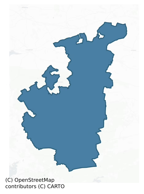
Loughrea is a barony of County Galway, in the historical province of Connacht (Irish: Baile Locha Riach), covering 264 km² of land. The barony records 548 NMS archaeological sites and 72 NIAH listed buildings, placing it at around the 58th percentile among 280 ROI baronies for sites per km². This means it is in the upper half of all baronies for sites per km². Dated archaeological evidence runs from the Neolithic through to the Modern, spanning 8 of 9 archaeological periods, placing the barony in the 76th percentile among 280 ROI baronies for chronological depth. This means it is in the top third of all baronies for chronological depth. The largest dated subset of recorded sites dates to the Early Medieval. Logainm flags 48 placenames in the barony as carrying a recognised heritage root; the largest share — around 48% — are names associated with early Christian church and monastic foundations.
Heritage at a glance
Percentile rankings throughout this profile compare each barony only against the other 279 Republic of Ireland baronies.
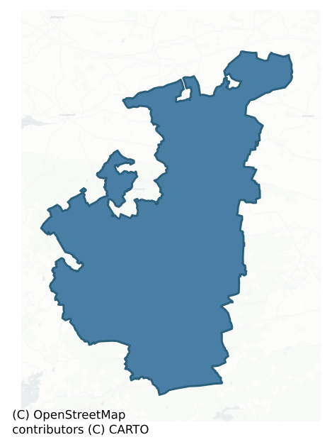
The recorded heritage of Loughrea
The National Monuments Service Sites and Monuments Record (SMR) is the statutory inventory of archaeological sites for the Republic of Ireland, maintained by the Department of Tourism, Culture, Arts, Gaeltacht, Sport and Media. Sites recorded here include earthworks, ringforts, megalithic tombs, ecclesiastical remains, and post-medieval features; not every record is legally protected, but each is registered as a monument of archaeological interest.
The National Monuments Service records 548 archaeological sites in Loughrea, putting it at the 58th percentile among 280 ROI baronies for sites per km². This means it is in the upper half of all baronies for sites per km². Of these, 468 (85%) fall within a recorded monument protection zone. The dominant category is defensive sites — ringforts, enclosures, hillforts, and stone forts (273 sites, 50% of the record). Ringfort – rath is the most prevalent type, making up 19% of the barony's recorded sites (105 records), broadly in line with the ROI average of 20% across all baronies where this type occurs. Ringfort – rath is an earthen ringfort enclosed by a bank and external ditch — the most common Early Medieval farmstead, broadly dated 500–1000 AD. Other significant types include Souterrain (51) and Enclosure (48). Souterrain is an underground stone-built passage and chamber, generally Early Medieval and often associated with ringforts as a defensive or storage feature; Enclosure is a banked or ditched feature of uncertain type, used as a catch-all where the original function cannot be determined from surface evidence. Across the barony's 264 km², this gives a recorded density of 2.08 sites per km².
Most common monument types
Hover or tap a monument type to see its definition.
| Type | Count |
|---|---|
| Ringfort – rath an earthen ringfort enclosed by a bank and external ditch — the most common Early Medieval farmstead, broadly dated 500–1000 AD | 105 |
| Souterrain an underground stone-built passage and chamber, generally Early Medieval and often associated with ringforts as a defensive or storage feature | 51 |
| Enclosure a banked or ditched feature of uncertain type, used as a catch-all where the original function cannot be determined from surface evidence | 48 |
| Children's burial ground an unconsecrated medieval and early-modern burial ground for unbaptised or stillborn children, often called a cillín or ceallúnach | 27 |
| Ringfort – cashel the stone-walled equivalent of the rath, found mainly in upland or western areas, broadly dated 500–1000 AD | 25 |
| Church a building used for public Christian worship, of any date from c. 500 AD onwards | 15 |
| House – indeterminate date a habitation building whose date cannot be determined from available evidence | 14 |
Chronological distribution
The dated archaeological record for Loughrea spans from the Neolithic through to the Modern, with activity attested across 8 of 9 archaeological periods. This is the 76th percentile across ROI baronies for chronological depth — an above-average span. Every period from earliest to latest is represented in the record — an unbroken sequence of dated activity across the full chronological span. Activity concentrates most heavily in the Early Medieval (203 sites, 53% of dated material), with the Iron Age forming a secondary peak (104 sites, 27%). A further 166 recorded sites (30% of the overall NMS register for the barony) carry no period attribution — appearing as 'Unknown' in the bar chart below. This typically reflects either records that pre-date the standardised period vocabulary or sites awaiting specialist dating review, rather than a genuine absence of chronological evidence.
Sample of recorded monuments
Show 25 sample monuments (of 548 total)
A representative sample of 25 recorded monuments drawn from the barony’s 548 total NMS entries. Sites within a recorded monument protection zone and rarer site types are prioritised so the list shows a meaningful cross-section rather than only the most common type. Each entry shows the official Sites and Monuments Record reference number and the description published by the National Monuments Service.
Gatehouse
The Archaeological Survey of Ireland (ASI) is in the process of providing information on all monuments on The Historic Environment Viewer (HEV). Currently the information for this record has not been uploaded. To…
The Archaeological Survey of Ireland (ASI) is in the process of providing information on all monuments on The Historic Environment Viewer (HEV). Currently the information for this record has not been uploaded. To access available information for research purposes please make an appointment in advance with the Archive Unit (open Fridays 10.00 am – 5.00 pm), Department of Culture, Heritage and the Gaeltacht, The Custom House, Dublin 1 D01W6XO or email nmarchive@chg.gov.ie.
Prehistoric site – lithic scatter
The Archaeological Survey of Ireland (ASI) is in the process of providing information on all monuments on The Historic Environment Viewer (HEV). Currently the information for this record has not been uploaded. To…
The Archaeological Survey of Ireland (ASI) is in the process of providing information on all monuments on The Historic Environment Viewer (HEV). Currently the information for this record has not been uploaded. To access available information for research purposes please make an appointment in advance with the Archive Unit (open Fridays 10.00 am – 5.00 pm), Department of Culture, Heritage and the Gaeltacht, The Custom House, Dublin 1 D01W6XO or email nmarchive@chg.gov.ie.
Mass-rock
The Archaeological Survey of Ireland (ASI) is in the process of providing information on all monuments on The Historic Environment Viewer (HEV). Currently the information for this record has not been uploaded. To…
The Archaeological Survey of Ireland (ASI) is in the process of providing information on all monuments on The Historic Environment Viewer (HEV). Currently the information for this record has not been uploaded. To access available information for research purposes please make an appointment in advance with the Archive Unit (open Fridays 10.00 am – 5.00 pm), Department of Culture, Heritage and the Gaeltacht, The Custom House, Dublin 1 D01W6XO or email nmarchive@chg.gov.ie.
Prison
The Archaeological Survey of Ireland (ASI) is in the process of providing information on all monuments on The Historic Environment Viewer (HEV). Currently the information for this record has not been uploaded. To…
The Archaeological Survey of Ireland (ASI) is in the process of providing information on all monuments on The Historic Environment Viewer (HEV). Currently the information for this record has not been uploaded. To access available information for research purposes please make an appointment in advance with the Archive Unit (open Fridays 10.00 am – 5.00 pm), Department of Culture, Heritage and the Gaeltacht, The Custom House, Dublin 1 D01W6XO or email nmarchive@chg.gov.ie.
Water mill – horizontal-wheeled
The Archaeological Survey of Ireland (ASI) is in the process of providing information on all monuments on The Historic Environment Viewer (HEV). Currently the information for this record has not been uploaded. To…
The Archaeological Survey of Ireland (ASI) is in the process of providing information on all monuments on The Historic Environment Viewer (HEV). Currently the information for this record has not been uploaded. To access available information for research purposes please make an appointment in advance with the Archive Unit (open Fridays 10.00 am – 5.00 pm), Department of Culture, Heritage and the Gaeltacht, The Custom House, Dublin 1 D01W6XO or email nmarchive@chg.gov.ie.
Historic town
The Archaeological Survey of Ireland (ASI) is in the process of providing information on all monuments on The Historic Environment Viewer (HEV). Currently the information for this record has not been uploaded. To…
The Archaeological Survey of Ireland (ASI) is in the process of providing information on all monuments on The Historic Environment Viewer (HEV). Currently the information for this record has not been uploaded. To access available information for research purposes please make an appointment in advance with the Archive Unit (open Fridays 10.00 am – 5.00 pm), Department of Culture, Heritage and the Gaeltacht, The Custom House, Dublin 1 D01W6XO or email nmarchive@chg.gov.ie.
Burial
The Archaeological Survey of Ireland (ASI) is in the process of providing information on all monuments on The Historic Environment Viewer (HEV). Currently the information for this record has not been uploaded. To…
The Archaeological Survey of Ireland (ASI) is in the process of providing information on all monuments on The Historic Environment Viewer (HEV). Currently the information for this record has not been uploaded. To access available information for research purposes please make an appointment in advance with the Archive Unit (open Fridays 10.00 am – 5.00 pm), Department of Culture, Heritage and the Gaeltacht, The Custom House, Dublin 1 D01W6XO or email nmarchive@chg.gov.ie.
Stone circle – embanked
On a ridge in pastureland, immediately to the S of the Loughrea-Portumna road. Named the ‘Seven Monuments’ and shown within a large mixed forest on the OS 6-inch maps, this National Monument was known locally as 'Feara…
On a ridge in pastureland, immediately to the S of the Loughrea-Portumna road. Named the ‘Seven Monuments’ and shown within a large mixed forest on the OS 6-inch maps, this National Monument was known locally as 'Feara Breige'. It was described in Dutton’s Statistical Survey of 1824 as a mound where there were ‘formerly eight flat rude stones’, but one was missing, five were still standing and two were lying flat on the bank. In the centre was a ‘tumulus’ and the entire site was planted with trees (O'Flanagan 1927, Vol. 2, 239). The trees have since been removed from the monument but traces of the plantation survive immediately to its S and around its W limits and a house has been built to its SE. Traces of lazy beds, running roughly NE-SW are visible immediately to its S. This embanked stone circle (30.15m N-S) is defined by a raised roughly circular area that is enclosed by a well-preserved mainly earthen flat-topped bank (Wth at N 0.8m; int. H 0.5m; ext. H 0.8m) that is clearly visible all round. An outhouse built in the early 1980s clips it a SE (SMR file). There is small gap (base Wth 0.7m) in the bank at SE. The seven boulders are still extant: two at NW and N are lying flat and the other five at NE, E, SE, SSE and SSW are upright. Within the interior, roughly centrally located, is a small cairn (1.8m N-S; H 0.35-0.7m). A low berm (Wth 11.7m) visible around it slopes gently towards the bank. There is no visible surface trace of a fosse. Knox (1915, 310-11) recorded t…
Hilltop enclosure
On a hill summit in undulating pastureland, overlooking Lough Rea c. 1km to the W. Aerial reconnaissance in October 1984 (ASGAP 193:37a, 38a) revealed a poorly preserved subcircular enclosure (115m N-S; 100m E-W)…
On a hill summit in undulating pastureland, overlooking Lough Rea c. 1km to the W. Aerial reconnaissance in October 1984 (ASGAP 193:37a, 38a) revealed a poorly preserved subcircular enclosure (115m N-S; 100m E-W) defined by a low bank from NE through E to SSE and elsewhere by the natural scarp of the hill. A number of field boundaries running NNE-SSW, cut across the monument and another extends from its centre and runs in a WNW direction. The foundations of a circular hut site (GA105-205001-) occupy the centre of the monument, while the remains of a possible house (GA105-205002-) are visible in the S sector. A rath (GA105-080—-) lies c. 70m to the E.
Compiled by: Galway Archaeological Survey, UCG
Date of upload: 27 August 2019
Barrow – unclassified
Encircling a hillock in an area of rough pastureland. This very poorly preserved oval enclosure (c. 70m E-W; c. 60m N-S) is defined by a bank of earth and stone (Wth 2m, H 1m) and an internal fosse (Wth 7.5m) from N…
Encircling a hillock in an area of rough pastureland. This very poorly preserved oval enclosure (c. 70m E-W; c. 60m N-S) is defined by a bank of earth and stone (Wth 2m, H 1m) and an internal fosse (Wth 7.5m) from N through E to S. At S it peters out and there is no visible surface trace elsewhere but the slope appears to be scarped from NW to N. A field boundary cuts across the hillock, close to its base, at W and quarrying has encroached upon N sector. Field-clearance material is evident on the SW slope. There is a children's burial ground (GA105-020—-) within the interior, on the summit.
Compiled by: Galway Archaeological Survey, UCG
Date of upload: 2 June 2017
Castle – Anglo-Norman masonry castle
On the summit of an E-W running ridge in gently undulating pastureland, formerly part of Castleboy demesne. This castle appears to have been of 13th century date. It was still occupied in 1574 when it was in the…
On the summit of an E-W running ridge in gently undulating pastureland, formerly part of Castleboy demesne. This castle appears to have been of 13th century date. It was still occupied in 1574 when it was in the possession of 'Redmud Mc Hubert roe' (Nolan 1901, 112). When initially visited in October 1982, it consisted of a two-storey ivy-mantled rectangular building (L 12.8m, Wth 5.8m) in fair condition. Aligned E-W, it had been constructed partly on the crest and E slope of the ridge. Apart from a prominent base-batter to the walls, the other principal architectural features were two doorways in the N wall on the ground floor and four long narrow archery slits, three in the S wall and one in the E wall. There was a rectangular projection towards the W end of the S wall which did not appear to be bonded into it. This extended to the full height of the building and had an arched opening at ground level. It probably contained a latrine on the 1st floor. The W wall of the castle appeared to form part of an earlier rectangular or square structure which lay to the W, where substantial fragments of masonry stood. This may possibly have been an earlier keep or, perhaps more likely, a curtain wall. The castle was subsequently demolished in December 1982. (O'Flanagan 1927, Vol. 2, 44)
Compiled by: Galway Archaeological Survey, UCG
Date of upload: 31 August 2018
Barrow – stepped barrow
In undulating pastureland. Marked on the 1838 edition of the OS 6-inch map as an embanked circular enclosure (diam. c. 60m) with a central mound is shown. On inspection a well-preserved circular earthwork (diam. c. 10m)…
In undulating pastureland. Marked on the 1838 edition of the OS 6-inch map as an embanked circular enclosure (diam. c. 60m) with a central mound is shown. On inspection a well-preserved circular earthwork (diam. c. 10m) comprising a low platform of earth and stone with a small circular raised area (diam. c. 2m) at its centre was visible; possibly a mound barrow. A series of hollows and trenches surrounding the monument appeared to be modern. Quarrying had occurred on its S side.
Compiled by: Galway Archaeological Survey, UCG
Date of upload: 25 July 2019
Inauguration site
On a prominent gravel ridge, known locally as ‘Fahy's Hill’, in an area of flat pastureland. Regarded as a ringfort by Killanin and Duignan (1967, 69). Aerial imagery taken in 1970 (CUCAP BDN 37) shows that a large…
On a prominent gravel ridge, known locally as ‘Fahy's Hill’, in an area of flat pastureland. Regarded as a ringfort by Killanin and Duignan (1967, 69). Aerial imagery taken in 1970 (CUCAP BDN 37) shows that a large quarry was being developed immediately to its E. Consequently in 1971 a rescue excavation was undertaken by E. Rynne (pers. comm.) who described it as a large earthwork (max. diam. c. 68m) comprising a flat-topped mound (diam. c. 28m) encircled by a fosse and external bank. There was a gap (Wth 6m) at SE. Within the interior was a semicircular enclosure (diam. c. 5.5m) defined by a bank with an external shallow fosse. A number of seemingly haphazardly placed pits and/or post holes occurred in this area. Also found in this vicinity were two concentrations of cremated bones and one shallow cremation-burial. Rynne (ibid.) concluded that the exposed position and the complete lack of any trace of a hearth, together with the widespread scatter of small fragments of cremated bones, suggested that the site was not used for habitation but was more likely used for ritual purposes; it may have been an assembly place or an inauguration mound. No visible surface trace survives. A ring-barrow (GA114-088—-) lay c. 30m to the NE.
Compiled by: Galway Archaeological Survey, UCG
Date of upload: 12 August 2019
Monumental structure
The Archaeological Survey of Ireland (ASI) is in the process of providing information on all monuments on The Historic Environment Viewer (HEV). Currently the information for this record has not been uploaded. To…
The Archaeological Survey of Ireland (ASI) is in the process of providing information on all monuments on The Historic Environment Viewer (HEV). Currently the information for this record has not been uploaded. To access available information for research purposes please make an appointment in advance with the Archive Unit (open Fridays 10.00 am – 5.00 pm), Department of Culture, Heritage and the Gaeltacht, The Custom House, Dublin 1 D01W6XO or email nmarchive@chg.gov.ie.
Icehouse
The Archaeological Survey of Ireland (ASI) is in the process of providing information on all monuments on The Historic Environment Viewer (HEV). Currently the information for this record has not been uploaded. To…
The Archaeological Survey of Ireland (ASI) is in the process of providing information on all monuments on The Historic Environment Viewer (HEV). Currently the information for this record has not been uploaded. To access available information for research purposes please make an appointment in advance with the Archive Unit (open Fridays 10.00 am – 5.00 pm), Department of Culture, Heritage and the Gaeltacht, The Custom House, Dublin 1 D01W6XO or email nmarchive@chg.gov.ie.
Dovecote
The Archaeological Survey of Ireland (ASI) is in the process of providing information on all monuments on The Historic Environment Viewer (HEV). Currently the information for this record has not been uploaded. To…
The Archaeological Survey of Ireland (ASI) is in the process of providing information on all monuments on The Historic Environment Viewer (HEV). Currently the information for this record has not been uploaded. To access available information for research purposes please make an appointment in advance with the Archive Unit (open Fridays 10.00 am – 5.00 pm), Department of Culture, Heritage and the Gaeltacht, The Custom House, Dublin 1 D01W6XO or email nmarchive@chg.gov.ie.
Burnt mound
In a marshy field close to a stream and some 60m to the E of a fulacht fia (GA105-014—-). Fire-fractured stones and black earth are evident in this irregularly shaped low burnt mound (5.8m E-W; H 0.25m max).…
In a marshy field close to a stream and some 60m to the E of a fulacht fia (GA105-014—-). Fire-fractured stones and black earth are evident in this irregularly shaped low burnt mound (5.8m E-W; H 0.25m max).
Compiled by: Galway Archaeological Survey, UCG
Date of upload: 15 November 2019
Designed landscape – summer house
The Archaeological Survey of Ireland (ASI) is in the process of providing information on all monuments on The Historic Environment Viewer (HEV). Currently the information for this record has not been uploaded. To…
The Archaeological Survey of Ireland (ASI) is in the process of providing information on all monuments on The Historic Environment Viewer (HEV). Currently the information for this record has not been uploaded. To access available information for research purposes please make an appointment in advance with the Archive Unit (open Fridays 10.00 am – 5.00 pm), Department of Culture, Heritage and the Gaeltacht, The Custom House, Dublin 1 D01W6XO or email nmarchive@chg.gov.ie.
Cathedral
The Archaeological Survey of Ireland (ASI) is in the process of providing information on all monuments on The Historic Environment Viewer (HEV). Currently the information for this record has not been uploaded. To…
The Archaeological Survey of Ireland (ASI) is in the process of providing information on all monuments on The Historic Environment Viewer (HEV). Currently the information for this record has not been uploaded. To access available information for research purposes please make an appointment in advance with the Archive Unit (open Fridays 10.00 am – 5.00 pm), Department of Culture, Heritage and the Gaeltacht, The Custom House, Dublin 1 D01W6XO or email nmarchive@chg.gov.ie.
House – 19th century
The following description is from the National Inventory of Architectural Heritage (buildingsofireland.ie/niah/search.jsp?type=record&county=GA®no=30411501 last accessed 19 September 2019): Detached three-bay…
The following description is from the National Inventory of Architectural Heritage (buildingsofireland.ie/niah/search.jsp?type=record&county=GA®no=30411501 last accessed 19 September 2019): Detached three-bay two-storey house, built c.1820, refenestrated c.1910. Half-hipped slate roof with terracotta ridge tiles, symmetrically placed rendered chimneystacks, and brick eaves course. Roughcast rendered walls with smooth rendered plinth course. Square-headed tripartite two-over-two pane timber sliding sash windows throughout, with ogee horns and tooled limestone sills. Square-headed double-leaf timber panelled door, with sidelights having tooled limestone sills, and tripartite overlight. Decorative wrought-iron gates flanked by tooled limestone piers flanked by rubble limestone entrance walls with tooled limestone terminating piers. Rubble limestone boundary walls to site.
An unusual and curious house given its character by the tripartite windows to its front façade and understated doorway with sidelights. Its symmetrical composition is mirrored in the individual openings, each with a central component flanked by narrower windows, giving the structure a simple elegance. The setting is enhanced by its boundary walls and decorative gate.
Uploaded by: Olive Alcock
Date of upload: 19 September 2019
House – 17th century
The Archaeological Survey of Ireland (ASI) is in the process of providing information on all monuments on The Historic Environment Viewer (HEV). Currently the information for this record has not been uploaded. To…
The Archaeological Survey of Ireland (ASI) is in the process of providing information on all monuments on The Historic Environment Viewer (HEV). Currently the information for this record has not been uploaded. To access available information for research purposes please make an appointment in advance with the Archive Unit (open Fridays 10.00 am – 5.00 pm), Department of Culture, Heritage and the Gaeltacht, The Custom House, Dublin 1 D01W6XO or email nmarchive@chg.gov.ie.
House – medieval
The Archaeological Survey of Ireland (ASI) is in the process of providing information on all monuments on The Historic Environment Viewer (HEV). Currently the information for this record has not been uploaded. To…
The Archaeological Survey of Ireland (ASI) is in the process of providing information on all monuments on The Historic Environment Viewer (HEV). Currently the information for this record has not been uploaded. To access available information for research purposes please make an appointment in advance with the Archive Unit (open Fridays 10.00 am – 5.00 pm), Department of Culture, Heritage and the Gaeltacht, The Custom House, Dublin 1 D01W6XO or email nmarchive@chg.gov.ie.
Structure
Within the NW sector of the interior of the moated site (GA105-182—-) there is a rectangular stone structure (4.9m N-S; 3.8m E-W) with an entrance gap (Wth 2.7m) at S. The walls average 2.6m in width and 0.3m in…
Within the NW sector of the interior of the moated site (GA105-182—-) there is a rectangular stone structure (4.9m N-S; 3.8m E-W) with an entrance gap (Wth 2.7m) at S. The walls average 2.6m in width and 0.3m in height.
Compiled by: Galway Archaeological Survey, UCG
Date of upload: 9 December 2019
Penitential station
This possible penitential station lies c. 5m to the SW of a holy well (GA114-066002-). It consists of a small rectangular drystone walled enclosure (3m ENE-WSW; 2m WNW-ESE; H 0.5m). Two courses of walling survive. It is…
This possible penitential station lies c. 5m to the SW of a holy well (GA114-066002-). It consists of a small rectangular drystone walled enclosure (3m ENE-WSW; 2m WNW-ESE; H 0.5m). Two courses of walling survive. It is totally overgrown and a large thorn tree is growing at its E end.
Compiled by: Olive Alcock
Date of upload: 3 February 2020
Ringfort – rath
In level grassland. Known locally as ‘Lisin na bPaistidh’ (O'Flanagan 1927, Vol. 1, 499), this very poorly preserved subcircular rath (38m E-W; 36.2m N-S) is defined by a bank which is visible only from E to ESE.…
In level grassland. Known locally as ‘Lisin na bPaistidh’ (O'Flanagan 1927, Vol. 1, 499), this very poorly preserved subcircular rath (38m E-W; 36.2m N-S) is defined by a bank which is visible only from E to ESE. Elsewhere a scarp forms the enclosing element. A field bank overlies the monument from N to E. There is a children’s burial ground (GA098-065001-) and a souterrain (GA098-065002-) within the interior.
Compiled by: Galway Archaeological Survey, UCG
Date of upload: 24 January 2017
Listed buildings
The National Inventory of Architectural Heritage (NIAH) is a state survey appraising buildings of architectural, historical, archaeological, artistic, cultural, scientific, social, or technical interest. Each surveyed structure receives a rating from International (the highest, for buildings of European importance) through National, Regional, Local, and Record-Only.
The NIAH records 72 listed buildings in Loughrea (39th percentile across ROI baronies). The highest-graded structure include 1 of National significance. The Republic holds 937 National-graded buildings in total, so this barony accounts for around 0% of the national total. Construction dates concentrate most heavily in the Victorian (1830-1900) period. The most-recorded building type is house (21 examples, 29% of the listed stock).
Terrain and environment
Mean elevation across the barony is 138m — the 82nd percentile among 280 ROI baronies for elevation. This means it is in the top fifth of all baronies for elevation. This is a relatively elevated landscape by ROI standards. Elevation matters for heritage because higher-altitude baronies typically favour defensive monuments — ringforts and hilltop forts placed on prominent ground — while lowland baronies are more likely to carry the dense settlement and church networks of intensive agricultural landscapes. The barony reaches 369m at its highest point — a vertical span of more than 230m within its boundary, indicating significant topographic diversity. Mean slope is 4.0° — the 59th percentile among 280 ROI baronies for slope. This means it is in the upper half of all baronies for slope. Slope is a key control on both land use and archaeological preservation: steep ground resists ploughing and tends to preserve earthworks intact, while gentle slopes favour intensive cultivation that damages or destroys surface archaeology over time. The Topographic Wetness Index averages 10.6, the 40th percentile among 280 ROI baronies for wetness. This means it is in the lower half of all baronies for wetness. Drainage matters for heritage because poorly-drained ground preserves organic archaeology (wooden trackways, leather, textiles, and on rare occasions human remains) far better than free-draining soil; well-drained ground favours arable use but destroys organic material rapidly. The land cover is dominated by improved grassland (64%) and woodland (33%). In overall character, this is elevated but relatively gentle terrain — typical of plateau country, with land use dominated by improved grassland.
Terrain measurements
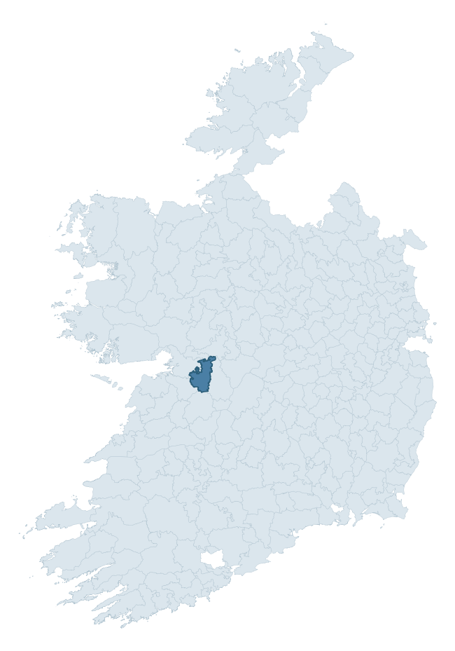
Where this barony sits in the Republic of Ireland
Geology and preservation
Bedrock geology shapes the landscape long before any settlement begins — controlling soil drainage, agricultural potential, the survival of upstanding monuments, and the preservation of buried archaeology. The figures below come from the Geological Survey Ireland 1:100,000 bedrock map.
The bedrock underlying Loughrea is predominantly mudstone, siltstone, conglomerate (46% of the barony by area), laid down during the Carboniferous period (50% by area, around 359 to 299 million years ago). A substantial secondary geology of limestone (38%) adds further variety to the underlying landscape. The single largest mapped unit is the Ayle River Formation (46% of the barony's bedrock).
Rock type composition
Largest mapped unit: Ayle River Formation (46% of the barony)
Placename evidence
Logainm records 48 heritage-diagnostic placenames for Loughrea, drawn from townland and civil-parish names across the barony. The dominant stratum is Early Christian ecclesiastical — cill-, teampall-, and domhnach-prefixed names that record the dense network of early church foundations established between the fifth and tenth centuries. The leading diagnostic roots are cathair- (14 — stone fort), cill- (11 — church), and cillín- (5 — killeen). This is above the ROI average of 30.7 heritage placenames per barony. The presence of multiple heritage strata side by side indicates layered occupation of the landscape across successive prehistoric and historic periods. Logainm records 203 placenames for Loughrea (predominantly townland names). Of these, 48 (24%) carry one of the diagnostic Gaelic roots tracked above; the remainder draw on more generic landscape vocabulary that does not encode a heritage period.
Pre-Christian / Early Medieval Defensive
| Root | Count | Meaning |
|---|---|---|
| cathair- | 14 | stone fort |
| ráth- | 3 | earthen ringfort |
| dún- | 3 | hilltop or promontory fort |
| lios- | 2 | ringfort or enclosure |
Early Christian Ecclesiastical
| Root | Count | Meaning |
|---|---|---|
| cill- | 11 | church (early) |
| cillín- | 5 | unconsecrated burial ground |
| díseart- | 3 | hermitage |
| gráinseach- | 3 | monastic farm / grange |
| bile- | 1 | sacred tree / boundary marker |
Burial, Ritual, and Norse-Contact
| Root | Count | Meaning |
|---|---|---|
| uaimh- | 2 | cave / souterrain |
| carn- | 1 | cairn |
Other baronies in Galway
About this profile
Click any section below to expand.
What is a barony?
A barony is a historic administrative unit in Ireland, broadly equivalent to an English hundred. The 280 baronies used here are from the OSi 2019 National Statutory Boundaries (generalised 20m), covering the 26 counties of the Republic of Ireland. Baronies derive from the Norman period, were formalised in the 17th century, and have not been redrawn for statistical purposes. They vary enormously in area, from compact urban baronies in Dublin to vast upland baronies in Connacht, and should not be compared by raw site count without accounting for area differences.
What counts as a site?
This profile combines three distinct heritage registers, each with its own definition of what constitutes a recordable site:
- Archaeological sites (NMS). The National Monuments Service Sites and Monuments Record (SMR) catalogues every known archaeological monument or site of archaeological interest in the Republic, from prehistoric burial mounds and ringforts to medieval churches and post-medieval defensive works. Inclusion does not require legal protection — only that the site has been identified, surveyed, and assessed as having archaeological value. A separate subset of these sites lies within a recorded protection zone, which gives them statutory protection under the National Monuments Acts.
- Listed buildings (NIAH). The National Inventory of Architectural Heritage records buildings of architectural, historical, archaeological, artistic, cultural, scientific, social, or technical interest. Each surveyed structure is appraised on a five-tier scale: International, National, Regional, Local, and Record-Only. The NIAH appraisal is informational rather than strictly statutory, but it underpins local-authority Record of Protected Structures (RPS) listings.
- Heritage placenames (Logainm). Logainm is the authoritative database of Irish placenames maintained by the Placenames Branch. This profile applies a heritage-diagnostic classifier to the Irish-language form of each townland name, flagging roots that signal defensive sites (ráth-, lios-, dún-, caiseal-, cathair-), ecclesiastical foundations (cill-, teampall-, domhnach-, mainistir-), prehistoric burial-ritual features (tuaim-, carn-, leaba-), or Norse-contact settlement (gall-). Townlands without one of these diagnostic roots are not flagged here — they may still carry historical significance, but that significance is not encoded in the name itself.
Editorial principles
The narrative sections of this profile follow several explicit principles:
- Evidential. Every claim about this barony’s heritage character is anchored in the underlying register data. Where a site count, a placename count, or a percentile rank is cited, it is computed from the source datasets at export time, not estimated.
- Comparative. Counts and metrics are reported alongside their percentile rank against the other 279 ROI baronies. A barony with 50 ringforts in absolute terms could be unusually high or unusually low depending on its size and regional context; percentile ranking removes that ambiguity.
- Transparent on limits. Where a register has known coverage gaps, survey biases, or data-quality issues that affect this barony’s figures, the profile flags them rather than presenting the numbers as definitive.
- No interpretation beyond what the data supports. The narrative does not speculate about historical events, social dynamics, or cultural meaning beyond what the recorded heritage and placename evidence directly attests.
Data caveats and limits
- NMS Sites and Monuments Record is the product of survey campaigns conducted at different intensities across different counties and decades. Some baronies have been surveyed more thoroughly than others, and absolute counts should be read in that light. Sites destroyed by development before survey are typically not represented; sites in heavily forested or upland terrain are sometimes under-recorded.
- NIAH coverage is broadly complete for the Republic of Ireland but the survey was conducted on a rolling county-by-county basis, and the most recent appraisal date varies. Buildings demolished or substantially altered after their original survey may still appear in the register; conversely, recent buildings of merit may not yet have been appraised.
- Logainm classification applies a deliberately conservative pattern-matching approach to the Irish-language townland forms. The classifier prioritises true positives over recall: a townland may carry a heritage signal that the classifier doesn’t recognise, particularly where the diagnostic root has been heavily anglicised or where the townland name draws on a less common term. The 60,000+ townland records and ~9,800 classified placenames give a substantial signal at barony scale, but individual townland names should be checked against Logainm directly for definitive interpretation.
- Period attribution. The chronological distribution reflects only those NMS sites that carry a recognised period attribution in the source data. Sites listed as “Unknown” period are excluded from the dated subset.
- Boundary changes. Some baronies have undergone minor boundary adjustments since their 19th-century definition; the OSi 2019 generalised boundaries used here are the current statutory definition and may differ slightly from historical maps in border areas.
- Bedrock geology is mapped at 1:100,000 scale, which means local variation within a barony — small pockets of different rock type, mineral veins, alluvium overlying bedrock — is generalised. The dominant-system and rocktype figures are area-weighted, so a barony reading “70% Carboniferous limestone” may still contain small but archaeologically important pockets of older or younger rock. Around 3% of GSI polygons do not match the lexicon and contribute no rocktype or system attribution.
Data sources
- National Monuments Service — Sites and Monuments Record (SMR) https://data.gov.ie/dataset/national-monuments-service-archaeological-survey-of-ireland
- National Inventory of Architectural Heritage (NIAH) https://data.gov.ie/dataset/national-inventory-of-architectural-heritage-niah-national-dataset
- Logainm — Placenames Database of Ireland https://www.logainm.ie/
- Ordnance Survey Ireland — National Statutory Barony Boundaries 2019 https://data-osi.opendata.arcgis.com/
- EURODEM — European Digital Elevation Model https://www.mapsforeurope.org/datasets/euro-dem
- ESA WorldCover https://esa-worldcover.org/en
- Geological Survey Ireland — 1:100,000 Bedrock Geology https://www.gsi.ie/en-ie/data-and-maps/Pages/Bedrock.aspx
Explore more: Search any of the 280 ROI baronies, browse by historical province, or read the methodology and data sources for the full Republic of Ireland Heritage Tool.