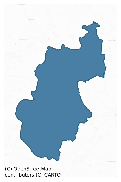
Lune is a barony of County Meath, in the historical province of Leinster (Irish: Luíne), covering 162 km² of land. The barony records 136 NMS archaeological sites and 56 NIAH listed buildings, placing it at around the 6th percentile among 280 ROI baronies for sites per km². This means it is in the bottom tenth of all baronies for sites per km². Dated archaeological evidence runs from the Early Bronze Age through to the Modern, spanning 7 of 9 archaeological periods, placing the barony in the 43rd percentile among 280 ROI baronies for chronological depth. This means it is in the lower half of all baronies for chronological depth. The largest dated subset of recorded sites dates to the Iron Age. Logainm flags 19 placenames in the barony as carrying a recognised heritage root; the largest share — around 53% — are names associated with pre-christian defensive.
Heritage at a glance
Percentile rankings throughout this profile compare each barony only against the other 279 Republic of Ireland baronies.
The recorded heritage of Lune
The National Monuments Service Sites and Monuments Record (SMR) is the statutory inventory of archaeological sites for the Republic of Ireland, maintained by the Department of Tourism, Culture, Arts, Gaeltacht, Sport and Media. Sites recorded here include earthworks, ringforts, megalithic tombs, ecclesiastical remains, and post-medieval features; not every record is legally protected, but each is registered as a monument of archaeological interest.
The National Monuments Service records 136 archaeological sites in Lune, putting it at the 6th percentile among 280 ROI baronies for sites per km². This means it is in the bottom tenth of all baronies for sites per km². A sparse recorded total of this kind in Ireland often reflects survey priority rather than genuine absence of past activity. Protection coverage is near-universal — 131 sites (96%) fall within a recorded monument protection zone, indicating an extensively surveyed landscape. The dominant category is defensive sites — ringforts, enclosures, hillforts, and stone forts (58 sites, 43% of the record). Ringfort – rath is the most prevalent type, making up 17% of the barony's recorded sites (23 records), broadly in line with the ROI average of 20% across all baronies where this type occurs. Ringfort – rath is an earthen ringfort enclosed by a bank and external ditch — the most common Early Medieval farmstead, broadly dated 500–1000 AD. Other significant types include Enclosure (10) and Church (6). Enclosure is a banked or ditched feature of uncertain type, used as a catch-all where the original function cannot be determined from surface evidence; Church is a building used for public Christian worship, of any date from c. 500 AD onwards. Across the barony's 162 km², this gives a recorded density of 0.84 sites per km².
Most common monument types
Hover or tap a monument type to see its definition.
| Type | Count |
|---|---|
| Ringfort – rath an earthen ringfort enclosed by a bank and external ditch — the most common Early Medieval farmstead, broadly dated 500–1000 AD | 23 |
| Enclosure a banked or ditched feature of uncertain type, used as a catch-all where the original function cannot be determined from surface evidence | 10 |
| Church a building used for public Christian worship, of any date from c. 500 AD onwards | 6 |
| Castle – tower house a fortified residential tower of four or five storeys, mostly built by lords in the 15th and 16th centuries and often within a defended bawn | 6 |
| Field system a group of related fields forming a coherent agricultural landscape, of any date from the Neolithic onwards | 6 |
| Graveyard a burial area associated with a church, in use from the medieval period onwards | 6 |
| Earthwork an unclassified earthen structure with no diagnostic features that allow a more specific classification | 5 |
Chronological distribution
The dated archaeological record for Lune spans from the Early Bronze Age through to the Modern, with activity attested across 7 of 9 archaeological periods. Every period from earliest to latest is represented in the record — an unbroken sequence of dated activity across the full chronological span. Activity concentrates most heavily in the Iron Age (41 sites, 46% of dated material), with the Medieval forming a secondary peak (18 sites, 20%). A further 46 recorded sites (34% of the overall NMS register for the barony) carry no period attribution — appearing as 'Unknown' in the bar chart below. This typically reflects either records that pre-date the standardised period vocabulary or sites awaiting specialist dating review, rather than a genuine absence of chronological evidence.
Sample of recorded monuments
Show 25 sample monuments (of 136 total)
A representative sample of 25 recorded monuments drawn from the barony’s 136 total NMS entries. Sites within a recorded monument protection zone and rarer site types are prioritised so the list shows a meaningful cross-section rather than only the most common type. Each entry shows the official Sites and Monuments Record reference number and the description published by the National Monuments Service.
Ritual site – holy/saint's stone
Situated on a fairly level landscape. This is a glacial erratic with a natural hole at its base on the S side, which is reputed to have been made by St. Laurence O’Toole’s hands. It had originally been at Rathmore…
Situated on a fairly level landscape. This is a glacial erratic with a natural hole at its base on the S side, which is reputed to have been made by St. Laurence O’Toole’s hands. It had originally been at Rathmore castle (ME024-018001-) but it was moved to a corner of a field near the road (R164) from Athboy to Kells. (O’Reilly 1955, 15)
Compiled by: Michael Moore
Date of upload: 16 April 2019
O’Reilly, M. 1955 Rathmore. Ríocht na Mídhe, vol. 1, No. 1, 14-17.
Town defences
Athboy was one of the four walled towns in Co. Meath and it seems to have been walled from the early fourteenth century. A grant of murage was made in 1306 and the construction of the walls may have begun shortly…
Athboy was one of the four walled towns in Co. Meath and it seems to have been walled from the early fourteenth century. A grant of murage was made in 1306 and the construction of the walls may have begun shortly afterwards. Further grants of murage were made in 1446 and 1462 after the town had been burned by O’Connor Offaly in 1443, and it was still listed as a walled town in 1596 (Bradley and King 1985, 19-20).
The town was quite large but the only part of the town wall that survives visibly is a section (L c. 100m) with a base-batter extending WSW from the graveyard (ME029-023012-) of the parish church but it could include the wall on the S side of the graveyard and a boundary wall further NE (total L c. 220m). The surviving wall (H 2-3m; T 0.9m) is of roughly coursed masonry with a rubble core. Towards the WSW end an open-backed tower (int. diam. c. 2.45m) projects from the wall and has an internal rebate to support a second floor. A short section of an external ditch or fosse (L 26m; Wth of top 3.6m; Wth of base 1.6m; ext. D 2.4m) is between the tower and the graveyard. (ibid. 19-20)
Excavation (01E0883; 01E0883 ext.) c. 50m W of the surviving tower (Danaher 2001; 2003; O’Hara 2002; 2004) discovered a robber-trench (Wth of top 1.45-2.2.5m; D 0.9-1.5m) on the WNW-ESE line of the town wall (L 50m plus), which is on a different alignment to the ENE-WSW section of surviving wall. The robbed section was probably running to a gate at the junction of O’Growney Street…
Souterrain
Situated on top of a hill. Just S of the E-W field bank bisecting rath (ME029-016—-) is a circular depression (diam. 7m N-S; 6m E-W) defined by an earthen bank (Wth of base 2.8m; H 0.3-0.4m), which is probably the…
Situated on top of a hill. Just S of the E-W field bank bisecting rath (ME029-016—-) is a circular depression (diam. 7m N-S; 6m E-W) defined by an earthen bank (Wth of base 2.8m; H 0.3-0.4m), which is probably the remains of a souterrain with a beehive chamber reported by Beryl Moore to the National Museum of Ireland (Rynne and Prendergast 1962, 43).
The above description is derived from the published 'Archaeological Inventory of County Meath' (Dublin: Stationery Office, 1987). In certain instances the entries have been revised and updated in the light of recent research.
Compiled by: Michael Moore
Date of revision: 28 February 2019
Fulacht fia
Situated in a level landscape and c. 16m S of a canalised NW-SE stream. This is an oval stony mound (dims 10m E-W; 6.6m N-S; H 0.8m) with a clay mantle in places and evidence of charcoal associated with the mantle.…
Situated in a level landscape and c. 16m S of a canalised NW-SE stream. This is an oval stony mound (dims 10m E-W; 6.6m N-S; H 0.8m) with a clay mantle in places and evidence of charcoal associated with the mantle.
The above description is derived from the published 'Archaeological Inventory of County Meath' (Dublin: Stationery Office, 1987). In certain instances the entries have been revised and updated in the light of recent research.
Compiled by: Michael Moore
Date of revision: 28 February 2019
Historic town
The town of Athboy is situated in a level low-lying landscape on the W side of a NNW-SSE section of the Athboy River, and close to the headwaters of the river which flows into the Boyne c. 3km above Trim. It is located…
The town of Athboy is situated in a level low-lying landscape on the W side of a NNW-SSE section of the Athboy River, and close to the headwaters of the river which flows into the Boyne c. 3km above Trim. It is located about half way between the towns of Kells and Trim. The name is derived from the Gaelic Ath Buidhe – yellow ford – so the crossing point of the river was an important part of its development, and it may have had old associations with the prehistoric earthworks on Tlachta (Hill of Ward) c. 2 km to the ENE (ME030-001001-). Ath Buidhe Tlachtga was the scene of a battle between the Norse of Dublin and Maelseachlainn, King of Meath, in 1022 (AFM), which the Norse lost, and a Church synod, convened by Ruaraí O’Conchbhair King of Connaught, was held here in 1167 (AFM). (Bradley and King 1985, 16)
During the period of the Anglo-Norman settlement Athboy became the centre of the barony of Lune, which was granted by Hugh de Lacy to William de Muset in the 1170s, and it passed on his death in 1213 briefly to the Tuites. The de Loundres (London) family held it until 1386 when it was divided between the Preston and Brown families (ibid. 16-17). A castle, probably a motte, was being fortified at Athboy in 1211-12 but its location is not known (Graham 1974, 43; 1980, 47). The ‘Castletown of Athboy’ is constantly referred to in the Gormanston Register but the location of a castle is not known. The date of the foundation of the town is not known with any certainty. A gr…
Designed landscape – tree-ring
Situated on a fairly level landscape and c. 500m N of Woodtown House. This feature is depicted as a small circular copse (diam. c.30m) only on the 1836 edition of the OS map but it was recorded in 1955 (SMR file) as a…
Situated on a fairly level landscape and c. 500m N of Woodtown House. This feature is depicted as a small circular copse (diam. c.30m) only on the 1836 edition of the OS map but it was recorded in 1955 (SMR file) as a circular platform (diam. 30m) with some tree-stumps defined by a fosse (Wth of top 2.5m; int. D. c. 0.9m; ext. D c. 0.2m). It was probably a tree-ring but its visible profile had been removed by 2005 (OSAP).
Compiled by: Michael Moore
Date of upload: 28 February 2019
Religious house – Dominican friars
Despite the dissolution of the Dominican abbey in Trim (ME036-048022-) which took place in 1539 the order maintained a continuing presence in the vicinity (Fenning 1961). Early in the 18th century a farm at Donore was…
Despite the dissolution of the Dominican abbey in Trim (ME036-048022-) which took place in 1539 the order maintained a continuing presence in the vicinity (Fenning 1961). Early in the 18th century a farm at Donore was let by a Mr. Ashe to the prior, and community life resumed in the new location c. 1713. The friars provided a pastoral service for many local parishes. In 1756 the community is recorded as Prior Patrick Lynham and six others. Novices were trained at Donore after 1773, and in 1788-9 an academy for boys was launched but it had little success. By the end of the century the community was in decline and it dispersed early in the 19th century. Fr. Laurence Shaw OP, who died in Ballivor in 1833 and is commemorated there, was the last of the community. A headstone erected in 1787 in the ruin of the parish church of Killyon (ME041-046—-), c. 2km to the WSW, commemorates seven member friars, (Cogan 1862-70, 1, 307-10; 2, 346; Fenning 1963).
Situated on the N bank of the River Boyne at a point c. 40m N of where it changes from a SW-NE course to NW-SE, and at the head of a steep slope down to the stream. A roofless structure (dims c. 10m E-W; c. 5m N-S) depicted on the 1836 ed. of the OS 6-inch map is described in gothic lettering as ‘Friary Chapel’. Another roofless structure (dims c. 10m N-S; c. 5m E-W) is depicted running S from its W end. The location is described as the site of the friary and chapel on the 1909 edition. The foundations of a N-S wall (L 11.7m; Wt…
Stone head
There is a string-course externally over the second floor of the medieval tower at St James' church (ME029-023003-), and a grotesque head that is almost eroded away is on the outer face of the N wall.
Compiled by:…
There is a string-course externally over the second floor of the medieval tower at St James' church (ME029-023003-), and a grotesque head that is almost eroded away is on the outer face of the N wall.
Compiled by: Michael Moore
Date of upload: 2 January, 2015
Cross – Churchyard cross
Outside the N wall of Rathmore church (ME024-017001-) is a cross that was erected at the behest of Sir Christopher Plunkett and his wife, Katherine Preston, in 1519. It consists of the base (dims 0.6m x 0.5m; H 0.33m)…
Outside the N wall of Rathmore church (ME024-017001-) is a cross that was erected at the behest of Sir Christopher Plunkett and his wife, Katherine Preston, in 1519. It consists of the base (dims 0.6m x 0.5m; H 0.33m) with a Latin inscription and part of the lower shaft (dims 0.22m x 0.15m; H 0.44m) with three figures in niches, and part of the upper shaft (dims 0.32m x 0.2m; H 0.32m) with raised mouldings that might be from another cross (King 1984, 101-02). (FitzGerald 1908, 437-8; Leask 1933, 164)
See attached image.
Compiled by: Michael Moore
Date of upload: 24 June, 2014
Well
Located at the S base of the Hill of Ward or Tlachta. A well is depicted on the 1836 and 1912 editions of the OS 6-inch map, but no name is recorded. A well survives but there is no reason to believe that it is…
Located at the S base of the Hill of Ward or Tlachta. A well is depicted on the 1836 and 1912 editions of the OS 6-inch map, but no name is recorded. A well survives but there is no reason to believe that it is ancient.
Compiled by: Michael Moore
Date of upload; 17 April 2019
Excavation – miscellaneous
Excavation (01E0883) within the town wall of Athboy has produced some evidence of medieval occupation in six intercutting medieval and post-medieval pits (max. diam. 4m; max. D 1.3m) inside the robber trench (Wth of top…
Excavation (01E0883) within the town wall of Athboy has produced some evidence of medieval occupation in six intercutting medieval and post-medieval pits (max. diam. 4m; max. D 1.3m) inside the robber trench (Wth of top 1.45-2.2.5m; D 0.9-1.5m) on the WNW-ESE line of the town wall (L 50m plus). The robbed wall would have cut across the burgage plots depicted on the 1836 edition of the OS 6-inch map. (Danaher 2001; 2003; O’Hara 2002; 2004)
Compiled by: Michael Moore
Date of upload: 28 February 2019
Settlement cluster
Located at the bottom of the E-facing slope of the broad Hill of Ward or Tlachta. An area of habitation plots, fields and a sunken hollow way were identified on LiDAR material within a subrectangular field (max. dims c.…
Located at the bottom of the E-facing slope of the broad Hill of Ward or Tlachta. An area of habitation plots, fields and a sunken hollow way were identified on LiDAR material within a subrectangular field (max. dims c. 350m NE-SW: c. 170m NW-SE) (Davis, 2011, 39) before it was partially ploughed. There is evidence of narrow land divisions (dims c. 65m plus NE-SW; c. 25m NW-SE; H 0.2-3m) running along the W side of the area with a larger rectangular field (dims 120m NW-SE; c. 100m NE-SW) just to the E. This large enclosure has a raised rectangular area (dims c. 28m x c. 14m) at the E angle and a raised circular feature (diam. c. 25m; H 0.6m) outside the W angle, which is interpreted as a possible windmill mound. A remote sensing survey (12R0058) recovered evidence of two three-roomed house sites (dims c. 15m NW-SE; c. 4-5m NE-SW) located on a NNW-SSE street or hollow way that are probably associated with the smaller W fields. Three areas that are interpreted as possible middens were also identified. (Davis 2017, 7)
Compiled by: Michael Moore
Date of revised upload: 21 April 2017
Barrow – bowl-barrow
Located NE of the Hill of Ward on a small esker. This was identified on LiDAR coverage (Davis 2011, 39), and is described as a mound (diam. 35m; H 1.5m) which is surrounded by shallow inner ditch and outer…
Located NE of the Hill of Ward on a small esker. This was identified on LiDAR coverage (Davis 2011, 39), and is described as a mound (diam. 35m; H 1.5m) which is surrounded by shallow inner ditch and outer bank.
Compiled by: Geraldine Stout
Date of upload: 29 February 2012
Memorial stone
On the inner face of the W wall of the N porch at Rathmore parish church (ME024-017—-) is a dedicatory plaque (Wth 0.98m; H 0.38m) commemorating in Latin its construction in 1519 at the behest of Sir Christopher…
On the inner face of the W wall of the N porch at Rathmore parish church (ME024-017—-) is a dedicatory plaque (Wth 0.98m; H 0.38m) commemorating in Latin its construction in 1519 at the behest of Sir Christopher Plunkett and his wife, Catherine Preston. (FitzGerald 1908, 34-6; Leask 1933, 154)
It is described by FitzGerald (1908, 34-6) as: The mural slab measures 37 inches by 15 inches by 5 inches thick. The inscription is incised ‘black-letter’, and is full of contractions, which being expanded it reads as follows: Orate pro animabus Cristofori Plunkett de Rathmore, millitis et Katrine / Preston uxoris cius, qui crucem lapideam infra villami stam ante cimite / rium construccerunt, et porticum istum, et omnibus ante crucem predictam / dicentibus Pater Noster et Ave Maria pro animabus dictorum Cristoferi et Katrine et parentum suorum, concessum est ducenti dies indulgencie / per V episcopes in concilio provinciali totiens quotiens perpetuis temporivus duraturis Anno DominI MCCCCCXIX.
Translation: Pray for the souls of Sir Christopher Plunkett, Knight, of Rathmore, and of Katherine Preston, his wife, who erected the stone cross before the burial ground within this town(land), and this porch; and to all saying an Our Father and a Hail Mary, before the said cross, for the souls of the said Christopher and Katherine and of their parents, two hundred days of indulgence have been granted by five bishops, in Provincial Council, as often as they shall say them, for ever. AD 1…
Ring-ditch
Situated on a SE-NW spur on the N side of the Hill of Ward, or Tlachta. The cropmark of a small enclosure (diam. c. 20m) defined by a single fosse feature is visible on OSI aerial images (1995), but not on other aerial…
Situated on a SE-NW spur on the N side of the Hill of Ward, or Tlachta. The cropmark of a small enclosure (diam. c. 20m) defined by a single fosse feature is visible on OSI aerial images (1995), but not on other aerial images. A remote sensing survey (12R0057) confirmed this feature (TLN2) and identified an entrance gap at S (Davis 2017, 6). The survey also recovered evidence of a field system (ME030-038—–) in the vicinity, but the fields cannot be connected directly with this enclosure.
Compiled by: Michael Moore
Date of revised upload: 21 April, 2017
Ceremonial enclosure
Located towards the top of the S-facing slope of the broad Hill of Ward or Tlachta. The visible monument (ME030-001—-) overlies a large subcircular enclosure (int. dims c. 170m x c. 195m) defined by three…
Located towards the top of the S-facing slope of the broad Hill of Ward or Tlachta. The visible monument (ME030-001—-) overlies a large subcircular enclosure (int. dims c. 170m x c. 195m) defined by three closely-spaced fosse features (ext. diam. c. 200-220m), which was identified in a remote sensing survey (12R0057). The three fosses sweeping from E to S appear to terminate at S, perhaps at an original entrance, although it is also c. 15m E of a modern installation, which may have disturbed their line. (Davis 2017, 3, TL 1)
Archaeological excavation (E004474) in Trench 2 during 2014 NW of the visible monument and across the innermost fosse of the ceremonial enclosure recorded a rock-cut ditch (Wth of top 3.4m; Wth of base 0.75-0.85m; D 0.76-1.13m). A piece of cattle bone from the top of the fill produced a C14 date in the fourth century BC. During 2015 Trench 4 across the three rock-cut ditches at SE recorded the outer as a V-shaped (Wth of top 2.4m; D 0.9m) fosse separated by a berm (Wth 7m) from the central V-shaped ditch (D 1.13m), which had been re-cut twice. A further berm (Wth 4m) separated the central from the inner U-shaped fosse (Wth of top 3.4m; Wth of base 1.44-2.16m; D 1.26m), which was re-cut once. Lines of stake-holes and post-holes at the edges of this ditch suggest the presence of post-and-wattle walls, perhaps to retain earthen banks. Small deposits of human remains in the ditches could be votary, and animal bones occur throughout the ditch deposits….
Concentric enclosure
Located on a fairly level landscape. A circular grass-covered enclosure (diam. c. 80m), probably defined by a fosse, is visible on Map Genie (1995). It is within a larger enclosure (diam. c. 150m), again probably…
Located on a fairly level landscape. A circular grass-covered enclosure (diam. c. 80m), probably defined by a fosse, is visible on Map Genie (1995). It is within a larger enclosure (diam. c. 150m), again probably defined by a fosse that can only be traced N-ESE on the same image but relict drains extend NNW and NNE from this outer feature. The enclosures can also be viewed on Map Genie (2013-18) where the outer feature can also be seen extending ESE-SW. It was first reported by Katherine Daly.
See the attached views from (_01) Map Genie (1995) and (_02) Map Genie (2013-18)
Compiled by: Michael Moore
Date of upload: 8 October, 2018
House – indeterminate date
Located just outside the fosse of rath (ME030-003—-) at WNW. A rectangular grass-covered area (int. dims c. 3m NE-SW; c. 2m NW-SE) is defined by an earthen bank (Wth 2.3m; H 0.2m) but no entrance is visible.…
Located just outside the fosse of rath (ME030-003—-) at WNW. A rectangular grass-covered area (int. dims c. 3m NE-SW; c. 2m NW-SE) is defined by an earthen bank (Wth 2.3m; H 0.2m) but no entrance is visible.
Compiled by: Michael Moore
Date of upload: 17 April, 2019
Bullaun stone
In the interior of rath (ME035-009—-) there is a bullaun stone that is flush with the surface (dims 1m x c. 0.8m) with a single basin.
Compiled by: Michael Moore
Date of upload: 5 July, 2019
Road – road/trackway
Archaeological monitoring (E003687) by R. Clutterbuck in 2008 and 2009 of a water scheme within and around the town of Athboy involved the excavation (excavations.ie 2008:937; 2009:631) of a corridor immediately outside…
Archaeological monitoring (E003687) by R. Clutterbuck in 2008 and 2009 of a water scheme within and around the town of Athboy involved the excavation (excavations.ie 2008:937; 2009:631) of a corridor immediately outside the ENE-WSW town wall at the S side of the town where a magnetic gradiometer survey (07R0216) by I. Elliott (2008) had identified a number of anomalous features. For the most part these proved to be large pits (diam. up to 15m; D up to 1m) that are probably quarries for sand and gravel. Some of these could be medieval, but few artefacts were recovered from them. In Area 3 opposite the parish church (ME029-023003-) one pit contained fragments of a 13th -14th century stone window frame. Some of the pits were overlain by stone slabs forming an area of cobbling (dims 6.37m E-W; 2.5m N-S) bounded by a more regularly-set E-W path of stones (Wth 0.35m) on the N side while a drain was beneath it. This is probably the remnants of a medieval road running ENE-WSW outside the town wall. There was also a post-medieval N-S clay-bonded wall with two flush faces (L 7.75m plus; Wth 1.1m). The remains were preserved in situ beneath the pipe run and the re-established ground level. (Clutterbuck 2008)
Compiled by: Michael Moore
Date of upload; 11 November 2021
Mound
Situated on a hillock in an undulating low-lying landscape. It is not depicted on any map but a circular wood is depicted as occupying the hill on the 1836 edition of the OS 6-inch map while a crescent-shaped wood lies…
Situated on a hillock in an undulating low-lying landscape. It is not depicted on any map but a circular wood is depicted as occupying the hill on the 1836 edition of the OS 6-inch map while a crescent-shaped wood lies around it SW-N-SE on the 1912 edition. This is a circular grass-covered mound (diam. of base c. 30m; H 1.8m at S to 3m at N) with some trees. The wood is bordered by a bank and outer ditch, and a N-S field bank with ditches on either side runs over the mound.
The above description is derived from the published 'Archaeological Inventory of County Meath' (Dublin: Stationery Office, 1987). In certain instances the entries have been revised and updated in the light of recent research.
Compiled by: Michael Moore
Date of revision: 27 February 2019
Ritual site – holy well
The Archaeological Survey of Ireland (ASI) is in the process of providing information on all monuments on The Historic Environment Viewer (HEV). Currently the information for this record has not been uploaded. To…
The Archaeological Survey of Ireland (ASI) is in the process of providing information on all monuments on The Historic Environment Viewer (HEV). Currently the information for this record has not been uploaded. To access available information for research purposes please make an appointment in advance with the Archive Unit (open Fridays 10.00 am – 5.00 pm), Department of Culture, Heritage and the Gaeltacht, The Custom House, Dublin 1 D01W6XO or email nmarchive@chg.gov.ie.
Linear earthwork
A straight field bank running NNW-SSE (L c. 1.1km) c. 100-200m W of the Athboy River, which here is known as the Tremblestown River, is represented on the 1836 and 1912 editions of the OS 6-inch map, but it is described…
A straight field bank running NNW-SSE (L c. 1.1km) c. 100-200m W of the Athboy River, which here is known as the Tremblestown River, is represented on the 1836 and 1912 editions of the OS 6-inch map, but it is described as ‘The Pale’ only on the latter. Much of it is now a farm lane, and its true nature is not known.
Compiled by: Michael Moore
Date of upload: 17 April, 2019
Castle – motte and bailey
Located at the N end of a low NNW-SSE ridge. This is a flat-topped and grass-covered mound (dims of top 11m N-S; c. 30m E-W; diam. of base c. 40m N-S; H 3m at N to 4m at S) with some bushes. It is defined by a wide…
Located at the N end of a low NNW-SSE ridge. This is a flat-topped and grass-covered mound (dims of top 11m N-S; c. 30m E-W; diam. of base c. 40m N-S; H 3m at N to 4m at S) with some bushes. It is defined by a wide fosse (at S: Wth of top 10m; ext. D 1.5m), but the N part of the mound had been quarried. There is a grass-covered rectangular bailey (dims 9m N-S; c. 40m E-W) attached ESE-SSW defined by a fosse (at S: Wth of top 7m; ext. D 0.7m) and an outer bank (Wth 4m; ext. H 0.3m) with some bushes at S. There is a causeway (Wth of top 2.3m) connecting the motte and bailey at SSE, and a causeway (Wth of top 2.5m) across the fosse to the bailey at SSE.
The above description is derived from the published 'Archaeological Inventory of County Meath' (Dublin: Stationery Office, 1987). In certain instances the entries have been revised and updated in the light of recent research.
Compiled by: Michael Moore
Date of revision: 21 July 2016
Ringfort – rath
Located on a fairly level landscape. This feature is not marked on any map but aerial photographs (ACAP: V206/1456, 7) from the 1940s and later series clearly show a small embanked enclosure (diam. c. 30m) defined by an…
Located on a fairly level landscape. This feature is not marked on any map but aerial photographs (ACAP: V206/1456, 7) from the 1940s and later series clearly show a small embanked enclosure (diam. c. 30m) defined by an earthen bank N-SE and by what is probably a slight scarp elsewhere.
The above description is derived from the published 'Archaeological Inventory of County Meath' (Dublin: Stationery Office, 1987). In certain instances the entries have been revised and updated in the light of recent research.
Date of revised upload: 27 February 2019
Listed buildings
The National Inventory of Architectural Heritage (NIAH) is a state survey appraising buildings of architectural, historical, archaeological, artistic, cultural, scientific, social, or technical interest. Each surveyed structure receives a rating from International (the highest, for buildings of European importance) through National, Regional, Local, and Record-Only.
The NIAH records 56 listed buildings in Lune (26th percentile across ROI baronies). All recorded buildings carry Regional or lower grading; the barony does not contain any structures appraised as being of National or International architectural importance. Construction dates concentrate most heavily in the Victorian (1830-1900) period. The most-recorded building type is house (12 examples, 21% of the listed stock).
Terrain and environment
Mean elevation across the barony is 69m — the 32nd percentile among 280 ROI baronies for elevation. This means it is in the bottom third of all baronies for elevation. Elevation matters for heritage because higher-altitude baronies typically favour defensive monuments — ringforts and hilltop forts placed on prominent ground — while lowland baronies are more likely to carry the dense settlement and church networks of intensive agricultural landscapes. Mean slope is 1.9° — the 4th percentile among 280 ROI baronies for slope. This means it is in the bottom tenth of all baronies for slope. This is broadly flat terrain, the kind of landscape best suited to intensive agriculture. Slope is a key control on both land use and archaeological preservation: steep ground resists ploughing and tends to preserve earthworks intact, while gentle slopes favour intensive cultivation that damages or destroys surface archaeology over time. The Topographic Wetness Index averages 11.9, the 94th percentile among 280 ROI baronies for wetness. This means it is in the top tenth of all baronies for wetness. This is wet, slow-draining ground by ROI standards — the kind of landscape that may carry waterlogged archaeological sites of unusual preservation value. Drainage matters for heritage because poorly-drained ground preserves organic archaeology (wooden trackways, leather, textiles, and on rare occasions human remains) far better than free-draining soil; well-drained ground favours arable use but destroys organic material rapidly. The land-cover mosaic combines improved grassland (75%), arable farmland (16%), and woodland (9%), giving a mixed agricultural and semi-natural landscape.
Terrain measurements
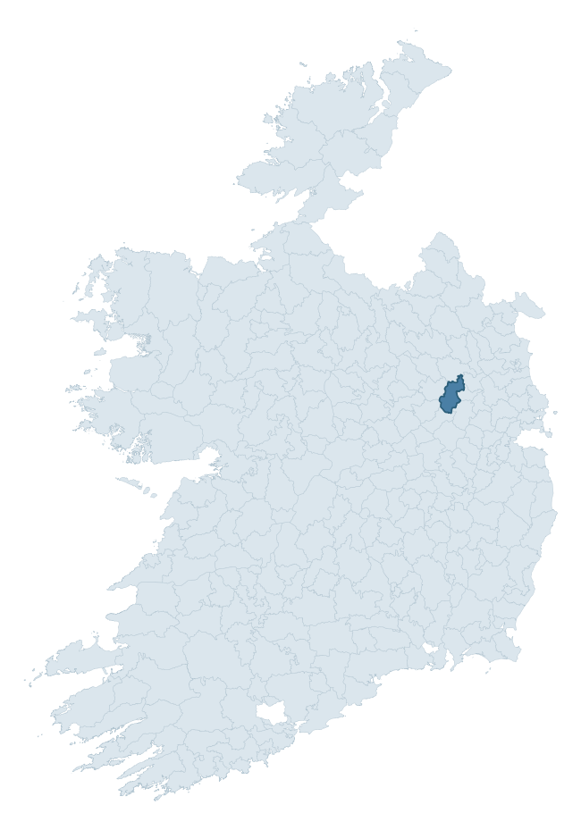
Where this barony sits in the Republic of Ireland
Geology and preservation
Bedrock geology shapes the landscape long before any settlement begins — controlling soil drainage, agricultural potential, the survival of upstanding monuments, and the preservation of buried archaeology. The figures below come from the Geological Survey Ireland 1:100,000 bedrock map.
The bedrock underlying Lune is predominantly limestone (98% of the barony by area), laid down during the Carboniferous period (100% by area, around 359 to 299 million years ago). Limestone is the most heritage-rich bedrock in Ireland. It supports fertile, well-drained soils that favoured dense Early Medieval settlement and Norman manorial agriculture, and it weathers into karst features — sinkholes, caves, swallow holes, and souterrains — that frequently carry archaeology. Where peat overlies limestone, organic preservation can be exceptional. The single largest mapped unit is the Lucan Formation (80% of the barony's bedrock). With only 2 distinct rock types mapped, the barony is geologically uniform compared to the rest of the Republic (17th percentile for diversity) — a single coherent bedrock landscape.
Rock type composition
Largest mapped unit: Lucan Formation (80% of the barony)
Placename evidence
Logainm records 19 heritage-diagnostic placenames for Lune, drawn from townland and civil-parish names across the barony. The dominant stratum is pre-Christian and Early Medieval defensive — ráth-, lios-, dún-, and caiseal-prefixed names that mark Iron Age and early historic settlement. The leading diagnostic roots are ráth- (9 — earthen ringfort), cill- (7 — church), and dún- (1 — hilltop fort or promontory fort). This is below the ROI average of 30.7 heritage placenames per barony, suggesting either lighter survey coverage or a townland-naming tradition that draws more on generic landscape vocabulary. The presence of multiple heritage strata side by side indicates layered occupation of the landscape across successive prehistoric and historic periods. Logainm records 89 placenames for Lune (predominantly townland names). Of these, 19 (21%) carry one of the diagnostic Gaelic roots tracked above; the remainder draw on more generic landscape vocabulary that does not encode a heritage period.
Pre-Christian / Early Medieval Defensive
| Root | Count | Meaning |
|---|---|---|
| ráth- | 9 | earthen ringfort |
| dún- | 1 | hilltop or promontory fort |
Early Christian Ecclesiastical
| Root | Count | Meaning |
|---|---|---|
| cill- | 7 | church (early) |
| gráinseach- | 1 | monastic farm / grange |
Burial, Ritual, and Norse-Contact
| Root | Count | Meaning |
|---|---|---|
| carn- | 1 | cairn |
Other baronies in Meath
About this profile
Click any section below to expand.
What is a barony?
A barony is a historic administrative unit in Ireland, broadly equivalent to an English hundred. The 280 baronies used here are from the OSi 2019 National Statutory Boundaries (generalised 20m), covering the 26 counties of the Republic of Ireland. Baronies derive from the Norman period, were formalised in the 17th century, and have not been redrawn for statistical purposes. They vary enormously in area, from compact urban baronies in Dublin to vast upland baronies in Connacht, and should not be compared by raw site count without accounting for area differences.
What counts as a site?
This profile combines three distinct heritage registers, each with its own definition of what constitutes a recordable site:
- Archaeological sites (NMS). The National Monuments Service Sites and Monuments Record (SMR) catalogues every known archaeological monument or site of archaeological interest in the Republic, from prehistoric burial mounds and ringforts to medieval churches and post-medieval defensive works. Inclusion does not require legal protection — only that the site has been identified, surveyed, and assessed as having archaeological value. A separate subset of these sites lies within a recorded protection zone, which gives them statutory protection under the National Monuments Acts.
- Listed buildings (NIAH). The National Inventory of Architectural Heritage records buildings of architectural, historical, archaeological, artistic, cultural, scientific, social, or technical interest. Each surveyed structure is appraised on a five-tier scale: International, National, Regional, Local, and Record-Only. The NIAH appraisal is informational rather than strictly statutory, but it underpins local-authority Record of Protected Structures (RPS) listings.
- Heritage placenames (Logainm). Logainm is the authoritative database of Irish placenames maintained by the Placenames Branch. This profile applies a heritage-diagnostic classifier to the Irish-language form of each townland name, flagging roots that signal defensive sites (ráth-, lios-, dún-, caiseal-, cathair-), ecclesiastical foundations (cill-, teampall-, domhnach-, mainistir-), prehistoric burial-ritual features (tuaim-, carn-, leaba-), or Norse-contact settlement (gall-). Townlands without one of these diagnostic roots are not flagged here — they may still carry historical significance, but that significance is not encoded in the name itself.
Editorial principles
The narrative sections of this profile follow several explicit principles:
- Evidential. Every claim about this barony’s heritage character is anchored in the underlying register data. Where a site count, a placename count, or a percentile rank is cited, it is computed from the source datasets at export time, not estimated.
- Comparative. Counts and metrics are reported alongside their percentile rank against the other 279 ROI baronies. A barony with 50 ringforts in absolute terms could be unusually high or unusually low depending on its size and regional context; percentile ranking removes that ambiguity.
- Transparent on limits. Where a register has known coverage gaps, survey biases, or data-quality issues that affect this barony’s figures, the profile flags them rather than presenting the numbers as definitive.
- No interpretation beyond what the data supports. The narrative does not speculate about historical events, social dynamics, or cultural meaning beyond what the recorded heritage and placename evidence directly attests.
Data caveats and limits
- NMS Sites and Monuments Record is the product of survey campaigns conducted at different intensities across different counties and decades. Some baronies have been surveyed more thoroughly than others, and absolute counts should be read in that light. Sites destroyed by development before survey are typically not represented; sites in heavily forested or upland terrain are sometimes under-recorded.
- NIAH coverage is broadly complete for the Republic of Ireland but the survey was conducted on a rolling county-by-county basis, and the most recent appraisal date varies. Buildings demolished or substantially altered after their original survey may still appear in the register; conversely, recent buildings of merit may not yet have been appraised.
- Logainm classification applies a deliberately conservative pattern-matching approach to the Irish-language townland forms. The classifier prioritises true positives over recall: a townland may carry a heritage signal that the classifier doesn’t recognise, particularly where the diagnostic root has been heavily anglicised or where the townland name draws on a less common term. The 60,000+ townland records and ~9,800 classified placenames give a substantial signal at barony scale, but individual townland names should be checked against Logainm directly for definitive interpretation.
- Period attribution. The chronological distribution reflects only those NMS sites that carry a recognised period attribution in the source data. Sites listed as “Unknown” period are excluded from the dated subset.
- Boundary changes. Some baronies have undergone minor boundary adjustments since their 19th-century definition; the OSi 2019 generalised boundaries used here are the current statutory definition and may differ slightly from historical maps in border areas.
- Bedrock geology is mapped at 1:100,000 scale, which means local variation within a barony — small pockets of different rock type, mineral veins, alluvium overlying bedrock — is generalised. The dominant-system and rocktype figures are area-weighted, so a barony reading “70% Carboniferous limestone” may still contain small but archaeologically important pockets of older or younger rock. Around 3% of GSI polygons do not match the lexicon and contribute no rocktype or system attribution.
Data sources
- National Monuments Service — Sites and Monuments Record (SMR) https://data.gov.ie/dataset/national-monuments-service-archaeological-survey-of-ireland
- National Inventory of Architectural Heritage (NIAH) https://data.gov.ie/dataset/national-inventory-of-architectural-heritage-niah-national-dataset
- Logainm — Placenames Database of Ireland https://www.logainm.ie/
- Ordnance Survey Ireland — National Statutory Barony Boundaries 2019 https://data-osi.opendata.arcgis.com/
- EURODEM — European Digital Elevation Model https://www.mapsforeurope.org/datasets/euro-dem
- ESA WorldCover https://esa-worldcover.org/en
- Geological Survey Ireland — 1:100,000 Bedrock Geology https://www.gsi.ie/en-ie/data-and-maps/Pages/Bedrock.aspx
Explore more: Search any of the 280 ROI baronies, browse by historical province, or read the methodology and data sources for the full Republic of Ireland Heritage Tool.