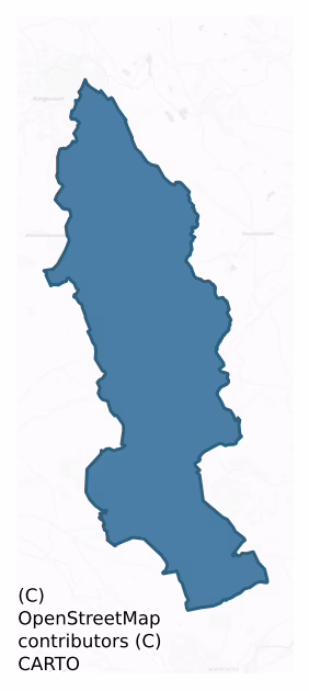
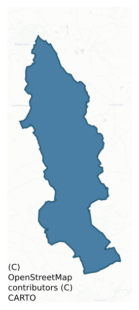
Morgallion is a barony of County Meath, in the historical province of Leinster (Irish: Machaire Gaileang), covering 127 km² of land. The barony records 245 NMS archaeological sites and 38 NIAH listed buildings, placing it at around the 52nd percentile among 280 ROI baronies for sites per km². This means it is in the upper half of all baronies for sites per km². Dated archaeological evidence runs from the Mesolithic through to the Modern, spanning 9 of 9 archaeological periods, placing the barony in the 91st percentile among 280 ROI baronies for chronological depth. This means it is in the top tenth of all baronies for chronological depth. The largest dated subset of recorded sites dates to the Early Medieval.
Heritage at a glance
Percentile rankings throughout this profile compare each barony only against the other 279 Republic of Ireland baronies.
The recorded heritage of Morgallion
The National Monuments Service Sites and Monuments Record (SMR) is the statutory inventory of archaeological sites for the Republic of Ireland, maintained by the Department of Tourism, Culture, Arts, Gaeltacht, Sport and Media. Sites recorded here include earthworks, ringforts, megalithic tombs, ecclesiastical remains, and post-medieval features; not every record is legally protected, but each is registered as a monument of archaeological interest.
The National Monuments Service records 245 archaeological sites in Morgallion, putting it at the 52nd percentile among 280 ROI baronies for sites per km². This means it is in the upper half of all baronies for sites per km². Protection coverage is near-universal — 244 sites (100%) fall within a recorded monument protection zone, indicating an extensively surveyed landscape. The dominant category is defensive sites — ringforts, enclosures, hillforts, and stone forts (130 sites, 53% of the record). Ringfort – rath is the most prevalent type, making up 33% of the barony's recorded sites (82 records) — well above the ROI average of 20% across all baronies where this type occurs. Ringfort – rath is an earthen ringfort enclosed by a bank and external ditch — the most common Early Medieval farmstead, broadly dated 500–1000 AD. Other significant types include Enclosure (18) and Souterrain (13). Enclosure is a banked or ditched feature of uncertain type, used as a catch-all where the original function cannot be determined from surface evidence; Souterrain is an underground stone-built passage and chamber, generally Early Medieval and often associated with ringforts as a defensive or storage feature. Across the barony's 127 km², this gives a recorded density of 1.92 sites per km².
Most common monument types
Hover or tap a monument type to see its definition.
| Type | Count |
|---|---|
| Ringfort – rath an earthen ringfort enclosed by a bank and external ditch — the most common Early Medieval farmstead, broadly dated 500–1000 AD | 82 |
| Enclosure a banked or ditched feature of uncertain type, used as a catch-all where the original function cannot be determined from surface evidence | 18 |
| Souterrain an underground stone-built passage and chamber, generally Early Medieval and often associated with ringforts as a defensive or storage feature | 13 |
| Hut site a low stone or earthen foundation enclosing a small circular or oval area, generally interpreted as a former dwelling, of any date from prehistory to the medieval period | 9 |
| Church a building used for public Christian worship, of any date from c. 500 AD onwards | 8 |
| Graveyard a burial area associated with a church, in use from the medieval period onwards | 7 |
Chronological distribution
The dated archaeological record for Morgallion spans from the Mesolithic through to the Modern, with activity attested across 9 of 9 archaeological periods. This places Morgallion in the top 9% of ROI baronies for chronological depth — few baronies record evidence across as many distinct archaeological periods. Every period from earliest to latest is represented in the record — an unbroken sequence of dated activity across the full chronological span. Activity concentrates most heavily in the Early Medieval (115 sites, 59% of dated material), with the Iron Age forming a secondary peak (35 sites, 18%). A further 50 recorded sites (20% of the overall NMS register for the barony) carry no period attribution — appearing as 'Unknown' in the bar chart below. This typically reflects either records that pre-date the standardised period vocabulary or sites awaiting specialist dating review, rather than a genuine absence of chronological evidence.
Sample of recorded monuments
Show 25 sample monuments (of 245 total)
A representative sample of 25 recorded monuments drawn from the barony’s 245 total NMS entries. Sites within a recorded monument protection zone and rarer site types are prioritised so the list shows a meaningful cross-section rather than only the most common type. Each entry shows the official Sites and Monuments Record reference number and the description published by the National Monuments Service.
Castle – unclassified
Lord Gormanstown owned 500 acres at Cloghreagh in 1640, including the ‘old Brocken Castle’ (Simington 1940, 335), which is also depicted on the Down Survey (1656-8) parish map of Nobber. It is situated on a low NW-SE…
Lord Gormanstown owned 500 acres at Cloghreagh in 1640, including the ‘old Brocken Castle’ (Simington 1940, 335), which is also depicted on the Down Survey (1656-8) parish map of Nobber. It is situated on a low NW-SE ridge. The E corner of a large, presumably square building, probably a tower house, survives to a height of c. 5m. The SE (ext. L 6m) and NE (ext. L 5.2m; T 1.2m) walls are featureless but both are rebated to take the first floor. A N-S lane just to its W truncates this building which stands at the E angle of a rectangular enclosure or bawn (dims c. 30m NW-SE; c. 23m NE-SW) defined by a ditch or fosse (Wth 4-6m; D 0.6-1m) on all sides except the SE where an 18th century building occupies its location. Just NE this building inside the bawn are the parallel grass-covered foundations of a house (int. dims 9.4m NE-SW; 3m NW-SE).
The above description is derived from the published 'Archaeological Inventory of County Meath' (Dublin: Stationery Office, 1987). In certain instances the entries have been revised and updated in the light of recent research.
Date of revision: 3 June 2016
Kiln
Situated on an E-facing slope c. 30m S of a W-E stream. A stone-lined pit was discovered in digging a trench during 1957. Only about a quarter of the bowl remained, and it is described as a ‘stone structure roughly two…
Situated on an E-facing slope c. 30m S of a W-E stream. A stone-lined pit was discovered in digging a trench during 1957. Only about a quarter of the bowl remained, and it is described as a ‘stone structure roughly two feet wide at the base, four feet wide at the mouth, and five feet in depth (c. 0.6m; 1.2m; 1.5m) – a kind of round bowl constructed in glacial silt. No flue was found’ (Moore 1958).
The above description is derived from the published 'Archaeological Inventory of County Meath' (Dublin: Stationery Office, 1987). In certain instances the entries have been revised and updated in the light of recent research.
Compiled by: Michael Moore
Date of revision: 5 September 2018
Historic town
Situated on a slight NE-SW spur with the ground falling away slightly to the NW and SE and to the SW where a diverted channel of the River Dee runs NNW-SSE just to the E of Moynagh Lough and re-connects with the…
Situated on a slight NE-SW spur with the ground falling away slightly to the NW and SE and to the SW where a diverted channel of the River Dee runs NNW-SSE just to the E of Moynagh Lough and re-connects with the original channel c. 1km to the SE of Nobber. This channel had been established by 1698 and is depicted on a Gormanston map (21 F 145) in NLI. The NW-SE cutting for the Kingscourt railway line was excavated through the tip of the spur, isolating it from the medieval church and the present village.
If there was not already an existing settlement around the early church (ME005-071001-) a borough was probably established by Gilbert d’Angulo who also built the motte (ME005-070—-), which is N of the church on its own hill. The d’Angellos fell out of favour with Prince John, who had been restored as Lord of Ireland in 1196, and the manor of Nobber returned to the younger Hugh de Lacy c. 1200. The borough is first mentioned in 1227 when the burgesses were granted four carucatees (townlands) and an annual fair of 14 days in November. Mills are mentioned in 1211-12, while burgage plots and a charter were referred to in 1290. Besides the annual fair a weekly market had also been established by 1467. The town was ruled by a Provost and had its own court and stocks. On the death of Hugh de Lacy in 1243 the manor of Nobber passed by marriage to the Fitzgerald family who held it into the fourteenth century when it passed by marriage through the le Botiller and de Londres fa…
Ceremonial enclosure
Situated on the summit of a N-S ridge. When first described in 1969 (SMR file) it presented as a large ring-barrow consisting of a circular grass-covered area (diam. 40m N-S; 39.5m E-W) separated by a fosse (Wth of top…
Situated on the summit of a N-S ridge. When first described in 1969 (SMR file) it presented as a large ring-barrow consisting of a circular grass-covered area (diam. 40m N-S; 39.5m E-W) separated by a fosse (Wth of top 6.5-7.5m; Wth of base 2-2.5m; int. D 0.6-0.7m; ext. D 0.8-0.9m) from an outer earthen bank (Wth of base 6.5-8m; ext. H 0.5m at NW to 1.2m at SE). A NNW-SSE scarp (H 0.4m) sloping down to the W that proved to be early medieval crossed the interior and extended across the fosse at N. There was an entrance (Wth of base 1.7m) in the outer bank at SSE.
The earthwork was damaged in 1988 and a subsequent excavation (E000510) in the years 1989-1993 revealed a complex of features including a possible Neolithic house (ME011-040003-), Late Bronze Age (ME011-040005-) and Early Iron Age (ME011-040007-) hut-sites, the fosse of a Neolithic enclosure (ME011-040002-), a Late Bronze Age palisaded enclosure (ME011-040004-), two timber circles (ME011-040001-; ME011-040006-), and a ritual burial (ME011-040008-). The excavation demonstrated that there was a causeway inside the entrance gap which had a metalled surface in the outer bank of the final monument (Newman 1993c, 14-15). The N-S surface scarp had a gully at its W base, and it appears to have overlain the circular Iron Age hut-site. A sample from the gully provided a C14 date of AD 380-670, but there appears to have been no further structural development of the monument after this (ibid. 18)
The above description is…
Castle – motte
Located towards the bottom of a W-facing slope with the headwaters of a small S-N stream c. 150m to the W. This was described in 1968 (SMR file) as a raised, subcircular and grass-covered area with trees (dims of top…
Located towards the bottom of a W-facing slope with the headwaters of a small S-N stream c. 150m to the W. This was described in 1968 (SMR file) as a raised, subcircular and grass-covered area with trees (dims of top 17m N-S; 15m E-W; dim of base 32m N-S; H 1.7m at N to 2.3m at S) defined by scarps with traces of a fosse (Wth of top 6m; ext. D 0.2m) at N. There was a fairly modern quarry in the defining scarp at N and another grass-covered rectangular one on the scarp at S. There was no visible entrance. It had been removed by 1986.
The above description is derived from the published 'Archaeological Inventory of County Meath' (Dublin: Stationery Office, 1987). In certain instances the entries have been revised and updated in the light of recent research.
Compiled by: Michael Moore
Date of upload: 10 July 2007
Amended: 2 August 2022
Ritual site – holy well
Located at the crest of a SE-facing slope. This is annotated as ‘Trinity Well’ in gothic script on the 1836 and 1908 editions of the OS 6-inch map, but nothing is known about it. From the aerial imagery it would appear…
Located at the crest of a SE-facing slope. This is annotated as ‘Trinity Well’ in gothic script on the 1836 and 1908 editions of the OS 6-inch map, but nothing is known about it. From the aerial imagery it would appear to be no longer extant.
Compiled by: Michael Moore
Date of upload: 3 August 2022
Castle – tower house
Richard Whyte of Clogell was a juror at an inquisition into the manor of Kilmainhambeg in 1541 (White 1943, 112). A castle at Clongill (10:2) in Clongill parish and Morgallion barony is depicted as a tower on the Down…
Richard Whyte of Clogell was a juror at an inquisition into the manor of Kilmainhambeg in 1541 (White 1943, 112). A castle at Clongill (10:2) in Clongill parish and Morgallion barony is depicted as a tower on the Down Survey (1656-8) barony and parish maps (http://downsurvey.tcd.ie/). According to the Civil Survey (1654-6) Lord Barnwall, James White of Clongill, Alexander Plunkett of Gibstown, and John Proudfoot of Clongill owned 388 acres there in 1640, and on the premises was ‘a Castle and Mansion House’ (Simington 1940, 326), which was probably occupied by White, the others being mortgagees. It is situated on a level landscape with the parish church (ME017-018001-) c. 150m to the NNE.
The tower house is rectangular structure (int. dims 6.5m N-S; 5.1m E-W) with curved angles, a circular stairs tower at the SW angle and a rectangular garderobe tower at the NE angle. The original doorway, now blocked, is towards the S end of the W wall with a murder-hole over the entrance lobby but the newel stairs off the lobby to the S is blocked. There is a N-S barrel-vault with wicker centring over the ground floor, which has a window in the S wall and a blocked doorway towards the N end of the W wall, which may be secondary and allowed further access with the house (ME017-019001-) attached to the W. The first floor (int. dims 7.2m N-S; 5.7m E-W) has single windows on the E and S walls, two windows on the N wall, and a robbed fireplace on the W wall. All the windows were adapted int…
Cross – Wayside cross
This cross-base was situated on a mound at the SE side of a NE-SW public road in a gently undulating landscape. Cogan (1862-70, 2, 284) notes that it 'had been broken in twain.' The base is undecorated, roughly…
This cross-base was situated on a mound at the SE side of a NE-SW public road in a gently undulating landscape. Cogan (1862-70, 2, 284) notes that it 'had been broken in twain.' The base is undecorated, roughly rectangular and pyramidal-shaped (dims of top 0.73-0.78m; dims of base 0.8-0.87m; H 0.35m) with a small chamfer at the top and a rectangular socket (dims 0.23m x 0.2m; D 0.2m) in the centre. The mound and cross-base were disturbed in 2004 when human remains were uncovered representing at least a middle-aged male: this was dated to AD 1486-1650 (King 2010, 146-151: see ME018-001001-). A rescue excavation (Licence No. 04E1028) revealed a stony platform (c. 2m sq.) which had formed a foundation for the cross base (Murphy 2007).
The above description is derived from the published 'Archaeological Inventory of County Meath' (Dublin: Stationery Office, 1987). In this instance the entry has been changed in the light of further work.
Compiled by: Geraldine Stout, Paul Walsh
Date of upload: 20 October 2014
Enclosure – large enclosure
Situated on a fairly level low-lying landscape with a NW-SE stream c. 80m to the SW. Aerial photographs from c. 1950 (ACAP: V307/1590) and 1973 (GSAP, N 269) show a large circular vegetation mark (diam. c. 140m) within…
Situated on a fairly level low-lying landscape with a NW-SE stream c. 80m to the SW. Aerial photographs from c. 1950 (ACAP: V307/1590) and 1973 (GSAP, N 269) show a large circular vegetation mark (diam. c. 140m) within which is the vegetation mark of rectangular enclosure (dims c. 50m x c. 60m). They can also be seen on MapGenie (2013) but are likely to be meandering old stream beds and not antiquities.
The above description is derived from the published 'Archaeological Inventory of County Meath' (Dublin: Stationery Office, 1987). In certain instances the entries have been revised and updated in the light of recent research.
Compiled by: Michael Moore
Date of upload: 10 July 2007
Revised: 24 March 2023
ACAP – Air Corps Aerial Photographs. Baldonnel, Co. Dublin
GSIAP – Geological Survey of Ireland Aerial Photographs (c. 1973). Geological Survey, Beggars Bush, Haddington Rd., Dublin 4.
Barrow – mound barrow
Located at the crest of the SE-facing slope of a N-S ridge (L c. 300m). This is depicted as a small rectangular feature on the 1836 (dims c. 15m x c. 15m) and 1908 (dims c. 20m x c. 20m) editions of the OS 6-inch map.…
Located at the crest of the SE-facing slope of a N-S ridge (L c. 300m). This is depicted as a small rectangular feature on the 1836 (dims c. 15m x c. 15m) and 1908 (dims c. 20m x c. 20m) editions of the OS 6-inch map. It is a circular grass-covered mound (diam. 9.5m NE-SW; H 2.2 at NE to 2.8m at SW) with a stone revetment (H c. 1m) around its base that survives NW-NE but has probably collapsed elsewhere. The mound supports a single beech tree at the E edge.
The above description is derived from the published 'Archaeological Inventory of County Meath' (Dublin: Stationery Office, 1987). In certain instances the entries have been revised and updated in the light of recent research.
Compiled by: Michael Moore
Date of upload: 10 July 2007
Revision: 24 March 2023
Water mill – horizontal-wheeled
Located on level, low-lying ground on the NE bank of a small NW-SE tributary of a SW-NE section of the old River Dee, c. 110m from its confluence with the river. The discovery of three rotary querns suggests that there…
Located on level, low-lying ground on the NE bank of a small NW-SE tributary of a SW-NE section of the old River Dee, c. 110m from its confluence with the river. The discovery of three rotary querns suggests that there may have been a water mill on the river shortly after it exited the original Moynagh Lough, which was much more extensive originally. It would have utilised the lake as a mill-pond, but there is no visible evidence of such a mill, and its location is not precisely known. The quernstones are kept at a nearby house.
Compiled by: Michael Moore
Date of upload: 17 August, 2017
Fulacht fia
Situated in a basin that extends north from Moynagh Lough, and which at one time would have been occupied by the lake. It is now the valley of a canalised NNW-SSE section of the River Dee, which is c. 50m to the E and…
Situated in a basin that extends north from Moynagh Lough, and which at one time would have been occupied by the lake. It is now the valley of a canalised NNW-SSE section of the River Dee, which is c. 50m to the E and Moynagh Lough is c. 200m to the SSW. A low grass-covered mound (dims 7.6m N-S; c. 4m E-W; H 0.1m) is kidney-shaped curving to the W at N and S. (Corlett 1997)
Compiled by: Michael Moore
Date of upload: 27 June, 2014
Amended: 4 July, 2014
House – Neolithic
Situated on the summit of a N-S ridge. When first described in 1969 (SMR file) the earthwork presented as a large ring-barrow consisting of a circular grass-covered area (diam. 38.5m NW-SE) separated by a fosse (Wth of…
Situated on the summit of a N-S ridge. When first described in 1969 (SMR file) the earthwork presented as a large ring-barrow consisting of a circular grass-covered area (diam. 38.5m NW-SE) separated by a fosse (Wth of top 6.5m-7.5m; Wth of base 2-2.5m; int. D 0.6-0.7m; ext. D 0.8-0.9m) from an outer earthen bank (Wth of base 3-5.8m; ext. H 0.5m at NW to 1.2m at SE).
The earthwork was damaged in 1988 and a subsequent excavation (E000510) in the years 1989-1993 revealed a complex of features including a possible Neolithic house, two hut-sites, two enclosures, two timber circles, and a ritual burial. In the final 1993 season the earliest fosse uncovered (ME011-040002-) was Neolithic in date and it was partly overlain by a small subrectangular structure (Wth 2.8m), which is interpreted as a possible Neolithic house. However, no diagnostic artefacts are associated with it and the structure was truncated by an Iron Age ditch. (Newman 1993d, 21)
Compiled by: Michael Moore
Date of upload: 10 April, 2019
Furnace
The third occupation level of the crannog is constructed on a peat base and was the first major level (Phase Y) encountered when the crannog was excavated. It consists of a large (ME005-088013-) and a small…
The third occupation level of the crannog is constructed on a peat base and was the first major level (Phase Y) encountered when the crannog was excavated. It consists of a large (ME005-088013-) and a small (ME005-088012-) hut, and a furnace. The furnace, contemporary with the large round-house was just to its W. It was a bowl-shaped depression (diam. 0.45m) lined with calcareous mud inside which was ring of charcoal around the bloom. Associated finds included charcoal spreads, a crucible, fragments of moulds and a lead ingot. (Bradley 1982-3, 28; 1991, 16; O’Sullivan 1998, 107-08)
Compiled by: Michael Moore
Date of upload: 6 September 2018
House – 16th/17th century
This is probably the ‘Mansion’ listed at Clongill in the Civil Survey (1654-6) (Simington 1940, 326). It is situated on a level landscape and attached to the W of the tower house (ME017-019001-), with the parish church…
This is probably the ‘Mansion’ listed at Clongill in the Civil Survey (1654-6) (Simington 1940, 326). It is situated on a level landscape and attached to the W of the tower house (ME017-019001-), with the parish church (ME017-018001-) c. 150m to the NNE. This is an oblong structure (ext. dims 18.5m E-W; c. 7.3m N-S) of two storeys but much of the walls are obscured with ivy. Nevertheless, it has very few architectural features. At the ground floor there are only two large Georgian-style openings towards the E end of the S wall and one in the N wall, which also has a doorway towards the E end. There is a wide, round-arched opening (Wth 3.1m) towards the W end of the S wall that is probably not original. There is a large destroyed fireplace in the W wall with an oven attached. There is also a circular stairs tower (int. diam. 2m) at the SW angle, but the stairs must have been of wood. The S wall is recessed for first floor, but the N wall does not survive, and the only architectural features are two large window openings towards the E end of the S wall and a robbed fireplace in the S wall. The house occupies much of the S edge of a rectangular enclosure (dims c. 30m ENE-WSW; c. 20m NNW-SSE) defined by masonry walls that could have constituted a bawn, which is more likely to be associated with the house than the tower house.
The above description is derived from the published 'Archaeological Inventory of County Meath' (Dublin: Stationery Office, 1987). In certain instances…
Architectural fragment
Six fragments of worked stone (a door jamb, a window head, a moulded arch stone and three other fragments) all of which must have been part of the Late Med Church. Some are now in use as head stones around the graveyard…
Six fragments of worked stone (a door jamb, a window head, a moulded arch stone and three other fragments) all of which must have been part of the Late Med Church. Some are now in use as head stones around the graveyard or tucked under a table tomb close to the north wall of the graveyard. One of these pieces has recently been identified by Gary Dempsey as part of a churchyard cross (ME005-071021-). (King 2007, 58-9)
Compiled by: Michael Moore
Date of revised upload: 1 September, 2017
Stone head
A stone head, re-used from the medieval church, is built high into the west end of the south wall of the 18th century church. (King 2007, 41)
Compiled by: Michael Moore
Date of upload; 10 July, 2014
Passage tomb art
A stone (dims 0.55m x 0.55m; T 0.15m) that had been in a drain was used in a stile. One surface has incised chevron touching a straight line at two points with two short lines parallel with lines of the chevron. (Ó…
A stone (dims 0.55m x 0.55m; T 0.15m) that had been in a drain was used in a stile. One surface has incised chevron touching a straight line at two points with two short lines parallel with lines of the chevron. (Ó Broin 2000; Eogan 2011, 14)
See attached line drawing taken from O'Broin 2000, Fig. 2
Compiled by: Michael Moore
Date of upload: 3 March, 2017
Cross – Churchyard cross
A small fragment of a churchyard cross (dims 0.37m x 0.21m; H 0.13m plus) with two rounded socket-holes in its upper surface has been identified by Gary Dempsey as a fragment of a churchyard cross, similar to that at…
A small fragment of a churchyard cross (dims 0.37m x 0.21m; H 0.13m plus) with two rounded socket-holes in its upper surface has been identified by Gary Dempsey as a fragment of a churchyard cross, similar to that at Crucietown (ME005-094004-). The piece is from close to the base of the cross and on one side the two crossed feet of the Saviour with a diamond-shaped nail-head can be seen in false relief. It is probably late sixteenth or early seventeenth century in date.
https://skfb.ly/6ssM9
Compiled by: Michael Moore
Date of upload: 1 September, 2017
Flat cemetery
Located on a shelf just off the summit at SW of a prominent natural knoll of limestone outcrop (dims of base c. 250m N-S; c. 170m N-S; dims of top c. 90m N-S; c. 50m E-W; max. H c. 10m at NE to c. 30m at SW).…
Located on a shelf just off the summit at SW of a prominent natural knoll of limestone outcrop (dims of base c. 250m N-S; c. 170m N-S; dims of top c. 90m N-S; c. 50m E-W; max. H c. 10m at NE to c. 30m at SW). Archaeological testing (05E0526) uncovered four small pits (diam. 0.12-0.25m) filled with a charcoal-rich clay that had burnt stone and bone inclusions. They were cut into a band of orange-brown subsoil (L c. 12m) amongst the rock outcrop nodes. A larger pit (diam. 1.3m) was nearby and three other pits (diam. 0.1-0.12m) were found in another trench c. 1.5m to the SW. About 20m to the NE and closer to the summit two pits (diam. 0.5m; 0.6m) are recorded, one of which produced a sherd of poorly made, crumbly pottery that is probably prehistoric. A trench on the W side of the knoll produce evidence of three linear features including a probable ditch (Wth of top 3.4m) aligned E-W and apparently extending down a steep slope. (O’Carroll 2005)
Compiled by: Michael Moore
Date of upload; 26 February 2021
O’Carroll, E. 2005 Archaeological Assessment at Cregg Townland, Co. Meath. Licence: 05E0526. Unpublished report, The Archaeology Company
Standing stone
Situated towards the SE end of an NW-SE drumlin ridge. A stone with a rectangular cross-section (dims 0.5-0.7m NW-SE; 0.65-0.7m NE-SW) has a blunt pointed top (H 1.2m) and is roughly aligned NW-SE.
The above…
Situated towards the SE end of an NW-SE drumlin ridge. A stone with a rectangular cross-section (dims 0.5-0.7m NW-SE; 0.65-0.7m NE-SW) has a blunt pointed top (H 1.2m) and is roughly aligned NW-SE.
The above description is derived from the published 'Archaeological Inventory of County Meath' (Dublin: Stationery Office, 1987). In certain instances the entries have been revised and updated in the light of recent research.
Compiled by: Michael Moore
Date of upload/revision: 31 August 2018
Castle – motte and bailey
Situated on a hillock c. 250m NW of the early medieval church of Nobber (ME005-071001-) and the N end of the village, overlooking the canalised River Dee c. 100m to the NW and its new course c. 250m to the SW. Hugh de…
Situated on a hillock c. 250m NW of the early medieval church of Nobber (ME005-071001-) and the N end of the village, overlooking the canalised River Dee c. 100m to the NW and its new course c. 250m to the SW. Hugh de Lacy granted Gaileanga Mór, the barony of Morgallion, to Gilbert de Angelo before 1186, and Gilbert made Nobber the caput or centre of his manor close to an existing church. After Gilbert was outlawed in 1196 Morgallion reverted to Walter de Lacy who granted it to his half-brother Hugh. This Hugh held John de Courcy, the Earl of Ulster, captive at Nobber in 1201 (Orpen 1911-20, 2, 189-90), and Hugh managed to retain it from 1210 until his death in 1243. In 1227 the burgesses of Nobber received four carucates (townlands) in return for building a causeway between the motte and the town. Hugh left the manor of Nobber to his daughter Matilda who was marred to David FitzWilliam, one of the FitzGerald family and the baron of Nass. The FitzGeralds held Nobber into the fourteenth century, when it passed by marriage through the le Botiller and de Londres families until in 1386 it passed to Christopher Preston, the second Lord Gormanston, and it remained with the Preston family into the nineteenth century. In the Civil Survey (1654) Lord Gormanston held Nobber and its hamlet, Kilbryde and Sallersook (Simington 1940. 333). (Bradley and King 1985, 118; Mount 2008)
The motte is a grass-covered earthen mound with a concave top (diam. of top 13m NNW-SSE; D of top 1-1.3m…
Moated site
Situated at the tip of a NW-SE spur. It is depicted as a rectangular enclosure described as ‘Lisnaclogh’ – Stone Lios – on the 1836 and 1908 editions of the OS 6-inch map. It was removed c. 1964 and is described locally…
Situated at the tip of a NW-SE spur. It is depicted as a rectangular enclosure described as ‘Lisnaclogh’ – Stone Lios – on the 1836 and 1908 editions of the OS 6-inch map. It was removed c. 1964 and is described locally as having deep ditches. The outline of a rectangular grass-covered area (dims 63m NE-SW; 56m NW-SE) defined by field banks at NW and SW and light (at SE: Wth 5.1m) and outer lush (at SE: Wth 2m) grass-growth on the line of the straight banks and outer fosses at NE and SE were visible in 1968.
The above description is derived from the published 'Archaeological Inventory of County Meath' (Dublin: Stationery Office, 1987). In certain instances the entries have been revised and updated in the light of recent research.
Compiled by: Michael Moore
Date of revision: 22 October 2018
Castle – motte and bailey
Located in a slight SSE-NNW valley, and c. 700m WSW of the early monastery (ME012-016—-) that became the parish church of Castletown parish. The barony of Morgallion was granted by Hugh de Lacy after 1172 to Gilbert…
Located in a slight SSE-NNW valley, and c. 700m WSW of the early monastery (ME012-016—-) that became the parish church of Castletown parish. The barony of Morgallion was granted by Hugh de Lacy after 1172 to Gilbert de Nangle, and as this was the caput or centre of the fief the motte may have been erected shortly after the grant.
This is a flat-topped, subcircular earthen mound (dims of top 28.5m NW-SE; 23.6m NE-SW; diam. of base 50m NW-SE; H 7m at NW to 7.6m at SE) defined by wide fosse (Wth of top c. 10m; Wth of base 2.5-3m; ext. D 2.1m at NW to 3.3m at SE) with an external bank that is most massive (Wth of base 11m; ext. H 2.5m) SE-S (max. ext. dims 80m NW-SE). There is a gap in the outer bank at ENE and there are slight traces of a bank at the summit of the mound. The mound is grass-covered with some scrub and it has some mature deciduous trees. The outer bank extends into a crescent-shaped berm (Wth of top 9m) defined by a scarp (H 2m) with a field bank and outer ditch beyond W-N, which could have served as a bailey. A grass-covered rectangular area (dims c. 60m NE-SW; c. 50m NW-SE) extends S from the motte, bounded by a scarp at NW and traces of a fosse at S that merges into the hillslope at E. This bailey is cut by a defunct N-S railway at W.
The above description is derived from the published 'Archaeological Inventory of County Meath' (Dublin: Stationery Office, 1987). In certain instances the entries have been revised and updated in the light of recent re…
Ringfort – rath
Situated on the tip of a short SE-NW spur. In 1968 this was described (SMR file) as a circular grass and rush-covered area (diam. 35.4m N-S; 35.3m E-W) defined by an overgrown earthen bank (Wth of base 4m at N to 8m at…
Situated on the tip of a short SE-NW spur. In 1968 this was described (SMR file) as a circular grass and rush-covered area (diam. 35.4m N-S; 35.3m E-W) defined by an overgrown earthen bank (Wth of base 4m at N to 8m at S; int. H 0.6-0.9m; ext. H 1.1-1.4) and an outer fosse (at N: Wth of top 5m; Wth of base 1.6m; ext. D 0.4m), with a slight outer bank (Wth of base 5.8m; ext. H 0.1m) NNW-NE. The original entrance (Wth of base 1.1m) is at SE.
The following description is derived from the published 'Archaeological Inventory of County Meath' (Dublin: Stationery Office, 1987). In certain instances the entries have been revised and updated in the light of recent research.
Compiled by: Michael Moore
Date of revision: 31 August 2018
Amended: 14 December 2022
Listed buildings
The National Inventory of Architectural Heritage (NIAH) is a state survey appraising buildings of architectural, historical, archaeological, artistic, cultural, scientific, social, or technical interest. Each surveyed structure receives a rating from International (the highest, for buildings of European importance) through National, Regional, Local, and Record-Only.
The NIAH records only 38 listed buildings in Morgallion, the 18th percentile across ROI baronies — a relatively thin architectural record. All recorded buildings carry Regional or lower grading; the barony does not contain any structures appraised as being of National or International architectural importance. Construction dates concentrate most heavily in the Victorian (1830-1900) period.
Terrain and environment
Mean elevation across the barony is 76m — the 37th percentile among 280 ROI baronies for elevation. This means it is in the lower half of all baronies for elevation. Elevation matters for heritage because higher-altitude baronies typically favour defensive monuments — ringforts and hilltop forts placed on prominent ground — while lowland baronies are more likely to carry the dense settlement and church networks of intensive agricultural landscapes. Mean slope is 3.6° — the 49th percentile among 280 ROI baronies for slope. This means it is in the lower half of all baronies for slope. Slope is a key control on both land use and archaeological preservation: steep ground resists ploughing and tends to preserve earthworks intact, while gentle slopes favour intensive cultivation that damages or destroys surface archaeology over time. The Topographic Wetness Index averages 10.7, the 44th percentile among 280 ROI baronies for wetness. This means it is in the lower half of all baronies for wetness. Drainage matters for heritage because poorly-drained ground preserves organic archaeology (wooden trackways, leather, textiles, and on rare occasions human remains) far better than free-draining soil; well-drained ground favours arable use but destroys organic material rapidly. The land-cover mosaic combines improved grassland (73%), arable farmland (14%), and woodland (12%), giving a mixed agricultural and semi-natural landscape.
Terrain measurements
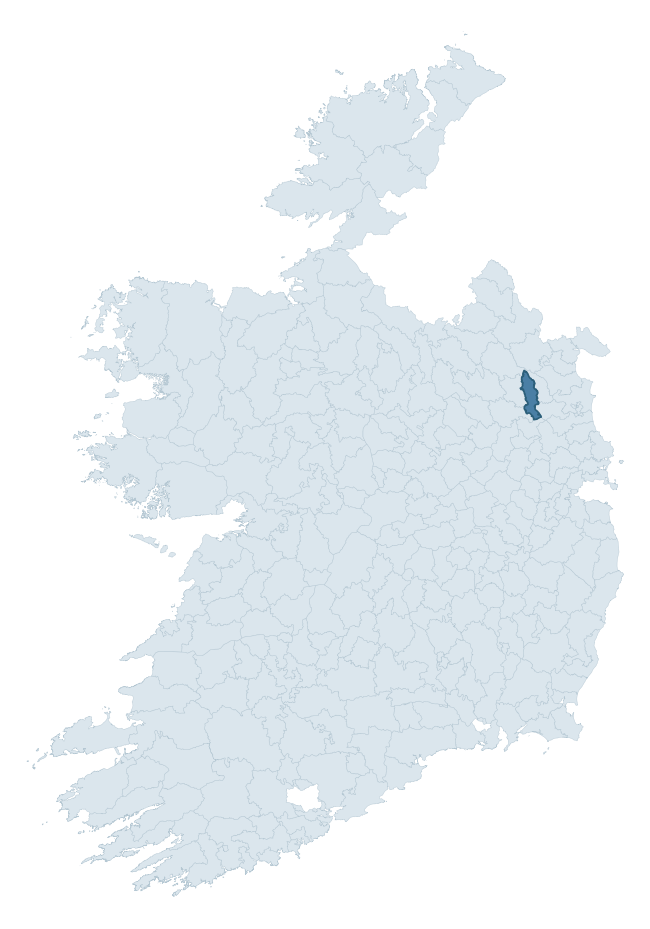
Where this barony sits in the Republic of Ireland
Geology and preservation
Bedrock geology shapes the landscape long before any settlement begins — controlling soil drainage, agricultural potential, the survival of upstanding monuments, and the preservation of buried archaeology. The figures below come from the Geological Survey Ireland 1:100,000 bedrock map.
The bedrock underlying Morgallion is predominantly limestone (30% of the barony by area), laid down during the Carboniferous period (57% by area, around 359 to 299 million years ago). Limestone is the most heritage-rich bedrock in Ireland. It supports fertile, well-drained soils that favoured dense Early Medieval settlement and Norman manorial agriculture, and it weathers into karst features — sinkholes, caves, swallow holes, and souterrains — that frequently carry archaeology. Where peat overlies limestone, organic preservation can be exceptional. A substantial secondary geology of greywacke, mudstone (15%) and mudstone, siltstone, greywacke (13%) adds further variety to the underlying landscape. With 9 distinct rock types mapped, the barony sits in the top third of ROI baronies for geological diversity (86th percentile) — typically a sign of complex tectonic history or coastal mosaics of differing rock units.
Rock type composition
Largest mapped unit: Fingal Group (18% of the barony)
Placename evidence
Logainm records 13 heritage-diagnostic placenames for Morgallion, a modest sample drawn predominantly from the townland record. The dominant stratum is early christian ecclesiastical. The most frequent diagnostic roots are cill- (5) and ráth- (4). With a sample of this size the count should be treated as indicative rather than definitive.
Pre-Christian / Early Medieval Defensive
| Root | Count | Meaning |
|---|---|---|
| ráth- | 4 | earthen ringfort |
| dún- | 1 | hilltop or promontory fort |
Early Christian Ecclesiastical
| Root | Count | Meaning |
|---|---|---|
| cill- | 5 | church (early) |
| gráinseach- | 1 | monastic farm / grange |
Burial, Ritual, and Norse-Contact
| Root | Count | Meaning |
|---|---|---|
| carn- | 1 | cairn |
| uaimh- | 1 | cave / souterrain |
Other baronies in Meath
About this profile
Click any section below to expand.
What is a barony?
A barony is a historic administrative unit in Ireland, broadly equivalent to an English hundred. The 280 baronies used here are from the OSi 2019 National Statutory Boundaries (generalised 20m), covering the 26 counties of the Republic of Ireland. Baronies derive from the Norman period, were formalised in the 17th century, and have not been redrawn for statistical purposes. They vary enormously in area, from compact urban baronies in Dublin to vast upland baronies in Connacht, and should not be compared by raw site count without accounting for area differences.
What counts as a site?
This profile combines three distinct heritage registers, each with its own definition of what constitutes a recordable site:
- Archaeological sites (NMS). The National Monuments Service Sites and Monuments Record (SMR) catalogues every known archaeological monument or site of archaeological interest in the Republic, from prehistoric burial mounds and ringforts to medieval churches and post-medieval defensive works. Inclusion does not require legal protection — only that the site has been identified, surveyed, and assessed as having archaeological value. A separate subset of these sites lies within a recorded protection zone, which gives them statutory protection under the National Monuments Acts.
- Listed buildings (NIAH). The National Inventory of Architectural Heritage records buildings of architectural, historical, archaeological, artistic, cultural, scientific, social, or technical interest. Each surveyed structure is appraised on a five-tier scale: International, National, Regional, Local, and Record-Only. The NIAH appraisal is informational rather than strictly statutory, but it underpins local-authority Record of Protected Structures (RPS) listings.
- Heritage placenames (Logainm). Logainm is the authoritative database of Irish placenames maintained by the Placenames Branch. This profile applies a heritage-diagnostic classifier to the Irish-language form of each townland name, flagging roots that signal defensive sites (ráth-, lios-, dún-, caiseal-, cathair-), ecclesiastical foundations (cill-, teampall-, domhnach-, mainistir-), prehistoric burial-ritual features (tuaim-, carn-, leaba-), or Norse-contact settlement (gall-). Townlands without one of these diagnostic roots are not flagged here — they may still carry historical significance, but that significance is not encoded in the name itself.
Editorial principles
The narrative sections of this profile follow several explicit principles:
- Evidential. Every claim about this barony’s heritage character is anchored in the underlying register data. Where a site count, a placename count, or a percentile rank is cited, it is computed from the source datasets at export time, not estimated.
- Comparative. Counts and metrics are reported alongside their percentile rank against the other 279 ROI baronies. A barony with 50 ringforts in absolute terms could be unusually high or unusually low depending on its size and regional context; percentile ranking removes that ambiguity.
- Transparent on limits. Where a register has known coverage gaps, survey biases, or data-quality issues that affect this barony’s figures, the profile flags them rather than presenting the numbers as definitive.
- No interpretation beyond what the data supports. The narrative does not speculate about historical events, social dynamics, or cultural meaning beyond what the recorded heritage and placename evidence directly attests.
Data caveats and limits
- NMS Sites and Monuments Record is the product of survey campaigns conducted at different intensities across different counties and decades. Some baronies have been surveyed more thoroughly than others, and absolute counts should be read in that light. Sites destroyed by development before survey are typically not represented; sites in heavily forested or upland terrain are sometimes under-recorded.
- NIAH coverage is broadly complete for the Republic of Ireland but the survey was conducted on a rolling county-by-county basis, and the most recent appraisal date varies. Buildings demolished or substantially altered after their original survey may still appear in the register; conversely, recent buildings of merit may not yet have been appraised.
- Logainm classification applies a deliberately conservative pattern-matching approach to the Irish-language townland forms. The classifier prioritises true positives over recall: a townland may carry a heritage signal that the classifier doesn’t recognise, particularly where the diagnostic root has been heavily anglicised or where the townland name draws on a less common term. The 60,000+ townland records and ~9,800 classified placenames give a substantial signal at barony scale, but individual townland names should be checked against Logainm directly for definitive interpretation.
- Period attribution. The chronological distribution reflects only those NMS sites that carry a recognised period attribution in the source data. Sites listed as “Unknown” period are excluded from the dated subset.
- Boundary changes. Some baronies have undergone minor boundary adjustments since their 19th-century definition; the OSi 2019 generalised boundaries used here are the current statutory definition and may differ slightly from historical maps in border areas.
- Bedrock geology is mapped at 1:100,000 scale, which means local variation within a barony — small pockets of different rock type, mineral veins, alluvium overlying bedrock — is generalised. The dominant-system and rocktype figures are area-weighted, so a barony reading “70% Carboniferous limestone” may still contain small but archaeologically important pockets of older or younger rock. Around 3% of GSI polygons do not match the lexicon and contribute no rocktype or system attribution.
Data sources
- National Monuments Service — Sites and Monuments Record (SMR) https://data.gov.ie/dataset/national-monuments-service-archaeological-survey-of-ireland
- National Inventory of Architectural Heritage (NIAH) https://data.gov.ie/dataset/national-inventory-of-architectural-heritage-niah-national-dataset
- Logainm — Placenames Database of Ireland https://www.logainm.ie/
- Ordnance Survey Ireland — National Statutory Barony Boundaries 2019 https://data-osi.opendata.arcgis.com/
- EURODEM — European Digital Elevation Model https://www.mapsforeurope.org/datasets/euro-dem
- ESA WorldCover https://esa-worldcover.org/en
- Geological Survey Ireland — 1:100,000 Bedrock Geology https://www.gsi.ie/en-ie/data-and-maps/Pages/Bedrock.aspx
Explore more: Search any of the 280 ROI baronies, browse by historical province, or read the methodology and data sources for the full Republic of Ireland Heritage Tool.