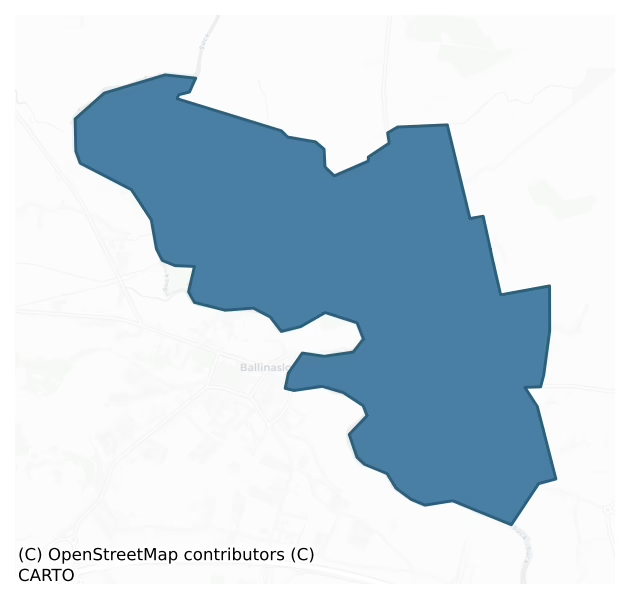
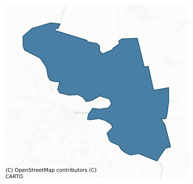
Moycarn is a barony of County Galway, in the historical province of Connacht (Irish: Maigh Charnáin), covering 6.7 km² of land. The barony records 27 NMS archaeological sites and 20 NIAH listed buildings, placing it at around the 92nd percentile among 280 ROI baronies for sites per km². This means it is in the top tenth of all baronies for sites per km². Dated archaeological evidence runs from the Iron Age through to the Post Medieval, spanning 4 of 9 archaeological periods, placing the barony in the 5th percentile among 280 ROI baronies for chronological depth. This means it is in the bottom tenth of all baronies for chronological depth. The largest dated subset of recorded sites dates to the Early Medieval.
Heritage at a glance
Percentile rankings throughout this profile compare each barony only against the other 279 Republic of Ireland baronies.
The recorded heritage of Moycarn
The National Monuments Service Sites and Monuments Record (SMR) is the statutory inventory of archaeological sites for the Republic of Ireland, maintained by the Department of Tourism, Culture, Arts, Gaeltacht, Sport and Media. Sites recorded here include earthworks, ringforts, megalithic tombs, ecclesiastical remains, and post-medieval features; not every record is legally protected, but each is registered as a monument of archaeological interest.
The National Monuments Service records 27 archaeological sites in Moycarn, putting it at the 92nd percentile among 280 ROI baronies for sites per km². This means it is in the top tenth of all baronies for sites per km². Of these, 21 (78%) fall within a recorded monument protection zone. The record is dominated by ecclesiastical sites — churches, graveyards, and holy wells (9 sites, 33% of the total), with defensive sites forming a substantial secondary presence (9 sites, 33%). Church is the most prevalent type, making up 19% of the barony's recorded sites (5 records) — well above the ROI average of 4% across all baronies where this type occurs. Church is a building used for public Christian worship, of any date from c. 500 AD onwards. Other significant types include Enclosure (4) and Ringfort – unclassified (3). Enclosure is a banked or ditched feature of uncertain type, used as a catch-all where the original function cannot be determined from surface evidence; Ringfort – unclassified is a circular Early Medieval settlement enclosure where surviving evidence does not allow distinction between earthen and stone forms.
Most common monument types
Hover or tap a monument type to see its definition.
| Type | Count |
|---|---|
| Church a building used for public Christian worship, of any date from c. 500 AD onwards | 5 |
| Enclosure a banked or ditched feature of uncertain type, used as a catch-all where the original function cannot be determined from surface evidence | 4 |
| Ringfort – unclassified a circular Early Medieval settlement enclosure where surviving evidence does not allow distinction between earthen and stone forms | 3 |
| Graveyard a burial area associated with a church, in use from the medieval period onwards | 3 |
| Ecclesiastical enclosure a large enclosure surrounding an Early Medieval church or monastery and its associated activity areas | 1 |
| Castle – unclassified a castle whose form cannot be precisely classified, dating somewhere between the late 12th and 16th centuries | 1 |
Chronological distribution
The dated archaeological record for Moycarn spans from the Iron Age through to the Post Medieval, with activity attested across 4 of 9 archaeological periods. This is the 5th percentile across ROI baronies — a relatively narrow chronological band, with much of Irish prehistory not represented in the dated record. Every period from earliest to latest is represented in the record — an unbroken sequence of dated activity across the full chronological span. Activity concentrates most heavily in the Early Medieval (7 sites, 47% of dated material), with the Iron Age forming a secondary peak (5 sites, 33%). A further 12 recorded sites (44% of the overall NMS register for the barony) carry no period attribution — appearing as 'Unknown' in the bar chart below. This typically reflects either records that pre-date the standardised period vocabulary or sites awaiting specialist dating review, rather than a genuine absence of chronological evidence.
Sample of recorded monuments
Show 25 sample monuments (of 27 total)
A representative sample of 25 recorded monuments drawn from the barony’s 27 total NMS entries. Sites within a recorded monument protection zone and rarer site types are prioritised so the list shows a meaningful cross-section rather than only the most common type. Each entry shows the official Sites and Monuments Record reference number and the description published by the National Monuments Service.
Ecclesiastical enclosure
In flat pastureland on E bank of the River Suck just NW of Ballinasloe town. Identified by Connellan (1943a, 147) as the site of a pre-Norman ecclesiastical site called 'Tuaim Sruthra' associated with a St Raoiriu or…
In flat pastureland on E bank of the River Suck just NW of Ballinasloe town. Identified by Connellan (1943a, 147) as the site of a pre-Norman ecclesiastical site called 'Tuaim Sruthra' associated with a St Raoiriu or Raoilinn. Egan (1960, 27) notes 'traces of an early enclosure' surrounding 'Templereelane Church' (GA074-011001-). This takes the form of a slightly raised platform to N of the church. Defined by a scarp (H c. 1m max.), it appears to define N sector of a large enclosure (NNE-SSW >85m, ESE-WNW c. 50m). A small low mound is visible along its line at N, and there are also traces of a short linear bank in NW quadrant. No clear trace of its line survives to S of the church. The grassed-over foundations of a wall, almost square in plan (26.5m by 27m), surround the latter: possibly delimiting a graveyard. A gap along W side probably marks the entrance. According to local information, a 'cross' was uncovered at the site some years ago.
The above description is derived from the published 'Archaeological Inventory of County Galway Vol. II – North Galway'. Compiled by Olive Alcock, Kathy de hÓra and Paul Gosling (Dublin: Stationery Office, 1999).
Date of upload: 05 August 2010
Castle – Anglo-Norman masonry castle
Strategically located on E bank of the River Suck in Ballinasloe town, it commands an ancient crossing point (GA088-047—-). The present ruins, dating from late medieval times, possibly stand on or close to the…
Strategically located on E bank of the River Suck in Ballinasloe town, it commands an ancient crossing point (GA088-047—-). The present ruins, dating from late medieval times, possibly stand on or close to the 'castle' built by Turlough O'Conor in 1124 (Leask 1977, 6) and the 'castle of Suicin' (Egan 1960, 32-3) built by the Anglo-Normans in 1245. Egan (ibid. 1, 83) states that the present castle was built by 'Tadhg O'Kelly, chief of Hy Many' in the 14th C. In 1572, it was held by the Earl of Clanricarde but in 1579 it was taken over by the crown (Killanin and Duignan 1967, 118). What survives is a rectangular crenellated bawn wall (GA088-040002-), in fair condition (N-S 54.5m, E-W 506.m, average H 4.5m), with a wall-walk and circular turret at SW corner. A 19th-century house (GA088-040001-) and associated outhouses have been built within the interior and, as a result, no visible surface trace of the castle survives. The remains of an arched gateway, in the centre of E wall, may mark the original bawn entrance. A keystone (GA088-04003-) dated 1597, inscribed with the name 'Anthony Braklon' and now lying to E of the house, was originally situated above the gate. The bawn is very heavily overgrown with ivy and the crenellations are only evident on W and N walls. Modern doorways have been inserted in E and W ends of N wall. The turret (D 2.45m) is three storeys high. Access is gained via a rectangular doorway on ground floor. The interior is lit by two small windows: some g…
Bridge
Spanning the River Suck at Ballinasloe: this is the easternmost of a two road bridges which carry the N6 across the meandering channels of the River Suck. From its proximity to the castle (GA088-040—-) on E bank, the…
Spanning the River Suck at Ballinasloe: this is the easternmost of a two road bridges which carry the N6 across the meandering channels of the River Suck. From its proximity to the castle (GA088-040—-) on E bank, the bridge is likely to stand on or close to the ancient fording point from which Ballinasloe partly takes its name. The earliest reference to a bridge here occurs in 1579, when it is recorded that 'a bridge had been lately made at Ballinasloe over the river of Suck at our own [the Government's] charges; so the castle there shall be continued in our hands, being the common passage into Galloway' (quoted in Egan 1960, 70). This bridge still survives albeit incorporated into the wider modern road bridge. From the investigations carried out by O'Keeffe and Simington (1991, 196-9), the original late medieval bridge appears to have been composed of two separate sections. The E section, labelled 'Ballinasloe Bridge East' on 3rd ed. of OS 6-inch map (1945), stands close to the castle. Comprised of 'at least four spans' originally (ibid., 198), it was 4.25m in width. The three surviving spans are now sandwiched between a downriver extension (Wth 4.1m), dating from 1745 (ibid.), and a modern concrete upriver addition (Wth 2.3m). The W section, now labelled 'Ballinasloe Bridge' (GA088-047001-), has also been extended downriver. It comprised four arches, all still intact, with massive (?)19th-C cutwaters on upstream side (ibid., 311). The arches on both sections are of thr…
Mill – corn
The Archaeological Survey of Ireland (ASI) is in the process of providing information on all monuments on The Historic Environment Viewer (HEV). Currently the information for this record has not been uploaded. To…
The Archaeological Survey of Ireland (ASI) is in the process of providing information on all monuments on The Historic Environment Viewer (HEV). Currently the information for this record has not been uploaded. To access available information for research purposes please make an appointment in advance with the Archive Unit (open Fridays 10.00 am – 5.00 pm), Department of Culture, Heritage and the Gaeltacht, The Custom House, Dublin 1 D01W6XO or email nmarchive@chg.gov.ie.
Bawn
Strategically located on the E bank of the River Suck in Ballinasloe town, this rectangular bawn wall (N-S 54.5m, E-W 50.6m, average H 4.5m), associated with a castle (GA088-040—-), commands an ancient crossing point…
Strategically located on the E bank of the River Suck in Ballinasloe town, this rectangular bawn wall (N-S 54.5m, E-W 50.6m, average H 4.5m), associated with a castle (GA088-040—-), commands an ancient crossing point (GA088-047—-). The wall is very heavily overgrown with ivy but crenellations are evident on the S and W walls and traces of the wall-walk survive along the E and S walls. A plinth is visible at the base of the W wall. Modern doorways have been inserted in the E and W ends of the N wall. However, the remains of an arched gateway, in the centre of the E wall, may mark the original entrance. A keystone (GA088-040003-) dated 1597, inscribed with the name 'Anthony Braklon', and now lying to the E of the 19th-century house (GA088-040001-) that occupies the S sector of the interior, was originally situated above the gateway. A circular turret (D 2.45m) at the SW corner is three storeys high. Access is gained via a rectangular doorway on the ground floor. The interior is lit by two small windows: some gun loops are also visible and there is a fireplace flue on the 1st floor. As a result of the construction of the house and its associated outhouses, no visible surface trace of the castle survives. The bawn is flanked on the E and W sides by watercourses marked on the OS 6-inch maps as 'Mill Race'. While these were undoubtedly designed to supply the 18th-19-C 'Corn Mill (in Ruins)', shown on the OS 6-inch maps immediately to the SE, they may be medieval in origin. (…
Inscribed stone
This stone, which lies to the east of house, formerly was set over the gateway into the bawn (GA088-040002-). It is inscribed 'Anthony Brabazon, 1597'. (Egan 1960, 70).
Compiled by: Paul Walsh
Date of upload: 14…
This stone, which lies to the east of house, formerly was set over the gateway into the bawn (GA088-040002-). It is inscribed 'Anthony Brabazon, 1597'. (Egan 1960, 70).
Compiled by: Paul Walsh
Date of upload: 14 July 2014
Ringfort – unclassified
In gently undulating grassland. Very poorly preserved circular rath (D 34m) defined by a degraded bank from SSW through N to NE, and elsewhere by a scarp. A field boundary cuts the monument at NE and SE, and the td.…
In gently undulating grassland. Very poorly preserved circular rath (D 34m) defined by a degraded bank from SSW through N to NE, and elsewhere by a scarp. A field boundary cuts the monument at NE and SE, and the td. boundary overlies it at S. Centrally placed within the interior is a stony mound (L 11m), probably the result of field clearance.
The above description is derived from the published 'Archaeological Inventory of County Galway Vol. II – North Galway'. Compiled by Olive Alcock, Kathy de hÓra and Paul Gosling (Dublin: Stationery Office, 1999).
Date of upload: 05 August 2010
Ringfort – unclassified
In level grassland. Very poorly preserved originally circular rath (D 43m), defined by a tree-lined bank from S through W to N. No visible surface trace of it survives elsewhere, or of the external fosse noted by Rynne…
In level grassland. Very poorly preserved originally circular rath (D 43m), defined by a tree-lined bank from S through W to N. No visible surface trace of it survives elsewhere, or of the external fosse noted by Rynne (Topgr. Files UCG). A gap (Wth 6.5m) at SW may be original.
The above description is derived from the published 'Archaeological Inventory of County Galway Vol. II – North Galway'. Compiled by Olive Alcock, Kathy de hÓra and Paul Gosling (Dublin: Stationery Office, 1999).
Date of upload: 05 August 2010
Graveyard
The Archaeological Survey of Ireland (ASI) is in the process of providing information on all monuments on The Historic Environment Viewer (HEV). Currently the information for this record has not been uploaded. To…
The Archaeological Survey of Ireland (ASI) is in the process of providing information on all monuments on The Historic Environment Viewer (HEV). Currently the information for this record has not been uploaded. To access available information for research purposes please make an appointment in advance with the Archive Unit (open Fridays 10.00 am – 5.00 pm), Department of Culture, Heritage and the Gaeltacht, The Custom House, Dublin 1 D01W6XO or email nmarchive@chg.gov.ie.
Ringfort – unclassified
In level grassland 300m N of the River Suck. Poorly preserved subcircular rath (E-W c. 23m, N-S c. 20m) defined by a bank and external fosse. A number of field boundaries cut the enclosing elements.
The above…
In level grassland 300m N of the River Suck. Poorly preserved subcircular rath (E-W c. 23m, N-S c. 20m) defined by a bank and external fosse. A number of field boundaries cut the enclosing elements.
The above description is derived from the published 'Archaeological Inventory of County Galway Vol. II – North Galway'. Compiled by Olive Alcock, Kathy de hÓra and Paul Gosling (Dublin: Stationery Office, 1999).
Date of upload: 05 August 2010
Graveyard
The Archaeological Survey of Ireland (ASI) is in the process of providing information on all monuments on The Historic Environment Viewer (HEV). Currently the information for this record has not been uploaded. To…
The Archaeological Survey of Ireland (ASI) is in the process of providing information on all monuments on The Historic Environment Viewer (HEV). Currently the information for this record has not been uploaded. To access available information for research purposes please make an appointment in advance with the Archive Unit (open Fridays 10.00 am – 5.00 pm), Department of Culture, Heritage and the Gaeltacht, The Custom House, Dublin 1 D01W6XO or email nmarchive@chg.gov.ie.
House – 18th/19th century
The Archaeological Survey of Ireland (ASI) is in the process of providing information on all monuments on The Historic Environment Viewer (HEV). Currently the information for this record has not been uploaded. To…
The Archaeological Survey of Ireland (ASI) is in the process of providing information on all monuments on The Historic Environment Viewer (HEV). Currently the information for this record has not been uploaded. To access available information for research purposes please make an appointment in advance with the Archive Unit (open Fridays 10.00 am – 5.00 pm), Department of Culture, Heritage and the Gaeltacht, The Custom House, Dublin 1 D01W6XO or email nmarchive@chg.gov.ie.
Graveyard
The Archaeological Survey of Ireland (ASI) is in the process of providing information on all monuments on The Historic Environment Viewer (HEV). Currently the information for this record has not been uploaded. To…
The Archaeological Survey of Ireland (ASI) is in the process of providing information on all monuments on The Historic Environment Viewer (HEV). Currently the information for this record has not been uploaded. To access available information for research purposes please make an appointment in advance with the Archive Unit (open Fridays 10.00 am – 5.00 pm), Department of Culture, Heritage and the Gaeltacht, The Custom House, Dublin 1 D01W6XO or email nmarchive@chg.gov.ie.
Enclosure
In level grassland near N limits of Ballinasloe town. Marked on 1st ed. of OS 6-inch map as a U-shaped enclosure. What survives is a very poorly preserved subcircular enclosure (NNE-SSW 46m, WNW-ESE 40m) defined by a…
In level grassland near N limits of Ballinasloe town. Marked on 1st ed. of OS 6-inch map as a U-shaped enclosure. What survives is a very poorly preserved subcircular enclosure (NNE-SSW 46m, WNW-ESE 40m) defined by a degraded scarp, quarried out at N. The td. boundary overlies the enclosing element at E. The level of the interior is lower than the surrounding terrain.
The above description is derived from the published 'Archaeological Inventory of County Galway Vol. II – North Galway'. Compiled by Olive Alcock, Kathy de hÓra and Paul Gosling (Dublin: Stationery Office, 1999).
Date of upload: 05 August 2010
Enclosure
In gently undulating grassland near NE limits of Ballinasloe town. Marked on 1st ed. of OS 6-inch map as a circular enclosure (D c. 35m). The enclosing element is defined by a degraded scarp from S through W to N. No…
In gently undulating grassland near NE limits of Ballinasloe town. Marked on 1st ed. of OS 6-inch map as a circular enclosure (D c. 35m). The enclosing element is defined by a degraded scarp from S through W to N. No visible surface trace survives elsewhere. A number of field walls cut the monument.
The above description is derived from the published 'Archaeological Inventory of County Galway Vol. II – North Galway'. Compiled by Olive Alcock, Kathy de hÓra and Paul Gosling (Dublin: Stationery Office, 1999).
Date of upload: 05 August 2010
Enclosure
On flat farmland near NE limits of Ballinasloe town. Marked on 1st ed. of OS 6-inch map as a C-shaped enclosure and named 'Fort (Remains of)' (c. 95m NW-SE) on the OS 1:2500 plan (surveyed 1912-16). No visible surface…
On flat farmland near NE limits of Ballinasloe town. Marked on 1st ed. of OS 6-inch map as a C-shaped enclosure and named 'Fort (Remains of)' (c. 95m NW-SE) on the OS 1:2500 plan (surveyed 1912-16). No visible surface trace survives.
The above description is derived from the published 'Archaeological Inventory of County Galway Vol. II – North Galway'. Compiled by Olive Alcock, Kathy de hÓra and Paul Gosling (Dublin: Stationery Office, 1999). In certain instances the entries have been revised and updated in the light of recent research.
Updated by: Olive Alcock
Date of revised upload: 5 December 2016
Enclosure
In undulating farmland on E outskirts of Ballinasloe town. A subcircular enclosure (ENE-WSW 80.5m, SSE-NNW 78.3m), in fair condition, defined by a degraded earthen bank/scarp and a wide external fosse. The bank is…
In undulating farmland on E outskirts of Ballinasloe town. A subcircular enclosure (ENE-WSW 80.5m, SSE-NNW 78.3m), in fair condition, defined by a degraded earthen bank/scarp and a wide external fosse. The bank is visible from WNW through N to ESE. From ESE to S a straight field boundary appears to be built on the line of its inner face. A quarry pit has been dug at SSW, outside of which is a cattle shed. A scarp forms the enclosing element from SSW to WNW. The fosse survives from NNW through N to ESE. A number of breaches occur in the bank but that at NNE (Wth 7m), with a corresponding causeway across the fosse, possibly indicates the original entrance. Some outcropping rock is visible in the interior.
The above description is derived from the published 'Archaeological Inventory of County Galway Vol. II – North Galway'. Compiled by Olive Alcock, Kathy de hÓra and Paul Gosling (Dublin: Stationery Office, 1999).
Date of upload: 05 August 2010
Church
Within a probable early ecclesiastical enclosure (GA074-011002-). All that survives are the grassed-over foundations of a possible nave and chancel church (E-W; L21.5m, Wth 7.6m). Traces of the external wall-face are…
Within a probable early ecclesiastical enclosure (GA074-011002-). All that survives are the grassed-over foundations of a possible nave and chancel church (E-W; L21.5m, Wth 7.6m). Traces of the external wall-face are visible along N side. A limited 'excavation' on the walls, reported by Connellan (1943a, 145-6), described them as being built of 'crude [stones], some big, some small' with traces of mortar, and suggested a wall width of c. 0.9m. The main body of the church is rectangular in plan (L 15.8m) with the possible chancel at E end (L 5.7m). According to local information, the stone from the church was used to build Ashford House, 250m to NW. Egan (1960, 12, 27) suggests that these are the foundations of 'a later medieval church', probably a parish church.
The above description is derived from the published 'Archaeological Inventory of County Galway Vol. II – North Galway'. Compiled by Olive Alcock, Kathy de hÓra and Paul Gosling (Dublin: Stationery Office, 1999).
Date of upload: 05 August 2010
Church
In a rectangular graveyard on E outskirts of Ballinasloe town. The standing remains are those of an ivy-mantled rectangular church (E-W; L c. 17.7m, Wth 6.8m) in fair condition. Apart from W gable, all the walls stand…
In a rectangular graveyard on E outskirts of Ballinasloe town. The standing remains are those of an ivy-mantled rectangular church (E-W; L c. 17.7m, Wth 6.8m) in fair condition. Apart from W gable, all the walls stand to full height. There is a rectangular doorway towards W end of S wall, to E of which are three plain rectangular windows. A large round-headed window graces E gable and there is also a window in N wall. As Egan (1960, 27) surmises, this is a Protestant church of 18th-C date, though it probably stands on the site of the medieval parish church.
The above description is derived from the published 'Archaeological Inventory of County Galway Vol. II – North Galway'. Compiled by Olive Alcock, Kathy de hÓra and Paul Gosling (Dublin: Stationery Office, 1999).
Date of upload: 05 August 2010
Church
Immediately NW of a chapel (GA088-008001-). This church was built in 1824 to replace the earlier chapel and was itself abandoned in 1914 (Egan 1960, 172-3, 119). The visible remains consist of the lower courses of the…
Immediately NW of a chapel (GA088-008001-). This church was built in 1824 to replace the earlier chapel and was itself abandoned in 1914 (Egan 1960, 172-3, 119). The visible remains consist of the lower courses of the walls (H c. 1m) of a rectangular building (E-W; L 17m, Wth 12.5m), now much overgrown. It appears to have been deliberately levelled since Egan (ibid., 172-3) wrote, as he was able to provide a full description of the church. The surviving architectural features comprise a doorway in W wall, immediately to S of which is the inscribed holy water font from the earlier chapel. A number of window opes, some blocked, are also visible in N and S walls and in E gable.
The above description is derived from the published 'Archaeological Inventory of County Galway Vol. II – North Galway'. Compiled by Olive Alcock, Kathy de hÓra and Paul Gosling (Dublin: Stationery Office, 1999).
Date of upload: 05 August 2010
Castle – unclassified
In undulating grassland, c. 10m S of a stream, near N limits of Ballinasloe town. In existence in the 16th C when it was occupied by 'Sean na Maighe O'Kelly' (Egan 1960, 37). What survives is a large slightly raised…
In undulating grassland, c. 10m S of a stream, near N limits of Ballinasloe town. In existence in the 16th C when it was occupied by 'Sean na Maighe O'Kelly' (Egan 1960, 37). What survives is a large slightly raised subcircular area (N-S c. 102m, E-W c. 88m) cut at N and S by a road. Of the castle itself, and the series of mounds and hollows noted by Rynne (pers. comm.), no visible surface trace survives. He described the monument as being 'eccentrically placed … the whole complex is much like a bailey with the remains of a motte/castle'.
The above description is derived from the published 'Archaeological Inventory of County Galway Vol. II – North Galway'. Compiled by Olive Alcock, Kathy de hÓra and Paul Gosling (Dublin: Stationery Office, 1999).
Date of upload: 05 August 2010
Quarry
A hachured feature marked on the 1945 revision of the OS 6-inch map proved on inspection in 1985 to be a disused gravel pit.
Compiled by: Olive Alcock
Date of upload: 23 July 2014
Burial ground
Immediately to the E of the graveyard (GA088-008—-). This trapezoidal-shaped graveyard widens towards its WSW end and is bounded on three sides by much-collapsed stone walls. A field fence delimits the NNW side.…
Immediately to the E of the graveyard (GA088-008—-). This trapezoidal-shaped graveyard widens towards its WSW end and is bounded on three sides by much-collapsed stone walls. A field fence delimits the NNW side. Access is gained through a gateway at NW. The interior is divided into four sections by two sunken pathways that dissect one another in the centre. Graves are in lines running ENW-WSW and consist of rectangular sunken depressions (L 2m; Wth 0.8m; D 0.4m) marked by small, uninscribed, iron, ringed crosses (H 0.4m). The burial ground probably dates from the late 19th to the early 20th century.
Compiled by: Olive Alcock
Date of upload: 6 March 2014
House – 18th/19th century
The Archaeological Survey of Ireland (ASI) is in the process of providing information on all monuments on The Historic Environment Viewer (HEV). Currently the information for this record has not been uploaded. To…
The Archaeological Survey of Ireland (ASI) is in the process of providing information on all monuments on The Historic Environment Viewer (HEV). Currently the information for this record has not been uploaded. To access available information for research purposes please make an appointment in advance with the Archive Unit (open Fridays 10.00 am – 5.00 pm), Department of Culture, Heritage and the Gaeltacht, The Custom House, Dublin 1 D01W6XO or email nmarchive@chg.gov.ie.
Listed buildings
The National Inventory of Architectural Heritage (NIAH) is a state survey appraising buildings of architectural, historical, archaeological, artistic, cultural, scientific, social, or technical interest. Each surveyed structure receives a rating from International (the highest, for buildings of European importance) through National, Regional, Local, and Record-Only.
The NIAH records only 20 listed buildings in Moycarn, the 7th percentile across ROI baronies — a relatively thin architectural record. All recorded buildings carry Regional or lower grading; the barony does not contain any structures appraised as being of National or International architectural importance. Construction dates concentrate most heavily in the Victorian (1830-1900) period. The most-recorded building type is hospital/infirmary (7 examples, 35% of the listed stock).
Terrain and environment
Mean elevation across the barony is 43m — the 13th percentile among 280 ROI baronies for elevation. This means it is in the bottom fifth of all baronies for elevation. This is a relatively low-lying landscape by ROI standards. Elevation matters for heritage because higher-altitude baronies typically favour defensive monuments — ringforts and hilltop forts placed on prominent ground — while lowland baronies are more likely to carry the dense settlement and church networks of intensive agricultural landscapes. Mean slope is 1.9° — the 5th percentile among 280 ROI baronies for slope. This means it is in the bottom tenth of all baronies for slope. This is broadly flat terrain, the kind of landscape best suited to intensive agriculture. Slope is a key control on both land use and archaeological preservation: steep ground resists ploughing and tends to preserve earthworks intact, while gentle slopes favour intensive cultivation that damages or destroys surface archaeology over time. The Topographic Wetness Index averages 11.9, the 96th percentile among 280 ROI baronies for wetness. This means it is in the top tenth of all baronies for wetness. This is wet, slow-draining ground by ROI standards — the kind of landscape that may carry waterlogged archaeological sites of unusual preservation value. Drainage matters for heritage because poorly-drained ground preserves organic archaeology (wooden trackways, leather, textiles, and on rare occasions human remains) far better than free-draining soil; well-drained ground favours arable use but destroys organic material rapidly. The land cover is dominated by improved grassland (83%) and woodland (9%). In overall character, this is low-lying, gently-sloping terrain — characteristic of Ireland's central plain and coastal lowlands, with land use dominated by improved grassland.
Terrain measurements
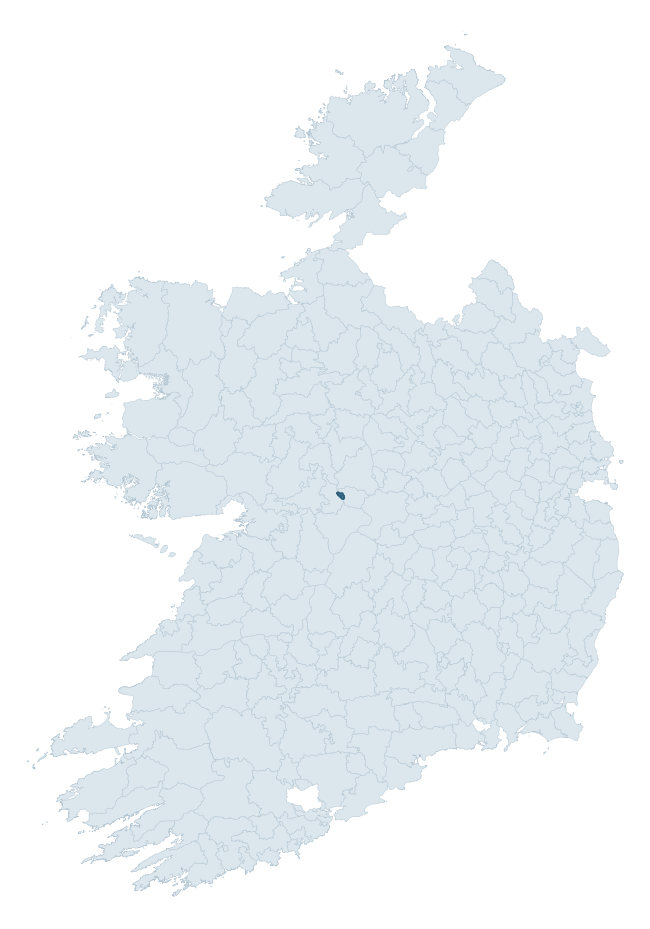
Where this barony sits in the Republic of Ireland
Geology and preservation
Bedrock geology shapes the landscape long before any settlement begins — controlling soil drainage, agricultural potential, the survival of upstanding monuments, and the preservation of buried archaeology. The figures below come from the Geological Survey Ireland 1:100,000 bedrock map.
The bedrock underlying Moycarn is predominantly limestones (77% of the barony by area), laid down during the Carboniferous period (100% by area, around 359 to 299 million years ago). Limestone is the most heritage-rich bedrock in Ireland. It supports fertile, well-drained soils that favoured dense Early Medieval settlement and Norman manorial agriculture, and it weathers into karst features — sinkholes, caves, swallow holes, and souterrains — that frequently carry archaeology. Where peat overlies limestone, organic preservation can be exceptional. A substantial secondary geology of limestone (23%) adds further variety to the underlying landscape. The single largest mapped unit is the Visean Limestones (undifferentiated) (77% of the barony's bedrock). With only 2 distinct rock types mapped, the barony is geologically uniform compared to the rest of the Republic (20th percentile for diversity) — a single coherent bedrock landscape.
Rock type composition
Largest mapped unit: Visean Limestones (undifferentiated) (77% of the barony)
Placename evidence
The Logainm record for Moycarn contains only 2 heritage-diagnostic placenames — 1 cill-name and 1 tuaim-name. With this few records, the count should be read as indicative rather than as a firm characterisation of the linguistic heritage layers; a larger sample would be needed to reliably distinguish defensive, ecclesiastical, or other stratigraphic signals from chance occurrence.
Early Christian Ecclesiastical
| Root | Count | Meaning |
|---|---|---|
| cill- | 1 | church (early) |
Burial, Ritual, and Norse-Contact
| Root | Count | Meaning |
|---|---|---|
| tuaim- | 1 | burial mound |
Other baronies in Galway
About this profile
Click any section below to expand.
What is a barony?
A barony is a historic administrative unit in Ireland, broadly equivalent to an English hundred. The 280 baronies used here are from the OSi 2019 National Statutory Boundaries (generalised 20m), covering the 26 counties of the Republic of Ireland. Baronies derive from the Norman period, were formalised in the 17th century, and have not been redrawn for statistical purposes. They vary enormously in area, from compact urban baronies in Dublin to vast upland baronies in Connacht, and should not be compared by raw site count without accounting for area differences.
What counts as a site?
This profile combines three distinct heritage registers, each with its own definition of what constitutes a recordable site:
- Archaeological sites (NMS). The National Monuments Service Sites and Monuments Record (SMR) catalogues every known archaeological monument or site of archaeological interest in the Republic, from prehistoric burial mounds and ringforts to medieval churches and post-medieval defensive works. Inclusion does not require legal protection — only that the site has been identified, surveyed, and assessed as having archaeological value. A separate subset of these sites lies within a recorded protection zone, which gives them statutory protection under the National Monuments Acts.
- Listed buildings (NIAH). The National Inventory of Architectural Heritage records buildings of architectural, historical, archaeological, artistic, cultural, scientific, social, or technical interest. Each surveyed structure is appraised on a five-tier scale: International, National, Regional, Local, and Record-Only. The NIAH appraisal is informational rather than strictly statutory, but it underpins local-authority Record of Protected Structures (RPS) listings.
- Heritage placenames (Logainm). Logainm is the authoritative database of Irish placenames maintained by the Placenames Branch. This profile applies a heritage-diagnostic classifier to the Irish-language form of each townland name, flagging roots that signal defensive sites (ráth-, lios-, dún-, caiseal-, cathair-), ecclesiastical foundations (cill-, teampall-, domhnach-, mainistir-), prehistoric burial-ritual features (tuaim-, carn-, leaba-), or Norse-contact settlement (gall-). Townlands without one of these diagnostic roots are not flagged here — they may still carry historical significance, but that significance is not encoded in the name itself.
Editorial principles
The narrative sections of this profile follow several explicit principles:
- Evidential. Every claim about this barony’s heritage character is anchored in the underlying register data. Where a site count, a placename count, or a percentile rank is cited, it is computed from the source datasets at export time, not estimated.
- Comparative. Counts and metrics are reported alongside their percentile rank against the other 279 ROI baronies. A barony with 50 ringforts in absolute terms could be unusually high or unusually low depending on its size and regional context; percentile ranking removes that ambiguity.
- Transparent on limits. Where a register has known coverage gaps, survey biases, or data-quality issues that affect this barony’s figures, the profile flags them rather than presenting the numbers as definitive.
- No interpretation beyond what the data supports. The narrative does not speculate about historical events, social dynamics, or cultural meaning beyond what the recorded heritage and placename evidence directly attests.
Data caveats and limits
- NMS Sites and Monuments Record is the product of survey campaigns conducted at different intensities across different counties and decades. Some baronies have been surveyed more thoroughly than others, and absolute counts should be read in that light. Sites destroyed by development before survey are typically not represented; sites in heavily forested or upland terrain are sometimes under-recorded.
- NIAH coverage is broadly complete for the Republic of Ireland but the survey was conducted on a rolling county-by-county basis, and the most recent appraisal date varies. Buildings demolished or substantially altered after their original survey may still appear in the register; conversely, recent buildings of merit may not yet have been appraised.
- Logainm classification applies a deliberately conservative pattern-matching approach to the Irish-language townland forms. The classifier prioritises true positives over recall: a townland may carry a heritage signal that the classifier doesn’t recognise, particularly where the diagnostic root has been heavily anglicised or where the townland name draws on a less common term. The 60,000+ townland records and ~9,800 classified placenames give a substantial signal at barony scale, but individual townland names should be checked against Logainm directly for definitive interpretation.
- Period attribution. The chronological distribution reflects only those NMS sites that carry a recognised period attribution in the source data. Sites listed as “Unknown” period are excluded from the dated subset.
- Boundary changes. Some baronies have undergone minor boundary adjustments since their 19th-century definition; the OSi 2019 generalised boundaries used here are the current statutory definition and may differ slightly from historical maps in border areas.
- Bedrock geology is mapped at 1:100,000 scale, which means local variation within a barony — small pockets of different rock type, mineral veins, alluvium overlying bedrock — is generalised. The dominant-system and rocktype figures are area-weighted, so a barony reading “70% Carboniferous limestone” may still contain small but archaeologically important pockets of older or younger rock. Around 3% of GSI polygons do not match the lexicon and contribute no rocktype or system attribution.
Data sources
- National Monuments Service — Sites and Monuments Record (SMR) https://data.gov.ie/dataset/national-monuments-service-archaeological-survey-of-ireland
- National Inventory of Architectural Heritage (NIAH) https://data.gov.ie/dataset/national-inventory-of-architectural-heritage-niah-national-dataset
- Logainm — Placenames Database of Ireland https://www.logainm.ie/
- Ordnance Survey Ireland — National Statutory Barony Boundaries 2019 https://data-osi.opendata.arcgis.com/
- EURODEM — European Digital Elevation Model https://www.mapsforeurope.org/datasets/euro-dem
- ESA WorldCover https://esa-worldcover.org/en
- Geological Survey Ireland — 1:100,000 Bedrock Geology https://www.gsi.ie/en-ie/data-and-maps/Pages/Bedrock.aspx
Explore more: Search any of the 280 ROI baronies, browse by historical province, or read the methodology and data sources for the full Republic of Ireland Heritage Tool.