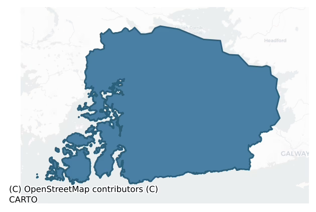
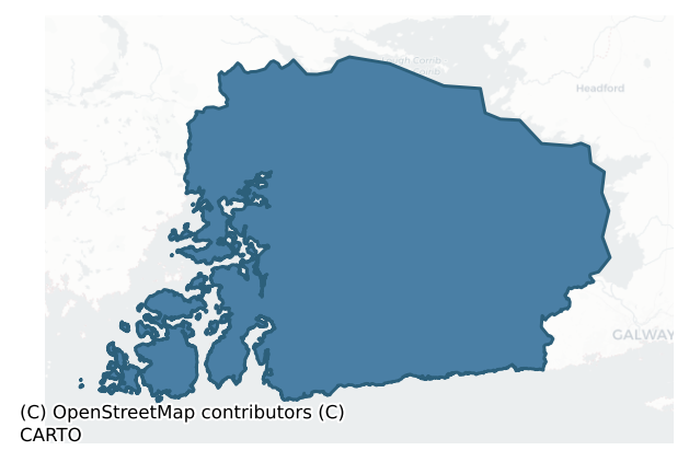
Moycullen is a barony of County Galway, in the historical province of Connacht (Irish: Maigh Cuilinn), covering 881 km² of land. The barony records 361 NMS archaeological sites and 105 NIAH listed buildings, placing it at around the 1st percentile among 280 ROI baronies for sites per km². This means it is in the bottom tenth of all baronies for sites per km². Dated archaeological evidence runs from the Neolithic through to the Modern, spanning 8 of 9 archaeological periods, placing the barony in the 61st percentile among 280 ROI baronies for chronological depth. This means it is in the upper half of all baronies for chronological depth. The largest dated subset of recorded sites dates to the Early Medieval. Logainm flags 29 placenames in the barony as carrying a recognised heritage root; the largest share — around 59% — are names associated with early Christian church and monastic foundations.
Heritage at a glance
Percentile rankings throughout this profile compare each barony only against the other 279 Republic of Ireland baronies.
The recorded heritage of Moycullen
The National Monuments Service Sites and Monuments Record (SMR) is the statutory inventory of archaeological sites for the Republic of Ireland, maintained by the Department of Tourism, Culture, Arts, Gaeltacht, Sport and Media. Sites recorded here include earthworks, ringforts, megalithic tombs, ecclesiastical remains, and post-medieval features; not every record is legally protected, but each is registered as a monument of archaeological interest.
The National Monuments Service records 361 archaeological sites in Moycullen, putting it at the 1st percentile among 280 ROI baronies for sites per km². This means it is in the bottom tenth of all baronies for sites per km². A sparse recorded total of this kind in Ireland often reflects survey priority rather than genuine absence of past activity. Of these, 294 (81%) fall within a recorded monument protection zone. The record is dominated by ecclesiastical sites — churches, graveyards, and holy wells (108 sites, 30% of the total), with defensive sites forming a substantial secondary presence (84 sites, 23%). The most diagnostically specific type is Ritual site – holy well (33 records, 9% of the barony's NMS total) — compared to an ROI average of 3% across all baronies where this type occurs. Ritual site – holy well is a well or spring traditionally associated with a saint, often credited with healing properties; many trace earlier ritual origins but devotion is documented from the medieval period onwards. The broader 'Enclosure' classification — which catches unclassified ringforts and field enclosures — accounts for a further 34 records (9%) and reflects the difficulty of sub-classifying degraded earthworks from surface evidence alone. Across the barony's 881 km², this gives a recorded density of 0.41 sites per km².
Most common monument types
Hover or tap a monument type to see its definition.
| Type | Count |
|---|---|
| Enclosure a banked or ditched feature of uncertain type, used as a catch-all where the original function cannot be determined from surface evidence | 34 |
| Ritual site – holy well a well or spring traditionally associated with a saint, often credited with healing properties; many trace earlier ritual origins but devotion is documented from the medieval period onwards | 33 |
| Children's burial ground an unconsecrated medieval and early-modern burial ground for unbaptised or stillborn children, often called a cillín or ceallúnach | 27 |
| Church a building used for public Christian worship, of any date from c. 500 AD onwards | 22 |
| Graveyard a burial area associated with a church, in use from the medieval period onwards | 13 |
| Ringfort – unclassified a circular Early Medieval settlement enclosure where surviving evidence does not allow distinction between earthen and stone forms | 12 |
| Ringfort – cashel the stone-walled equivalent of the rath, found mainly in upland or western areas, broadly dated 500–1000 AD | 12 |
| Burial ground an area set apart for burial that is not associated with a church, in use from the medieval period onwards | 10 |
Chronological distribution
The dated archaeological record for Moycullen spans from the Neolithic through to the Modern, with activity attested across 8 of 9 archaeological periods. Every period from earliest to latest is represented in the record — an unbroken sequence of dated activity across the full chronological span. Activity concentrates most heavily in the Early Medieval (82 sites, 44% of dated material), with the Iron Age forming a secondary peak (55 sites, 29%). A further 173 recorded sites (48% of the overall NMS register for the barony) carry no period attribution — appearing as 'Unknown' in the bar chart below. This typically reflects either records that pre-date the standardised period vocabulary or sites awaiting specialist dating review, rather than a genuine absence of chronological evidence.
Sample of recorded monuments
Show 25 sample monuments (of 361 total)
A representative sample of 25 recorded monuments drawn from the barony’s 361 total NMS entries. Sites within a recorded monument protection zone and rarer site types are prioritised so the list shows a meaningful cross-section rather than only the most common type. Each entry shows the official Sites and Monuments Record reference number and the description published by the National Monuments Service.
Burial
Close to summit of a wooded hill, on a promontory on W side of Lough Corrib. Named but not indicated on 2nd ed. of OS 6-inch map (1899). No visible surface trace was found.
The above description is derived from the…
Close to summit of a wooded hill, on a promontory on W side of Lough Corrib. Named but not indicated on 2nd ed. of OS 6-inch map (1899). No visible surface trace was found.
The above description is derived from the published 'Archaeological Inventory of County Galway Vol. I – West Galway'. Compiled by Paul Gosling (Dublin: Stationery Office, 1993).
Date of upload: 05 August 2010
Standing stone – pair
Crowning a prominent glacial ridge at the foot of Cnoc Úraid. Incorporated into a modern L-shaped sheepfold. Aligned N-S and c. 1.15m apart. Both stones are subrectangular in plan. The N stone is prostrate (1.14m by…
Crowning a prominent glacial ridge at the foot of Cnoc Úraid. Incorporated into a modern L-shaped sheepfold. Aligned N-S and c. 1.15m apart. Both stones are subrectangular in plan. The N stone is prostrate (1.14m by 0.65m by 0.55m); S stone (H 1.15m). A house lies 175m to SW (GA052-006—-). (Ó Nualláin 1988, 197, who interprets it as 'two uprights and a prostrate stone')
The above description is derived from the published 'Archaeological Inventory of County Galway Vol. I – West Galway'. Compiled by Paul Gosling (Dublin: Stationery Office, 1993).
Date of upload: 05 August 2010
Prehistoric site – lithic scatter
The Archaeological Survey of Ireland (ASI) is in the process of providing information on all monuments on The Historic Environment Viewer (HEV). Currently the information for this record has not been uploaded. To…
The Archaeological Survey of Ireland (ASI) is in the process of providing information on all monuments on The Historic Environment Viewer (HEV). Currently the information for this record has not been uploaded. To access available information for research purposes please make an appointment in advance with the Archive Unit (open Fridays 10.00 am – 5.00 pm), Department of Culture, Heritage and the Gaeltacht, The Custom House, Dublin 1 D01W6XO or email nmarchive@chg.gov.ie.
Barracks
This barrack was built in 1761 following on from problems experienced by the landowner, Usher St. George, in securing tenure for his tenants. The following account of the events leading up to its construction was…
This barrack was built in 1761 following on from problems experienced by the landowner, Usher St. George, in securing tenure for his tenants. The following account of the events leading up to its construction was written in 1761 by the Lord Chief Baron, Edward Willes, in a letter to the Earl of Warwick giving a report of the Connacht circuit. With reference to Iar Connacht he records how
'This whole tract of land is inhabited by the ancient Irish, and has never yet been made amenable to the laws. No sheriff dares go thither to execute any processs, but I believe they now will soon be reduced. Mr Usher St. George* of the county of Galway has a large tract of land of Eyre Connaught, the tenants of which paid him some small acknowledgements, but their leases being out, and refusing to renew with him (for O'Flahtery [Morgan O'Flaherty] one the Irish chiefs claimed the land) he brought ejectement and recovered it but how to get possession was the query. The sheriff and his posse were soon routed. Government were applied to to grant the assistance of the army, which they did and 3 companies of foot supported the sheriff in giving possession to Mr St George which they did without opposition, but so soon as the military returned to their barracks O'Flaherty's people drove away the persons who were left in possession, burnt down the houses and laid the estate waste. The Duke of Bedford [the Lord Lieutenant of Ireland, 1755-61] very properly thought this a serious affair and that…
Dovecote
The Archaeological Survey of Ireland (ASI) is in the process of providing information on all monuments on The Historic Environment Viewer (HEV). Currently the information for this record has not been uploaded. To…
The Archaeological Survey of Ireland (ASI) is in the process of providing information on all monuments on The Historic Environment Viewer (HEV). Currently the information for this record has not been uploaded. To access available information for research purposes please make an appointment in advance with the Archive Unit (open Fridays 10.00 am – 5.00 pm), Department of Culture, Heritage and the Gaeltacht, The Custom House, Dublin 1 D01W6XO or email nmarchive@chg.gov.ie.
Icehouse
The Archaeological Survey of Ireland (ASI) is in the process of providing information on all monuments on The Historic Environment Viewer (HEV). Currently the information for this record has not been uploaded. To…
The Archaeological Survey of Ireland (ASI) is in the process of providing information on all monuments on The Historic Environment Viewer (HEV). Currently the information for this record has not been uploaded. To access available information for research purposes please make an appointment in advance with the Archive Unit (open Fridays 10.00 am – 5.00 pm), Department of Culture, Heritage and the Gaeltacht, The Custom House, Dublin 1 D01W6XO or email nmarchive@chg.gov.ie.
Monumental structure
The Archaeological Survey of Ireland (ASI) is in the process of providing information on all monuments on The Historic Environment Viewer (HEV). Currently the information for this record has not been uploaded. To…
The Archaeological Survey of Ireland (ASI) is in the process of providing information on all monuments on The Historic Environment Viewer (HEV). Currently the information for this record has not been uploaded. To access available information for research purposes please make an appointment in advance with the Archive Unit (open Fridays 10.00 am – 5.00 pm), Department of Culture, Heritage and the Gaeltacht, The Custom House, Dublin 1 D01W6XO or email nmarchive@chg.gov.ie.
Barrow – unclassified
On a ridge summit surrounded by bogland. A subcircular platform (NNE-SSW 14.5m, WNW-ESE 11.5m), in fair condition, defined by a scarp. The interior is slightly dished and a gap at E could be original. Possibly a…
On a ridge summit surrounded by bogland. A subcircular platform (NNE-SSW 14.5m, WNW-ESE 11.5m), in fair condition, defined by a scarp. The interior is slightly dished and a gap at E could be original. Possibly a barrow.
The above description is derived from the published 'Archaeological Inventory of County Galway Vol. I – West Galway'. Compiled by Paul Gosling (Dublin: Stationery Office, 1993).
Date of upload: 05 August 2010
Kiln
The Archaeological Survey of Ireland (ASI) is in the process of providing information on all monuments on The Historic Environment Viewer (HEV). Currently the information for this record has not been uploaded. To…
The Archaeological Survey of Ireland (ASI) is in the process of providing information on all monuments on The Historic Environment Viewer (HEV). Currently the information for this record has not been uploaded. To access available information for research purposes please make an appointment in advance with the Archive Unit (open Fridays 10.00 am – 5.00 pm), Department of Culture, Heritage and the Gaeltacht, The Custom House, Dublin 1 D01W6XO or email nmarchive@chg.gov.ie.
Signal tower
Situated towards the western edge of Golam Head, on Golam\Gólam, a small tidal islet off the western tip of Lettermullan Island\Leitir Mealláin (29m OD). The islet consists of low exposed limestone hills and short boggy…
Situated towards the western edge of Golam Head, on Golam\Gólam, a small tidal islet off the western tip of Lettermullan Island\Leitir Mealláin (29m OD). The islet consists of low exposed limestone hills and short boggy valleys. Located on a small knoll with a shallow valley running away to the NE. The surrounding area consists of small irregularly-shaped fields defined by low drystone walls. The signal tower has unobstructed views in all directions. Site located c. 80m N of coastline at its closest point. The signal tower on Inishmore (GA110-133001-), located 12.5kms to the SSE, is clearly visible from here during good weather. The signal tower at Ard Castle Hill (GA076-006—-), located c. 12.5kms to the NW, has been reduced to a low barely-defined ruins, and can no longer be seen from this location. This signal tower at Golam\Gólam is located c. 180m W of a holy well (GA089-014—-), known locally as ‘Tobar Cholmcille’, and c. 2.63kms SW of the site of a Roman Catholic chapel (GA089-016—-) on Lettermullan Island\Leitir Mealláin, now demolished.
An early nineteenth-century (c. 1804-6) two-storey square-plan signal tower, built with roughly coursed rubble stone masonry (int. dims. 4.25m NE-SW x 4.27m NW-SE; wall H 12.4m). This is one of the best surviving examples of its type on the W coast of Ireland, and survives to its full original height. The doorway is located to the centre of the SW elevation at first floor level, and would have been originally accessed via…
House – 17th century
On the side of an old trackway c. 250m S of Loch Bhaile na Cille. Poorly defined foundations of a long rectangular house indicated on 1st ed. of OS 6-inch map. Reputed to belong to the O'Flaherty clan in 17-18th C…
On the side of an old trackway c. 250m S of Loch Bhaile na Cille. Poorly defined foundations of a long rectangular house indicated on 1st ed. of OS 6-inch map. Reputed to belong to the O'Flaherty clan in 17-18th C (info. T. Robinson). Not visited.
The above description is derived from the published 'Archaeological Inventory of County Galway Vol. I – West Galway'. Compiled by Paul Gosling (Dublin: Stationery Office, 1993).
Date of upload: 05 August 2010
Kiln – kelp drying
The Archaeological Survey of Ireland (ASI) is in the process of providing information on all monuments on The Historic Environment Viewer (HEV). Currently the information for this record has not been uploaded. To…
The Archaeological Survey of Ireland (ASI) is in the process of providing information on all monuments on The Historic Environment Viewer (HEV). Currently the information for this record has not been uploaded. To access available information for research purposes please make an appointment in advance with the Archive Unit (open Fridays 10.00 am – 5.00 pm), Department of Culture, Heritage and the Gaeltacht, The Custom House, Dublin 1 D01W6XO or email nmarchive@chg.gov.ie.
Martello tower
On seashore on E side of Cuan Chasla. A well-preserved tower, built in 1811-14, which is elliptical in plan externally but circular internally (D 8.92m, H 12m). A doorway on N side, on 1st-floor level, gives access to…
On seashore on E side of Cuan Chasla. A well-preserved tower, built in 1811-14, which is elliptical in plan externally but circular internally (D 8.92m, H 12m). A doorway on N side, on 1st-floor level, gives access to living quarters above the magazine, on ground floor, and basement water tank. Mural stairs lead to circular rooftop gun emplacement (D 7.75m) eccentrically placed to give broader parapet on seaward side. It mounted one gun rotating through 360 degrees; parts of the iron traversing platform and the 24-pounder cannon survive. (Kerrigan 1982, 41-3; Gosling 1990)
The above description is derived from the published 'Archaeological Inventory of County Galway Vol. I – West Galway'. Compiled by Paul Gosling (Dublin: Stationery Office, 1993).
Date of upload: 05 August 2010
Boundary stone
The Archaeological Survey of Ireland (ASI) is in the process of providing information on all monuments on The Historic Environment Viewer (HEV). Currently the information for this record has not been uploaded. To…
The Archaeological Survey of Ireland (ASI) is in the process of providing information on all monuments on The Historic Environment Viewer (HEV). Currently the information for this record has not been uploaded. To access available information for research purposes please make an appointment in advance with the Archive Unit (open Fridays 10.00 am – 5.00 pm), Department of Culture, Heritage and the Gaeltacht, The Custom House, Dublin 1 D01W6XO or email nmarchive@chg.gov.ie.
Mine
The Archaeological Survey of Ireland (ASI) is in the process of providing information on all monuments on The Historic Environment Viewer (HEV). Currently the information for this record has not been uploaded. To…
The Archaeological Survey of Ireland (ASI) is in the process of providing information on all monuments on The Historic Environment Viewer (HEV). Currently the information for this record has not been uploaded. To access available information for research purposes please make an appointment in advance with the Archive Unit (open Fridays 10.00 am – 5.00 pm), Department of Culture, Heritage and the Gaeltacht, The Custom House, Dublin 1 D01W6XO or email nmarchive@chg.gov.ie.
Hearth
On the shoreline of An Trá Mór close to the outflow of Furbogh Stream. A short stretch of habitation material exposed in a scarp face (L 0.83m, T 0.9m) and consisting of charcoal and burnt stone: probably the remains of…
On the shoreline of An Trá Mór close to the outflow of Furbogh Stream. A short stretch of habitation material exposed in a scarp face (L 0.83m, T 0.9m) and consisting of charcoal and burnt stone: probably the remains of a hearth. Overlain by sod layer (T 0.33m).
The above description is derived from the published 'Archaeological Inventory of County Galway Vol. I – West Galway'. Compiled by Paul Gosling (Dublin: Stationery Office, 1993).
Date of upload: 05 August 2010
Boulder-burial
The Archaeological Survey of Ireland (ASI) is in the process of providing information on all monuments on The Historic Environment Viewer (HEV). Currently the information for this record has not been uploaded. To…
The Archaeological Survey of Ireland (ASI) is in the process of providing information on all monuments on The Historic Environment Viewer (HEV). Currently the information for this record has not been uploaded. To access available information for research purposes please make an appointment in advance with the Archive Unit (open Fridays 10.00 am – 5.00 pm), Department of Culture, Heritage and the Gaeltacht, The Custom House, Dublin 1 D01W6XO or email nmarchive@chg.gov.ie.
Burial mound
The Archaeological Survey of Ireland (ASI) is in the process of providing information on all monuments on The Historic Environment Viewer (HEV). Currently the information for this record has not been uploaded. To…
The Archaeological Survey of Ireland (ASI) is in the process of providing information on all monuments on The Historic Environment Viewer (HEV). Currently the information for this record has not been uploaded. To access available information for research purposes please make an appointment in advance with the Archive Unit (open Fridays 10.00 am – 5.00 pm), Department of Culture, Heritage and the Gaeltacht, The Custom House, Dublin 1 D01W6XO or email nmarchive@chg.gov.ie.
Cairn – ring-cairn
On the summit of Knockranny, a locally prominent steep-sided hill. This small low circular ring-cairn (overall diam. c. 11m) is defined by a grassy bank externally and a ragged stony scarp internally. There is a narrow…
On the summit of Knockranny, a locally prominent steep-sided hill. This small low circular ring-cairn (overall diam. c. 11m) is defined by a grassy bank externally and a ragged stony scarp internally. There is a narrow gap (Wth 0.5m) at NNW. The interior is slightly dished in profile but it is partially obscured by a modern drystone-built cairn (H 1m; diam. 2.3m) which occupies the centre of the monument. A possible cist (GA057-029001-) is visible in the SSE sector (pers. comm. P. Gosling 2013).
Compiled by: Olive Alcock
Date of upload: 8 November 2016
Cross-slab
Within the graveyard (GA068-024001-) surrounding St Annin’s Church (GA068-024—-). Recorded by Higgins (1987, ii, 376, no. 96), this large subrectangular slab of limestone with a curved or bow-shaped head bears an…
Within the graveyard (GA068-024001-) surrounding St Annin’s Church (GA068-024—-). Recorded by Higgins (1987, ii, 376, no. 96), this large subrectangular slab of limestone with a curved or bow-shaped head bears an 18th-century inscription that overlies a two-line ringed cross with wedge-shaped terminals at the head and arms. The cross form appears to be early Christian or early medieval in date and the slab appears to have been recut when the sides were straightened and trimmed to shape the later gravestone.
Compiled by: Olive Alcock
Date of upload: 29 May 2018
Megalithic structure
The Archaeological Survey of Ireland (ASI) is in the process of providing information on all monuments on The Historic Environment Viewer (HEV). Currently the information for this record has not been uploaded. To…
The Archaeological Survey of Ireland (ASI) is in the process of providing information on all monuments on The Historic Environment Viewer (HEV). Currently the information for this record has not been uploaded. To access available information for research purposes please make an appointment in advance with the Archive Unit (open Fridays 10.00 am – 5.00 pm), Department of Culture, Heritage and the Gaeltacht, The Custom House, Dublin 1 D01W6XO or email nmarchive@chg.gov.ie.
Castle – tower house
On a natural rock outcrop on S bank of Drimneen River close to its outflow into Lough Corrib. This Nat. Mon. consists of a 16th-17th-C tower house enclosed by two bawns: a large, irregular outer bawn (46m by 49m), lying…
On a natural rock outcrop on S bank of Drimneen River close to its outflow into Lough Corrib. This Nat. Mon. consists of a 16th-17th-C tower house enclosed by two bawns: a large, irregular outer bawn (46m by 49m), lying to S and E of the tower house, is defended by five turrets. The remains of a rectangular banqueting hall (L 24m, Wth >7m) stand in its SW corner. The earlier, wedge-shaped inner bawn (36m by 22m max.) sits on the rock outcrop and was defended by a drawbridge, gun loops and a circular turret at SE corner, the latter later reused as a dovecote. Centrally placed in the inner bawn is the conserved, rectangular tower house (L 12.2m, Wth 8.7m) of seven storeys, built in two phases. The doorway, in E wall, gives access to a lobby with murder-hole above, and spiral stairs in SE corner. The ground and upper floors each comprise a main chamber with a subsidiary one to E. Stone vaults exist between ground/1st and 3rd/4th floors. There is a fireplace on 4th floor in S wall and latrines on 1st and 4th floors: a trapdoor in the latter gives access to a concealed chamber below it in the thickness of the arch. There are bartizans at SE and NE corners on 2nd floor and a centrally placed machicolation on each wall at parapet level. Much of the latter, and the 7th-storey gabled garret, are reconstructions. There are single-light ogee-headed windows and later twin-light flat-headed windows, with hood-mouldings, in tower: one of the two surviving windows in the banqueting hall…
Ritual site – holy/saint's stone
This massive glacial erratic (H 2.7-4.4m; max. Wth 7.1m), named 'St. Patrick's Stone' on the 1898-9 resurvey of the OS 6-inch map, is located close to the NW summit of Corkernarusheeny Hill, in an area of rough terrain…
This massive glacial erratic (H 2.7-4.4m; max. Wth 7.1m), named 'St. Patrick's Stone' on the 1898-9 resurvey of the OS 6-inch map, is located close to the NW summit of Corkernarusheeny Hill, in an area of rough terrain scattered with numerous boulders. A dark band running diagonally across its S face is believed to mark line of the chain used by St Patrick to tow the stone from Maam to its present location.
Compiled by: Olive Alcock
Date of upload: 10 February 2023
Cist
On the summit of a ridged promontory jutting out into Lough Corrib. A rectangular cist-like structure exposed in the face of a quarry. Excavation in 1986 revealed it to have been aligned ENE-WSW but previously unroofed…
On the summit of a ridged promontory jutting out into Lough Corrib. A rectangular cist-like structure exposed in the face of a quarry. Excavation in 1986 revealed it to have been aligned ENE-WSW but previously unroofed and both ends robbed (L >2.2m, Wth 0.44m, H 0.39m). (Casey 1988a)
The above description is derived from the published 'Archaeological Inventory of County Galway Vol. I – West Galway'. Compiled by Paul Gosling (Dublin: Stationery Office, 1993).
Date of upload: 05 August 2010
Enclosure
On E slopes of a hill. Marked on 1st 2nd eds. of OS 6-inch maps as a subcircular enclosure (N-S c. 40m). No visible surface trace survives. (Killanin 1947, 125)
The above description is derived from the published…
On E slopes of a hill. Marked on 1st 2nd eds. of OS 6-inch maps as a subcircular enclosure (N-S c. 40m). No visible surface trace survives. (Killanin 1947, 125)
The above description is derived from the published 'Archaeological Inventory of County Galway Vol. I – West Galway'. Compiled by Paul Gosling (Dublin: Stationery Office, 1993).
Date of upload: 05 August 2010
Listed buildings
The National Inventory of Architectural Heritage (NIAH) is a state survey appraising buildings of architectural, historical, archaeological, artistic, cultural, scientific, social, or technical interest. Each surveyed structure receives a rating from International (the highest, for buildings of European importance) through National, Regional, Local, and Record-Only.
The NIAH records 105 listed buildings in Moycullen (52nd percentile across ROI baronies). The highest-graded structure include 1 of National significance. The Republic holds 937 National-graded buildings in total, so this barony accounts for around 0% of the national total. Construction dates concentrate most heavily in the Victorian (1830-1900) period. The most-recorded building type is house (25 examples, 24% of the listed stock).
Terrain and environment
Mean elevation across the barony is 65m — the 27th percentile among 280 ROI baronies for elevation. This means it is in the bottom third of all baronies for elevation. This is a relatively low-lying landscape by ROI standards. Elevation matters for heritage because higher-altitude baronies typically favour defensive monuments — ringforts and hilltop forts placed on prominent ground — while lowland baronies are more likely to carry the dense settlement and church networks of intensive agricultural landscapes. The barony reaches 618m at its highest point — a vertical span of more than 553m within its boundary, indicating significant topographic diversity. Mean slope is 4.0° — the 57th percentile among 280 ROI baronies for slope. This means it is in the upper half of all baronies for slope. Slope is a key control on both land use and archaeological preservation: steep ground resists ploughing and tends to preserve earthworks intact, while gentle slopes favour intensive cultivation that damages or destroys surface archaeology over time. The Topographic Wetness Index averages 10.8, the 50th percentile among 280 ROI baronies for wetness. This means it is in the upper half of all baronies for wetness. Drainage matters for heritage because poorly-drained ground preserves organic archaeology (wooden trackways, leather, textiles, and on rare occasions human remains) far better than free-draining soil; well-drained ground favours arable use but destroys organic material rapidly. The land-cover mosaic combines improved grassland (71%), woodland (15%), and open water (10%), giving a mixed agricultural and semi-natural landscape.
Terrain measurements
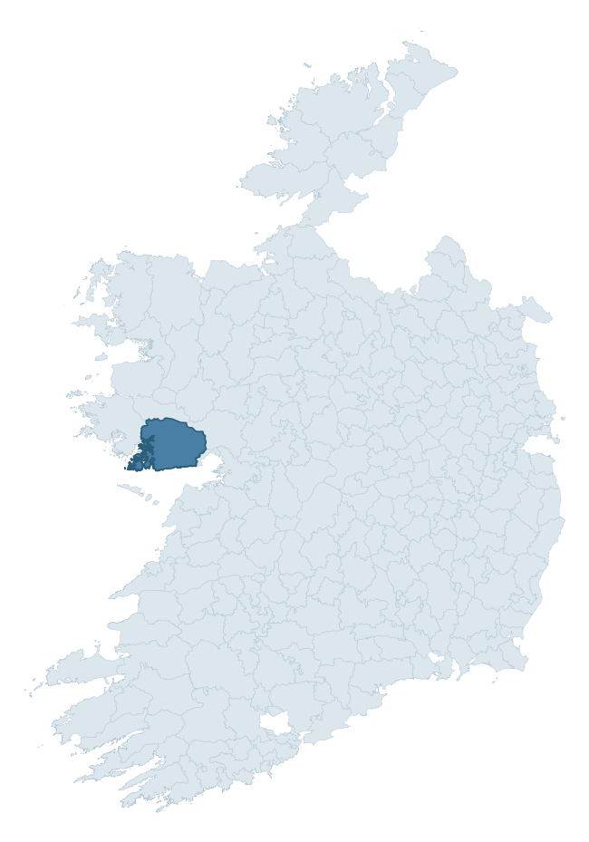
Where this barony sits in the Republic of Ireland
Geology and preservation
Bedrock geology shapes the landscape long before any settlement begins — controlling soil drainage, agricultural potential, the survival of upstanding monuments, and the preservation of buried archaeology. The figures below come from the Geological Survey Ireland 1:100,000 bedrock map.
The bedrock underlying Moycullen is predominantly monzogranite, mafic, megacrystic (25% of the barony by area), laid down during the Devonian period (59% by area, around 419 to 359 million years ago). The single largest mapped unit is the Megacrystic-Porphyritic Granite (Galway Granite) (25% of the barony's bedrock). With 21 distinct rock types mapped, the barony sits in the top third of ROI baronies for geological diversity (100th percentile) — typically a sign of complex tectonic history or coastal mosaics of differing rock units.
Rock type composition
Largest mapped unit: Megacrystic-Porphyritic Granite (Galway Granite) (25% of the barony)
Placename evidence
Logainm records 29 heritage-diagnostic placenames for Moycullen, drawn from townland and civil-parish names across the barony. The dominant stratum is Early Christian ecclesiastical — cill-, teampall-, and domhnach-prefixed names that record the dense network of early church foundations established between the fifth and tenth centuries. The leading diagnostic roots are cill- (16 — church), ráth- (5 — earthen ringfort), and uaimh- (2 — cave or souterrain). This is broadly in line with the ROI average of 30.7 heritage placenames per barony. The presence of multiple heritage strata side by side indicates layered occupation of the landscape across successive prehistoric and historic periods. Logainm records 394 placenames for Moycullen (predominantly townland names). Of these, 29 (7%) carry one of the diagnostic Gaelic roots tracked above; the remainder draw on more generic landscape vocabulary that does not encode a heritage period.
Pre-Christian / Early Medieval Defensive
| Root | Count | Meaning |
|---|---|---|
| ráth- | 5 | earthen ringfort |
| lios- | 1 | ringfort or enclosure |
| dún- | 1 | hilltop or promontory fort |
Early Christian Ecclesiastical
| Root | Count | Meaning |
|---|---|---|
| cill- | 16 | church (early) |
| bile- | 1 | sacred tree / boundary marker |
Burial, Ritual, and Norse-Contact
| Root | Count | Meaning |
|---|---|---|
| uaimh- | 2 | cave / souterrain |
| carn- | 1 | cairn |
| leacht- | 1 | grave monument |
| sián- | 1 | fairy mound |
| gall- | 1 | foreigner — Norse settlement marker |
Other baronies in Galway
About this profile
Click any section below to expand.
What is a barony?
A barony is a historic administrative unit in Ireland, broadly equivalent to an English hundred. The 280 baronies used here are from the OSi 2019 National Statutory Boundaries (generalised 20m), covering the 26 counties of the Republic of Ireland. Baronies derive from the Norman period, were formalised in the 17th century, and have not been redrawn for statistical purposes. They vary enormously in area, from compact urban baronies in Dublin to vast upland baronies in Connacht, and should not be compared by raw site count without accounting for area differences.
What counts as a site?
This profile combines three distinct heritage registers, each with its own definition of what constitutes a recordable site:
- Archaeological sites (NMS). The National Monuments Service Sites and Monuments Record (SMR) catalogues every known archaeological monument or site of archaeological interest in the Republic, from prehistoric burial mounds and ringforts to medieval churches and post-medieval defensive works. Inclusion does not require legal protection — only that the site has been identified, surveyed, and assessed as having archaeological value. A separate subset of these sites lies within a recorded protection zone, which gives them statutory protection under the National Monuments Acts.
- Listed buildings (NIAH). The National Inventory of Architectural Heritage records buildings of architectural, historical, archaeological, artistic, cultural, scientific, social, or technical interest. Each surveyed structure is appraised on a five-tier scale: International, National, Regional, Local, and Record-Only. The NIAH appraisal is informational rather than strictly statutory, but it underpins local-authority Record of Protected Structures (RPS) listings.
- Heritage placenames (Logainm). Logainm is the authoritative database of Irish placenames maintained by the Placenames Branch. This profile applies a heritage-diagnostic classifier to the Irish-language form of each townland name, flagging roots that signal defensive sites (ráth-, lios-, dún-, caiseal-, cathair-), ecclesiastical foundations (cill-, teampall-, domhnach-, mainistir-), prehistoric burial-ritual features (tuaim-, carn-, leaba-), or Norse-contact settlement (gall-). Townlands without one of these diagnostic roots are not flagged here — they may still carry historical significance, but that significance is not encoded in the name itself.
Editorial principles
The narrative sections of this profile follow several explicit principles:
- Evidential. Every claim about this barony’s heritage character is anchored in the underlying register data. Where a site count, a placename count, or a percentile rank is cited, it is computed from the source datasets at export time, not estimated.
- Comparative. Counts and metrics are reported alongside their percentile rank against the other 279 ROI baronies. A barony with 50 ringforts in absolute terms could be unusually high or unusually low depending on its size and regional context; percentile ranking removes that ambiguity.
- Transparent on limits. Where a register has known coverage gaps, survey biases, or data-quality issues that affect this barony’s figures, the profile flags them rather than presenting the numbers as definitive.
- No interpretation beyond what the data supports. The narrative does not speculate about historical events, social dynamics, or cultural meaning beyond what the recorded heritage and placename evidence directly attests.
Data caveats and limits
- NMS Sites and Monuments Record is the product of survey campaigns conducted at different intensities across different counties and decades. Some baronies have been surveyed more thoroughly than others, and absolute counts should be read in that light. Sites destroyed by development before survey are typically not represented; sites in heavily forested or upland terrain are sometimes under-recorded.
- NIAH coverage is broadly complete for the Republic of Ireland but the survey was conducted on a rolling county-by-county basis, and the most recent appraisal date varies. Buildings demolished or substantially altered after their original survey may still appear in the register; conversely, recent buildings of merit may not yet have been appraised.
- Logainm classification applies a deliberately conservative pattern-matching approach to the Irish-language townland forms. The classifier prioritises true positives over recall: a townland may carry a heritage signal that the classifier doesn’t recognise, particularly where the diagnostic root has been heavily anglicised or where the townland name draws on a less common term. The 60,000+ townland records and ~9,800 classified placenames give a substantial signal at barony scale, but individual townland names should be checked against Logainm directly for definitive interpretation.
- Period attribution. The chronological distribution reflects only those NMS sites that carry a recognised period attribution in the source data. Sites listed as “Unknown” period are excluded from the dated subset.
- Boundary changes. Some baronies have undergone minor boundary adjustments since their 19th-century definition; the OSi 2019 generalised boundaries used here are the current statutory definition and may differ slightly from historical maps in border areas.
- Bedrock geology is mapped at 1:100,000 scale, which means local variation within a barony — small pockets of different rock type, mineral veins, alluvium overlying bedrock — is generalised. The dominant-system and rocktype figures are area-weighted, so a barony reading “70% Carboniferous limestone” may still contain small but archaeologically important pockets of older or younger rock. Around 3% of GSI polygons do not match the lexicon and contribute no rocktype or system attribution.
Data sources
- National Monuments Service — Sites and Monuments Record (SMR) https://data.gov.ie/dataset/national-monuments-service-archaeological-survey-of-ireland
- National Inventory of Architectural Heritage (NIAH) https://data.gov.ie/dataset/national-inventory-of-architectural-heritage-niah-national-dataset
- Logainm — Placenames Database of Ireland https://www.logainm.ie/
- Ordnance Survey Ireland — National Statutory Barony Boundaries 2019 https://data-osi.opendata.arcgis.com/
- EURODEM — European Digital Elevation Model https://www.mapsforeurope.org/datasets/euro-dem
- ESA WorldCover https://esa-worldcover.org/en
- Geological Survey Ireland — 1:100,000 Bedrock Geology https://www.gsi.ie/en-ie/data-and-maps/Pages/Bedrock.aspx
Explore more: Search any of the 280 ROI baronies, browse by historical province, or read the methodology and data sources for the full Republic of Ireland Heritage Tool.