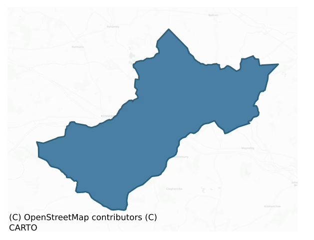
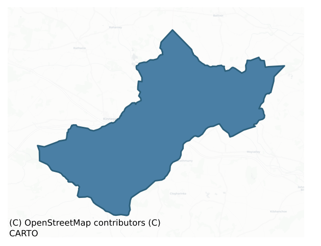
Moyfenrath Upper is a barony of County Meath, in the historical province of Leinster (Irish: Maigh Fionnráithe Uachtarach), covering 128 km² of land. The barony records 168 NMS archaeological sites and 39 NIAH listed buildings, placing it at around the 23rd percentile among 280 ROI baronies for sites per km². This means it is in the bottom third of all baronies for sites per km². Dated archaeological evidence runs from the Early Bronze Age through to the Modern, spanning 7 of 9 archaeological periods, placing the barony in the 42nd percentile among 280 ROI baronies for chronological depth. This means it is in the lower half of all baronies for chronological depth. The largest dated subset of recorded sites dates to the Medieval.
Heritage at a glance
Percentile rankings throughout this profile compare each barony only against the other 279 Republic of Ireland baronies.
The recorded heritage of Moyfenrath Upper
The National Monuments Service Sites and Monuments Record (SMR) is the statutory inventory of archaeological sites for the Republic of Ireland, maintained by the Department of Tourism, Culture, Arts, Gaeltacht, Sport and Media. Sites recorded here include earthworks, ringforts, megalithic tombs, ecclesiastical remains, and post-medieval features; not every record is legally protected, but each is registered as a monument of archaeological interest.
The National Monuments Service records 168 archaeological sites in Moyfenrath Upper, putting it at the 23rd percentile among 280 ROI baronies for sites per km². This means it is in the bottom third of all baronies for sites per km². Of these, 146 (87%) fall within a recorded monument protection zone. The record is dominated by industrial sites — mills, kilns, and quarries (40 sites, 24% of the total), with defensive sites forming a substantial secondary presence (25 sites, 15%). Structure – peatland is the most prevalent type, making up 24% of the barony's recorded sites (40 records) — well above the ROI average of 15% across all baronies where this type occurs. Structure – peatland is a construction of unknown function, either extant or implied by archaeological evidence, of any date. Other significant types include Ringfort – rath (11) and Graveyard (8). Ringfort – rath is an earthen ringfort enclosed by a bank and external ditch — the most common Early Medieval farmstead, broadly dated 500–1000 AD; Graveyard is a burial area associated with a church, in use from the medieval period onwards. Across the barony's 128 km², this gives a recorded density of 1.31 sites per km².
Most common monument types
Hover or tap a monument type to see its definition.
| Type | Count |
|---|---|
| Structure – peatland a construction of unknown function, either extant or implied by archaeological evidence, of any date | 40 |
| Ringfort – rath an earthen ringfort enclosed by a bank and external ditch — the most common Early Medieval farmstead, broadly dated 500–1000 AD | 11 |
| Graveyard a burial area associated with a church, in use from the medieval period onwards | 8 |
| Road – class 3 togher a short wooden peatland trackway up to 15m long, deliberately laid to cross a small area of bog; Neolithic to medieval | 7 |
| Church a building used for public Christian worship, of any date from c. 500 AD onwards | 6 |
| Burial an isolated interment of human or animal remains, not associated with a formal burial ground | 6 |
Chronological distribution
The dated archaeological record for Moyfenrath Upper spans from the Early Bronze Age through to the Modern, with activity attested across 7 of 9 archaeological periods. Every period from earliest to latest is represented in the record — an unbroken sequence of dated activity across the full chronological span. Activity concentrates most heavily in the Iron Age (18 sites, 24% of dated material), with the Medieval forming a secondary peak (17 sites, 22%). A further 92 recorded sites (55% of the overall NMS register for the barony) carry no period attribution — appearing as 'Unknown' in the bar chart below. This typically reflects either records that pre-date the standardised period vocabulary or sites awaiting specialist dating review, rather than a genuine absence of chronological evidence.
Sample of recorded monuments
Show 25 sample monuments (of 168 total)
A representative sample of 25 recorded monuments drawn from the barony’s 168 total NMS entries. Sites within a recorded monument protection zone and rarer site types are prioritised so the list shows a meaningful cross-section rather than only the most common type. Each entry shows the official Sites and Monuments Record reference number and the description published by the National Monuments Service.
Chapel
Located on a level landscape with slightly lower ground just to the W, and it is c. 40m NNW of the N bastion of the fort (ME046-010—-). It is marked as a rectangular building (dims c. 10m x c. 5m) on the 1836 ed. of…
Located on a level landscape with slightly lower ground just to the W, and it is c. 40m NNW of the N bastion of the fort (ME046-010—-). It is marked as a rectangular building (dims c. 10m x c. 5m) on the 1836 ed. of the OS 6-inch map where it is described in gothic lettering as a ‘Chapel of Ease’, with the added word ‘vault’ in italic lettering. This was probably an estate or private chapel attached to the FitzGerald manor of Ticroghan (ME046-010001-) as it does not appear on visitation lists, unless its name is not recognised. It probably also served the garrison church of the bastioned fort (ME046-010—-), but no references to it have been discovered and it was probably defunct by the early nineteenth century or earlier.
The chapel is a rectangular, ivy-covered building (int. dims 11.1m E-W; 5.05m N-S) that survives almost complete (H of long walls 2.5-2.8m), with a round-headed doorway (Wth 1.02m; H 2m) towards the W end of the S wall. There is a square two-light window (Wth 0.93m; H 0.92m) with the central mullion removed in the W wall, and a similar inaccessible window with a square hood-moulding externally towards the E end of the S wall. There is also a large pointed E window, which might be inserted but it is overgrown with ivy. A barrel-vaulted crypt or burial vault (int. dims 3m E-W; 2.35m N-S; H 1.6m plus) with wicker-centering in its roof is under the floor at the centre. It is accessed by steps from the W and the interior is strewn with rubble. The chape…
Bastioned fort
There was a FitzGerald manor and castle at Ticroghan in the sixteenth century. It was held by Oliver, the half-brother of the Earl of Kildare, in 1528 (Valkenburg 1970, 534). In 1557 ‘the site of the manor and castle of…
There was a FitzGerald manor and castle at Ticroghan in the sixteenth century. It was held by Oliver, the half-brother of the Earl of Kildare, in 1528 (Valkenburg 1970, 534). In 1557 ‘the site of the manor and castle of Tecroghane, part of the possessions of Walter FitzGerald, attained’, was leased to John Parker, Keeper of the Rolls (Nicholls 1994, 1, 315). Walter may have been implicated in the rebellion of Silken Thomas in 1535, but even though the FitzGeralds were restored to some Meath possession in 1564, Ticroghan was excluded (ibid. 2, 154-6). In 1571 the manor of Ticroghan was leased to Anthony Lowe and in 1574 to the Earl of Ormonde (ibid. 2, 224, 326), but in 1599 Edward, the son of George FitzGerald who had been slain by rebels, was restored to Ticroghan (ibid. 3, 345-6). According to the Civil Survey (1654-6) Sir Luke FitzGerald owned 425 acres at Techraghan in 1640 and on the premises were ‘a castle, a mill and divers cabins and farm houses’ (Simington 1940, 187). He also owned 600 acres in Clonard parish at Moorelicke (73 acres), Ballinibarny (100), Tonlaught (120), Ardnemullan and Aghelliah (166), Kilvardan (90) and Rossan (52) (ibid. 186-8). During the siege of Drogheda by Cromwell in 1649, the Earl of Ormonde was at Ticroghan (Simms 1973-4) but in 1650 Lady FitzGerald, a daughter of Sir Luke, resisted an attack by Cromwellian forces but did surrender (Wilde 1850, 64).
At some point the bastioned fort was constructed around what was probably a tower hous…
Tomb – chest tomb (present location)
Now in the Roman Catholic church at Ballinbrackey and thought to have come from Ballyboggan Abbey (ME046-018—-) (Callary 1957). Three panels of an early sixteenth century tomb chest (Hunt 1974, 203-4) are displayed on…
Now in the Roman Catholic church at Ballinbrackey and thought to have come from Ballyboggan Abbey (ME046-018—-) (Callary 1957). Three panels of an early sixteenth century tomb chest (Hunt 1974, 203-4) are displayed on the inside of the SW wall of the transept. The figures represented include The Holy Trinity (Roe 1979, 107, 129), St John the Baptist, and a Madona.
The above description is derived from the published 'Archaeological Inventory of County Meath' (Dublin: Stationery Office, 1987). In certain instances the entries have been revised and updated in the light of recent research.
Compiled by: Michael Moore
Date of revised upload: 30 March 2016
Religious house – Augustinian canons
Located towards the bottom of a SW-facing slope with a W-E section of the River Boyne c. 150m to the S. A priory following the rule of St Augustine and dedicated to the Holy Trinity, sometimes known as ‘de laude Dei’ –…
Located towards the bottom of a SW-facing slope with a W-E section of the River Boyne c. 150m to the S. A priory following the rule of St Augustine and dedicated to the Holy Trinity, sometimes known as ‘de laude Dei’ – of the praise of God – was founded by a Jordon Comin in the late 12th century (Gwynn and Hadcock 1970, 159-60). In 1399 it was claimed that John O’Mayller, an Irishman, was prior, contrary to the statutes of Kilkenny, but Richard Cuthbert was able to demonstrate that he was the prior. The priory was burnt in 1446 and the following year the prior died of the plague. The priory possessed a much-venerated crucifix that was publically burnt in 1538 (Cogan 1862-70, 1, 169-170).
At its suppression in 1540 the priory was described as a church that had long been the parish church, a cemetery, cloister, a hall and other chambers that were ‘decayed’. There were also a garden and an orchard in the precinct. Ninety two acres and a water-mill were held in demesne where seven cottiers provided very specific services. A hundred acres at Ballyboggan were held by Sir William Bermingham. The priory owned 50 acres at Herenston (Harristown) and 200 acres of pasture or arable at Knockeangwoll and Kylnodogaghe (Knockersally or Colehill), Kyllosyllyng (Killaskillen), Balloskystye (Ballynakill?) and the unknown Cardystown. They also owned 160 acres of woodland in these townlands, which together amounted to Ballyboggan parish. They held the churches of Castlejordan, Killaderry, Co…
Concentric enclosure
Situated on a rise in a level landscape with the canalised NW-SE Clonard stream c. 70m to the SW and a smaller N-S stream or drain c. 70m to the E. It is not depicted on any OS map but an aerial photograph from the…
Situated on a rise in a level landscape with the canalised NW-SE Clonard stream c. 70m to the SW and a smaller N-S stream or drain c. 70m to the E. It is not depicted on any OS map but an aerial photograph from the 1970s (CUCAP: AYR: 33) shows a fosse on top of the rise (dims c. 80m E-W; c. 65m) with an entrance (Wth of base 3m) at SSE. Another fosse or scarp defined the base of the rise N-E-W. The visible profile had been removed by 1985 (SMR file).
The above description is derived from the published 'Archaeological Inventory of County Meath' (Dublin: Stationery Office, 1987). In certain instances the entries have been revised and updated in the light of recent research.
Compiled by: Michael Moroe
Date of revision: 13 August 2019
Castle – ringwork
Situated on the S bank of the W-E Clonard River, with a NW-SE canalised section of the steam c. 10m to the E. This is an oval, grass-covered area (dims c. 70m NE-SW, c. 50m NW-SE) defined by the remains of an earthen…
Situated on the S bank of the W-E Clonard River, with a NW-SE canalised section of the steam c. 10m to the E. This is an oval, grass-covered area (dims c. 70m NE-SW, c. 50m NW-SE) defined by the remains of an earthen bank with an external fosse and outer bank NNW-NNE, and slighter features elsewhere. Partial excavation (E000154) by P. D. Sweetman (1978, 15) revealed a wooden palisade at the E end of the outer bank at NE, which could be dated to the late thirteenth or early fourteenth century (excavations.ie 1976:55). The motte (ME047-004—-) is across the river, c. 70m to the NE, and the burial ground (ME047-017—-) is c. 40m to the S.
The above description is derived from the published 'Archaeological Inventory of County Meath' (Dublin: Stationery Office, 1987). In certain instances the entries have been revised and updated in the light of recent research.
Compiled by: Michael Moore
Date of revision: 21 July 2016
Amended: 13 August 2019
Font
A baptismal font was formerly in the Church of Ireland church. It was moved to St Finian's R.C. Church in 1991. For descriptive details see ME047-020—-.
Compiled by: Paul Walsh
Date of upload: 30 January 2013
Stone trough
There is no evidence of ancient or medieval structures in the graveyard (ME047-007001-) at the site of the parish church of Clonard and the probable site of St Finnian's early monastery (ME047-007—-), apart from a…
There is no evidence of ancient or medieval structures in the graveyard (ME047-007001-) at the site of the parish church of Clonard and the probable site of St Finnian's early monastery (ME047-007—-), apart from a face corbel (ME047-007004-) in the tower of the now closed Church of Ireland church that was built in 1810 and a rectangular, flat-bottomed trough (dims 0.91m x 0.54m; D 0.37-0.39m) of uncertain date and function cut in the bedrock just SW of the surviving church. (Wilde 1850, 56-8)
Compiled by: Michael Moore
Date of upload: 9 April, 2015
Barrow – bowl-barrow
Situated at the crest of a NE-facing slope down to a canalised WNW-ESE section of the Clonard River, which is c. 320m to the N. It is depicted on the undated manuscript map (2161, (48)) in NLI, and it is represented as…
Situated at the crest of a NE-facing slope down to a canalised WNW-ESE section of the Clonard River, which is c. 320m to the N. It is depicted on the undated manuscript map (2161, (48)) in NLI, and it is represented as a small copse on the 1836 and 1912 editions of the OS 6-inch map. This is a circular grass-covered mound (diam. of base 31m N-S; 30m E-W; H 3.4m E-S to 4.7-5.2m W-N) surrounded by an earth bank (Wth c. 2m; H 0.3-0.5m) with an outer ditch.
The above description is derived from the published 'Archaeological Inventory of County Meath' (Dublin: Stationery Office, 1987). In certain instances the entries have been revised and updated in the light of recent research.
Compiled by: Michael Moore
Date of revision: 13 August 2019
House – fortified house
Border trouble between O’Connor of Offaly and the Birminghams of Carbury (KD008-001002-) in 1540 produced the suggestion that a castle at Castlejordan and another at Kynafad would reduce the opportunities for O’Connor…
Border trouble between O’Connor of Offaly and the Birminghams of Carbury (KD008-001002-) in 1540 produced the suggestion that a castle at Castlejordan and another at Kynafad would reduce the opportunities for O’Connor to enter the Pale (Devitt 1896-9, 108). When counties Laois and Offaly were planted under Queen Mary, Philipstown now called Daingean, was established as the principal strongpoint of the new King’s County in the 1550s. Phillipstown’s principal communications would have been with Trim, Co. Meath, by an overland route that passed through Castlejordan. The bridge (ME052-006—-) is 60m to the E and this structure could have been built to protect it, although there is no documentation that can be associated with its construction. In 1601 it is recorded that ‘the ward of Castlejordan’ resisted an assault by Sir Rurke Burke (Cal. Carew Docs, 4, 41). According to the Civil Survey (1654-6) the part of Castlejordan parish in county Meath, amounting to almost 400 acres, was owned by Sir John Giffard in 1640, and on the property at Castle Jordane was ‘one castle and two mills’ (Simington 1940, 190-1), but the castle is more likely to be the tower house (ME052-005—-), which is c. 60m to the SW.
This house is situated in the valley of the Castlejordan River with a NNE-SSW section of the stream c. 50m to the SE. It is also located c. 1km N of where the Castlejordan River meets the W-E Yellow River, which is a tributary of the River Boyne and forms the boundary with C…
Castle – unclassified
Situated on a broad rise with a NNE-SSW section of the Castlejordan River c. 225m to the E. It is located c. 1km N of where the Castlejordan River meets the W-E Yellow River, which is a tributary of the River Boyne and…
Situated on a broad rise with a NNE-SSW section of the Castlejordan River c. 225m to the E. It is located c. 1km N of where the Castlejordan River meets the W-E Yellow River, which is a tributary of the River Boyne and forms the boundary with County Offaly. A NW-SE section of the Yellow River is c. 600m to the SW, and the remains are c. 50m NE of the mound (ME052-002—-). This structure is depicted as a rectangular enclosure on the 1908 ed. of the OS 6-inch map. The centre of a grass-covered structure has been excavated (dims 12m N-S; 7.3m E-W; D 0.8-1.6m) with the inner face of the W wall (Wth 1.1m; ext. H 0.5m) exposed, revealing a buried relieving arch. Traces of the inner face of the E wall are also evident (int. dim. 6.7m E-W) with an inserted wall (Wth 0.5m) extending W from it.
The above description is derived from the published 'Archaeological Inventory of County Meath' (Dublin: Stationery Office, 1987). In certain instances the entries have been revised and updated in the light of recent research.
Compiled by: Michael Moore
Date of revision: 15 August 2015
Architectural fragment
There is no evidence of ancient or medieval structures in the graveyard (ME047-007001-) at the site of the parish church of Clonard and the probable site of St Finnian's early monastery (ME047-007—-), apart from a…
There is no evidence of ancient or medieval structures in the graveyard (ME047-007001-) at the site of the parish church of Clonard and the probable site of St Finnian's early monastery (ME047-007—-), apart from a face corbel on the S face of the tower of the now closed Church of Ireland church that was built in 1810 and a trough (ME047-007003-) cut in the bedrock just SW of the surviving church. (Wilde 1850, 56-8)
Compiled by: Michael Moore
Date of upload: 9 April, 2015
Fulacht fia
Situated on a S-facing slope in a gently undulating landscape. An area of sub-surface archaeological features was identified by Ian Russell in centre-line testing (02E0108) for the M4 Dublin to Galway motorway and set…
Situated on a S-facing slope in a gently undulating landscape. An area of sub-surface archaeological features was identified by Ian Russell in centre-line testing (02E0108) for the M4 Dublin to Galway motorway and set aside as Towlaght 1. It was completely excavated (02E1145) by Stephen Linnane who revealed a pond dating to c. 1700 and at a different location a spread of burnt mound material. This consisted of a black silty clay with broken and burnt stone and some charcoal content (dims c. 12m x c. 10m; max. T 0.4m) with a line of stones at its W edge providing a kerb. No troughs were revealed, and a date was not derived from the mound material, which is largely preserved outside the road-take. However, a small hearth (dims 0.7m x 0.58m; T 0.15m) c. 50m to the S and undoubtedly unrelated produced a C14 date of Cal AD 720-740. (Linnane 2004, 6-8)
Compiled by: Michael Moore
Date of upload: 13 August, 2019
Font (present location)
This baptismal font was formerly in the Church of Ireland church at Anneville or Clonard Old (ME047-007002-). It was moved to St Finian's R.C. Church in 1991. The font is carved from limestone and is octagonal in shape…
This baptismal font was formerly in the Church of Ireland church at Anneville or Clonard Old (ME047-007002-). It was moved to St Finian's R.C. Church in 1991. The font is carved from limestone and is octagonal in shape with deeply chamfered under panels depicting a range of biblical scenes. The inner basin of the font is circular and it has concave sides and a central drain. The font stands on a similarly deeply carved octagonal base which sits on a rectangular modern base. The font is somewhat small and it has been suggested that perhaps it originally stood on a medieval pedestal or that there was a short shaft which would have connected the base and font. All the panels of the font and base are decorated. The execution of the carving suggests that the carver was a skilled amateur and not a master craftsman.
Beginning with the Flight into Egypt and proceeding from left to right, we see the Blessed Virgin holding the infant Jesus while seated on a donkey, with Joseph wearing a cloak and holding the reigns walking along side.
The next panel comprises a winged angel holding a book with an interlacing design underneath and it has been suggested that it may have been a 'filler'.
The Baptism of Jesus in the river Jordan is illustrated on the next panel. Jesus is depicted standing in the river Jordan and John the Baptist is depicted by his side baptising him with water from a vessel. The upper part of the panel depicting John the Baptist has been damaged and so it is hard t…
Ritual site – holy well
Situated in a clearing within deciduous woodland and at the bottom of a slight N-facing slope with the W-E River Deel c. 35m to the N. It is dedicated to the Assumption of the Blessed Virgin, but John O'Donovan, writing…
Situated in a clearing within deciduous woodland and at the bottom of a slight N-facing slope with the W-E River Deel c. 35m to the N. It is dedicated to the Assumption of the Blessed Virgin, but John O'Donovan, writing in 1836, had little faith in this (Herity 2001, 82). It is a circular consolidated well (int. diam. 1.2m; D 1.1m) approached by steps from the W. It is surrounded by a paved walk (Wth 1.7m), a flower bed (Wth 1.7m) and a low wall and wire fence (diam. 8m). A statue of the Blessed Virgin in a shrine at the E edge of the path is the only evidence of veneration. It took on its present appearance in 1954 (French 2012, 46-7).
Compiled by: Michael Moore
Date of upload: 20 March, 2015
Ecclesiastical enclosure
Situated on a fairly level landscape, with a small SSE-NNW stream that flows into the Kinnegad River flowing through it. The church of Templeavy (ME046-003—-) and its graveyard (ME046-003001-) are within an oval…
Situated on a fairly level landscape, with a small SSE-NNW stream that flows into the Kinnegad River flowing through it. The church of Templeavy (ME046-003—-) and its graveyard (ME046-003001-) are within an oval ecclesiastical enclosure (dims c. 145m N-S; c. 110m E-W) defined by a fosse that is best preserved S-W-N (at W: Wth of top 7-8m; int. D 1.4m; ext. D 0.8m) but is still traceable throughout its extent. A S-N field bank and hedge with an accompanying drain, which forms the townland boundary with Cappaboggan to the E, divides the enclosure unequally with the greater part in Baltigeer, and this boundary bifurcates to ENE and SW towards the S edge of the enclosure.
Compiled by: Michael Moore
Date of upload: 8 April, 2015
Bullaun stone
There is a possible bullaun stone on one of the banks of the field system (ME046-002—-), and it is located c. 35m W of the perimeter of the ecclesiastical enclosure of Templeavy (ME046-003—-). It is a piece of rock…
There is a possible bullaun stone on one of the banks of the field system (ME046-002—-), and it is located c. 35m W of the perimeter of the ecclesiastical enclosure of Templeavy (ME046-003—-). It is a piece of rock outcrop (dims c. 1m x c. 1m; H 0.8m) with one hollow (diam. c. 0.3m; D 0.3m) at one edge of the stone, but this could be a solution-hole.
Compiled by: Michael Moore
Date of upload: 8 April, 2015
Headstone
Within the graveyard associated with the site of the medieval parish church of Cloghjordan (ME052-003—-), and close to the perimeter at E. the headstone (Wth 0.5m; H 0.77-0.87m; T 0.18m) to Francis Digbie has an…
Within the graveyard associated with the site of the medieval parish church of Cloghjordan (ME052-003—-), and close to the perimeter at E. the headstone (Wth 0.5m; H 0.77-0.87m; T 0.18m) to Francis Digbie has an English inscription in roman capitals carved in false relief, with the date 1?62, probably 1562. It reads: HERE LIETHE THE / BODIE OF FRANCES / DIGBIE OF COLSIL / ESQVIRE WHO / DECEASSED I / X DAE OF IVNE / 1?62. It was first recorded by Moore (c. 1975) who identifies Colsil as Colehill, a townland c. 2km to the NE.
See the attached image
Compiled by: Michael Moore
Date of upload: 13 April, 2015
Linear earthwork
Situated on a broad rise with a NNE-SSW section of the Castlejordan River c. 250m to the E It is located c. 1km N of where the Castlejordan River meets the W-E Yellow River, which is a tributary of the River Boyne and…
Situated on a broad rise with a NNE-SSW section of the Castlejordan River c. 250m to the E It is located c. 1km N of where the Castlejordan River meets the W-E Yellow River, which is a tributary of the River Boyne and forms the boundary with Co. Offaly. A NW-SE section of the Yellow River is c. 550m to the SW. The mound (ME052-002—-) is just to the E of the S end of this feature, and the church (ME052-003—-) is c. 200m to the NE. This consists of two grass-covered earthen banks extending N-S (L c. 80m) in a small area of mixed woodland. An earthen bank (at S: Wth of base 5.8m; Wth of top 2.8m; H 0.6-0.7m) is separated by a fosse (at S: Wth of top 7m; D at W 0.4m) from another bank (at S: Wth of base 5.6m; Wth of top 2.8m; H at W 0.7m) to the W and there is another fosse (at S: Wth of top 5.7m; D at W 1m) outside this to the W. The features decline in magnitude towards the N where they meld into the ground surface.
Compiled by: Michael Moore
Date of upload; 15 August, 2016
Bawn
Situated in the valley of the Castlejordan River with a NNE-SSW section of the stream c. 50m to the SE. Extending WSW from the fortified house (ME052-004—-) is a bawn wall (L c. 40m; T 1.2m; H c. 4m), overgrown with…
Situated in the valley of the Castlejordan River with a NNE-SSW section of the stream c. 50m to the SE. Extending WSW from the fortified house (ME052-004—-) is a bawn wall (L c. 40m; T 1.2m; H c. 4m), overgrown with ivy and with some breaks, probably where dressed stone has been removed from embrasures. The tower house (ME052-005—-) is c. 60m to the SW of the fortified house and may have occupied the SW angle of the bawn, but no traces of the bawn wall are associated with it and a later walled garden (dims c. 75m ENE-WSW; c. 35m NNW-SSE) occupies much of the area of the bawn.
Compiled by: Michael Moore
Date of upload: 16 August, 2016
Inscribed stone
A limestone plaque (Wth 0.31m; H 0.24m) with the date 1632 carved in relief is now built into the outer wall of the return of the present farmhouse, which is thought to be the oldest part of the house, but it might have…
A limestone plaque (Wth 0.31m; H 0.24m) with the date 1632 carved in relief is now built into the outer wall of the return of the present farmhouse, which is thought to be the oldest part of the house, but it might have come originally from either the nearby fortified house (ME052-004—–) or the tower house (ME052-005—-).
Compiled by: Michael Moore
Date of upload: 16 August, 2016
Burial Vault
A barrel-vaulted crypt or burial vault (int. dims 3m E-W; 2.35m N-S; H 1.6m plus) with wicker-centering in its roof is under the floor of the chapel (ME046-009—-) at its centre. It is accessed by steps from the W and…
A barrel-vaulted crypt or burial vault (int. dims 3m E-W; 2.35m N-S; H 1.6m plus) with wicker-centering in its roof is under the floor of the chapel (ME046-009—-) at its centre. It is accessed by steps from the W and the interior is strewn with rubble.
Compiled by: Michael Moore
Date of upload: 16 August, 2016
Road – road/trackway
Located on a slight S-facing slope and immediately in the area to the N and E of the motte (ME041-014—-). A roadway (Wth c. 5-15m; L c. 180m) defined by earthen banks extends NNE from the vicinity of the site of the…
Located on a slight S-facing slope and immediately in the area to the N and E of the motte (ME041-014—-). A roadway (Wth c. 5-15m; L c. 180m) defined by earthen banks extends NNE from the vicinity of the site of the medieval parish church of Castlerickard (ME041-015—-) and the motte, and then turns NE (L c. 180m). It is visible on aerial photographs (GSIAP: N 304, 302) and is also visible on Google Earth (18/04/2009; 17/07/2016; 24/03/2017), OSAP (2005; 2017) and Digital Globe.
Compiled by: Michael Moore
Date of upload: 9 August 2019
Barrow – mound barrow
Situated at the E end of a broad E-W ridge in a gently undulating landscape. This is a gently rounded, steep-sided mound (diam. of base 18.5m WNW-ESE; diam. of top 5.5m NE-SW; 5m NW-SE; H 4.6m) planted with some trees.…
Situated at the E end of a broad E-W ridge in a gently undulating landscape. This is a gently rounded, steep-sided mound (diam. of base 18.5m WNW-ESE; diam. of top 5.5m NE-SW; 5m NW-SE; H 4.6m) planted with some trees.
The above description is derived from the published 'Archaeological Inventory of County Meath' (Dublin: Stationery Office, 1987). In certain instances the entries have been revised and updated in the light of recent research.
Compiled by: Michael Moore
Date of revision: 9 August 2019
Structure – peatland
A single piece of worked brushwood located on the field surface. The brushwood retained toolmarks made using a metal blade. The wood was located within the immediate vicinity of the site of a possible “bog butter”…
A single piece of worked brushwood located on the field surface. The brushwood retained toolmarks made using a metal blade. The wood was located within the immediate vicinity of the site of a possible “bog butter” (ME-KRS 0002). The stake was sampled for radiocarbon dating and wood species analysis. (Bermingham 2014)
Compiled by: David O’Connor
Date of upload: 20 November 2014
Listed buildings
The National Inventory of Architectural Heritage (NIAH) is a state survey appraising buildings of architectural, historical, archaeological, artistic, cultural, scientific, social, or technical interest. Each surveyed structure receives a rating from International (the highest, for buildings of European importance) through National, Regional, Local, and Record-Only.
The NIAH records only 39 listed buildings in Moyfenrath Upper, the 18th percentile across ROI baronies — a relatively thin architectural record. All recorded buildings carry Regional or lower grading; the barony does not contain any structures appraised as being of National or International architectural importance. Construction dates concentrate most heavily in the Victorian (1830-1900) period. The most-recorded building type is church/chapel (8 examples, 21% of the listed stock).
Terrain and environment
Mean elevation across the barony is 72m — the 34th percentile among 280 ROI baronies for elevation. This means it is in the lower half of all baronies for elevation. Elevation matters for heritage because higher-altitude baronies typically favour defensive monuments — ringforts and hilltop forts placed on prominent ground — while lowland baronies are more likely to carry the dense settlement and church networks of intensive agricultural landscapes. Mean slope is 2.1° — the 11th percentile among 280 ROI baronies for slope. This means it is in the bottom fifth of all baronies for slope. This is broadly flat terrain, the kind of landscape best suited to intensive agriculture. Slope is a key control on both land use and archaeological preservation: steep ground resists ploughing and tends to preserve earthworks intact, while gentle slopes favour intensive cultivation that damages or destroys surface archaeology over time. The Topographic Wetness Index averages 11.7, the 87th percentile among 280 ROI baronies for wetness. This means it is in the top fifth of all baronies for wetness. This is wet, slow-draining ground by ROI standards — the kind of landscape that may carry waterlogged archaeological sites of unusual preservation value. Drainage matters for heritage because poorly-drained ground preserves organic archaeology (wooden trackways, leather, textiles, and on rare occasions human remains) far better than free-draining soil; well-drained ground favours arable use but destroys organic material rapidly. The land-cover mosaic combines improved grassland (83%), woodland (10%), and arable farmland (6%), giving a mixed agricultural and semi-natural landscape.
Terrain measurements
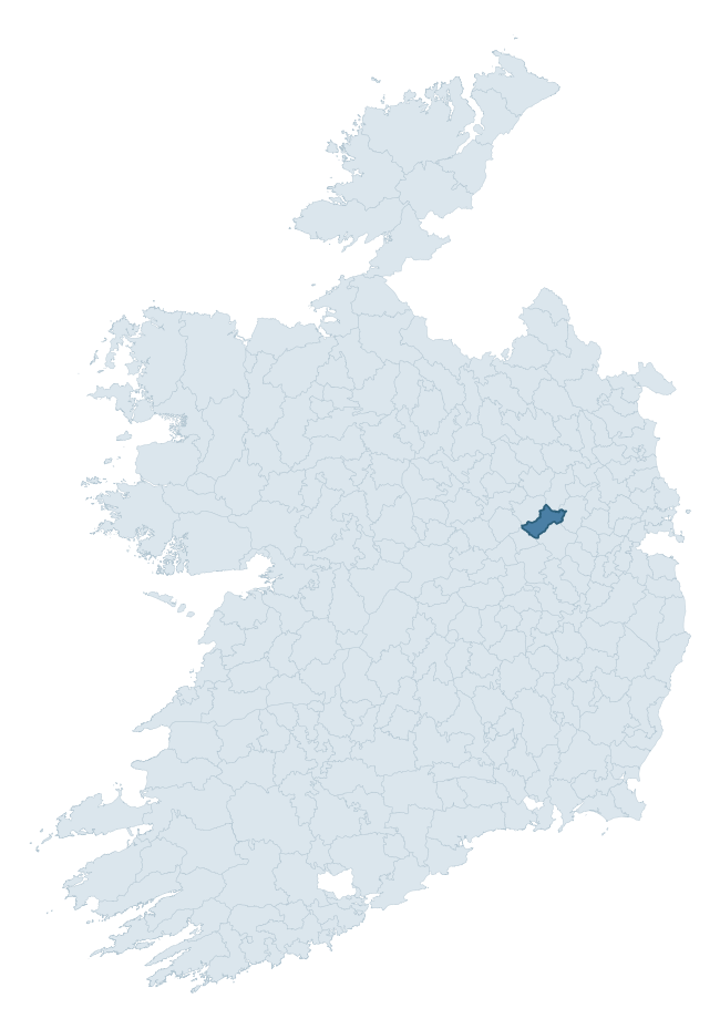
Where this barony sits in the Republic of Ireland
Geology and preservation
Bedrock geology shapes the landscape long before any settlement begins — controlling soil drainage, agricultural potential, the survival of upstanding monuments, and the preservation of buried archaeology. The figures below come from the Geological Survey Ireland 1:100,000 bedrock map.
The bedrock underlying Moyfenrath Upper is predominantly limestone (77% of the barony by area), laid down during the Carboniferous period (100% by area, around 359 to 299 million years ago). Limestone is the most heritage-rich bedrock in Ireland. It supports fertile, well-drained soils that favoured dense Early Medieval settlement and Norman manorial agriculture, and it weathers into karst features — sinkholes, caves, swallow holes, and souterrains — that frequently carry archaeology. Where peat overlies limestone, organic preservation can be exceptional. A substantial secondary geology of oolitic limestone (21%) adds further variety to the underlying landscape. The single largest mapped unit is the Lucan Formation (44% of the barony's bedrock).
Rock type composition
Largest mapped unit: Lucan Formation (44% of the barony)
Placename evidence
Logainm records 9 heritage-diagnostic placenames for Moyfenrath Upper, a modest sample drawn predominantly from the townland record. The dominant stratum is early christian ecclesiastical. The most frequent diagnostic roots are cill- (7) and gall- (2). With a sample of this size the count should be treated as indicative rather than definitive.
Pre-Christian / Early Medieval Defensive
| Root | Count | Meaning |
|---|---|---|
| ráth- | 1 | earthen ringfort |
Early Christian Ecclesiastical
| Root | Count | Meaning |
|---|---|---|
| cill- | 7 | church (early) |
| cillín- | 1 | unconsecrated burial ground |
Burial, Ritual, and Norse-Contact
| Root | Count | Meaning |
|---|---|---|
| gall- | 2 | foreigner — Norse settlement marker |
Other baronies in Meath
About this profile
Click any section below to expand.
What is a barony?
A barony is a historic administrative unit in Ireland, broadly equivalent to an English hundred. The 280 baronies used here are from the OSi 2019 National Statutory Boundaries (generalised 20m), covering the 26 counties of the Republic of Ireland. Baronies derive from the Norman period, were formalised in the 17th century, and have not been redrawn for statistical purposes. They vary enormously in area, from compact urban baronies in Dublin to vast upland baronies in Connacht, and should not be compared by raw site count without accounting for area differences.
What counts as a site?
This profile combines three distinct heritage registers, each with its own definition of what constitutes a recordable site:
- Archaeological sites (NMS). The National Monuments Service Sites and Monuments Record (SMR) catalogues every known archaeological monument or site of archaeological interest in the Republic, from prehistoric burial mounds and ringforts to medieval churches and post-medieval defensive works. Inclusion does not require legal protection — only that the site has been identified, surveyed, and assessed as having archaeological value. A separate subset of these sites lies within a recorded protection zone, which gives them statutory protection under the National Monuments Acts.
- Listed buildings (NIAH). The National Inventory of Architectural Heritage records buildings of architectural, historical, archaeological, artistic, cultural, scientific, social, or technical interest. Each surveyed structure is appraised on a five-tier scale: International, National, Regional, Local, and Record-Only. The NIAH appraisal is informational rather than strictly statutory, but it underpins local-authority Record of Protected Structures (RPS) listings.
- Heritage placenames (Logainm). Logainm is the authoritative database of Irish placenames maintained by the Placenames Branch. This profile applies a heritage-diagnostic classifier to the Irish-language form of each townland name, flagging roots that signal defensive sites (ráth-, lios-, dún-, caiseal-, cathair-), ecclesiastical foundations (cill-, teampall-, domhnach-, mainistir-), prehistoric burial-ritual features (tuaim-, carn-, leaba-), or Norse-contact settlement (gall-). Townlands without one of these diagnostic roots are not flagged here — they may still carry historical significance, but that significance is not encoded in the name itself.
Editorial principles
The narrative sections of this profile follow several explicit principles:
- Evidential. Every claim about this barony’s heritage character is anchored in the underlying register data. Where a site count, a placename count, or a percentile rank is cited, it is computed from the source datasets at export time, not estimated.
- Comparative. Counts and metrics are reported alongside their percentile rank against the other 279 ROI baronies. A barony with 50 ringforts in absolute terms could be unusually high or unusually low depending on its size and regional context; percentile ranking removes that ambiguity.
- Transparent on limits. Where a register has known coverage gaps, survey biases, or data-quality issues that affect this barony’s figures, the profile flags them rather than presenting the numbers as definitive.
- No interpretation beyond what the data supports. The narrative does not speculate about historical events, social dynamics, or cultural meaning beyond what the recorded heritage and placename evidence directly attests.
Data caveats and limits
- NMS Sites and Monuments Record is the product of survey campaigns conducted at different intensities across different counties and decades. Some baronies have been surveyed more thoroughly than others, and absolute counts should be read in that light. Sites destroyed by development before survey are typically not represented; sites in heavily forested or upland terrain are sometimes under-recorded.
- NIAH coverage is broadly complete for the Republic of Ireland but the survey was conducted on a rolling county-by-county basis, and the most recent appraisal date varies. Buildings demolished or substantially altered after their original survey may still appear in the register; conversely, recent buildings of merit may not yet have been appraised.
- Logainm classification applies a deliberately conservative pattern-matching approach to the Irish-language townland forms. The classifier prioritises true positives over recall: a townland may carry a heritage signal that the classifier doesn’t recognise, particularly where the diagnostic root has been heavily anglicised or where the townland name draws on a less common term. The 60,000+ townland records and ~9,800 classified placenames give a substantial signal at barony scale, but individual townland names should be checked against Logainm directly for definitive interpretation.
- Period attribution. The chronological distribution reflects only those NMS sites that carry a recognised period attribution in the source data. Sites listed as “Unknown” period are excluded from the dated subset.
- Boundary changes. Some baronies have undergone minor boundary adjustments since their 19th-century definition; the OSi 2019 generalised boundaries used here are the current statutory definition and may differ slightly from historical maps in border areas.
- Bedrock geology is mapped at 1:100,000 scale, which means local variation within a barony — small pockets of different rock type, mineral veins, alluvium overlying bedrock — is generalised. The dominant-system and rocktype figures are area-weighted, so a barony reading “70% Carboniferous limestone” may still contain small but archaeologically important pockets of older or younger rock. Around 3% of GSI polygons do not match the lexicon and contribute no rocktype or system attribution.
Data sources
- National Monuments Service — Sites and Monuments Record (SMR) https://data.gov.ie/dataset/national-monuments-service-archaeological-survey-of-ireland
- National Inventory of Architectural Heritage (NIAH) https://data.gov.ie/dataset/national-inventory-of-architectural-heritage-niah-national-dataset
- Logainm — Placenames Database of Ireland https://www.logainm.ie/
- Ordnance Survey Ireland — National Statutory Barony Boundaries 2019 https://data-osi.opendata.arcgis.com/
- EURODEM — European Digital Elevation Model https://www.mapsforeurope.org/datasets/euro-dem
- ESA WorldCover https://esa-worldcover.org/en
- Geological Survey Ireland — 1:100,000 Bedrock Geology https://www.gsi.ie/en-ie/data-and-maps/Pages/Bedrock.aspx
Explore more: Search any of the 280 ROI baronies, browse by historical province, or read the methodology and data sources for the full Republic of Ireland Heritage Tool.