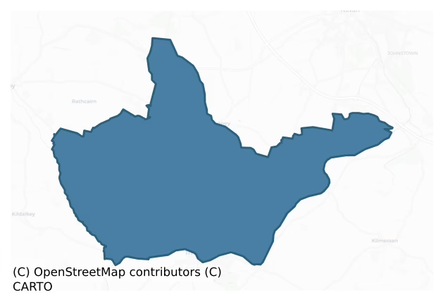
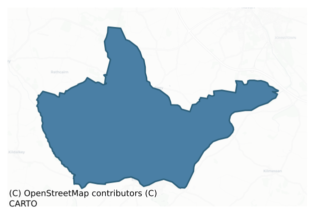
Navan Upper is a barony of County Meath, in the historical province of Leinster (Irish: An Uaimh Uachtarach), covering 72 km² of land. The barony records 205 NMS archaeological sites and 32 NIAH listed buildings, placing it at around the 77th percentile among 280 ROI baronies for sites per km². This means it is in the top third of all baronies for sites per km². Dated archaeological evidence runs from the Early Bronze Age through to the Medieval, spanning 5 of 9 archaeological periods, placing the barony in the 5th percentile among 280 ROI baronies for chronological depth. This means it is in the bottom tenth of all baronies for chronological depth. The largest dated subset of recorded sites dates to the Iron Age.
Heritage at a glance
Percentile rankings throughout this profile compare each barony only against the other 279 Republic of Ireland baronies.
The recorded heritage of Navan Upper
The National Monuments Service Sites and Monuments Record (SMR) is the statutory inventory of archaeological sites for the Republic of Ireland, maintained by the Department of Tourism, Culture, Arts, Gaeltacht, Sport and Media. Sites recorded here include earthworks, ringforts, megalithic tombs, ecclesiastical remains, and post-medieval features; not every record is legally protected, but each is registered as a monument of archaeological interest.
The National Monuments Service records 205 archaeological sites in Navan Upper, putting it at the 77th percentile among 280 ROI baronies for sites per km². This means it is in the top third of all baronies for sites per km². Protection coverage is near-universal — 201 sites (98%) fall within a recorded monument protection zone, indicating an extensively surveyed landscape. The record is dominated by defensive sites — ringforts, enclosures, hillforts, and stone forts (51 sites, 25% of the total), with ecclesiastical sites forming a substantial secondary presence (39 sites, 19%). Ring-ditch is the most prevalent type, making up 15% of the barony's recorded sites (31 records) — well above the ROI average of 6% across all baronies where this type occurs. Ring-ditch is a circular ditch under 20m across, often the ploughed-out remains of a barrow, ring-barrow or roundhouse. Other significant types include Enclosure (29) and Ringfort – rath (13). Enclosure is a banked or ditched feature of uncertain type, used as a catch-all where the original function cannot be determined from surface evidence; Ringfort – rath is an earthen ringfort enclosed by a bank and external ditch — the most common Early Medieval farmstead, broadly dated 500–1000 AD. Across the barony's 72 km², this gives a recorded density of 2.86 sites per km².
Most common monument types
Hover or tap a monument type to see its definition.
| Type | Count |
|---|---|
| Ring-ditch a circular ditch under 20m across, often the ploughed-out remains of a barrow, ring-barrow or roundhouse | 31 |
| Enclosure a banked or ditched feature of uncertain type, used as a catch-all where the original function cannot be determined from surface evidence | 29 |
| Ringfort – rath an earthen ringfort enclosed by a bank and external ditch — the most common Early Medieval farmstead, broadly dated 500–1000 AD | 13 |
| Graveslab a recumbent grave-marking slab, dated 1200–1700 AD | 12 |
| Church a building used for public Christian worship, of any date from c. 500 AD onwards | 10 |
| Graveyard a burial area associated with a church, in use from the medieval period onwards | 9 |
| Excavation – miscellaneous | 7 |
| Bridge a built structure spanning a river or ravine to allow crossing, dated medieval onwards | 6 |
Chronological distribution
The dated archaeological record for Navan Upper spans from the Early Bronze Age through to the Medieval, with activity attested across 5 of 9 archaeological periods. This is the 5th percentile across ROI baronies — a relatively narrow chronological band, with much of Irish prehistory not represented in the dated record. Every period from earliest to latest is represented in the record — an unbroken sequence of dated activity across the full chronological span. Activity concentrates most heavily in the Iron Age (55 sites, 42% of dated material), with the Medieval forming a secondary peak (42 sites, 32%). A further 75 recorded sites (37% of the overall NMS register for the barony) carry no period attribution — appearing as 'Unknown' in the bar chart below. This typically reflects either records that pre-date the standardised period vocabulary or sites awaiting specialist dating review, rather than a genuine absence of chronological evidence.
Sample of recorded monuments
Show 25 sample monuments (of 205 total)
A representative sample of 25 recorded monuments drawn from the barony’s 205 total NMS entries. Sites within a recorded monument protection zone and rarer site types are prioritised so the list shows a meaningful cross-section rather than only the most common type. Each entry shows the official Sites and Monuments Record reference number and the description published by the National Monuments Service.
House – 17th century
The Rochfort family are associated with Kilbride since at least 1415 (Longfield 1971, 30, fn 3). According to the Civil Survey (1654-6) Robert Rochfort owned 328 acres at Kilbride in Moymet parish in 1640, and on the…
The Rochfort family are associated with Kilbride since at least 1415 (Longfield 1971, 30, fn 3). According to the Civil Survey (1654-6) Robert Rochfort owned 328 acres at Kilbride in Moymet parish in 1640, and on the property were ‘a stone house and a mill’ (Simington 1940, 244). In 1685 Robert Longfield who was born in Wales received land grants in counties Clare, and Westmeath, while in Meath he acquired 641 acres largely in Kilbride alias Kilbridge, Kellistown (Kennastown?), Robertstown and Villonage (?) as the manor of Kilbride, where he settled. Although he forfeited the estate by supporting James II in 1689, it was restored to him in 1692 (Longfield 1971, 30-1). His son, William, or more probably his grandson, Robert, adapted the Rochfort house into a three bay, two storey and attic mansion by inserting large Georgian windows and a pediment doorway at the first floor on the E side. A large house was attached to the S in the nineteenth century.
The original N-S house (ext. dims c. 15m N-S; c. 9m E-W) has a base-batter and three barrel-vaults aligned E-W at the ground floor, but the entrance was in an attached tower with a newel stairs at the N end of the W wall which led to the first floor, while a separate entrance in the W wall led to the vaulted chambers. A single blocked light in the W wall is the only recognisable original feature on the first floor and the joists for the ceiling are set into the long E and W walls. There is a blocked light on the second floor o…
Barrow – mound barrow
Situated on a slight rise in a gently undulating landscape. It is not depicted as an antiquity on any map. This is an oval mound (dims c. 15m N-S; c. 8m E-W; H 1.5m). Two set stones on the perimeter at W may be kerb…
Situated on a slight rise in a gently undulating landscape. It is not depicted as an antiquity on any map. This is an oval mound (dims c. 15m N-S; c. 8m E-W; H 1.5m). Two set stones on the perimeter at W may be kerb stones. It is listed as possible passage-tomb (Herity 1974, 252). (Moore 1960)
The above description is derived from the published 'Archaeological Inventory of County Meath' (Dublin: Stationery Office, 1987). In certain instances the entries have been revised and updated in the light of recent research.
Compiled by: Michael Moore
Date of revision: 17 April 2019
Gatehouse
Located on a level landscape c. 80m N of the tower house (ME030-023—-) and the house (ME030-023001-). This is a rectangular structure (ext. dims 7.4m E-W; 5.6m N-S) with a vaulted N-S passage (Wth 3.6m) behind a round…
Located on a level landscape c. 80m N of the tower house (ME030-023—-) and the house (ME030-023001-). This is a rectangular structure (ext. dims 7.4m E-W; 5.6m N-S) with a vaulted N-S passage (Wth 3.6m) behind a round arch on the N wall, but much of the vault is damaged. A flat-arched doorway in the W wall of the passage leads to a guard room with a N-S barrel-vault and a light in the N wall and another in the S wall. Externally, a flat-arched doorway (Wth 0.78m) in the S wall leads to a newel stairs that rises to the first floor, which has large windows in the N and W walls and a fireplace with two small lights in the E wall.
The above description is derived from the published 'Archaeological Inventory of County Meath' (Dublin: Stationery Office, 1987). In certain instances the entries have been revised and updated in the light of recent research.
Compiled by: Michael Moore
Date of revision: 28 June 2016
Earthwork
Situated in a relatively low-lying position on the S bank of a small NW-SE section of a canalised stream, which is just to the NE. A small circular embanked enclosure (diam. c. 20-25m) is depicted only on the 1836…
Situated in a relatively low-lying position on the S bank of a small NW-SE section of a canalised stream, which is just to the NE. A small circular embanked enclosure (diam. c. 20-25m) is depicted only on the 1836 edition of the OS 6-inch map where it is described as a ‘Fort’. Slight traces of an oval area (dims c. 40m x c. 30m) were visible in a ploughed field in 1969 when a piece of iron slag and burnt clay was apparent (SMR file), but an enclosure has never become apparent on any aerial imagery.
The above description is derived from the published 'Archaeological Inventory of County Meath' (Dublin: Stationery Office, 1987). In certain instances the entries have been revised and updated in the light of recent research.
Compiled by: Michael Moore
Date of revision: 17 April 2019
Religious house – Cistercian monks
Situated on a low rise in a broad bend of the River Boyne with a SW-NE section of the river c. 150m to the SE. The Cistercian abbey known as the Beatitudes and which was dedicated to the Blessed Virgin was founded by…
Situated on a low rise in a broad bend of the River Boyne with a SW-NE section of the river c. 150m to the SE. The Cistercian abbey known as the Beatitudes and which was dedicated to the Blessed Virgin was founded by Marchad O'Maeil Sheachlainn, king of Meath c. 1150. It was the first daughter-house of Mellifont (LH023-007002-) and as it was within the Pale was able to remain in contact with it until both were suppressed in 1537-40. The abbey was endowed by Hugh de Lacy, and although he died in 1186, his body was buried here in 1195 after a dispute with the Augustinians at St Thomas’ abbey in Dublin (DU018-020051-), who got his head. The abbot was a lord of the realm, and in 1488 abbot James Castlemartin was pardoned for supporting the pretender to the throne, Lambert Simnel. There was a religious community at Bective up to the end (Hogan 1976). At the Suppression in 1537 the timbers of the church roof were used to repair a mill at Trim. A hall and a cloister ‘roofed with tiles’ are also mentioned in the description of the precinct.
There was 280 acres of demesne land together with a weir and a mill. Five tenants, with plots of 30-40 acres in the Grange of Bective, leased 175 acres, while there were four cottiers and 20 acres of commonage. There were other farms leased to tenants of a similar size with a compliment of cottiers: Balgyll (Balgill/Gillstown – 144 acres), Balbradok (Balbradagh – 155 acres), Dyellogh (Dunlough – 104 acres), Cloncoillen (Cloncullen – 120 acres)…
Castle – motte
Situated on a level landscape with the NW-SE Athboy River c. 150m to the SW. This is a circular, grass-covered mound (diam. of base 23m NW-SE; H 3.6-4.1m) with some trees, now much quarried. The church of Tremblestown…
Situated on a level landscape with the NW-SE Athboy River c. 150m to the SW. This is a circular, grass-covered mound (diam. of base 23m NW-SE; H 3.6-4.1m) with some trees, now much quarried. The church of Tremblestown (ME036-002—-) is c. 200m to the WNE, and the tower house (ME036-003—-) is adjacent c. 20m to the SW.
The above description is derived from the published 'Archaeological Inventory of County Meath' (Dublin: Stationery Office, 1987). In certain instances the entries have been revised and updated in the light of recent research.
Date of revision: 2 June 2016
Religious house – Dominican friars
Situated on a level landscape on the N bank of the River Boyne, with a NW-SE section of the stream c. 500m to the SW. It was just outside the walls of Trim on the N side. A full record has been made (Potterton 2005,…
Situated on a level landscape on the N bank of the River Boyne, with a NW-SE section of the stream c. 500m to the SW. It was just outside the walls of Trim on the N side. A full record has been made (Potterton 2005, 318-31), of which this is a summary. The Dominican friary, dedicated to the Assumption of the Blessed Virgin Mary, was founded in 1263 by Geoffrey de Geneville, who became a friar there in 1308 and was buried there in 1314 (Gwynn and Hadcock 1970, 230). The Hussey family of Galtrim (ME043-002—-) were generous benefactors and were frequently interred here but were not the founders. A synod of the Irish church was held there in 1291 (Cogan 1862-70, 1, 305-6), and Dominican chapters were held there in 1285, 1300 and 1315 (Conwell 1872-3, 388-90). Parliament even met here in 1446 and 1491 (Hennessy 2004, 10). In 1484 a legal case involving 70 acres adjoining the friary that had been granted by Richard, Duke of York, was settled to the friars' satisfaction (Potterton 2005, 323-4).
The friary was than in decline and being dismantled even before the Suppression. An extent of 1540 suggests that the church, cloister, hall, kitchen, garden, the cemetery and an orchard, covering 4 acres in total, were already dilapidated or dismantled. The only land remaining were a close of 3 acres, 63 acres in the commonage of Trim, and 6 acres at Tyllaughard (Tullyard) (White 1943, 308-09). The land was acquired by Sir Thomas Cussack of Cushinstown and Lismullin, who was accumulati…
Gateway
Situated on a SW-facing slope on the NE bank of the River Boyne, which is c. 40m distant. The town wall of Trim had a circuit of almost 2km with five gateways, but only this gate known as ‘Sheep Gate’ between the…
Situated on a SW-facing slope on the NE bank of the River Boyne, which is c. 40m distant. The town wall of Trim had a circuit of almost 2km with five gateways, but only this gate known as ‘Sheep Gate’ between the Augustinian abbey and the Porch Field, which the abbey owned in 1540 (White 1943, 303), survives. This is a rectangular masonry block (dims 8.45m NNE-SSW; 2.8-3.5m WNW-ESE; H c. 3m) with an entrance passage towards its N end. There are round arches over the inner (W: Wth 3.23m; H 3.8m) and outer (E: Wth 2.7m; H 3.3m) facades of the entrance passage, with draw-bar sockets at ground level inside the E arch only. The N wall of the entrance passage has a blocked doorway leading to a newel stairs to an upper level, while a short segmental arched passage on the S side leads to a now blocked doorway in the S wall giving access from the Porch field to the town when the main gate was closed. Archaeological monitoring (E003644) of new paths in the vicinity during 2007 produced no related material (Seaver 2010).
This is a National Monument in state ownership, No. 469.
See the attached view from SE
Compiled by: Michael Moore
Date of upload: 10 July 2019
Town defences
The earliest surviving murage grant for Trim in 1290 was renewed in 1308 and 1316 (Bradley and King 1985, 163), so the town walls might have been in place by 1315, as Edward Bruce refrained from attacking either the…
The earliest surviving murage grant for Trim in 1290 was renewed in 1308 and 1316 (Bradley and King 1985, 163), so the town walls might have been in place by 1315, as Edward Bruce refrained from attacking either the town or castle during his Irish campaign (1315-18). Additional murage in 1393, which also diverted the tolls of Athboy, Navan, and Skreen to Trim, testifies not only to the need to refurbish the walls but also to the status of Trim as the centre of the liberty that it retained until 1906 when the county council offices moved to the more central town of Navan (Hennessy 2004, 7). In 1422 Dunshaughlin, Dunboyne, Greenoge and Slane replaced the original tree towns in the supporting financial role. The town walls and the paving of the streets preoccupied the burgesses throughout the fifteenth century and in 1584 the quality of its walls was cited unsuccessfully to promote Trim as the site of Ireland’s first university. Although it is depicted as a walled town on the Down Survey maps (1658) the walls were known to be in a poor condition at that time, and the last recorded repairs were conducted in 1689. Thereafter they were neglected and even removed at some points, particularly where they hindered traffic, but considerable stretches remain.
The town wall had a circuit of almost 2km with five gateways, but only the ‘Sheep Gate’ (ME036-048011-) between the Augustinian abbey and the Porch Field (ME036-048054-), which it owned as demesne land in 1540 (White 1943, 303…
Cathedral
Situated at the S edge of a level landscape, and at the crest of a SW-facing slope down to a WSW-ENE section of the River Boyne. In 1206 Bishop Simon de Rochford founded the Augustinian priory of SS Peter and Paul at…
Situated at the S edge of a level landscape, and at the crest of a SW-facing slope down to a WSW-ENE section of the River Boyne. In 1206 Bishop Simon de Rochford founded the Augustinian priory of SS Peter and Paul at Newtown by Trim within the protective ambit afforded by the castle (ME036-048004-) at Trim. In 1216 a synod was held there, and Simon was buried in it in 1224 (Conwell 1872-4, 383). Since Clonard, which had been the diocesan centre, was burned in 1200, the church at Newtown began to fulfill that function. Although a licence to build a cathedral was granted in 1255 to Bishop Hugh de Tachmon, one was never constructed, and the church of the canons assumed the place. An attempt to replace the canons with a Dean and chapter of secular clergy in 1397 failed. The priory was of the congregation of St Victor, who maintained a stricter rule, and the names of many of the priors are known (Cogan 1862-70, 1, 312-15). Bishop Edward Stapples, who was appointed in 1529, supported the policy of suppressing the monasteries, but he was replaced by William Walsh under Queen Mary in 1554, to be replaced by Hugh Brady under Elizabeth in 1563. By then the priory was dissolved and the church in ruins. (Gwynn and Hadcock 1970, 97-8; 190)
According to an extent made in 1540 materials from ‘the cross church’ had been used to repair Portlester Castle (ME035-020—-) or sold, and what was left was only fit to repair the nearby church of Newtown by Trym (ME036-049005-). The demesne conta…
Historic town
Situated on both banks of a NW-SE run of the River Boyne. The town was built around slight hills on the NE bank at St Patrick’s church (ME036-048012-) and at the castle (ME036-048004-) on the SW bank. In 1172 King Henry…
Situated on both banks of a NW-SE run of the River Boyne. The town was built around slight hills on the NE bank at St Patrick’s church (ME036-048012-) and at the castle (ME036-048004-) on the SW bank. In 1172 King Henry II granted Meath to Hugh de Lacy ‘as Murrough O’Maelaghlin best held it’ (Otway-Ruthven 1968, 52-3). This king of Meath died in 1153 before the province was dismembered, so in theory de Lacy’s fief, if he could secure it, was as extensive as the modern counties of Meath, Westmeath and Longford with a large part of Offaly. Hugh determined that Trim would be the caput or centre of this vast estate and commenced planning a suitable headquarters for it in a castle that would be defensively strong as well as visually impressive and capable of administering a wide area.
A town would naturally grow up around such an important centre, but there had probably been settlement here for some time. Its Gaelic name Áth Thruim – the ford of the alder trees – suggests that it had long been an important, though possibly overgrown, fording point of the river. This may have been where the medieval bridge (ME036-048001-) and Market Street were later constructed on low-lying ground where the river might have been quite broad. A hoard of Middle Bronze Age axes and other prehistoric artefacts from the town testify to prehistoric traffic at least (Potterton 2005, 29-34). According to an eight century source Lommán, a disciple and nephew of St Patrick, was welcomed at Trim by Fede…
Burial
Situated on a slight gravel ridge. Archaeological testing (97E0389) of a road improvement scheme uncovered the inhumed remains of three males and one female aligned W-E. One burial produced a C14 date of 1694 +-37 BP…
Situated on a slight gravel ridge. Archaeological testing (97E0389) of a road improvement scheme uncovered the inhumed remains of three males and one female aligned W-E. One burial produced a C14 date of 1694 +-37 BP (Cal. AD 414-532). Further testing during 1998 recovered another inhumation 75m to the SE. A single male, aged 17-25, was lying supine W-E in a grave-cut (dis 1.38m E-W; 0.52m N-S; D 0.28-0.36m) c. 1m below present ground level. It produced a C14 date of 446+-46 (Cal. AD 1425-1461) demonstrating that it was unconnected with the earlier burials (Murphy 1998, 2000). Further testing (04E0622) by D. Noonan c. 100m to the NE at the nearest point produced no related material (excavatioins.ie 2004:1352), and testing (18E0631) by I. Russell c. 40m S of the main concentration produced no further inhumations (excavations.ie 2018:721).
Compiled by: Michael Moore
Date of upload: 22 October, 2018
Amended: 29 January 2021, 29 April 2021
Architectural fragment
From Potterton (2005, App. 13, 409-12)
At least fifty fragments of medieval masonry, mainly of window tracery, can be seen in the vicinity of the church of St Patrick (ME036-048012-). Most of the pieces have been…
From Potterton (2005, App. 13, 409-12)
At least fifty fragments of medieval masonry, mainly of window tracery, can be seen in the vicinity of the church of St Patrick (ME036-048012-). Most of the pieces have been gathered together and piled at the west end of the medieval chancel, but others are to be found underneath some of the table tombs in the graveyard, and several decorated pieces have been placed in the vestibule of the tower. Among the various slabs and pieces of masonry that have been assembled into a ‘fire-place’ are some window mullions with grooves for glazing. Two mullions are each decorated with an undulating branch of ivy and oak leaves in relief. A number of ogee-headed windows are also represented among the scattered vestiges, at least one of which was at least triple-light. There are also pieces of doorjambs and capitals as well as gable fragments and part of a carved stone drain or gutter. A number of worked sandstone blocks were reused in the construction of the west door of the tower.
In 1885 it was recorded (Butler 1854, 168) that ‘some years ago… the remains of another tomb and of a carved doorway [from Newtown Trim], for greater security were also inserted in the porch at the east end of Trim Church’. Butler also brought some decorated floor-tiles from Bective and others from Newtown Trim to St Patrick’s Church where he placed them in the wall of the vestry. In 1906 the tiles were still present (Anon. 1906, 449), but they are not visible today…
Tomb – chest tomb
From Potterton (2005, App. 13, 397, No. 4):
This large rectangular slab has been set up as a table tomb on a low side panel at the base of the window in the ruined chancel of St Patrick's church (ME036-048012-). An…
From Potterton (2005, App. 13, 397, No. 4):
This large rectangular slab has been set up as a table tomb on a low side panel at the base of the window in the ruined chancel of St Patrick's church (ME036-048012-). An incised marginal gothic inscription reads HIC: IACET.I [W]ALTERVS: THOVMBE: DE TRVM:/ Q‘: OBIIT: XVIII:. DIE: JVNII: A:D: M: CCCC: LVIII/. The letters on the first three sides of the inscription are spaced wide apart (c. 12cm), whereas those on the fourth side closer together (c. 3 cm). The central portion of the slab is undecorated, with the exception of three rows of three small circular depressions arranged in a square towards the base of the slab. It is not known what this design represents, although it seems to be contemporary with the Latin inscription. When Austin Cooper visited the churchyard on 15 May 1795 he recorded the inscription and wrote that ‘there was another which I could not read’ (Price 1942, 99). It is not clear what exactly he meant by this. [Length: 212cm; Width: 110cm; Thickness: 12cm],
Date of upload: 16 February, 2015
Well
An oval, earth-cut well (dims 1.42m; D 2.2m) containing silty sand that was closed with clay containing stone and slate was recorded in excavation (E002398). The skeletal remains of an adult male, who had suffered a…
An oval, earth-cut well (dims 1.42m; D 2.2m) containing silty sand that was closed with clay containing stone and slate was recorded in excavation (E002398). The skeletal remains of an adult male, who had suffered a traumatic death and can be dated to the 15th century, had slumped into the well through the collapse of its sides. Three other truncated inhumations were recorded in the vicinity. (Seaver 2011)
Compiled by: Michael Moore
Date of upload: 17 February, 2015
Amended: 11 August 2023
Field boundary
The Dominican friary (ME036-048022-) has some relict field banks attached to its precinct which are depicted on the 1836 edition of the OS 6-inch map. In the extent of the Friary at its Suppression in 1540 the site of…
The Dominican friary (ME036-048022-) has some relict field banks attached to its precinct which are depicted on the 1836 edition of the OS 6-inch map. In the extent of the Friary at its Suppression in 1540 the site of the church and cloister are described with ‘an orchard, garden and cemetery’ covering about four acres, and ‘a close of pasture adjacent to the wall of the house’ containing about 3 acres (White 1940, 308-09). The surviving area of about 5 acres (c. 2 ha) around the friary is divided by an L-shaped boundary into two fields and forms a park within the town. The boundary separated the church precinct from other land and is best preserved at the E end of the N section where it consists of an inner earthen bank (Wth of base 7m; H at S 0.6m; ext. H 0.8m) at S separated by a fosse (Wth top 4.2m; Wth of base 1.5m; ext. D 0.9m at N) often retaining water, from an outer earthen bank (Wth of base 4m; ext. H 0.5m at N).
Compiled by: Michael Moore
Date of upload: 8 July 2019
Stone sculpture
Outside the S doorway of the parish church of Clonbun (ME036-049005-) the ornate arch (Wth 1.66m; H 0.83m; D 0.26m) of a tomb recess with a carved representation of the crowning of the Virgin at the apex is set high in…
Outside the S doorway of the parish church of Clonbun (ME036-049005-) the ornate arch (Wth 1.66m; H 0.83m; D 0.26m) of a tomb recess with a carved representation of the crowning of the Virgin at the apex is set high in the wall, probably as a result of conservation works. It has been described by Hunt (1974, 1, 211) as:
No. 198 Newtown Trim. Niche-head with the Crowning of the Virgin. Late 15th century
On the outer face of the south wall of the small medieval church to the east of the Cathedral is a round-headed niche built into its present position in 1842. It is not clear whether it was part of a doorway or a canopied tomb of Western type. The arch is decorated with foliate crockets and from the centre springs the commencement of a pinnacle, containing within its spandrels a finely carved group of the Coronation of the Virgin. On the sinister side is God the Father placing a crown upon the head of the Virgin who sits upon his right with her hands raised in prayer. On either side below their knees are angels with re-curved wings and flowing drapery, swinging censers. Below this, on the surface of the moulding of the face of the arch, is a female head, the hair parted and hanging in two tresses at the sides of the face. This is flanked by two figures of birds, their heads turned inwards and with their wings half-opened. This and the group above are highly competent and quite masterly pieces of carving in the full European idiom of the late fifteenth century.
Compile…
Holed stone
There is a holed stone is in the graveyard (ME036-049014-) associated with the parish church of Newtown Clonbun (ME036-049005-) and the Cathedral of SS Peter and Paul (ME036-049002-). It is aligned N-S and has a…
There is a holed stone is in the graveyard (ME036-049014-) associated with the parish church of Newtown Clonbun (ME036-049005-) and the Cathedral of SS Peter and Paul (ME036-049002-). It is aligned N-S and has a subrectangular cross-section (dims 0.36-0.42m x 0.1-0.18m; H 0.53m) with a hole (diam. 5cm) at the top. (Crawford 1915)
Compiled by: Michael Moore
Date of upload: 17 February, 2015
Burnt spread
Two small spreads of burnt stone and charcoal (dims c. 2m x 1m; c. 2m x c. 1m) were noted at a stripped soil store during the construction of a bypass road (pers com. Carmel Duffy 25/10/2001), but the precise location…
Two small spreads of burnt stone and charcoal (dims c. 2m x 1m; c. 2m x c. 1m) were noted at a stripped soil store during the construction of a bypass road (pers com. Carmel Duffy 25/10/2001), but the precise location is not certain.
Compiled by: Michael Moore
Date of upload: 8 July, 2019
Prison
Situated on the N bank of the canalised WNW-ESE River Boyne as it passes through Trim, with the stream immediately to the SW. Provision of a town gaol is stipulated in a charter of 1430, but whether one was provided…
Situated on the N bank of the canalised WNW-ESE River Boyne as it passes through Trim, with the stream immediately to the SW. Provision of a town gaol is stipulated in a charter of 1430, but whether one was provided then is not known (Potterton 2005, 136). A prison (ME036-048085-) is associated with the castle from the beginning, but by the seventeenth century it was in disrepair and enticements for the lesee of the manor to construct a new structure at the castle were ineffectual. By c. 1617 the court had become established on the site of Franciscan friary (ME036-048025-) (Hennessy 2004, 12), and the goal had moved to Mill St. by 1684. The form of the Mill Street building is not known, but it had been replaced by a new prison building in 1760 (ibid. 12). This was extended c. 1805 and extended again in 1823 to include a treadmill, 36 cells, 4 debtors’ rooms, 7 dayrooms, a chapel, and a hospital room. This wasn’t enough to sustain it and it was closed in 1833. It seems to have been U-shaped with two or three wings extending from the street frontage towards the river as depicted on the 1836 OS 6-inch map where it is described as the ‘Old Gaol’.
Compiled by: Michael Moore
Date of upload: 9 July 2019
Building
Situated on a S-facing slope and on the NW side of Main Street. An archaeological rescue excavation and watching brief (E000404) in 1987 uncovered evidence of a medieval building and other features (Walsh 1988). A…
Situated on a S-facing slope and on the NW side of Main Street. An archaeological rescue excavation and watching brief (E000404) in 1987 uncovered evidence of a medieval building and other features (Walsh 1988). A trench (dims c. 13m NW-SE; c. 7m NE-SW) was opened mechanically and excavated below modern disturbance and garden soil (T c. 0.7m) at the N end where stratified medieval deposits survived (dims c. 4m x c. 5m). A layer of gritty silt, interpreted as the original sod contained animal bone and was overlain by thin layers with charcoal flecks. This was covered by a sandy clay containing animal bone and a shale bracelet. This surface was covered by garden soil, which was sealed by a cobbled surface. The cobbles were breached by a pit containing Ham Green and local wares as well as an antler comb. The pit was sealed by an organic layer under redeposited river gravels. The area was bordered at NE by a NW-SE wall (L 4m) of drystone construction that was robbed (Wth c. 1.5m) but had been built on the subsoil, whether inserted or not is not known. A slot-trench (L 4.5m plus; Wth 0.6m; D 0.3m) extended NE from its S end. The wall and trench are interpreted as from a house that extended further NE and NW, and at least one floor was recognised, although no internal features were evident. About 12m to the W a NE-SW ditch (ME036-048047-) was sampled. (Walsh 1990-91, 42-5)
Compiled by: Michael Moore
Date of upload: 9 July 2019
Structure
Situated on a S-facing slope and on the NW side of Main Street. An archaeological rescue excavation and watching brief (E000404) in 1987 uncovered evidence of a medieval building (ME036-048046-) and other features. In…
Situated on a S-facing slope and on the NW side of Main Street. An archaeological rescue excavation and watching brief (E000404) in 1987 uncovered evidence of a medieval building (ME036-048046-) and other features. In the course of the watching brief a substantial wall (L 8m plus; Wth of base 1.8m; max. H 1m) with base-batters on both faces was identified running NE-SW over the area of the house (ME036-048046-) and parallel with the present street. A sherd of medieval cooking ware was recovered from the fabric, and the wall was sealed beneath garden soil and rubble. (Walsh 1990-91, 45)
A wall (Wth 0.95-1.2m) was uncovered in archaeological testing (19E0573) by L. Coen c. 20m to the NW (excavations.ie 2019: 245, 602). It has the same alignment as this wall and the street, and extends off to the NE (L 15m plus) just outside the rear wall of the Library. It has a drain (Wth 0.8-1m; D 0.5m plus) on its SE side and is thought to be medieval although there were no artefacts associated with it. (Coen 2019)
Compiled by: Michael Moore
Date of upload: 9 July 2019
Amended: 30 April, 2021
House – 16th/17th century
Located on a level landscape. Sir James Dillon, the eldest son of Sir Lucas Dillon of Newtown and Moymet, became the first Earl of Roscommon in 1622 (Conwell 1873, 378-9). According to the Civil Survey (1654-6), the…
Located on a level landscape. Sir James Dillon, the eldest son of Sir Lucas Dillon of Newtown and Moymet, became the first Earl of Roscommon in 1622 (Conwell 1873, 378-9). According to the Civil Survey (1654-6), the Earl, a Protestant, owned 210 acres at Moymet in Navan barony in 1640, and the property included ‘a Castle, a Church ruinated, a stone house, an open Quarry, and an orchard.’ (Simington 1940, 204).
The house was described (Conwell 1873, 369) as ‘122 feet (c. 37m) in length, and 43 feet ( c. 13m) wide, the principal walls being 5.5 feet (c. 1.7m) thick. Seven large windows can still be counted in the southern portion of the ruins’. It survives today as the remains of a barrel-vaulted chamber (surviving L 11.7m E-W; int. Wth 4.4m) situated c. 15m W of the tower house (ME030-023—-). The gatehouse (ME030-022—-) is c. 80m to the NNE and the parish church of Moymet (ME030-21—-) is c. 80m to the NW.
The above description is derived from the published 'Archaeological Inventory of County Meath' (Dublin: Stationery Office, 1987). In certain instances the entries have been revised and updated in the light of recent research.
Compiled by: Michael Moore
Date of revision: 28 June 2016
House – 16th century
Situated on a low rise in a broad bend of the River Boyne with a SW-NE section of the river c. 150m to the SE. The Cistercian abbey of the Beatitudes (ME031-026—-) was suppressed in 1537 when the estate was leased by…
Situated on a low rise in a broad bend of the River Boyne with a SW-NE section of the river c. 150m to the SE. The Cistercian abbey of the Beatitudes (ME031-026—-) was suppressed in 1537 when the estate was leased by Thomas Agard, a vice Treasurer of the Mint, and purchased from the Crown by Andrew Wyse in 1552. Sometime in the later 16th century, after the Suppression, the buildings were transformed into a U-shaped house, adapting the first floor of the E, S and W ranges as accommodation. The tower house was incorporated into the design and the W range was extended northwards into the W end of the now defunct church. A new entrance was provided on the S front at the first floor, reached by a grand stone staircase. The old chapter house was converted into a kitchen with a large oven in the adjacent chamber to the N. The other vaulted chambers of the ground floor were used for storage, and a stairs to the first floor was inserted in the S range, accessed from the old cloister walk. The most distinctive features of this phase are the large chimney stacks that are particularly visible, two on the N wall of the S range and one on the N gable of the E range. The first floor and an attic survive here with large rectangular windows of two or three lights under rectangular hood mouldings. It might have continued in occupation until Bective House was built around 1790 (Bence-Jones 1978, 35) c. 1.5km to the NNE. (Leask 1916)
The above description is derived from the published '…
Ring-ditch
Located just SW of a local summit in a fairly level landscape. The outermost fosse of rath (ME036-007—-) is entangled at SW with a ring-ditch (diam. c. 20m) defined by a single fosse feature which is visible on aerial…
Located just SW of a local summit in a fairly level landscape. The outermost fosse of rath (ME036-007—-) is entangled at SW with a ring-ditch (diam. c. 20m) defined by a single fosse feature which is visible on aerial photographs (CUCAP: NDU 51; BGH 81) taken in 1968 before the land was developed a golf course.
Compiled by: Michael Moore
Date of upload: 5 July, 2019
Listed buildings
The National Inventory of Architectural Heritage (NIAH) is a state survey appraising buildings of architectural, historical, archaeological, artistic, cultural, scientific, social, or technical interest. Each surveyed structure receives a rating from International (the highest, for buildings of European importance) through National, Regional, Local, and Record-Only.
The NIAH records only 32 listed buildings in Navan Upper, the 15th percentile across ROI baronies — a relatively thin architectural record. All recorded buildings carry Regional or lower grading; the barony does not contain any structures appraised as being of National or International architectural importance. Construction dates concentrate most heavily in the Victorian (1830-1900) period. The most-recorded building type is house (17 examples, 53% of the listed stock).
Terrain and environment
Mean elevation across the barony is 64m — the 26th percentile among 280 ROI baronies for elevation. This means it is in the bottom third of all baronies for elevation. This is a relatively low-lying landscape by ROI standards. Elevation matters for heritage because higher-altitude baronies typically favour defensive monuments — ringforts and hilltop forts placed on prominent ground — while lowland baronies are more likely to carry the dense settlement and church networks of intensive agricultural landscapes. Mean slope is 2.0° — the 7th percentile among 280 ROI baronies for slope. This means it is in the bottom tenth of all baronies for slope. This is broadly flat terrain, the kind of landscape best suited to intensive agriculture. Slope is a key control on both land use and archaeological preservation: steep ground resists ploughing and tends to preserve earthworks intact, while gentle slopes favour intensive cultivation that damages or destroys surface archaeology over time. The Topographic Wetness Index averages 11.8, the 91st percentile among 280 ROI baronies for wetness. This means it is in the top tenth of all baronies for wetness. This is wet, slow-draining ground by ROI standards — the kind of landscape that may carry waterlogged archaeological sites of unusual preservation value. Drainage matters for heritage because poorly-drained ground preserves organic archaeology (wooden trackways, leather, textiles, and on rare occasions human remains) far better than free-draining soil; well-drained ground favours arable use but destroys organic material rapidly. The land-cover mosaic combines improved grassland (60%), arable farmland (30%), and woodland (9%), giving a mixed agricultural and semi-natural landscape. In overall character, this is low-lying, gently-sloping terrain — characteristic of Ireland's central plain and coastal lowlands, with land use dominated by improved grassland.
Terrain measurements
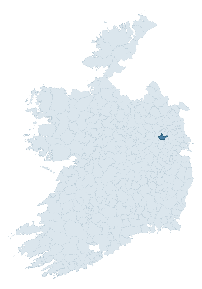
Where this barony sits in the Republic of Ireland
Geology and preservation
Bedrock geology shapes the landscape long before any settlement begins — controlling soil drainage, agricultural potential, the survival of upstanding monuments, and the preservation of buried archaeology. The figures below come from the Geological Survey Ireland 1:100,000 bedrock map.
The bedrock underlying Navan Upper is predominantly limestone (92% of the barony by area), laid down during the Carboniferous period (100% by area, around 359 to 299 million years ago). Limestone is the most heritage-rich bedrock in Ireland. It supports fertile, well-drained soils that favoured dense Early Medieval settlement and Norman manorial agriculture, and it weathers into karst features — sinkholes, caves, swallow holes, and souterrains — that frequently carry archaeology. Where peat overlies limestone, organic preservation can be exceptional. The single largest mapped unit is the Lucan Formation (92% of the barony's bedrock). With only 2 distinct rock types mapped, the barony is geologically uniform compared to the rest of the Republic (12th percentile for diversity) — a single coherent bedrock landscape.
Rock type composition
Largest mapped unit: Lucan Formation (92% of the barony)
Placename evidence
Logainm records 10 heritage-diagnostic placenames for Navan Upper, a modest sample drawn predominantly from the townland record. The dominant stratum is early christian ecclesiastical. The most frequent diagnostic roots are cill- (5) and dún- (3). With a sample of this size the count should be treated as indicative rather than definitive.
Pre-Christian / Early Medieval Defensive
| Root | Count | Meaning |
|---|---|---|
| dún- | 3 | hilltop or promontory fort |
| ráth- | 1 | earthen ringfort |
Early Christian Ecclesiastical
| Root | Count | Meaning |
|---|---|---|
| cill- | 5 | church (early) |
| gráinseach- | 1 | monastic farm / grange |
Other baronies in Meath
About this profile
Click any section below to expand.
What is a barony?
A barony is a historic administrative unit in Ireland, broadly equivalent to an English hundred. The 280 baronies used here are from the OSi 2019 National Statutory Boundaries (generalised 20m), covering the 26 counties of the Republic of Ireland. Baronies derive from the Norman period, were formalised in the 17th century, and have not been redrawn for statistical purposes. They vary enormously in area, from compact urban baronies in Dublin to vast upland baronies in Connacht, and should not be compared by raw site count without accounting for area differences.
What counts as a site?
This profile combines three distinct heritage registers, each with its own definition of what constitutes a recordable site:
- Archaeological sites (NMS). The National Monuments Service Sites and Monuments Record (SMR) catalogues every known archaeological monument or site of archaeological interest in the Republic, from prehistoric burial mounds and ringforts to medieval churches and post-medieval defensive works. Inclusion does not require legal protection — only that the site has been identified, surveyed, and assessed as having archaeological value. A separate subset of these sites lies within a recorded protection zone, which gives them statutory protection under the National Monuments Acts.
- Listed buildings (NIAH). The National Inventory of Architectural Heritage records buildings of architectural, historical, archaeological, artistic, cultural, scientific, social, or technical interest. Each surveyed structure is appraised on a five-tier scale: International, National, Regional, Local, and Record-Only. The NIAH appraisal is informational rather than strictly statutory, but it underpins local-authority Record of Protected Structures (RPS) listings.
- Heritage placenames (Logainm). Logainm is the authoritative database of Irish placenames maintained by the Placenames Branch. This profile applies a heritage-diagnostic classifier to the Irish-language form of each townland name, flagging roots that signal defensive sites (ráth-, lios-, dún-, caiseal-, cathair-), ecclesiastical foundations (cill-, teampall-, domhnach-, mainistir-), prehistoric burial-ritual features (tuaim-, carn-, leaba-), or Norse-contact settlement (gall-). Townlands without one of these diagnostic roots are not flagged here — they may still carry historical significance, but that significance is not encoded in the name itself.
Editorial principles
The narrative sections of this profile follow several explicit principles:
- Evidential. Every claim about this barony’s heritage character is anchored in the underlying register data. Where a site count, a placename count, or a percentile rank is cited, it is computed from the source datasets at export time, not estimated.
- Comparative. Counts and metrics are reported alongside their percentile rank against the other 279 ROI baronies. A barony with 50 ringforts in absolute terms could be unusually high or unusually low depending on its size and regional context; percentile ranking removes that ambiguity.
- Transparent on limits. Where a register has known coverage gaps, survey biases, or data-quality issues that affect this barony’s figures, the profile flags them rather than presenting the numbers as definitive.
- No interpretation beyond what the data supports. The narrative does not speculate about historical events, social dynamics, or cultural meaning beyond what the recorded heritage and placename evidence directly attests.
Data caveats and limits
- NMS Sites and Monuments Record is the product of survey campaigns conducted at different intensities across different counties and decades. Some baronies have been surveyed more thoroughly than others, and absolute counts should be read in that light. Sites destroyed by development before survey are typically not represented; sites in heavily forested or upland terrain are sometimes under-recorded.
- NIAH coverage is broadly complete for the Republic of Ireland but the survey was conducted on a rolling county-by-county basis, and the most recent appraisal date varies. Buildings demolished or substantially altered after their original survey may still appear in the register; conversely, recent buildings of merit may not yet have been appraised.
- Logainm classification applies a deliberately conservative pattern-matching approach to the Irish-language townland forms. The classifier prioritises true positives over recall: a townland may carry a heritage signal that the classifier doesn’t recognise, particularly where the diagnostic root has been heavily anglicised or where the townland name draws on a less common term. The 60,000+ townland records and ~9,800 classified placenames give a substantial signal at barony scale, but individual townland names should be checked against Logainm directly for definitive interpretation.
- Period attribution. The chronological distribution reflects only those NMS sites that carry a recognised period attribution in the source data. Sites listed as “Unknown” period are excluded from the dated subset.
- Boundary changes. Some baronies have undergone minor boundary adjustments since their 19th-century definition; the OSi 2019 generalised boundaries used here are the current statutory definition and may differ slightly from historical maps in border areas.
- Bedrock geology is mapped at 1:100,000 scale, which means local variation within a barony — small pockets of different rock type, mineral veins, alluvium overlying bedrock — is generalised. The dominant-system and rocktype figures are area-weighted, so a barony reading “70% Carboniferous limestone” may still contain small but archaeologically important pockets of older or younger rock. Around 3% of GSI polygons do not match the lexicon and contribute no rocktype or system attribution.
Data sources
- National Monuments Service — Sites and Monuments Record (SMR) https://data.gov.ie/dataset/national-monuments-service-archaeological-survey-of-ireland
- National Inventory of Architectural Heritage (NIAH) https://data.gov.ie/dataset/national-inventory-of-architectural-heritage-niah-national-dataset
- Logainm — Placenames Database of Ireland https://www.logainm.ie/
- Ordnance Survey Ireland — National Statutory Barony Boundaries 2019 https://data-osi.opendata.arcgis.com/
- EURODEM — European Digital Elevation Model https://www.mapsforeurope.org/datasets/euro-dem
- ESA WorldCover https://esa-worldcover.org/en
- Geological Survey Ireland — 1:100,000 Bedrock Geology https://www.gsi.ie/en-ie/data-and-maps/Pages/Bedrock.aspx
Explore more: Search any of the 280 ROI baronies, browse by historical province, or read the methodology and data sources for the full Republic of Ireland Heritage Tool.