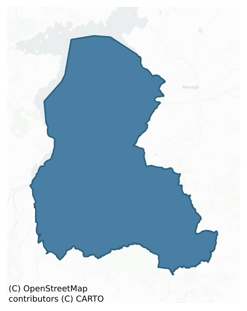
Owney And Arra is a barony of County Tipperary, in the historical province of Munster (Irish: Uaithne agus Ara), covering 363 km² of land. The barony records 463 NMS archaeological sites and 62 NIAH listed buildings, placing it at around the 22nd percentile among 280 ROI baronies for sites per km². This means it is in the bottom third of all baronies for sites per km². Dated archaeological evidence runs from the Neolithic through to the Modern, spanning 8 of 9 archaeological periods, placing the barony in the 58th percentile among 280 ROI baronies for chronological depth. This means it is in the upper half of all baronies for chronological depth. The largest dated subset of recorded sites dates to the Early Medieval. Logainm flags 34 placenames in the barony as carrying a recognised heritage root; the largest share — around 79% — are names associated with early Christian church and monastic foundations.

Heritage at a glance
Percentile rankings throughout this profile compare each barony only against the other 279 Republic of Ireland baronies.
The recorded heritage of Owney And Arra
The National Monuments Service Sites and Monuments Record (SMR) is the statutory inventory of archaeological sites for the Republic of Ireland, maintained by the Department of Tourism, Culture, Arts, Gaeltacht, Sport and Media. Sites recorded here include earthworks, ringforts, megalithic tombs, ecclesiastical remains, and post-medieval features; not every record is legally protected, but each is registered as a monument of archaeological interest.
The National Monuments Service records 463 archaeological sites in Owney And Arra, putting it at the 22nd percentile among 280 ROI baronies for sites per km². This means it is in the bottom third of all baronies for sites per km². Protection coverage is near-universal — 452 sites (98%) fall within a recorded monument protection zone, indicating an extensively surveyed landscape. The dominant category is defensive sites — ringforts, enclosures, hillforts, and stone forts (262 sites, 57% of the record). Ringfort – rath is the most prevalent type, making up 30% of the barony's recorded sites (139 records) — well above the ROI average of 20% across all baronies where this type occurs. Ringfort – rath is an earthen ringfort enclosed by a bank and external ditch — the most common Early Medieval farmstead, broadly dated 500–1000 AD. Other significant types include Enclosure (72) and Standing stone (19). Enclosure is a banked or ditched feature of uncertain type, used as a catch-all where the original function cannot be determined from surface evidence; Standing stone is a deliberately set upright stone, used variously as a Bronze/Iron Age burial marker, route marker or commemorative monument. Across the barony's 363 km², this gives a recorded density of 1.27 sites per km².
Most common monument types
Hover or tap a monument type to see its definition.
| Type | Count |
|---|---|
| Ringfort – rath an earthen ringfort enclosed by a bank and external ditch — the most common Early Medieval farmstead, broadly dated 500–1000 AD | 139 |
| Enclosure a banked or ditched feature of uncertain type, used as a catch-all where the original function cannot be determined from surface evidence | 72 |
| Standing stone a deliberately set upright stone, used variously as a Bronze/Iron Age burial marker, route marker or commemorative monument | 19 |
| Church a building used for public Christian worship, of any date from c. 500 AD onwards | 13 |
| Fulacht fia a horseshoe-shaped Bronze Age burnt mound built around a sunken trough beside a water source, traditionally interpreted as a cooking site | 13 |
| Earthwork an unclassified earthen structure with no diagnostic features that allow a more specific classification | 12 |
| Children's burial ground an unconsecrated medieval and early-modern burial ground for unbaptised or stillborn children, often called a cillín or ceallúnach | 11 |
| Barrow – ring-barrow a Bronze/Iron Age burial monument: a low circular area enclosed by ditch and outer bank | 10 |
Chronological distribution
The dated archaeological record for Owney And Arra spans from the Neolithic through to the Modern, with activity attested across 8 of 9 archaeological periods. Every period from earliest to latest is represented in the record — an unbroken sequence of dated activity across the full chronological span. Activity concentrates most heavily in the Early Medieval (158 sites, 41% of dated material), with the Iron Age forming a secondary peak (105 sites, 27%). A further 73 recorded sites (16% of the overall NMS register for the barony) carry no period attribution — appearing as 'Unknown' in the bar chart below. This typically reflects either records that pre-date the standardised period vocabulary or sites awaiting specialist dating review, rather than a genuine absence of chronological evidence.
Sample of recorded monuments
Show 25 sample monuments (of 463 total)
A representative sample of 25 recorded monuments drawn from the barony’s 463 total NMS entries. Sites within a recorded monument protection zone and rarer site types are prioritised so the list shows a meaningful cross-section rather than only the most common type. Each entry shows the official Sites and Monuments Record reference number and the description published by the National Monuments Service.
Weir – fish
The Archaeological Survey of Ireland (ASI) is in the process of providing information on all monuments on The Historic Environment Viewer (HEV). Currently the information for this record has not been uploaded. To…
The Archaeological Survey of Ireland (ASI) is in the process of providing information on all monuments on The Historic Environment Viewer (HEV). Currently the information for this record has not been uploaded. To access available information for research purposes please make an appointment in advance with the Archive Unit (open Fridays 10.00 am – 5.00 pm), Department of Culture, Heritage and the Gaeltacht, The Custom House, Dublin 1 D01W6XO or email nmarchive@chg.gov.ie.
Mine
Mine complex identified, post inventory fieldwork, by Dr. William O'Brien, NUI, Galway (pers. comm. 26.6.1998). Site is not indicated on the 1st (1840) or 2nd (1901-5) ed. OS 6-inch map. The mine is referred to by…
Mine complex identified, post inventory fieldwork, by Dr. William O'Brien, NUI, Galway (pers. comm. 26.6.1998). Site is not indicated on the 1st (1840) or 2nd (1901-5) ed. OS 6-inch map. The mine is referred to by Kinahan as 'Garrykennedy was a very ancient mine, stone and wood implements, &c., having been found in the "Old Men's Workings". Dr. O'Brien visited the site in January 1996 and found a number of extant mine workings of unknown age still surviving.
Reference:
Kinahen, G.H. (1886) 'Irish metal mining', Royal Dublin Society Scientific Proceedings 5, 219.
The above description is derived from 'The Archaeological Inventory of County Tipperary. Vol. 1 – North Tipperary' compiled by Jean Farrelly and Caimin O'Brien (Dublin: Stationery Office, 2002). In certain instances the entries have been revised and updated in the light of recent research.
Date of upload/revision: 22 September 2008
Inscribed stone
These inscribed stones are built into the fabric of the S wall of St Conlan's medieval parish church (TN014-045001-). Situated on the crest of a hill. A largely destroyed church (TN014-045001-) constructed of roughly…
These inscribed stones are built into the fabric of the S wall of St Conlan's medieval parish church (TN014-045001-). Situated on the crest of a hill. A largely destroyed church (TN014-045001-) constructed of roughly coursed limestone blocks. The S wall is best preserved, though the W end is gone. The external E end of the S wall is rendered with concrete with a gap to expose a round-headed single-light with external chamfer and splayed ingoings. On the E side of this window embrasure there is an incised cross pattée and soul-effigy in a naïve style. A similar cross is carved in relief on the external face of the S wall of the church. At the W end of the S wall c. 2m above the external ground level a carved stone head (L 0.24m) protrudes from the wall – the hair is about ear length, the bulging eyes are near the top of the head, there is no nose, a long neck and a chin outlined by a curving groove. Beneath this head are three rectangular blocks of stone, one above two. The upper-most block has an incised inscription which reads 'ST. COE[ ]' and underneath this 'NE 433'. The lower W block has a cross pattée and the E block has two angels as mentioned above.
In 1837 the church remains were described as ‘the ruins of an oratory, supposed to have been a place of worship of the O’Brien family; and on a part of the well of the old church is the figure of a head, with the inscription “St. Coonna, 434.” A well near it is called St. Coulan’s [TN014-044001-]’ (Lewis 1837, 730)….
Ecclesiastical enclosure
Situated on a NW-facing slope of rising ground in an upland area. A large circular-shaped area (diam. 74m N-S; 74m E-W) enclosed by a low barely discernible bank (Wth 3.5m; int. H 0.2m; ext. H 0.4m) with an external…
Situated on a NW-facing slope of rising ground in an upland area. A large circular-shaped area (diam. 74m N-S; 74m E-W) enclosed by a low barely discernible bank (Wth 3.5m; int. H 0.2m; ext. H 0.4m) with an external fosse (Wth 4m). There is a smaller square-shaped platform (TN-019-027003-), possibly a burial ground in the S quadrant which may have contained the site of a church (TN019-027002-) (OPW Field Report 19/09/1957). Small upright stones protruding above the surface of the platform may be grave markers associated with a possible /children's burial ground (TN019-027003). A possible cup-marked stone (TN019-027004-) lies on the NE edge of this platform.
See attached sketch plan of enclosure drawn in 1957
The above description is derived from 'The Archaeological Inventory of County Tipperary. Vol. 1 – North Tipperary' compiled by Jean Farrelly and Caimin O'Brien (Dublin: Stationery Office, 2002). In certain instances the entries have been revised and updated in the light of recent research.
Compiled and revised by: Caimin O'Brien
Date of revised upload: 14 March 2019
Crannog
Situated just off the E shore of Lough Derg on the River Shannon. A small circular stone-built island (approx. diam. 30m) which appears to have been artificially constructed with loosely piled rubble creating a stone…
Situated just off the E shore of Lough Derg on the River Shannon. A small circular stone-built island (approx. diam. 30m) which appears to have been artificially constructed with loosely piled rubble creating a stone cairn. A cashel (TN019-034005-) was constructed on top of the crannóg by Conchobhar Uí Bhriain [Conor O'Brien], King of Thomond, in the 12th century (Westropp 1911-12, 211) and was later refortified with a tower house and bawn (TN019-034001-) in the late medieval period. A stone causeway (TN019-034004-) which appears to have been recently widened and enlarged, connects the E portion of the crannóg to the mainland. Described by Cairns (1987, 11) as the site of a crannóg. The townland is referred to as Cahirconner in the Civil Survey (Simington 1934, vol.2, 160). The castle island is depicted on the 1654-7 Down Survey map of Owny and Arra barony (NLI, Ms 721).
This monument is subject to a preservation order made under the National Monuments Acts 1930 to 2014 (PO no. 4/2001).
The above description is derived from 'The Archaeological Inventory of County Tipperary. Vol. 1 – North Tipperary' compiled by Jean Farrelly and Caimin O'Brien (Dublin: Stationery Office, 2002). In certain instances the entries have been revised and updated in the light of recent research.
Compiled by: Jean Farrelly and Caimin O'Brien
Revised by: Caimin O'Brien
Date of revised upload: 21 February 2020
Causeway
Situated just off the E shore of Lough Derg on the River Shannon. A small circular stone-built island (approx. diam. 30m) which appears to have been artificially constructed with loosely piled rubble. A cashel…
Situated just off the E shore of Lough Derg on the River Shannon. A small circular stone-built island (approx. diam. 30m) which appears to have been artificially constructed with loosely piled rubble. A cashel (TN019-034005) was constructed on top of the crannóg by Conchobhar Ua Briain [Conor O'Brien], King of Thomond, in the 12th century (Westropp 1911-12, 211) and was later refortified with a tower house and bawn (TN019-034001) in the late medieval period. A stone causeway (Wth 1m; L 70m), which appears to have been recently widened and enlarged, connects the E portion of the crannóg to the shoreline. Described by Cairns (1987, 11) as the site of a crannóg. The townland is referred to as Cahirconner in the Civil Survey (Simington 1934, vol.2, 160).
This monument is subject to a preservation order made under the National Monuments Acts 1930 to 2014 (PO no. 4/2001).
The above description is derived from 'The Archaeological Inventory of County Tipperary. Vol. 1 – North Tipperary' compiled by Jean Farrelly and Caimin O'Brien (Dublin: Stationery Office, 2002). In certain instances the entries have been revised and updated in the light of recent research.
Compiled by: Jean Farrelly and Caimin O'Brien
Revised by: Caimin O'Brien
Date of revised upload: 21 February 2020
Ringfort – unclassified
Situated on flat pasture in undulating countryside. Depicted on the 1st ed. OS 6-inch map as a semi-circular shaped platform type earthwork. Not indicated on subsequent editions of the OS 6-inch maps. In 1976 the site…
Situated on flat pasture in undulating countryside. Depicted on the 1st ed. OS 6-inch map as a semi-circular shaped platform type earthwork. Not indicated on subsequent editions of the OS 6-inch maps. In 1976 the site was described as 'a shallow depression no more than 30cm deep. It lies immediately west of a farm trackway' (SMR File 1976). In 1976 it was recorded that the local landowner believed that this shallow depression was possibly a 'fort' (SMR File 1976). Not visible at ground level.
The above description is derived from 'The Archaeological Inventory of County Tipperary. Vol. 1 – North Tipperary' compiled by Jean Farrelly and Caimin O'Brien (Dublin: Stationery Office, 2002). In certain instances the entries have been revised and updated in the light of recent research.
Date of upload/revision: 16 January 2012
Megalithic tomb – portal tomb
Situated on a local rocky rise in farmland. The feature, now obscured by thorn bushes, is referred to as a 'Pagan Altar' in the OS Memoranda (1840) though no details are provided. According to an OS Name Book (1904)…
Situated on a local rocky rise in farmland. The feature, now obscured by thorn bushes, is referred to as a 'Pagan Altar' in the OS Memoranda (1840) though no details are provided. According to an OS Name Book (1904) there were then two large stones here. A rough sketch by Seán P. Ó Riordáin dating to about the mid 1950s shows a large orthostat, some 2m high and apparently orientated E-W, at the southern edge of a pile of field stones among or on which are two partly overlapping prostate slabs. In 1967 a pile of overgrown field stones marked the spot. (De Valera and Ó Nualláin 1982, 97, No.2)
Monument was described in 1915 as following; ‘In the townland of Creggawns in the parish of Youghal Ara are the remains of a Druid’s Altar and Grove. Three large stones remain; one stone is 12 feet [3.65m] high by 4 feet 6 inches [1.37m] wide, it is still standing erect; two other stones lie at its base, the latter stones are about 9 feet [2.75m] long by 1 foot 6 inches [0.45m] to 3 feet [0.9m] wide. The land in which the stones are situated underwent reclamation about twenty years ago, and many stones removed at that time. During the reclamation a stone axe was found at the base of the largest stone; the blade of axe was complete, and the stone of which it was composed was of very hard quality ; silver coins, about the size of crown pieces and of the purest silver, were also found here. About fifty yards from the altar a subterranean chamber was found, its dimensions were 14 feet [4….
Castle – Anglo-Norman masonry castle
Situated on a natural ridge of rock outcrop in an upland area with extensive views. Described in the Civil Survey (1654-6) as a 'ruinous castle with the priviledge of a court leete and courte' (Simington 1934, vol. 2,…
Situated on a natural ridge of rock outcrop in an upland area with extensive views. Described in the Civil Survey (1654-6) as a 'ruinous castle with the priviledge of a court leete and courte' (Simington 1934, vol. 2, 141-2). Donogh O Bryen is listed as proprietor in 1640 (ibid.). The OS Letters describe a water-filled moat with the wall-footings of castle on top of rock outcrop (O'Flanagan 1930, vol. 3, 14). The present remains consist of the collapsed masonry of a castle which was enclosed at its base on the W side by a rock-cut moat (TN020-024002-) with causewayed entrance (Wth 4m) at WSW. Possible early medieval castle.
The above description is derived from 'The Archaeological Inventory of County Tipperary. Vol. 1 – North Tipperary' compiled by Jean Farrelly and Caimin O'Brien (Dublin: Stationery Office, 2002). In certain instances the entries have been revised and updated in the light of recent research.
Date of upload/revision: 16 January 2012
Designed landscape feature
Situated 580m N of Kilcolman House on its demesne lands, standing on a low natural hillock in undulating countryside. Depicted on the 1840 ed. OS 6-inch map as a square-shaped tree-plantation of post-1700 date and not…
Situated 580m N of Kilcolman House on its demesne lands, standing on a low natural hillock in undulating countryside. Depicted on the 1840 ed. OS 6-inch map as a square-shaped tree-plantation of post-1700 date and not as an antiquity. On the revised 1901 ed. OS 25-inch map this plantation is depicted as a polygonal-shaped enclosure. An elongated hillock which has been scarped and enclosed by a stone wall visible only by its wall-footings with slight traces of a shallow external fosse. Halfway along the earthwork a deep trench aligned NW-SE (Wth 3m; D 1m) traverses the site. Natural rock outcrop protrudes from the surface of the hillock. A possible landscape feature associated with Kilcolman House.
The above description is derived from 'The Archaeological Inventory of County Tipperary. Vol. 1 – North Tipperary' compiled by Jean Farrelly and Caimin O'Brien (Dublin: Stationery Office, 2002). In certain instances the entries have been revised and updated in the light of recent research.
Date of upload/revision: 16 January 2012
Stone row
Situated on platform of ground in upland area overlooking a stream to N, a stone circle (TN019-046001) to the NW and a possible stone pair (TN019-040) to the W. A row of three stones, aligned E-W, 8m in overall length.…
Situated on platform of ground in upland area overlooking a stream to N, a stone circle (TN019-046001) to the NW and a possible stone pair (TN019-040) to the W. A row of three stones, aligned E-W, 8m in overall length. E stone 1.77m H; Wth 1.4m; T 0.5m; middle stone 1.9m H; Wth 1.38m; T 0.5m: W stone H 1.64m; W 1.1m; T 0.65m. Packing stones visible at base of all three stones. In c. 2010 the easternmost stone (total L 2.35m) of the row fell over. Previous to this it had been leaning to the S. This stone tapers towards the base (to 0.25m) and when it was upstanding only a deep of 0.5-0.58m of the stone was embedded in the ground. At least two packing stone remain in place around the waterlogged socket, which is visible under the tapering base of the stone. One packing stone to the S (dims. 0.26m x 0.1m; H 0.18m above ground) and one to the W (dims. 0.24m x 0.24m; H 0.15m above ground), with a further stone (dims 0.36m x 0.28m; H 0.23m above ground), partially embedded, between these. The next nearest stone, the middle stone of the stone row, is c. 1.2m W of the fallen stone.
Compiled by: Jean Farrelly
Date of upload: 04 December 2013
Castle – hall-house
Situated on high ground overlooking a deep ravine and nearby church (TN025-016—-) to the S. The poorly preserved remains of a small rectangular building surviving to first-floor level only, built with roughly coursed…
Situated on high ground overlooking a deep ravine and nearby church (TN025-016—-) to the S. The poorly preserved remains of a small rectangular building surviving to first-floor level only, built with roughly coursed sandstone rubble of cyclopean appearance. The building consists of a narrow small ground-floor chamber (int. dims. 6.65m N-S; 3.05m E-W; Wall T 2m) accessed from a segmental-arched doorway situated in the centre of the E wall. This appears to be an insertion and may belong a later phase of construction. The ground floor had a wooden ceiling carried in the thickness of the wall with a destroyed flat-headed window in the centre of the W wall which replaced an earlier window. At first-floor level there is a single-light
round-arched window in the N wall (Fitzpatrick 1985, vol. 3, 75-86) which is now obscured by ivy growth. At the E end of the extant S wall there is the remains of a garderobe chute. Possible stairs are visible at the E end of the S wall which gave access to an E chamber (now destroyed). There was no cut stone used in the fabric of the building. It is unclear from the surviving evidence and the dense cover of ivy if this building survives fully intact or whether only the W half of the castle survives. There is possible evidence for a bawn wall extending E from the SE angle of the castle.
In 2001 archaeological testing by Brian Hodkinson on a proposed house site beside the Ballina-Birdhill road and is overlooked by the ruins of Cloghaneena ca…
Castle – motte
Situated in wooded area on the W side of a steep ravine in an upland area overlooking a river below with Burgesbeg medieval church (TN025-038001-) and graveyard (TN025-038003-) 160m to the E. The river marks the W…
Situated in wooded area on the W side of a steep ravine in an upland area overlooking a river below with Burgesbeg medieval church (TN025-038001-) and graveyard (TN025-038003-) 160m to the E. The river marks the W boundary of the parish of Burgesbeg. A medieval watermill (TN025-039—-) was located along the river 300m to the S of the motte. Present remains consists of a steep-sided flat-topped circular-shaped mound (H 3m at E; 6m at W; top diam. 14.6m N-S; 15.1m E-W) with a wide fosse (Wth 3m) at base that is visible at NW only; elsewhere it has been filled in with evidence of an external earth and stone bank well faced with stone in places. No evidence for an adjoining bailey area.
The above description is derived from 'The Archaeological Inventory of County Tipperary. Vol. 1 – North Tipperary' compiled by Jean Farrelly and Caimin O'Brien (Dublin: Stationery Office, 2002). In certain instances the entries have been revised and updated in the light of recent research.
Compiled by: Jean Farrelly and Caimin O'Brien
Revised by: Caimin O'Brien
Date of revised upload: 21 February 2020
Sheela-na-gig
Discovered by local workmen in 1932 in the NE corner of Burgesbeg church (TN025-038001) and now housed in the National Museum (Cherry 1992, 6). Described by Raftery (1969, 92-3) as a roughly dressed rectangular block (H…
Discovered by local workmen in 1932 in the NE corner of Burgesbeg church (TN025-038001) and now housed in the National Museum (Cherry 1992, 6). Described by Raftery (1969, 92-3) as a roughly dressed rectangular block (H 0.7m; Wth 0.35m; T 0.33m) with a naked female figure carved in high relief (L 0.62m) on one face. The figure consists of a well-carved round head with round eyes, unclear mouth with bent arms pulling the vulva apart and knees slightly bent with toes pointing downwards. The breasts are barely indicated.
Described by Freitag as a 'figure carved in relief on block of sandstone; partly dressed to an approximately rectangular shape. Shape would suggest that figure was once built into the structure and formed part of arch of door or window. Round head with sharp chin; eyes clearly cut circles, but nose and mouth ill-defined; narrow neck. Breasts barely indicated. Arms flexed and hands grasping deeply hollowed out pudenda between widely separated thighs; prominent touchhole or anus below genitals. Knees bent; feet pointing downwards' (Freitag 2004, 126).
The above description is derived from 'The Archaeological Inventory of County Tipperary. Vol. 1 – North Tipperary' compiled by Jean Farrelly and Caimin O'Brien (Dublin: Stationery Office, 2002). In certain instances the entries have been revised and updated in the light of recent research.
Compiled by: Caimin O'Brien
Date of upload/revision: 05 June 2012
Historic town
Situated on the E bank of the River Shannon with Killaloe Bridge (TN025-094001) connecting Ballina to the neighbouring town of Killaloe. Ballina castle (TN025-094002) is located at the N end of the modern town with…
Situated on the E bank of the River Shannon with Killaloe Bridge (TN025-094001) connecting Ballina to the neighbouring town of Killaloe. Ballina castle (TN025-094002) is located at the N end of the modern town with Cloghaneena castle (TN025-15) and Templeachally church (TN025-016) located at the S end. In 1607 the 'castle, town and lands of Belanagh in Arra' were granted to Murtagh Mc Ibrien (Cal. pat. Rolls, Ire., Jas I, 89).
The above description is derived from 'The Archaeological Inventory of County Tipperary. Vol. 1 – North Tipperary' compiled by Jean Farrelly and Caimin O'Brien (Dublin: Stationery Office, 2002). In certain instances the entries have been revised and updated in the light of recent research.
Date of upload/revision: 22 September 2008
Weir – regulating
Unlocated weir within townland, Civil Survey of 1654-56 refers to 14 weares upon the River Shannon (Simington 1934, Vol. 2, 163).
The above description is derived from 'The Archaeological Inventory of County…
Unlocated weir within townland, Civil Survey of 1654-56 refers to 14 weares upon the River Shannon (Simington 1934, Vol. 2, 163).
The above description is derived from 'The Archaeological Inventory of County Tipperary. Vol. 1 – North Tipperary' compiled by Jean Farrelly and Caimin O'Brien (Dublin: Stationery Office, 2002). In certain instances the entries have been revised and updated in the light of recent research.
Date of upload/revision: 22 September 2008
Barrow – stepped barrow
Situated on top of a hill in a mountainous region with extensive views. A steep-sided, flat-topped mound (H 5m; diam. 21m NW-SE) with a berm enclosing the base from S through W to NW. A modern quarry has destroyed the E…
Situated on top of a hill in a mountainous region with extensive views. A steep-sided, flat-topped mound (H 5m; diam. 21m NW-SE) with a berm enclosing the base from S through W to NW. A modern quarry has destroyed the E face of the mound. The exposed section revealed no evidence of burials or any archaeological activity.
The above description is derived from 'The Archaeological Inventory of County Tipperary. Vol. 1 – North Tipperary' compiled by Jean Farrelly and Caimin O'Brien (Dublin: Stationery Office, 2002). In certain instances the entries have been revised and updated in the light of recent research.
Date of upload/revision: 22 September 2008
Boulder-burial
Situated atop high ground on Barnarhu Hill in a mountainous region with extensive views in all directions and a possible stone circle site (TN038-005) to the SSW. A row of four boulders, one of which is prostrate,…
Situated atop high ground on Barnarhu Hill in a mountainous region with extensive views in all directions and a possible stone circle site (TN038-005) to the SSW. A row of four boulders, one of which is prostrate, aligned E-W. All four boulder burials are resting on smaller support-stones in typical boulder-burial arrangement. None of the stones penetrate the surface of the ground. The prostrate E stone is 0.7m x 0.95m x 0.4m and rests on three smaller support-stones. The second stone is 1m x 2.1m x 1.3m and also rests on small support-stones. The third stone is 0.8m x 0.9m x 0.8m and rests on three support-stones, two to the W and one to the E which creates a small chamber underneath the stone. The fourth stone is 1.1m x 1.6m x 1.3m and rests on three smaller stones. The overall length of the row is 10m with the gaps between the stones measuring from E to W 1.8m, 1.6m, 1.4m. (Rynne 1969, 90).
The above description is derived from 'The Archaeological Inventory of County Tipperary. Vol. 1 – North Tipperary' compiled by Jean Farrelly and Caimin O'Brien (Dublin: Stationery Office, 2002). In certain instances the entries have been revised and updated in the light of recent research.
Date of upload/revision: 22 September 2008
Pit-burial
Situated on an E-facing slope of rising ground overlooking a nearby river to the E in an upland area. Cremated human bones found in a pit (0.65m D; 0.52m W) with flagstone floor and capstone with prostrate pointed stone…
Situated on an E-facing slope of rising ground overlooking a nearby river to the E in an upland area. Cremated human bones found in a pit (0.65m D; 0.52m W) with flagstone floor and capstone with prostrate pointed stone (1.7m x 0.8m x 0.25m) which may have been erected over the site (Lucas 1961, 89). The second burial was found 10m to the W and consisted of the cremated remains of a burial placed in a pit protected by three small slabs with accompanying bronze blade (Waddell 1969, 3-5). No visible remains at ground level.
The above description is derived from 'The Archaeological Inventory of County Tipperary. Vol. 1 – North Tipperary' compiled by Jean Farrelly and Caimin O'Brien (Dublin: Stationery Office, 2002). In certain instances the entries have been revised and updated in the light of recent research.
Date of upload/revision: 22 September 2008
Megalithic tomb – court tomb
The tomb, excavated and partly restored in 1958 (O'Kelly 1958), stands on an E-facing slope at the NE foot of Cullaun Mountain. It stands in a kerbed cairn of U-shaped outline measuring some 12.5m long and 9.5m in…
The tomb, excavated and partly restored in 1958 (O'Kelly 1958), stands on an E-facing slope at the NE foot of Cullaun Mountain. It stands in a kerbed cairn of U-shaped outline measuring some 12.5m long and 9.5m in maximum width. A court at the NE, 3.8m long and 3.1m in maximum width, opens into a two-chambered gallery the entrance to which is formed by two transversely set jambs. The front chamber of the gallery is 2.1m long and 2m wide. The division between this and the second chamber is formed by a tall jamb crossing half the width of the gallery and a low sill which fills the gap between the jamb and the more northerly side of the gallery. The inner chamber is 3m long and 2.2m wide. At either side of the back of the gallery, which is closed by three stones, there are two stones that have been interpreted as non-functional jambs. Excavation revealed a setting of thirty-four post-holes about 2m outside the sides and back of the kerb. At the front this setting turned inwards to meet the ends of the court. About 1m beyond the front of the monument and at right angles to its long axis there was a gapped line, 8m long, of three low stones and the socket of a fourth. Six separate lots of human bone were recovered at the site, only one of which, from a pit in the inner chamber, was in an undisturbed position. Finds comprised stone implements, notably a number of flint arrowheads, and a small amount of poorly preserved pottery, all of Neolithic date. (De Valera and Ó Nualláin 19…
Mine – copper
Situated on a S-facing slope of rising ground in an upland region overlooking the Clare River valley. According to Kinahen (1886) 'ancient tools were found in the “old mens'” workings' at this mine. These artefacts were…
Situated on a S-facing slope of rising ground in an upland region overlooking the Clare River valley. According to Kinahen (1886) 'ancient tools were found in the “old mens'” workings' at this mine. These artefacts were probably found when the mine was exploited between 1810 and 1859 (pers. comm. Dr William O'Brien; Cowman 1992, 109-12). Several shafts have collapsed leaving large open pits with evidence of spoil heaps all over the area containing copper ore. There is no evidence for prehistoric mining visible in the area although the site is heavily overgrown making detailed examination of the exposed cliff faces impossible.
The above description is derived from 'The Archaeological Inventory of County Tipperary. Vol. 1 – North Tipperary' compiled by Jean Farrelly and Caimin O'Brien (Dublin: Stationery Office, 2002). In certain instances the entries have been revised and updated in the light of recent research.
Date of upload/revision: 22 September 2008
Mound
Situated on level ground at the base of a high natural scarp, overlooking a river valley to the NE. The Clasher River runs c. 2m NE of the site. An irregular, roughly circular enclosure (TN039-012) in a level area…
Situated on level ground at the base of a high natural scarp, overlooking a river valley to the NE. The Clasher River runs c. 2m NE of the site. An irregular, roughly circular enclosure (TN039-012) in a level area between the river and the cliff-edge. The enclosure is defined by a denuded, moss-covered wall of earth and stone construction. There is a heavy growth of scrub in the NW quadrant. The site was described as 'disused keel' or children's burial ground in 1910 (Crawford 1910, 51), however, no grave-markers were apparent. A low linear mound in the SW quadrant, running NW-SE (L 6.1m x W 1.3m; H 0.4m), is constructed of earth and stone. It appears to be a section of a low field boundary and is not a megalithic structure.
The above description is derived from 'The Archaeological Inventory of County Tipperary. Vol. 1 – North Tipperary' compiled by Jean Farrelly and Caimin O'Brien (Dublin: Stationery Office, 2002). In certain instances the entries have been revised and updated in the light of recent research.
Date of upload/revision: 22 September 2008
Chapel
Situated on a low natural rock outcrop at the N end of a low N-S ridge in a mountain valley, overlooked by higher ground on all sides. The site consists of a section of a drystone field wall (H 1.1m; T 0.5m; L 22m)…
Situated on a low natural rock outcrop at the N end of a low N-S ridge in a mountain valley, overlooked by higher ground on all sides. The site consists of a section of a drystone field wall (H 1.1m; T 0.5m; L 22m) extending N-S across the top of a low ridge which according to local knowledge is the site of a penal chapel. This appears to be the remains of an old field boundary with no evidence of any cut stone or building material for a building. In the Archbishop's Visitation of Ballina in 1752 it is recorded that there was a chapel in the mountain which local people believe to have been located at this site (Griffin and Griffin 2000, 62).
The above description is derived from 'The Archaeological Inventory of County Tipperary. Vol. 1 – North Tipperary' compiled by Jean Farrelly and Caimin O'Brien (Dublin: Stationery Office, 2002). In certain instances the entries have been revised and updated in the light of recent research.
Date of upload/revision: 22 September 2008
Stone sculpture
Situated on an E-facing slope of rising ground in a valley in a mountainous region with a nearby stream to the E. Referred to as the 'Church of Kilcascoln' in the taxation of the Diocese of Cashel in 1302 (CDI, vol. 5,…
Situated on an E-facing slope of rising ground in a valley in a mountainous region with a nearby stream to the E. Referred to as the 'Church of Kilcascoln' in the taxation of the Diocese of Cashel in 1302 (CDI, vol. 5, 281). A nineteenth-century RC church built on the site of a medieval parish church (TN032-002), the wall-footings of which were removed to facilitate the construction of the present church. According to local information an Early Christian decorated pillar stone now in the graveyard (TN032-002001) was discovered in the fabric of the wall-footings and was erected in its present location in the graveyard. The pillar is decorated with a figure of Christ the Warrior with a shield carved in relief and a vertical slot/groove running up the side. This is a possible caryatid used as a decorative frame around an object inside an Early Christian church. The oval-shaped face is similar to the figures on the Moon high cross in Co. Kildare while the depiction of Christ the Warrior on pillar stones is found on possible caryatids from White Island, Lower Lough Erne, Co. Fermanagh. Both the Moon high cross and the Fermanagh figures are dated to the ninth/tenth century and it is possible that a similar date could be assigned to the Killoscully figure. However the naivety of the carving along with the unusual representation of the feet may suggest a folk art tradition of the nineteenth century. The groove along the side of the pillar could have acted as a support for an altar…
Ringfort – rath
Situated on the E-facing slope of a hill in undulating pastureland. The site has been levelled but is still visible as a circular enclosure (diam. 34.2m N-S; 33m E-W) defined by a poorly preserved bank. The interior…
Situated on the E-facing slope of a hill in undulating pastureland. The site has been levelled but is still visible as a circular enclosure (diam. 34.2m N-S; 33m E-W) defined by a poorly preserved bank. The interior slopes with the hill towards the E. The site was visited in 1979 and described as being a single embanked ringfort with no visible evidence of a fosse. 'It is overgrown with brambles and the enclosed area is planted with evergreens, which are about three years old. The bank is very badly defaced all around and is on average only about 2m wide and 1m high from the outside. There is only a drop of about 50cm from the top of the bank to the level of the enclosed area. There are the remains of a stone wall incorporated in the bank at the northwest side, but it may be part of field fence rather than an original feature, as it does not appear elsewhere in the bank. The enclosed area is about 40m in diameter from east to west. There is no obvious evidence of an entrance' (OPW files, 1-9-1979).
The above description is derived from 'The Archaeological Inventory of County Tipperary. Vol. 1 – North Tipperary' compiled by Jean Farrelly and Caimin O'Brien (Dublin: Stationery Office, 2002). In certain instances the entries have been revised and updated in the light of recent research.
Date of upload/revision: 22 September 2008
Listed buildings
The National Inventory of Architectural Heritage (NIAH) is a state survey appraising buildings of architectural, historical, archaeological, artistic, cultural, scientific, social, or technical interest. Each surveyed structure receives a rating from International (the highest, for buildings of European importance) through National, Regional, Local, and Record-Only.
The NIAH records 62 listed buildings in Owney And Arra (31st percentile across ROI baronies). The highest-graded structure include 1 of National significance. The Republic holds 937 National-graded buildings in total, so this barony accounts for around 0% of the national total. Construction dates concentrate most heavily in the Victorian (1830-1900) period.
Terrain and environment
Mean elevation across the barony is 163m — the 91st percentile among 280 ROI baronies for elevation. This means it is in the top tenth of all baronies for elevation. This is a relatively elevated landscape by ROI standards. Elevation matters for heritage because higher-altitude baronies typically favour defensive monuments — ringforts and hilltop forts placed on prominent ground — while lowland baronies are more likely to carry the dense settlement and church networks of intensive agricultural landscapes. The barony reaches 690m at its highest point — a vertical span of more than 527m within its boundary, indicating significant topographic diversity. Mean slope is 6.1° — the 84th percentile among 280 ROI baronies for slope. This means it is in the top fifth of all baronies for slope. This is consistently steep terrain by ROI standards, the kind of landscape that tends to preserve upstanding archaeological features well. Slope is a key control on both land use and archaeological preservation: steep ground resists ploughing and tends to preserve earthworks intact, while gentle slopes favour intensive cultivation that damages or destroys surface archaeology over time. Localised maximum slopes reach 17°, typical of stream-cut valleys, escarpments, or coastal bluffs within the wider landscape. The Topographic Wetness Index averages 9.9, the 19th percentile among 280 ROI baronies for wetness. This means it is in the bottom fifth of all baronies for wetness. This is well-drained ground by ROI standards — typical of upland or steeply-sloping country that sheds water rapidly. Drainage matters for heritage because poorly-drained ground preserves organic archaeology (wooden trackways, leather, textiles, and on rare occasions human remains) far better than free-draining soil; well-drained ground favours arable use but destroys organic material rapidly. The land cover is dominated by improved grassland (62%) and woodland (32%). In overall character, this is an upland landscape of steep, elevated terrain, with land use dominated by improved grassland.
Terrain measurements
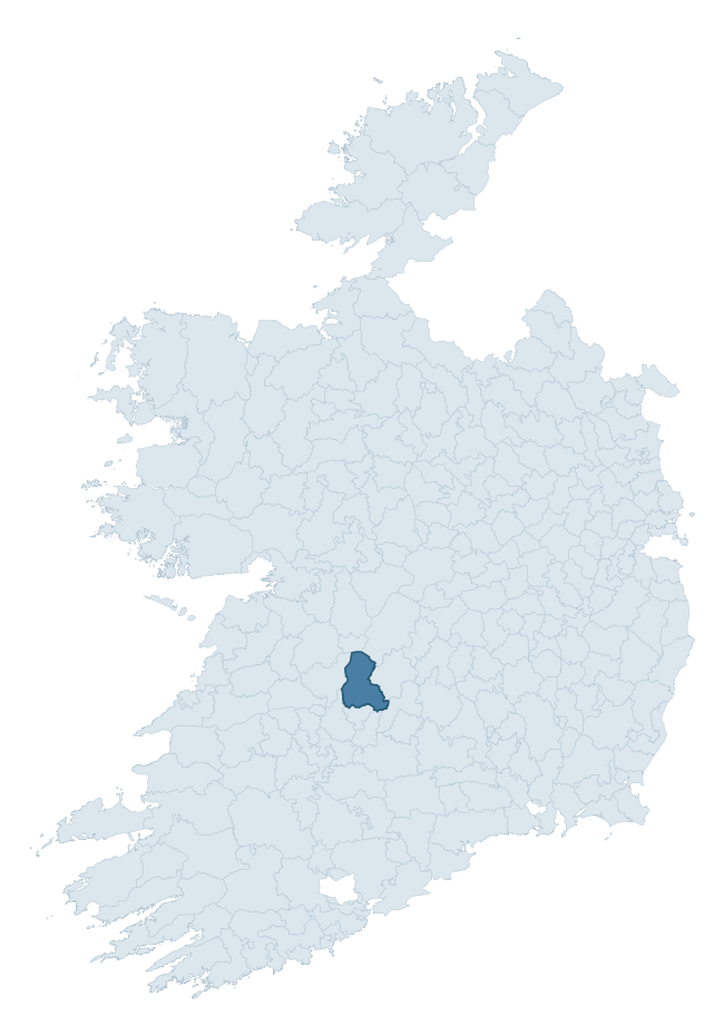
Where this barony sits in the Republic of Ireland
Geology and preservation
Bedrock geology shapes the landscape long before any settlement begins — controlling soil drainage, agricultural potential, the survival of upstanding monuments, and the preservation of buried archaeology. The figures below come from the Geological Survey Ireland 1:100,000 bedrock map.
The bedrock underlying Owney And Arra is predominantly greywack, siltstone and grit (30% of the barony by area), laid down during the Silurian period (54% by area, around 444 to 419 million years ago). A substantial secondary geology of sandstone and conglomerates (17%) and mudstone, arenaceous horizons (11%) adds further variety to the underlying landscape. The single largest mapped unit is the Hollyford Formation (30% of the barony's bedrock). With 8 distinct rock types mapped, the barony sits in the top third of ROI baronies for geological diversity (77th percentile) — typically a sign of complex tectonic history or coastal mosaics of differing rock units.
Rock type composition
Largest mapped unit: Hollyford Formation (30% of the barony)
Placename evidence
Logainm records 34 heritage-diagnostic placenames for Owney And Arra, drawn from townland and civil-parish names across the barony. The dominant stratum is Early Christian ecclesiastical — cill-, teampall-, and domhnach-prefixed names that record the dense network of early church foundations established between the fifth and tenth centuries. The leading diagnostic roots are cill- (19 — church), cillín- (3 — killeen), and tuaim- (3 — burial mound). This is broadly in line with the ROI average of 30.7 heritage placenames per barony. The presence of multiple heritage strata side by side indicates layered occupation of the landscape across successive prehistoric and historic periods. Logainm records 273 placenames for Owney And Arra (predominantly townland names). Of these, 34 (12%) carry one of the diagnostic Gaelic roots tracked above; the remainder draw on more generic landscape vocabulary that does not encode a heritage period.
Pre-Christian / Early Medieval Defensive
| Root | Count | Meaning |
|---|---|---|
| dún- | 2 | hilltop or promontory fort |
| ráth- | 1 | earthen ringfort |
Early Christian Ecclesiastical
| Root | Count | Meaning |
|---|---|---|
| cill- | 19 | church (early) |
| cillín- | 3 | unconsecrated burial ground |
| teampall- | 2 | church (later medieval) |
| mainistir- | 1 | monastery |
| tobar- | 1 | holy well |
| gráinseach- | 1 | monastic farm / grange |
Burial, Ritual, and Norse-Contact
| Root | Count | Meaning |
|---|---|---|
| tuaim- | 3 | burial mound |
| leacht- | 1 | grave monument |
| gall- | 1 | foreigner — Norse settlement marker |
Other baronies in Tipperary
- Clanwilliam
- Slievardagh
- Glenahiry
- Kilnamanagh Upper
- Middlethird
- Upperthird
- Ormond Lower
- Trughanacmy — Kerry
- Kilnamanagh Upper
- Carbery West (east Division) — Cork
See all 280 baronies in the Republic of Ireland Heritage Tool.

Explore further
Grounding History: 10 Maps of Northern Ireland’s Past
If you’re interested in Irish heritage more widely, the companion report for Northern Ireland brings together the analysis of all 462 NI wards into one place through 10 high-quality maps — covering monument density, archaeological periods, placename heritage, terrain, wetland, and the historic landscape at first survey. Take a look.
About this profile
Click any section below to expand.
What is a barony?
A barony is a historic administrative unit in Ireland, broadly equivalent to an English hundred. The 280 baronies used here are from the OSi 2019 National Statutory Boundaries (generalised 20m), covering the 26 counties of the Republic of Ireland. Baronies derive from the Norman period, were formalised in the 17th century, and have not been redrawn for statistical purposes. They vary enormously in area, from compact urban baronies in Dublin to vast upland baronies in Connacht, and should not be compared by raw site count without accounting for area differences.
What counts as a site?
This profile combines three distinct heritage registers, each with its own definition of what constitutes a recordable site:
- Archaeological sites (NMS). The National Monuments Service Sites and Monuments Record (SMR) catalogues every known archaeological monument or site of archaeological interest in the Republic, from prehistoric burial mounds and ringforts to medieval churches and post-medieval defensive works. Inclusion does not require legal protection — only that the site has been identified, surveyed, and assessed as having archaeological value. A separate subset of these sites lies within a recorded protection zone, which gives them statutory protection under the National Monuments Acts.
- Listed buildings (NIAH). The National Inventory of Architectural Heritage records buildings of architectural, historical, archaeological, artistic, cultural, scientific, social, or technical interest. Each surveyed structure is appraised on a five-tier scale: International, National, Regional, Local, and Record-Only. The NIAH appraisal is informational rather than strictly statutory, but it underpins local-authority Record of Protected Structures (RPS) listings.
- Heritage placenames (Logainm). Logainm is the authoritative database of Irish placenames maintained by the Placenames Branch. This profile applies a heritage-diagnostic classifier to the Irish-language form of each townland name, flagging roots that signal defensive sites (ráth-, lios-, dún-, caiseal-, cathair-), ecclesiastical foundations (cill-, teampall-, domhnach-, mainistir-), prehistoric burial-ritual features (tuaim-, carn-, leaba-), or Norse-contact settlement (gall-). Townlands without one of these diagnostic roots are not flagged here — they may still carry historical significance, but that significance is not encoded in the name itself.
Editorial principles
The narrative sections of this profile follow several explicit principles:
- Evidential. Every claim about this barony’s heritage character is anchored in the underlying register data. Where a site count, a placename count, or a percentile rank is cited, it is computed from the source datasets at export time, not estimated.
- Comparative. Counts and metrics are reported alongside their percentile rank against the other 279 ROI baronies. A barony with 50 ringforts in absolute terms could be unusually high or unusually low depending on its size and regional context; percentile ranking removes that ambiguity.
- Transparent on limits. Where a register has known coverage gaps, survey biases, or data-quality issues that affect this barony’s figures, the profile flags them rather than presenting the numbers as definitive.
- No interpretation beyond what the data supports. The narrative does not speculate about historical events, social dynamics, or cultural meaning beyond what the recorded heritage and placename evidence directly attests.
Data caveats and limits
- NMS Sites and Monuments Record is the product of survey campaigns conducted at different intensities across different counties and decades. Some baronies have been surveyed more thoroughly than others, and absolute counts should be read in that light. Sites destroyed by development before survey are typically not represented; sites in heavily forested or upland terrain are sometimes under-recorded.
- NIAH coverage is broadly complete for the Republic of Ireland but the survey was conducted on a rolling county-by-county basis, and the most recent appraisal date varies. Buildings demolished or substantially altered after their original survey may still appear in the register; conversely, recent buildings of merit may not yet have been appraised.
- Logainm classification applies a deliberately conservative pattern-matching approach to the Irish-language townland forms. The classifier prioritises true positives over recall: a townland may carry a heritage signal that the classifier doesn’t recognise, particularly where the diagnostic root has been heavily anglicised or where the townland name draws on a less common term. The 60,000+ townland records and ~9,800 classified placenames give a substantial signal at barony scale, but individual townland names should be checked against Logainm directly for definitive interpretation.
- Period attribution. The chronological distribution reflects only those NMS sites that carry a recognised period attribution in the source data. Sites listed as “Unknown” period are excluded from the dated subset.
- Boundary changes. Some baronies have undergone minor boundary adjustments since their 19th-century definition; the OSi 2019 generalised boundaries used here are the current statutory definition and may differ slightly from historical maps in border areas.
- Bedrock geology is mapped at 1:100,000 scale, which means local variation within a barony — small pockets of different rock type, mineral veins, alluvium overlying bedrock — is generalised. The dominant-system and rocktype figures are area-weighted, so a barony reading “70% Carboniferous limestone” may still contain small but archaeologically important pockets of older or younger rock. Around 3% of GSI polygons do not match the lexicon and contribute no rocktype or system attribution.
Data sources
- National Monuments Service — Sites and Monuments Record (SMR) https://data.gov.ie/dataset/national-monuments-service-archaeological-survey-of-ireland
- National Inventory of Architectural Heritage (NIAH) https://data.gov.ie/dataset/national-inventory-of-architectural-heritage-niah-national-dataset
- Logainm — Placenames Database of Ireland https://www.logainm.ie/
- Ordnance Survey Ireland — National Statutory Barony Boundaries 2019 https://data-osi.opendata.arcgis.com/
- EURODEM — European Digital Elevation Model https://www.mapsforeurope.org/datasets/euro-dem
- ESA WorldCover https://esa-worldcover.org/en
- Geological Survey Ireland — 1:100,000 Bedrock Geology https://www.gsi.ie/en-ie/data-and-maps/Pages/Bedrock.aspx
Explore more: Search any of the 280 ROI baronies, browse by historical province, or read the methodology and data sources for the full Republic of Ireland Heritage Tool.