Shelmaliere East is a barony of County Wexford, in the historical province of Leinster (Irish: Síol Maoluír Thoir), covering 79 km² of land. The barony records 71 NMS archaeological sites and 79 NIAH listed buildings, placing it at around the 9th percentile among 280 ROI baronies for sites per km². This means it is in the bottom tenth of all baronies for sites per km². Dated archaeological evidence runs from the Early Bronze Age through to the Medieval, spanning 4 of 9 archaeological periods, placing the barony in the 2nd percentile among 280 ROI baronies for chronological depth. This means it is in the bottom tenth of all baronies for chronological depth. The largest dated subset of recorded sites dates to the Iron Age.

Heritage at a glance
Percentile rankings throughout this profile compare each barony only against the other 279 Republic of Ireland baronies.
The recorded heritage of Shelmaliere East
The National Monuments Service Sites and Monuments Record (SMR) is the statutory inventory of archaeological sites for the Republic of Ireland, maintained by the Department of Tourism, Culture, Arts, Gaeltacht, Sport and Media. Sites recorded here include earthworks, ringforts, megalithic tombs, ecclesiastical remains, and post-medieval features; not every record is legally protected, but each is registered as a monument of archaeological interest.
The National Monuments Service records 71 archaeological sites in Shelmaliere East, putting it at the 9th percentile among 280 ROI baronies for sites per km². This means it is in the bottom tenth of all baronies for sites per km². A sparse recorded total of this kind in Ireland often reflects survey priority rather than genuine absence of past activity. Protection coverage is near-universal — 69 sites (97%) fall within a recorded monument protection zone, indicating an extensively surveyed landscape. The record is dominated by defensive sites — ringforts, enclosures, hillforts, and stone forts (33 sites, 46% of the total), with ecclesiastical sites forming a substantial secondary presence (27 sites, 38%). Ringfort – rath is the most prevalent type, making up 25% of the barony's recorded sites (18 records) — well above the ROI average of 20% across all baronies where this type occurs. Ringfort – rath is an earthen ringfort enclosed by a bank and external ditch — the most common Early Medieval farmstead, broadly dated 500–1000 AD. Other significant types include Church (8) and Graveyard (8). Church is a building used for public Christian worship, of any date from c. 500 AD onwards; Graveyard is a burial area associated with a church, in use from the medieval period onwards. Across the barony's 79 km², this gives a recorded density of 0.90 sites per km².
Most common monument types
Hover or tap a monument type to see its definition.
| Type | Count |
|---|---|
| Ringfort – rath an earthen ringfort enclosed by a bank and external ditch — the most common Early Medieval farmstead, broadly dated 500–1000 AD | 18 |
| Church a building used for public Christian worship, of any date from c. 500 AD onwards | 8 |
| Graveyard a burial area associated with a church, in use from the medieval period onwards | 8 |
| Ritual site – holy well a well or spring traditionally associated with a saint, often credited with healing properties; many trace earlier ritual origins but devotion is documented from the medieval period onwards | 7 |
| Castle – tower house a fortified residential tower of four or five storeys, mostly built by lords in the 15th and 16th centuries and often within a defended bawn | 3 |
| Moated site | 3 |
| Castle – unclassified a castle whose form cannot be precisely classified, dating somewhere between the late 12th and 16th centuries | 3 |
| Enclosure a banked or ditched feature of uncertain type, used as a catch-all where the original function cannot be determined from surface evidence | 3 |
Chronological distribution
The dated archaeological record for Shelmaliere East spans from the Early Bronze Age through to the Medieval, with activity attested across 4 of 9 archaeological periods. This is the 2nd percentile across ROI baronies — a relatively narrow chronological band, with much of Irish prehistory not represented in the dated record. The record is near-continuous, with only the Middle Late Bronze Age period falling inside the span without any recorded sites. Activity concentrates most heavily in the Iron Age (24 sites, 50% of dated material), with the Early Medieval forming a secondary peak (15 sites, 31%). A further 23 recorded sites (32% of the overall NMS register for the barony) carry no period attribution — appearing as 'Unknown' in the bar chart below. This typically reflects either records that pre-date the standardised period vocabulary or sites awaiting specialist dating review, rather than a genuine absence of chronological evidence.
Sample of recorded monuments
Show 25 sample monuments (of 71 total)
A representative sample of 25 recorded monuments drawn from the barony’s 71 total NMS entries. Sites within a recorded monument protection zone and rarer site types are prioritised so the list shows a meaningful cross-section rather than only the most common type. Each entry shows the official Sites and Monuments Record reference number and the description published by the National Monuments Service.
Ring-ditch
Marked faintly as a small circular feature (diam. c. 20m) on the 1839 ed. of the OS 6 inch map, and situated on a rise in the valley of a small stream that is c. 50m to the E and c. 70m to the S but joins the N-S River…
Marked faintly as a small circular feature (diam. c. 20m) on the 1839 ed. of the OS 6 inch map, and situated on a rise in the valley of a small stream that is c. 50m to the E and c. 70m to the S but joins the N-S River Slaney c. 400m to the W. It is not visible at ground level but a ring-ditch (diam. c. 15-20m) is visible on the OSI series of aerial photographs (1995).
The above description is derived from the published 'Archaeological Inventory of County Wexford' (Dublin: Stationery Office, 1996). In certain instances the entries have been revised and updated in the light of recent research.
Compiled by: Michael Moore
Date of upload/revision: 3 September, 2012
Castle – ringwork
Located on a natural promontory in a loop of the N-S River Sow with steep slopes (H c. 15m) N-E-W where the river is c. 20-50m distant. This is a subcircular grass and scrub-covered area (dims. 28m NW-SE; 23.8m NE-SW)…
Located on a natural promontory in a loop of the N-S River Sow with steep slopes (H c. 15m) N-E-W where the river is c. 20-50m distant. This is a subcircular grass and scrub-covered area (dims. 28m NW-SE; 23.8m NE-SW) defined by an earthen bank (at NW: Wth 10m; int. H 1.5m; ext. H 3.5m) with an external flat bottomed fosse (at NW: Wth of top 8.5m; Wth of base 2.5m; ext. D 1.5m) W-N and elsewhere by a scarp (Wth 5-6m; H 3.6-4.5m) with a berm (Wth 1 3m) at its base and natural steep slopes below. There is no visible entrance. Castlesow motte (WX032-022—-) is c. 100 m to the S, on the other side of the river.
The above description is derived from the published 'Archaeological Inventory of County Wexford' (Dublin: Stationery Office, 1996). In certain instances the entries have been revised and updated in the light of recent research.
Compiled by: Michael Moore
Date of upload/revision: 3 September, 2012
Cist
Located towards the bottom of a N-facing slope. One cist containing a cremation and a possible food vessel, together with other possible burials, were destroyed in sand quarrying in 1951 (Hartnett, P.J. and Prendergast,…
Located towards the bottom of a N-facing slope. One cist containing a cremation and a possible food vessel, together with other possible burials, were destroyed in sand quarrying in 1951 (Hartnett, P.J. and Prendergast, E. 1953, 57).
The above description is derived from the published 'Archaeological Inventory of County Wexford' (Dublin: Stationery Office, 1996). In certain instances the entries have been revised and updated in the light of recent research.
Compiled by: Michael Moore
Date of upload/revision: 31 August, 2012
Ringfort – unclassified
Marked as a small circular embanked enclosure (ext. diam. c. 25m) on the 1839 ed. of the OS 6 inch map and situated on a gentle E-facing slope of a small NW-SE spur with a small NW-SE stream c. 50m to the NE. It is not…
Marked as a small circular embanked enclosure (ext. diam. c. 25m) on the 1839 ed. of the OS 6 inch map and situated on a gentle E-facing slope of a small NW-SE spur with a small NW-SE stream c. 50m to the NE. It is not visible at ground level in pasture.
The above description is derived from the published 'Archaeological Inventory of County Wexford' (Dublin: Stationery Office, 1996). In certain instances the entries have been revised and updated in the light of recent research.
Compiled by: Michael Moore
Date of upload/revision: 31 August, 2012
Standing stone
Located on the flood-plain of the N-S River Slaney which is c. 40m to the W, and c. 140m N of where a small NE-SW stream enters the Slaney. A granite stone is roughly aligned NW SE (dims. 0.8m x 0.65m; H 1.85m).
The…
Located on the flood-plain of the N-S River Slaney which is c. 40m to the W, and c. 140m N of where a small NE-SW stream enters the Slaney. A granite stone is roughly aligned NW SE (dims. 0.8m x 0.65m; H 1.85m).
The above description is derived from the published 'Archaeological Inventory of County Wexford' (Dublin: Stationery Office, 1996). In certain instances the entries have been revised and updated in the light of recent research.
Compiled by: Michael Moore
Date of upload/revision: 3 September, 2012
Cross – Churchyard cross
The base (dims 0.34m x 0.34m; H 0.37m) and part of the shaft (H 0.87m) of what might have been a cross with a hexagonal or octagonal cross-section is set up on top of the graveyard wall (WX037-017003-) at NW.…
The base (dims 0.34m x 0.34m; H 0.37m) and part of the shaft (H 0.87m) of what might have been a cross with a hexagonal or octagonal cross-section is set up on top of the graveyard wall (WX037-017003-) at NW.
Compiled by: Michael Moore
Date of upload: 18 December, 2012
Cross-inscribed stone
There is a granite slab (dims 0.6m x 0.45m) with an incised cross within an incised rectangle (dims 0.2m x 0.15m) lying prone towards the E side of the graveyard (WX038-004002-).
Compiled by: Michael Moore
Date…
There is a granite slab (dims 0.6m x 0.45m) with an incised cross within an incised rectangle (dims 0.2m x 0.15m) lying prone towards the E side of the graveyard (WX038-004002-).
Compiled by: Michael Moore
Date of upload; 18 January, 2012
Font
A fragment of a rectangular font (H 0.26m) with a flat base (dims 0.38m x 0.37m) is at Ardcavan church (WX038-006001-).
Compiled by: Michael Moore
Date of upload: 18 January, 2012
Road – road/trackway
Located on a gentle S-facing slope extending from the parish church of Kilpatrick (WX037-017001-) down towards the NW shore on the inner Wexford Harbour which is c. 700m to the SE of the church. Aerial photographs…
Located on a gentle S-facing slope extending from the parish church of Kilpatrick (WX037-017001-) down towards the NW shore on the inner Wexford Harbour which is c. 700m to the SE of the church. Aerial photographs (ASIAP, WX 70, 1 5) show the cropmark of a roadway (L c. 200m) approaching the E edge of the graveyard from the S.
Compiled by: Michael Moore
Date of upload: 18 December, 2012
Font (present location)
A sub-rectangular granite stone (dims of top 0.35m x 0.34m; H 0.27m) that is bored through the centre (diam. of top 13cm; diam. of base 7.5cm) and might be the unfinished stem of a font was moved from the church site…
A sub-rectangular granite stone (dims of top 0.35m x 0.34m; H 0.27m) that is bored through the centre (diam. of top 13cm; diam. of base 7.5cm) and might be the unfinished stem of a font was moved from the church site (WX048-021—-) at Graheeroge and is now at a house in Ballinacoola More.
Compiled by: Michael Moore
Date of upload: 16 December, 2013
Cupmarked stone
A naturally rounded granite stone (dims 0.44m x 0.4m; T 0.27m) covered in cup-marks (diam. c. 2.5-4cm; D0.5-1cm) on one face only is in the SE angle of Artramon graveyard (WX037-005002-). It was reported by Michael…
A naturally rounded granite stone (dims 0.44m x 0.4m; T 0.27m) covered in cup-marks (diam. c. 2.5-4cm; D0.5-1cm) on one face only is in the SE angle of Artramon graveyard (WX037-005002-). It was reported by Michael Fortune and recorded by Chris Corlett.
See the attached image courtesy of Chris Corlett
Compiled by: Michael Moore
Date of upload; 10 October, 2018
Ecclesiastical enclosure
Located towards the top of a gentle S-facing slope. The parish church of Artramon (WX037-005001-) is within a small rectangular graveyard (WX037-005002-). This is within a possible ecclesiastical enclosure visible as a…
Located towards the top of a gentle S-facing slope. The parish church of Artramon (WX037-005001-) is within a small rectangular graveyard (WX037-005002-). This is within a possible ecclesiastical enclosure visible as a D-shaped area (dims c. 130m N-S; c. 120m E-W) truncated by a N-S lane at W that is visible on digitalmap images. It is also faintly visible under polythene on Google Earth (25/05/2017), and was first reported by Ivor Kenny.
Compiled by: Michael Moore
Date of upload: 26 October, 2018
Enclosure – large enclosure
Located on a fairly level low-lying landscape. The cropmark of a large subcircular area (dims c. 100m N-S; c. 85m E-W) defined by a single ditch or drain (Wth c. 2-5m) is visible only on Google Earth (18/07/2021). The…
Located on a fairly level low-lying landscape. The cropmark of a large subcircular area (dims c. 100m N-S; c. 85m E-W) defined by a single ditch or drain (Wth c. 2-5m) is visible only on Google Earth (18/07/2021). The cropmark of a rectangular quarry (dims c. 30m E-W; c. 20m N-S) is in the NE part of the interior, and the enclosing element might just be drainage around a slightly raised area. It was first reported by Jean Charles Cailére.
See the attached enhanced view from Google Earth (18/07/2021)
Compiled by: Michael Moore
Date of upload: 4 January 2022
Castle – motte
Situated on a promontory in a loop of the N-S River Sow with steep slopes S-W-N where the river is c. 20m distant to the N, and c. 80-90m distant S-NW. This is a raised and overgrown subcircular platform (dims. 16m N-S;…
Situated on a promontory in a loop of the N-S River Sow with steep slopes S-W-N where the river is c. 20m distant to the N, and c. 80-90m distant S-NW. This is a raised and overgrown subcircular platform (dims. 16m N-S; 13m E-W) defined a by flat bottomed fosse (Wth of top 4.7 6m; D c. 1.4-1.6m) with an external bank (Wth s. 3m) SE W NE situated at the W end of the natural promontory with steep slopes (H c. 10m) down to the river Sow. The monument is damaged at the E side by farm buildings. Toberfinnick ringwork (WX032 021—-) is c. 100m to the N on the other side of the river. It is listed as a possible ringwork castle (Barry 1987, 53), and suggested as a possible caput for the Roche grant of Fernegenel (Colfer 2002, 105).
The above description is derived from the published 'Archaeological Inventory of County Wexford' (Dublin: Stationery Office, 1996). In certain instances the entries have been revised and updated in the light of recent research.
Compiled by: Michael Moore
Date of upload/revision: 17 July 2007
Castle – motte
Located on a slight rise in a low-lying landscape close to the original N shore of Wexford Harbour which is c. 240-360m to the E and S. This is an overgrown and flat-topped earthen mound (diam. of base 27m; diam. of top…
Located on a slight rise in a low-lying landscape close to the original N shore of Wexford Harbour which is c. 240-360m to the E and S. This is an overgrown and flat-topped earthen mound (diam. of base 27m; diam. of top 13m; H 5m) defined by a flat-bottomed fosse (Wth 3-4m; D c. 0.5m). Around 1220-30 the Roches of Fernegenel sub-infeudated Ardcolm parish to the Sinotts and this motte may have become their caput (Brooks 1950, 147-8; Colfer 2002, 105).
The above description is derived from the published 'Archaeological Inventory of County Wexford' (Dublin: Stationery Office, 1996). In certain instances the entries have been revised and updated in the light of recent research.
Compiled by: Michael Moore
Date of upload/revision: 18 January 2013
Castle – tower house
Fernegenel, amounting almost to the barony of Shelmeliere East, was granted by Strongbow to Maurice de Prendergast, but it was held for five knight’s fees by Gerard de Rupe (Roche) from William Valence in 1247, and by…
Fernegenel, amounting almost to the barony of Shelmeliere East, was granted by Strongbow to Maurice de Prendergast, but it was held for five knight’s fees by Gerard de Rupe (Roche) from William Valence in 1247, and by George de Rupe in 1324 (Brooks 1950, 145-51). However, Deeps may not have been part of the grant as in 1395 Richard II granted much of the Valence lands in Wexford between the River Slaney and the River Blackwater at Arklow to John de Beaumont, excluding the lands of established lords including the Roches. The Beaumont possessions were later named and included Dipps. Beaumont’s lands returned to the crown in 1485 (ibid. 6-7).
The Devereux family became occupiers in the late 16th century and probably re-built the upper storeys of the castle (O’Callaghan 1969, 29). In 1641 Phillip Devereux owned 560 acres in Tikillen parish at Newtown, Castlesow, Ballydicken and Deeps where there was a large castle (Simington 1953, 111). In January 1650 the castle was captured by colonels Cooke and Shelburne for Cromwell, and the property subsequently passed to Francis Randall (Jeffrey 1970, 49), who was a Quaker and is said to have succoured James II on his journey into exile (O’Callaghan 1969, 31-2). The Edermine Meeting to which Randall belonged met at his house until it moved to Forest (WX036-061—-), near Taghmon, in 1666 (Goodbody 1971-2, 37; Butler 2004, 64). Deeps had passed to the Frayne family by 1726, probably throught marriage, and the Fraynes may have occupied…
Enclosure
Located at the crest of a W and SW-facing slope. The faint cropmark of a circular enclosure (diam. c. 30m) defined by a slngle fosse or ditch feature and with with the cropmark of a lane or field bank flanked by two…
Located at the crest of a W and SW-facing slope. The faint cropmark of a circular enclosure (diam. c. 30m) defined by a slngle fosse or ditch feature and with with the cropmark of a lane or field bank flanked by two ditches (L c. 30m) approaching from the SW is visible on aerial photographs (MM (11) 12-13). The enclosure (WX032-050—-) is c. 100m to the SSE, and may be connected to this enclosure by the cropmark of a field bank.
The above description is derived from the published 'Archaeological Inventory of County Wexford' (Dublin: Stationery Office, 1996). In certain instances the entries have been revised and updated in the light of recent research.
Compiled by: Michael Moore
Date of upload/revision: 31 August, 2012
Amended: 21 February, 2014
Moated site
Situated on a slight S-facing slope. The faint cropmark of a rectangular enclosure (dims. c. 40m N-S; c. 40m E-W) defined by wide fosse or moat features (Wth c. 5m) is visible on aerial photographs (MM (11) 12-13). The…
Situated on a slight S-facing slope. The faint cropmark of a rectangular enclosure (dims. c. 40m N-S; c. 40m E-W) defined by wide fosse or moat features (Wth c. 5m) is visible on aerial photographs (MM (11) 12-13). The enclosure (WX032-049—-) is c. 100m to the NNW and may be connected to this feature by the cropmark of a field bank with two ditches. This site may be a moated site.
The above description is derived from the published 'Archaeological Inventory of County Wexford' (Dublin: Stationery Office, 1996). In certain instances the entries have been revised and updated in the light of recent research.
Compiled by: Michael Moore
Date of upload/revision: 31 August, 2012
Amended: 21 February, 2014
Moated site
Marked as a rectangular embanked enclosure (dims. c. 55m N-S; c. 35m E-W) with an outer wooded moat (ext. dims. c. 75m N-S; c. 65m E-W) on the 1839 ed. of the OS 6-inch map, and situated at the E end and the highest…
Marked as a rectangular embanked enclosure (dims. c. 55m N-S; c. 35m E-W) with an outer wooded moat (ext. dims. c. 75m N-S; c. 65m E-W) on the 1839 ed. of the OS 6-inch map, and situated at the E end and the highest point of a short W-E spur. The W edge of this site is now removed. It survives as a rectangular wooded area (dims. 35m N-S; 22m E-W) defined by earthen banks (Wth 3m; int. H 0.5-1m) with raised corners and external flat bottomed moats (Wth 12-14m; int. D 1.5-2.5; ext. D 2.5-3m) on each side except the W. There is a berm (Wth 5m) in the bottom of' the S moat on its inner edge, probably representing a partial re-cutting. An outer bank (Wth 3m; int. H 1.3m; ext. H 1.5m) and outer flat bottomed fosse (Wth of top 5m; Wth of base 2m; ext. D 1.5m) bordering the road boundary at S are probably not original. (Barry 1977, 222, WX 73)
The above description is derived from the published 'Archaeological Inventory of County Wexford' (Dublin: Stationery Office, 1996). In certain instances the entries have been revised and updated in the light of recent research.
Compiled by: Michael Moore
Date of upload/revision: 5 September, 2012
Castle – tower house
Fernegenel, consisting of most of the barony of Shelmaliere East, was held from Strongbow by Maurice de Prendergast by the service of five knights’ fees, but by 1247 it was held by Gerard de Rupe (Roche) from de…
Fernegenel, consisting of most of the barony of Shelmaliere East, was held from Strongbow by Maurice de Prendergast by the service of five knights’ fees, but by 1247 it was held by Gerard de Rupe (Roche) from de Valency. Artramon, or Ardcroman as it was known, was held by the Roches into the early 16th century but it had passed by marriage to the Mastersons by the early seventeenth century (Hore 1900-11, vol. 6, 119, 121; Jeffrey 1979, 91 2). The castle was captured by Walter Roche of Newcastle (WX037-016—-) in 1641. According to the Civil Survey (1654-6) Edward Masterson owned the castle at Ardcroman, which was described as in ‘indifferent repair’, as well as a total of 700 acres in Ardtramon parish, at Ardcroman, Ballyregan, Crory, Galbally, and the unknown Eilephockan, Ballyleckie and Illanegappull (Simington 1953, 109).
It is situated on a slight rise towards the bottom of a gentle S-facing slope on the N shore of the inner Wexford harbour. The stone, including dressed stone, is largely of an Old Red Sandstone conglomerate. This is a four storey tower (ext. dims. 8.55m E-W; 8m N-S) with a base batter and quoins but it only survives to the base of the parapet (H 14.25m). The pointed granite entrance with a yett is located towards the W end of the S wall. The entrance is further protected by machicolation on the parapet and a murder hole inside the doorway. The lobby leads through a lintelled doorway to the ground floor (int. dims 5.55m E-W; 4.85m N-S), where there…
Castle – unclassified
Ballytramon was also known as Farrelstown, and it was held in the later 16th century by a branch of the Synotts of Ballybrennan (WX048-001—-) in Forth barony (Hore 1900-11, vol. 5, 401). The Synotts appear to have…
Ballytramon was also known as Farrelstown, and it was held in the later 16th century by a branch of the Synotts of Ballybrennan (WX048-001—-) in Forth barony (Hore 1900-11, vol. 5, 401). The Synotts appear to have sold it to Lord Esmonde of Limerick (WX003-024—-) in 1626, and his son, Sir Thomas Esmonde, is said to have re-built the castle (Jeffrey 1979, 97 8). According to the Civil Survey (1654-6) Sir Thomas Esmonde owned ‘a faire house’ at Ballytramon together with 800 acres in Ardcavan parish at Ballytramon, Ballywish, Ballymartin, Crosstown, Ardcavan, Great Island (Big Island), Ferrybank and the unknown Rath & knattan (Knottown?) (Simington 1953, 113).
The castle was situated on a local rise in a low-lying landscape on the E side of the inner harbour of Wexford. It is described (Wexford People 14-6-1913) as an oblong with one and possibly two diagonally opposed circular towers. It was occupied into the late 19th century and may have been a fortified house. It collapsed in 1940, and there are no visible remains of a structure at ground level in a farmyard.
See the attached section from the Down Survey (1656-8) parish map (N at left) reproduced courtesy of the National Library of Ireland (Ms 725)
The above description is derived from the published 'Archaeological Inventory of County Wexford' (Dublin: Stationery Office, 1996). In certain instances the entries have been revised and updated in the light of recent research.
Compiled by: Michael Moore
Date…
Castle – unclassified
Traditionally this is thought to have been built by a junior branch of the Roches of Artramon (WX037-007—-). Walter Roche of Newcastle is the only proprietor known (Jeffrey 1979, 122 3). According to the Civil Survey…
Traditionally this is thought to have been built by a junior branch of the Roches of Artramon (WX037-007—-). Walter Roche of Newcastle is the only proprietor known (Jeffrey 1979, 122 3). According to the Civil Survey (1654-6) he owned ‘a handsome castle in indifferent repair’ at Newcastle in 1654. In 1640 he also owned 960 acres in Tikillin parish in the townlands of Newcastle, Killowen, Ballytarfan (Ballyharran) and the unknown Ballyboggan, as well as the ferry at Ferrycarrig (Simington 1953, 112). Newcastle is depicted as a ruin on Taylor and Skinners map (1778) (Andrews 1969, 143), and it is described as the site of a castle on the 1839 and 1941 eds of the OS 6-inch map. It is situated on a level landscape, but there are no visible remains of a structure at ground level in a farm complex.
See the attached section from the Down Survey (1656-8) parish map (N at right) reproduced courtesy of the National Library of Ireland (Ms 725)
The above description is derived from the published 'Archaeological Inventory of County Wexford' (Dublin: Stationery Office, 1996). In certain instances the entries have been revised and updated in the light of recent research.
Compiled by: Michael Moore
Date of upload/revision: 14 December, 2012
Castle – tower house
Specific references to the structure are elusive but it probably dates to the 15th century. In 1555 Alexander Roche of Ardtramon (WX037-007—-) settled the ferry of Carge on his son along with other possessions (Brooks…
Specific references to the structure are elusive but it probably dates to the 15th century. In 1555 Alexander Roche of Ardtramon (WX037-007—-) settled the ferry of Carge on his son along with other possessions (Brooks 1950, 151), and according to the Civil Survey (1654-6) Walter Roche of Newcastle (WX037-016—-) controlled it in 1641 (Simington 1953, 112). The ferry may have lasted until a wooden bridge was built in 1794 (Lewis 1839, vol. 1, 280). The tower is situated on a piece of rock outcrop on the N side of and commanding the narrow NW-SE passage (Wth c. 100m) of the River Slaney as it enters the inner Wexford harbour, and it is now separated by the N11 Wexford town to Enniscorthy road from a high bluff (H c. 40m) c. 70m to the W. Originally the road skirted the S and E sides of the monument. The Newtown ring-work (WX037-028002-), often known as Ferrycarrig, is on a bluff on the S side of the river, c. 200m to the WSW.
The rectangular tower house (ext. dims. 7.3m E-W; 6m N-S) with conglomerate quoins survives to four storeys with a base batter which covers much of the face of the rock pinnacle. The rebuilt doorway towards the E end of the S wall, is protected inside with an original murder-hole. An entrance leads directly to a mural stairs in the E wall, but the entrance to the ground floor chamber (int. dims 3.6m N-S; 3.6m E-W) is destroyed. On the ground floor an alcove at the NW angle has double-splayed loops facing W and N, and an embrasure in the N wall has…
Castle – unclassified
Situated on the S bank of a meandering NE-SW tidal river c. 60m from the stream. Lewis (1837, vol. 1, 45) records that the present Church of Ireland church was built in 1764 on the site of a castle that was on ground…
Situated on the S bank of a meandering NE-SW tidal river c. 60m from the stream. Lewis (1837, vol. 1, 45) records that the present Church of Ireland church was built in 1764 on the site of a castle that was on ground provided by the bishop. The name ‘Castlebridge’ would suggest that there was a castle here, but this and the Lewis statement are the only indications of it. The 1839 and 1925 eds of the OS 6-inch map record the site of a church (WX032-031001-) at the same location. There is no visible trace of an older church or castle at ground level within a raised rectangular graveyard (WX032-031002-), and the present church was probably built in the developing village of Castlebridge at a location that may have had a castle.
Compiled by: Michael Moore
Date of upload: 31 August, 2012
Ringfort – rath
Located on top of a hill at the E edge of the Slaney valley with the N-S river c. 200m to the W. This is a raised, scrub-covered, circular area (diam. 21m) defined by scarps (H 0.7m at SW to 1.4m generally). There is no…
Located on top of a hill at the E edge of the Slaney valley with the N-S river c. 200m to the W. This is a raised, scrub-covered, circular area (diam. 21m) defined by scarps (H 0.7m at SW to 1.4m generally). There is no visible fosse or entrance.
The above description is derived from the published 'Archaeological Inventory of County Wexford' (Dublin: Stationery Office, 1996). In certain instances the entries have been revised and updated in the light of recent research.
Compiled by: Michael Moore
Date of upload/revision: 3 September, 2012
Listed buildings
The National Inventory of Architectural Heritage (NIAH) is a state survey appraising buildings of architectural, historical, archaeological, artistic, cultural, scientific, social, or technical interest. Each surveyed structure receives a rating from International (the highest, for buildings of European importance) through National, Regional, Local, and Record-Only.
The NIAH records 79 listed buildings in Shelmaliere East (42nd percentile across ROI baronies). All recorded buildings carry Regional or lower grading; the barony does not contain any structures appraised as being of National or International architectural importance. Construction dates concentrate most heavily in the Victorian (1830-1900) period. The most-recorded building type is farm house (25 examples, 32% of the listed stock).
Terrain and environment
Mean elevation across the barony is 26m — the 4th percentile among 280 ROI baronies for elevation. This means it is in the bottom tenth of all baronies for elevation. This is a relatively low-lying landscape by ROI standards. Elevation matters for heritage because higher-altitude baronies typically favour defensive monuments — ringforts and hilltop forts placed on prominent ground — while lowland baronies are more likely to carry the dense settlement and church networks of intensive agricultural landscapes. Mean slope is 3.4° — the 46th percentile among 280 ROI baronies for slope. This means it is in the lower half of all baronies for slope. Slope is a key control on both land use and archaeological preservation: steep ground resists ploughing and tends to preserve earthworks intact, while gentle slopes favour intensive cultivation that damages or destroys surface archaeology over time. The Topographic Wetness Index averages 11.0, the 56th percentile among 280 ROI baronies for wetness. This means it is in the upper half of all baronies for wetness. Drainage matters for heritage because poorly-drained ground preserves organic archaeology (wooden trackways, leather, textiles, and on rare occasions human remains) far better than free-draining soil; well-drained ground favours arable use but destroys organic material rapidly. The land-cover mosaic combines improved grassland (53%), arable farmland (21%), and woodland (20%), giving a mixed agricultural and semi-natural landscape.
Terrain measurements
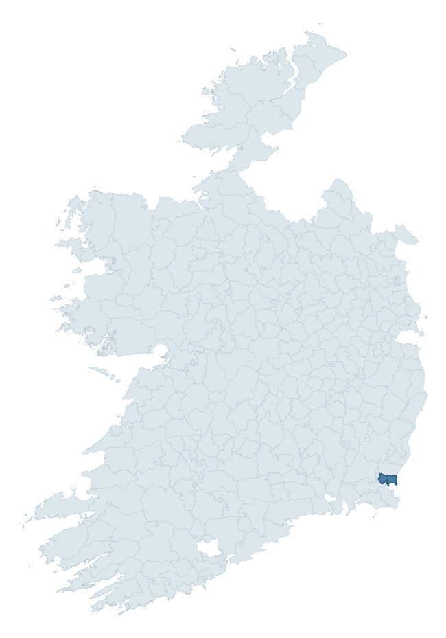
Where this barony sits in the Republic of Ireland
Geology and preservation
Bedrock geology shapes the landscape long before any settlement begins — controlling soil drainage, agricultural potential, the survival of upstanding monuments, and the preservation of buried archaeology. The figures below come from the Geological Survey Ireland 1:100,000 bedrock map.
The bedrock underlying Shelmaliere East is predominantly limestone (43% of the barony by area), laid down during the Carboniferous period (50% by area, around 359 to 299 million years ago). Limestone is the most heritage-rich bedrock in Ireland. It supports fertile, well-drained soils that favoured dense Early Medieval settlement and Norman manorial agriculture, and it weathers into karst features — sinkholes, caves, swallow holes, and souterrains — that frequently carry archaeology. Where peat overlies limestone, organic preservation can be exceptional. A substantial secondary geology of sandstone (40%) adds further variety to the underlying landscape. The single largest mapped unit is the Newtown Formation (39% of the barony's bedrock). With 7 distinct rock types mapped, the barony sits in the top third of ROI baronies for geological diversity (68th percentile) — typically a sign of complex tectonic history or coastal mosaics of differing rock units.
Rock type composition
Largest mapped unit: Newtown Formation (39% of the barony)
Placename evidence
Logainm records 11 heritage-diagnostic placenames for Shelmaliere East, a modest sample drawn predominantly from the townland record. The dominant stratum is early christian ecclesiastical. The most frequent diagnostic roots are cill- (6) and gall- (6). With a sample of this size the count should be treated as indicative rather than definitive.
Pre-Christian / Early Medieval Defensive
| Root | Count | Meaning |
|---|---|---|
| ráth- | 1 | earthen ringfort |
Early Christian Ecclesiastical
| Root | Count | Meaning |
|---|---|---|
| cill- | 6 | church (early) |
| cillín- | 3 | unconsecrated burial ground |
| tobar- | 1 | holy well |
Burial, Ritual, and Norse-Contact
| Root | Count | Meaning |
|---|---|---|
| gall- | 6 | foreigner — Norse settlement marker |
Other baronies in Wexford
About this profile
Click any section below to expand.
What is a barony?
A barony is a historic administrative unit in Ireland, broadly equivalent to an English hundred. The 280 baronies used here are from the OSi 2019 National Statutory Boundaries (generalised 20m), covering the 26 counties of the Republic of Ireland. Baronies derive from the Norman period, were formalised in the 17th century, and have not been redrawn for statistical purposes. They vary enormously in area, from compact urban baronies in Dublin to vast upland baronies in Connacht, and should not be compared by raw site count without accounting for area differences.
What counts as a site?
This profile combines three distinct heritage registers, each with its own definition of what constitutes a recordable site:
- Archaeological sites (NMS). The National Monuments Service Sites and Monuments Record (SMR) catalogues every known archaeological monument or site of archaeological interest in the Republic, from prehistoric burial mounds and ringforts to medieval churches and post-medieval defensive works. Inclusion does not require legal protection — only that the site has been identified, surveyed, and assessed as having archaeological value. A separate subset of these sites lies within a recorded protection zone, which gives them statutory protection under the National Monuments Acts.
- Listed buildings (NIAH). The National Inventory of Architectural Heritage records buildings of architectural, historical, archaeological, artistic, cultural, scientific, social, or technical interest. Each surveyed structure is appraised on a five-tier scale: International, National, Regional, Local, and Record-Only. The NIAH appraisal is informational rather than strictly statutory, but it underpins local-authority Record of Protected Structures (RPS) listings.
- Heritage placenames (Logainm). Logainm is the authoritative database of Irish placenames maintained by the Placenames Branch. This profile applies a heritage-diagnostic classifier to the Irish-language form of each townland name, flagging roots that signal defensive sites (ráth-, lios-, dún-, caiseal-, cathair-), ecclesiastical foundations (cill-, teampall-, domhnach-, mainistir-), prehistoric burial-ritual features (tuaim-, carn-, leaba-), or Norse-contact settlement (gall-). Townlands without one of these diagnostic roots are not flagged here — they may still carry historical significance, but that significance is not encoded in the name itself.
Editorial principles
The narrative sections of this profile follow several explicit principles:
- Evidential. Every claim about this barony’s heritage character is anchored in the underlying register data. Where a site count, a placename count, or a percentile rank is cited, it is computed from the source datasets at export time, not estimated.
- Comparative. Counts and metrics are reported alongside their percentile rank against the other 279 ROI baronies. A barony with 50 ringforts in absolute terms could be unusually high or unusually low depending on its size and regional context; percentile ranking removes that ambiguity.
- Transparent on limits. Where a register has known coverage gaps, survey biases, or data-quality issues that affect this barony’s figures, the profile flags them rather than presenting the numbers as definitive.
- No interpretation beyond what the data supports. The narrative does not speculate about historical events, social dynamics, or cultural meaning beyond what the recorded heritage and placename evidence directly attests.
Data caveats and limits
- NMS Sites and Monuments Record is the product of survey campaigns conducted at different intensities across different counties and decades. Some baronies have been surveyed more thoroughly than others, and absolute counts should be read in that light. Sites destroyed by development before survey are typically not represented; sites in heavily forested or upland terrain are sometimes under-recorded.
- NIAH coverage is broadly complete for the Republic of Ireland but the survey was conducted on a rolling county-by-county basis, and the most recent appraisal date varies. Buildings demolished or substantially altered after their original survey may still appear in the register; conversely, recent buildings of merit may not yet have been appraised.
- Logainm classification applies a deliberately conservative pattern-matching approach to the Irish-language townland forms. The classifier prioritises true positives over recall: a townland may carry a heritage signal that the classifier doesn’t recognise, particularly where the diagnostic root has been heavily anglicised or where the townland name draws on a less common term. The 60,000+ townland records and ~9,800 classified placenames give a substantial signal at barony scale, but individual townland names should be checked against Logainm directly for definitive interpretation.
- Period attribution. The chronological distribution reflects only those NMS sites that carry a recognised period attribution in the source data. Sites listed as “Unknown” period are excluded from the dated subset.
- Boundary changes. Some baronies have undergone minor boundary adjustments since their 19th-century definition; the OSi 2019 generalised boundaries used here are the current statutory definition and may differ slightly from historical maps in border areas.
- Bedrock geology is mapped at 1:100,000 scale, which means local variation within a barony — small pockets of different rock type, mineral veins, alluvium overlying bedrock — is generalised. The dominant-system and rocktype figures are area-weighted, so a barony reading “70% Carboniferous limestone” may still contain small but archaeologically important pockets of older or younger rock. Around 3% of GSI polygons do not match the lexicon and contribute no rocktype or system attribution.
Data sources
- National Monuments Service — Sites and Monuments Record (SMR) https://data.gov.ie/dataset/national-monuments-service-archaeological-survey-of-ireland
- National Inventory of Architectural Heritage (NIAH) https://data.gov.ie/dataset/national-inventory-of-architectural-heritage-niah-national-dataset
- Logainm — Placenames Database of Ireland https://www.logainm.ie/
- Ordnance Survey Ireland — National Statutory Barony Boundaries 2019 https://data-osi.opendata.arcgis.com/
- EURODEM — European Digital Elevation Model https://www.mapsforeurope.org/datasets/euro-dem
- ESA WorldCover https://esa-worldcover.org/en
- Geological Survey Ireland — 1:100,000 Bedrock Geology https://www.gsi.ie/en-ie/data-and-maps/Pages/Bedrock.aspx
Explore more: Search any of the 280 ROI baronies, browse by historical province, or read the methodology and data sources for the full Republic of Ireland Heritage Tool.