
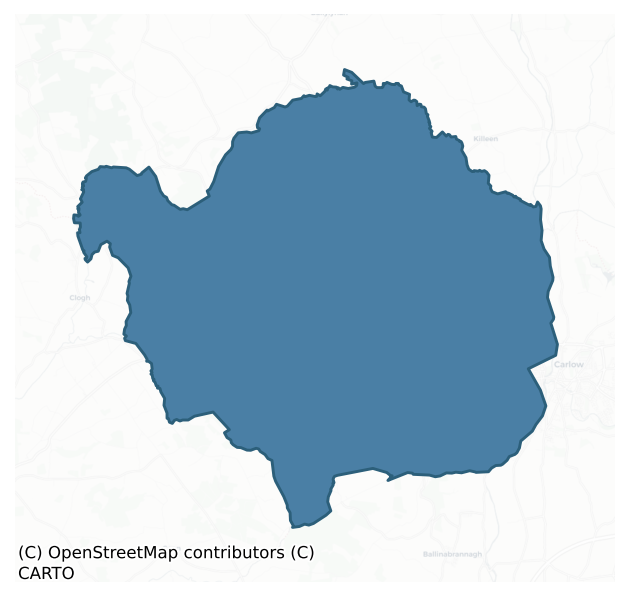
Slievemargy is a barony of County Laois, in the historical province of Leinster (Irish: Sliabh Mairge), covering 143 km² of land. The barony records 101 NMS archaeological sites and 18 NIAH listed buildings, placing it at around the 5th percentile among 280 ROI baronies for sites per km². This means it is in the bottom tenth of all baronies for sites per km². Dated archaeological evidence runs from the Early Bronze Age through to the Modern, spanning 6 of 9 archaeological periods, placing the barony in the 22nd percentile among 280 ROI baronies for chronological depth. This means it is in the bottom third of all baronies for chronological depth. The largest dated subset of recorded sites dates to the Iron Age.
Heritage at a glance
Percentile rankings throughout this profile compare each barony only against the other 279 Republic of Ireland baronies.
The recorded heritage of Slievemargy
The National Monuments Service Sites and Monuments Record (SMR) is the statutory inventory of archaeological sites for the Republic of Ireland, maintained by the Department of Tourism, Culture, Arts, Gaeltacht, Sport and Media. Sites recorded here include earthworks, ringforts, megalithic tombs, ecclesiastical remains, and post-medieval features; not every record is legally protected, but each is registered as a monument of archaeological interest.
The National Monuments Service records 101 archaeological sites in Slievemargy, putting it at the 5th percentile among 280 ROI baronies for sites per km². This means it is in the bottom tenth of all baronies for sites per km². A sparse recorded total of this kind in Ireland often reflects survey priority rather than genuine absence of past activity. Protection coverage is near-universal — 95 sites (94%) fall within a recorded monument protection zone, indicating an extensively surveyed landscape. The dominant category is defensive sites — ringforts, enclosures, hillforts, and stone forts (53 sites, 52% of the record). The most diagnostically specific type is Graveyard (7 records, 7% of the barony's NMS total) — compared to an ROI average of 4% across all baronies where this type occurs. Graveyard is a burial area associated with a church, in use from the medieval period onwards. The broader 'Enclosure' classification — which catches unclassified ringforts and field enclosures — accounts for a further 36 records (36%) and reflects the difficulty of sub-classifying degraded earthworks from surface evidence alone. Across the barony's 143 km², this gives a recorded density of 0.71 sites per km².
Most common monument types
Hover or tap a monument type to see its definition.
| Type | Count |
|---|---|
| Enclosure a banked or ditched feature of uncertain type, used as a catch-all where the original function cannot be determined from surface evidence | 36 |
| Graveyard a burial area associated with a church, in use from the medieval period onwards | 7 |
| Fulacht fia a horseshoe-shaped Bronze Age burnt mound built around a sunken trough beside a water source, traditionally interpreted as a cooking site | 6 |
| Church a building used for public Christian worship, of any date from c. 500 AD onwards | 5 |
| Ringfort – rath an earthen ringfort enclosed by a bank and external ditch — the most common Early Medieval farmstead, broadly dated 500–1000 AD | 5 |
| Ritual site – holy well a well or spring traditionally associated with a saint, often credited with healing properties; many trace earlier ritual origins but devotion is documented from the medieval period onwards | 5 |
| Moated site | 3 |
Chronological distribution
The dated archaeological record for Slievemargy spans from the Early Bronze Age through to the Modern, with activity attested across 6 of 9 archaeological periods. This is the 22nd percentile across ROI baronies — a relatively narrow chronological band, with much of Irish prehistory not represented in the dated record. The record is near-continuous, with only the Post Medieval period falling inside the span without any recorded sites. Activity concentrates most heavily in the Iron Age (41 sites, 51% of dated material), with the Early Medieval forming a secondary peak (15 sites, 19%). A further 21 recorded sites (21% of the overall NMS register for the barony) carry no period attribution — appearing as 'Unknown' in the bar chart below. This typically reflects either records that pre-date the standardised period vocabulary or sites awaiting specialist dating review, rather than a genuine absence of chronological evidence.
Sample of recorded monuments
Show 25 sample monuments (of 101 total)
A representative sample of 25 recorded monuments drawn from the barony’s 101 total NMS entries. Sites within a recorded monument protection zone and rarer site types are prioritised so the list shows a meaningful cross-section rather than only the most common type. Each entry shows the official Sites and Monuments Record reference number and the description published by the National Monuments Service.
Castle – motte and bailey
In undulating countryside. Castletown was the manorial centre of Ui Buidhe (Oboy), which was the pre-Norman territory given to Robert de Bigarz by Strongbow before 1176 (Orpen 1911-20, iii, 105). Giraldus Cambrensis…
In undulating countryside. Castletown was the manorial centre of Ui Buidhe (Oboy), which was the pre-Norman territory given to Robert de Bigarz by Strongbow before 1176 (Orpen 1911-20, iii, 105). Giraldus Cambrensis records that Hugh de Lacy built a castle in 1182 for Robert de Bigarz at Oboy, close to Timahoe (Scott and Martin 1978, 195). After 1245 it passed to William de Cantilupe and was obtained by John de Hastings in 1283 (Sweetman 1875-86, ii, no. 2107). In 1348 the Earl of Pembroke received 30s. yearly from the burgesses of Castletown and returns from the hundred of the town. (PRO1916, 128). There is no mention of Castletown after 1348 until the late-sixteenth century (Urban Survey 1986, 19). Remains include a flat-topped conical mound (summit diam. 6.5; base diam. c. 30m; H c. 10-12m) enclosed by a low gapped bank on summit. Steep-sided to W, N and E. Stone steps and a stone-built seat are set into the mound at SE. A cottage to S and farm buildings to SW have caused some disturbance. Slight remains of the fosse and external bank to N where the modern road skirts the motte. Possible bailey, now landscaped to SE of the motte where the ground is raised some 1-2m above the level of the surrounding fields. This area is enclosed by fences and at present forms the garden of Castletown House.
Compiled by: Caimin O'Brien
Date of upload: 17 December 2007
Field boundary
A curving earthwork (C c. 199m L) which is indicated on the 1906 edition of the OS 6-inch map is indicated as a field boundary of a farmhouse on the 1838 edition of the OS 6-inch map. Situated in an upland area. Today…
A curving earthwork (C c. 199m L) which is indicated on the 1906 edition of the OS 6-inch map is indicated as a field boundary of a farmhouse on the 1838 edition of the OS 6-inch map. Situated in an upland area. Today there are no visible surface remains of this earthwork which appears to be a field boundary of a post-1700 farmhouse, now levelled, both of which are indicated on the 1838 OS 6-inch map but not on subsequent editions.
The above description is derived from the published 'Archaeological Inventory of County Laois' (Dublin Stationery Office, 1995) compiled by P. David Sweetman, Olive Alcock and Bernie Moran. In certain instances the entries have been revised and updated in the light of recent research.
Compiled by Caimin O'Brien
Date of upload/revision: 11 December 2011
Barrow – unclassified
Not marked on the 1841 or 1906 editions of the OS 6-inch maps. A circular area (diam. c. 14m) defined by a low bank with twenty-two stones protruding slightly above the ground except at the E. From N-E the stones touch…
Not marked on the 1841 or 1906 editions of the OS 6-inch maps. A circular area (diam. c. 14m) defined by a low bank with twenty-two stones protruding slightly above the ground except at the E. From N-E the stones touch each other. There is a slight rise in the centre of enclosure. Large erratic boulder to the S, possible outlier.
Situated in an upland area on wet ,marshy land with nearby ring-barrow (LA031-020) to NE. A slightly concave circular area (diam. 14) enclosed by an earth and stone bank witn stone facing visible in bank face. Not a stone circle but more like a small embanked enclosure or pond barrow.
The above description is derived from the published 'Archaeological Inventory of County Laois' (Dublin Stationery Office, 1995) compiled by P. David Sweetman, Olive Alcock and Bernie Moran. In certain instances the entries have been revised and updated in the light of recent research.
Date of upload: 17 December 2007
Barrow – ring-barrow
A sub-circular area (dims. c. 15.9m N-S, c. 14.2m E-W) with dome-shaped rise in the centre. Slight evidence of internal fosse and external bank.
The above description is derived from the published 'Archaeological…
A sub-circular area (dims. c. 15.9m N-S, c. 14.2m E-W) with dome-shaped rise in the centre. Slight evidence of internal fosse and external bank.
The above description is derived from the published 'Archaeological Inventory of County Laois' (Dublin Stationery Office, 1995) compiled by P. David Sweetman, Olive Alcock and Bernie Moran. In certain instances the entries have been revised and updated in the light of recent research.
Date of upload: 17 December 2007
Standing stone
Not marked on the 1841 or 1906 editions of the OS 6-inch maps. Irregular green stone flag (H c. 1.2m, Wth c. 43-0.63m, T c. 0.4m-0.11m) orientated N-S. Another stone (H c. 1.1m, Wth c. 0.22-0.55m) immediately to SW, may…
Not marked on the 1841 or 1906 editions of the OS 6-inch maps. Irregular green stone flag (H c. 1.2m, Wth c. 43-0.63m, T c. 0.4m-0.11m) orientated N-S. Another stone (H c. 1.1m, Wth c. 0.22-0.55m) immediately to SW, may have broken off the standing stone.
This does not appear to be a standing stone, it is the wrong shape and size and form more like something that was erected in the nineteenth century. This could be the standing stone referred to in H. Roe's unpublished report.
The above description is derived from the published 'Archaeological Inventory of County Laois' (Dublin Stationery Office, 1995) compiled by P. David Sweetman, Olive Alcock and Bernie Moran. In certain instances the entries have been revised and updated in the light of recent research.
Date of upload: 17 December 2007
Chapel
Reference to a thatched chapel built in 1686 by a member of the Hartpole family (O'Hanlon and O'Leary 1907, vol. 2, 579). Situated atop high ground with excellent views of surrounding countryside. It was subsequently…
Reference to a thatched chapel built in 1686 by a member of the Hartpole family (O'Hanlon and O'Leary 1907, vol. 2, 579). Situated atop high ground with excellent views of surrounding countryside. It was subsequently replaced by the modern church. No early grave-markers visible.
Described in the History of the Queen's County as 'The earliest place of worship in this parish of which any record remains was the thatched chapel built in 1686, of which Grose gives an illustration and description. It was erected he says by a lady of the family of Hartpole. In one of the transepts there was 'a small chapel which was the place of interment of the Grace family'. According to the published memoirs of this family this ancient thatched chapel was replaced in 1795 by a structure of better class. This in its turn, yielded place to the present beautiful edifice, to the erection of which the munificence of Mrs. Grace, of Gracefield, largely contributed' (O'Hanlon and O'Leary 1907, vol. 2, 579).
The above description is derived from the published 'Archaeological Inventory of County Laois' (Dublin Stationery Office, 1995) compiled by P. David Sweetman, Olive Alcock and Bernie Moran. In certain instances the entries have been revised and updated in the light of recent research.
Date of upload: 17 December 2007
Penal Mass station
Reference to mass-station here (O'Hanlon and O'Leary 1907, vol. 2, 580). Situated in undulating countryside. No visible surface remains.
Described in the History of the Queens County as' Mass used to be said during…
Reference to mass-station here (O'Hanlon and O'Leary 1907, vol. 2, 580). Situated in undulating countryside. No visible surface remains.
Described in the History of the Queens County as' Mass used to be said during the penal era under a holly bush in one of the fields of Old leagh. The place lies to the S.W. of Arles at a distance of about a mile. The situation is extremely picturesque. A small river wends its way through a deep ravine, and serves as an outlet for the overflow waters of the well of St. Abban (LA032-005001-), the patron saint of Kilabban, the more ancient name of Arles. It was an ideal spot for a Mass-station' (O'Hanlon and O'Leary 1907, vol. 2, 580).
The above description is derived from the published 'Archaeological Inventory of County Laois' (Dublin Stationery Office, 1995) compiled by P. David Sweetman, Olive Alcock and Bernie Moran. In certain instances the entries have been revised and updated in the light of recent research.
Date of upload: 17 December 2007
Religious house – unclassified
In undulating countryside. Possible unclassified religious house (Gwynn and Hadcock 1970, 364) associated with St Fintan (O'Flanagan 1933, Vol. 2, 16-17). Monastic building at Clonagh described in 1801 as; 'There was…
In undulating countryside. Possible unclassified religious house (Gwynn and Hadcock 1970, 364) associated with St Fintan (O'Flanagan 1933, Vol. 2, 16-17). Monastic building at Clonagh described in 1801 as; 'There was formerly a monastery at Clonagh a fine steeple was erected here and was pulled down by the barbarian who tenanted the ground, for the sake of the limestone of which it was built. The ruins of the monastery are yet to be seen with the vestige of a curious arch' (Coote 1801, 188; O'Flanagan 1933, Vol. 2, pp. 16-17)' This is shown as a large Church on the old Map of Leix and Offaly (Hore 1863). Monastery ruins described by Comerford (1886, vol. 3, 76) as; 'Due east of Old Court, at a distance of about half a mile, and with distinct traces of a roadway connecting both places, there is a burial ground (LA032-007002-), now disused, in the townland of Clonagh'.
Present remains consist of a twin towered gatehouse on the E side of a medieval building the identity of which remains uncertain. According to Sir Charles Coote this was the remains of a monastery depicted on the Cotton map of Laois-Offaly dating from c. 1563. However on this map it is not clear whether the building depicted represented the remains of a monastery or of a castle. The partially destroyed gatehouse was protected by a moat or fosse now filled in but visible on Google Earth orthoimages. The present farm track to E appears to follow the line of a medieval road which leads up to the entrance wi…
Castle – tower house
Built by Robert Hartpole during the reign of Queen Elizabeth (O'Hanlon and O'Leary 1907, vol. 1, 315, 316). In 1576 Robert Hartpole of Carlow was granted the ‘manor of the Blackeforde (LA014-045—-), a castle in…
Built by Robert Hartpole during the reign of Queen Elizabeth (O'Hanlon and O'Leary 1907, vol. 1, 315, 316). In 1576 Robert Hartpole of Carlow was granted the ‘manor of the Blackeforde (LA014-045—-), a castle in Monyferricke (LA014-100—-), Rathmadocke alias the Blackeforde, the lands of Moniferick, Rathmadock alias the Blackeforde, Kilteighan, Garrans, Kilgessin, Ballekilkavan, Dromlin alias Killiclery, Inche alias Ballicowley, and Bavon an old castle in Colvanacre (LA008-015—-) alias Colbanahore [Coolbanagher], the lands of Colvanacre alias Colbanahore, Ballarighan, Killgenne, Ballenebeg, Shanebeg, Ballemolrone, and Ballenestraghe, the lands of Shrowle [Shrule] (LA032-012001-), Ballyhormer, Ballecollin, Rathduf, Garribriken, Aghatenan, and Cappescribedor, in the lordship of Slemarge, a ruinous castle and lands in Clonrere [Clonreher] (LA013-019—-) alias Merickeston, lands in Cultwerin, Killclonhoberd, Ballekillkaraghe, Knockandiere, Rathnemanaghe, and lands of Killehide, Ballehide, Garrenoe, Ballinecard, Farrinduf, Rossemore, and Ballim’Kegane, in the lordship of Slemarge, the lands of Ballirahen, Rossenalgan, Garroughe, Dormoile, and Capoile, or Cappahoile, in the same lordship; the advowson of the rectory of S. Fenton [Fintan], of Clowenenaghe [Clonenagh] (LA017-003001-), diocese of Leighlen, all in Queen’s co.. To hold for ever, by the service of a fouth part of a knight’s fee; rent £26 1s. 2d., Maintaining six English horsemen’ (Nicholls 1994, 376).
Tower ho…
Tomb – unclassified
Described in the History of the Queen's County as 'There are few ecclesiastical remains at Shrule, but there is a graveyard (LA032-012005-) near Shrule Castle (LA032-012001-). In it are the ruins of an old chapel…
Described in the History of the Queen's County as 'There are few ecclesiastical remains at Shrule, but there is a graveyard (LA032-012005-) near Shrule Castle (LA032-012001-). In it are the ruins of an old chapel (LA032-012004-), and within its nave are the tombs of the Hartpole's and their connexions. Many of the inscriptions there are defaced and illegible (O'Hanlon and O'Leary 1907, vol. 1, 315-16). In the s quadrant of the graveyard are the poorly preserved ivy-covered remains of low wall which appears to be the S wall of some sort of tomb or possibly the remains of a church (LA032-012004-). This wall is covered in ivy and is impossible to examine and appears to represent the S wall of a building aligned E-W. The S wall of the structure runs parallel to the S wall of the graveyard and is only 1m to the N of this wall. The SE quadrant of the graveyard was covered in trees and other vegetation making examination of this area impossible.
Compiled by: Caimin O'Brien
Date of revision: 11 December 2014
Burial ground
Reference to a burial ground called Killanure (the church of the yew), sometimes called Rath Killanure here (Comerford 1886, vol. 3, 265). Described by Comerford as 'There are no traces of a church here, nor is there…
Reference to a burial ground called Killanure (the church of the yew), sometimes called Rath Killanure here (Comerford 1886, vol. 3, 265). Described by Comerford as 'There are no traces of a church here, nor is there any local tradition of such having existed (Comerford 1886, vol. 3, 265). In gently undulating countryside. No visible surface remains.
The above description is derived from the published 'Archaeological Inventory of County Laois' (Dublin Stationery Office, 1995) compiled by P. David Sweetman, Olive Alcock and Bernie Moran. In certain instances the entries have been revised and updated in the light of recent research.
Date of upload: 17 December 2007
Castle – motte
Situated on a ridge with commanding views of the surrounding countryside. Medieval church ruins (LA032-020002-) and graveyard (LA032-020004-) 110m to NW. Present remains consist of a flat-topped conical-shaped…
Situated on a ridge with commanding views of the surrounding countryside. Medieval church ruins (LA032-020002-) and graveyard (LA032-020004-) 110m to NW. Present remains consist of a flat-topped conical-shaped earthen mound (summit diam. c. 18m; base diam. c. 33.8m, H c. 8m) the base of which has been scarped. The mound is covered in briars and thorn bushes making detailed examination impossible. Traces of low barely discernible earthworks in field surrounding the base of the motte which may be remains of a possibly bailey area. Placed on the Register of Historic Monuments on the 5th of February 1975.
The above description is derived from the published 'Archaeological Inventory of County Laois' (Dublin Stationery Office, 1995) compiled by P. David Sweetman, Olive Alcock and Bernie Moran. In certain instances the entries have been revised and updated in the light of recent research.
Updated by: Caimin O'Brien
Date of revised upload: 26 March 2015
Round tower
A round tower to SW of church (LA032-020002-) (Crawford and Leask 1925, 84) was destroyed in 1703 (Fitzgerald 1910, 189, 198). Fitzgerald (1910, 189) recorded that on 'Monday ye 8th Day of March 1702/3, that day the…
A round tower to SW of church (LA032-020002-) (Crawford and Leask 1925, 84) was destroyed in 1703 (Fitzgerald 1910, 189, 198). Fitzgerald (1910, 189) recorded that on 'Monday ye 8th Day of March 1702/3, that day the Steeple of Killeshan undermined and flung down by one Bambrick, imployed by Captain Wolseley, in Three Days Works. 1702/3, 8th March at 3 of the clocke in ye afternoon ye Steeple fell to ye ground, being measured it was 105 feet [32m] high, or in length'. A second reference to the round tower dating from 1709 recorded that 'near the foot of the Mountain stands the old church of Killeshen, of which is a very old building. Here lately stood over again the Doore of the Church, one of the old round steeples which, I am told was very high old and well built, so that when the owner of the place had it fallen, it came to the ground in one solid piece, and was not even by the fall against the ground so broke, but that several pieces yet remain sticking together, so that you can easily discover what this building was. It plainly appears to be of the same building & age with the adjacent Church (LA032-020002-)'. No visible surface remains of any round tower in NW quadrant of graveyard (LA032-020004-).
The above description is derived from the published 'Archaeological Inventory of County Laois' (Dublin Stationery Office, 1995) compiled by P. David Sweetman, Olive Alcock and Bernie Moran. In certain instances the entries have been revised and updated in the ligh…
Cairn – unclassified
Possible cairn visible on aerial photographs (GSI, S 25/6). No visible on ground. A possible enclosure (LA036-001001-) lay to SW.
The above description is derived from the published 'Archaeological Inventory of…
Possible cairn visible on aerial photographs (GSI, S 25/6). No visible on ground. A possible enclosure (LA036-001001-) lay to SW.
The above description is derived from the published 'Archaeological Inventory of County Laois' (Dublin Stationery Office, 1995) compiled by P. David Sweetman, Olive Alcock and Bernie Moran. In certain instances the entries have been revised and updated in the light of recent research.
Date of upload: 17 December 2007
Ritual site – holy tree/bush
Described by Comerford as 'An ancient grave-yard, still extensively used, occupies the probable site of St. Lony's cell and oratory, the latter, no doubt, in subsequent times by a public church (LA036-002001-). The…
Described by Comerford as 'An ancient grave-yard, still extensively used, occupies the probable site of St. Lony's cell and oratory, the latter, no doubt, in subsequent times by a public church (LA036-002001-). The trunk of a venerable tree remains from an aperture in which, six feet from the ground, people still living state that they recollect to have seen water flow in a copious stream. Every available portion of the withered trunk is decorated with ex voto rags. The Saint's Well (LA036-002003-) is immediately outside the burial ground. A Patron used to be held here on the 24th of June; very old natives tell of crowds of people flocking to it, and of fields and tents set up for their accomodation' (Comerford 1886, vol. 3, 197).
The above description is derived from the published 'Archaeological Inventory of County Laois' (Dublin Stationery Office, 1995) compiled by P. David Sweetman, Olive Alcock and Bernie Moran. In certain instances the entries have been revised and updated in the light of recent research.
Date of upload: 17 December 2007
Earthwork
Aerial photograph (GB89.Y.02) shows a sub-circular earthwork with raised interior and steep bank. Covered in bracken.
Graveslab
Unable to locate recumbent 17th century graveslab located S of Killeshin church (LA032-020002-) in S quadrant of graveyard (LA032-020004-). According to Fitzgerald (1910, 198) ‘the oldest tombstone appears to be dated…
Unable to locate recumbent 17th century graveslab located S of Killeshin church (LA032-020002-) in S quadrant of graveyard (LA032-020004-). According to Fitzgerald (1910, 198) ‘the oldest tombstone appears to be dated 1688; it is a flat slab on the south side of the churchyard and was erected to the memory of John Dodd’s and Bryan Hogan’s families’.
Compiled by: Caimin O'Brien
Date of upload: 26 March 2015
Hilltop enclosure
Cropmark of possible hilltop enclosure (approx. diam. 93m; overall diam. 160m) visible on Google earth aerial imagery. Cropmark of outer enclosing element follows contour line depicted on OS 6-inch map
See attached…
Cropmark of possible hilltop enclosure (approx. diam. 93m; overall diam. 160m) visible on Google earth aerial imagery. Cropmark of outer enclosing element follows contour line depicted on OS 6-inch map
See attached image taken from Google Earth aerial photographs taken 14/07/2018
Compiled by: Caimin O'Brien based on details provided by Jean-Charles Caillère
Date of upload: 19 September 2019
Enclosure – large enclosure
Partial cropmark of oval-shaped enclosure (approx. diam. 78m E-W) visible on Google earth aerial imagery.
See attached image of Google Earth photograph taken 14/07/2018
Compiled by: Caimin O'Brien based on…
Partial cropmark of oval-shaped enclosure (approx. diam. 78m E-W) visible on Google earth aerial imagery.
See attached image of Google Earth photograph taken 14/07/2018
Compiled by: Caimin O'Brien based on details provided by Simon Dowling
Date of upload: 30 December 2019
Castle – unclassified
Marked on the 1841 and 1906 editions of the OS 6-inch maps. Situated in undulating countryside. No visible surface remains. Destroyed approx. 10 yrs ago. Castle site indicated by a slight rise in the ground, slight…
Marked on the 1841 and 1906 editions of the OS 6-inch maps. Situated in undulating countryside. No visible surface remains. Destroyed approx. 10 yrs ago. Castle site indicated by a slight rise in the ground, slight evidence of a fosse (Wth 6m) at W, N and NE.
The above description is derived from the published 'Archaeological Inventory of County Laois' (Dublin Stationery Office, 1995) compiled by P. David Sweetman, Olive Alcock and Bernie Moran. In certain instances the entries have been revised and updated in the light of recent research.
Date of upload: 17 December 2007
Ringfort – unclassified
Marked on the 1841 edition of the OS 6-inch map; a circular 'fort' (max. diam. c. 45m). Situated in undulating countryside. No visible surface remains.
The above description is derived from the published…
Marked on the 1841 edition of the OS 6-inch map; a circular 'fort' (max. diam. c. 45m). Situated in undulating countryside. No visible surface remains.
The above description is derived from the published 'Archaeological Inventory of County Laois' (Dublin Stationery Office, 1995) compiled by P. David Sweetman, Olive Alcock and Bernie Moran. In certain instances the entries have been revised and updated in the light of recent research.
Date of upload: 17 December 2007
Cross – High cross
National Monument No. 116. A plain granite cross, (H. c. 1.45m, W. of arms c. 0.73m, W. of shaft 0.36m, T. c. 0.26m). A plain granite cross with cusps (H. c. 2.8m, W. of arms c. 0.7m, W of shaft c. 0.35m, T. c. 0.25m)…
National Monument No. 116. A plain granite cross, (H. c. 1.45m, W. of arms c. 0.73m, W. of shaft 0.36m, T. c. 0.26m). A plain granite cross with cusps (H. c. 2.8m, W. of arms c. 0.7m, W of shaft c. 0.35m, T. c. 0.25m) located in W quadrant of graveyard (LA032-018002-) immediately W of W gable of church (LA032-018001-). Described by Comerford as 'in the churchyard, nearly, opposite the N.W. corner of the W gable, stands a granite cross about 7 feet 10 inches [2.38m] high. It was never inscribed' (Comerford 1886,vol. 3, 249). Described by Harbison as the North Cross which is 'a tall ringless cross, 2.75m high, without any decoration' (Harbison 1992, vol. 1, 168).
The above description is derived from the published 'Archaeological Inventory of County Laois' (Dublin Stationery Office, 1995) compiled by P. David Sweetman, Olive Alcock and Bernie Moran. In certain instances the entries have been revised and updated in the light of recent research.
Updated by: Caimin O'Brien
Date of revised upload: 19 March 2015
Font
Octagonal font in roughly dressed granite (W. c. 0.81m, D. c. 0.48m, T. 0.12m) located at W end of church (LA032-018001-). Described by Comerford as ' Inside the old church of Sletty, near the doorway, and to the left…
Octagonal font in roughly dressed granite (W. c. 0.81m, D. c. 0.48m, T. 0.12m) located at W end of church (LA032-018001-). Described by Comerford as ' Inside the old church of Sletty, near the doorway, and to the left as you enter there is a large font of granite with a deep circular hollow, and pierced in the centre, which appears to me to have belonged to the primitive church of St. Fiacc. There was also a holy well (LA032-018004-) near this church called Tober-Feeg, but it is now stopped up' (Comerford 1886, vol. 3, 249).
The above description is derived from the published 'Archaeological Inventory of County Laois' (Dublin Stationery Office, 1995) compiled by P. David Sweetman, Olive Alcock and Bernie Moran. In certain instances the entries have been revised and updated in the light of recent research.
Updated by: Caimin O'Brien
Date of revised upload: 19 March 2015
Font
Located immediately W of Killeshin church (LA032-020002-) close to NW angle of church. A circular, granite font (diam. c. 0.8m) with cone shaped basin and aperture in the centre with a small hole on the rim of the font…
Located immediately W of Killeshin church (LA032-020002-) close to NW angle of church. A circular, granite font (diam. c. 0.8m) with cone shaped basin and aperture in the centre with a small hole on the rim of the font which may have been related to a cover. A narrow incised line visible halfway down runs around the outside of the font (Crawford and Leask 1925, 83-94; O'Hanlon and O'Leary 1907, vol. 1, 257-64). According to Fitzgerald (1910, 199) 'formerly a bulb-shaped granite font lay sunk in the ground on the north-east side of the church (LA032-020002-) ruins; it is now placed at the western wall of the church. The interior of the bowl is cone-shaped, and of such rude workmanship that it strikes one it was intended to hold a metal vessel or was lined with lead. The aperture is in the centre; on the rim is a circular hole, and beside it a small socket 4½ inches [0.11m] long, which both probably had some connexion with the fittings of a lid or cover'.
The font was described in 1925 as measuring '29 inches (0.73m) in diameter and 22 inches (0.55m) in height. It is undecorated except that the exterior is divided into three broad swelling bands, the funnel-shaped basin is unusual, its breadth and depth are alike 16 inches (0.4m). The base is hollowed and connected with the basin by a narrow aperture; a small socket, 1 inch (0.02m) in diameter and 2 inches (0.04m) deep, in the upper surface of the rim, probably held the hinge of a lid' (Crawford and Leask 1925, 94)….
Enclosure
Situated on a hillside in a very prominent position with excellent views to W, N and E. A subcircular area (diam. 19.8m N-S) defined by low earthen bank (Wth c. 2.2m; ext. H c. 1.05m, int. H c. 0.2m W c. 2.2m) best…
Situated on a hillside in a very prominent position with excellent views to W, N and E. A subcircular area (diam. 19.8m N-S) defined by low earthen bank (Wth c. 2.2m; ext. H c. 1.05m, int. H c. 0.2m W c. 2.2m) best preserved at W.
The above description is derived from the published 'Archaeological Inventory of County Laois' (Dublin Stationery Office, 1995) compiled by P. David Sweetman, Olive Alcock and Bernie Moran. In certain instances the entries have been revised and updated in the light of recent research.
Date of upload: 17 December 2007
Listed buildings
The National Inventory of Architectural Heritage (NIAH) is a state survey appraising buildings of architectural, historical, archaeological, artistic, cultural, scientific, social, or technical interest. Each surveyed structure receives a rating from International (the highest, for buildings of European importance) through National, Regional, Local, and Record-Only.
The NIAH records only 18 listed buildings in Slievemargy, the 5th percentile across ROI baronies — a relatively thin architectural record. All recorded buildings carry Regional or lower grading; the barony does not contain any structures appraised as being of National or International architectural importance. Construction dates concentrate most heavily in the Late Georgian (1800-1830) period. The most-recorded building type is house (6 examples, 33% of the listed stock).
Terrain and environment
Mean elevation across the barony is 160m — the 89th percentile among 280 ROI baronies for elevation. This means it is in the top fifth of all baronies for elevation. This is a relatively elevated landscape by ROI standards. Elevation matters for heritage because higher-altitude baronies typically favour defensive monuments — ringforts and hilltop forts placed on prominent ground — while lowland baronies are more likely to carry the dense settlement and church networks of intensive agricultural landscapes. A maximum elevation of 349m gives the barony meaningful vertical relief. Mean slope is 3.6° — the 50th percentile among 280 ROI baronies for slope. This means it is in the upper half of all baronies for slope. Slope is a key control on both land use and archaeological preservation: steep ground resists ploughing and tends to preserve earthworks intact, while gentle slopes favour intensive cultivation that damages or destroys surface archaeology over time. The Topographic Wetness Index averages 10.8, the 47th percentile among 280 ROI baronies for wetness. This means it is in the lower half of all baronies for wetness. Drainage matters for heritage because poorly-drained ground preserves organic archaeology (wooden trackways, leather, textiles, and on rare occasions human remains) far better than free-draining soil; well-drained ground favours arable use but destroys organic material rapidly. The land-cover mosaic combines improved grassland (74%), woodland (14%), and arable farmland (10%), giving a mixed agricultural and semi-natural landscape. In overall character, this is elevated but relatively gentle terrain — typical of plateau country, with land use dominated by improved grassland.
Terrain measurements
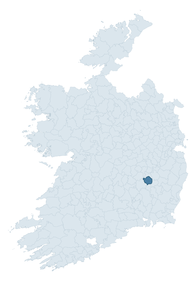
Where this barony sits in the Republic of Ireland
Geology and preservation
Bedrock geology shapes the landscape long before any settlement begins — controlling soil drainage, agricultural potential, the survival of upstanding monuments, and the preservation of buried archaeology. The figures below come from the Geological Survey Ireland 1:100,000 bedrock map.
The bedrock underlying Slievemargy is predominantly shale (33% of the barony by area), laid down during the Carboniferous period (100% by area, around 359 to 299 million years ago). Shale weathers to thin, acidic, frequently waterlogged soils, historically marginal for arable but suited to upland pasture and bog development. Shale-dominated baronies often carry sparse ringfort records and a higher representation of bog-preserved archaeology. A substantial secondary geology of limestone (29%) and siltstone (17%) adds further variety to the underlying landscape. The single largest mapped unit is the Coolbaun Formation (29% of the barony's bedrock). With 6 distinct rock types mapped, the barony sits in the top third of ROI baronies for geological diversity (67th percentile) — typically a sign of complex tectonic history or coastal mosaics of differing rock units.
Rock type composition
Largest mapped unit: Coolbaun Formation (29% of the barony)
Placename evidence
Logainm records 13 heritage-diagnostic placenames for Slievemargy, a modest sample drawn predominantly from the townland record. The dominant stratum is early christian ecclesiastical. The most frequent diagnostic roots are cill- (8) and ráth- (4). With a sample of this size the count should be treated as indicative rather than definitive.
Pre-Christian / Early Medieval Defensive
| Root | Count | Meaning |
|---|---|---|
| ráth- | 4 | earthen ringfort |
| dún- | 1 | hilltop or promontory fort |
Early Christian Ecclesiastical
| Root | Count | Meaning |
|---|---|---|
| cill- | 8 | church (early) |
Burial, Ritual, and Norse-Contact
| Root | Count | Meaning |
|---|---|---|
| gall- | 1 | foreigner — Norse settlement marker |
Other baronies in Laois
About this profile
Click any section below to expand.
What is a barony?
A barony is a historic administrative unit in Ireland, broadly equivalent to an English hundred. The 280 baronies used here are from the OSi 2019 National Statutory Boundaries (generalised 20m), covering the 26 counties of the Republic of Ireland. Baronies derive from the Norman period, were formalised in the 17th century, and have not been redrawn for statistical purposes. They vary enormously in area, from compact urban baronies in Dublin to vast upland baronies in Connacht, and should not be compared by raw site count without accounting for area differences.
What counts as a site?
This profile combines three distinct heritage registers, each with its own definition of what constitutes a recordable site:
- Archaeological sites (NMS). The National Monuments Service Sites and Monuments Record (SMR) catalogues every known archaeological monument or site of archaeological interest in the Republic, from prehistoric burial mounds and ringforts to medieval churches and post-medieval defensive works. Inclusion does not require legal protection — only that the site has been identified, surveyed, and assessed as having archaeological value. A separate subset of these sites lies within a recorded protection zone, which gives them statutory protection under the National Monuments Acts.
- Listed buildings (NIAH). The National Inventory of Architectural Heritage records buildings of architectural, historical, archaeological, artistic, cultural, scientific, social, or technical interest. Each surveyed structure is appraised on a five-tier scale: International, National, Regional, Local, and Record-Only. The NIAH appraisal is informational rather than strictly statutory, but it underpins local-authority Record of Protected Structures (RPS) listings.
- Heritage placenames (Logainm). Logainm is the authoritative database of Irish placenames maintained by the Placenames Branch. This profile applies a heritage-diagnostic classifier to the Irish-language form of each townland name, flagging roots that signal defensive sites (ráth-, lios-, dún-, caiseal-, cathair-), ecclesiastical foundations (cill-, teampall-, domhnach-, mainistir-), prehistoric burial-ritual features (tuaim-, carn-, leaba-), or Norse-contact settlement (gall-). Townlands without one of these diagnostic roots are not flagged here — they may still carry historical significance, but that significance is not encoded in the name itself.
Editorial principles
The narrative sections of this profile follow several explicit principles:
- Evidential. Every claim about this barony’s heritage character is anchored in the underlying register data. Where a site count, a placename count, or a percentile rank is cited, it is computed from the source datasets at export time, not estimated.
- Comparative. Counts and metrics are reported alongside their percentile rank against the other 279 ROI baronies. A barony with 50 ringforts in absolute terms could be unusually high or unusually low depending on its size and regional context; percentile ranking removes that ambiguity.
- Transparent on limits. Where a register has known coverage gaps, survey biases, or data-quality issues that affect this barony’s figures, the profile flags them rather than presenting the numbers as definitive.
- No interpretation beyond what the data supports. The narrative does not speculate about historical events, social dynamics, or cultural meaning beyond what the recorded heritage and placename evidence directly attests.
Data caveats and limits
- NMS Sites and Monuments Record is the product of survey campaigns conducted at different intensities across different counties and decades. Some baronies have been surveyed more thoroughly than others, and absolute counts should be read in that light. Sites destroyed by development before survey are typically not represented; sites in heavily forested or upland terrain are sometimes under-recorded.
- NIAH coverage is broadly complete for the Republic of Ireland but the survey was conducted on a rolling county-by-county basis, and the most recent appraisal date varies. Buildings demolished or substantially altered after their original survey may still appear in the register; conversely, recent buildings of merit may not yet have been appraised.
- Logainm classification applies a deliberately conservative pattern-matching approach to the Irish-language townland forms. The classifier prioritises true positives over recall: a townland may carry a heritage signal that the classifier doesn’t recognise, particularly where the diagnostic root has been heavily anglicised or where the townland name draws on a less common term. The 60,000+ townland records and ~9,800 classified placenames give a substantial signal at barony scale, but individual townland names should be checked against Logainm directly for definitive interpretation.
- Period attribution. The chronological distribution reflects only those NMS sites that carry a recognised period attribution in the source data. Sites listed as “Unknown” period are excluded from the dated subset.
- Boundary changes. Some baronies have undergone minor boundary adjustments since their 19th-century definition; the OSi 2019 generalised boundaries used here are the current statutory definition and may differ slightly from historical maps in border areas.
- Bedrock geology is mapped at 1:100,000 scale, which means local variation within a barony — small pockets of different rock type, mineral veins, alluvium overlying bedrock — is generalised. The dominant-system and rocktype figures are area-weighted, so a barony reading “70% Carboniferous limestone” may still contain small but archaeologically important pockets of older or younger rock. Around 3% of GSI polygons do not match the lexicon and contribute no rocktype or system attribution.
Data sources
- National Monuments Service — Sites and Monuments Record (SMR) https://data.gov.ie/dataset/national-monuments-service-archaeological-survey-of-ireland
- National Inventory of Architectural Heritage (NIAH) https://data.gov.ie/dataset/national-inventory-of-architectural-heritage-niah-national-dataset
- Logainm — Placenames Database of Ireland https://www.logainm.ie/
- Ordnance Survey Ireland — National Statutory Barony Boundaries 2019 https://data-osi.opendata.arcgis.com/
- EURODEM — European Digital Elevation Model https://www.mapsforeurope.org/datasets/euro-dem
- ESA WorldCover https://esa-worldcover.org/en
- Geological Survey Ireland — 1:100,000 Bedrock Geology https://www.gsi.ie/en-ie/data-and-maps/Pages/Bedrock.aspx
Explore more: Search any of the 280 ROI baronies, browse by historical province, or read the methodology and data sources for the full Republic of Ireland Heritage Tool.