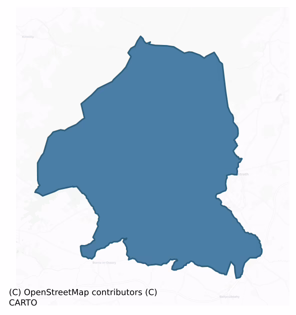
Upperwoods is a barony of County Laois, in the historical province of Leinster (Irish: An Choill Uachtarach), covering 198 km² of land. The barony records 106 NMS archaeological sites and 23 NIAH listed buildings, placing it at around the 2nd percentile among 280 ROI baronies for sites per km². This means it is in the bottom tenth of all baronies for sites per km². Dated archaeological evidence runs from the Early Bronze Age through to the Post Medieval, spanning 6 of 9 archaeological periods, placing the barony in the 19th percentile among 280 ROI baronies for chronological depth. This means it is in the bottom fifth of all baronies for chronological depth. The largest dated subset of recorded sites dates to the Iron Age.
Heritage at a glance
Percentile rankings throughout this profile compare each barony only against the other 279 Republic of Ireland baronies.
The recorded heritage of Upperwoods
The National Monuments Service Sites and Monuments Record (SMR) is the statutory inventory of archaeological sites for the Republic of Ireland, maintained by the Department of Tourism, Culture, Arts, Gaeltacht, Sport and Media. Sites recorded here include earthworks, ringforts, megalithic tombs, ecclesiastical remains, and post-medieval features; not every record is legally protected, but each is registered as a monument of archaeological interest.
The National Monuments Service records 106 archaeological sites in Upperwoods, putting it at the 2nd percentile among 280 ROI baronies for sites per km². This means it is in the bottom tenth of all baronies for sites per km². A sparse recorded total of this kind in Ireland often reflects survey priority rather than genuine absence of past activity. Protection coverage is near-universal — 97 sites (92%) fall within a recorded monument protection zone, indicating an extensively surveyed landscape. The record is dominated by defensive sites — ringforts, enclosures, hillforts, and stone forts (46 sites, 43% of the total), with ecclesiastical sites forming a substantial secondary presence (21 sites, 20%). The most diagnostically specific type is Ringfort – rath (13 records, 12% of the barony's NMS total) — compared to an ROI average of 20% across all baronies where this type occurs. Ringfort – rath is an earthen ringfort enclosed by a bank and external ditch — the most common Early Medieval farmstead, broadly dated 500–1000 AD. The broader 'Enclosure' classification — which catches unclassified ringforts and field enclosures — accounts for a further 22 records (21%) and reflects the difficulty of sub-classifying degraded earthworks from surface evidence alone. Across the barony's 198 km², this gives a recorded density of 0.54 sites per km².
Most common monument types
Hover or tap a monument type to see its definition.
| Type | Count |
|---|---|
| Enclosure a banked or ditched feature of uncertain type, used as a catch-all where the original function cannot be determined from surface evidence | 22 |
| Ringfort – rath an earthen ringfort enclosed by a bank and external ditch — the most common Early Medieval farmstead, broadly dated 500–1000 AD | 13 |
| Church a building used for public Christian worship, of any date from c. 500 AD onwards | 8 |
| Graveyard a burial area associated with a church, in use from the medieval period onwards | 8 |
| Barrow – ring-barrow a Bronze/Iron Age burial monument: a low circular area enclosed by ditch and outer bank | 4 |
| Castle – tower house a fortified residential tower of four or five storeys, mostly built by lords in the 15th and 16th centuries and often within a defended bawn | 3 |
| Field system a group of related fields forming a coherent agricultural landscape, of any date from the Neolithic onwards | 3 |
Chronological distribution
The dated archaeological record for Upperwoods spans from the Early Bronze Age through to the Post Medieval, with activity attested across 6 of 9 archaeological periods. This is the 19th percentile across ROI baronies — a relatively narrow chronological band, with much of Irish prehistory not represented in the dated record. Every period from earliest to latest is represented in the record — an unbroken sequence of dated activity across the full chronological span. Activity concentrates most heavily in the Iron Age (28 sites, 34% of dated material), with the Early Medieval forming a secondary peak (26 sites, 32%). A further 24 recorded sites (23% of the overall NMS register for the barony) carry no period attribution — appearing as 'Unknown' in the bar chart below. This typically reflects either records that pre-date the standardised period vocabulary or sites awaiting specialist dating review, rather than a genuine absence of chronological evidence.
Sample of recorded monuments
Show 25 sample monuments (of 106 total)
A representative sample of 25 recorded monuments drawn from the barony’s 106 total NMS entries. Sites within a recorded monument protection zone and rarer site types are prioritised so the list shows a meaningful cross-section rather than only the most common type. Each entry shows the official Sites and Monuments Record reference number and the description published by the National Monuments Service.
Well
In 1601 Hugh O'Neill on his march from the North of Ireland to Kinsale, Co. Cork, on his journey he camped in Glenleitir Valley in the Slieve Bloom Mountains. Not far from the source of the Silver River there is a well…
In 1601 Hugh O'Neill on his march from the North of Ireland to Kinsale, Co. Cork, on his journey he camped in Glenleitir Valley in the Slieve Bloom Mountains. Not far from the source of the Silver River there is a well known as Hugh O'Neill's Well, this natural spring well may have provided water for Hugh O'Neill's encampment.
Compiled by: Caimin O'Brien
Date of upload: 17 December 2007
Ritual site – holy tree/bush
Reference to church site and graveyard (LA010-002002-). which was used for the burial of unbaptized children and within which was a bush known as the 'Burying Bush' (LA010-002003-). Close by lay a holy water stone, a…
Reference to church site and graveyard (LA010-002002-). which was used for the burial of unbaptized children and within which was a bush known as the 'Burying Bush' (LA010-002003-). Close by lay a holy water stone, a font or bullaun stone (LA010-002004-) (Carrigan 1905, vol. 2, 150). No visible surface remains. Substantial remains of an ecclesiastical enclosure(LA010-002006-) defined by a low earth and stone bank survive. No visible surface remains.
The above description is derived from the published 'Archaeological Inventory of County Laois' (Dublin Stationery Office, 1995) compiled by P. David Sweetman, Olive Alcock and Bernie Moran. In certain instances the entries have been revised and updated in the light of recent research.
Date of upload: 17 December 2007
Standing stone
Not marked on the 1841 or 1962 editions of the OS 6-inch maps. A sandstone conglomerate (max. base L 1.08m; Wth 1.13m; H 1.38m) roughly rectangular in plan, narrowing towards the top and tilting sligtly to W. Two small…
Not marked on the 1841 or 1962 editions of the OS 6-inch maps. A sandstone conglomerate (max. base L 1.08m; Wth 1.13m; H 1.38m) roughly rectangular in plan, narrowing towards the top and tilting sligtly to W. Two small pieces of sandstone protrude from the soil around its base. The ground around it has been eroded, probably by cattle using the stone as a scratching post. Known locally as the 'Mass Rock' and believed to bave been used in Penal times as a mas site (Feehan 1979, 237).
The above description is derived from the published 'Archaeological Inventory of County Laois' (Dublin Stationery Office, 1995) compiled by P. David Sweetman, Olive Alcock and Bernie Moran. In certain instances the entries have been revised and updated in the light of recent research.
Date of upload: 17 December 2007
Font (present location)
Not marked on the 1841 and 1909 editions of the OS 6-inch maps. The font (LA011-023004-) was originally located in Killinure church (LA011-023), it was moved during Penal times to 'Burke's Cross' where Mass was said in…
Not marked on the 1841 and 1909 editions of the OS 6-inch maps. The font (LA011-023004-) was originally located in Killinure church (LA011-023), it was moved during Penal times to 'Burke's Cross' where Mass was said in the open (Carrigan 1905, vol. 2, 152). A limestone subcircular font (dims NW-SE c. 0.65m, NE-SW c. 0.75m, D c. 0.23m) with central drain-hole.
According to Carrigan 'the holy water font that once belonged to it [Killanure Church] is still to be seen at "Burke's Cross", a little beyond Killanure Chapel, in the direction of Mountrath. This font is of freestone, and like thos of Srahane and Killeen is rough and unhewn, with a large basin 14 in. in diamtere and 9 in. deep. During the Penal times, Mass used to be said in the open air, a few perches from Burke's Cross, and the font was brought there from Killanure churchyard, wherever that was, to be used by the people for its original purpose' (Carrigan 1905, vol. 2, 152).
The above description is derived from the published 'Archaeological Inventory of County Laois' (Dublin Stationery Office, 1995) compiled by P. David Sweetman, Olive Alcock and Bernie Moran. In certain instances the entries have been revised and updated in the light of recent research.
Date of upload: 17 December 2007
Moated site
Marked on the 1841 edition O.S. 6-inch map as a rectangular shaped enclosure or possible moated site. Situated on wet marshy land. No visible surface remains.
The above description is derived from the published…
Marked on the 1841 edition O.S. 6-inch map as a rectangular shaped enclosure or possible moated site. Situated on wet marshy land. No visible surface remains.
The above description is derived from the published 'Archaeological Inventory of County Laois' (Dublin Stationery Office, 1995) compiled by P. David Sweetman, Olive Alcock and Bernie Moran. In certain instances the entries have been revised and updated in the light of recent research.
Date of upload: 17 December 2007
Fulacht fia
In a low-lying marshy area, stream to E, deserted house and associated outbuildings immediately to W. Possible fulacht fiadh indicated by a small oval-shaped mound (dims. 11m N-S, 7m E-W; H 0.8m).
The above…
In a low-lying marshy area, stream to E, deserted house and associated outbuildings immediately to W. Possible fulacht fiadh indicated by a small oval-shaped mound (dims. 11m N-S, 7m E-W; H 0.8m).
The above description is derived from the published 'Archaeological Inventory of County Laois' (Dublin Stationery Office, 1995) compiled by P. David Sweetman, Olive Alcock and Bernie Moran. In certain instances the entries have been revised and updated in the light of recent research.
Date of upload: 17 December 2007
Barrow – bowl-barrow
Situated on high ground. Impressive bowl-shaped mound (summit dims. 6.5m E-W; 5.3m N-S; H 3m) surrounded by a broad deep fosse (Wth 3.5m; D 1.6m), which is enclosed by a denuded counterscarp bank (max. ext. H 0.6m).…
Situated on high ground. Impressive bowl-shaped mound (summit dims. 6.5m E-W; 5.3m N-S; H 3m) surrounded by a broad deep fosse (Wth 3.5m; D 1.6m), which is enclosed by a denuded counterscarp bank (max. ext. H 0.6m). Summit of mound slightly hollow and overgrown with roawn and crab-apple trees.
The above description is derived from the published 'Archaeological Inventory of County Laois' (Dublin Stationery Office, 1995) compiled by P. David Sweetman, Olive Alcock and Bernie Moran. In certain instances the entries have been revised and updated in the light of recent research.
Date of upload: 17 December 2007
Souterrain
Not marked on the 1841 or 1909 editions of the OS 6-inch map. Situated in an upland area, with good visibility. A slight depression, visible in NE quadrant of ringfort (LA015-008001-) may indicate the line of a…
Not marked on the 1841 or 1909 editions of the OS 6-inch map. Situated in an upland area, with good visibility. A slight depression, visible in NE quadrant of ringfort (LA015-008001-) may indicate the line of a souterrain.
The above description is derived from the published 'Archaeological Inventory of County Laois' (Dublin Stationery Office, 1995) compiled by P. David Sweetman, Olive Alcock and Bernie Moran. In certain instances the entries have been revised and updated in the light of recent research.
Date of upload: 17 December 2007
Mound
A flat topped circular mound (diam c. 14m, H c. 2m) with a circular depression (W c. 4.7m, d c. 0.5m) at the top.
The above description is derived from the published 'Archaeological Inventory of County Laois' (Dublin…
A flat topped circular mound (diam c. 14m, H c. 2m) with a circular depression (W c. 4.7m, d c. 0.5m) at the top.
The above description is derived from the published 'Archaeological Inventory of County Laois' (Dublin Stationery Office, 1995) compiled by P. David Sweetman, Olive Alcock and Bernie Moran. In certain instances the entries have been revised and updated in the light of recent research.
Date of upload: 17 December 2007
Rabbit warren
Marked as rabbit burrow on the 1841 ed OS 6-inch map. Reference to possible medieval rabbit warren site here (Feehan, 1983, 383). No visible surface remains. According to Feehan on Badger Hill there was a site named…
Marked as rabbit burrow on the 1841 ed OS 6-inch map. Reference to possible medieval rabbit warren site here (Feehan, 1983, 383). No visible surface remains. According to Feehan on Badger Hill there was a site named Rabbit Warren, and there is the possibility that this was on the site of the medieval warren which the de Clares and their sucessors would certainly have had (Feehan 1983, 383).
The above description is derived from the published 'Archaeological Inventory of County Laois' (Dublin Stationery Office, 1995) compiled by P. David Sweetman, Olive Alcock and Bernie Moran. In certain instances the entries have been revised and updated in the light of recent research.
Date of upload: 17 December 2007
Ritual site – holy/saint's stone
Situated NW of Anatrim Church (LA016-016003-). Projecting inward from S side of St Kaban's Well (LA016-016002-), and filling the greater part of its mouth, is a large limestone flag (dims. 1.6m x 1.15m, T c. 0.45m)…
Situated NW of Anatrim Church (LA016-016003-). Projecting inward from S side of St Kaban's Well (LA016-016002-), and filling the greater part of its mouth, is a large limestone flag (dims. 1.6m x 1.15m, T c. 0.45m) decorated on its smooth upper surface with an incised circle and two elliptical depressions (dims. 0.11m x 0.05m; D 0.04-0.06m) (Elizabeth FitzPatrick 1991).
The above description is derived from the published 'Archaeological Inventory of County Laois' (Dublin Stationery Office, 1995) compiled by P. David Sweetman, Olive Alcock and Bernie Moran. In certain instances the entries have been revised and updated in the light of recent research.
Date of upload: 17 December 2007
Ritual site – holy well
Situated 130m NW of Anatrim Church (LA016-016003-). Pattern day on 3rd November that was held at the well up until the 1830's (Carrigan 1905, 146-150). A subcircular spring well (dims. 2.2m x 2.1m; D 1.2m) lined…
Situated 130m NW of Anatrim Church (LA016-016003-). Pattern day on 3rd November that was held at the well up until the 1830's (Carrigan 1905, 146-150). A subcircular spring well (dims. 2.2m x 2.1m; D 1.2m) lined internally with drystone masonry at N and W partly covered over by 'St. Kaban's Stone' which is a limestone flag, decorated on its upper surface with an incised circle and two elliptical depressions (LA016-016001-) (Elizabeth FitzPatrick 1991).
The above description is derived from the published 'Archaeological Inventory of County Laois' (Dublin Stationery Office, 1995) compiled by P. David Sweetman, Olive Alcock and Bernie Moran. In certain instances the entries have been revised and updated in the light of recent research.
Date of upload: 17 December 2007
Settlement deserted – medieval
According to Carrigan the parish of Offerlane or Upperwoods, 'formed one parish from remote times, till the year 1839, when it was broken up into two new parishes, viz., Castletown and Camross (Carrigan 1905, vol. 2,…
According to Carrigan the parish of Offerlane or Upperwoods, 'formed one parish from remote times, till the year 1839, when it was broken up into two new parishes, viz., Castletown and Camross (Carrigan 1905, vol. 2, 171). In 1290, Gilbert de Clare, Earl of Gloucester surrendered to the King his castles of Kilkenny and Offerlane (Castletown) and received a regrant of them the next month. In 1306 'it was stated that the manor attached to the castle of Offerlane, located in the far north of Ossory, had once been worth £26 6s 6d per annum to the earl of Gloucester (O'Cleirigh 1999, 171). In 1307 it belonged to Joan, Countess of Gloucester, widow of Earl Gilbert. Thomas de Cantewelle was constable of the castle in 1309 and held it for the crown. In 1600 the castle and town of Castletown were burnt to the ground by Teige Fitzpatrick at the approach of the Lord Deputy and his army (O'Hanlon and O'Leary 1907, vol.1, 493). Medieval settlement may have been located in the townland of Oldborris to the N of the Fair Green and to the W of Castletown Bridge.
The above description is derived from the published 'Archaeological Inventory of County Laois' (Dublin Stationery Office, 1995) compiled by P. David Sweetman, Olive Alcock and Bernie Moran. In certain instances the entries have been revised and updated in the light of recent research.
Date of upload: 17 December 2007
Castle – unclassified
Situated on high ground overlooking Castletown bridge (LA016-017004-) which crosses the River Nore to the N. In 1290, Gilbert de Clare, Earl of Gloucester surrendered to the King his castles of Kilkenny and Offerclane…
Situated on high ground overlooking Castletown bridge (LA016-017004-) which crosses the River Nore to the N. In 1290, Gilbert de Clare, Earl of Gloucester surrendered to the King his castles of Kilkenny and Offerclane (Castletown) and received a regrant of them the next month. In 1306 'it was stated that the manor attached to the castle of Offerlane, located in the far north of Ossory, had once been worth £26 6s 6d per annum to the earl of Gloucester (O'Cleirigh 1999, 171, Cal. doc. Ire. 1302-07, no. 670). An "Extent" of the possessions of Joan, Countess of Gloucester, widow of Earl Gilbert, dating 1307, states 'that there is a castle [viz., that of Castletown] in Offarclan, which belonged to the Countess aforesaid, in which are contained, as well in lordship as in demesne, 29 carucates and 60 acres of land, which formerly were wont to be worth £26 4s. 4d.; but as this castle lies in a strong march, all the lands aforesaid lie waste on account of the war of the Irish, so that nothing can be recovered there from; but the lord the King spends £40 a year of his own on the custody of the castle' (Carrigan 1905, vol. 2, 171-2). Thomas de Cantewelle was constable of the castle in 1309 and held it for the crown. In 1600 the castle was burnt down by Teige Fitzpatrick (Carrigan 1905, vol. 2, 171-172). Depicted on the 1563 map of leix and Offaly as a castle in 'Balachassan'. According to Carrigan in The History and Antiquities of the Diocese of Ossory the 'old castle which formerly…
Holed stone
Reference to rough holed stone within the graveyard (Carrigan 1905, vol. 2, 173). No visible surface remains.
The above description is derived from the published 'Archaeological Inventory of County Laois' (Dublin…
Reference to rough holed stone within the graveyard (Carrigan 1905, vol. 2, 173). No visible surface remains.
The above description is derived from the published 'Archaeological Inventory of County Laois' (Dublin Stationery Office, 1995) compiled by P. David Sweetman, Olive Alcock and Bernie Moran. In certain instances the entries have been revised and updated in the light of recent research.
Date of upload: 17 December 2007
Burial
Not marked on the 1841 or 1909 editions of the OS 6-inch map. Reference to burials located outside the ringfort (LA016-023005-) (Carrigan 1905, vol. 2, 180). No visible surface remains.
The above description is…
Not marked on the 1841 or 1909 editions of the OS 6-inch map. Reference to burials located outside the ringfort (LA016-023005-) (Carrigan 1905, vol. 2, 180). No visible surface remains.
The above description is derived from the published 'Archaeological Inventory of County Laois' (Dublin Stationery Office, 1995) compiled by P. David Sweetman, Olive Alcock and Bernie Moran. In certain instances the entries have been revised and updated in the light of recent research.
Date of upload: 17 December 2007
Inn
Marked as 'Rush Hall Inn' on the 1841 edition of the OS 6-inch map. It is described by Carrigan (1905, vol. 2, 183) as having, 'projecting chimneys; it had, too, the lozenge-shaped chimney stacks, but only in single…
Marked as 'Rush Hall Inn' on the 1841 edition of the OS 6-inch map. It is described by Carrigan (1905, vol. 2, 183) as having, 'projecting chimneys; it had, too, the lozenge-shaped chimney stacks, but only in single rows, till 1896. It is traditionally said to have been erected to accommodate the men employed in building [Rush Hall] Court [LA016-026—-]. As far as anyone remembers it was always, as its name implies, a public Inn, till about 1860'.
This detached two-storey five-bay house dates to the seventeenth century with later modifications. It has heavy projecting chimney stacks at both gable ends.
The above description is derived from the published 'Archaeological Inventory of County Laois' (Dublin Stationery Office, 1995) compiled by P. David Sweetman, Olive Alcock and Bernie Moran. In certain instances the entries have been revised and updated in the light of recent research.
Date of revised upload: 4 March 2019
House – 17th century
Rush Hall appears to have been the residence of the Ruish family in the first quarter of the seventeenth century and later through marriage became the residence of the Coote family (Brewer 1826, vol. 2, 90). In the…
Rush Hall appears to have been the residence of the Ruish family in the first quarter of the seventeenth century and later through marriage became the residence of the Coote family (Brewer 1826, vol. 2, 90). In the first quarter of the seventeenth century, Sir Charles Coote, 1st Earl of Mountrath, married Mary Ruish, the second daughter and co-heiress of Sir Francis Ruish, of Ruish Hall, Co. Laois and of Castle Jordan, Co. Meath, who was M.P. for the King’s Co. [Offaly] and of the privy council in the reign of King James I (Burke 1866, 134; Lodge 1789 vol. 2, 77). Sir Francis Ruish of Castlejordan and Ruish Hall died in 1623 and was succeeded by his daughter Mary who around this time married Sir Charles Coote (Berwick 1819, 45). According to other sources the lands of Rush Hall then known as Ballymoy belonged to the Costigan family who lost these lands after the Irish Confederate Wars of 1641-1652 to Major Thomas Davis. The 1659 Census of Ireland lists Thomas Davis as the chief tenant or landowner of the townland of 'Ballemoy' [Rush Hall] (Pender 2002, 496). This person appears to have been Major Thomas Davis a soldier in the Cromwellian army who had received these lands which formerly belonged to the Costigans (Prendergast 1887, 72). Shortly after this date, possibly in 1660, Major Thomas Davis sold these lands to Sir Charles Coote, then Earl of Mountrath (Prendergast 1887, 72). In 1660, Sir Charles Coote of Ruish-Hall was appointed Colonel of a Regiment of Horse an…
Metalworking site
Not marked on the 1841 or 1909 eds OS 6-inch maps. Remains of a mound of glass waste (diam. c. 50m) now partly quarried away. Defined by dry-stone walling (L c. N-S5.05m; E-W 8.7m). Heaps of glass waste visible. Remains…
Not marked on the 1841 or 1909 eds OS 6-inch maps. Remains of a mound of glass waste (diam. c. 50m) now partly quarried away. Defined by dry-stone walling (L c. N-S5.05m; E-W 8.7m). Heaps of glass waste visible. Remains are of an eighteenth century glass working factory. (Inf. from owner of Crannagh house).
Remains not of a glassworks but of a seventeenth / eighteenth century Ironworks which has waste slag that looks like glass.
The above description is derived from the published 'Archaeological Inventory of County Laois' (Dublin Stationery Office, 1995) compiled by P. David Sweetman, Olive Alcock and Bernie Moran. In certain instances the entries have been revised and updated in the light of recent research.
Date of upload: 17 December 2007
Water mill – horizontal-wheeled
Not marked on the 1841 or 1909 editions of the OS 6-inch maps. Discovered 66m NNW of Ironwworks (LA016-041001-). The base of wooden uprights were visible in the stream.
The above description is derived from the…
Not marked on the 1841 or 1909 editions of the OS 6-inch maps. Discovered 66m NNW of Ironwworks (LA016-041001-). The base of wooden uprights were visible in the stream.
The above description is derived from the published 'Archaeological Inventory of County Laois' (Dublin Stationery Office, 1995) compiled by P. David Sweetman, Olive Alcock and Bernie Moran. In certain instances the entries have been revised and updated in the light of recent research.
Date of upload: 17 December 2007
Inscribed stone
On the south wall of Kilbrickan church (LA017-012001-) there was an inscribed stone (LA017-011). It was moved to Kilbrickan House by Roberts and used as a hearth-stone(Carrigan 1905, vol. 2, 176). No visible surface…
On the south wall of Kilbrickan church (LA017-012001-) there was an inscribed stone (LA017-011). It was moved to Kilbrickan House by Roberts and used as a hearth-stone(Carrigan 1905, vol. 2, 176). No visible surface remains.
Described by Carrigan (Carrigan 1905, vol. 2, 175) as a 'church (LA017-012001-) has all the appearances of great antiquity. It is rectangular in shape and measures 55 and a half feet in length and 26 ft. in breadth, the walls being 3 ft. 9 in. thick and varying in height, at present from 7 ft. downwards. In the south side-wall on the inside, there are two recesses about 2 ft. wide and reaching to the ground, one beside the altar, the other about the middle of the wall; the upper parts of the recesses, probably containing windows, are broken away. There was no doorway in this wall. An aged tree, growing up in the centre of the west gable, probably occupies the place of the original entrance. The stones used in the building were very rough, but not very large, no cut stone. No interments have taken place about the church in the memory of anyone now living. There are no monuments now visible, all having sunk beneath the surface of the graveyard (LA017-012002-) long ago. It is said, however that one large monument, with an inscription was formerly fixed into the south wall of the church, on the inside and that it was removed thence to Kilbrickan House by a man named Roberts, who made use of it there as a hearth stone in his bed-room' (Carrigan 1905, vol….
Castle – Anglo-Norman masonry castle
Situated on high ground overlooking Castletown bridge (LA016-017004-) which crosses the River Nore to the N. A late medieval tower house site (LA016-017001-) is located 50m to the E. In 1290, Gilbert de Clare, Earl of…
Situated on high ground overlooking Castletown bridge (LA016-017004-) which crosses the River Nore to the N. A late medieval tower house site (LA016-017001-) is located 50m to the E. In 1290, Gilbert de Clare, Earl of Gloucester surrendered to the King his castles of Kilkenny and Offerclane (Castletown) and received a regrant of them the next month. In 1306 'it was stated that the manor attached to the castle of Offerlane, located in the far north of Ossory, had once been worth £26 6s 6d per annum to the earl of Gloucester (O'Cleirigh 1999, 171, Cal. doc. Ire. 1302-07, no. 670). An "Extent" of the possessions of Joan, Countess of Gloucester, widow of Earl Gilbert, dating 1307, states 'that there is a castle [viz., that of Castletown] in Offarclan, which belonged to the Countess aforesaid, in which are contained, as well in lordship as in demesne, 29 carucates and 60 acres of land, which formerly were wont to be worth £26 4s. 4d.; but as this castle lies in a strong march, all the lands aforesaid lie waste on account of the war of the Irish, so that nothing can be recovered there from; but the lord the King spends £40 a year of his own on the custody of the castle' (Carrigan 1905, vol. 2, 171-2). Thomas de Cantewelle was constable of the castle in 1309 and held it for the crown. In 1600 the castle was burnt down by Teige Fitzpatrick (Carrigan 1905, vol. 2, 171-172). Depicted on the 1563 map of leix and Offaly as a castle in 'Balachassan'. According to Carrigan in The Hist…
Bullaun stone
Reference to church site and graveyard (LA010-002002-). which was used for the burial of unbaptized children and within which was a bush known as the 'Burying Bush' (LA010-002003-). Close by lay a holy water stone, a…
Reference to church site and graveyard (LA010-002002-). which was used for the burial of unbaptized children and within which was a bush known as the 'Burying Bush' (LA010-002003-). Close by lay a holy water stone, a font or bullaun stone (LA010-002004-) (Carrigan 1905, vol. 2, 150). Described as a rough limestone block with round artificial basin (Carrigan 1905, vol. 2, 150). No visible surface remains.
The above description is derived from the published 'Archaeological Inventory of County Laois' (Dublin Stationery Office, 1995) compiled by P. David Sweetman, Olive Alcock and Bernie Moran. In certain instances the entries have been revised and updated in the light of recent research.
Date of upload: 17 December 2007
Ecclesiastical enclosure
Reference to church site and graveyard (LA010-002002-). which was used for the burial of unbaptized children and within which was a bush known as the 'Burying Bush' (LA010-002003-). Close by lay a holy water stone, a…
Reference to church site and graveyard (LA010-002002-). which was used for the burial of unbaptized children and within which was a bush known as the 'Burying Bush' (LA010-002003-). Close by lay a holy water stone, a font or bullaun stone (LA010-002004-) (Carrigan 1905, vol. 2, 150). No visible surface remains. Substantial remains of an ecclesiastical enclosure(LA010-002006-) defined by a low earth and stone bank survive.
The above description is derived from the published 'Archaeological Inventory of County Laois' (Dublin Stationery Office, 1995) compiled by P. David Sweetman, Olive Alcock and Bernie Moran. In certain instances the entries have been revised and updated in the light of recent research.
Date of upload: 17 December 2007
Enclosure
Situated in Coillte forestry in upland area. Possible enclosure not marked on any edition of OS 6-inch maps but visible on aerial photograph taken by the Irish air corps c. 1950 (ACAP, V 300, 776-7). No surface…
Situated in Coillte forestry in upland area. Possible enclosure not marked on any edition of OS 6-inch maps but visible on aerial photograph taken by the Irish air corps c. 1950 (ACAP, V 300, 776-7). No surface remains visible of monument in area marked on the OS map. A site inspection carried out in 20/07/2018 by Ed Lyne failed to locate the possible enclosure identified on the air corps aerial photograph.
The above description is derived from the published 'Archaeological Inventory of County Laois' (Dublin Stationery Office, 1995) compiled by P. David Sweetman, Olive Alcock and Bernie Moran. In certain instances the entries have been revised and updated in the light of recent research.
Compiled by: David Sweetman
Revised by: Caimin O'Brien
Date of revised upload: 29 November 2018
Listed buildings
The National Inventory of Architectural Heritage (NIAH) is a state survey appraising buildings of architectural, historical, archaeological, artistic, cultural, scientific, social, or technical interest. Each surveyed structure receives a rating from International (the highest, for buildings of European importance) through National, Regional, Local, and Record-Only.
The NIAH records only 23 listed buildings in Upperwoods, the 9th percentile across ROI baronies — a relatively thin architectural record. The highest-graded structure include 1 of National significance. The Republic holds 937 National-graded buildings in total, so this barony accounts for around 0% of the national total. Construction dates concentrate most heavily in the Late Georgian (1800-1830) period. The most-recorded building type is house (8 examples, 35% of the listed stock).
Terrain and environment
Mean elevation across the barony is 195m — the 95th percentile among 280 ROI baronies for elevation. This means it is in the top tenth of all baronies for elevation. This is a relatively elevated landscape by ROI standards. Elevation matters for heritage because higher-altitude baronies typically favour defensive monuments — ringforts and hilltop forts placed on prominent ground — while lowland baronies are more likely to carry the dense settlement and church networks of intensive agricultural landscapes. The barony reaches 525m at its highest point — a vertical span of more than 329m within its boundary, indicating significant topographic diversity. Mean slope is 5.0° — the 74th percentile among 280 ROI baronies for slope. This means it is in the top third of all baronies for slope. Slope is a key control on both land use and archaeological preservation: steep ground resists ploughing and tends to preserve earthworks intact, while gentle slopes favour intensive cultivation that damages or destroys surface archaeology over time. The Topographic Wetness Index averages 10.3, the 30th percentile among 280 ROI baronies for wetness. This means it is in the bottom third of all baronies for wetness. Drainage matters for heritage because poorly-drained ground preserves organic archaeology (wooden trackways, leather, textiles, and on rare occasions human remains) far better than free-draining soil; well-drained ground favours arable use but destroys organic material rapidly. The land cover is dominated by improved grassland (62%) and woodland (35%). In overall character, this is elevated but relatively gentle terrain — typical of plateau country, with land use dominated by improved grassland.
Terrain measurements
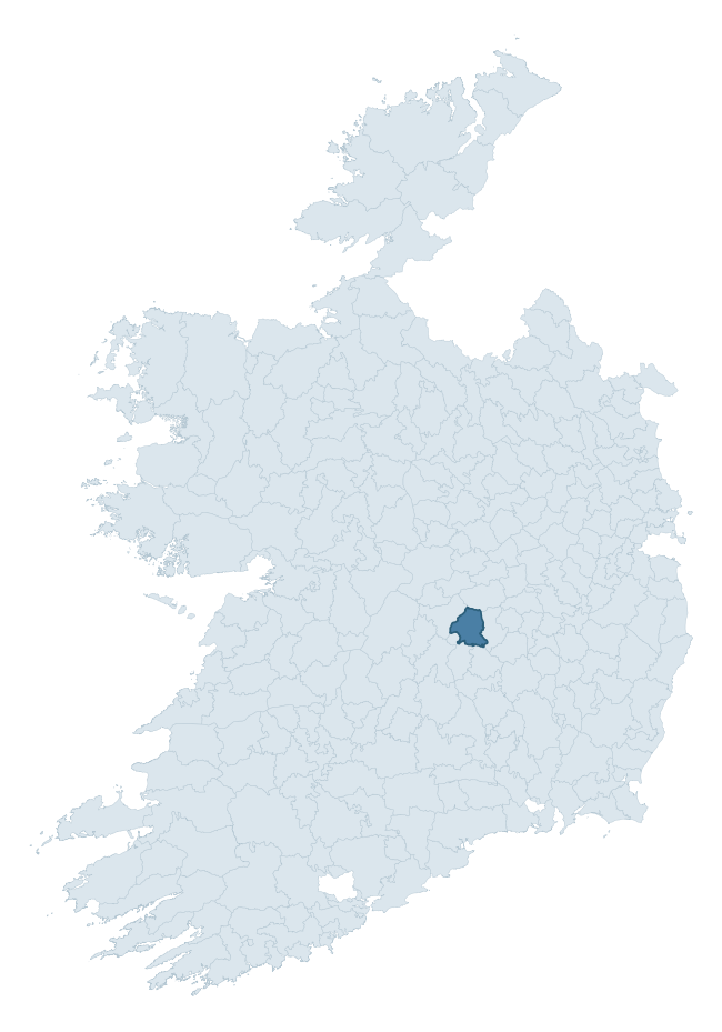
Where this barony sits in the Republic of Ireland
Geology and preservation
Bedrock geology shapes the landscape long before any settlement begins — controlling soil drainage, agricultural potential, the survival of upstanding monuments, and the preservation of buried archaeology. The figures below come from the Geological Survey Ireland 1:100,000 bedrock map.
The bedrock underlying Upperwoods is predominantly sandstone (29% of the barony by area), laid down during the Devonian period (51% by area, around 419 to 359 million years ago). Sandstone weathers to free-draining, moderately fertile soils that supported Early Medieval ringfort agriculture and later manorial estates. The rock itself is a major source of building stone — visible in churches, tower houses, and farm buildings across the barony's historic landscape. A substantial secondary geology of sandstone, siltstone (22%) and limestone (20%) adds further variety to the underlying landscape. The single largest mapped unit is the Cadamstown Formation (29% of the barony's bedrock).
Rock type composition
Largest mapped unit: Cadamstown Formation (29% of the barony)
Placename evidence
Logainm records 12 heritage-diagnostic placenames for Upperwoods, a modest sample drawn predominantly from the townland record. The dominant stratum is pre-christian defensive. The most frequent diagnostic roots are cill- (4) and caiseal- (3). With a sample of this size the count should be treated as indicative rather than definitive.
Pre-Christian / Early Medieval Defensive
| Root | Count | Meaning |
|---|---|---|
| caiseal- | 3 | stone ringfort |
| ráth- | 2 | earthen ringfort |
| dún- | 1 | hilltop or promontory fort |
Early Christian Ecclesiastical
| Root | Count | Meaning |
|---|---|---|
| cill- | 4 | church (early) |
| cillín- | 1 | unconsecrated burial ground |
Other baronies in Laois
About this profile
Click any section below to expand.
What is a barony?
A barony is a historic administrative unit in Ireland, broadly equivalent to an English hundred. The 280 baronies used here are from the OSi 2019 National Statutory Boundaries (generalised 20m), covering the 26 counties of the Republic of Ireland. Baronies derive from the Norman period, were formalised in the 17th century, and have not been redrawn for statistical purposes. They vary enormously in area, from compact urban baronies in Dublin to vast upland baronies in Connacht, and should not be compared by raw site count without accounting for area differences.
What counts as a site?
This profile combines three distinct heritage registers, each with its own definition of what constitutes a recordable site:
- Archaeological sites (NMS). The National Monuments Service Sites and Monuments Record (SMR) catalogues every known archaeological monument or site of archaeological interest in the Republic, from prehistoric burial mounds and ringforts to medieval churches and post-medieval defensive works. Inclusion does not require legal protection — only that the site has been identified, surveyed, and assessed as having archaeological value. A separate subset of these sites lies within a recorded protection zone, which gives them statutory protection under the National Monuments Acts.
- Listed buildings (NIAH). The National Inventory of Architectural Heritage records buildings of architectural, historical, archaeological, artistic, cultural, scientific, social, or technical interest. Each surveyed structure is appraised on a five-tier scale: International, National, Regional, Local, and Record-Only. The NIAH appraisal is informational rather than strictly statutory, but it underpins local-authority Record of Protected Structures (RPS) listings.
- Heritage placenames (Logainm). Logainm is the authoritative database of Irish placenames maintained by the Placenames Branch. This profile applies a heritage-diagnostic classifier to the Irish-language form of each townland name, flagging roots that signal defensive sites (ráth-, lios-, dún-, caiseal-, cathair-), ecclesiastical foundations (cill-, teampall-, domhnach-, mainistir-), prehistoric burial-ritual features (tuaim-, carn-, leaba-), or Norse-contact settlement (gall-). Townlands without one of these diagnostic roots are not flagged here — they may still carry historical significance, but that significance is not encoded in the name itself.
Editorial principles
The narrative sections of this profile follow several explicit principles:
- Evidential. Every claim about this barony’s heritage character is anchored in the underlying register data. Where a site count, a placename count, or a percentile rank is cited, it is computed from the source datasets at export time, not estimated.
- Comparative. Counts and metrics are reported alongside their percentile rank against the other 279 ROI baronies. A barony with 50 ringforts in absolute terms could be unusually high or unusually low depending on its size and regional context; percentile ranking removes that ambiguity.
- Transparent on limits. Where a register has known coverage gaps, survey biases, or data-quality issues that affect this barony’s figures, the profile flags them rather than presenting the numbers as definitive.
- No interpretation beyond what the data supports. The narrative does not speculate about historical events, social dynamics, or cultural meaning beyond what the recorded heritage and placename evidence directly attests.
Data caveats and limits
- NMS Sites and Monuments Record is the product of survey campaigns conducted at different intensities across different counties and decades. Some baronies have been surveyed more thoroughly than others, and absolute counts should be read in that light. Sites destroyed by development before survey are typically not represented; sites in heavily forested or upland terrain are sometimes under-recorded.
- NIAH coverage is broadly complete for the Republic of Ireland but the survey was conducted on a rolling county-by-county basis, and the most recent appraisal date varies. Buildings demolished or substantially altered after their original survey may still appear in the register; conversely, recent buildings of merit may not yet have been appraised.
- Logainm classification applies a deliberately conservative pattern-matching approach to the Irish-language townland forms. The classifier prioritises true positives over recall: a townland may carry a heritage signal that the classifier doesn’t recognise, particularly where the diagnostic root has been heavily anglicised or where the townland name draws on a less common term. The 60,000+ townland records and ~9,800 classified placenames give a substantial signal at barony scale, but individual townland names should be checked against Logainm directly for definitive interpretation.
- Period attribution. The chronological distribution reflects only those NMS sites that carry a recognised period attribution in the source data. Sites listed as “Unknown” period are excluded from the dated subset.
- Boundary changes. Some baronies have undergone minor boundary adjustments since their 19th-century definition; the OSi 2019 generalised boundaries used here are the current statutory definition and may differ slightly from historical maps in border areas.
- Bedrock geology is mapped at 1:100,000 scale, which means local variation within a barony — small pockets of different rock type, mineral veins, alluvium overlying bedrock — is generalised. The dominant-system and rocktype figures are area-weighted, so a barony reading “70% Carboniferous limestone” may still contain small but archaeologically important pockets of older or younger rock. Around 3% of GSI polygons do not match the lexicon and contribute no rocktype or system attribution.
Data sources
- National Monuments Service — Sites and Monuments Record (SMR) https://data.gov.ie/dataset/national-monuments-service-archaeological-survey-of-ireland
- National Inventory of Architectural Heritage (NIAH) https://data.gov.ie/dataset/national-inventory-of-architectural-heritage-niah-national-dataset
- Logainm — Placenames Database of Ireland https://www.logainm.ie/
- Ordnance Survey Ireland — National Statutory Barony Boundaries 2019 https://data-osi.opendata.arcgis.com/
- EURODEM — European Digital Elevation Model https://www.mapsforeurope.org/datasets/euro-dem
- ESA WorldCover https://esa-worldcover.org/en
- Geological Survey Ireland — 1:100,000 Bedrock Geology https://www.gsi.ie/en-ie/data-and-maps/Pages/Bedrock.aspx
Explore more: Search any of the 280 ROI baronies, browse by historical province, or read the methodology and data sources for the full Republic of Ireland Heritage Tool.