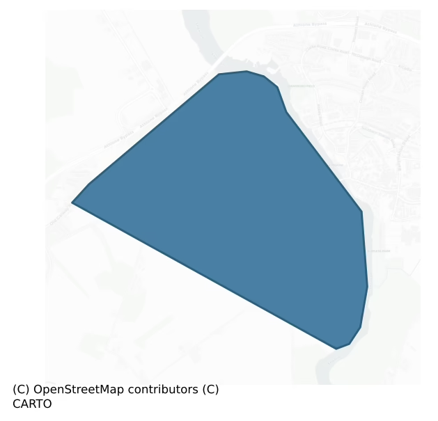
Athlone South is a barony of County Westmeath, in the historical province of Leinster (Irish: Baile Átha Luain Theas), a small barony covering less than 5 km² of land. The barony records 42 NMS archaeological sites and 90 NIAH listed buildings, placing it at around the 100th percentile among 280 ROI baronies for sites per km². This means it is in the top tenth of all baronies for sites per km². Dated archaeological evidence runs from the Iron Age through to the Post Medieval, spanning 4 of 9 archaeological periods, placing the barony in the 5th percentile among 280 ROI baronies for chronological depth. This means it is in the bottom tenth of all baronies for chronological depth. The largest dated subset of recorded sites dates to the Medieval.

Heritage at a glance
Percentile rankings throughout this profile compare each barony only against the other 279 Republic of Ireland baronies.
The recorded heritage of Athlone South
The National Monuments Service Sites and Monuments Record (SMR) is the statutory inventory of archaeological sites for the Republic of Ireland, maintained by the Department of Tourism, Culture, Arts, Gaeltacht, Sport and Media. Sites recorded here include earthworks, ringforts, megalithic tombs, ecclesiastical remains, and post-medieval features; not every record is legally protected, but each is registered as a monument of archaeological interest.
The National Monuments Service records 42 archaeological sites in Athlone South, putting it at the 100th percentile among 280 ROI baronies for sites per km². This means it is in the top tenth of all baronies for sites per km². Protection coverage is near-universal — 42 sites (100%) fall within a recorded monument protection zone, indicating an extensively surveyed landscape. The dominant category is defensive sites — ringforts, enclosures, hillforts, and stone forts (3 sites, 7% of the record). Castle – unclassified is the most prevalent type, making up 5% of the barony's recorded sites (2 records) — well above the ROI average of 2% across all baronies where this type occurs. Castle – unclassified is a castle whose form cannot be precisely classified, dating somewhere between the late 12th and 16th centuries.
Most common monument types
Hover or tap a monument type to see its definition.
| Type | Count |
|---|---|
| Castle – unclassified a castle whose form cannot be precisely classified, dating somewhere between the late 12th and 16th centuries | 2 |
Chronological distribution
The dated archaeological record for Athlone South spans from the Iron Age through to the Post Medieval, with activity attested across 4 of 9 archaeological periods. This is the 5th percentile across ROI baronies — a relatively narrow chronological band, with much of Irish prehistory not represented in the dated record. Every period from earliest to latest is represented in the record — an unbroken sequence of dated activity across the full chronological span. Activity concentrates most heavily in the Medieval (9 sites, 45% of dated material), with the Early Medieval forming a secondary peak (5 sites, 25%). A further 22 recorded sites (52% of the overall NMS register for the barony) carry no period attribution — appearing as 'Unknown' in the bar chart below. This typically reflects either records that pre-date the standardised period vocabulary or sites awaiting specialist dating review, rather than a genuine absence of chronological evidence.
Sample of recorded monuments
Show 25 sample monuments (of 42 total)
A representative sample of 25 recorded monuments drawn from the barony’s 42 total NMS entries. Sites within a recorded monument protection zone and rarer site types are prioritised so the list shows a meaningful cross-section rather than only the most common type. Each entry shows the official Sites and Monuments Record reference number and the description published by the National Monuments Service.
Battery
Napoleonic fortification situated in rough pasture (45m/146ft OD), at a strategic location 150m W of the River Shannon as it flows from Lough Ree into Athlone town. Athlone Canal 40m to W. Annotated 'Battery' on the…
Napoleonic fortification situated in rough pasture (45m/146ft OD), at a strategic location 150m W of the River Shannon as it flows from Lough Ree into Athlone town. Athlone Canal 40m to W. Annotated 'Battery' on the 1837 OS 6-inch map and depicted as a D-shaped structure (approx. dims. 70m NW-SE; 25m NE-SW) with straight side at E and polygonal side formed from three linear faces of equal length on the W side. A triangular-shaped building annotated ‘Guard Ho.’ is shown straddling the straight side of the D-shaped battery.
Artillery fortification described by the National Inventory of Architectural Heritage (NIAH) as a free-standing battery defined by a ditch and two ramps which form a concentric D-shaped earthwork of earth and stone. No associated buildings are extant. Structure was built on Ordnance Grounds by the British Army c. 1795 to defend against possible French attack during the Napoleonic Wars. The battery is orientated to defend attack from the W (www.buildingsofireland.ie; NIAH Reg. No. 15003134). Monument is visible today as a tree-covered earthwork on Digital Globe aerial photography. An earthwork (WM029-010001-) associated with the battery lies c. 100m to N, within the same ordnance grounds. A separate military complex (WM029-011—-) lies c. 500m to SSW.
Compiled by Alison McQueen, Vera Rahilly and Caimin O’Brien.
Date of upload: 07 November 2019
Fortification
Napoleonic fortification situated in a modern housing estate on the NW side of Athlone town, on an elevated site, abutting Athlone Canal to E and the River Shannon 475m to E. Annotated 'Ordnance Ground' and depicted on…
Napoleonic fortification situated in a modern housing estate on the NW side of Athlone town, on an elevated site, abutting Athlone Canal to E and the River Shannon 475m to E. Annotated 'Ordnance Ground' and depicted on the 1837 OS 6-inch map as a substantial polygonal-shaped fortified complex (approx. dims. 380m WNW-ESE; max. 320m NW-SE). Monument consists of an irregular-shaped rampart which connects six batteries, including one at N, one at W, one at the SW corner, two along the S side and one at the SE corner. The batteries at the N, SW, S and SE have a triangular-shaped guard house. A series of pathways across the interior provide access routes to each of the batteries. National Inventory of Architectural Heritage (NIAH) in 2006 as Nos. 2 to 7 batteries consisting of the remains of an extensive series of ramparts and batteries built by the British Army, c. 1800 to defend against possible French attack during the Napoleonic Wars. Now largely built over by a local authority housing estate, constructed c. 1965. The surviving ramparts are constructed of earth and stone, although no associated buildings are extant (www.buildingsofireland.ie; NIAH Reg. No. 15001072). Oblique aerial photographs (CUCAP AHH059/060) taken 25/09/1963 show upstanding remains of this artillery fortification. Fortification is no longer visible today on Digital Globe aerial photography as the whole area is now occupied by a modern housing estate. Ranelagh battery (WM029-010—-) lies c. 500m to NNE….
Castle – Anglo-Norman masonry castle
National Monument No. 520. Athlone Castle was built as a Royal Castle in 1210 to control an important fording point over the River Shannon which may have had a pre-Norman fortification (WM029-042098-) at this location.…
National Monument No. 520. Athlone Castle was built as a Royal Castle in 1210 to control an important fording point over the River Shannon which may have had a pre-Norman fortification (WM029-042098-) at this location. The Anglo-Norman stone castle was built on lands originally granted in 1200 to Geoffrey de Constentin who was then granted other lands in Connacht due to the construction of Athlone Castle which became the demesne lands of King John. The king of England then ordered Geoffrey de Constentin to maintain and keep possession of the castle on behalf of the king. In the year 1200 as part of the Anglo-Norman settlement of Connacht, King John of England granted Geoffrey de Costentin, ‘a cantred in Connaught called Tirieghrachbothe’ (Cal. doc. Ire., 22). The castle of Athlone and the western side of Athlone town were located on these lands called ‘Tirieghrachtbothe’. In 1214 shortly after the construction of the Royal Castle of Athlone, King John allowed Geoffrey de Constentin to exchange the lands containing Athlone Castle for the cantred of Trithweth also located in Connacht (Cal. doc. Ire., 92). The lands of Trithweth were described as being located ‘more remote from the castle, and nearer to the Irish’ (Cal. doc. Ire., 257). In this year following a petition submitted by Geoffrey to the Archbishop of Dublin, King John commanded the ‘exchange for the cantred in which the Castle of Athlone is situated, the Archbishop cause Godfrey [Geoffrey] to have another…
Religious house – Cluniac monks
The priory of Athlone appears to have been known by several names including the priory of Saints Peter and Paul, the monastery de Innocentia and the priory of St. Peter and Benedict. This priory was the only Cluniac…
The priory of Athlone appears to have been known by several names including the priory of Saints Peter and Paul, the monastery de Innocentia and the priory of St. Peter and Benedict. This priory was the only Cluniac house in Ireland which according to tradition was founded by Tulough O’Conor, King of Connacht in 1150 (Gwynn and Hadcock 1970, 110). The priory was referred to as the monastery ‘de Innocentia’ in 1280 (Cal. doc. Ire., 351) and again in 1391 when a letter was sent to the ‘prior of the monastery of St. Peter, Athlone (de Innocentia)’ (Cal. papal letters 1362-1404, 417). The priory was also known as the monastery of St. Peter and Benedict as recorded by Sir James Ware in 1626 (Gilbert 2012, civ-cv). Some discussion surrounds the date of its foundation. In the late 17th century Alemand recorded that this abbey was founded in 1150 and was dedicated to St. Peter and St. Benedict on the basis of the writings of the monastic historian Gaspar Jongelin (Stevens and Moll 1722, 196). Gaspar Jongelin based his dating on the writings of Sir James Ware who in 1626 compiled a table of the foundation dates of the Cistercian monasteries in Ireland (Gilbert 2012, civ-cv). Sir James Ware recorded in his table of Cistercian foundation dates, that the abbey of Athlone was founded in 1150 (ibid., 220). There is no mention in either source that this monastery was founded under the patronage of Turlough O’Conor, king of Connacht. Gwynn and Hadcock (1970, 110) question the rel…
Bridge
The present town of Athlone developed around the Anglo-Norman stone castle (WM029-042002-) and medieval bridge which offered a crossing point over the River Shannon connecting the medieval kingdom of Connacht to the…
The present town of Athlone developed around the Anglo-Norman stone castle (WM029-042002-) and medieval bridge which offered a crossing point over the River Shannon connecting the medieval kingdom of Connacht to the kingdom of Meath. In 1682 Sir Henry Piers described the siting of the town and bridge when he wrote that Athlone town was situated 'on both banks of the Shannon. The part on this side [east] the river was better built. The other part [west] together with the king's castle (WM029-042002-) situated on the western banks, is in the county of Roscommon, both parts united into one town, by a very strong, high-raised and well-built bridge' (Vallancey 1786, 85). There appears to have been a sequence of bridges built over the River Shannon possibly at the same location which may have been located close to a natural fording point over the river since prehistoric times. In the year 994 the Annals of Clonmacnoise records that Maelsechlainn [king of Mide] and Cathal O’Connor [king of Connacht] ‘made a bridge at Athlone over the Synan’ (Ann. Clon., 165). It has been suggested that this reference to a bridge may be describing the construction of a ford instead (Murtagh 1994, 12). In the year 1001 the Annals of Ulster recorded that the ‘causeway of Ath-Luain [was made] by Maelsechlainn (high king of Ireland), and by Cathal son of Conchobar’ (AU, 509). This causeway may have been a wooden bridge built on the site of the fording point over the River Shannon.
At least…
Historic town
The following description of Athlone has been mainly taken from the Urban Survey of Co. Westmeath (Bradley et. al. 1985, 20-49). The town sits astride the River Shannon just south of Lough Ree and is located on top of a…
The following description of Athlone has been mainly taken from the Urban Survey of Co. Westmeath (Bradley et. al. 1985, 20-49). The town sits astride the River Shannon just south of Lough Ree and is located on top of a broad ridge which forms part of the glacial eskers which traversed the country from east to west serving as natural routeways. The placename Athlone is derived from the Irish, Áth Luain, meaning the ford of Luain, which is a reference to a fording point (WM029-042054-) over the River Shannon. The ford is located at the point where the river Shannon intersects with the glacial ridge running east-west (Murtagh 1994, 1). This indicates that the town of Athlone developed around a fording point over the River Shannon. By the close of the Early Historic period it is evident that the ford had acquired strategic importance as the main gateway between Leinster and Connacht. To the Anglo-Normans, Athlone was the entrance to Connacht and the importance of its position is evident from the fact that since the Middle Ages all routes linking the eastern provinces with the west, including the Dublin-Galway railway, have crossed here.
The first evidence for settlement in Athlone is provided by five cross-inscribed slabs (WM029-042095-; WM029-042096-; WM029-042097-; WM029-042047-), four of which were found in the graveyard (WM029-042092-) of the Franciscan Friary (WM029-042001-) graveyard, dating from the mid-eighth to eleventh centuries (Fanning and Ó hÉailidhe 1980…
Stone head (present location)
On display in Athlone Castle Museum. Keystone of an archway into which has been set the medieval head of a tonsured cleric possibly of granite, with the words "St. Peter's Port" and initials 'I.B'. 'I.B' refers to a man…
On display in Athlone Castle Museum. Keystone of an archway into which has been set the medieval head of a tonsured cleric possibly of granite, with the words "St. Peter's Port" and initials 'I.B'. 'I.B' refers to a man named Booth, a property owner otherwise known as 'Copper Fisted Jack' who levied a toll on all produce brought through St. Peter's Port. (See also WM029-042088-). Head (dims. H 0.19m; Wth 0.13m; T 0.33m) has a long pointed face with damaged chin. Unknown date (Bradley et. al. 1985, 48).
Compiled by: Rachel Barrett and Caimin O'Brien
Date of upload: 30 October 2013
Sheela-na-gig (present location)
On display in Athlone Castle Museum. Abraded sandstone squatting figure (dims. H 0.4m; Wth 0.21m; Wth 0.21m; D 0.2m). The hands are clasped around the legs which are drawn up under the chin and the vulva or anus is…
On display in Athlone Castle Museum. Abraded sandstone squatting figure (dims. H 0.4m; Wth 0.21m; Wth 0.21m; D 0.2m). The hands are clasped around the legs which are drawn up under the chin and the vulva or anus is openly displayed. The face has protruding lips and slanting eyes. According to the information panel in the museum this sheela-na-gig originally came from the keystone of the archway belonging to the water gate known as St. Peter's Port which was part of the Cluniac priory dedicated to SS. Pater and Paul (WM029-042003-/ WM029-042091-) (Bradley et. al. 1985, 48-9; Weir 1980, 64). Described by Freitag as a ‘sculptured almost in the round. Strong face with pursed lips, and a striated pattern incised across left cheek. With arms embracing tightly flexed knees. Big V-shaped vulva’ (Freitag 2004, 122).
Compiled by: Rachel Barrett and Caimin O'Brien
Date of upload: 30 October 2013
Cross – Wayside cross
Fragment of a possible 17th century wayside cross (dims. H 0.43m; Wth 0.42m; D 0.17m) located outside Athlone Castle Museum. Decorated in low false relief with quarter of a ringed cross having incised crosses on the…
Fragment of a possible 17th century wayside cross (dims. H 0.43m; Wth 0.42m; D 0.17m) located outside Athlone Castle Museum. Decorated in low false relief with quarter of a ringed cross having incised crosses on the stem. Inscribed with INRI on the ring and the date 16.. is in one corner. Exact provenance unknown (Bradley et. al. 1985, 50).
Compiled by: Rachel Barrett
Date of upload: 24 June 2010
Barracks
Custume Barracks. Temporary accommodation for 1000 cavalry and 1500 infantry built in 1691. Cavalry stables, riding house, infantry barracks of four blocks built c. 1697 and demolished by 1793 (Murtagh 1994, 10-11).…
Custume Barracks. Temporary accommodation for 1000 cavalry and 1500 infantry built in 1691. Cavalry stables, riding house, infantry barracks of four blocks built c. 1697 and demolished by 1793 (Murtagh 1994, 10-11). Garda Station and government offices built in 1935-47 on partial site of barracks facing onto Barrack's St. and the church of Saints Peter and Paul built 1930 on SE corner of barracks.
Compiled by: Rachel Barrett
Date of upload: 15 October 2010
Weir – fish
In the late 12th or early 13th century the fish weirs of Athlone were built by the monks of St Peter and Paul's Priory (WM029-042003-). These fish weirs were taken into the possession of the Crown in the early 13th…
In the late 12th or early 13th century the fish weirs of Athlone were built by the monks of St Peter and Paul's Priory (WM029-042003-). These fish weirs were taken into the possession of the Crown in the early 13th century as part of the Anglo-Norman settlement of Athlone. In 1216 King John commanded Geoffrey de Mariscis, justiciar of Ireland ‘to cause an exchange to be made to the Prior of Athlone, for the 4 cantreds in the fee of Logseuethy [Lough Sewdy] assigned to the Prior by John Bishop of Norwich in compensation for the site of the K.’s castle of Athlone (WM029-042002-); the Prior was disseised of these 4 cantreds when the K. restored Walter de Lascy’s land of Meath. The K. further commands the justiciary to cause competent satisfaction to be given to the Prior touching an exchange for his meadow, his fisheries of 12 marks, and the tithes of the castle. Protection for the Prior’ (Cal. doc. Ire., 107). The precise location of these weirs have not been identified. The weirs may have been located along the west side of the River Shannon in close proximity to the Anglo-Norman castle (WM029-042002-) and close to St Peter and Paul's Priory (WM029-042003-) for in 1235 the crown recorded that ‘the monks of Adlon [Athlone] have been wont to receive at the Exchequer, Dublin, an annuity of 10 marks for the vill (WM029-042—-), castle (WM029-042002-), mill (WM029-042056-) and fishery towards Connaught, which John [de Grey] Bishop of Norwich, when [justiciary], constructed…
Architectural fragment
Four architectural fragments, including a male and female stone head, located in the Athlone Castle Museum (one of the pieces is located just outside the entrance to the museum beside a milestone). Exact date or…
Four architectural fragments, including a male and female stone head, located in the Athlone Castle Museum (one of the pieces is located just outside the entrance to the museum beside a milestone). Exact date or provenance unknown.
Compiled by: Rachel Barrett
Date of upload: 15 October 2010
Stone head
Currently in Athlone Museum. Carved stone head of uncertain date discovered at Hodson Bay. Slight damage to the nose. On loan from the Lenihan family, Athlone. Original location – Co. Roscommon. See RO049-011—- for…
Currently in Athlone Museum. Carved stone head of uncertain date discovered at Hodson Bay. Slight damage to the nose. On loan from the Lenihan family, Athlone. Original location – Co. Roscommon. See RO049-011—- for more information.
Compiled by: Rachel Barrett
Date of upload: 15 October 2010
Architectural feature
On the premises of Sean's Bar (WM029-042086-), 13 Main Street, is a late medieval stone built fireplace from a house on an island in Lough Ree (Bradley et. al. 1985, 28).
Compiled by: Rachel Barrett
Date of…
On the premises of Sean's Bar (WM029-042086-), 13 Main Street, is a late medieval stone built fireplace from a house on an island in Lough Ree (Bradley et. al. 1985, 28).
Compiled by: Rachel Barrett
Date of upload: 15 October 2010
Inn
'Sean's Bar' was originally a two storey high building with thick walls, an additional third storey in brick was added later. Preserved on the premises is a section of wattle partition removed from a first floor wall.…
'Sean's Bar' was originally a two storey high building with thick walls, an additional third storey in brick was added later. Preserved on the premises is a section of wattle partition removed from a first floor wall. This could be of seventeenth century date but it is not securely dated (Bradley et. al. 1985, 28). Claims to have a documented history of all its innkeepers since 1600.
Compiled by: Rachel Barrett
Date of upload: 15 October 2010
Inscribed stone (present location)
On display in Athlone Castle Museum. One of two stones (WM029-042089-) (dims. H 0.35m, Wth 0.46m, D 0.15m) removed from gateway to St. Peter's Port (see also WM029-042089-). The inscription reads 'WILL O' WISP AND JACK…
On display in Athlone Castle Museum. One of two stones (WM029-042089-) (dims. H 0.35m, Wth 0.46m, D 0.15m) removed from gateway to St. Peter's Port (see also WM029-042089-). The inscription reads 'WILL O' WISP AND JACK THE PRINTER'. Will O' Wisp and Jack the Printer refer to two prominent men with whom a man named Booth was in dispute. They were William Sproule, a Quaker merchant, and John Potts, a printer and owner of Saunders' newspaper. Booth owned the property and was otherwise known as 'Copper Fisted Jack', who levied a toll on all produce brought through the port. Stones probably date from the 18th century.
Compiled by: Rachel Barrett and Caimin O'Brien
Date of upload: 31 October 2013
Sheela-na-gig
On display in Athlone Castle Museum (WM029-042053-). Figure formerly placed above gateway of laundry belonging to the Convent at St Peter's Port (Guest 1936, 113; McMahon and Roberts 2001, 113). Abraded sandstone…
On display in Athlone Castle Museum (WM029-042053-). Figure formerly placed above gateway of laundry belonging to the Convent at St Peter's Port (Guest 1936, 113; McMahon and Roberts 2001, 113). Abraded sandstone squatting figure. The hands are clasped around the legs which are drawn up under the chin and the vulva or anus is openly displayed. The face has protruding lips and slanting eyes. Dims. H 40cm, W 21cm, D 20cm. Originally from St. Peter's Abbey (WM029-042003-/ WM029-042091) (Bradley et. al. 1985, 48-9). Described by Freitag as a ‘sculptured almost in the round. Strong face with pursed lips, and a striated pattern incised across left cheek. With arms embracing tightly flexed knees. Big V-shaped vulva’ (Freitag 2004, 122).
Compiled by: Rachel Barrett and Caimin O'Brien
Date of upload/revision: 05 June 2012
Castle – motte
The Kingdom of Míde [Meath] was granted to Hugh de Lacy in 1172 (Mills and McEnery 1916, 177) and the process of sub-infeudation and settlement began soon afterwards but it is unlikely that any effective inroads were…
The Kingdom of Míde [Meath] was granted to Hugh de Lacy in 1172 (Mills and McEnery 1916, 177) and the process of sub-infeudation and settlement began soon afterwards but it is unlikely that any effective inroads were made as far west as Athlone for some time. The original Anglo-Norman grantee of Athlone was Geoffrey de Costentin who was granted a cantred in Connacht adjoining Athlone in 1200 (Cal. doc. Ire., no. 137; Orpen 1907, 259; Claffey 1970-1, 55). In this year, King John of England granted Geoffrey de Costentin, ‘a cantred in Connaught called Tirieghrachbothe’ (Cal. doc. Ire., 22). If a motte castle had been constructed in Athlone then Geoffrey would have been responsible for the construction of this earth and timber castle (WM020-042098-) between the years 1191 and 1199 (Orpen 1911-20, II, 129; Graham 1980, 53; Bradley et. al. 1985, 35). In 1199 the annals recorded that a 'depredation was comitted on the Foreigners by Cathal Crobhderg, who burned the bódhún [bawn] of Ath [Athlone], and killed many persons; and they carried with them many cows to their homes' (ALC). The use of the word bódhún [Cow fort] anglicised as bawn to describe an Anglo-Norman fortification suggests that the fortification may have been a ringwork type earthwork rather than a motte. Alternativey the bawn may have been a reference to the bailey or courtyard adjoining the motte castle. Graham (1980, 52-3) suggests that Athlone formed a part of the final western frontier of the Liberty of M…
Water mill – unclassified
One of three mills (WM029-042079-; WM029-042080-) built onto the S face of the 16th century bridge (WM029-042004-) of Athlone. This mill was located at the W end of the bridge built onto the S face of the final arch of…
One of three mills (WM029-042079-; WM029-042080-) built onto the S face of the 16th century bridge (WM029-042004-) of Athlone. This mill was located at the W end of the bridge built onto the S face of the final arch of the 16th century bridge (WM029-042004-) and is shown on Thomas Sherrard's map of Athlone dating from 1784 (RCB Ms. 151; Murtagh 1994, map 7(A)). A flour mill known as Mabbot's flour mill was built on the site of the 16th century mill and may have incorporated fabric of the earlier mill. This flour mill was demolished c. 1840 (Murtagh 1994, 12). Sir Henry Piers writing in 1682, described several undershaft mills (WM029-042079-; WM029-042080-) located at either end of the medieval bridge (WM029-042004-) of Athlone. In 1682 he wrote that 'this bridge, tho’ the arches thereof be wide and large, causeth the river, which here is very deep, to rise and swell backwards, so that under it the river hath a great fall, which giveth an advantageous situation to several undershaft mills (WM029-042079-; WM029-042080-; WM029-042100-) at each end of the bridge' (Vallancey 1786, 86). This mill on the W side of town may have been the same mill referred to in 1619 when the Crown granted 'John Trestian, esq. – Roscommon Co. – a mes. and mater-mill, lately Hugh Magauly’s' (Cal. pat. rolls Ire., Jas I, 421). There is also documentary evidence to suggest that there were four corn mills, the location of which is unknown, in 1675 (Murtagh 1994, 12). Three watermills located o…
Castle – unclassified
The castle known as Cox's Castle (Murtagh 1994, 10) is depicted on Thomas Sherrard's map of Athlone dating from 1784 where it is shown located on the corner of St. George's Lane now Excise St. (RCB Ms. 151; Murtagh…
The castle known as Cox's Castle (Murtagh 1994, 10) is depicted on Thomas Sherrard's map of Athlone dating from 1784 where it is shown located on the corner of St. George's Lane now Excise St. (RCB Ms. 151; Murtagh 1994, Map 7(a) and 7 (b)).
Compiled by: Caimin O'Brien
Date of upload: 06 December 2013
Castle – unclassified
No surface remains visible of a medieval tower known as the Connacht tower which was located to the N of Athlone Castle (WM029-042002-). This building appears to have been a feature of the west town defences on the…
No surface remains visible of a medieval tower known as the Connacht tower which was located to the N of Athlone Castle (WM029-042002-). This building appears to have been a feature of the west town defences on the Connacht side of Athlone and was known in medieval documents as the Connacht Tower. Described by Bradley as a rectangular structure with two circular towers at N angles, linked to Athlone Castle by defensive wall or ditch, perhaps the 'great fosse' to form the riverside bawn (Bradley et. al. 1985, 38). In 1581, the crown granted Thomas, earl of Ormond and Ossory 'an old ruinous tower called Connaghte tower covered with straw, near the castle of Athlone (WM029-042002-), with a parcel of land on the south side containing 90 feet [27m], and a garden plot with certain ruined cottages on the north side, and a parcel of land in the great foss[e] on the west, from the tower to the river Shennen [Shannon]’ (Nicholls 1994, 511). The Connacht Tower was partially demolished by the artillery of the Williamite army in 1691 (Murtagh 1994, 10). The partial remains of the Connacht Tower are depicted on Thomas Sherrard's map of Athlone dating from 1784 (Murtagh 1994, map 7a). Langrishe records that its ruins survived into the mid-nineteenth century and that it was removed during the Shannon improvements and the construction of Grace Road (Bradley et. al. 1985, 38).
Compiled by: Rachel Barrett and Caimin O'Brien
Date of upload: 01 November 2013
Armorial plaque (present location)
Armorial plaque from the house of John Waple dating from 1621. Currently on display in Athlone Castle Museum. Rectangular block of limestone originally from Church Street. Carved in false relief with a heater shaped…
Armorial plaque from the house of John Waple dating from 1621. Currently on display in Athlone Castle Museum. Rectangular block of limestone originally from Church Street. Carved in false relief with a heater shaped shield and an inscription in Roman lettering. The shield has two bends and three cross crosslets per fess. The date 1621 is incised below. Inscription: 'ERECTED BY JOHN/ WAPLE MARCHANT'. Dims. H 0.41m, Wth 0.37m, T 0.12m (Bradley et. al. 1985, 28). According to the information panel in the Athlone Castle Museum the armorial plaque was recovered from an external wall in Custume Place, which may have been the location of the merchants premises.
Compiled by: Rachel Barrett and Caimin O'Brien
Date of upload: 30 October 2013
Armorial plaque (present location)
Unidentified Heraldic Plaque. Seventeenth century. Currently on display in Athlone Castle Museum. Rectangular limestone plaque with heater-shaped shield and mantling similar to WM029-047—-. Removed from Hogan's on…
Unidentified Heraldic Plaque. Seventeenth century. Currently on display in Athlone Castle Museum. Rectangular limestone plaque with heater-shaped shield and mantling similar to WM029-047—-. Removed from Hogan's on the S side of Church Street. Engrailed shield with a bend sinister and a lion rampart overall. The family have not been identified but it could be either Gray, Lloyd, Price or Grace. Dims. H 0.5m, Wth 0.46m, T 0.16m (Bradley et. al. 1985, 28). According to the information panel in the museum this armorial plaque was erected by a member of the Jones family in the 17th century. The plaque was recovered from the external wall of premises in Church Street which was the residence of the Jones family.
Compiled by: Rachel Barrett and Caimin O'Brien
Date of upload: 30 October 2013
Armorial plaque (present location)
Amorial plaque that is now on display in Athlone Castle Museum may be the Dillon memorial recorded in the Urban Survey of Athlone (Bradely et. al. 1982, 28). According to Bradley a stone mural tablet carrying the…
Amorial plaque that is now on display in Athlone Castle Museum may be the Dillon memorial recorded in the Urban Survey of Athlone (Bradely et. al. 1982, 28). According to Bradley a stone mural tablet carrying the Dillon arms is mentioned in the Burgess Papers (Bradley et. al. 1985, 28; English 1974-5, 256). Partially damaged armorial plaque decorated with a shield and lion rampant with the letter D on right side of shield and the letters 620 beneath the shield with partial inscription carved in relief. According to the information panel in the museum this plaque dated 1620, bears a coat of arms possibly belonging to the Jones family and may have been inserted into the external wall of a premises belonging to this family in the town of Athlone. The partial Latin inscription has been interpreted as meaning MAKE ME JOYFUL, O LORD.
Compiled by: Rachel Barrett and Caimin O'Brien
Date of upload: 30 October 2013
Armorial plaque
In National Museum of Ireland. Rectangular. Carved in high relief with a male demi-figure in a narrow-waisted armour of lames with cowters at the elbows. He holds a sword in an upright position in his right hand and his…
In National Museum of Ireland. Rectangular. Carved in high relief with a male demi-figure in a narrow-waisted armour of lames with cowters at the elbows. He holds a sword in an upright position in his right hand and his left hand rests on his waist and touches the garter which is worn knotted over his left shoulder. The head is missing. Below the figure is a small grotesque head with leavy swags protruding from his ears and held down by chains. On his left side is a coat of arms surrounded by the garter with the legend HONI SOIT QUI MAL Y PENSE. The end of the garter rests on a parchment with an ivy spray and the motto INVI/ DIA. NOTI/ OB. Dims. H 62cm, W 86cm (Bradley et. al. 1985, 32).
Compiled by: Rachel Barrett
Date of upload: 04 October 2010
Listed buildings
The National Inventory of Architectural Heritage (NIAH) is a state survey appraising buildings of architectural, historical, archaeological, artistic, cultural, scientific, social, or technical interest. Each surveyed structure receives a rating from International (the highest, for buildings of European importance) through National, Regional, Local, and Record-Only.
The NIAH records 90 listed buildings in Athlone South (46th percentile across ROI baronies). The highest-graded structures include 4 of National significance. The Republic holds 937 National-graded buildings in total, so this barony accounts for around 0% of the national total. Construction dates concentrate most heavily in the Victorian (1830-1900) period. The most-recorded building type is house (32 examples, 36% of the listed stock).
Terrain and environment
Mean elevation across the barony is 38m — the 10th percentile among 280 ROI baronies for elevation. This means it is in the bottom fifth of all baronies for elevation. This is a relatively low-lying landscape by ROI standards. Elevation matters for heritage because higher-altitude baronies typically favour defensive monuments — ringforts and hilltop forts placed on prominent ground — while lowland baronies are more likely to carry the dense settlement and church networks of intensive agricultural landscapes. Mean slope is 2.3° — the 20th percentile among 280 ROI baronies for slope. This means it is in the bottom third of all baronies for slope. This is broadly flat terrain, the kind of landscape best suited to intensive agriculture. Slope is a key control on both land use and archaeological preservation: steep ground resists ploughing and tends to preserve earthworks intact, while gentle slopes favour intensive cultivation that damages or destroys surface archaeology over time. The Topographic Wetness Index averages 11.6, the 80th percentile among 280 ROI baronies for wetness. This means it is in the top fifth of all baronies for wetness. This is wet, slow-draining ground by ROI standards — the kind of landscape that may carry waterlogged archaeological sites of unusual preservation value. Drainage matters for heritage because poorly-drained ground preserves organic archaeology (wooden trackways, leather, textiles, and on rare occasions human remains) far better than free-draining soil; well-drained ground favours arable use but destroys organic material rapidly. Urban land covers 26% of the barony (the 98th percentile among 280 ROI baronies for urban cover. This means it is in the top tenth of all baronies for urban cover). Heavy urban coverage compresses heritage analysis: many archaeological features have been buried or destroyed by development, but the surviving record is concentrated in protected city-centre cores, and the NIAH listed-buildings count is typically high. The land-cover mosaic combines improved grassland (46%), urban land (26%), and woodland (20%), giving a mixed agricultural and semi-natural landscape. In overall character, this is low-lying, gently-sloping terrain — characteristic of Ireland's central plain and coastal lowlands, with land use dominated by improved grassland.
Terrain measurements
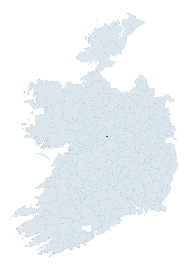
Where this barony sits in the Republic of Ireland
Geology and preservation
Bedrock geology shapes the landscape long before any settlement begins — controlling soil drainage, agricultural potential, the survival of upstanding monuments, and the preservation of buried archaeology. The figures below come from the Geological Survey Ireland 1:100,000 bedrock map.
The bedrock underlying Athlone South is predominantly limestone (100% of the barony by area), laid down during the Carboniferous period (100% by area, around 359 to 299 million years ago). Limestone is the most heritage-rich bedrock in Ireland. It supports fertile, well-drained soils that favoured dense Early Medieval settlement and Norman manorial agriculture, and it weathers into karst features — sinkholes, caves, swallow holes, and souterrains — that frequently carry archaeology. Where peat overlies limestone, organic preservation can be exceptional. The single largest mapped unit is the Waulsortian Limestones (100% of the barony's bedrock). With only 1 distinct rock type mapped, the barony is geologically uniform compared to the rest of the Republic (5th percentile for diversity) — a single coherent bedrock landscape.
Largest mapped unit: Waulsortian Limestones (100% of the barony)
Placename evidence
Logainm records 9 placenames for Athlone South, but none carry the diagnostic Gaelic roots tracked by the heritage classifier — defensive (ráth-, lios-, dún-, caiseal-), ecclesiastical (cill-, teampall-, domhnach-), burial-ritual, or Norse-contact terms. The barony's townland names appear to draw on the more generic Gaelic landscape vocabulary (baile-, cnoc-, gleann-, droim-) which is common throughout Ireland and carries no specific heritage-period signal.
Other baronies in Westmeath
About this profile
Click any section below to expand.
What is a barony?
A barony is a historic administrative unit in Ireland, broadly equivalent to an English hundred. The 280 baronies used here are from the OSi 2019 National Statutory Boundaries (generalised 20m), covering the 26 counties of the Republic of Ireland. Baronies derive from the Norman period, were formalised in the 17th century, and have not been redrawn for statistical purposes. They vary enormously in area, from compact urban baronies in Dublin to vast upland baronies in Connacht, and should not be compared by raw site count without accounting for area differences.
What counts as a site?
This profile combines three distinct heritage registers, each with its own definition of what constitutes a recordable site:
- Archaeological sites (NMS). The National Monuments Service Sites and Monuments Record (SMR) catalogues every known archaeological monument or site of archaeological interest in the Republic, from prehistoric burial mounds and ringforts to medieval churches and post-medieval defensive works. Inclusion does not require legal protection — only that the site has been identified, surveyed, and assessed as having archaeological value. A separate subset of these sites lies within a recorded protection zone, which gives them statutory protection under the National Monuments Acts.
- Listed buildings (NIAH). The National Inventory of Architectural Heritage records buildings of architectural, historical, archaeological, artistic, cultural, scientific, social, or technical interest. Each surveyed structure is appraised on a five-tier scale: International, National, Regional, Local, and Record-Only. The NIAH appraisal is informational rather than strictly statutory, but it underpins local-authority Record of Protected Structures (RPS) listings.
- Heritage placenames (Logainm). Logainm is the authoritative database of Irish placenames maintained by the Placenames Branch. This profile applies a heritage-diagnostic classifier to the Irish-language form of each townland name, flagging roots that signal defensive sites (ráth-, lios-, dún-, caiseal-, cathair-), ecclesiastical foundations (cill-, teampall-, domhnach-, mainistir-), prehistoric burial-ritual features (tuaim-, carn-, leaba-), or Norse-contact settlement (gall-). Townlands without one of these diagnostic roots are not flagged here — they may still carry historical significance, but that significance is not encoded in the name itself.
Editorial principles
The narrative sections of this profile follow several explicit principles:
- Evidential. Every claim about this barony’s heritage character is anchored in the underlying register data. Where a site count, a placename count, or a percentile rank is cited, it is computed from the source datasets at export time, not estimated.
- Comparative. Counts and metrics are reported alongside their percentile rank against the other 279 ROI baronies. A barony with 50 ringforts in absolute terms could be unusually high or unusually low depending on its size and regional context; percentile ranking removes that ambiguity.
- Transparent on limits. Where a register has known coverage gaps, survey biases, or data-quality issues that affect this barony’s figures, the profile flags them rather than presenting the numbers as definitive.
- No interpretation beyond what the data supports. The narrative does not speculate about historical events, social dynamics, or cultural meaning beyond what the recorded heritage and placename evidence directly attests.
Data caveats and limits
- NMS Sites and Monuments Record is the product of survey campaigns conducted at different intensities across different counties and decades. Some baronies have been surveyed more thoroughly than others, and absolute counts should be read in that light. Sites destroyed by development before survey are typically not represented; sites in heavily forested or upland terrain are sometimes under-recorded.
- NIAH coverage is broadly complete for the Republic of Ireland but the survey was conducted on a rolling county-by-county basis, and the most recent appraisal date varies. Buildings demolished or substantially altered after their original survey may still appear in the register; conversely, recent buildings of merit may not yet have been appraised.
- Logainm classification applies a deliberately conservative pattern-matching approach to the Irish-language townland forms. The classifier prioritises true positives over recall: a townland may carry a heritage signal that the classifier doesn’t recognise, particularly where the diagnostic root has been heavily anglicised or where the townland name draws on a less common term. The 60,000+ townland records and ~9,800 classified placenames give a substantial signal at barony scale, but individual townland names should be checked against Logainm directly for definitive interpretation.
- Period attribution. The chronological distribution reflects only those NMS sites that carry a recognised period attribution in the source data. Sites listed as “Unknown” period are excluded from the dated subset.
- Boundary changes. Some baronies have undergone minor boundary adjustments since their 19th-century definition; the OSi 2019 generalised boundaries used here are the current statutory definition and may differ slightly from historical maps in border areas.
- Bedrock geology is mapped at 1:100,000 scale, which means local variation within a barony — small pockets of different rock type, mineral veins, alluvium overlying bedrock — is generalised. The dominant-system and rocktype figures are area-weighted, so a barony reading “70% Carboniferous limestone” may still contain small but archaeologically important pockets of older or younger rock. Around 3% of GSI polygons do not match the lexicon and contribute no rocktype or system attribution.
Data sources
- National Monuments Service — Sites and Monuments Record (SMR) https://data.gov.ie/dataset/national-monuments-service-archaeological-survey-of-ireland
- National Inventory of Architectural Heritage (NIAH) https://data.gov.ie/dataset/national-inventory-of-architectural-heritage-niah-national-dataset
- Logainm — Placenames Database of Ireland https://www.logainm.ie/
- Ordnance Survey Ireland — National Statutory Barony Boundaries 2019 https://data-osi.opendata.arcgis.com/
- EURODEM — European Digital Elevation Model https://www.mapsforeurope.org/datasets/euro-dem
- ESA WorldCover https://esa-worldcover.org/en
- Geological Survey Ireland — 1:100,000 Bedrock Geology https://www.gsi.ie/en-ie/data-and-maps/Pages/Bedrock.aspx
Explore more: Search any of the 280 ROI baronies, browse by historical province, or read the methodology and data sources for the full Republic of Ireland Heritage Tool.