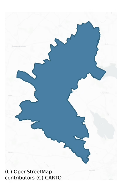
Moygoish is a barony of County Westmeath, in the historical province of Leinster (Irish: Uí Mhac gCuais), covering 163 km² of land. The barony records 296 NMS archaeological sites and 110 NIAH listed buildings, placing it at around the 46th percentile among 280 ROI baronies for sites per km². This means it is in the lower half of all baronies for sites per km². Dated archaeological evidence runs from the Mesolithic through to the Post Medieval, spanning 7 of 9 archaeological periods, placing the barony in the 36th percentile among 280 ROI baronies for chronological depth. This means it is in the lower half of all baronies for chronological depth. The largest dated subset of recorded sites dates to the Early Medieval. Logainm flags 27 placenames in the barony as carrying a recognised heritage root; the largest share — around 70% — are names associated with early Christian church and monastic foundations.
Heritage at a glance
Percentile rankings throughout this profile compare each barony only against the other 279 Republic of Ireland baronies.
The recorded heritage of Moygoish
The National Monuments Service Sites and Monuments Record (SMR) is the statutory inventory of archaeological sites for the Republic of Ireland, maintained by the Department of Tourism, Culture, Arts, Gaeltacht, Sport and Media. Sites recorded here include earthworks, ringforts, megalithic tombs, ecclesiastical remains, and post-medieval features; not every record is legally protected, but each is registered as a monument of archaeological interest.
The National Monuments Service records 296 archaeological sites in Moygoish, putting it at the 46th percentile among 280 ROI baronies for sites per km². This means it is in the lower half of all baronies for sites per km². Protection coverage is near-universal — 283 sites (96%) fall within a recorded monument protection zone, indicating an extensively surveyed landscape. The dominant category is defensive sites — ringforts, enclosures, hillforts, and stone forts (157 sites, 53% of the record). Ringfort – rath is the most prevalent type, making up 30% of the barony's recorded sites (89 records) — well above the ROI average of 20% across all baronies where this type occurs. Ringfort – rath is an earthen ringfort enclosed by a bank and external ditch — the most common Early Medieval farmstead, broadly dated 500–1000 AD. Other significant types include Ringfort – unclassified (14) and Hut site (10). Ringfort – unclassified is a circular Early Medieval settlement enclosure where surviving evidence does not allow distinction between earthen and stone forms; Hut site is a low stone or earthen foundation enclosing a small circular or oval area, generally interpreted as a former dwelling, of any date from prehistory to the medieval period. Across the barony's 163 km², this gives a recorded density of 1.82 sites per km².
Most common monument types
Hover or tap a monument type to see its definition.
| Type | Count |
|---|---|
| Ringfort – rath an earthen ringfort enclosed by a bank and external ditch — the most common Early Medieval farmstead, broadly dated 500–1000 AD | 89 |
| Ringfort – unclassified a circular Early Medieval settlement enclosure where surviving evidence does not allow distinction between earthen and stone forms | 14 |
| Hut site a low stone or earthen foundation enclosing a small circular or oval area, generally interpreted as a former dwelling, of any date from prehistory to the medieval period | 10 |
| House – indeterminate date a habitation building whose date cannot be determined from available evidence | 10 |
| Graveyard a burial area associated with a church, in use from the medieval period onwards | 10 |
| Moated site | 9 |
| Ecclesiastical enclosure a large enclosure surrounding an Early Medieval church or monastery and its associated activity areas | 8 |
| Enclosure a banked or ditched feature of uncertain type, used as a catch-all where the original function cannot be determined from surface evidence | 8 |
Chronological distribution
The dated archaeological record for Moygoish spans from the Mesolithic through to the Post Medieval, with activity attested across 7 of 9 archaeological periods. The record is near-continuous, with only the Neolithic period falling inside the span without any recorded sites. Activity concentrates most heavily in the Early Medieval (135 sites, 53% of dated material), with the Iron Age forming a secondary peak (40 sites, 16%). A further 40 recorded sites (14% of the overall NMS register for the barony) carry no period attribution — appearing as 'Unknown' in the bar chart below. This typically reflects either records that pre-date the standardised period vocabulary or sites awaiting specialist dating review, rather than a genuine absence of chronological evidence.
Sample of recorded monuments
Show 25 sample monuments (of 296 total)
A representative sample of 25 recorded monuments drawn from the barony’s 296 total NMS entries. Sites within a recorded monument protection zone and rarer site types are prioritised so the list shows a meaningful cross-section rather than only the most common type. Each entry shows the official Sites and Monuments Record reference number and the description published by the National Monuments Service.
Religious house nunnery – unclassified
Situated on partially reclaimed grassland with spring well located 35m to ESE. Site of Kinard Nunnery depicted on the 1837 ed. OS 6-inch map as a rectangular shaped earthwork or moated site with stream marking townland…
Situated on partially reclaimed grassland with spring well located 35m to ESE. Site of Kinard Nunnery depicted on the 1837 ed. OS 6-inch map as a rectangular shaped earthwork or moated site with stream marking townland boundary with Lismacaffry immediately to SW. Shown on the OS 25 inch map as a rectangular-shaped area (approx. dims. 36m NE-SW x 25m NW-SE) enclosed by an earthen bank with possible quarry hole in W corner of earthwork. Outline of earthwork visible today with farm buildings immediately to N of earthwork on Digital Globe aerial photographs. No religious site is shown on the 1654-9 Down Survey map of Moygoish Barony or the parish map of Street (NLI, MS 723-4).
Compiled by: Caimin O'Brien
Date of upload: 23 January 2019
Windmill
Monument described in 1980 as ‘the ruins of a small circular stone built structure (int. diam. 3.1m; wall T 0.8m; H c. 4m) with a solid stone built projection (L 1m; Wth 2.9m) on the SE. The structure shows evidence of…
Monument described in 1980 as ‘the ruins of a small circular stone built structure (int. diam. 3.1m; wall T 0.8m; H c. 4m) with a solid stone built projection (L 1m; Wth 2.9m) on the SE. The structure shows evidence of having had 2 floors but its original height is uncertain. There is a rectangular doorway (Wth 0.8-0.9m; H 1.68m) on the N, this narrows in width from bottom to top. There are 2 narrow window opes (Wth 0.33-0.28m; H 0.64m) in the ground floor both with internal splays and both narrowing in width from bottom to top, one on the NE and the other on the NW. There is a small fireplace (Wth 0.88m; H 0.8m; D 0.57m) in the NE above the ground floor window and a window on the WSW, this is wider than the windows on the ground floor but its stop is missing. The structure is built of small blocks of undressed limestone with small flat stones also laid in regular course and bonded with a rough mortar. The windmill is just S of a narrow stream or drain in boggy land, on the edge of Coolnagun bog’ (SMR File 04/03/1980).
Compiled by: Caimin O’Brien
Date of upload: 23 July 2015
Concentric enclosure
Situated on a low natural rise surrounded by relatively low-lying gently undulating poorly drained land with good views to the ESE, S and SSW. A circular area (diam. 33m) enclosed by a wide low earthen bank levelled at…
Situated on a low natural rise surrounded by relatively low-lying gently undulating poorly drained land with good views to the ESE, S and SSW. A circular area (diam. 33m) enclosed by a wide low earthen bank levelled at N and S, and a flat slightly concave berm (Wth 9m) defined by a low earthen bank best preserved from S to W, with an external fosse visible from NE-E. The interior is fairly even and featureless. Total overall diameter of the monument measures approx. 70m. From SSE-S an old laneway depicted on the 1837 ed. OS 6-inch map skirts the perimeter of the monument. A field boundary running NE-SW transects the perimeter of the site at S. The presence of the encircling slightly concave berm is unusual and suggests that this monument may be classified as a concentric enclosure. Alternatively the surface of the berm is slightly concave and could be the remains of an inner fosse which would suggest a henge-type or large barrow-type monument.
Compiled by: Frank Coyne & Caimin O'Brien
Date of upload: 19 December 2016
Religious house – Franciscan Third Order Regular
Kilmichael monastery belonging to the Third Order of St. Francis was founded by the Petit family who were granted the barony of Magheradernon in the late 12th century by Hugh de Lacy, lord of Meath (Stevens and Moll…
Kilmichael monastery belonging to the Third Order of St. Francis was founded by the Petit family who were granted the barony of Magheradernon in the late 12th century by Hugh de Lacy, lord of Meath (Stevens and Moll 1722, 199). Recorded in 1976 as 'the ruins now consist of the grass-covered foundations of a fairly large rectangular structure (ext. dims. 24m E-W by 9.4m N-S) orientated east-west and having a N extension (transept feature) (ext. dims. 11.2m N-S by 8.3m E-W). The low banks are best preserved on the SW and NW sides. Two indifferent gaps on the S side and on the W end may represent door opes. There is some visible stonework, but no facing stones. A slight internal mounding towards the W end may represent an internal division. There is also a vague gap in the N side towards the W end. The annexe/transept feature at the E end on the N side is also comprised of very low grass-covered stone footings. Some slight gaps in these banks, one of which at the E corner may represent an opening. In both structures the internal moundings lie directly alongside the footings and so probably consist of collapse. Extending out from the NW corner of the main structure is a low double bank on the slope. Another low bank extending in E direction out from the SE corner for some 15m. Faint traces of low earthworks to the N and E may indicate the location of some of the domestic buildings. Further away to the S and on the higher knoll to the NE are traces of ancient field fences. The…
Habitation site
Situated on the top of a small knoll of fen-peat on Clonava Island which is now on reclaimed grassland which was formerly the flood-plain of the Inny River 80m to N and Lough Derravaragh 500m to E. The Mesolithic…
Situated on the top of a small knoll of fen-peat on Clonava Island which is now on reclaimed grassland which was formerly the flood-plain of the Inny River 80m to N and Lough Derravaragh 500m to E. The Mesolithic shoreline of the lake was exposed after the Inny River was drained in the 1960s resulting in the lowering of the water level on Lough Derravaragh. Another Mesolithic chert scatter (WM006-025—-) was also exposed 200m to the NE. The findspot of 5 chert Bann flakes, points, and some cores by Dr. J. Raftery of the NMI who brought the find to the attention of Professor Frank Mitchell (Mitchell 1972, 160-1; NMI Reg. No. 1968, 199-205). On the 1837 ed. OS 6-inch map the location of this lithic scatter was situated on a small headland adjacent to the NW shoreline Lough Derravaragh where the Inny River enters the lake. Clonava Island is a knoll of calcite mudstone with numerous bands of chert. The 'island' appears to have been an attractive settlement site in prehistoric times. The chert at Lake Derravaragh has an unusual banded structure and disintegrates easily on exposure to the weather. The site referred to as Site No. 1 consisted of a 4m square area that was excavated by Professor Frank Mitchell of Trinity College Dublin who uncovered the remains of a settlement site consisting of heaps of chert and stone on the floodplain of the river along with a scatter of charcoal and struck chert. Two scatters of loose chert debitage were revealed on the top and flank of…
Chapel
Situated on a low knoll or hillock in the NE corner of a field, church stands on the highest part of the knoll in centre of roughly D-shaped graveyard (WM010-012001-). The church is covered in ivy and located in dense…
Situated on a low knoll or hillock in the NE corner of a field, church stands on the highest part of the knoll in centre of roughly D-shaped graveyard (WM010-012001-). The church is covered in ivy and located in dense scrub vegetation making examination of the structure impossible. Medieval chapel of Emper located in the medieval townland of Conlanstown but today located in the townland of Churchtown. Depicted as a church building with glebe land attached on the 1654-59 Down Survey map of Kilmacnevan parish (NLI, MS 723-4). The Ecclesiastical Taxation of 1302-06 valued the church of Emper [Imper] located in the Deanery of Lough Sewdy at 4 marks with an annual tax due of 5s. 4d. (Cal. doc. Ire., 266). In 1540 the tithes of the church of Emper formed part of the extent of Augustinian priory of Tristernagh (WM011-053—-) (White 1943, 277). Described in the terrier of the Down Survey parish map as 'one Chapell in Conlanstowne' (NLI, MS 723-4). The medieval parish church (WM011-115—) of Kilmacnevan is located 3.5km to the SE.
Church surveyed by the ASI in the 1980s and described as the remains consist of a poorly preserved ivy-clad ruins of a nave (int. dims. 4.7m N-S; 10.5m E-W; wall T. 0.9m) and chancel (int. dims. 4.7m N-S; 7.5m E-W) church (overall ext. dims. 20m E-W; 6.5m N-S) standing in the centre of an oval-shaped graveyard (WM010-012001-). Only the E and S walls of the church survive upstanding with grass-covered wall footings indicating the line of the…
Ringfort – cashel
Situated on a slight natural rise in gently undulating grassland. Depicted on the 1837 OS Fair Plan map as a small circular earthwork annotated as a ‘fort’. Present remains consist of a circular shaped area (diam.…
Situated on a slight natural rise in gently undulating grassland. Depicted on the 1837 OS Fair Plan map as a small circular earthwork annotated as a ‘fort’. Present remains consist of a circular shaped area (diam. 11.2m N-S; 12.5m E-W) enclosed by a dry stone wall (Wth 1m; H 0.8m). A collapsed L-shaped dry-stone wall (long portion 5m WSW-ENE; short portion 3.20m SSE-NW; Wth 1.8m; H 0.4m; T 0.5m) of uncertain date is visible in the interior.
Compiled by: Frank Coyne and Caimin O'Brien
Date of upload: 9 June 2017
Leper hospital
According to the Urban Survey of Ireland (Bradley et. al. 1985, 109-10) ‘the foundation of this hospital has been attributed by Gwynn and Hadcock (1970, 351) and Lee (1974-5, 226) to de Lacy on the assumption that he…
According to the Urban Survey of Ireland (Bradley et. al. 1985, 109-10) ‘the foundation of this hospital has been attributed by Gwynn and Hadcock (1970, 351) and Lee (1974-5, 226) to de Lacy on the assumption that he was responsible for the construction of the motte (WM011-039—-) in 1192. There is no evidence, however, to support this association of de Lacy with either the motte or the hospital and their suggestion that it was established in the 1198’s is without foundation. There are no references to the hospital in the Register of Tristernagh which records grants to that priory from its foundation until the early fourteenth century. The earliest direct reference to the 'Leper House of St. Brigid' is in 1409 when the register of Archbishop Fleming of Armagh recorded a 'Letter on behalf of the leper house (domu[s] seu casella) of St. Brigid, April 1409. Kylbyxy, in the diocese of Meath. Exorts the faithful in the deaneries of fauoria, Molynger, Lox, and Arnurchyr to give to the proctor of the house when he comes to them, and grants an indulgence of 40 days to contributors throughout the whole diocese' (Lawlor 1912, 131). Gwynn and Hadcock (1970, 351) suggest that the hospital was suppressed along with Tristernagh Priory (WM011-053—-) in 1540 but it is not mentioned in the priory extents. In 1837 John O’Donovan visited Kilbixy where he found the following; ‘1. The Leper-house (WM011-040001-), a mere ruin; 2. The site of the castle (WM011-040006-), but no remains wha…
Font
Post-reformation octagonal-shaped limestone font, partially broken, lying on the surface of the graveyard between C of I church and Malone family mausoleum to the ESE of church. According to the Urban Survey of Ireland…
Post-reformation octagonal-shaped limestone font, partially broken, lying on the surface of the graveyard between C of I church and Malone family mausoleum to the ESE of church. According to the Urban Survey of Ireland (Bradley et. al. 1985, 108-09) ‘the church (WM011-040002-) of Kilbixy granted by Geoffrey de Costentin to Ralph Petit, archdeacon of Meath, in a charter of 1192/1218 is to be identified with this church, established before the coming of the Normans (Clarke 1941, 90). The parish church of Kilbixy is specifically mentioned in 1259 (Clarke 1941, 122), 1492 (Cal. papal letters 1978, 430) and 1540 (White 1943, 277). In 1682 Piers (1981, 77) described it as ‘the remains of an ancient and well built church, the mother of many churches and chapels about it, which had at the west end a very well built high tower or steeple’. The present church, which is in ruins, was constructed c.1800. Octagonal limestone font (dims. H 0.48m; ext. diam. 0.55m; int. diam. 0.42m), north-east of the church. Less than half of the basin survives but it appears to lack a drainage hole. There were four wide and four narrow panels. The lower panels are chamfered inwards. Roe (1968, 123) regarded it as of post-Reformation date'.
To see a 3D model of the font visit; https://skfb.ly/ozrzN
Compiled and revised by: Caimin O'Brien
Date of revised upload: 17 June 2015
Road – road/trackway
The remains of a roadway depicted on all editions of the OS 6-inch map as 'Bohereennamarve' meaning 'little road of the dead' and which appears to connect the public road to Templecross church (WM011-051—-) and…
The remains of a roadway depicted on all editions of the OS 6-inch map as 'Bohereennamarve' meaning 'little road of the dead' and which appears to connect the public road to Templecross church (WM011-051—-) and graveyard (WM011-051001-) and onwards to Tristernagh Abbey (WM011-053—-). The roadway (approx. Wth. 15m) runs from SW to NE for a distance of c. 1.3km. A small bridge (WM011-052—-) at the NE end of the roadway traverses a small stream giving access to Tristernagh Abbey (WM011-053—-).
An Extent of the priory lands made at Tristernagh Priory on the 8th of October 1540 described the road as following; 'Within the site of the priory (WM011-053—-) or manor:—a church, which is the parish church; its belfry is a stone tower. Certain chambers and other buildings necessary for the farmer's use. A curtilage surrounded with a stone wall. All these are situated above a large lake (Lough Iron), broad and deep. The other parts of the site are surrounded with a large bog, except that there is a single straight road (WM011-049—-) for entrance' (White 1943, 276).
Compiled by: Caimin O'Brien
Date of upload: 21 October 2010
Barrow – stepped barrow
Situated on the summit of a natural hillock in grassland with extensive views of the surrounding area. A medieval roadway annotated as 'Bohereenamarve' runs past the monument 20m to the W, Templecross church…
Situated on the summit of a natural hillock in grassland with extensive views of the surrounding area. A medieval roadway annotated as 'Bohereenamarve' runs past the monument 20m to the W, Templecross church (WM011-051—-) and graveyard (WM011-051001-) 600m to NE. A small circular-shaped mound that appears to have been landscaped in the post-1700 period when a curving terrace leading to the top was built. The mound is enclosed by a wide berm with traces of a slight bank and narrow deep fosse which seems to have ben re-cut in the post-1700 period possibly when the monument was enclosed by a field boundary. A causewayed entrance feature at N appears to be a post-1700 feature. A spiral step pathway has been cut into the mound from NNE, curving around to the top of the mound. The top of the mound was used as a trigonometrical station by the OS marking the spot height of 277ft. The landscaping of the monument and the deepening of the fosse may have been related to landscaping carried out by the OS when placing their trig. station on top of the mound. The stepped-barrow stands in the centre of a large circular enclosure (approx. diam. 33m) which appears to date from the post-1700 period when the monument was enclosed by a circular field boundary. The larger circular enclosure is clearly visible on aerial photograph taken in 1969 (CUCAP AYR008). The monument could be interpreted as a prehistoric bell-barrow or stepped-barrow which was either landscaped as an ornament…
Religious house – Augustinian canons
Situated on the site of Tristernagh House with medieval bridge (WM011-052—-) 160m to W. Lough Iron was originally 280m to NE but since the Inny River drainage scheme of the late 1960s the shoreline of the lake now…
Situated on the site of Tristernagh House with medieval bridge (WM011-052—-) 160m to W. Lough Iron was originally 280m to NE but since the Inny River drainage scheme of the late 1960s the shoreline of the lake now stands 650m to NE. A modern coniferous plantation now stands on the land between the priory and the lake.
Augustinian priory of Tristernagh sometimes called the Priory of Kilbixy, dedicated to the Blessed Virgin Mary and founded by Geoffrey de Constantine of Cosmeston Castle, Glamorganshire (Galfridus de Constantine) in the late 12th century (Gwynn and Hadcock 1970, 196; Dugdale 1846, 1147). Geoffrey had been granted lands in the territory of Kilbixy by Hugh de Lacy as part of the subinfeudation of the Norman Lordship of Meath (Orpen 1892, 229). The Charter of Tristernagh described the extent of the priory as following; ‘Divers liberties and privileges, together with four carucates of land adjoining; the islands in the Lough (Lough Iron), and sundry other lands, with a water mill in Kilbixy; two carucates in Cunemucks, with a mill and two fisheries, called Duffchara and Carangilly; in Balyrothy a toft, and all that land which belonged to Ralph the carpenter; a messuage without the walls of Dublin, near the village of Hogges; the churches of Kilbixy, Balyrothery, Tyrclogher, Rathroin, Glin, Croskeyn, and Killoe, with all their appurtenances; five carucates of the wood of Kilcareth, with several other lands, &c., and liberty to elect their own prior after t…
Fish-pond
Situated on lowlying marshy ground with medieval road (WM011-049—-) and bridge (WM011-052—) immediately to N and NE respectively. Templecross church (WM011-051—-) and graveyard (WM011-051001-) 300m to W.…
Situated on lowlying marshy ground with medieval road (WM011-049—-) and bridge (WM011-052—) immediately to N and NE respectively. Templecross church (WM011-051—-) and graveyard (WM011-051001-) 300m to W. Tristernagh priory (WM011-053—-) 300m to NE. Fish-pond depicted on the 1837 ed. OS 6-inch map as a rectangular-shaped pond fed by a water channel on E side. A rectangular-shaped depression (approx. dims. 70m ENE-WSW x 25m NNW-SSE) intersected by post-1700 drains along its E side appears to represent the remains of a fish pond of uncertain date. It close proximity to the 13th century Augustinian priory (WM011-053—) may suggest it is medieval in date. However it is also possible that it formed part of the estate of Tristernagh House built on the site of the priory in 1783.
Compiled by: Frank Coyne and Caimin O'Brien
Date of upload: 22 August 2017
Sweathouse
Situated -n an area of grassland with possible ringfort annotated as 'Raheen' (WM011-079—-) immediately to NE with Shanwallia House 80m to S. Depicted on the 1837 OS Fair Plan map and annotated as ‘Site of Sweat…
Situated -n an area of grassland with possible ringfort annotated as 'Raheen' (WM011-079—-) immediately to NE with Shanwallia House 80m to S. Depicted on the 1837 OS Fair Plan map and annotated as ‘Site of Sweat House’. Small building annotated as 'Site of Sweat Ho.' on 1837 ed. OS 6-inch map. No surface remains visible of Sweat House which had been levelled before 1837.
Compiled by: Frank Coyne and Caimin O'Brien
Date of upload: 24 August 2017
House – fortified house
Piercefield Castle was possibly named after Captain Pierce of Tristernagh a Protestant landowner who is the owner of 460 acres of land in Templeoran as recorded in the terrier of the 1654-9 Down Survey map of Templeoran…
Piercefield Castle was possibly named after Captain Pierce of Tristernagh a Protestant landowner who is the owner of 460 acres of land in Templeoran as recorded in the terrier of the 1654-9 Down Survey map of Templeoran parish (NLI, MS 723-4). The castle may have passed into the hands of Andrew Wilson in the second half of the 17th century. A mansion house in 'Piersfield' belonging to Andrew Wilson of Shinglis born c. 1640 and founder of Wilson Hospital is mentioned in his will of 1724 (Anon. 1813,119, 127). He died in 1725 and Wilson's Hospital was completed in 1761 (ibid.).
Situated on a low natural rise in well drained grassland with wide views from W-N. Depicted on the revised 1911 ed. OS 25 inch map as a rectangular building aligned E-W with rectangular shaped field immediately to N that is depicted on the 1837 ed. OS 6-inch map. On this map a field boundary or wall runs runs W from centre of W gable of castle. The rectangular field immediately N of the castle is not indicated on the revised 1911 ed. OS 25-inch map. In 1966 the site of the castle was described as all that remains IS a sunken rectangular shaped area (approx.dims. 24m E-W x 8m N-S; D 1.5m) defined by low grass-covered wall footings with no upstanding remains visible. This sunken area marked the site of the castle which may have been a 17th century rectangular-shaped fortified house rather than a square-shaped medieval tower house. the sunken area or castle site stood on the NW corner of a large…
Religious house – unclassified
Situated on low-lying undulating grassland, 30m E of Balroe Bridge. Ringfort (WM011-119—) 135m to NW. Laragh Castle (WM011-120—-) 200m to SW. Ringfort (WM011-122—) 75m to NE. The Royal canal is 50m to E with…
Situated on low-lying undulating grassland, 30m E of Balroe Bridge. Ringfort (WM011-119—) 135m to NW. Laragh Castle (WM011-120—-) 200m to SW. Ringfort (WM011-122—) 75m to NE. The Royal canal is 50m to E with stream immediately to W. Depicted as a rectnaguar shaped building aligned E-W on the 1837 ed. OS 6-inch map and annotated as a ‘Nunnery’. On the revised 1911 ed. OS 25-inch map only the E gable of the 'Nunnery' is depicted as upstanding suggesting that most of the building was levelled between these two dates. In 1978 the site was described as consisting of a rectangular shaped area defined by grass-covered wall footings (approx. diam 6m N-S; 16m E-W). An ASI site report from 1980 recorded that this site has been levelled, with pieces of masonry lying against a nearby field fence. A farm road now crosses the site which is visible on Digital Globe aerial photograph taken November 2011.
Compiled by: Frank Coyne and Caimin O'Brien
Date of upload: 28 August 2017
Deer park
An earthwork complex consisting of a series of linear earthworks forming small rectangular enclosures and other features are clearly visible on aerial photographs taken by Cambridge University in 1966 (CUCAP…
An earthwork complex consisting of a series of linear earthworks forming small rectangular enclosures and other features are clearly visible on aerial photographs taken by Cambridge University in 1966 (CUCAP APG090-098). These earthworks are contained within one large field (approx. dims. 725m N-S x 850m NW-SE) which form the townland of Deerpark as depicted on the 1837 ed. OS 6-inch map. The earthworks visible on the aerial photographs appear to be associated with this deerpark the dating of which is uncertain. On the 1837 ed. OS 6-inch map a large tree plantation is depicted in the centre of the park with walled garden on the NW side of this woodland. A series of pathways running through the woodland are visible on the 1837 ed. OS 6-inch map. Possible medieval deerpark associated with Ballintue Castle (WM010-019—-) located 180m to the NW or with Ballintue Castle (WM010-040001-) and deserted medieval settlement (WM010-040—-) located 200m to the S.
Compiled by: Caimin O'Brien
Date of upload: 16 June 2017
Designed landscape feature
Depicted on the 1837 edition of the OS 6-inch map as 'Temple' which was a landscape feature or folly associated with Baronstown House located 150m to the W. The site of this 'Temple' was recorded in 1981 and described…
Depicted on the 1837 edition of the OS 6-inch map as 'Temple' which was a landscape feature or folly associated with Baronstown House located 150m to the W. The site of this 'Temple' was recorded in 1981 and described as 'Nothing now remains of this site, nor is there any indication of its former existence. The site was situated in the parkland of Baronstown House' (SMR file 1981).
Compiled by: Caimin O'Brien
Date of upload: 4 October 2010
Penitential station
Monument located beside the crossroads of Laragh, overlooking Kilmacnevan Church (WM011-115—-) and graveyard (WM011-115001-) 550m to the W. Situated on the Hill of Laragh with commanding views in all directions. …
Monument located beside the crossroads of Laragh, overlooking Kilmacnevan Church (WM011-115—-) and graveyard (WM011-115001-) 550m to the W. Situated on the Hill of Laragh with commanding views in all directions. Penitential station located beside road with access for public via steps built into the roadside wall at SSE. Roughly rectangular-shaped flat-topped grass-covered mound of earth and stones with stone revetment or facing clearly visible on SE side. Stone chair (dims. 0.45m x 0.5m x 0.4m) built into SE face of mound known locally as 'St Patrick's Chair' (ASI Field Report). Statue of St. Patrick standing inside concrete shelter located 8m to SE. Earthworks in field to E appear to be the result of post-1700 quarrying. According to the Estate Records of William Meade Smythe there was a local tradition that, 'St. Patrick when on his journey to Usnagh crossed this hill, and when he reached the top or highest summit he rested. There is a resemblance of a rude chair, where he seated himself. I have heard it stated that people used to visit this chair and seat themselves in it to obtain a cure for pain or hurted back. I was told by a man now long dead that there was a cross erected here just beside the chair he told me he saw portion of the cross' (http://www.igp-web.com/IGPArchives/ire/westmeath/land/legends.txt).
Surveyed in 2013 and described by McGuinness (2014, 66) as following: 'Roughly pointed-oval or eye-shaped mound (10m x 5.5m), its long axis running E…
Castle – ringwork
Situated on the side of a high ridge running roughly NW-SE, with extensive views to N, E and SE, overlooked by higher ground to SW, W and NW. A castle (WM018-007—-) lies c. 100m to SE. Depicted on the 1837 ed. OS…
Situated on the side of a high ridge running roughly NW-SE, with extensive views to N, E and SE, overlooked by higher ground to SW, W and NW. A castle (WM018-007—-) lies c. 100m to SE. Depicted on the 1837 ed. OS 6-inch map as a roughly circular-shaped earthwork truncated at NW by a short field boundary running NE-SW and incorporating a townland boundary running S-W-NW. Depicted on the revised 1913 ed. OS 25-inch map as a slightly penannular-shaped earthwork which is open to NW.
Described in 1980 as a large, irregular roughly oval-shaped area (dims. 63m NNW-SSE; 63m E-W) enclosed by an earthen bank from NNW-N-E-S with an intervening berm and an outer bank from NNW-N-E-SE, and no evidence of an entrance feature. A townland boundary consisting of a wall and hedge forms the perimeter from S-W-NNW. An old field bank runs NE-SW from the corner of the townland boundary to the NE. The inner bank is poorly preserved where reduced to a scarp from NNW-N-NE, it is best preserved from NE-E-SE and is very low SE-S, where there are traces of internal and external stone facing. A flat intervening berm-like feature is present between the two banks. The outer bank of earth and stone is low and poorly preserved NNW-N-NNE, being reduced to a scarp NNE-E-SE. The interior has a relatively steep E-facing slope and has an uneven surface due to various disturbances visible as irregular scarps and hollows in the NW and SE quadrants. There are traces of old cultivation ridges running NE-SW ac…
Building
Situated on the side of a large ridge running NW-SE, in pasture, with extensive views to N, E and S, overlooked by slightly higher ground to W. A possible ringwork (WM018-006—-) lies c. 100m to NW. No antiquity…
Situated on the side of a large ridge running NW-SE, in pasture, with extensive views to N, E and S, overlooked by slightly higher ground to W. A possible ringwork (WM018-006—-) lies c. 100m to NW. No antiquity depicted at this location on the 1837 ed. OS 6-inch map or the revised 1913 ed. OS 25-inch map.
Described in 1980 as the remains of a rectangular structure (dims. 15m NW-SE; 8.5m NE-SW) defined by a low mound of earth covered stones assumed to form the NW wall and a low scarp with abundant stone defining the SE end. There is no indication of the line of the NE or SW walls. Just to the NW of the presumed NW wall of the structure there is a short stretch of a low, recently disturbed, stony scarp. The corner of another similar scarp forms an angle to SE of the possible structure. Old cultivation ridges running roughly NW-SE cross the scarp & cover the area to NE and E of the structure. Other similar ridges running roughly NE-SW are just outside the scarp at SE. The exact nature of this site is uncertain. The possible structure/building was provisionally interpreted as a castle site with the outer scarps representing the remains of a possible bawn wall. Monument is not clearly visible on Digital Globe aerial photography.
Compiled by: Alison McQueen, Vera Rahilly and Caimin O’Brien
Date of upload: 11 January 2019
Burial mound
Situated on the shoulder of a hill, with a marshy area at the foot of the hill to W, in pasture, with good views to W. Not depicted on the 1837 ed. OS 6-inch map, however quarrying evident in same field c. 170m to SE.…
Situated on the shoulder of a hill, with a marshy area at the foot of the hill to W, in pasture, with good views to W. Not depicted on the 1837 ed. OS 6-inch map, however quarrying evident in same field c. 170m to SE. Located at OS Trig. Station/spot height (99m/324ft OD) on the revised 1913 ed. OS 25-inch map and current ed. OS 6-inch map.
Described in 1983 as a low, circular-shaped mound (diam. 12m; H 1-2m) with a small, irregular-shaped raised area (diam. 3-4m) in the centre which has an uneven and quite disturbed appearance. A curvilinear earthen bank extends from the mound at E. Much of the area around the bank has been disturbed, leaving a series of humps and hollows on the surface of the field. There is a deep, broad circular depression on the NW side of the mound that appears to be the result of quarrying. Monument is not clearly visible on Digital Globe aerial photography, however a broad, roughly oval depression (approx. dims. 55m NW-SE; 58m NE-SW) adjoining to W, is clearly evident and probably represents the remains of post-1700 quarrying. Could be the remains of a burial mound or that of a stepped-barrow however the presence of the OS trig. station may suggest that the mound was altered or modified by the OS. Quarrying of post-1700 date immediately to W has also altered the condition of the earthwork.
Compiled by: Alison McQueen, Vera Rahilly and Caimin O’Brien
Date of upload: 11 January 2019
Architectural fragment
Chamfered limestone fragment used as a gravemarker. Dims. H.45cm W.27cm T.26cm. Within the grounds of the 19th century St. Bigseach's Church of Ireland church (WM011-040002-). (Bradley et. al. 1985, 109). This…
Chamfered limestone fragment used as a gravemarker. Dims. H.45cm W.27cm T.26cm. Within the grounds of the 19th century St. Bigseach's Church of Ireland church (WM011-040002-). (Bradley et. al. 1985, 109). This architectural fragment located within the graveyard enclosing the 19th century Church of Ireland church may have come from the medieval parish church (WM011-040002-) which was located within this graveyard.
Compiled by: Rachel Barrett
Date of upload: 4 October 2010
Burial
In May 1988 an inhumation burial was discovered during the removal of a field fence on a farm. It had a covering of limestone pebbles and appears to have been in an unlined grave. No accompanying artifacts were found.…
In May 1988 an inhumation burial was discovered during the removal of a field fence on a farm. It had a covering of limestone pebbles and appears to have been in an unlined grave. No accompanying artifacts were found. The human remains represented an adult, probably male. Two samples were giving dates of 275+-40 BP and 245 +- BP which calibrate to AD 1480-1800 and AD 1510-1950 respectively (NMI).
Ringfort – rath
Situated on a natural rise of ground on well drained drained pasture-land with moderate views of the surrounding countryside. Large circular area (approx. diam. 58m N-S) enclosed by an earthen bank (approx. H 1.5m)…
Situated on a natural rise of ground on well drained drained pasture-land with moderate views of the surrounding countryside. Large circular area (approx. diam. 58m N-S) enclosed by an earthen bank (approx. H 1.5m) which has been levelled from N-S-SSE with traces of a shallow external fosse visible from S-W only. From SE-S-SW-W-NNW the outside of the bank has been steepened to form parts of modern field boundaries. A gap on the SE now partly filled up may have formed the entrance. A laneway intersects the fosse from W-NW.
See attached profile of monument surveyed and drawn by the ASI.
Compiled by: Frank Coyne & Caimin O'Brien
Date of upload: 21 November 2016
Listed buildings
The National Inventory of Architectural Heritage (NIAH) is a state survey appraising buildings of architectural, historical, archaeological, artistic, cultural, scientific, social, or technical interest. Each surveyed structure receives a rating from International (the highest, for buildings of European importance) through National, Regional, Local, and Record-Only.
The NIAH records 110 listed buildings in Moygoish (53rd percentile across ROI baronies). The highest-graded structure include 1 of National significance. The Republic holds 937 National-graded buildings in total, so this barony accounts for around 0% of the national total. Construction dates concentrate most heavily in the Victorian (1830-1900) period. The most-recorded building type is house (25 examples, 23% of the listed stock).
Terrain and environment
Mean elevation across the barony is 71m — the 33rd percentile among 280 ROI baronies for elevation. This means it is in the lower half of all baronies for elevation. Elevation matters for heritage because higher-altitude baronies typically favour defensive monuments — ringforts and hilltop forts placed on prominent ground — while lowland baronies are more likely to carry the dense settlement and church networks of intensive agricultural landscapes. Mean slope is 2.1° — the 9th percentile among 280 ROI baronies for slope. This means it is in the bottom tenth of all baronies for slope. This is broadly flat terrain, the kind of landscape best suited to intensive agriculture. Slope is a key control on both land use and archaeological preservation: steep ground resists ploughing and tends to preserve earthworks intact, while gentle slopes favour intensive cultivation that damages or destroys surface archaeology over time. The Topographic Wetness Index averages 11.8, the 89th percentile among 280 ROI baronies for wetness. This means it is in the top fifth of all baronies for wetness. This is wet, slow-draining ground by ROI standards — the kind of landscape that may carry waterlogged archaeological sites of unusual preservation value. Drainage matters for heritage because poorly-drained ground preserves organic archaeology (wooden trackways, leather, textiles, and on rare occasions human remains) far better than free-draining soil; well-drained ground favours arable use but destroys organic material rapidly. The land cover is dominated by improved grassland (79%) and woodland (18%).
Terrain measurements
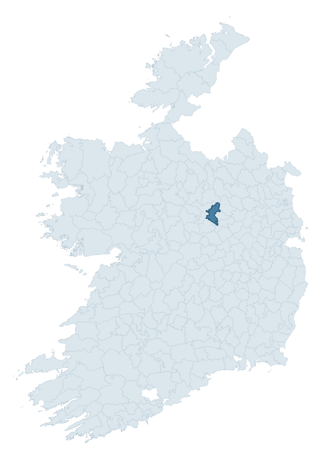
Where this barony sits in the Republic of Ireland
Geology and preservation
Bedrock geology shapes the landscape long before any settlement begins — controlling soil drainage, agricultural potential, the survival of upstanding monuments, and the preservation of buried archaeology. The figures below come from the Geological Survey Ireland 1:100,000 bedrock map.
The bedrock underlying Moygoish is predominantly limestone (94% of the barony by area), laid down during the Carboniferous period (100% by area, around 359 to 299 million years ago). Limestone is the most heritage-rich bedrock in Ireland. It supports fertile, well-drained soils that favoured dense Early Medieval settlement and Norman manorial agriculture, and it weathers into karst features — sinkholes, caves, swallow holes, and souterrains — that frequently carry archaeology. Where peat overlies limestone, organic preservation can be exceptional. The single largest mapped unit is the Lucan Formation (64% of the barony's bedrock). With only 2 distinct rock types mapped, the barony is geologically uniform compared to the rest of the Republic (14th percentile for diversity) — a single coherent bedrock landscape.
Rock type composition
Largest mapped unit: Lucan Formation (64% of the barony)
Placename evidence
Logainm records 27 heritage-diagnostic placenames for Moygoish, drawn from townland and civil-parish names across the barony. The dominant stratum is Early Christian ecclesiastical — cill-, teampall-, and domhnach-prefixed names that record the dense network of early church foundations established between the fifth and tenth centuries. The leading diagnostic roots are cill- (14 — church), ráth- (3 — earthen ringfort), and lios- (3 — ringfort or enclosure). This is broadly in line with the ROI average of 30.7 heritage placenames per barony. The presence of multiple heritage strata side by side indicates layered occupation of the landscape across successive prehistoric and historic periods. Logainm records 119 placenames for Moygoish (predominantly townland names). Of these, 27 (23%) carry one of the diagnostic Gaelic roots tracked above; the remainder draw on more generic landscape vocabulary that does not encode a heritage period.
Pre-Christian / Early Medieval Defensive
| Root | Count | Meaning |
|---|---|---|
| ráth- | 3 | earthen ringfort |
| lios- | 3 | ringfort or enclosure |
| dún- | 1 | hilltop or promontory fort |
Early Christian Ecclesiastical
| Root | Count | Meaning |
|---|---|---|
| cill- | 14 | church (early) |
| teampall- | 2 | church (later medieval) |
| domhnach- | 1 | pre-Patrician or earliest Patrician church |
| mainistir- | 1 | monastery |
| gráinseach- | 1 | monastic farm / grange |
Burial, Ritual, and Norse-Contact
| Root | Count | Meaning |
|---|---|---|
| carn- | 1 | cairn |
| gall- | 1 | foreigner — Norse settlement marker |
Other baronies in Westmeath
About this profile
Click any section below to expand.
What is a barony?
A barony is a historic administrative unit in Ireland, broadly equivalent to an English hundred. The 280 baronies used here are from the OSi 2019 National Statutory Boundaries (generalised 20m), covering the 26 counties of the Republic of Ireland. Baronies derive from the Norman period, were formalised in the 17th century, and have not been redrawn for statistical purposes. They vary enormously in area, from compact urban baronies in Dublin to vast upland baronies in Connacht, and should not be compared by raw site count without accounting for area differences.
What counts as a site?
This profile combines three distinct heritage registers, each with its own definition of what constitutes a recordable site:
- Archaeological sites (NMS). The National Monuments Service Sites and Monuments Record (SMR) catalogues every known archaeological monument or site of archaeological interest in the Republic, from prehistoric burial mounds and ringforts to medieval churches and post-medieval defensive works. Inclusion does not require legal protection — only that the site has been identified, surveyed, and assessed as having archaeological value. A separate subset of these sites lies within a recorded protection zone, which gives them statutory protection under the National Monuments Acts.
- Listed buildings (NIAH). The National Inventory of Architectural Heritage records buildings of architectural, historical, archaeological, artistic, cultural, scientific, social, or technical interest. Each surveyed structure is appraised on a five-tier scale: International, National, Regional, Local, and Record-Only. The NIAH appraisal is informational rather than strictly statutory, but it underpins local-authority Record of Protected Structures (RPS) listings.
- Heritage placenames (Logainm). Logainm is the authoritative database of Irish placenames maintained by the Placenames Branch. This profile applies a heritage-diagnostic classifier to the Irish-language form of each townland name, flagging roots that signal defensive sites (ráth-, lios-, dún-, caiseal-, cathair-), ecclesiastical foundations (cill-, teampall-, domhnach-, mainistir-), prehistoric burial-ritual features (tuaim-, carn-, leaba-), or Norse-contact settlement (gall-). Townlands without one of these diagnostic roots are not flagged here — they may still carry historical significance, but that significance is not encoded in the name itself.
Editorial principles
The narrative sections of this profile follow several explicit principles:
- Evidential. Every claim about this barony’s heritage character is anchored in the underlying register data. Where a site count, a placename count, or a percentile rank is cited, it is computed from the source datasets at export time, not estimated.
- Comparative. Counts and metrics are reported alongside their percentile rank against the other 279 ROI baronies. A barony with 50 ringforts in absolute terms could be unusually high or unusually low depending on its size and regional context; percentile ranking removes that ambiguity.
- Transparent on limits. Where a register has known coverage gaps, survey biases, or data-quality issues that affect this barony’s figures, the profile flags them rather than presenting the numbers as definitive.
- No interpretation beyond what the data supports. The narrative does not speculate about historical events, social dynamics, or cultural meaning beyond what the recorded heritage and placename evidence directly attests.
Data caveats and limits
- NMS Sites and Monuments Record is the product of survey campaigns conducted at different intensities across different counties and decades. Some baronies have been surveyed more thoroughly than others, and absolute counts should be read in that light. Sites destroyed by development before survey are typically not represented; sites in heavily forested or upland terrain are sometimes under-recorded.
- NIAH coverage is broadly complete for the Republic of Ireland but the survey was conducted on a rolling county-by-county basis, and the most recent appraisal date varies. Buildings demolished or substantially altered after their original survey may still appear in the register; conversely, recent buildings of merit may not yet have been appraised.
- Logainm classification applies a deliberately conservative pattern-matching approach to the Irish-language townland forms. The classifier prioritises true positives over recall: a townland may carry a heritage signal that the classifier doesn’t recognise, particularly where the diagnostic root has been heavily anglicised or where the townland name draws on a less common term. The 60,000+ townland records and ~9,800 classified placenames give a substantial signal at barony scale, but individual townland names should be checked against Logainm directly for definitive interpretation.
- Period attribution. The chronological distribution reflects only those NMS sites that carry a recognised period attribution in the source data. Sites listed as “Unknown” period are excluded from the dated subset.
- Boundary changes. Some baronies have undergone minor boundary adjustments since their 19th-century definition; the OSi 2019 generalised boundaries used here are the current statutory definition and may differ slightly from historical maps in border areas.
- Bedrock geology is mapped at 1:100,000 scale, which means local variation within a barony — small pockets of different rock type, mineral veins, alluvium overlying bedrock — is generalised. The dominant-system and rocktype figures are area-weighted, so a barony reading “70% Carboniferous limestone” may still contain small but archaeologically important pockets of older or younger rock. Around 3% of GSI polygons do not match the lexicon and contribute no rocktype or system attribution.
Data sources
- National Monuments Service — Sites and Monuments Record (SMR) https://data.gov.ie/dataset/national-monuments-service-archaeological-survey-of-ireland
- National Inventory of Architectural Heritage (NIAH) https://data.gov.ie/dataset/national-inventory-of-architectural-heritage-niah-national-dataset
- Logainm — Placenames Database of Ireland https://www.logainm.ie/
- Ordnance Survey Ireland — National Statutory Barony Boundaries 2019 https://data-osi.opendata.arcgis.com/
- EURODEM — European Digital Elevation Model https://www.mapsforeurope.org/datasets/euro-dem
- ESA WorldCover https://esa-worldcover.org/en
- Geological Survey Ireland — 1:100,000 Bedrock Geology https://www.gsi.ie/en-ie/data-and-maps/Pages/Bedrock.aspx
Explore more: Search any of the 280 ROI baronies, browse by historical province, or read the methodology and data sources for the full Republic of Ireland Heritage Tool.