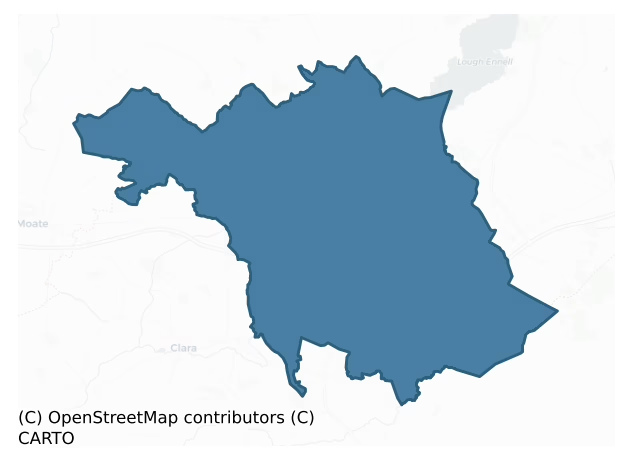
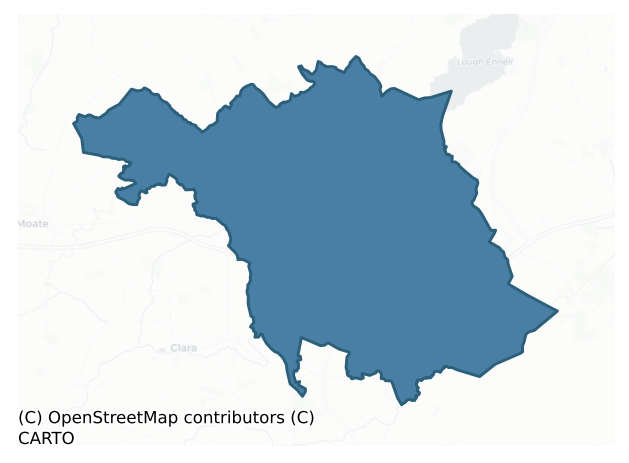
Moycashel is a barony of County Westmeath, in the historical province of Leinster (Irish: Maigh Chaisil), covering 191 km² of land. The barony records 624 NMS archaeological sites and 181 NIAH listed buildings, placing it at around the 86th percentile among 280 ROI baronies for sites per km². This means it is in the top fifth of all baronies for sites per km². Dated archaeological evidence runs from the Neolithic through to the Modern, spanning 8 of 9 archaeological periods, placing the barony in the 67th percentile among 280 ROI baronies for chronological depth. This means it is in the top third of all baronies for chronological depth. The largest dated subset of recorded sites dates to the Early Medieval. Logainm flags 34 placenames in the barony as carrying a recognised heritage root; the largest share — around 76% — are names associated with early Christian church and monastic foundations.
Heritage at a glance
Percentile rankings throughout this profile compare each barony only against the other 279 Republic of Ireland baronies.
The recorded heritage of Moycashel
The National Monuments Service Sites and Monuments Record (SMR) is the statutory inventory of archaeological sites for the Republic of Ireland, maintained by the Department of Tourism, Culture, Arts, Gaeltacht, Sport and Media. Sites recorded here include earthworks, ringforts, megalithic tombs, ecclesiastical remains, and post-medieval features; not every record is legally protected, but each is registered as a monument of archaeological interest.
The National Monuments Service records 624 archaeological sites in Moycashel, putting it at the 86th percentile among 280 ROI baronies for sites per km². This means it is in the top fifth of all baronies for sites per km². Of these, 494 (79%) fall within a recorded monument protection zone. The record is dominated by defensive sites — ringforts, enclosures, hillforts, and stone forts (213 sites, 34% of the total), with industrial sites forming a substantial secondary presence (196 sites, 31%). Structure – peatland is the most prevalent type, making up 31% of the barony's recorded sites (196 records) — well above the ROI average of 15% across all baronies where this type occurs. Structure – peatland is a construction of unknown function, either extant or implied by archaeological evidence, of any date. Other significant types include Ringfort – rath (130) and Road – class 3 togher (51). Ringfort – rath is an earthen ringfort enclosed by a bank and external ditch — the most common Early Medieval farmstead, broadly dated 500–1000 AD; Road – class 3 togher is a short wooden peatland trackway up to 15m long, deliberately laid to cross a small area of bog; Neolithic to medieval. Across the barony's 191 km², this gives a recorded density of 3.26 sites per km².
Most common monument types
Hover or tap a monument type to see its definition.
| Type | Count |
|---|---|
| Structure – peatland a construction of unknown function, either extant or implied by archaeological evidence, of any date | 196 |
| Ringfort – rath an earthen ringfort enclosed by a bank and external ditch — the most common Early Medieval farmstead, broadly dated 500–1000 AD | 130 |
| Road – class 3 togher a short wooden peatland trackway up to 15m long, deliberately laid to cross a small area of bog; Neolithic to medieval | 51 |
| Enclosure a banked or ditched feature of uncertain type, used as a catch-all where the original function cannot be determined from surface evidence | 27 |
| House – indeterminate date a habitation building whose date cannot be determined from available evidence | 25 |
| Church a building used for public Christian worship, of any date from c. 500 AD onwards | 11 |
| Castle – tower house a fortified residential tower of four or five storeys, mostly built by lords in the 15th and 16th centuries and often within a defended bawn | 9 |
| Ecclesiastical enclosure a large enclosure surrounding an Early Medieval church or monastery and its associated activity areas | 9 |
Chronological distribution
The dated archaeological record for Moycashel spans from the Neolithic through to the Modern, with activity attested across 8 of 9 archaeological periods. Every period from earliest to latest is represented in the record — an unbroken sequence of dated activity across the full chronological span. Activity concentrates most heavily in the Early Medieval (165 sites, 49% of dated material), with the Iron Age forming a secondary peak (78 sites, 23%). A further 286 recorded sites (46% of the overall NMS register for the barony) carry no period attribution — appearing as 'Unknown' in the bar chart below. This typically reflects either records that pre-date the standardised period vocabulary or sites awaiting specialist dating review, rather than a genuine absence of chronological evidence.
Sample of recorded monuments
Show 25 sample monuments (of 624 total)
A representative sample of 25 recorded monuments drawn from the barony’s 624 total NMS entries. Sites within a recorded monument protection zone and rarer site types are prioritised so the list shows a meaningful cross-section rather than only the most common type. Each entry shows the official Sites and Monuments Record reference number and the description published by the National Monuments Service.
Well
Situated on the bend of a stream, in low-lying, flat pasture, immediately W of parish boundary between Kilcumreragh and Killare. Depicted on the revised 1913 ed. OS 25-inch map as a small circular spring, annotated…
Situated on the bend of a stream, in low-lying, flat pasture, immediately W of parish boundary between Kilcumreragh and Killare. Depicted on the revised 1913 ed. OS 25-inch map as a small circular spring, annotated 'Toberfely'. Monument described as a small, unenclosed, surface spring which is grass covered with no special characteristics to distinguish it as a blessed well. This site no longer seems to be revered as a holy well. According to local folklore there was only one holy well in the townland of Coolatoor known as Toberavill (WM031-014002-) (The Schools’ Collection, Volume 0733, Page 177).
Compiled by Alison McQueen, Vera Rahilly and Caimin O’Brien.
Date of upload: 03 September 2019
Anomalous stone group
Situated on a slight rise, in gently undulating pasture, with good views to S. Depicted as a ‘circle of stones’ on the 1837 OS Fair Plan map. Monument described in 2003 as no surface remains visible. A building and a…
Situated on a slight rise, in gently undulating pasture, with good views to S. Depicted as a ‘circle of stones’ on the 1837 OS Fair Plan map. Monument described in 2003 as no surface remains visible. A building and a compound with a concrete yard are at this location. A mound (WM025-141001-) to E may be of archaeological interest.
Compiled by Alison McQueen, Vera Rahilly and Caimin O’Brien.
Date of upload: 27 September 2019
Castle – ringwork
Situated in gently undulating pasture, with restricted views. Depicted on the 1910 ed. OS 25-inch map as a subrectangular-shaped earthwork. Monument described in 1982 as a high subcircular-shaped platform (dims. 20m…
Situated in gently undulating pasture, with restricted views. Depicted on the 1910 ed. OS 25-inch map as a subrectangular-shaped earthwork. Monument described in 1982 as a high subcircular-shaped platform (dims. 20m N-S; 21m E-W) defined by a scarp, an intervening fosse and an outer bank. The inner scarp is approx. H 2m above the base of the intervening fosse. A wide, deep fosse (approx. Wth 5m) is visible from N-E-S-SSW. A wide tree-lined outer bank (approx. Wth 3m; ext. H 0.75m-1m) is visible from ESE-S-SSW. There is no trace of a fosse or an outer bank from SSW-W-N. Close to the base of the scarp, a tree-lined jumble of large boulders and a very inconsequential earthen back (possibly debris from field clearance) continues from SSW-W-N. The interior is slightly domed and there are no structures visible. The monument is riddled with large badger sets and a long section from ESE-SSE has been quarried away. Monument is visible today as a tree-planted earthwork on Digital Globe aerial photography.
Compiled by Alison McQueen, Vera Rahilly and Caimin O’Brien.
Date of upload: 12 November 2019
Stone head
Situated on the terrace on the S side of Coolatoor House (b. c. 1866, NIAH). An inscribed stone (WM031-007001—-) is built into a wall at the E end of the house. An architectural fragment (WM031-007002-) and a…
Situated on the terrace on the S side of Coolatoor House (b. c. 1866, NIAH). An inscribed stone (WM031-007001—-) is built into a wall at the E end of the house. An architectural fragment (WM031-007002-) and a sheela-na-gig (WM031-007003-) are reputed to have been situated at the house, although these are currently unlocated. Monument described in 1981 as a carved limestone bust of a female figure which was recovered some years ago in an overgrown rockery in the grounds of the house. Nothing else of its origins are known. The figure (H 0.57m; Wth 0.31m; T 0.28m) is carved in the round and was seemingly intended to be freestanding and upright. It is well carved with a very flat face and has a damaged nose. A dimple can be seen under her chin. The top of the dress is defined by a beaded border which falls on either side of the chest and is finished by a tassel. An open right hand extending from a thin arm, lies on the left breast. The lady wears a head-dress with a veil falling over the shoulders. The back & sides of the head-dress are carved with a foliage pattern. The base of the figure is roughly carved with an unfinished appearance. The stone appears to be of medieval date.
According to local information, Col. Upton was the former owner of the house and a well-known antiquarian. He had a large collection of medieval carved stones and graveslabs which he had collected during the early part of the 20th century. The grounds of the house are extensive, with very overgrown…
House – 17th century
17th century house known as 'Old Court' situated NW of an 18th century dwelling annotated 'Rose Mount' (b. 1773, NIAH) on OS 6-inch map. Depicted on the revised 1910 ed. OS 25-inch map as a rectangular-shaped structure…
17th century house known as 'Old Court' situated NW of an 18th century dwelling annotated 'Rose Mount' (b. 1773, NIAH) on OS 6-inch map. Depicted on the revised 1910 ed. OS 25-inch map as a rectangular-shaped structure in a complex of buildings annotated Old Court. According to O’Donovan (1837 OSNB 26, 7), there is a complex of buildings which ‘contains a ruin called the Old Court of Rosemount’. Building described in 1982 as the much altered gable of a 17th century house with a wide chimney breast leading to a high chimney. The remains of an unroofed cottage or farm outbuilding adjoin to W. The latter comprises of one wall and a number of cross walls. Although both structures were originally built of stone, there is a good deal of brick visible. Monument is not clearly visible today on Digital Globe aerial photography.
Compiled by Alison McQueen, Vera Rahilly and Caimin O’Brien.
Date of upload: 13 November 2019
Settlement deserted – medieval
The deserted borough of Ardnurcher is located on a ridge of elevated pasture in an area of undulating countryside about 500m north of the present village of Horseleap with good views in all directions. The settlement…
The deserted borough of Ardnurcher is located on a ridge of elevated pasture in an area of undulating countryside about 500m north of the present village of Horseleap with good views in all directions. The settlement was located in the fields between the medieval church (WM031-098—-) and the Anglo-Norman motte and bailey castle (WM031-099—-). The town of Ardnurcher was defended by a stone wall (WM031-107—-) traces of which still survive in the surrounding fields. The placename is a corruption of Ath an Urchair, the ford of the cast or throw (Joyce 1902, 9). The origin of the name is uncertain, although there is a tradition connecting it with the wounding of Conchobhar MacNeasa (Joyce 1871, 161). Apart from its traditional association with Conchobar MacNeasa the only evidence for activity on the site prior to the coming of the Normans is a somewhat doubtful reference to a souterrain (WM031-106—-) in the castle (WM031-099—-) bailey (Brownrigg 1788, 46). In the early 1170's, however, the cantred of Ardnurcher was granted to Meiler FitzHenry by Hugh de Lacy (Orpen 1892, 229). The manor was an important one and was defended from an early date. A settlement existed at Ardnurcher before the year 1200 when the Annals of Clonmacnoise recorded that ‘some of Meyler Bermingham’s people tooke the spoyle of the castle (WM031-099—-) of Ardnurcher and burnt all the houses of the markett’ (Ann. Clon., 217). In 1213 the Annals recorded that ‘Cormack Mc Art O’Melaghlin t…
Inauguration stone
A glacial erratic, that was the inauguration stone of the MacGeoghegan clan, known locally as Mac Geoghegan’s Chair (Brewer 1826, 257). Not marked on any edition of the OS 6-inch maps. Situated on rolling pastureland…
A glacial erratic, that was the inauguration stone of the MacGeoghegan clan, known locally as Mac Geoghegan’s Chair (Brewer 1826, 257). Not marked on any edition of the OS 6-inch maps. Situated on rolling pastureland with good views from NE-E-SE, restricted elsewhere by higher ground. Glacial boulder set on shoulder of natural hillock 315m NE of Ballybrennan House' (SMR file).
Compiled by: Caimin O'Brien
Date of upload: 06 March 2013
Field system
Described in 1977, as a large complex of shallow fosses and low banks in a field to the SW, W and N of a horseshoe-shaped earthwork (WM032-093001-). Some of the fosses run for a long distance in a N-S direction and…
Described in 1977, as a large complex of shallow fosses and low banks in a field to the SW, W and N of a horseshoe-shaped earthwork (WM032-093001-). Some of the fosses run for a long distance in a N-S direction and others run into them aligned E-W forming small fields of square and rectangular shapes containing cultivation ridges visible on aerial photographs. St. David’s Well (WM032-094—-) located at the SSE of the field in which the field system is located. The adjoining fields to the S and SW contain traces of this field system. The dating of this field system is uncertain but the extensive scale of this system may suggest that it is post-1700 in date.
Compiled by: Caimin O’Brien
Date of upload: 28 March 2013
See attached jpeg files showing aerial photograph taken from Bing Maps of field system and cultivation ridges, www.bing.com.maps/, accessed 28 March 2013.
House – fortified house
Situated on the summit of a ridge, in undulating pasture, with good views in all directions.
Depicted on the 1655 Down Survey map of Newtown parish as a castellated house with gable ended chimneystacks and a lower…
Situated on the summit of a ridge, in undulating pasture, with good views in all directions.
Depicted on the 1655 Down Survey map of Newtown parish as a castellated house with gable ended chimneystacks and a lower house extending from one side which stood in 1640 on lands belonging to Thomas Geoghegan who is listed as an 'Irish papist' (NLI, MS 723-4). The terrier of this parish map described the castle as a 'handsome House at Cominstowne' (ibid.). Thomas Geoghegan of Cominstown was listed in 1653-4 as one of the people transplanted from Co. Westmeath (O'Hart 1884, 352). In 1837 the Ordnance Survey Letters recorded that 'there is an old Castle in ruins, of which, I could obtain no information as to its erection, or period of its erection' (OSL, Vol. 2, 32). Cumminstown Castle depicted on the 1837 ed. OS 6-inch map and on the revised 1910 ed. OS 25-inch map as a rectangular-shaped building orientated NE-SW with building to NNE and SSW. Levelled castle described in 1973 as no surface remains visible, a modern house now stands on the site. Castle is not visible today on Digital Globe aerial photography.
Compiled by Alison McQueen, Vera Rahilly and Caimin O’Brien.
Date of upload: 17 December 2019
Historic town
Kilbeggan is situated on the River Brosna in the low-lying countryside of south Westmeath. According to Gwynn and Hadcock (1970, 388) a monastery (WM038-017001-) was founded at Kilbeggan by St Beagán in the sixth or…
Kilbeggan is situated on the River Brosna in the low-lying countryside of south Westmeath. According to Gwynn and Hadcock (1970, 388) a monastery (WM038-017001-) was founded at Kilbeggan by St Beagán in the sixth or seventh century. The possible boundary ditch of the early Christian monastery at Kilbeggan may have been identified by Earthsound on behalf of ADS Ltd. when carrying out a geophysical survey in 2004 in the field to the W of the Cistercian Abbey (WM038-017007-) (Corcoran 2008, 377). The Urban Survey suggested that 'the church of St Beagán was located in or beside the old graveyard (WM038-017002-) south-west of the town but definite evidence can only be obtained by archaeological excavation' (Bradley et. al. 1985, 104). According to the Urban Survey (Bradley et. al. 1985, 102) the 'early monastery was superseded by a Cistercian monastery (WM038-017007-) c.1150 but the history of Kilbeggan as a town does not begin until the seventeenth century. In 1606 Sir Oliver Lambert was granted a ‘licence to hold a saturday market, and a fair on the feast of st. Michael (29th September), and the next two days, at Kilbeggan, in co. Meath; with courts of pie-powder and all tolls, etc. to said market and fair belonging, at a rent of 5s. per ann.’ (Erck 1846, 267). In the same year he was also granted ‘the site and precinct of the late abbey (WM038-017007-) of the B. V. Mary of Kilbeggan, in M’Geoghogans countrie, with the stone walls of a church and other buildings there…
Barrow – bowl-barrow
Surveyed in 2013 and described by McGuinness (2014, 58-9) as following: 'Large circular mound (Diam. 13m N-S x 13.3m E-W), domed in appearance with slightly flattened upper surface at edge of which is a mature beech; a…
Surveyed in 2013 and described by McGuinness (2014, 58-9) as following: 'Large circular mound (Diam. 13m N-S x 13.3m E-W), domed in appearance with slightly flattened upper surface at edge of which is a mature beech; a much silted-up ditch up to 2.2m in width is visible around the base of the mound running clockwise from NE to SW, being absent or difficult to trace elsewhere. Where ditch is clearest on NE side, the natural ground just beyond it rises higher than surrounding areas, giving the illusory impression of an outer bank. Mound rises up to 1.95m in height on NW side, where surrounding ground is lowest and ditch is barely visible. Although summit of eminence on which it lies (see below) slopes down from SE to NW, flattish upper surface of mound appears level when viewed from NE, SE side of mound being much lower than NW side. In the SMR file are a good plan and profile of the barrow and the flat summit of the knoll on which it lies. Monument is very prominently sited on the flattened summit of a striking landform, apparently a kame with dry kettle-hole lake close by to SW, at the N end of an esker ridge (FitzPatrick 2005, 270-71) in a heavily glaciated landscape littered with kames (pers comm. Seamus O’Brien). The Slieve Blooms dominate the view to the S; Knockastia (WM031-015—-) and Croghan Hill (OF010-004001-), each with burial mounds, are prominent to NW and E respectively; Ardan Hill, capped by a mound-barrow (WM038-031—), is visible to N. Mo…
Cross-slab
Known locally as the 'Headache Stone' this early Christian cross-slab is now incorporated into the SE side of a hedgerow forming a field boundary running NE-SW. Rahugh church (WM038-041—-) and graveyard…
Known locally as the 'Headache Stone' this early Christian cross-slab is now incorporated into the SE side of a hedgerow forming a field boundary running NE-SW. Rahugh church (WM038-041—-) and graveyard (WM038-041001-) 145m to NE. St. Hugh's holy well 300m to ESE. This cross-slab is sometimes referred to as the birthstone of St. Hugh. A story in the 12th century Life of St. Hugh recorded that ‘at his birth, the baby’s head struck upon the stone whereon his mother had been sitting, and formed a hollow depression, the exact size of his head, and further informs us that the water which collects in this little hole still avails for the cure of all kinds of diseases’ (Stokes 1896, 328). Present remains consist of a large roughly rectangular-shaped limestone slab (dims. 1.33m x H 0.95m; T 0.36m) with ringed cross carved in low relief inside a panel the faint outline of which can be seen on one side only. A large depression can be seen in the centre of the cross with a second circular hollow located to the right which has been carved into the arm of the cross. According to the local tradition this was the stone on which St. Hugh was born. Described in 1896 as ‘an immense block of stone, lying in a ditch in the same field as the holy well. It is called by the peasantry, St. High’s tombstone. It has a large Celtic circle and cross incised upon its face. The arms of the cross extend beyond the circle. But the most curious thing about it is this; in the very centre…
Inscribed stone
Built into a wall at the E end of Coolatore House (b. c. 1866, NIAH). A stone head (WM031-007—-) was recovered from the garden and is situated on the S terrace of the house. An architectural fragment (WM031-007002-)…
Built into a wall at the E end of Coolatore House (b. c. 1866, NIAH). A stone head (WM031-007—-) was recovered from the garden and is situated on the S terrace of the house. An architectural fragment (WM031-007002-) and a sheela-na-gig (WM031-007003-/WM024-123001) are reputed to have been situated at the house, although these are currently unlocated. Datestone described in 1981 as a trapezoidal-shaped cut limestone (H 0.4m; Wth at top 0.35m; basal Wth 0.3m) inscribed with the letters N A K IHS 1640. This date stone may have come from an earlier building on the site or may have been brought here from elsewhere. The present house has datestones inscribed with the dates 1864 and 1866. According to local information, Col. Upton was the former owner of the house and a well-known antiquarian. He had a large collection of medieval carved stones and graveslabs which he had collected during the early part of the 20th century.
Compiled by Alison McQueen, Vera Rahilly and Caimin O’Brien.
Date of upload: 12 November 2019
House – medieval
Nothing is known of the form or extent of the domestic housing within the borough of Ardnurcher (WM031-104—-) but a stone house is specifically referred to in a grant of c.1280 (Bradley et. al. 1985, 14; Brooks 1936,…
Nothing is known of the form or extent of the domestic housing within the borough of Ardnurcher (WM031-104—-) but a stone house is specifically referred to in a grant of c.1280 (Bradley et. al. 1985, 14; Brooks 1936, 162). An irregular shaped poorly preserved earth and stone mound in the field 90m WSW of Ardnurcher Church (WM031-098—-) and graveyard represents the grass covered remains of a possible medieval stone structure which may have been the stone building referred to in the 13th century. This stone building is located on on the W edge of the ridge of high ground running across the medieval settlement of Ardnurcher. The building appears to have been standing along the town wall (WM031-107—-) of Ardnurcher or just inside the enclosing element of the town defences of Ardnurcher which follows the natural contour of the ridge on which it is situated. The poorly preserved remains makes it impossible to be certain that these are the remains of a building. It is possible that they may be the remains of the town wall or of a mural tower/gatehouse standing along the route of the destroyed wall of Ardnurcher town. The grass covered wall footings of a short section of the town wall along with a possible mural tower can be seen 75m to the NW which area alos located on the W edge of the ridge of high ground and appear to represent the town wall and mural tower of Ardnurcher town. The wall footings of the mural tower are similar in size to the mural towers visible in t…
Town defences
The deserted borough of Ardnurcher is located on a ridge about 500m north of the present village of Horseleap. The settlement was located in the fields labelled by Brownrigg in 1788 as 'high arable land' situated…
The deserted borough of Ardnurcher is located on a ridge about 500m north of the present village of Horseleap. The settlement was located in the fields labelled by Brownrigg in 1788 as 'high arable land' situated between the medieval church (WM031-098—-) (WM031-098001-) and the Anglo-Norman motte and bailey castle (WM031-099—-). In the early 1170's, however, the cantred of Ardnurcher was granted to Meiler FitzHenry by Hugh de Lacy (Orpen 1892, 229). The manor was an important one and was defended from an early date. A settlement existed at Ardnurcher before the year 1200 when the Annals of Clonmacnoise recorded that ‘some of Meyler Bermingham’s people tooke the spoyle of the castle (WM031-099—-) of Ardnurcher and burnt all the houses of the markett’ (Ann. Clon., 217). In 1213 the Annals recorded that ‘Cormack Mc Art O’Melaghlin tooke a great prey from the Towne of Ardnurcher, and the next morrow after tooke the spoyles of the castle of Ardnurcher, and market of the same, he tooke many other small preys and booties’ (Ann. Clon. , 226). The settlement had attained borough status by about 1235 when a burgage in Ardnurcher is mentioned in a charter of Walter de Lacy (Mac Niocaill 1977, 55). The Anglo-Norman settlers of Ardnurcher were often described in the Annals as the ‘Englishmen of Ardnurcher’ (Ann. Clon., 232). The settlement was in a frontier situation, and exposed to attacks from the native Irish such as that recorded in the Annals of Clonmacnoise for 1234…
Wall monument – effigial
Described by the Urban Survey of Westmeath (Bradley et. al. 1985, 16-17) as following: Peyton wall memorial (dims. H 4m; Wth 2.04m). 17th century. Mounted on south wall of the church porch with demi-effigies on the…
Described by the Urban Survey of Westmeath (Bradley et. al. 1985, 16-17) as following: Peyton wall memorial (dims. H 4m; Wth 2.04m). 17th century. Mounted on south wall of the church porch with demi-effigies on the east and west walls. It consists of two rectangular stone tablets set within an architectural frame. The upper tablet is flanked by two pilasters supporting a moulded shelf. The pilasters are decorated with rows of beaded mouldings and the shelf supports a typanum flanked on two pinnacles. The lower tablet is in five sections and is flanked by both sugar-barley and undecorated pilasters. The sugar barley pilasters have floriated capitals with bead moulding. The typanum has an open book incised THE BIBLE and along the base THE HOSPITALL OF THE SOULE. The upper tablet is carved in low relief and carries an elaborate achievement of arms. Heater shaped shield with dexter: sable a cross engrailed or, in the first quarter a mullet argent, for Peyton; sinister : ermine, three fusils conjoined in fess sable, the centre one charged with a crescent or, for Piggott. Above the inscription on the lower tablet is an angel's head with two trumpets emerging from flanking clouds and the words THE TRUMPET SHAL SOUND THE DEAD ARISE. Incised Roman inscription: HERE LYETH THE BODY OF GEORGE PEYTON LATE OF STR/EASESTOUNE ESQR WHO DYED MARCH THE 15 1698 IN THE / 68 YEARE OF HIS AGE BY WHOM THIS MONUMENT AND VAULT WERE/DESINED & CONTRIVED IN HIS LIFETIME FOR Ye BURIALL PLAC/ OF…
Religious house – Cistercian monks
Kilbeggan town (WM038-017—-) is situated on the River Brosna in the low-lying countryside of south Westmeath. According to Gwynn and Hadcock (1970, 388) a monastery (WM038-017001-) was founded at Kilbeggan by St…
Kilbeggan town (WM038-017—-) is situated on the River Brosna in the low-lying countryside of south Westmeath. According to Gwynn and Hadcock (1970, 388) a monastery (WM038-017001-) was founded at Kilbeggan by St Beagán in the sixth or seventh century. The early monastery was superseded by a Cistercian monastery dedicated to the Blessed Virgin Mary. This abbey known as De Benedictio Dei, was founded c.1150 as a daughter house of Mellifont, probably by members of the MacCochlain family (Gwynn and Hadcock 1970, 137). In 1213 Mael Sechlainn MacCochlain, Lord of Delvin, died on pilgrimage to the abbey and in the same year his sons Ruaidhri and Mael Sechlainn died there (ibid., 137). In 1228 the abbey was made subject to Buildwas Abbey in England but judging by the names of its abbots it seems to have retained an Irish character throughout the Middle Ages (ibid., 137). At the Dissolution the abbey was apparently granted to Owen O Morrain of Multifarnham (Walsh 1957, 274-5) but in 1550 it was in the possession of Francis Digby, alias Ros MacEochacain (Morrin 1861, 233). It passed through various hands until 1606 when it was granted to Sir Oliver Lambert (Erck 1846-52, 267-8). In this year Sir Oliver Lambert was granted ‘the site and precinct of the late abbey of the B. V. Mary of Kilbeggan, in M’Geoghogans countrie, with the stone walls of a church and other buildings therein – 3 gardens, and a waste orchard, containing half an acre – a small chapel or church (WM038-017…
Water mill – vertical-wheeled
The precise location of a watermill in the town of Kilbeggan has not been identified. Kilbeggan town (WM038-017—-) is situated on the River Brosna in the low-lying countryside of south Westmeath. In 1606 Sir Oliver…
The precise location of a watermill in the town of Kilbeggan has not been identified. Kilbeggan town (WM038-017—-) is situated on the River Brosna in the low-lying countryside of south Westmeath. In 1606 Sir Oliver Lambert was granted ‘the site and precinct of the late abbey (WM038-017007-) of the B. V. Mary of Kilbeggan, in M’Geoghogans countrie, with the stone walls of a church and other buildings therein – 3 gardens, and a waste orchard, containing half an acre – a small chapel or church (WM038-017006-) belonging to the town of Kilbeggan, and to the parishioners of said monastery – a close to said monastery adjacent, containing 1a. – 3 messuages, 6 cottages, 60a. arable, standard measure, 16a. pasture, 6a. bog, in the town and fields of Kilbeggan – a water mill, near the town of Kilbeggan, upon the river Brassnagh (Brosnagh) – 2 eel-weares (WM038-017010-), 2 mess., 3 closes or cottages, 70a. arable, 30a. pasture and common of bog’ (Erck 1846, 268). In 1618 an inquisition into the estate of the deceased of Oliver Lord Lambert listed a water mill and a fulling mill (WM038-017012-) which were powered by the River Brosna (Anon 1826, 56). It is possible that the mills may have formed part of the monastic estate of the Cistercian abbey of Kilbeggan that was granted to Sir Oliver Lambert in 1606 (Erck 1846, 268). It is not clear if there were two separate mills at Kilbeggan on the River Brosna consisting of a watermill and a fulling mill. The 1656-59 Down Survey map of…
Water mill – unclassified
In 1621 Hugh Mageoghegan of Castletown was ‘seised in fee of the manor of Castleton, Kinalleen, and the lands of Castleton, containing 1 castle (WM032-013—-) and 60a, with a water-mill and fair’ (Cal. pat. rolls Ire.,…
In 1621 Hugh Mageoghegan of Castletown was ‘seised in fee of the manor of Castleton, Kinalleen, and the lands of Castleton, containing 1 castle (WM032-013—-) and 60a, with a water-mill and fair’ (Cal. pat. rolls Ire., Jas I, 566).
Compiled by: Caimin O'Brien
Date of upload: 27 July 2015
Stone circle
Situated on poorly drained grassland with possible moated site (WM031-115—) immediately to SSW. Present remains consist of a circular area (diam. 7m) defined by 12 low circular shaped boulders (max. H 0.8m) set…
Situated on poorly drained grassland with possible moated site (WM031-115—) immediately to SSW. Present remains consist of a circular area (diam. 7m) defined by 12 low circular shaped boulders (max. H 0.8m) set approx. 0.6-1.3m apart with single standing stone (H 0.5m) in centre of circle. The stones are loosely placed on the ground and do not appear to be set into sockets. The upright stone in the centre of the circle is also not set securely into the ground. The shape of the boulders forming the circle and the way they are placed on the surface of the ground casts doubt on the antiquity of this monument.
Compiled by: Caimin O'Brien based on details kindly supplied by Melanie McQuade.
Date of upload: 22 March 2017
Burial Vault
Burial vault of uncertain date in Ardnurcher graveyard (WM031-098001-) located off centre to W approx. 3m N of the N wall of Ardnurcher C of I church. Present remains consist of a displaced boulder located 8m from the…
Burial vault of uncertain date in Ardnurcher graveyard (WM031-098001-) located off centre to W approx. 3m N of the N wall of Ardnurcher C of I church. Present remains consist of a displaced boulder located 8m from the NW corner of the C of I church and 3m out which revealed a cavity in the surface of the graveyard. The hole in the graveyard is formed by a collapse in a section of the stone vaulted roof of a burial vault of uncertain date. The rise in the surface of the graveyard in this area is formed by the stone vaulted roof of the burial chamber. The rectangular-shaped vault was accessed from beneath the floor of the present church. A blocked doorway is visible in the S wall of the chamber which leads into an area beneath the floor of the present church. The segmental arch of this doorway is formed from chamfered cut limestone of late medieval appearance. It is not clear if the dressed stone has been reused from the medieval church or if it is contemporaneous with the burial vault.
Compiled and revised by: Caimin O'Brien
Date of revised upload: 26 June 2017
Graveslab
The 17th century parish church (WM038-107006-) and graveyard of St. James in the town of Kilbeggan was located near the western limit of the town (WM038-017—-). The present ruins of the 18th/19th century C. of I.…
The 17th century parish church (WM038-107006-) and graveyard of St. James in the town of Kilbeggan was located near the western limit of the town (WM038-017—-). The present ruins of the 18th/19th century C. of I. church standing in the centre of a disused graveyard (WM038-017013-) probably stands on the site of the parish church and graveyard of Kilbeggan that is listed in the 1606 land grant to Sir Oliver Lambert where it is described as 'a small chapel or church (WM038-017006-) belonging to the town of Kilbeggan, and to the parishioners of said monastery (WM037-017007-)’ (Erck 1846, 268). The patron’s day at Kilbeggan was held on the 24th of July, the eve of the feast of St James (Ó Riain 2011, 93). The site of the Cistercian monastery (WM038-107007-) of Kilbeggan and a graveyard (WM038-017002-) lies 190m to the SSW and S respectively.
A 16th/17th century graveslab belonging to John Nelson was recently unearthed in the NE quadrant of the graveyard adjacent to the boundary wall and close to the entrance gate. The undecorated tapering partially damaged graveslab (dims. L 1.68m; top Wth 0.73m; base Wth 0.64m) has a Latin inscription carved in false relief running around the edge of the slab. The corner of the slab has been broken off and is now missing and so the inscription survives in an incomplete form. The surviving inscription reads ' Hic jacet joannes nelson qui obii die ….. poster …..'. A John Nelson is listed in the c. 1659 census of Ireland as living…
Children's burial ground
Multiperiod site consisting of a Bronze Age burial (WM032-121—–) with medieval burial ground (diam. c. 48m) reused possibly as a children's bruail ground and two corn-drying kilns (WM032-123/124—-) partially…
Multiperiod site consisting of a Bronze Age burial (WM032-121—–) with medieval burial ground (diam. c. 48m) reused possibly as a children's bruail ground and two corn-drying kilns (WM032-123/124—-) partially excavated in 2002 by Angela Wallace, on behalf of Margaret Gowen & Co. Ltd, under licence No. 02E0479. The results of this excavation were summarised as follows; 'This site was exposed during construction of the Bord Gáis Éireann Pipeline to the West project, c. 11km east-north-east of Moate. It was detected by archaeologists monitoring topsoil removal; fragments of burnt and unburnt human and animal bone were noted extending across a wide area. The site is in a low-lying landscape of undulating hills, on the plateau of a low hill rising to the 100ft contour; there was a laneway to the east curving around the site. A ringfort [WM032-068—-] is clearly visible 150m to the north. The site extended for a length of c. 70m east–west and across the entire width of the pipeline corridor (15–18m north–south); the remainder extended beyond the pipeline corridor and was not excavated. Most of the thin peaty topsoil had been removed before excavation; it overlay a rocky subsoil and boulder clay with boulder drift left by fluvio-glacial deposition. Several phases of activity were identified. The earliest was represented by the remains of a badly disturbed crouched inhumation [WM032-121—-] associated with sherds of a decorated vase. This vessel was identified by A.L. Bri…
Bridge
This bridge is part of the nearby Big House known as Belview House and mill complex located to the south of the bridge and probably dates to the late 18th century. The present stone bridge which traverses the River…
This bridge is part of the nearby Big House known as Belview House and mill complex located to the south of the bridge and probably dates to the late 18th century. The present stone bridge which traverses the River Brosna where it connects county Offaly to Westmeath may have replaced an earlier bridge as in the 17th century Lismoyny was described as the 'chief entrance into Fercall' by the Lord Deputy Mountjoy in 1601 (Cal. S.P. Ire. 1600-1601, 203-264).
The above description is derived from the published 'Archaeological Inventory of County Offaly' (Dublin: Stationery Office, 1997). In certain instances the entries have been revised and updated in the light of recent research.
Date of upload: 23 May 2011
Structure – peatland
This site was located in the industrial peatlands of Toar Bog. It was recorded in the 2013 Re-assessment Peatland Survey as a drain face sighting of three upright brushwood pegs and a dense cluster of six NW–SE…
This site was located in the industrial peatlands of Toar Bog. It was recorded in the 2013 Re-assessment Peatland Survey as a drain face sighting of three upright brushwood pegs and a dense cluster of six NW–SE orientated brushwoods, located 0.4m below the field surface (Whitaker 2014).
A single cutting was opened and excavated under licence 14E0289. A fragment of hazel was chosen for AMS dating and returned a result of cal. 39 BC–AD 83 (UBA 26621). The peat overlying and surrounding the site consisted of poorly decomposed Sphagnum pool peat. The structure consisted of a sparse arrangement of hazel and birch brushwood and roundwood (L0.08-1.1m, Diam. 0.02-0.07m) with no apparent form or structure. A single flat faceted chisel point was the only evidence for woodworking noted.
Compiled by: Jane Whitaker/Femke Vleeshouwer
Date of upload: 28/02/2020
Listed buildings
The National Inventory of Architectural Heritage (NIAH) is a state survey appraising buildings of architectural, historical, archaeological, artistic, cultural, scientific, social, or technical interest. Each surveyed structure receives a rating from International (the highest, for buildings of European importance) through National, Regional, Local, and Record-Only.
The NIAH records 181 listed buildings in Moycashel, the 74th percentile across ROI baronies for listed-building density. Among these, 5 are graded National — buildings of interest to the whole of Ireland rather than only its region. The Republic holds 937 National-graded buildings in total, so this barony accounts for around 1% of the national total. Construction dates concentrate most heavily in the Victorian (1830-1900) period. The most-recorded building type is house (53 examples, 29% of the listed stock).
Terrain and environment
Mean elevation across the barony is 86m — the 47th percentile among 280 ROI baronies for elevation. This means it is in the lower half of all baronies for elevation. Elevation matters for heritage because higher-altitude baronies typically favour defensive monuments — ringforts and hilltop forts placed on prominent ground — while lowland baronies are more likely to carry the dense settlement and church networks of intensive agricultural landscapes. A maximum elevation of 195m gives the barony meaningful vertical relief. Mean slope is 2.7° — the 31st percentile among 280 ROI baronies for slope. This means it is in the bottom third of all baronies for slope. Slope is a key control on both land use and archaeological preservation: steep ground resists ploughing and tends to preserve earthworks intact, while gentle slopes favour intensive cultivation that damages or destroys surface archaeology over time. The Topographic Wetness Index averages 11.4, the 69th percentile among 280 ROI baronies for wetness. This means it is in the top third of all baronies for wetness. Drainage matters for heritage because poorly-drained ground preserves organic archaeology (wooden trackways, leather, textiles, and on rare occasions human remains) far better than free-draining soil; well-drained ground favours arable use but destroys organic material rapidly. The land cover is dominated by improved grassland (82%) and woodland (13%).
Terrain measurements
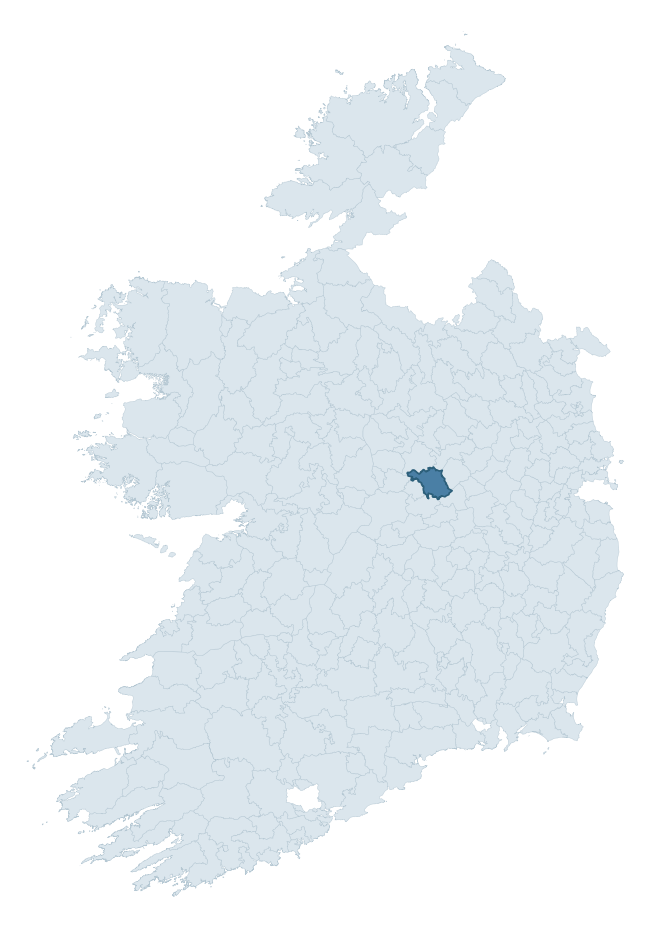
Where this barony sits in the Republic of Ireland
Geology and preservation
Bedrock geology shapes the landscape long before any settlement begins — controlling soil drainage, agricultural potential, the survival of upstanding monuments, and the preservation of buried archaeology. The figures below come from the Geological Survey Ireland 1:100,000 bedrock map.
The bedrock underlying Moycashel is predominantly limestone (97% of the barony by area), laid down during the Carboniferous period (100% by area, around 359 to 299 million years ago). Limestone is the most heritage-rich bedrock in Ireland. It supports fertile, well-drained soils that favoured dense Early Medieval settlement and Norman manorial agriculture, and it weathers into karst features — sinkholes, caves, swallow holes, and souterrains — that frequently carry archaeology. Where peat overlies limestone, organic preservation can be exceptional. The single largest mapped unit is the Waulsortian Limestones (37% of the barony's bedrock). With only 2 distinct rock types mapped, the barony is geologically uniform compared to the rest of the Republic (13th percentile for diversity) — a single coherent bedrock landscape.
Rock type composition
Largest mapped unit: Waulsortian Limestones (37% of the barony)
Placename evidence
Logainm records 34 heritage-diagnostic placenames for Moycashel, drawn from townland and civil-parish names across the barony. The dominant stratum is Early Christian ecclesiastical — cill-, teampall-, and domhnach-prefixed names that record the dense network of early church foundations established between the fifth and tenth centuries. The leading diagnostic roots are cill- (20 — church), lios- (5 — ringfort or enclosure), and gráinseach- (3 — grange). This is broadly in line with the ROI average of 30.7 heritage placenames per barony. The presence of multiple heritage strata side by side indicates layered occupation of the landscape across successive prehistoric and historic periods. Logainm records 171 placenames for Moycashel (predominantly townland names). Of these, 34 (20%) carry one of the diagnostic Gaelic roots tracked above; the remainder draw on more generic landscape vocabulary that does not encode a heritage period.
Pre-Christian / Early Medieval Defensive
| Root | Count | Meaning |
|---|---|---|
| lios- | 5 | ringfort or enclosure |
| ráth- | 2 | earthen ringfort |
| caiseal- | 1 | stone ringfort |
Early Christian Ecclesiastical
| Root | Count | Meaning |
|---|---|---|
| cill- | 20 | church (early) |
| gráinseach- | 3 | monastic farm / grange |
| cillín- | 2 | unconsecrated burial ground |
| teampall- | 1 | church (later medieval) |
Burial, Ritual, and Norse-Contact
| Root | Count | Meaning |
|---|---|---|
| gall- | 2 | foreigner — Norse settlement marker |
Other baronies in Westmeath

Explore further
Grounding History: 10 Maps of Northern Ireland’s Past
If you’re interested in Irish heritage more widely, the companion report for Northern Ireland brings together the analysis of all 462 NI wards into one place through 10 high-quality maps — covering monument density, archaeological periods, placename heritage, terrain, wetland, and the historic landscape at first survey. Take a look.
About this profile
Click any section below to expand.
What is a barony?
A barony is a historic administrative unit in Ireland, broadly equivalent to an English hundred. The 280 baronies used here are from the OSi 2019 National Statutory Boundaries (generalised 20m), covering the 26 counties of the Republic of Ireland. Baronies derive from the Norman period, were formalised in the 17th century, and have not been redrawn for statistical purposes. They vary enormously in area, from compact urban baronies in Dublin to vast upland baronies in Connacht, and should not be compared by raw site count without accounting for area differences.
What counts as a site?
This profile combines three distinct heritage registers, each with its own definition of what constitutes a recordable site:
- Archaeological sites (NMS). The National Monuments Service Sites and Monuments Record (SMR) catalogues every known archaeological monument or site of archaeological interest in the Republic, from prehistoric burial mounds and ringforts to medieval churches and post-medieval defensive works. Inclusion does not require legal protection — only that the site has been identified, surveyed, and assessed as having archaeological value. A separate subset of these sites lies within a recorded protection zone, which gives them statutory protection under the National Monuments Acts.
- Listed buildings (NIAH). The National Inventory of Architectural Heritage records buildings of architectural, historical, archaeological, artistic, cultural, scientific, social, or technical interest. Each surveyed structure is appraised on a five-tier scale: International, National, Regional, Local, and Record-Only. The NIAH appraisal is informational rather than strictly statutory, but it underpins local-authority Record of Protected Structures (RPS) listings.
- Heritage placenames (Logainm). Logainm is the authoritative database of Irish placenames maintained by the Placenames Branch. This profile applies a heritage-diagnostic classifier to the Irish-language form of each townland name, flagging roots that signal defensive sites (ráth-, lios-, dún-, caiseal-, cathair-), ecclesiastical foundations (cill-, teampall-, domhnach-, mainistir-), prehistoric burial-ritual features (tuaim-, carn-, leaba-), or Norse-contact settlement (gall-). Townlands without one of these diagnostic roots are not flagged here — they may still carry historical significance, but that significance is not encoded in the name itself.
Editorial principles
The narrative sections of this profile follow several explicit principles:
- Evidential. Every claim about this barony’s heritage character is anchored in the underlying register data. Where a site count, a placename count, or a percentile rank is cited, it is computed from the source datasets at export time, not estimated.
- Comparative. Counts and metrics are reported alongside their percentile rank against the other 279 ROI baronies. A barony with 50 ringforts in absolute terms could be unusually high or unusually low depending on its size and regional context; percentile ranking removes that ambiguity.
- Transparent on limits. Where a register has known coverage gaps, survey biases, or data-quality issues that affect this barony’s figures, the profile flags them rather than presenting the numbers as definitive.
- No interpretation beyond what the data supports. The narrative does not speculate about historical events, social dynamics, or cultural meaning beyond what the recorded heritage and placename evidence directly attests.
Data caveats and limits
- NMS Sites and Monuments Record is the product of survey campaigns conducted at different intensities across different counties and decades. Some baronies have been surveyed more thoroughly than others, and absolute counts should be read in that light. Sites destroyed by development before survey are typically not represented; sites in heavily forested or upland terrain are sometimes under-recorded.
- NIAH coverage is broadly complete for the Republic of Ireland but the survey was conducted on a rolling county-by-county basis, and the most recent appraisal date varies. Buildings demolished or substantially altered after their original survey may still appear in the register; conversely, recent buildings of merit may not yet have been appraised.
- Logainm classification applies a deliberately conservative pattern-matching approach to the Irish-language townland forms. The classifier prioritises true positives over recall: a townland may carry a heritage signal that the classifier doesn’t recognise, particularly where the diagnostic root has been heavily anglicised or where the townland name draws on a less common term. The 60,000+ townland records and ~9,800 classified placenames give a substantial signal at barony scale, but individual townland names should be checked against Logainm directly for definitive interpretation.
- Period attribution. The chronological distribution reflects only those NMS sites that carry a recognised period attribution in the source data. Sites listed as “Unknown” period are excluded from the dated subset.
- Boundary changes. Some baronies have undergone minor boundary adjustments since their 19th-century definition; the OSi 2019 generalised boundaries used here are the current statutory definition and may differ slightly from historical maps in border areas.
- Bedrock geology is mapped at 1:100,000 scale, which means local variation within a barony — small pockets of different rock type, mineral veins, alluvium overlying bedrock — is generalised. The dominant-system and rocktype figures are area-weighted, so a barony reading “70% Carboniferous limestone” may still contain small but archaeologically important pockets of older or younger rock. Around 3% of GSI polygons do not match the lexicon and contribute no rocktype or system attribution.
Data sources
- National Monuments Service — Sites and Monuments Record (SMR) https://data.gov.ie/dataset/national-monuments-service-archaeological-survey-of-ireland
- National Inventory of Architectural Heritage (NIAH) https://data.gov.ie/dataset/national-inventory-of-architectural-heritage-niah-national-dataset
- Logainm — Placenames Database of Ireland https://www.logainm.ie/
- Ordnance Survey Ireland — National Statutory Barony Boundaries 2019 https://data-osi.opendata.arcgis.com/
- EURODEM — European Digital Elevation Model https://www.mapsforeurope.org/datasets/euro-dem
- ESA WorldCover https://esa-worldcover.org/en
- Geological Survey Ireland — 1:100,000 Bedrock Geology https://www.gsi.ie/en-ie/data-and-maps/Pages/Bedrock.aspx
Explore more: Search any of the 280 ROI baronies, browse by historical province, or read the methodology and data sources for the full Republic of Ireland Heritage Tool.