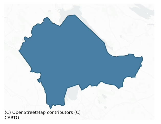
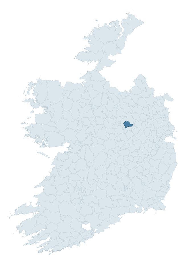
Corkaree is a barony of County Westmeath, in the historical province of Leinster (Irish: Corca Raoi), covering 109 km² of land. The barony records 357 NMS archaeological sites and 70 NIAH listed buildings, placing it at around the 86th percentile among 280 ROI baronies for sites per km². This means it is in the top fifth of all baronies for sites per km². Dated archaeological evidence runs from the Mesolithic through to the Post Medieval, spanning 6 of 9 archaeological periods, placing the barony in the 17th percentile among 280 ROI baronies for chronological depth. This means it is in the bottom fifth of all baronies for chronological depth. The largest dated subset of recorded sites dates to the Early Medieval.

Heritage at a glance
Percentile rankings throughout this profile compare each barony only against the other 279 Republic of Ireland baronies.
The recorded heritage of Corkaree
The National Monuments Service Sites and Monuments Record (SMR) is the statutory inventory of archaeological sites for the Republic of Ireland, maintained by the Department of Tourism, Culture, Arts, Gaeltacht, Sport and Media. Sites recorded here include earthworks, ringforts, megalithic tombs, ecclesiastical remains, and post-medieval features; not every record is legally protected, but each is registered as a monument of archaeological interest.
The National Monuments Service records 357 archaeological sites in Corkaree, putting it at the 86th percentile among 280 ROI baronies for sites per km². This means it is in the top fifth of all baronies for sites per km². Protection coverage is near-universal — 347 sites (97%) fall within a recorded monument protection zone, indicating an extensively surveyed landscape. The dominant category is defensive sites — ringforts, enclosures, hillforts, and stone forts (250 sites, 70% of the record). Ringfort – rath is the most prevalent type, making up 47% of the barony's recorded sites (167 records) — well above the ROI average of 20% across all baronies where this type occurs. Ringfort – rath is an earthen ringfort enclosed by a bank and external ditch — the most common Early Medieval farmstead, broadly dated 500–1000 AD. Other significant types include Ringfort – unclassified (37) and Standing stone (10). Ringfort – unclassified is a circular Early Medieval settlement enclosure where surviving evidence does not allow distinction between earthen and stone forms; Standing stone is a deliberately set upright stone, used variously as a Bronze/Iron Age burial marker, route marker or commemorative monument. Across the barony's 109 km², this gives a recorded density of 3.27 sites per km².
Most common monument types
Hover or tap a monument type to see its definition.
| Type | Count |
|---|---|
| Ringfort – rath an earthen ringfort enclosed by a bank and external ditch — the most common Early Medieval farmstead, broadly dated 500–1000 AD | 167 |
| Ringfort – unclassified a circular Early Medieval settlement enclosure where surviving evidence does not allow distinction between earthen and stone forms | 37 |
| Standing stone a deliberately set upright stone, used variously as a Bronze/Iron Age burial marker, route marker or commemorative monument | 10 |
| Crannog an artificial or partly artificial island built up on a lake or river bed, in use from the 6th to 17th centuries AD | 8 |
| Church a building used for public Christian worship, of any date from c. 500 AD onwards | 8 |
| Moated site | 8 |
| Hut site a low stone or earthen foundation enclosing a small circular or oval area, generally interpreted as a former dwelling, of any date from prehistory to the medieval period | 8 |
| Castle – unclassified a castle whose form cannot be precisely classified, dating somewhere between the late 12th and 16th centuries | 7 |
Chronological distribution
The dated archaeological record for Corkaree spans from the Mesolithic through to the Post Medieval, with activity attested across 6 of 9 archaeological periods. This is the 17th percentile across ROI baronies — a relatively narrow chronological band, with much of Irish prehistory not represented in the dated record. The record is periodic rather than continuous: the Neolithic, and Middle Late Bronze Age periods fall inside the chronological span but record no dated sites — likely reflecting either genuine settlement discontinuity or limits of survey attribution. Activity concentrates most heavily in the Early Medieval (203 sites, 62% of dated material), with the Iron Age forming a secondary peak (49 sites, 15%). A further 28 recorded sites (8% of the overall NMS register for the barony) carry no period attribution — appearing as 'Unknown' in the bar chart below. This typically reflects either records that pre-date the standardised period vocabulary or sites awaiting specialist dating review, rather than a genuine absence of chronological evidence.
Sample of recorded monuments
Show 25 sample monuments (of 357 total)
A representative sample of 25 recorded monuments drawn from the barony’s 357 total NMS entries. Sites within a recorded monument protection zone and rarer site types are prioritised so the list shows a meaningful cross-section rather than only the most common type. Each entry shows the official Sites and Monuments Record reference number and the description published by the National Monuments Service.
Religious house – Franciscan friars
Franciscan friary which was founded by William Delamar in the thirteenth century and was reformed into an observant order in 1460 (Gwynn & Hadcock 1988, 241, 256). The patronage of the friary changed to the Nugents…
Franciscan friary which was founded by William Delamar in the thirteenth century and was reformed into an observant order in 1460 (Gwynn & Hadcock 1988, 241, 256). The patronage of the friary changed to the Nugents after the extinction of the Delamere line. In 1540 the friars had abandoned the friary which was described as consisting of 'a hall with buttery and kitchen, a church with cloister and a chapter-house beneath a dormitory, another hall with a chamber and other offices, all in sufficient repair, also a malt-house, brew-house and bakery, cemetery with a small wood, a garden, orchard and close, the site of 6 or more acres being surrounded with ditches of running water; outside were 43 acres of land, and a small island' (Gwynn & Hadcock 1988, 256). The friary was twice burnt and it was raided by the English at least six times between 1590 and 1617 (Gwynn & Hadcock 1988, 256). Today the franciscan abbey is still in use and incorporates portions of the medieval structure (SMR file). The medieval S transept forms the nave of the present Franciscan church.. The archway under tower is now a chapel shrine to St. Anthony (SMR file).
Ecclesiastical site
Situated in an area of pasture-land. Religious House-Franciscan Friars (WM006-058—-) 190m to NE. Depicted on the 1837 ed. OS 6-inch map as ‘convent’, adjoining the townland boundary between Abbeyland and Multyfarnham.…
Situated in an area of pasture-land. Religious House-Franciscan Friars (WM006-058—-) 190m to NE. Depicted on the 1837 ed. OS 6-inch map as ‘convent’, adjoining the townland boundary between Abbeyland and Multyfarnham. The convent buildings depicted on the 1837 ed. OS 6-inch map have been levelled, and no trace of any buildings survive.
Compiled by: Frank Coyne & Caimin O'Brien
Date of upload: 1 February 2017
Souterrain
There is no paper file in the ASI archive for this monument. Not listed in the Westmeath SMR (1985), listed in the Westmeath RMP (1996) as 'Souterrain'. Excavation by Sylvia Desmond for Judith Carroll & Co. Ltd under…
There is no paper file in the ASI archive for this monument. Not listed in the Westmeath SMR (1985), listed in the Westmeath RMP (1996) as 'Souterrain'. Excavation by Sylvia Desmond for Judith Carroll & Co. Ltd under licence No. 99E0036, located the site of the souterrain as well as an unrecorded ringfort (WM006-082—-). The results of this excavation were summarised as follows; 'Eleven test-trenches were excavated by machine, during January 1999, on the site of a souterrain. It was proposed to erect two houses within the general area of this monument, the exact location of which was not known before the test excavations.
Five trenches for House 1, which varied from 10m to 20m long and were all 1.5m wide, were excavated by machine down to natural boulder clay, which was revealed at 0.3m below the sod. These trenches, in the southern portion of the site, revealed no archaeological remains.
A further six trenches, including a small cut for a sewage tank, ranging from 10m to 20m long and 1.5m wide, were excavated in the northern portion of the site for House 2. All of these trenches revealed charcoal flecking and archaeological features. The trenches revealed that the souterrain lay within the central area of the proposed location for this house. The souterrain passage ran completely across the width of the site for House 2 in an east-west direction. It was traced for a length of 25m, and it was obvious that it extended out under the present Multyfarnham road. The souter…
House – 17th century
The precise location of a possible early 17th century house described in the terrier of the Down Survey has not been identified. The terrier of the 1659 Down Survey map of Multyfarnham parish stated that 'There is…
The precise location of a possible early 17th century house described in the terrier of the Down Survey has not been identified. The terrier of the 1659 Down Survey map of Multyfarnham parish stated that 'There is likewise Donowre upon the side of the Lough Derevarrah a very Handsome English like House with an orchard adjoining to it well planted with good Fruit Trees' (NLI MS 723-4). In 1640 this house belonged to Andrew Nugent described in the Down Survey as an 'Irish papist' and owner of 423 acres of profitable land in Donore (ibid.). Andrew Nugent of Donore had a special livery of his estate dating 3rd April 1629. In 1641 he was appointed a captain in the Irish army, and commanded one hundred men at Kilsoghlin, to defend that place against the English, for which he was indicted (Burke 1832, 248-9). This house may have been built on the site of a medieval castle belonging to his father Richard Nugent. In 1613 an inquisition into the property of the deceased Richard Nugent of Donore recorded that he possessed 1 castle & 240 acres of land in the townland of Donowre which formed part of the manor of Multyfarnham (Cal. inq. post mortem, 11 Jas 1).
This house is shown standing close to the shoreline of Lough Derravaragh in the NW quadrant of Donore townland on the 1659 Down Survey map of Multyfarnham parish. On this map the building is depicted as a single pile two storey high house aligned E-W with attic and gable ended chimney stacks on both gables rising above th…
Pier/Jetty
A survey of the findspot of a dug out canoe recorded that 'a short distance from the canoe are the remains of a stake on the shoreline, while at least three pieces of beams lie on the shore partly submerged in the…
A survey of the findspot of a dug out canoe recorded that 'a short distance from the canoe are the remains of a stake on the shoreline, while at least three pieces of beams lie on the shore partly submerged in the water. These may be the remains of a jetty.' (ASI Survey Report 3 June 1982)
Compiled by: Caimin O'Brien
Date of upload: 13 May 2013
Prehistoric site – lithic scatter
Situated on the S shoreline of Lough Derravaragh. The Mesolithic shoreline of the lake was exposed after the Inny River was drained in the 1960s resulting in the lowering of the water level on Lough Derravaragh (Little…
Situated on the S shoreline of Lough Derravaragh. The Mesolithic shoreline of the lake was exposed after the Inny River was drained in the 1960s resulting in the lowering of the water level on Lough Derravaragh (Little 2014, 2). Described as Site 4 by Professor Frank Mitchell (Mitchell 1972, 170). The chert at Lake Derravaragh has an unusual banded structure and disintegrates easily on exposure to the weather. Site 4 was described by Mitchell as 'a knoll of higher ground, rising to 80m, composed of rock and glacial deposits. Along the foreshore there was a thin scatter of chert debitage' (Mitchell 1972, 170). Today there are no surface remains visible of this lithic scatter.
Compiled by: Frank Coyne & Caimin O'Brien
Date of upload: 2 February 2017
Sweathouse
Situated inside a 19th tree plantation on the demesne lands of Clonhugh House located 530m to NW. On a slight rise of ground on the E shore of Lough Owel. Ringfort (WM011-107—) 180m to NW. A small sub-circular…
Situated inside a 19th tree plantation on the demesne lands of Clonhugh House located 530m to NW. On a slight rise of ground on the E shore of Lough Owel. Ringfort (WM011-107—) 180m to NW. A small sub-circular shaped chamber (dims. 0.9m NW-SE; 0.75m NE-SW; H 1.15m) built of limestone with brick in the upper courses, accessed by a limestone rubble-built passage (L 1.7m; H 0.75m) leading from the NW. The passage is entered via three stone steps.
Compiled by: Frank Coyne and Caimin O'Brien
Date of upload: 25 August 2017
Standing stone (present location)
Situated on grassland. Ringfort (WM012-002—-) 40m to E, chapel (WM012-003—-) 190m to SE. Depicted on the 1837 OS Fair Plan map and annotated as ‘standing stone’. A tall roughly dressed limestone pillar (H 1.6m;…
Situated on grassland. Ringfort (WM012-002—-) 40m to E, chapel (WM012-003—-) 190m to SE. Depicted on the 1837 OS Fair Plan map and annotated as ‘standing stone’. A tall roughly dressed limestone pillar (H 1.6m; Dims. 0.25m x 0.21m) stands at the end of a field fence running NE-SW, a short distance from where it is marked on the 1837 OS Fair Plan map. A small round depression in one face suggests that it was used as a gate post. Standing stone was possibly moved from location marked on 1837 map to present location in modern times. Cross-referenced with WM012-210—-.
Compiled by: Frank Coyne and Caimin O'Brien
Date of upload: 30 August 2017
Building
Situated on the S face of a slight ridge, overlooked by higher ground to the N, with poorly drained lands to the W. Stream running roughly N-S lies 40m to E. Tyfarnham church site (WM012-003—-) and surrounding…
Situated on the S face of a slight ridge, overlooked by higher ground to the N, with poorly drained lands to the W. Stream running roughly N-S lies 40m to E. Tyfarnham church site (WM012-003—-) and surrounding earthworks lie 150m to N. Depicted on the 1837 OS Fair Plan map as a small rectilinear-shaped earthwork, and annotated as a ‘fort’. A rectangular-shaped area (approx. dims. 12m NW-SE; 14m NE-SW) enclosed by a slight earth and stone bank, and a narrow shallow fosse, with entrance gap (Wth 0.9m) at E. This earthwork appears to be located in the N quadrant of a large sub-triangular-shaped earthwork visible on Digital Globe aerial photograph taken November 2011. It is not clear if this large sub-triangular-shaped earthwork is a pre-1700 archaeological monument or the remains of post-1700 land reclamation works. Tyfarnham church is depicted on the 1654-56 Down Survey map of Leny and Tyfarnan parish where it is depicted standing beside a building (NLI, MS 723-4). The terrier of the Down Survey parish of Tyfarnan recorded that in this parish are 'Scituate the Hall & Church of Tyfarnan' (ibid.) This rectangular-shaped earthwork may represent the levelled remains of the 'Hall'.
Compiled by: Frank Coyne and Caimin O'Brien
Date of upload: 15 November 2017
Ceremonial enclosure
Situated on the SE face of a high ridge in hilly grass-land surrounded by hills. Ringfort (WM012-026—) 250m to NW. This site was almost completely levelled in the 1960s. An unusually large, slightly raised…
Situated on the SE face of a high ridge in hilly grass-land surrounded by hills. Ringfort (WM012-026—) 250m to NW. This site was almost completely levelled in the 1960s. An unusually large, slightly raised circular-shaped area (approx. diam. 61m WNW-ESE; 62m NNE-SSW) enclosed by a shallow internal fosse and poorly preserved earthen bank with possible entrance gap at ENE. The interior slopes slightly from NW-SE. A field fence running NE-SW intersects the monument at NW. This site is clearly visible on Digital Globe aerial photograph taken November 2011.
See attached profile of monument surveyed and drawn by the ASI.
Compiled by: Frank Coyne and Caimin O'Brien
Date of upload: 13 December 2017
Designed landscape feature
There is no paper file in the ASI archive for this monument. In grassland with ringfort (WM012-084—-) 90m to NE. Depicted on the OSi 25-inch map as a large D-shaped-shaped area (dims. c. 125m NE-SW x 118m NW-SE)…
There is no paper file in the ASI archive for this monument. In grassland with ringfort (WM012-084—-) 90m to NE. Depicted on the OSi 25-inch map as a large D-shaped-shaped area (dims. c. 125m NE-SW x 118m NW-SE) defined by a scarp immediately to the SE of Woodland House. Outline of designed landscape feature, possibly a ha-ha is visible on Digital Globe orthoimage taken between 2011-13.
Compiled by: Caimin O'Brien
Date of upload: 16 August 2023
Barrow – unclassified
Situated on a natural rise in undulating grassland with good views over Lough Owel 230m to SW. Depicted on the 1837 OS Fair Plan map as an oval shaped earthwork with circular feature in centre and annotated as ‘fort’.…
Situated on a natural rise in undulating grassland with good views over Lough Owel 230m to SW. Depicted on the 1837 OS Fair Plan map as an oval shaped earthwork with circular feature in centre and annotated as ‘fort’. The depiction of this monument on the 1837 ed. OS 6-inch map may suggest that this was the site of a burial site or possible ring barrow rather than that of a ringfort. No surface remains visible of levelled monument. Visible as a circular crop mark (approx. diam. 22m N-S) on Digital Globe aerial photograph taken November 2011.
Compiled by: Frank Coyne and Caimin O'Brien
Date of upload: 19 February 2018
Mill – unclassified
No paper file or documentary source known for this mill site in the archives of the National Monuments Service. The source of information on this monument has not been identified.
Compiled by: Caimin O'Brien
Date…
No paper file or documentary source known for this mill site in the archives of the National Monuments Service. The source of information on this monument has not been identified.
Compiled by: Caimin O'Brien
Date of upload: 23 July 2015
Cross-inscribed stone
Described in 1980 as 'a flat sandstone slab (L 0.67m; Wth 0.28m) with an incised cross in the centre surrounded by a lightly incised pattern of rectangles. This stone lies on the ground about 2m west of the west end of…
Described in 1980 as 'a flat sandstone slab (L 0.67m; Wth 0.28m) with an incised cross in the centre surrounded by a lightly incised pattern of rectangles. This stone lies on the ground about 2m west of the west end of the church (WM011-145—-)' (SMR file, 15/10/1980).
See attached rough sketch of graveslab drawn in 1980.
Compiled by: Caimin O'Brien
Date of upload: 24 June 2010
Cross
Described in 1980 as 'Almost 6m west of the west wall of the ruin (WM011-145—-) is a small broken cross (H 0.9m; Wth c. 0.22m; T 0.12m) with a solid ring. The cross is of limestone and bears no inscription. The…
Described in 1980 as 'Almost 6m west of the west wall of the ruin (WM011-145—-) is a small broken cross (H 0.9m; Wth c. 0.22m; T 0.12m) with a solid ring. The cross is of limestone and bears no inscription. The workmanship suggests a late medieval date at the earliest' (SMR file) the cross is located to the W of a medieval church ruins (WM011-145—-) standing inside a ciruclar shaped graveyard (WM011-145004-) with bowl-barrow (WM011-144—-) 220m to W.
See attached rough sketch of cross drawn in 1980.
Compiled by: Caimin O'Brien
Date of upload: 24 June 2010
Sheela-na-gig
St. Munna's Church standing in centre of graveyard (WM012-076001-) with Taghmon Castle (WM012-074—-) 150m to NW and motte and bailey (WM012-079—-) 350m to SE. Sheela-na-gig located over trefoil window in N wall of…
St. Munna's Church standing in centre of graveyard (WM012-076001-) with Taghmon Castle (WM012-074—-) 150m to NW and motte and bailey (WM012-079—-) 350m to SE. Sheela-na-gig located over trefoil window in N wall of 15th century Taghmon church (WM012-076—-); not in original location (Freitag 2004, 142). Described in 1980 as following; ‘The more westerly window in the north wall has a sheela-na-gig (WM012-076002-) above it (also of sandstone)’ (SMR File, 24/10/1980).
Described by Freitag as a, ‘figure carved on slab in seated position. Big head without ears; pained expression on face, with mouth wide open, baring two rows of teeth. Two indentations for eyebrows and clearly marked nostrils. Big hands clasping tightly flexed knees. Lower legs held apart, revealing big oval pudenda with round hole in middle. Lower part of carving missing’ (Freitag 2004, 142).
Compiled and revised by: Caimin O'Brien
Date of revised upload: 27 January 2015
Cross-slab
Situated on rising ground with commanding views to the W, N and E. Ruins of medieval nave and chancel church (WM006-037—-) stands in N quadrant of rectangular-shaped graveyard (WM006-037001-). Medieval church built…
Situated on rising ground with commanding views to the W, N and E. Ruins of medieval nave and chancel church (WM006-037—-) stands in N quadrant of rectangular-shaped graveyard (WM006-037001-). Medieval church built on site of Early Christian monastery of Lecan-Midhe mentioned in 750 when the Annals of Ulster recorded the death of ‘Fursu, abbot of Lecan Midhe’ (AU, 215). According to O’Donovan the monastery was founded by St. Cruimín whose feastday was celebrated here on June 28th (AFM, 349). According to the Martyrology of Tallaght a second feastday to St. Cruimín (Croimín) fell on the 29th of December (Ó Riain 2011, 237). Early Christian sandstone cross-slab (L 1.15m; Wth 0.45m; T 0.1m) reused as lintel over doorway in S wall of church (WM006-037—-) (Swan 1988, 9). Sandstone slab containing an incised double-lined cross with circular centre and semi-circular or D-shaped terminals contained within an incised double-lined rectangular-shaped frame. The edge of the cross-slab has been broken off and part of the arm of the cross along with the incised frame is now missing.
See attached drawing of cross-slab by Kevin O'Brien, OPW taken from SMR File.
Compiled and revised by: Caimin O’Brien
Date of revised upload: 5 August 2015
Water mill – unclassified
In 1682 Sir Henry Piers of Tristernagh described the route of the River Gaine and the mills and bridges along its route. He wrote the following about the bridge (WM007-123—-) at Multyfarnham; 'it passeth to…
In 1682 Sir Henry Piers of Tristernagh described the route of the River Gaine and the mills and bridges along its route. He wrote the following about the bridge (WM007-123—-) at Multyfarnham; 'it passeth to Multifornan, where it falleth under another large bridge; thence to a mill, whence immediately it watereth the ground of the late Friery of Multifernan (WM006-058—-)' (Vallancey 1786, 6). The 'Corn Mill' depicted standing on the banks of the River Gaine on the 1837 ed. OS 6-inch map may have been built on site of or in close proximity to the medieval mill of Multyfarnham.
Compiled by: Caimin O'Brien
Date of upload: 6 December 2016
Bawn
Standing on rock outcrop, atop high ground with commanding views of the surrounding countryside from SW-W-N-NE, with limited views to E. Rectangular shaped tower house (WM011-012—-) standing two storeys high with…
Standing on rock outcrop, atop high ground with commanding views of the surrounding countryside from SW-W-N-NE, with limited views to E. Rectangular shaped tower house (WM011-012—-) standing two storeys high with long axis aligned NW-SE standing on NW side of levelled bawn (WM011-012001-) with levelled 18th century house built onto NE face of castle. Low scarp and wall footings or facing of levelled bawn wall visible on all sides of the castle.
Compiled by: Caimin O’Brien
Date of upload: 19 July 2017
Settlement deserted – medieval
A church (WM012-003—-) and a medieval hall or building (WM012-023—-) are depicted on the 1654-56 Down Survey map of Leny and Tyfarnham parish (NLI, MS 723-4). The terrier of the Down Survey parish map recorded…
A church (WM012-003—-) and a medieval hall or building (WM012-023—-) are depicted on the 1654-56 Down Survey map of Leny and Tyfarnham parish (NLI, MS 723-4). The terrier of the Down Survey parish map recorded that in this parish are 'Scituate the Hall & Church of Tyfarnan' (ibid.)
Tyfarnham church is annotated as a 'Chapel' on the 1837 ed. OS 6-inch map where it is shown standing in the W quadrant of a churchyard (WM012-003001-). The levelled chapel stands in a field covered with numerous rectilinear earthworks clustered to the NE and which are clearly visible on Digital Globe aerial photograph taken November 2011. The earthworks appear to form a series of small rectangular enclosures and may represent a clustered settlement contemporaneous with the church and hall. In the NE corner of this field are the remains of a square-shaped enclosure . Immediately S of the chapel there is a curving linear earthwork which possibly represents the remains of a sunken way or roadway. Cultivation ridges running roughly E-W and N-S are also visible on the aerial photographs. A rectangular-shaped earthwork (WM012-023—-) located 155m to the S may represent the remains of the 'Hall' depicted on the 1654-56 Down Survey map of Leny and Tyfarnham parishes.
Compiled by: Caimin O'Brien
Date of upload: 16 November 2017
Barrow – ditch barrow
Situated in grassland, with large possible ceremonial enclosure (WM012-027—) 80m to NNW. Cropmark of curving ditch of possible barrow (approx. diam. 8m) visible from SSE-S-W only on Digital Globe aerial photograph.…
Situated in grassland, with large possible ceremonial enclosure (WM012-027—) 80m to NNW. Cropmark of curving ditch of possible barrow (approx. diam. 8m) visible from SSE-S-W only on Digital Globe aerial photograph.
See attached image taken from Digital Globe aerial photographs supplied by Brian Doyle
Compiled by: Caimin O'Brien based on details kindly provided by Brian Doyle
Date of upload: 18 February 2019
Castle – motte and bailey
Situated on low lying ground on the E bank of the Inny River. A fording point over the river is depicted here on the 1837 ed. OS 6-inch map and an eel weir is also shown to the N of the motte. Ringfort (WM006-033—-)…
Situated on low lying ground on the E bank of the Inny River. A fording point over the river is depicted here on the 1837 ed. OS 6-inch map and an eel weir is also shown to the N of the motte. Ringfort (WM006-033—-) 550m to NE. Moated site (WM006-051—-) 750m to SE. On the 1837 OS Fair Plan map the monument is marked as 'Moat' and as 'Ballyharney Fort'. A steep-sided flat-topped earthen mound (top diam. 10m N-S; 10.5m E-W), enclosed by a fosse (Wth 5m) visible at SW only. Part of the mound has been quarried away on the NW and NE, and spoil from the dredging of the Inny River has been dumped against the W side of the monument. Small square shaped field (approx. dims. 40m N-S; 45m E-W) immediately E of motte visible on Digital Globe aerial photograph taken November 2011 may represent the remains of a bailey area.
Compiled by: Frank Coyne & Caimin O'Brien
Date of upload: 31 January 2017
Penitential station
Situated in the middle of the public road at a T-Junction. Lackan Chapel (WM006-037—-) and graveyard (WM006-037001-) 500m to N and Tobercrummeen holy well (WM006-064—-) 320m to SE. Depicted on the 1837 ed. OS…
Situated in the middle of the public road at a T-Junction. Lackan Chapel (WM006-037—-) and graveyard (WM006-037001-) 500m to N and Tobercrummeen holy well (WM006-064—-) 320m to SE. Depicted on the 1837 ed. OS 6-inch map as ‘Monument’ and shown located in the centre of the public road. On the revised 1911 ed. OS 6-inch map the location is depicted as 'Monument (Site of)' which indicates that the structure was removed or levelled between 1837 and 1911. Today there are no surface remains visible. The 1837 Ordnance Survey Name Book (No. 35, 13) for Lackan Parish described the monument as a 'heap of stones at which the peasantry lay down corpses to pray for them’ (SMR File).
Compiled by: Frank Coyne & Caimin O'Brien
Date of upload: 1 February 2017
Mound
Surveyed in 2012 and described by McGuinness (2012, 31) as following: ‘Not located. The grass was high in these fields, possibly obscuring low-visibility features, although the local landowner claimed to know of no…
Surveyed in 2012 and described by McGuinness (2012, 31) as following: ‘Not located. The grass was high in these fields, possibly obscuring low-visibility features, although the local landowner claimed to know of no sites other than the bowl-barrow (WM007-075—-)’.
Compiled by: Caimin O'Brien based on details provided by David McGuinness.
Date of upload: 22 April 2016
Ringfort – rath
The monument was surveyed in 1980 and described as following; ‘This is a roughly circular earthwork bounded by an uneven scarp, now much defaced with a wide shallow fosse at its foot from north to east the fosse is…
The monument was surveyed in 1980 and described as following; ‘This is a roughly circular earthwork bounded by an uneven scarp, now much defaced with a wide shallow fosse at its foot from north to east the fosse is represented by a fairly flat ledge, beyond which the ground falls away naturally. From east to south to west to north there is a wide low outer bank of earth beyond the fosse. The interior is quite uneven with rises & a general slope from the centre towards the SE. The interior measures approx. 29m NW-SE by approx. 27m NE-SW. Sited on the lower slope of a NE facing rise’ (SMR File 15/10/1980). Outline of monument clearly visible on aerial photograph taken in 1966 (CUCAP APE035/036) which shows the monument standing inside a larger rectangular enclosure or field. The outline of this monument is clearly visible on Digital Globe aerial photograph taken November 2011.
Monument revisited in 1981 and described as following; ‘Site noted from St. Joseph (CUCAP APE036) and G. S. [Geological Survey] Air photographs in 1976. The site appears to be a destroyed ringfort. On the northern sloping face of a steepish hill. The site appears to be circular, or perhaps slightly oval (int. diam. 32.5m N-S; 32m E-W). The raised interior in enclosed by a fosse, with traces of an outer bank to the S, E & W. On the northern side the fosse and outer bank have been interfered with by old field fences which appear to have respected the site. These have since been removed, and…
Listed buildings
The National Inventory of Architectural Heritage (NIAH) is a state survey appraising buildings of architectural, historical, archaeological, artistic, cultural, scientific, social, or technical interest. Each surveyed structure receives a rating from International (the highest, for buildings of European importance) through National, Regional, Local, and Record-Only.
The NIAH records 70 listed buildings in Corkaree (38th percentile across ROI baronies). The highest-graded structures include 4 of National significance. The Republic holds 937 National-graded buildings in total, so this barony accounts for around 0% of the national total. Construction dates concentrate most heavily in the Victorian (1830-1900) period.
Terrain and environment
Mean elevation across the barony is 95m — the 58th percentile among 280 ROI baronies for elevation. This means it is in the upper half of all baronies for elevation. Elevation matters for heritage because higher-altitude baronies typically favour defensive monuments — ringforts and hilltop forts placed on prominent ground — while lowland baronies are more likely to carry the dense settlement and church networks of intensive agricultural landscapes. A maximum elevation of 198m gives the barony meaningful vertical relief. Mean slope is 3.7° — the 52nd percentile among 280 ROI baronies for slope. This means it is in the upper half of all baronies for slope. Slope is a key control on both land use and archaeological preservation: steep ground resists ploughing and tends to preserve earthworks intact, while gentle slopes favour intensive cultivation that damages or destroys surface archaeology over time. The Topographic Wetness Index averages 10.9, the 52nd percentile among 280 ROI baronies for wetness. This means it is in the upper half of all baronies for wetness. Drainage matters for heritage because poorly-drained ground preserves organic archaeology (wooden trackways, leather, textiles, and on rare occasions human remains) far better than free-draining soil; well-drained ground favours arable use but destroys organic material rapidly. The land-cover mosaic combines improved grassland (66%), woodland (16%), and open water (10%), giving a mixed agricultural and semi-natural landscape.
Terrain measurements
Where this barony sits in the Republic of Ireland
Geology and preservation
Bedrock geology shapes the landscape long before any settlement begins — controlling soil drainage, agricultural potential, the survival of upstanding monuments, and the preservation of buried archaeology. The figures below come from the Geological Survey Ireland 1:100,000 bedrock map.
The bedrock underlying Corkaree is predominantly limestone (56% of the barony by area), laid down during the Carboniferous period (100% by area, around 359 to 299 million years ago). Limestone is the most heritage-rich bedrock in Ireland. It supports fertile, well-drained soils that favoured dense Early Medieval settlement and Norman manorial agriculture, and it weathers into karst features — sinkholes, caves, swallow holes, and souterrains — that frequently carry archaeology. Where peat overlies limestone, organic preservation can be exceptional. A substantial secondary geology of cherty limestone (44%) adds further variety to the underlying landscape. The single largest mapped unit is the Lucan Formation (56% of the barony's bedrock). With only 2 distinct rock types mapped, the barony is geologically uniform compared to the rest of the Republic (14th percentile for diversity) — a single coherent bedrock landscape.
Rock type composition
Largest mapped unit: Lucan Formation (56% of the barony)
Placename evidence
Logainm records 8 heritage-diagnostic placenames for Corkaree, a modest sample drawn predominantly from the townland record. The dominant stratum is early christian ecclesiastical. The most frequent diagnostic roots are cill- (4) and gráinseach- (2). With a sample of this size the count should be treated as indicative rather than definitive.
Pre-Christian / Early Medieval Defensive
| Root | Count | Meaning |
|---|---|---|
| lios- | 1 | ringfort or enclosure |
Early Christian Ecclesiastical
| Root | Count | Meaning |
|---|---|---|
| cill- | 4 | church (early) |
| gráinseach- | 2 | monastic farm / grange |
| tobar- | 1 | holy well |
Burial, Ritual, and Norse-Contact
| Root | Count | Meaning |
|---|---|---|
| gall- | 1 | foreigner — Norse settlement marker |
Other baronies in Westmeath
About this profile
Click any section below to expand.
What is a barony?
A barony is a historic administrative unit in Ireland, broadly equivalent to an English hundred. The 280 baronies used here are from the OSi 2019 National Statutory Boundaries (generalised 20m), covering the 26 counties of the Republic of Ireland. Baronies derive from the Norman period, were formalised in the 17th century, and have not been redrawn for statistical purposes. They vary enormously in area, from compact urban baronies in Dublin to vast upland baronies in Connacht, and should not be compared by raw site count without accounting for area differences.
What counts as a site?
This profile combines three distinct heritage registers, each with its own definition of what constitutes a recordable site:
- Archaeological sites (NMS). The National Monuments Service Sites and Monuments Record (SMR) catalogues every known archaeological monument or site of archaeological interest in the Republic, from prehistoric burial mounds and ringforts to medieval churches and post-medieval defensive works. Inclusion does not require legal protection — only that the site has been identified, surveyed, and assessed as having archaeological value. A separate subset of these sites lies within a recorded protection zone, which gives them statutory protection under the National Monuments Acts.
- Listed buildings (NIAH). The National Inventory of Architectural Heritage records buildings of architectural, historical, archaeological, artistic, cultural, scientific, social, or technical interest. Each surveyed structure is appraised on a five-tier scale: International, National, Regional, Local, and Record-Only. The NIAH appraisal is informational rather than strictly statutory, but it underpins local-authority Record of Protected Structures (RPS) listings.
- Heritage placenames (Logainm). Logainm is the authoritative database of Irish placenames maintained by the Placenames Branch. This profile applies a heritage-diagnostic classifier to the Irish-language form of each townland name, flagging roots that signal defensive sites (ráth-, lios-, dún-, caiseal-, cathair-), ecclesiastical foundations (cill-, teampall-, domhnach-, mainistir-), prehistoric burial-ritual features (tuaim-, carn-, leaba-), or Norse-contact settlement (gall-). Townlands without one of these diagnostic roots are not flagged here — they may still carry historical significance, but that significance is not encoded in the name itself.
Editorial principles
The narrative sections of this profile follow several explicit principles:
- Evidential. Every claim about this barony’s heritage character is anchored in the underlying register data. Where a site count, a placename count, or a percentile rank is cited, it is computed from the source datasets at export time, not estimated.
- Comparative. Counts and metrics are reported alongside their percentile rank against the other 279 ROI baronies. A barony with 50 ringforts in absolute terms could be unusually high or unusually low depending on its size and regional context; percentile ranking removes that ambiguity.
- Transparent on limits. Where a register has known coverage gaps, survey biases, or data-quality issues that affect this barony’s figures, the profile flags them rather than presenting the numbers as definitive.
- No interpretation beyond what the data supports. The narrative does not speculate about historical events, social dynamics, or cultural meaning beyond what the recorded heritage and placename evidence directly attests.
Data caveats and limits
- NMS Sites and Monuments Record is the product of survey campaigns conducted at different intensities across different counties and decades. Some baronies have been surveyed more thoroughly than others, and absolute counts should be read in that light. Sites destroyed by development before survey are typically not represented; sites in heavily forested or upland terrain are sometimes under-recorded.
- NIAH coverage is broadly complete for the Republic of Ireland but the survey was conducted on a rolling county-by-county basis, and the most recent appraisal date varies. Buildings demolished or substantially altered after their original survey may still appear in the register; conversely, recent buildings of merit may not yet have been appraised.
- Logainm classification applies a deliberately conservative pattern-matching approach to the Irish-language townland forms. The classifier prioritises true positives over recall: a townland may carry a heritage signal that the classifier doesn’t recognise, particularly where the diagnostic root has been heavily anglicised or where the townland name draws on a less common term. The 60,000+ townland records and ~9,800 classified placenames give a substantial signal at barony scale, but individual townland names should be checked against Logainm directly for definitive interpretation.
- Period attribution. The chronological distribution reflects only those NMS sites that carry a recognised period attribution in the source data. Sites listed as “Unknown” period are excluded from the dated subset.
- Boundary changes. Some baronies have undergone minor boundary adjustments since their 19th-century definition; the OSi 2019 generalised boundaries used here are the current statutory definition and may differ slightly from historical maps in border areas.
- Bedrock geology is mapped at 1:100,000 scale, which means local variation within a barony — small pockets of different rock type, mineral veins, alluvium overlying bedrock — is generalised. The dominant-system and rocktype figures are area-weighted, so a barony reading “70% Carboniferous limestone” may still contain small but archaeologically important pockets of older or younger rock. Around 3% of GSI polygons do not match the lexicon and contribute no rocktype or system attribution.
Data sources
- National Monuments Service — Sites and Monuments Record (SMR) https://data.gov.ie/dataset/national-monuments-service-archaeological-survey-of-ireland
- National Inventory of Architectural Heritage (NIAH) https://data.gov.ie/dataset/national-inventory-of-architectural-heritage-niah-national-dataset
- Logainm — Placenames Database of Ireland https://www.logainm.ie/
- Ordnance Survey Ireland — National Statutory Barony Boundaries 2019 https://data-osi.opendata.arcgis.com/
- EURODEM — European Digital Elevation Model https://www.mapsforeurope.org/datasets/euro-dem
- ESA WorldCover https://esa-worldcover.org/en
- Geological Survey Ireland — 1:100,000 Bedrock Geology https://www.gsi.ie/en-ie/data-and-maps/Pages/Bedrock.aspx
Explore more: Search any of the 280 ROI baronies, browse by historical province, or read the methodology and data sources for the full Republic of Ireland Heritage Tool.