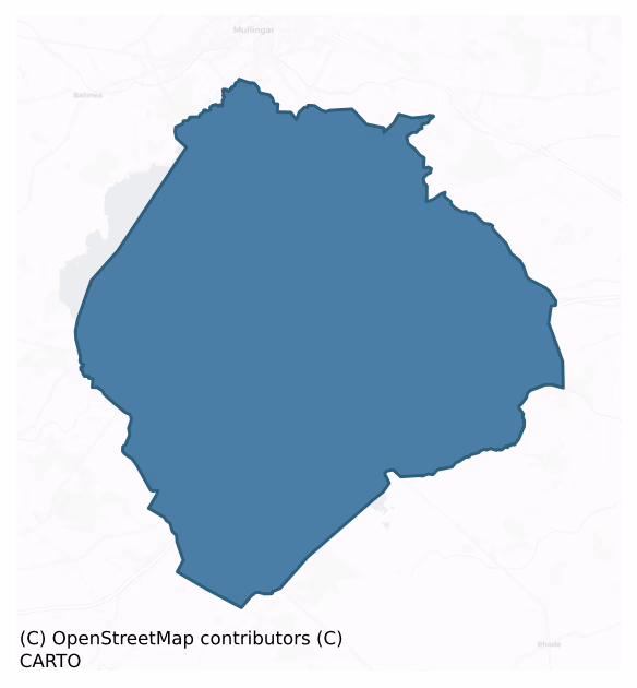
Fartullagh is a barony of County Westmeath, in the historical province of Leinster (Irish: Fir Thulach), covering 159 km² of land. The barony records 306 NMS archaeological sites and 131 NIAH listed buildings, placing it at around the 51st percentile among 280 ROI baronies for sites per km². This means it is in the upper half of all baronies for sites per km². Dated archaeological evidence runs from the Early Bronze Age through to the Modern, spanning 7 of 9 archaeological periods, placing the barony in the 31st percentile among 280 ROI baronies for chronological depth. This means it is in the bottom third of all baronies for chronological depth. The largest dated subset of recorded sites dates to the Early Medieval.

Heritage at a glance
Percentile rankings throughout this profile compare each barony only against the other 279 Republic of Ireland baronies.
The recorded heritage of Fartullagh
The National Monuments Service Sites and Monuments Record (SMR) is the statutory inventory of archaeological sites for the Republic of Ireland, maintained by the Department of Tourism, Culture, Arts, Gaeltacht, Sport and Media. Sites recorded here include earthworks, ringforts, megalithic tombs, ecclesiastical remains, and post-medieval features; not every record is legally protected, but each is registered as a monument of archaeological interest.
The National Monuments Service records 306 archaeological sites in Fartullagh, putting it at the 51st percentile among 280 ROI baronies for sites per km². This means it is in the upper half of all baronies for sites per km². Protection coverage is near-universal — 277 sites (90%) fall within a recorded monument protection zone, indicating an extensively surveyed landscape. The dominant category is defensive sites — ringforts, enclosures, hillforts, and stone forts (172 sites, 56% of the record). Ringfort – rath is the most prevalent type, making up 35% of the barony's recorded sites (108 records) — well above the ROI average of 20% across all baronies where this type occurs. Ringfort – rath is an earthen ringfort enclosed by a bank and external ditch — the most common Early Medieval farmstead, broadly dated 500–1000 AD. Other significant types include Enclosure (16) and Structure – peatland (16). Enclosure is a banked or ditched feature of uncertain type, used as a catch-all where the original function cannot be determined from surface evidence; Structure – peatland is a construction of unknown function, either extant or implied by archaeological evidence, of any date. Across the barony's 159 km², this gives a recorded density of 1.92 sites per km².
Most common monument types
Hover or tap a monument type to see its definition.
| Type | Count |
|---|---|
| Ringfort – rath an earthen ringfort enclosed by a bank and external ditch — the most common Early Medieval farmstead, broadly dated 500–1000 AD | 108 |
| Enclosure a banked or ditched feature of uncertain type, used as a catch-all where the original function cannot be determined from surface evidence | 16 |
| Structure – peatland a construction of unknown function, either extant or implied by archaeological evidence, of any date | 16 |
| House – indeterminate date a habitation building whose date cannot be determined from available evidence | 15 |
| Ringfort – unclassified a circular Early Medieval settlement enclosure where surviving evidence does not allow distinction between earthen and stone forms | 12 |
| Road – class 3 togher a short wooden peatland trackway up to 15m long, deliberately laid to cross a small area of bog; Neolithic to medieval | 11 |
| Graveyard a burial area associated with a church, in use from the medieval period onwards | 10 |
Chronological distribution
The dated archaeological record for Fartullagh spans from the Early Bronze Age through to the Modern, with activity attested across 7 of 9 archaeological periods. Every period from earliest to latest is represented in the record — an unbroken sequence of dated activity across the full chronological span. Activity concentrates most heavily in the Early Medieval (129 sites, 55% of dated material), with the Iron Age forming a secondary peak (50 sites, 21%). A further 71 recorded sites (23% of the overall NMS register for the barony) carry no period attribution — appearing as 'Unknown' in the bar chart below. This typically reflects either records that pre-date the standardised period vocabulary or sites awaiting specialist dating review, rather than a genuine absence of chronological evidence.
Sample of recorded monuments
Show 25 sample monuments (of 306 total)
A representative sample of 25 recorded monuments drawn from the barony’s 306 total NMS entries. Sites within a recorded monument protection zone and rarer site types are prioritised so the list shows a meaningful cross-section rather than only the most common type. Each entry shows the official Sites and Monuments Record reference number and the description published by the National Monuments Service.
Chapel
Situated on low rise of ground with good views in all directions with modern graveyard extension immediately to S. Site of building (WM026-035—-) in field 220m to W, standing stone (WM026-036—-) known locally as…
Situated on low rise of ground with good views in all directions with modern graveyard extension immediately to S. Site of building (WM026-035—-) in field 220m to W, standing stone (WM026-036—-) known locally as the 'Cloghstuckagh' 235m to NW, ringfort (WM026-038—-) 185m to N, ringfort (WM026-039—-) 130m to NNE and third ringfort (WM026-073—-) 280m to SSE. In 1837 Thomas O'Conor of the Ordnance Survey recorded that in Catherinestown 'there are small remains of the walls of an old church in ruins' (OSL 14/G/14/5(11), vol. 2, 47). No church or graveyard is depicted on the 1657 Down Survey parish map of Lynn (NLI, MS 723-4). In 1867 Cogan (1867, 453) wrote that 'the old chapels of Marlonstown, Kenny, Kilronan, and Hopestown were pulled down. They are now graveyards'.
Kilronan Church depicted on 1837 ed. OS 6-inch where it is shown standing in SE quadrant of Kilronan graveyard (WM036-037003-). On this map the S and E walls of the church formed the enclosing element of the graveyard. On the revised 1876 ed. OS 6-inch map the church building is depicted as 'Church Site of'. Church building possibly levelled between 1837 and 1876 editions of the OS maps. Low wall footings enclose a sunken area marks site of levelled church or chapel (approx. dims. 15m E-W x 6m N-S) in SE quadrant of graveyard. Several headstones have been erected on the footprint of the levelled church.
See attached plan of monument surveyed and drawn by the ASI.
Compiled by: Caimin…
Fulacht fia
Situated at the base of a W-facing slope of a low ridge, in wet pasture. Ringfort (WM026-070—-) lies c. 90m to NW. Monument described in 1982 as a small mound of earth and burnt stones. The mound (diam. 5m; H…
Situated at the base of a W-facing slope of a low ridge, in wet pasture. Ringfort (WM026-070—-) lies c. 90m to NW. Monument described in 1982 as a small mound of earth and burnt stones. The mound (diam. 5m; H 0.5-0.6m) is roughly U-shaped, with a depression to the W, which probably represents the trough. There is a lot of disturbance in the sides of the mound which have exposed large quantities of burnt stone, yet no bone or any other identifiable remains. Monument is visible on Digital Globe aerial photography as a small subcircular-shaped mound.
Compiled by Alison McQueen, Vera Rahilly and Caimin O’Brien.
Date of upload: 02 October 2019
Font (present location)
Font (WM026-003003-) now located inside W porch of R. C. church at Gainestown, 2.65km SSE of Lynn Church (WM026-003—-) and graveyard (WM026-003001-) where the font originally stood. Moved from Lynn graveyard in 1954…
Font (WM026-003003-) now located inside W porch of R. C. church at Gainestown, 2.65km SSE of Lynn Church (WM026-003—-) and graveyard (WM026-003001-) where the font originally stood. Moved from Lynn graveyard in 1954 and placed inside the porch of Gainestown Church by Fr. Finian O'Conor. Cogan (1867, 452) recorded in 1867 that a 'fine old font of the church [Lynn] is in the cemetery; the bowl is circular, and measures one foot ten inches (0.56m) in diameter'. Described by Roe (1968, 118-9) as a 'most remarkable creation and one which well may be unique. Square and massive, the vessel is cut from a single stone (dims. H 0.72m x Wth 0.66m), into three stages, each decreasing in width from the top down. To merge with the middle section (Wth 0.55m x H 0.15m) the under part of the top stage (Wth 0.65m x H 0.29m) is carved as a gentle concave curve while instead of being formed as a simple cube, the lowest part (Wth 0.42m x H 0.27m) has its angles shaped to give a convex profile. The basin (diam. 0.56m x D 0.19m; rim T. 0.05m) is flat-bottomed without a drain'. The R. C. Church at Gainestown was reputedly built with stones taken from Catherinestown Castle (WM026-124—-) in 1853.
Compiled by: Caimin O'Brien
Date of upload: 19 January 2018
Well
A wide shallow pool of clear water formed from a natural spring, used as a drinking place for livestock marks the site of the well depicted as 'White Well' on the 1837 ed. OS 6-inch map. A stream runs S from the pool…
A wide shallow pool of clear water formed from a natural spring, used as a drinking place for livestock marks the site of the well depicted as 'White Well' on the 1837 ed. OS 6-inch map. A stream runs S from the pool of water. No evidence of any votive offerings around the well or any evidence that the well was ever used as a site of pilgrimage. no evidence to suggest that this is the site of a holy well. Whitewell House located 155m to NNE and ringfort (WM033-013—) 150m to the W.
Compiled by: Caimin O'Brien
Date of upload: 26 July 2013
Castle – motte and bailey
Situated on top of a natural glacial hillock with good views in all directions. Castle ruins (WM033-043—-) located 20m to the E with medieval church (WM033-031—-) and graveyard (WM033-031001-) located 400m to the…
Situated on top of a natural glacial hillock with good views in all directions. Castle ruins (WM033-043—-) located 20m to the E with medieval church (WM033-031—-) and graveyard (WM033-031001-) located 400m to the N. This motte and bailey castle consists of a poorly preserved high, steep-sided mound of earth and stone the S side of which has been cut into by the construction of the Rochfortbridge road running NW-SE. A photograph of the monument taken in 1910, shows the motte as a high steep-sided mound (H c. 5m; top diam. 20m x 12m) with rounded summit, giving the mound a typical pudding bowl profile (Orpen 1910, 226). This classic shape and profile of the motte is no longer apparent due to soil erosion and vegetation cover. Traces of a stone structure can be seen on the poorly preserved summit (dims. NW-SE 8m; NE-SW 3.5m) of the motte that appear to be the remains of an Ordnance Survey Trigonometrical Station as depicted on all editions of the OS 6-inch maps. The sides of the motte are defaced in several places and show signs of scarring where the soil has slipped down exposing the core of the mound. The stone castle (WM033-043—-) to the E of the motte appears to be standing on the scarp of a raised area which may be the remains of a bailey or courtyard associated with the motte castle. A large hole in the NE quadrant of the bailey located to the N of the castle may be the remains of a levelled building described in 1826 as a mansion-house (Brewer 1826, 252)…
Castle – hall-house
The remains of a large multi-period castle that is difficult to examine as it has been incorporated into the S angle of a 19th century farmyard range of outbuildings adjoining the S side of Newcastle House. Salter…
The remains of a large multi-period castle that is difficult to examine as it has been incorporated into the S angle of a 19th century farmyard range of outbuildings adjoining the S side of Newcastle House. Salter (2004, 153) described this castle as a '13th century hall-house 15.m long by 10.2m wide over a battered base which contained just one room over a pair of vaults supported upon a longitudinal cross-wall which was probably a later insertion. The whole of the northern corner and adjoining walls and that end of the vaults are missing. Just part of the SW wall and a projecting wing or turret remain of a later extension to the NW'.
The castle was described in 1983 as a rectangular tower (ext. dims. 10.5m NE-SW; c. 8m NW-SE) standing two storeys high (c. H 7-8m) with two stone vaulted chambers aligned NW-SE at ground floor level. The NE chamber has been altered to form an entrance gateway into the courtyard of Newcastle House. A keystone over the arch of the gateway on the SE face bears the inscription ‘RCC Esq. 1855’. In the SE wall of the tower there are the remains of a poorly preserved mural stairs which gave access to the first floor level. The SW wall of the castle runs for a total length of 23m extending beyond the rectangular tower. The inner NE face of this wall possesses a blocked up door and window opes all of which appear to be later 19th century rebuilding and associated with the farmyard outbuildings. In the 19th century the medieval SW wall wa…
Mound
This monument has been levelled and is not visible at ground level. Nearby ringfort (WM033-056—-) located 65m to the NE. Depicted as a small mound-like earthwork on the 1837 ed. OS 6-inch map. Not depicted on…
This monument has been levelled and is not visible at ground level. Nearby ringfort (WM033-056—-) located 65m to the NE. Depicted as a small mound-like earthwork on the 1837 ed. OS 6-inch map. Not depicted on subsequent editions of the OS 6-inch maps as the site was levelled between these editions.
Compiled by: Caimin O'Brien
Date of upload: 09 July 2013
Religious house – Dominican friars
Monument surveyed by ASI in 1976 and described as following; 'A rectangular embankment of earth and stone with the earth covered footings of a stone wall at its edge on the N and w and probably also the S. There is an…
Monument surveyed by ASI in 1976 and described as following; 'A rectangular embankment of earth and stone with the earth covered footings of a stone wall at its edge on the N and w and probably also the S. There is an external fosse with an outer bank. There is no indication of the stone wall on the E but the ground slopes down here and it is very faint on the S. The fosse and external bank are best preserved on the N and W, and are faint on the S. On the E the fosse and bank seem to be incorporated in a field fence which runs (roughly N-S) along this side of the site. This latter field fence may also incorporate a boundary bank running to the S enclosing one side of a field to the S of this site. There is what may be a hut site in the SE corner of the modern field but this is rather doubtful. Consisting of a roughly rectangular depression with some evidence of stone in the sides. There are two causeways across the fosse, one on the W and the other on the S and both may be original entrances. A later field bank running E-W begins at the outer edge of the W causeway and runs to the W for a short distance. The interior is fairly level in the W but slopes towards the E. At the S there are fairly substantial remains, grass covered stone footings of a rectangular structure with some grass covered collapse around it. The NW corner of this feature survives to a height of approx. 2m and part of its E wall also survives to a height of c. 1.5m. The walls are built of ho…
Cross-slab
This slab was recorded in 1980 as located inside the graveyard (WM033-008001-) to the S of a church (WM033-008—-) (SMR File). This stone has been moved to the side of the road to the SSW of the graveyard…
This slab was recorded in 1980 as located inside the graveyard (WM033-008001-) to the S of a church (WM033-008—-) (SMR File). This stone has been moved to the side of the road to the SSW of the graveyard (WM033-008001-) where it has been mounted on a stone base and is signposted as the 'De Profundis Stone'. According to the local history on the information panel beside the stone, this slab was used as a resting stone for the coffin before entering the graveyard. the slab consists of a thick tapering or partially broken limestone flag (H 0.94m; top Wth. 0.44m; T 0.14m) with a crudely incised cross with T shaped terminals can be seen. The cross has been incised into the surface of the slab and is located towards the top of the slab. The top of the slab is wider than the base. The dating of this slab is uncertain, however it appears to be pre-1700 in date (SMR File).
Compiled by : Caimin O'Brien
Date of upload: 04 July 2013
Tomb – effigial
I was unable to locate this effigial tomb that was located inside the medieval church (WM033-031—-) ruins of Castlelost due to the dense cover of vegetation and trees inside the church. This monument was described in…
I was unable to locate this effigial tomb that was located inside the medieval church (WM033-031—-) ruins of Castlelost due to the dense cover of vegetation and trees inside the church. This monument was described in 1826 when it was recorded that the 'antient and ruined church (WM033-031—-) contains numerous disregarded and mutilated monuments of this family (Tyrrell), amongst which is conspicuous an altar-tomb, bearing the representation, in alto relieve, of a knight, in complete armour. This monument has suffered so much from the neglect of contumely of successive ages, that the name it was intended to commemorate cannot now be ascertained. From the embellishments it would appear to be of the sixteenth century, and was, probably erected for Sir John Tyrrel, of Castel-Lost, father of James of the same place, whose son, Gerald, or Garret Tyrrel, of Castle-Lost, Esq. died April 6th, 1637, and was here interred. The Castle-Lost estates were forfeited by the Tyrrel family, in the troubles of the seventeenth century’ (Brewer 1826, 252).
Compiled by: Caimin O'Brien
Date of upload: 23 July 2013.
Mass-rock
Information panel inside W porch of R. C. church at Gainestown located 940m to E mentioned the presence of a mass-rock in the adjoining townland of Gorteen. According to the information panel 'mass was celebrated by…
Information panel inside W porch of R. C. church at Gainestown located 940m to E mentioned the presence of a mass-rock in the adjoining townland of Gorteen. According to the information panel 'mass was celebrated by the Dominican priests who fled Mullingar town and resided at a house of refuge on the shores of nearby Lough Ennell'.
Large earthfast rock outcrop (dims. Wth 4.8-5.1m; T 3.1-3.6m; H 2.1-4.1m) with broad flat face orientated to the SE set into SE facing slope of low ridge in undulating rocky grassland. Small pond located 100m to NNE, ringfort (WM026-030—-) with adjoining 19th century cottage 260m to SE.
Compiled by: Caimin O'Brien
Date of upload: 29 August 2018
Burial ground
A castle (WM026-002—-) is indicated in Gothic Script on the 1840 edition of the OS 6-inch map. On the revised 1910 edition of the revised OS 6-inch map the annotation on the map has changed from 'Castle' to 'Monastery…
A castle (WM026-002—-) is indicated in Gothic Script on the 1840 edition of the OS 6-inch map. On the revised 1910 edition of the revised OS 6-inch map the annotation on the map has changed from 'Castle' to 'Monastery (in Ruins)'. The monument was visited in 1976 and described as 'Directly behind and to the NW of Lynn House and within the high walled garden stands the ivy covered E gable of the monastic church (WM026-002001-). The gable contains a large pointed Gothic ope from which the dressings, mullions and tracery of a 14th/15th cent.[ury] window have dissappeared. There is a large rebate to the outer face of the gable, probably part of a buttress. The 'early' walls of the medieval monastic buildings, domestic gardens etc. can be faintly discerned in the character of the surrounding farm outhouses. At the W side of the house [Lynn House] and outbuildings is the reputed site of a 'castle' (WM026-002—-). An 18th/19th century gateway (arched) at entrance from the road. There are faint traces of low earthworks in field directly NE of house [Lynn House] and local information places a number of burials & tunnel bteween the house and the graveyard (WM026-003001-) (SMR file 1976).
The files of the National Museum of Ireland records that in May 1967 human remains were discovered during excavation works at Mount Lynn House (Cahill & Sikora 2011, vol. 2, 522). The remains were discovered in a trench at a depth of 0.5m below ground level. The monument was reported to the NMI…
Barrow – ring-barrow
Situated on top of a small, yet prominent rise, in gently undulating pasture. Monument described as a low barely visible egg-shaped mound (dims. 6.3m; 5.2m; max. H 1.2m) enclosed by an inner fosse, an inner bank, an…
Situated on top of a small, yet prominent rise, in gently undulating pasture. Monument described as a low barely visible egg-shaped mound (dims. 6.3m; 5.2m; max. H 1.2m) enclosed by an inner fosse, an inner bank, an intervening fosse and an outer bank. The inner fosse is very slight and almost imperceptible. The two earthen banks are slight with a wide shallow fosse between them. The inner bank rises very marginally above the slight inner fosse. Approximately five stones form part of an internal stone facing of the outer bank at SE. The banks and fosses are best preserved from NE-E-S-W-NW, however the intervening fosse and outer bank are defaced at N. Some small sod-covered stones are visible on the surface of the mound but they could have been deposited here in relatively recent times. There is no visible trace of a formal entrance.
See attached profile of monument drawn and surveyed by the ASI.
Compiled by Alison McQueen, Vera Rahilly and Caimin O’Brien.
Date of upload: 30 September 2019
Building
Situated at S end of low hillock overlooking Kilronan chapel (WM026-037001-) and graveyard (WM026-037003-) 225m to E. Standing Stone (WM026-036—-) 125m to N, ringfort (WM026-038—-) 320m to NNE, second ringfort…
Situated at S end of low hillock overlooking Kilronan chapel (WM026-037001-) and graveyard (WM026-037003-) 225m to E. Standing Stone (WM026-036—-) 125m to N, ringfort (WM026-038—-) 320m to NNE, second ringfort (WM026-039—-) 380m to ENE. Building stood in field approximately 3m E of the field fence running N-S that is shown on the 1911 ed. OS 25-inch map. No surface remains visible of 'Ruins' depicted in this field on Larkin's 1808 map of Co. Westmeath. This site was mistakenly identified as the site of 'Catherinestown Castle' (WM026-124—-) and listed in the Westmeath RMP as a 'Castle site of'. The medieval castle of Catherinestown was located in the N quadrant of the townland close to the boundary with Burnellstown and Ardillon. The ruins of a building depicted in this field on Larkin's 1808 map of Westmeath could have been the remains of a pre-1700 house.
Compiled by: Caimin O'Brien
Date of upload: 22 January 2018
Barrow – ring-barrow
Situated on top of a prominent rise, in gently undulating pasture, with good views in all directions. Depicted on the revised 1913 ed. OS 25-inch map as a small circular-shaped earthwork (diam. 9.5m) defined by a scarp,…
Situated on top of a prominent rise, in gently undulating pasture, with good views in all directions. Depicted on the revised 1913 ed. OS 25-inch map as a small circular-shaped earthwork (diam. 9.5m) defined by a scarp, fosse and external bank. Levelled monument described in 1971 as the remains of a circular-shaped area (diam. 23m) defined by a scarp with external fosse. A low, smooth scarp (H 0.8m) with faint traces of a fosse (approx. Wth 2.1m) are visible from SE-S-W-N. A linear wire fence skirts the monument to N and E which forms part of a modern dwelling plot.
Compiled by Alison McQueen, Vera Rahilly and Caimin O’Brien.
Date of upload: 04 November 2019
Barrow – mound barrow
Situated on top of a small ridge running N-S, in pasture, with good views in all directions. Depicted as an earthwork on Larkin’s 1808 map of Co. Westmeath (NLI, MS 46,580). Monument described in 1978 as a small roughly…
Situated on top of a small ridge running N-S, in pasture, with good views in all directions. Depicted as an earthwork on Larkin’s 1808 map of Co. Westmeath (NLI, MS 46,580). Monument described in 1978 as a small roughly circular-shaped sod-covered mound (diam. 8m) of earth and small stones. The top of the mound is uneven and there is a slight depression in the centre.
Compiled by Alison McQueen, Vera Rahilly and Caimin O’Brien.
Date of upload: 04 November 2019
Castle – motte
On level pasture with good views in all directions. Located on the demesne lands of Gallstown House depicted in 1837 as Castletown House which is located 160m to the NE. On the 1837 ed. OS 6-inch map this mound is…
On level pasture with good views in all directions. Located on the demesne lands of Gallstown House depicted in 1837 as Castletown House which is located 160m to the NE. On the 1837 ed. OS 6-inch map this mound is depicted as a circular grove of trees located amongst the landscaped demesne of Castletown House. This map suggests that the mound was either re-used as a landscape feature on the demesne or that it was created as a landscape feature in the post-1700 landscaping of the demesne. Present remains consist of a large flat-topped steep sided mound of earth composed mainly of earth with small stones. The sides of the mound have been defaced by animals which has exposed the core of the mound. The remains of a livestock track can be seen encircling the mound just above the base. There are no signs of a fosse or bailey associated with the mound. The summit (diam. 8m N-S; 10m E-W) of the mound is flat with no sign of any features on its summit.
Compiled by: Caimin O'Brien
Date of upload: 25 July 2013
Architectural feature
The modern R. C. Church at Meedian contains a carved doorway at the NE end along with a window (WM033-0400001-) over the entrance both of which appear to be 15th century in date. The present RC Church replaced was…
The modern R. C. Church at Meedian contains a carved doorway at the NE end along with a window (WM033-0400001-) over the entrance both of which appear to be 15th century in date. The present RC Church replaced was built on the site of an earlier T-plan R. C. Chapel which was marked as a 'chapel' in 1818 on the Boyd-Belvedere estate map of the area (SMR File). This T-plan chapel was probably built in the 18th century. There is no evidence to suggest that there was a pre-1700 church at this location. It is possible that the present medieval doorway and window were taken from a nearby medieval church and reused during the building of the present R. C. Church. The medieval church (WM033-031—-) ruins at Castlelost located 3km to the NE contains dressed stone with similar stone carvings. The upper section of the medieval doorway at Castlelost is missing. The medieval doorway at Meedian comprises of an archway in two orders without capitals, the mouldings of the orders consists of hollows and rolls. On the left hand side of the arch there is a star symbol carved into the stone. This symbol is also used in the window above where it is located under the hood moulding of the window. Halfway down the doorway on either side there are two decorated jambs. The stone on the left side is decorated with a stylised plant motif, while the stone of the right has a two strand interlace pattern with triangular-shaped terminals. The interlaced carving on this stone is similar to the…
Castle – motte
On a slight natural rise of ground in undulating countryside with good views in all directions. Located 300m E of the Pass of Kilbride. Church (WM034-002001-) and graveyard (WM034-002003-) located 85m to the WNW and…
On a slight natural rise of ground in undulating countryside with good views in all directions. Located 300m E of the Pass of Kilbride. Church (WM034-002001-) and graveyard (WM034-002003-) located 85m to the WNW and St. Bridget’s Well (WM034-001—-) 140m to the NNW. Steep sided mound (H 2m), there is a low rise on the centre of the summit, the significance of which is unclear. At the base of the motte from NE-E-S-W to WNW there is a wide shallow fosse. No visible trace of a bailey. The Milltownpass-Kinnegad road (N6) running E-W intersects the base of the motte at N. On the 1654 Down Survey parish map of the Pass of Kilbride (‘Pacekilbride’), the lands of the Pass of Kilbride belonged to Nicholas Darcy in 1640, an Irish papist (NLI p.7384). No castle or church and graveyard are depicted on the 1654 Down Survey map. Traces of linear earthworks in field to the SW are visible on Bing Maps aerial photographs taken between 06-07 November 2011 (www.bing.com/maps). These earthworks could be the remains of a medieval road associated with the motte.
See attached word document with Bing Maps aerial photograph taken from www.bing.com/maps showing linear earthworks in field to SW of motte.
Compiled by: Caimin O’Brien
Date of upload: 29 July 2013
Barrow – mound barrow
On a low rise of ground with good views to the N. Small circular-shaped flat-topped mound (top diam. 9.5m N-S; 8.5m E-W; H 2m) of earth and stone defined by a scarp with no visible sign of an external fosse. Not…
On a low rise of ground with good views to the N. Small circular-shaped flat-topped mound (top diam. 9.5m N-S; 8.5m E-W; H 2m) of earth and stone defined by a scarp with no visible sign of an external fosse. Not indicated on the 1837 ed. OS 6-inch map.
Compiled by: Caimin O'Brien
Date of upload: 01 August 2013
Burial ground
In 2002 human bone was found during ploughing in a raised area of a field known locally as the 'chapel field'. This was found near the site of a whitethorn 'mass bush' ( pers com. J. Carey, Rochfortbridge).
Date of…
In 2002 human bone was found during ploughing in a raised area of a field known locally as the 'chapel field'. This was found near the site of a whitethorn 'mass bush' ( pers com. J. Carey, Rochfortbridge).
Date of upload: 10 July 2013
Architectural feature
The modern R. C. Church at Meedian contains a carved doorway (WM033-040—-) at the NE end along with a window over the entrance both of which appear to be 15th century in date. The present RC Church replaced was built…
The modern R. C. Church at Meedian contains a carved doorway (WM033-040—-) at the NE end along with a window over the entrance both of which appear to be 15th century in date. The present RC Church replaced was built on the site of an earlier T-plan R. C. Chapel which was marked as a 'chapel' in 1818 on the Boyd-Belvedere estate map of the area (SMR File). This T-plan chapel was probably built in the 18th century. There is no evidence to suggest that there was a pre-1700 church at this location. It is possible that the present medieval doorway and window were taken from a nearby medieval church and reused during the building of the present R. C. Church. The medieval church (WM033-031—-) ruins at Castlelost located 3km to the NE contains dressed stone with similar stone carvings.
The window is a tall, twin-light ogee-headed window with hood moulding above. The terminals of the hood mouldings are decorated with a spiral pattern on the left hand side and interlaced pattern on the right hand side. There are three small carved motifs under the hood moulding consisting of a spiral, a star and a twin pronged spear.
To see a 3D model of this window visit; https://skfb.ly/oJALM
Compiled by: Caimin O'Brien
Date of upload: 10 July 2013
Font
On a slight natural rise of ground in undulating countryside with good views in all directions. Located 180m E of the Pass of Kilbride. Church (WM034-002001-) in centre of graveyard (WM034-002003-) with St. Bridget’s…
On a slight natural rise of ground in undulating countryside with good views in all directions. Located 180m E of the Pass of Kilbride. Church (WM034-002001-) in centre of graveyard (WM034-002003-) with St. Bridget’s Well (WM034-001—-) 70m to the N and motte castle (WM034-003—-) 90m to the SSE. A defaced square-shaped font (H 0.75m; Wth 0.53m) with inverted pyramidal shaped-base carved from a single piece of stone has been cemented into the surface of the graveyard (WM034-002003-) presumably at the same time as the church walls were rebuilt in 1991. The font with circular flat-bottomed bowl (D 0.2m; base diam. 0.41m) is located a few metres SE of the gap located in the S wall of the church.
Compiled by: Caimin O’Brien
Date of upload: 29 July 2013
Font
Font (WM026-106—-) now located inside W porch of R. C. church at Gainestown, 2.65km SSE of Lynn Church (WM026-003—-) and graveyard (WM026-003001-) where the font originally stood. Moved from Lynn graveyard in 1954…
Font (WM026-106—-) now located inside W porch of R. C. church at Gainestown, 2.65km SSE of Lynn Church (WM026-003—-) and graveyard (WM026-003001-) where the font originally stood. Moved from Lynn graveyard in 1954 and placed inside the porch of Gainestown Church by Fr. Finian O'Conor. Cogan (1867, 452) recorded in 1867 that a 'fine old font of the church [Lynn] is in the cemetery; the bowl is circular, and measures one foot ten inches (0.56m) in diameter'. Described by Roe (1968, 118-9) as a 'most remarkable creation and one which well may be unique. Square and massive, the vessel is cut from a single stone (dims. H 0.72m x Wth 0.66m), into three stages, each decreasing in width from the top down. To merge with the middle section (Wth 0.55m x H 0.15m) the under part of the top stage (Wth 0.65m x H 0.29m) is carved as a gentle concave curve while instead of being formed as a simple cube, the lowest part (Wth 0.42m x H 0.27m) has its angles shaped to give a convex profile. The basin (diam. 0.56m x D 0.19m; rim T. 0.05m) is flat-bottomed without a drain'.
Compiled by: Caimin O'Brien
Date of upload: 19 January 2018
Ringfort – rath
Situated on low rise of ground in rocky undulating grassland with ringfort (WM026-030—-) 290m to WNW. Bivallate ringfort consisting of a raised roughly circular-shaped area (diam. 34m N-S) defined by a bank mainly…
Situated on low rise of ground in rocky undulating grassland with ringfort (WM026-030—-) 290m to WNW. Bivallate ringfort consisting of a raised roughly circular-shaped area (diam. 34m N-S) defined by a bank mainly reduced to a scarp with traces of a fosse and external bank. The low outer bank is depicted as a curving field boundary on the 1838 ed. OS 6-inch map and it is possible that this outer enclosing element post-dates the monument and represents the remains of a later field bank/boundary. The E quadrant of the monument has been severely degraded with only partial evidence of the enclosing fosse and external bank visible. The remains of a souterrain (WM026-031001-) are visible in the N quadrant of the ringfort interior. Sunken areas in W and S quadrant of ringfort interior may represent remains of chambers belonging to the souterrain. The interior of the ringfort slopes from WNW-ESE and has stones protruding from the surface in the W quadrant which may be roof stones of the souterrain. A sunken area in the E quadrant of the ringfort interior may represent the remains of house site or a second souterrain although this is uncertain as the surface of the ringfort is very disturbed in this area. In 1977 it was recorded that to the S and W of the ringfort are a series of low banks forming irregular-shaped enclosures of uncertain antiquity. These faint earthworks which are now barely visible may represent the remains of a small field system. At that time it was…
Listed buildings
The National Inventory of Architectural Heritage (NIAH) is a state survey appraising buildings of architectural, historical, archaeological, artistic, cultural, scientific, social, or technical interest. Each surveyed structure receives a rating from International (the highest, for buildings of European importance) through National, Regional, Local, and Record-Only.
The NIAH records 131 listed buildings in Fartullagh (61st percentile across ROI baronies). The highest-graded structures include 4 of National significance. The Republic holds 937 National-graded buildings in total, so this barony accounts for around 0% of the national total. Construction dates concentrate most heavily in the Late Georgian (1800-1830) period. The most-recorded building type is house (38 examples, 29% of the listed stock).
Terrain and environment
Mean elevation across the barony is 96m — the 58th percentile among 280 ROI baronies for elevation. This means it is in the upper half of all baronies for elevation. Elevation matters for heritage because higher-altitude baronies typically favour defensive monuments — ringforts and hilltop forts placed on prominent ground — while lowland baronies are more likely to carry the dense settlement and church networks of intensive agricultural landscapes. Mean slope is 2.3° — the 17th percentile among 280 ROI baronies for slope. This means it is in the bottom fifth of all baronies for slope. This is broadly flat terrain, the kind of landscape best suited to intensive agriculture. Slope is a key control on both land use and archaeological preservation: steep ground resists ploughing and tends to preserve earthworks intact, while gentle slopes favour intensive cultivation that damages or destroys surface archaeology over time. The Topographic Wetness Index averages 11.6, the 81st percentile among 280 ROI baronies for wetness. This means it is in the top fifth of all baronies for wetness. This is wet, slow-draining ground by ROI standards — the kind of landscape that may carry waterlogged archaeological sites of unusual preservation value. Drainage matters for heritage because poorly-drained ground preserves organic archaeology (wooden trackways, leather, textiles, and on rare occasions human remains) far better than free-draining soil; well-drained ground favours arable use but destroys organic material rapidly. The land cover is dominated by improved grassland (74%) and woodland (17%).
Terrain measurements
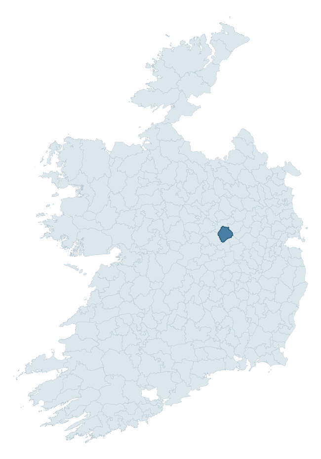
Where this barony sits in the Republic of Ireland
Geology and preservation
Bedrock geology shapes the landscape long before any settlement begins — controlling soil drainage, agricultural potential, the survival of upstanding monuments, and the preservation of buried archaeology. The figures below come from the Geological Survey Ireland 1:100,000 bedrock map.
The bedrock underlying Fartullagh is predominantly limestone (98% of the barony by area), laid down during the Carboniferous period (100% by area, around 359 to 299 million years ago). Limestone is the most heritage-rich bedrock in Ireland. It supports fertile, well-drained soils that favoured dense Early Medieval settlement and Norman manorial agriculture, and it weathers into karst features — sinkholes, caves, swallow holes, and souterrains — that frequently carry archaeology. Where peat overlies limestone, organic preservation can be exceptional. The single largest mapped unit is the Lucan Formation (65% of the barony's bedrock). With only 2 distinct rock types mapped, the barony is geologically uniform compared to the rest of the Republic (10th percentile for diversity) — a single coherent bedrock landscape.
Rock type composition
Largest mapped unit: Lucan Formation (65% of the barony)
Placename evidence
Logainm records 11 heritage-diagnostic placenames for Fartullagh, a modest sample drawn predominantly from the townland record. The dominant stratum is early christian ecclesiastical. The most frequent diagnostic roots are cill- (7) and teampall- (2). With a sample of this size the count should be treated as indicative rather than definitive.
Pre-Christian / Early Medieval Defensive
| Root | Count | Meaning |
|---|---|---|
| ráth- | 1 | earthen ringfort |
| dún- | 1 | hilltop or promontory fort |
Early Christian Ecclesiastical
| Root | Count | Meaning |
|---|---|---|
| cill- | 7 | church (early) |
| teampall- | 2 | church (later medieval) |
Burial, Ritual, and Norse-Contact
| Root | Count | Meaning |
|---|---|---|
| gall- | 1 | foreigner — Norse settlement marker |
Other baronies in Westmeath
About this profile
Click any section below to expand.
What is a barony?
A barony is a historic administrative unit in Ireland, broadly equivalent to an English hundred. The 280 baronies used here are from the OSi 2019 National Statutory Boundaries (generalised 20m), covering the 26 counties of the Republic of Ireland. Baronies derive from the Norman period, were formalised in the 17th century, and have not been redrawn for statistical purposes. They vary enormously in area, from compact urban baronies in Dublin to vast upland baronies in Connacht, and should not be compared by raw site count without accounting for area differences.
What counts as a site?
This profile combines three distinct heritage registers, each with its own definition of what constitutes a recordable site:
- Archaeological sites (NMS). The National Monuments Service Sites and Monuments Record (SMR) catalogues every known archaeological monument or site of archaeological interest in the Republic, from prehistoric burial mounds and ringforts to medieval churches and post-medieval defensive works. Inclusion does not require legal protection — only that the site has been identified, surveyed, and assessed as having archaeological value. A separate subset of these sites lies within a recorded protection zone, which gives them statutory protection under the National Monuments Acts.
- Listed buildings (NIAH). The National Inventory of Architectural Heritage records buildings of architectural, historical, archaeological, artistic, cultural, scientific, social, or technical interest. Each surveyed structure is appraised on a five-tier scale: International, National, Regional, Local, and Record-Only. The NIAH appraisal is informational rather than strictly statutory, but it underpins local-authority Record of Protected Structures (RPS) listings.
- Heritage placenames (Logainm). Logainm is the authoritative database of Irish placenames maintained by the Placenames Branch. This profile applies a heritage-diagnostic classifier to the Irish-language form of each townland name, flagging roots that signal defensive sites (ráth-, lios-, dún-, caiseal-, cathair-), ecclesiastical foundations (cill-, teampall-, domhnach-, mainistir-), prehistoric burial-ritual features (tuaim-, carn-, leaba-), or Norse-contact settlement (gall-). Townlands without one of these diagnostic roots are not flagged here — they may still carry historical significance, but that significance is not encoded in the name itself.
Editorial principles
The narrative sections of this profile follow several explicit principles:
- Evidential. Every claim about this barony’s heritage character is anchored in the underlying register data. Where a site count, a placename count, or a percentile rank is cited, it is computed from the source datasets at export time, not estimated.
- Comparative. Counts and metrics are reported alongside their percentile rank against the other 279 ROI baronies. A barony with 50 ringforts in absolute terms could be unusually high or unusually low depending on its size and regional context; percentile ranking removes that ambiguity.
- Transparent on limits. Where a register has known coverage gaps, survey biases, or data-quality issues that affect this barony’s figures, the profile flags them rather than presenting the numbers as definitive.
- No interpretation beyond what the data supports. The narrative does not speculate about historical events, social dynamics, or cultural meaning beyond what the recorded heritage and placename evidence directly attests.
Data caveats and limits
- NMS Sites and Monuments Record is the product of survey campaigns conducted at different intensities across different counties and decades. Some baronies have been surveyed more thoroughly than others, and absolute counts should be read in that light. Sites destroyed by development before survey are typically not represented; sites in heavily forested or upland terrain are sometimes under-recorded.
- NIAH coverage is broadly complete for the Republic of Ireland but the survey was conducted on a rolling county-by-county basis, and the most recent appraisal date varies. Buildings demolished or substantially altered after their original survey may still appear in the register; conversely, recent buildings of merit may not yet have been appraised.
- Logainm classification applies a deliberately conservative pattern-matching approach to the Irish-language townland forms. The classifier prioritises true positives over recall: a townland may carry a heritage signal that the classifier doesn’t recognise, particularly where the diagnostic root has been heavily anglicised or where the townland name draws on a less common term. The 60,000+ townland records and ~9,800 classified placenames give a substantial signal at barony scale, but individual townland names should be checked against Logainm directly for definitive interpretation.
- Period attribution. The chronological distribution reflects only those NMS sites that carry a recognised period attribution in the source data. Sites listed as “Unknown” period are excluded from the dated subset.
- Boundary changes. Some baronies have undergone minor boundary adjustments since their 19th-century definition; the OSi 2019 generalised boundaries used here are the current statutory definition and may differ slightly from historical maps in border areas.
- Bedrock geology is mapped at 1:100,000 scale, which means local variation within a barony — small pockets of different rock type, mineral veins, alluvium overlying bedrock — is generalised. The dominant-system and rocktype figures are area-weighted, so a barony reading “70% Carboniferous limestone” may still contain small but archaeologically important pockets of older or younger rock. Around 3% of GSI polygons do not match the lexicon and contribute no rocktype or system attribution.
Data sources
- National Monuments Service — Sites and Monuments Record (SMR) https://data.gov.ie/dataset/national-monuments-service-archaeological-survey-of-ireland
- National Inventory of Architectural Heritage (NIAH) https://data.gov.ie/dataset/national-inventory-of-architectural-heritage-niah-national-dataset
- Logainm — Placenames Database of Ireland https://www.logainm.ie/
- Ordnance Survey Ireland — National Statutory Barony Boundaries 2019 https://data-osi.opendata.arcgis.com/
- EURODEM — European Digital Elevation Model https://www.mapsforeurope.org/datasets/euro-dem
- ESA WorldCover https://esa-worldcover.org/en
- Geological Survey Ireland — 1:100,000 Bedrock Geology https://www.gsi.ie/en-ie/data-and-maps/Pages/Bedrock.aspx
Explore more: Search any of the 280 ROI baronies, browse by historical province, or read the methodology and data sources for the full Republic of Ireland Heritage Tool.