
Fore is a barony of County Westmeath, in the historical province of Leinster (Irish: Baile Fhobhair), covering 213 km² of land. The barony records 482 NMS archaeological sites and 140 NIAH listed buildings, placing it at around the 64th percentile among 280 ROI baronies for sites per km². This means it is in the upper half of all baronies for sites per km². Dated archaeological evidence runs from the Mesolithic through to the Modern, spanning 9 of 9 archaeological periods, placing the barony in the 96th percentile among 280 ROI baronies for chronological depth. This means it is in the top tenth of all baronies for chronological depth. The largest dated subset of recorded sites dates to the Early Medieval.
Heritage at a glance
Percentile rankings throughout this profile compare each barony only against the other 279 Republic of Ireland baronies.
The recorded heritage of Fore
The National Monuments Service Sites and Monuments Record (SMR) is the statutory inventory of archaeological sites for the Republic of Ireland, maintained by the Department of Tourism, Culture, Arts, Gaeltacht, Sport and Media. Sites recorded here include earthworks, ringforts, megalithic tombs, ecclesiastical remains, and post-medieval features; not every record is legally protected, but each is registered as a monument of archaeological interest.
The National Monuments Service records 482 archaeological sites in Fore, putting it at the 64th percentile among 280 ROI baronies for sites per km². This means it is in the upper half of all baronies for sites per km². Protection coverage is near-universal — 467 sites (97%) fall within a recorded monument protection zone, indicating an extensively surveyed landscape. The dominant category is defensive sites — ringforts, enclosures, hillforts, and stone forts (261 sites, 54% of the record). Ringfort – rath is the most prevalent type, making up 30% of the barony's recorded sites (144 records) — well above the ROI average of 20% across all baronies where this type occurs. Ringfort – rath is an earthen ringfort enclosed by a bank and external ditch — the most common Early Medieval farmstead, broadly dated 500–1000 AD. Other significant types include Hut site (24) and Earthwork (21). Hut site is a low stone or earthen foundation enclosing a small circular or oval area, generally interpreted as a former dwelling, of any date from prehistory to the medieval period; Earthwork is an unclassified earthen structure with no diagnostic features that allow a more specific classification. Across the barony's 213 km², this gives a recorded density of 2.26 sites per km².
Most common monument types
Hover or tap a monument type to see its definition.
| Type | Count |
|---|---|
| Ringfort – rath an earthen ringfort enclosed by a bank and external ditch — the most common Early Medieval farmstead, broadly dated 500–1000 AD | 144 |
| Hut site a low stone or earthen foundation enclosing a small circular or oval area, generally interpreted as a former dwelling, of any date from prehistory to the medieval period | 24 |
| Earthwork an unclassified earthen structure with no diagnostic features that allow a more specific classification | 21 |
| Ringfort – unclassified a circular Early Medieval settlement enclosure where surviving evidence does not allow distinction between earthen and stone forms | 19 |
| Crannog an artificial or partly artificial island built up on a lake or river bed, in use from the 6th to 17th centuries AD | 18 |
| Church a building used for public Christian worship, of any date from c. 500 AD onwards | 16 |
| Enclosure a banked or ditched feature of uncertain type, used as a catch-all where the original function cannot be determined from surface evidence | 12 |
Chronological distribution
The dated archaeological record for Fore spans from the Mesolithic through to the Modern, with activity attested across 9 of 9 archaeological periods. This places Fore in the top 4% of ROI baronies for chronological depth — few baronies record evidence across as many distinct archaeological periods. Every period from earliest to latest is represented in the record — an unbroken sequence of dated activity across the full chronological span. Activity concentrates most heavily in the Early Medieval (234 sites, 58% of dated material), with the Medieval forming a secondary peak (62 sites, 15%). A further 78 recorded sites (16% of the overall NMS register for the barony) carry no period attribution — appearing as 'Unknown' in the bar chart below. This typically reflects either records that pre-date the standardised period vocabulary or sites awaiting specialist dating review, rather than a genuine absence of chronological evidence.
Sample of recorded monuments
Show 25 sample monuments (of 482 total)
A representative sample of 25 recorded monuments drawn from the barony’s 482 total NMS entries. Sites within a recorded monument protection zone and rarer site types are prioritised so the list shows a meaningful cross-section rather than only the most common type. Each entry shows the official Sites and Monuments Record reference number and the description published by the National Monuments Service.
Bastioned fort
Situated on low-lying flat land 20m S of the Inny River with Finnea Bridge (WM001-052—; CV041-022—) and castle (WM001-001—) 240m to NE. E shore of Lough Kinale 420m to W. In 1644 General John Butler, of the…
Situated on low-lying flat land 20m S of the Inny River with Finnea Bridge (WM001-052—; CV041-022—) and castle (WM001-001—) 240m to NE. E shore of Lough Kinale 420m to W. In 1644 General John Butler, of the Leinster regiment was sent to Finnea in order to ‘make good that passadge’ (Gilbert 1879, 83). On the 14th March 1650 [1] the Catholic Confederate garrison of Finnea (Finnagh) fort under the Governorship of Major Christopher Dardis surrendered to the Parliamentarian forces under the joint command of General John Reynolds and Colonel John Hewson (Woods 1907, 11). Finnea Fort was described in 1651 as ‘the onely bulwarke and gatehouse of that county’ (Gilbert 1880, 136). In 1644 the Earl of Castlehaven wrote that he commanded 'a colonel with 5 or 600 foot, and 100 horse, to defend the bridge of Fienaugh (WM001-052—; CV041-022—), that I might not be pursued; it was of stone, and a castle (WM001-001—–) on our end. I sent with him shovels, pickaxes and spades, with plenty of ammunition' (Castlehaven 1815, 70).
Constructed in the 17th century as an artillery fortification, consisting of a rectangular-shaped enclosure (approx. dims. 55m E-W) defined by an earthen bank, with projecting rectangular-shaped bastions at each angle. Today only N half of the fortification survives intact along with the scrub-covered NE and NW bastions, while the SE and SW bastions are destroyed by a field drain cutting across the SE side of the fort. Possible traces of an exter…
Ringfort – cashel
Situated on the summit of a hill known locally as 'The Hill of Mael' with panoramic views of the surrounding countryside in all directions. Cashel standing inside a large possible trivallate hillfort (WM003-008001-)…
Situated on the summit of a hill known locally as 'The Hill of Mael' with panoramic views of the surrounding countryside in all directions. Cashel standing inside a large possible trivallate hillfort (WM003-008001-) with two pre-1700 field walls (WM003-008002-) radiating out from the cashel. Small circular hilltop cashel consisting of a circular-shaped area (approx. diam. 16-18m) enclosed by a ruinous drystone wall (Wth 1.5m) set on a very low earthen bank with entrance feature (Wth 1.5m) at SE defined by the wall footings of two stone walls (L 19m) running parallel to each other forming an ‘avenue’ (Wth 7m) which connects the inner enclosure to a larger outer enclosing element. The larger enclosure (approx. diam. 60m E-W) is defined by a poorly preserved drystone wall standing on top of an earthen bank (overall Wth 6-8m). The stone facing of this wall has been robbed out from E-S, in other places the wall merges with the natural rock outcrop forming the enclosing element of the monument.
A small cairn located inside the centre of the inner enclosure was probably constructed as a trigonometrical station marking the spot height of 795 ft. by the Ordnance Survey in 19th century.
The cashel appears to be standing inside a multivallate hillfort the surface of which slopes gradually from N-S. The remains of two old field walls possibly of post-1700 date radiate out from the inner enclosure at NNE and NNW. The larger outer enclosing contours of the hillfort are clearly…
Megalithic tomb – wedge tomb
The following description is derived from Ruaidhrí de Valera and Seán Ó Nualláin, Survey of the Megalithic Tombs of Ireland. Volume III. Counties Galway, Roscommon, Leitrim, Longford, Westmeath, Laoighis, Offaly,…
The following description is derived from Ruaidhrí de Valera and Seán Ó Nualláin, Survey of the Megalithic Tombs of Ireland. Volume III. Counties Galway, Roscommon, Leitrim, Longford, Westmeath, Laoighis, Offaly, Kildare, Cavan. (Dublin: Stationery Office, 1972) (See linked document with details).
‘The monument is situated on rolling pasture land some three miles north of Castlepollard. About 1 mile from the site, towards the north-west, the land falls away to low flat bog. To the north the Hill of Mael and the Rock of Curry form the skyline. The tomb is ruined and the orthostats are deeply buried in the enveloping mound. The remains of a long narrow gallery, orientated roughly NNE-SSW, are visible. An outer-wall about 1 m. beyond the eastern side of the gallery is represented by two stones. One stone, near the northern edge of the mound, may be another outer-wall stone. Four prostrate stones lying along the gallery are probably displaced roofstones. These are from 1.30 m. to 2 m. in maximum dimension and between 0.30 m. and 0.50 m. thick. The structure stands in the northern end of a roughly oval-shaped mound about 20 m. long, 14 m. in greatest width and up to 1.50 m. high. The present outline of the mound is probably the result of spill and cultivation. About 1 m. south of the present end of the gallery a depression, about 2.30 m. in diameter, and 0.35 m. deep, is probably the result of robbing. A fence passes within 2 m. of the mound at the north-east. Embedded in th…
Megalithic structure
All that remains visible are the W corner, approximately rectangular, of a large slab with another stone set on edge beside it. The latter is orientated approximately SW-NE. According to the landowner the SW-NE stone…
All that remains visible are the W corner, approximately rectangular, of a large slab with another stone set on edge beside it. The latter is orientated approximately SW-NE. According to the landowner the SW-NE stone was years ago about 1 ft 6 inches (0.45m) in height. It is now only c. 0.15m in height. The stone on edge is 0.9m in length.
Compiled by: Frank Coyne & Caimin O'Brien
Date of upload: 5 January 2017
Cross (present location)
Wayside Cross (WM004-008—-) 870m to the NNW and two wayside crosses (WM004-011—-/025—-) 650m and 770m to the SSE respectively. The top of the cross may to have been removed from the field and mounted to the wall…
Wayside Cross (WM004-008—-) 870m to the NNW and two wayside crosses (WM004-011—-/025—-) 650m and 770m to the SSE respectively. The top of the cross may to have been removed from the field and mounted to the wall of the chancel of St. Feighin's RC church in the village of Fore (WM004-035017-). The cross base has been moved from original location in field to bend in road c. 40m SE of original location as shown on six-inch OS map. A new cross has been inserted into the base of this cross. This wayside cross was drawn by Du Noyer (George Victor Du Noyer, “Calvary cross on road side North of Fore Abbey Td. Of Clonageeragh. Sheet 4/3,” Royal Society of Antiquaries of Ireland, accessed January 27, 2020, http://rsai.locloudhosting.net/items/show/23409.) in the 19th century. Described in 1928 as a 'portion of the head of a small cross with solid ring or disc, also a flat socket stone 2ft. (0.6m) square. When Du Noyer made his drawings this cross head was in better preservation than at present; he shows it with a six rayed cross or star in a circle on one side; on the other are the remains of a sunk trefoil pattern. In the field west of the road at a sharp turn 1 mile N. of Fore and half a mile S of No. 8 (WM004-008—-)' (Crawford 1928, 59-60, no. 9). Described in 1976 as 'Only the base (dims. 0.6m x 0.4m) with socket (dims. 0.22m x 0.15m; D 0.15m) now survives with a fragment of a chamfered arm (L 0.26m; Wth 0.2m; T 0.1m), this lies in a field beside an old disused roa…
Prison
An 'Old Gaol' is depicted standing opposite to the N of the village green on the 1837 ed. of the OS 6-inch map. The market place is in the centre of the village and is of triangular plan, occupied by a small village…
An 'Old Gaol' is depicted standing opposite to the N of the village green on the 1837 ed. of the OS 6-inch map. The market place is in the centre of the village and is of triangular plan, occupied by a small village green. The site of the town gaol lies to the north. A small wayside cross (WM008-097001-) has been inserted into the base of a possible market cross (WM008-097016-) which stood in the the triangular-shaped green. None of the houses in the village have diagnostic pre-1700 architectural features but the masonry of some such as the Gaol, some walls at the rear of houses on the north side of the main street, the single storied shed on the east side of the Green, and the two storied house, now used as a farm outhouse, immediately north of the shed, may be of pre-1700 date. In the absence of detailed masonry studies, however, this remains only a guess.
The Gaol is perhaps the best preserved of these buildings. It is built of roughly coursed limestone and lacks jambs or quoins. Only the front facade and short returns of the side walls survive. It was originally rectangular with its long axis aligned east-west. It was at least two storied and has a slight batter at the base. The facade is 9.5m long and the length of the east return is 2.35 m. The facade wall is 1.3m thick and 3-4m high but the west gable is slightly higher. The ground floor was barrel-vaulted with a fireplace in the south wall which was later used as a doorway but is now blocked up. The…
Town defences
National Monument No. 220. The town defences of Fore are Anglo-Norman defences, dating from the 14th or 15th century as determined from the murage evidence. The earliest known reference is to a murage and pavage grant…
National Monument No. 220. The town defences of Fore are Anglo-Norman defences, dating from the 14th or 15th century as determined from the murage evidence. The earliest known reference is to a murage and pavage grant of Edward III (1327-77) stipulating a stone wall. In the 1436 a grant of murage to the town was made by Henry VI, believed to be in response to attacks of Irish which resulted in the burning of the priory and of the town. This was subsequently reaffirmed in 1462-3 by his successor Edward IV.
The defences were described in the Urban Survey of Westmeath (Bradley 1985, 76-7) as following; 'The exact course of the defences is difficult to trace. Apart from the two gatehouses only the wall foundations survive and these are difficult to distinguish from ordinary field boundaries. Drainage channels have been cut between almost every field and these have formed banks of much the same width and height as the town wall foundations.
The SOUTH GATE is a rectangular gatehouse built of fairly evenly coursed limestone. It stands on the south side of the road from Crossakeel opposite the modern St. Feighin’s (R.C.) Church. Only the ground floor survives but the presence of a spiral stair on the west side indicates that there was an upper level originally. The passage is entered through a round arch 2.6m wide. Some of the quoins are re-used stones from the Benedictine priory, and include one section of the cloister arcade. The north-east wall has an added external batte…
Religious house – Benedictine monks
National Monument No. 215. After the Anglo-Norman invasion the churches of Fore and their endowments were granted, apparently by Hugh de Lacy, to the Benedictine abbey of St. Taurin at Evreux in Normandy (Gwynn and…
National Monument No. 215. After the Anglo-Norman invasion the churches of Fore and their endowments were granted, apparently by Hugh de Lacy, to the Benedictine abbey of St. Taurin at Evreux in Normandy (Gwynn and Hadcock 1970, 106; Orpen 1911-20 ii, 82). This can hardly have occurred before c.1180 while Gwynn and Hadcock (1970, 106) have pointed out that this must have happened before 1185. The endowments of the priory were increased by Walter de Lacy in or before 1210 (Gilbert 1884 ii, 311). Fore was frequently taken into the King's hands, and delivered to a guardian, during the Hundred Years War because it was an alien house dependent on a French abbey. In 1340 the-prior (and guardian), William Tessone, was granted part of the revenues to support himself and five monks, possibly the complement of the priory at this date (Seymour 1934, 64). In 1384 the priory's revenues were committed to the prior John Croys, who was to use them for the support of a chantry consisting of the prior and three chaplains which again may indicate the complement of the priory (Seymour 1934, 66-7). The priory was fortified during the first half of the fifteenth century in response to raids from the Irish who attacked the priory lands in 1423 and again in 1428 (Seymour 1934, 68). William England, prior of Fore from 1418, and William Croys, prior from c.1441, are both credited with having erected "divers castles” for the defence of the priory (Seymour 1934, 68-9; Leask n.d. 21-2:…
Historic town
Fore is situated on the Kells-Castlepollard road in north-east Westmeath in a secluded marshy valley flanked by high ground on the north, east and south. The placename is derived from Fobhair, meaning a spring or well.…
Fore is situated on the Kells-Castlepollard road in north-east Westmeath in a secluded marshy valley flanked by high ground on the north, east and south. The placename is derived from Fobhair, meaning a spring or well. This spring emerges from a rock known as Carraig Bhaile Fhobhair (the "Ben of Fore") on the south side of the town (Bradley et. al. 1985, 73). The precise date of Feichin's foundation is unknown but a date in the second quarter of the seventh century seems likely. The deaths of its abbots are recorded in the Annals from 705 until 1163. The monastery was a prosperous one and was burned or raided in 745, 771, 804, 830, 870, 971, 1025, 1069, 1095, 1112, 1114, 1149, 1163, 1169, 1172 and 1176 (Gwynn and Hadcock 1970, 36; Leask n.d. 3-4). These raids indicate that it was a monastery of importance but it was probably eclipsed, if not actually suppressed, with the foundation of the Benedictine priory (WM004-035010-) in the 1180s. Fore was granted to Hugh de Lacy as part of the liberty of Meath in 1172 and in the same year De Lacy spent a fortnight at Fore and burned the monastery (Ann. Tig.). He may not have effectively occupied Fore, however, until c.1180 (Orpen 1911-20, 81) and the motte castle was probably built sometime between then and 1186. The Benedictine priory (WM004-035010-) was established before 1185 and the settlement had achieved borough status by c. 1235 (MacNiocaill 1977, 55). Little is known of the town in the thirteenth and fourtee…
Fulacht fia
In flat poorly drained pasture land with Yellow River marking boundary between Kiltoom and Coolure Demesne to W and N. Ring-barrow (WM007-006—-) 90m to W. A low horse-shoe shaped mound (dims. 8m N-S; 6m E-W; H 0.6m).…
In flat poorly drained pasture land with Yellow River marking boundary between Kiltoom and Coolure Demesne to W and N. Ring-barrow (WM007-006—-) 90m to W. A low horse-shoe shaped mound (dims. 8m N-S; 6m E-W; H 0.6m). Cultivation ridges (Wth 1.2m) aligned NW-SE run across the surface of the mound and possibly obscure the location of the trough area which may have been on the E side. In the adjoining field 50m to S are three low mounds (H 0.5m) which are situated on wet poorly drained land surrounded by reeds and may represent the remains of possible cooking sites. In 2015 McGuinness (2015, 56-7) was unable to locate any surface remains of the fulacht fia in this field.
Compiled by: Frank Coyne & Caimin O'Brien
Date of upload: 21 February 2017
Children's burial ground
Situated on rising ground in pasture-land with fairly wide views of the surrounding countryside. Whitehall R. C. Chapel 180m to E. A large sub-triangular shaped area (approx. diam. 100m N-S; 120m E-W) enclosed by a well…
Situated on rising ground in pasture-land with fairly wide views of the surrounding countryside. Whitehall R. C. Chapel 180m to E. A large sub-triangular shaped area (approx. diam. 100m N-S; 120m E-W) enclosed by a well preserved earthen bank (max. H 1m), gapped in places, and wide shallow external fosse. Entrance gap and causeway at SW. A field fence bisects the site from NE-SW. The interior contains cultivation ridges which run E-W in the W half of the site, and N-S in the E half. Remains of a ring-barrow (WM007-051001-) visible in the E quadrant. No visible remains of standing stone depicted on the 1911 ed. OS 6-inch map. A post-1837 field boundary intersects the monument at S, and a modern road curves around the monument from S-ESE. A low oval shaped earthen mound is located in a field to the S. This enclosure may have been used as a children's burial ground which is mentioned in the Schools' Collection for Castlepollard School. The folklore recorded from this school stated that there was a burial ground for unbaptised children in Whitehall which was not in use in the 1930s (The Schools’ Collection, Volume 0721, Page 176).
See attached section of monument surveyed and drawn by the ASI.
Compiled by: Frank Coyne and Caimin O'Brien
Date of upload: 13 April 2017
Concentric enclosure
Situated in pasture-land on the top of a prominent but gentle rise, with excellent views of the surrounding undulating countryside. Bishop’s Lough 220m to NE. A sub-circular shaped area (approx. diam. 34m N-S; 32m E-W)…
Situated in pasture-land on the top of a prominent but gentle rise, with excellent views of the surrounding undulating countryside. Bishop’s Lough 220m to NE. A sub-circular shaped area (approx. diam. 34m N-S; 32m E-W) enclosed two earthen banks and a wide intervening space or berm (approx. Wth 10m). The overall diameter of the site measures approx. 65m NE-SW. There is a slight fosse outside the inner bank. A gap (Wth 1.8m) at NE in the inner bank represents the entrance. The outer bank is levelled from SSW-N-NE. The remains of a N-S field fence intersects the site at W.
Compiled by: Frank Coyne and Caimin O'Brien
Date of upload: 17 April 2017
Barrow – unclassified
Monument surveyed in 2015 and described by McGuinness (2015, 52) as following: ‘This monument, densely overgrown with thorn trees, furze and brambles, comprises a steep-sided, bowl-shaped mound (Diam. 8.5m N-S x 9.3m…
Monument surveyed in 2015 and described by McGuinness (2015, 52) as following: ‘This monument, densely overgrown with thorn trees, furze and brambles, comprises a steep-sided, bowl-shaped mound (Diam. 8.5m N-S x 9.3m E-W) surrounded by a circular ditch (Diam. (overall) 14.4m N-S). Mound is mostly well preserved, although part of it appears to have been removed at S—apparently the same feature described in the ASI account as ‘a depression in the top of the mound which continues down the side on the SE, due to disturbance’ [SMR file]; possibly the site has been ransacked by treasure hunters. Where its edge is damaged on E side and the sod removed, mound can be seen to be composed of earth with some stone. Height of mound above well-preserved ditch on S side is 1.5m, but reaches 1.75m over line of filled-in ditch on E side. Where best preserved at NW and S, width of ditch is 1.8m and 3.2m respectively; the corresponding depths below ground level at these points are 0.14m and 0.60m. Although shallow and narrow on N and W sides, and not visible at all on E where it was presumably filled in when adjacent NNW-SSE-running field fence was constructed, ditch is both broad and deep on S side, at least in part due to the barrow’s location on land falling appreciably from S to N. There is no clear evidence of a bank having enclosed the ditch; possible traces of one at S are likely attributable to the natural ground rising in this direction, although the ASI account does refer to a ‘fa…
Burial mound
Situated at the base of E facing slope of a prominent ridge in grassland with good views to the NW and ESE. Ringfort (WM008-079—) 200m to SW. A sub-circular raised area (approx. diam. 8m WSW-ENE; 6m SSE-NNW)…
Situated at the base of E facing slope of a prominent ridge in grassland with good views to the NW and ESE. Ringfort (WM008-079—) 200m to SW. A sub-circular raised area (approx. diam. 8m WSW-ENE; 6m SSE-NNW) enclosed by a low narrow bank and very slight fosse. The fosse is only visible from SW-W. Classification of monument is very difficult. Originally classified as a motte castle but the low height of the mound would argue against such a classification. The small diameter of the platform and the mound like morphology of the site might suggest some form of barrow or possible burial mound.
See attached plan and section of monument surveyed and drawn by the ASI.
Compiled by: Frank Coyne and Caimin O'Brien
Date of upload: 24 April 2017
Dovecote
Located above the scarp, 35m NE of the 13th century abbey of Fore (WM004-035010-). Only the lower courses of the dovecote building survives to a height of 1.2m. The dovecote has an internal diameter of 3.35m and the…
Located above the scarp, 35m NE of the 13th century abbey of Fore (WM004-035010-). Only the lower courses of the dovecote building survives to a height of 1.2m. The dovecote has an internal diameter of 3.35m and the walls are 1.15m thick. The lower dressed jambs of an E door are present (Bradley et. al. 1985, 91).
Compiled and updated by: Rachel Barrett and Caimin O'Brien
Date of revised upload: 21 April 2015
Cross – High cross
Pre-twelfth century. Large undecorated pierced ringed cross (dims. H 1.18m; Wth 0.98m; T 0.22m) set on a concrete shaft E of St. Feichin's church (WM004-035003-) (Bradley et. al. 1985, 79). Described by Harbison (1992,…
Pre-twelfth century. Large undecorated pierced ringed cross (dims. H 1.18m; Wth 0.98m; T 0.22m) set on a concrete shaft E of St. Feichin's church (WM004-035003-) (Bradley et. al. 1985, 79). Described by Harbison (1992, vol. 1, 90) as following: 'The head of a ringed cross of sandstone stands to the east of St. Fechin's church (WM004-035003-) at Fore. It has no mouldings or decorations. In its present re-constructed form, it is 1.20m high, 1m across the arms, and the shaft is 35cm wide and 22cm thick'.
This high cross stands inside a graveyard (WM004-035032-).
Compiled and updated by: Caimin O'Brien
Date of revised upload: 21 April 2015
Tomb – chest tomb
Seventeenth century wall-plaque dedicated to Patrick Begley who died in 1616. The chest-tomb is set against the E wall of the Nugent mausoleum in the Anchorite's Cell (WM004-035004-). Side panel of a grey sandstone…
Seventeenth century wall-plaque dedicated to Patrick Begley who died in 1616. The chest-tomb is set against the E wall of the Nugent mausoleum in the Anchorite's Cell (WM004-035004-). Side panel of a grey sandstone chest-tomb (dims. H 0.7m; L 1.97m; Wth 0.15m) decorated in relief with a crucifixion, figures, and angel's heads. Incised inscription in Roman capitals except for the first two letters which are in relief: EN EGO PATRICIVS BEGLE, SACRAE INCOLA EREMI/ HOC LAPIDV TVMVLO CONDOR, HVMORQVE CAVO/ RVPE SVR AERIA MONVMENTO ET SEDE SACRATA. INTEMERATO ADYTO TV SINE LABE DOMO/ QVIS QVIS IS EST, ERGO, QVI CERNET BVTA VIATO/ DICAT EREMCOLAE SPIRITVS ASTRA PETAT AD 1616. Left of the inscription is a crucifixion with Christ's head bent sharply onto the right shoulder. Mary stands with her hands joined on His right and John on His left. Above the cross are the sun and moon and the letters INRI are visible on the upper shaft. The foot of the cross has two skulls. On the right of the panel is a damaged figure wearing what is possibly a long mantle. The head is missing and the hands are by his side. Above the inscription there are three stylised angel's heads with outspread wings (Bradley et. al. 1985, 81; Anon 1891, 510; Cogan 1862-70, 566; Vigors 1904-06, 410).
Compiled by: Rachel Barrett and Caimin O'Brien
Date of upload/revision: 21 November 2013
Gatehouse
Thirteenth century gatehouse located 40m E of Fore Abbey (WM004-035010-). Depicted on the 1837 ed. OS 6-inch map as a small rectangular building guarding the causewayed entrance over the enclosing moat which protected…
Thirteenth century gatehouse located 40m E of Fore Abbey (WM004-035010-). Depicted on the 1837 ed. OS 6-inch map as a small rectangular building guarding the causewayed entrance over the enclosing moat which protected Fore Abbey. This two storeyed rectangular gatehouse has two towers on the E façade. The S and W walls are battered externally and the remains of a small round archway are attached to the SE angle. Some walls of a modern outhouse survive on the W. The NE tower was three storeyed with small chambers on each floor. The ground floor is barrel-vaulted and divided longitudinally into two rooms. The northern room has a chimney in the N wall, and a splayed rectangular window and door in both the E and W walls. The southern room is entered from the N and has a fireplace in the S wall and a rectangular window in the E wall. The first floor is a single chamber with the remains of a tiled floor of recent date. The N wall has collapsed but there are three rectangular splayed windows with flat rear arch in the E wall and a small fireplace in the S wall (Bradley et. al. 1985, 91-2).
In 1992 archaeological excavations under licence No. 92E0046 were carried out by Georgina Scally in advance of OPW conservation work took place at the 13th-century gatehouse of Fore Abbey, Co. Westmeath. The Benedictine Abbey of Fore, or Priory as it is sometimes called, is thought to have been founded by one of the De Lacy's in the late 12th century. It was founded as a dependency of the Abb…
Penitential station
Wayside cross (WM003-097—-) located 340m to the W. Depicted as ‘Monument’ on all editions of the OS 6-inch maps. Described in 1983 as, ‘no visible trace of any monument or archaeological feature can be seen on the…
Wayside cross (WM003-097—-) located 340m to the W. Depicted as ‘Monument’ on all editions of the OS 6-inch maps. Described in 1983 as, ‘no visible trace of any monument or archaeological feature can be seen on the roadside. A high earthen bank forms the roadside boundary’ (SMR File 1983).
Compiled by: Caimin O’Brien
Date of upload: 14 August 2012
Cross – Market cross
The remains of a wayside cross (WM008-097001-) of possible 17th century date appears to have been taken from the nearby graveyard (WM008-097014-) and inserted into the socket of an earlier cross, possibly the market…
The remains of a wayside cross (WM008-097001-) of possible 17th century date appears to have been taken from the nearby graveyard (WM008-097014-) and inserted into the socket of an earlier cross, possibly the market cross of the village of Fore. Depicted as ‘Cross’ on the 1910 ed. OS 25-inch map where it is shown standing in a triangular-shaped green in the village of Fore, Co. Westmeath. In 1928 the wayside cross and its base was described by Crawford as consisting of the 'head and upper part of the shaft of a cross with a solid recessed ring; set in a large socket stone with inclined sides. The cross is 2ft. 3in. (0.68m) in height above the socket, and has a crucifixion carved on the front; the figure has the arms placed horizontally and the feet crossed. Some years ago the cross lay in the graveyard (WM008-097014-) at St. Mary's Church (WM008-097002-), but it has recently been fixed in the socket in the village street' (Crawford 1928, 62). The wayside cross and its base were described in 1980 as consisting of a 'small stone solid-ring cross (WM008-097016-) set in a base erected in the small triangular green in Fore village. The base (dims. Wth. 0.71m x H 0.4m) is a large roughly rectangular-shaped block of what seems to be a conglomerate stone. The socket (dims. 0.27m x 0.34m) appears to be much larger than the shaft (Wth 0.22m; T 0.15m) of the cross but it is now filled with concrete' (SMR file). According to the SMR file this wayside cross (WM008-097016-) was 'se…
Cross
Only the rectangular base of a cross survives lying on the surface of the graveyard (WM013-002001-) up against the external E wall of the chancel of Kilpatrick church (WM013-002—-). A watercolour drawing of this cross…
Only the rectangular base of a cross survives lying on the surface of the graveyard (WM013-002001-) up against the external E wall of the chancel of Kilpatrick church (WM013-002—-). A watercolour drawing of this cross was made in 1864 by George Du Noyer and this drawing is now kept in the library of the Royal Society of Antiquaries of Ireland (album ref. no. 9/45/3). The cross including the missing head of the cross was last recorded in 1981 when it was described as following: ‘Immediately outside the east wall [of the church is the rectangular base of a cross with a rectangular socket. The base is of limestone and measures 70cms by 45cms by 25cms deep. The socket measures 22cms by 33cms. Nearby lies the broken head of the cross. The shaft of the cross appears to be missing. The top of the head of the cross is broken off. One side bears a crucifixion while the other bears a pieta with remains of an inscription. Beneath the inscription appears to be C ERALD ROWN’ (SMR file 1982). The head of the cross described in 1981 could not be found during a recent site visit.
Compiled by: Caimin O’Brien
Date of upload: 28 March 2014
Bullaun stone
Unable to locate bullaun stone in Kilpatrick graveyard (WM013-002001-) which was described in 1981 by the Archaeological Survey of Ireland as the following: 'There is a bullaun stone 6.5m to the S of the church…
Unable to locate bullaun stone in Kilpatrick graveyard (WM013-002001-) which was described in 1981 by the Archaeological Survey of Ireland as the following: 'There is a bullaun stone 6.5m to the S of the church (WM013-002—-)' (SMR File 1981).
Compiled by: Caimin O’Brien
Date of upload: 28 March 2014
Cross-inscribed stone
Cross-inscribed stone of uncertain date standing in NW quadrant of graveyard (WM004-035032-), NNW of W gable of St. Feichin's Church (WM004-035003-). Low irregular shaped sandstone slab (H 03.5m x Wth 0.43m x T 0.09m)…
Cross-inscribed stone of uncertain date standing in NW quadrant of graveyard (WM004-035032-), NNW of W gable of St. Feichin's Church (WM004-035003-). Low irregular shaped sandstone slab (H 03.5m x Wth 0.43m x T 0.09m) with crudely cut cross on E face of stone. Stone located 1.7m S of N wall of graveyard and 12m E of W wall of graveyard.
Compiled by: Caimin O'Brien
Date of upload: 24 April 2015
Architectural fragment
Present remains consist of a square shaped area or bawn (WM001-031—-) enclosed by stone wall originally defended by four circular-shaped corner towers of which only three now survive upstanding at SW, NW and NE…
Present remains consist of a square shaped area or bawn (WM001-031—-) enclosed by stone wall originally defended by four circular-shaped corner towers of which only three now survive upstanding at SW, NW and NE angles. The interior of the bawn was entered through a gateway now destroyed on the E side. A square-headed doorway in S wall of stables built on the line of S wall of the bawn has two scroll brackets with date stone 1813, the brackets possibly dates from the late 17th or early 18th century and may have originally come from Carlanstown Castle.
Post-1700 farm buildings and farmyard occupies the interior of the bawn. Carlanstown House a multi-period structure stands along the line of the destroyed S wall of the bawn. No visible remains of 17th-century Carlanstown Castle or fortified house which may have stood in the S half of the bawn (WM001-031—-) where the post-1700 farm buildings now stand.
Compiled and revised by: Caimin O’Brien
Date of revised upload: 17 November 2017
Ringfort – rath
Situated on a N-S ridge with very good views to the SE. Overlooked by The Hill of Mael 1km to N and Rock of Curry 1.3km to NW. Circular area (diam. 30m N-S; 28m E-W) defined by a poorly preserved earthen bank best…
Situated on a N-S ridge with very good views to the SE. Overlooked by The Hill of Mael 1km to N and Rock of Curry 1.3km to NW. Circular area (diam. 30m N-S; 28m E-W) defined by a poorly preserved earthen bank best preserved from S-W-N, elsewhere reduced to a scarp, wide fosse and external bank. A gap in the bank at E may represent the original entrance. Running along the inner face of the inner bank there is a narrow flat ledge or berm (Wth 3-5m). The interior rises with the natural slope forming a circular shaped platform in the centre of the ringfort. The slight outline of a rectangular house (WM003-011001-) stands on top of this platform. No surface remains visible of souterrain (WM003-011002-) inside ringfort.
Compiled by: Frank Coyne & Caimin O'Brien
Date of upload: 9 December 2016
Listed buildings
The National Inventory of Architectural Heritage (NIAH) is a state survey appraising buildings of architectural, historical, archaeological, artistic, cultural, scientific, social, or technical interest. Each surveyed structure receives a rating from International (the highest, for buildings of European importance) through National, Regional, Local, and Record-Only.
The NIAH records 140 listed buildings in Fore (64th percentile across ROI baronies). The highest-graded structures include 4 of National significance. The Republic holds 937 National-graded buildings in total, so this barony accounts for around 0% of the national total. Construction dates concentrate most heavily in the Victorian (1830-1900) period. The most-recorded building type is house (29 examples, 21% of the listed stock).
Terrain and environment
Mean elevation across the barony is 94m — the 54th percentile among 280 ROI baronies for elevation. This means it is in the upper half of all baronies for elevation. Elevation matters for heritage because higher-altitude baronies typically favour defensive monuments — ringforts and hilltop forts placed on prominent ground — while lowland baronies are more likely to carry the dense settlement and church networks of intensive agricultural landscapes. A maximum elevation of 257m gives the barony meaningful vertical relief. Mean slope is 4.0° — the 60th percentile among 280 ROI baronies for slope. This means it is in the upper half of all baronies for slope. Slope is a key control on both land use and archaeological preservation: steep ground resists ploughing and tends to preserve earthworks intact, while gentle slopes favour intensive cultivation that damages or destroys surface archaeology over time. The Topographic Wetness Index averages 10.7, the 45th percentile among 280 ROI baronies for wetness. This means it is in the lower half of all baronies for wetness. Drainage matters for heritage because poorly-drained ground preserves organic archaeology (wooden trackways, leather, textiles, and on rare occasions human remains) far better than free-draining soil; well-drained ground favours arable use but destroys organic material rapidly. The land-cover mosaic combines improved grassland (71%), woodland (20%), and open water (6%), giving a mixed agricultural and semi-natural landscape.
Terrain measurements
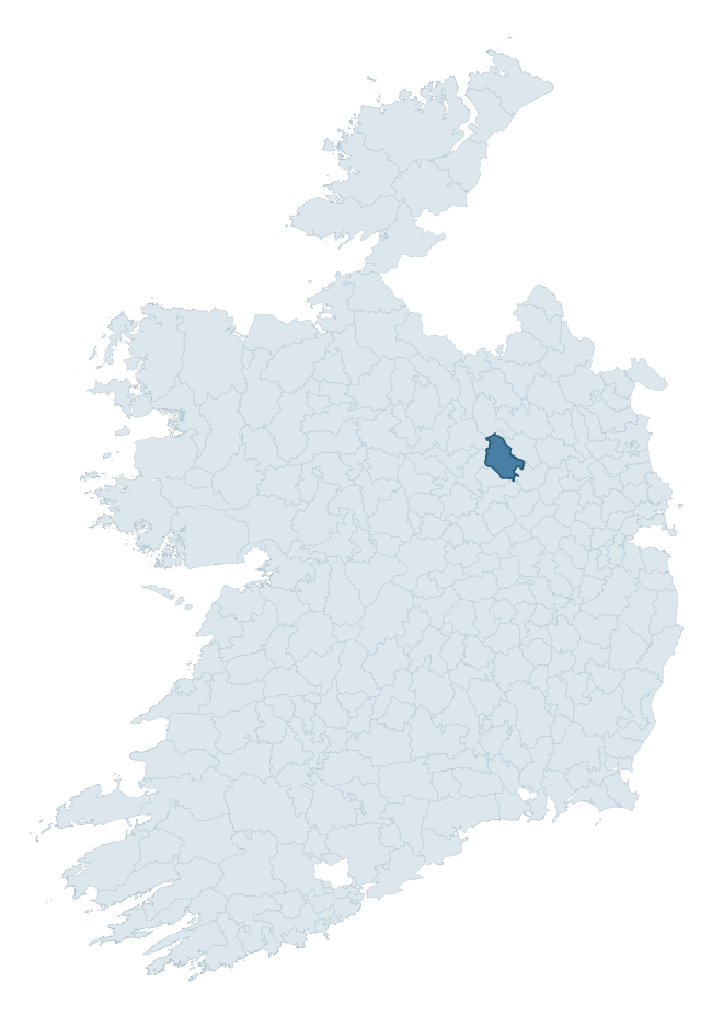
Where this barony sits in the Republic of Ireland
Geology and preservation
Bedrock geology shapes the landscape long before any settlement begins — controlling soil drainage, agricultural potential, the survival of upstanding monuments, and the preservation of buried archaeology. The figures below come from the Geological Survey Ireland 1:100,000 bedrock map.
The bedrock underlying Fore is predominantly limestone (44% of the barony by area), laid down during the Carboniferous period (100% by area, around 359 to 299 million years ago). Limestone is the most heritage-rich bedrock in Ireland. It supports fertile, well-drained soils that favoured dense Early Medieval settlement and Norman manorial agriculture, and it weathers into karst features — sinkholes, caves, swallow holes, and souterrains — that frequently carry archaeology. Where peat overlies limestone, organic preservation can be exceptional. A substantial secondary geology of cherty limestone (38%) and limestones (15%) adds further variety to the underlying landscape. The single largest mapped unit is the Lucan Formation (44% of the barony's bedrock).
Rock type composition
Largest mapped unit: Lucan Formation (44% of the barony)
Placename evidence
Logainm records 13 heritage-diagnostic placenames for Fore, a modest sample drawn predominantly from the townland record. The dominant stratum is early christian ecclesiastical. The most frequent diagnostic roots are cill- (5) and gall- (3). With a sample of this size the count should be treated as indicative rather than definitive.
Pre-Christian / Early Medieval Defensive
| Root | Count | Meaning |
|---|---|---|
| ráth- | 2 | earthen ringfort |
| lios- | 2 | ringfort or enclosure |
| dún- | 1 | hilltop or promontory fort |
Early Christian Ecclesiastical
| Root | Count | Meaning |
|---|---|---|
| cill- | 5 | church (early) |
| gráinseach- | 1 | monastic farm / grange |
Burial, Ritual, and Norse-Contact
| Root | Count | Meaning |
|---|---|---|
| gall- | 3 | foreigner — Norse settlement marker |
| carn- | 2 | cairn |
Other baronies in Westmeath
About this profile
Click any section below to expand.
What is a barony?
A barony is a historic administrative unit in Ireland, broadly equivalent to an English hundred. The 280 baronies used here are from the OSi 2019 National Statutory Boundaries (generalised 20m), covering the 26 counties of the Republic of Ireland. Baronies derive from the Norman period, were formalised in the 17th century, and have not been redrawn for statistical purposes. They vary enormously in area, from compact urban baronies in Dublin to vast upland baronies in Connacht, and should not be compared by raw site count without accounting for area differences.
What counts as a site?
This profile combines three distinct heritage registers, each with its own definition of what constitutes a recordable site:
- Archaeological sites (NMS). The National Monuments Service Sites and Monuments Record (SMR) catalogues every known archaeological monument or site of archaeological interest in the Republic, from prehistoric burial mounds and ringforts to medieval churches and post-medieval defensive works. Inclusion does not require legal protection — only that the site has been identified, surveyed, and assessed as having archaeological value. A separate subset of these sites lies within a recorded protection zone, which gives them statutory protection under the National Monuments Acts.
- Listed buildings (NIAH). The National Inventory of Architectural Heritage records buildings of architectural, historical, archaeological, artistic, cultural, scientific, social, or technical interest. Each surveyed structure is appraised on a five-tier scale: International, National, Regional, Local, and Record-Only. The NIAH appraisal is informational rather than strictly statutory, but it underpins local-authority Record of Protected Structures (RPS) listings.
- Heritage placenames (Logainm). Logainm is the authoritative database of Irish placenames maintained by the Placenames Branch. This profile applies a heritage-diagnostic classifier to the Irish-language form of each townland name, flagging roots that signal defensive sites (ráth-, lios-, dún-, caiseal-, cathair-), ecclesiastical foundations (cill-, teampall-, domhnach-, mainistir-), prehistoric burial-ritual features (tuaim-, carn-, leaba-), or Norse-contact settlement (gall-). Townlands without one of these diagnostic roots are not flagged here — they may still carry historical significance, but that significance is not encoded in the name itself.
Editorial principles
The narrative sections of this profile follow several explicit principles:
- Evidential. Every claim about this barony’s heritage character is anchored in the underlying register data. Where a site count, a placename count, or a percentile rank is cited, it is computed from the source datasets at export time, not estimated.
- Comparative. Counts and metrics are reported alongside their percentile rank against the other 279 ROI baronies. A barony with 50 ringforts in absolute terms could be unusually high or unusually low depending on its size and regional context; percentile ranking removes that ambiguity.
- Transparent on limits. Where a register has known coverage gaps, survey biases, or data-quality issues that affect this barony’s figures, the profile flags them rather than presenting the numbers as definitive.
- No interpretation beyond what the data supports. The narrative does not speculate about historical events, social dynamics, or cultural meaning beyond what the recorded heritage and placename evidence directly attests.
Data caveats and limits
- NMS Sites and Monuments Record is the product of survey campaigns conducted at different intensities across different counties and decades. Some baronies have been surveyed more thoroughly than others, and absolute counts should be read in that light. Sites destroyed by development before survey are typically not represented; sites in heavily forested or upland terrain are sometimes under-recorded.
- NIAH coverage is broadly complete for the Republic of Ireland but the survey was conducted on a rolling county-by-county basis, and the most recent appraisal date varies. Buildings demolished or substantially altered after their original survey may still appear in the register; conversely, recent buildings of merit may not yet have been appraised.
- Logainm classification applies a deliberately conservative pattern-matching approach to the Irish-language townland forms. The classifier prioritises true positives over recall: a townland may carry a heritage signal that the classifier doesn’t recognise, particularly where the diagnostic root has been heavily anglicised or where the townland name draws on a less common term. The 60,000+ townland records and ~9,800 classified placenames give a substantial signal at barony scale, but individual townland names should be checked against Logainm directly for definitive interpretation.
- Period attribution. The chronological distribution reflects only those NMS sites that carry a recognised period attribution in the source data. Sites listed as “Unknown” period are excluded from the dated subset.
- Boundary changes. Some baronies have undergone minor boundary adjustments since their 19th-century definition; the OSi 2019 generalised boundaries used here are the current statutory definition and may differ slightly from historical maps in border areas.
- Bedrock geology is mapped at 1:100,000 scale, which means local variation within a barony — small pockets of different rock type, mineral veins, alluvium overlying bedrock — is generalised. The dominant-system and rocktype figures are area-weighted, so a barony reading “70% Carboniferous limestone” may still contain small but archaeologically important pockets of older or younger rock. Around 3% of GSI polygons do not match the lexicon and contribute no rocktype or system attribution.
Data sources
- National Monuments Service — Sites and Monuments Record (SMR) https://data.gov.ie/dataset/national-monuments-service-archaeological-survey-of-ireland
- National Inventory of Architectural Heritage (NIAH) https://data.gov.ie/dataset/national-inventory-of-architectural-heritage-niah-national-dataset
- Logainm — Placenames Database of Ireland https://www.logainm.ie/
- Ordnance Survey Ireland — National Statutory Barony Boundaries 2019 https://data-osi.opendata.arcgis.com/
- EURODEM — European Digital Elevation Model https://www.mapsforeurope.org/datasets/euro-dem
- ESA WorldCover https://esa-worldcover.org/en
- Geological Survey Ireland — 1:100,000 Bedrock Geology https://www.gsi.ie/en-ie/data-and-maps/Pages/Bedrock.aspx
Explore more: Search any of the 280 ROI baronies, browse by historical province, or read the methodology and data sources for the full Republic of Ireland Heritage Tool.