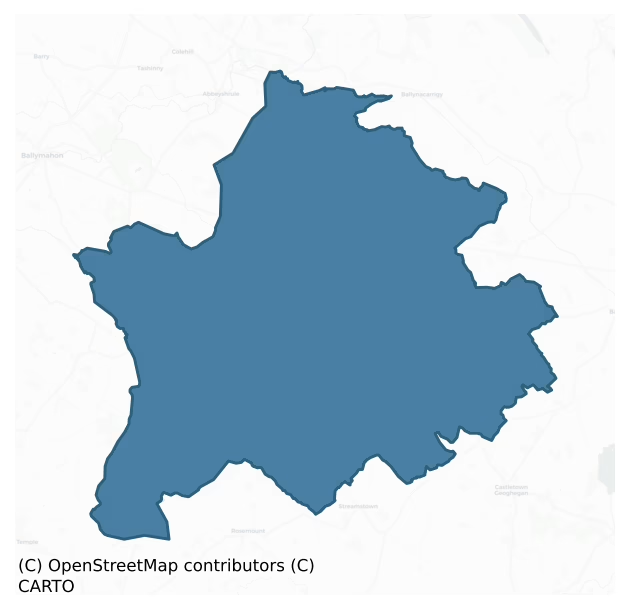
Rathconrath is a barony of County Westmeath, in the historical province of Leinster (Irish: Ráth Conarta), covering 195 km² of land. The barony records 686 NMS archaeological sites and 121 NIAH listed buildings, placing it at around the 89th percentile among 280 ROI baronies for sites per km². This means it is in the top fifth of all baronies for sites per km². Dated archaeological evidence runs from the Neolithic through to the Modern, spanning 8 of 9 archaeological periods, placing the barony in the 57th percentile among 280 ROI baronies for chronological depth. This means it is in the upper half of all baronies for chronological depth. The largest dated subset of recorded sites dates to the Early Medieval. Logainm flags 28 placenames in the barony as carrying a recognised heritage root; the largest share — around 57% — are names associated with early Christian church and monastic foundations.
Heritage at a glance
Percentile rankings throughout this profile compare each barony only against the other 279 Republic of Ireland baronies.
The recorded heritage of Rathconrath
The National Monuments Service Sites and Monuments Record (SMR) is the statutory inventory of archaeological sites for the Republic of Ireland, maintained by the Department of Tourism, Culture, Arts, Gaeltacht, Sport and Media. Sites recorded here include earthworks, ringforts, megalithic tombs, ecclesiastical remains, and post-medieval features; not every record is legally protected, but each is registered as a monument of archaeological interest.
The National Monuments Service records 686 archaeological sites in Rathconrath, putting it at the 89th percentile among 280 ROI baronies for sites per km². This means it is in the top fifth of all baronies for sites per km². Protection coverage is near-universal — 670 sites (98%) fall within a recorded monument protection zone, indicating an extensively surveyed landscape. The dominant category is defensive sites — ringforts, enclosures, hillforts, and stone forts (411 sites, 60% of the record). Ringfort – rath is the most prevalent type, making up 36% of the barony's recorded sites (244 records) — well above the ROI average of 20% across all baronies where this type occurs. Ringfort – rath is an earthen ringfort enclosed by a bank and external ditch — the most common Early Medieval farmstead, broadly dated 500–1000 AD. Other significant types include House – indeterminate date (54) and Souterrain (37). House – indeterminate date is a habitation building whose date cannot be determined from available evidence; Souterrain is an underground stone-built passage and chamber, generally Early Medieval and often associated with ringforts as a defensive or storage feature. Across the barony's 195 km², this gives a recorded density of 3.51 sites per km².
Most common monument types
Hover or tap a monument type to see its definition.
| Type | Count |
|---|---|
| Ringfort – rath an earthen ringfort enclosed by a bank and external ditch — the most common Early Medieval farmstead, broadly dated 500–1000 AD | 244 |
| House – indeterminate date a habitation building whose date cannot be determined from available evidence | 54 |
| Souterrain an underground stone-built passage and chamber, generally Early Medieval and often associated with ringforts as a defensive or storage feature | 37 |
| Enclosure a banked or ditched feature of uncertain type, used as a catch-all where the original function cannot be determined from surface evidence | 29 |
| Ringfort – unclassified a circular Early Medieval settlement enclosure where surviving evidence does not allow distinction between earthen and stone forms | 27 |
| Hut site a low stone or earthen foundation enclosing a small circular or oval area, generally interpreted as a former dwelling, of any date from prehistory to the medieval period | 27 |
| Earthwork an unclassified earthen structure with no diagnostic features that allow a more specific classification | 18 |
| Castle – unclassified a castle whose form cannot be precisely classified, dating somewhere between the late 12th and 16th centuries | 18 |
Chronological distribution
The dated archaeological record for Rathconrath spans from the Neolithic through to the Modern, with activity attested across 8 of 9 archaeological periods. Every period from earliest to latest is represented in the record — an unbroken sequence of dated activity across the full chronological span. Activity concentrates most heavily in the Early Medieval (348 sites, 55% of dated material), with the Iron Age forming a secondary peak (136 sites, 22%). A further 56 recorded sites (8% of the overall NMS register for the barony) carry no period attribution — appearing as 'Unknown' in the bar chart below. This typically reflects either records that pre-date the standardised period vocabulary or sites awaiting specialist dating review, rather than a genuine absence of chronological evidence.
Sample of recorded monuments
Show 25 sample monuments (of 686 total)
A representative sample of 25 recorded monuments drawn from the barony’s 686 total NMS entries. Sites within a recorded monument protection zone and rarer site types are prioritised so the list shows a meaningful cross-section rather than only the most common type. Each entry shows the official Sites and Monuments Record reference number and the description published by the National Monuments Service.
Religious house – unclassified
Situated in a modern farmyard, 34m NE of Oldtown House. Church site (WM017-053—-) c. 86m to WNW. Levelled monument not visible on Digital Globe aerial photography. Annotated ‘Site of Abbey’ on the 1837 ed. OS 6-inch…
Situated in a modern farmyard, 34m NE of Oldtown House. Church site (WM017-053—-) c. 86m to WNW. Levelled monument not visible on Digital Globe aerial photography. Annotated ‘Site of Abbey’ on the 1837 ed. OS 6-inch map in the farmyard of Oldtown House which was enclosed by a range of agricultural outbuildings. On the revised 1913 ed. OS 25-inch map, although annotated ‘Abbey (site of)’, the farm buildings at this location are no longer shown.
Levelled abbey described in 1978 as having no visible surface remains in an area that was occupied by modern farm sheds. No medieval wall or any fabric of medieval date could be identified in the range of upstanding buildings.
Compiled by: Alison McQueen, Vera Rahilly and Caimin O’Brien
Date of upload: 10 December 2018
Designed landscape feature
Situated on a small knoll (136m/445ft OD) on the northern shoulder of a very steep hill, in pasture. No antiquity depicted at this location on the 1837 OS 6-inch map. Depicted on the revised 1913 ed. OS 25-inch map as a…
Situated on a small knoll (136m/445ft OD) on the northern shoulder of a very steep hill, in pasture. No antiquity depicted at this location on the 1837 OS 6-inch map. Depicted on the revised 1913 ed. OS 25-inch map as a roughly square-shaped tree-plantation. Described in 1983 as a roughly square-shaped area (dims. 34m E-W x 33m N-S) enclosed by an earth and stone bank (H 1m) that has been rebuilt as a stone faced wall at the NW corner. There are no indications of an external fosse. Square shaped enclosure attached by a linear bank (approx. L 22m; basal Wth 2m; H 1m) forming an avenue leading into a circular-shaped enclosure/tree ring to NE. Earthwork visible as a roughly square-shaped tree-plantation with tree-ring to NE on Digital Globe aerial photography. Probably the remains of a tree-plantation of post-1700 date forming part of the designed landscape belonging to Hallstown House located 710m SSE. Several other circular-shaped enclosures to the S and SE also appear to be the remains of tree-rings of post-1700 date.
Compiled by: Alison McQueen, Vera Rahilly and Caimin O’Brien
Date of upload: 24 December 2018
Burial mound
Situated on top of a natural rise, in gently undulating pasture, with good views to W, N and E and overlooked by a higher rise to S. Possible burial mound described in 1971 as an oval-shaped earthen mound (dims. 13.6m…
Situated on top of a natural rise, in gently undulating pasture, with good views to W, N and E and overlooked by a higher rise to S. Possible burial mound described in 1971 as an oval-shaped earthen mound (dims. 13.6m E-W; 11.8m N-S) defined by a steep scarp (H 2-2.5m). The side of the mound has been quarried away from E-SSE and the top has hollows and mounds which relate to disturbance. There is no visible trace of a fosse or a formal way of approach to the top of the mound. There are no remains of a bailey, although an area of high ground to W could potentially have been the site of a bailey. There are slight remains of old field fences to E and S of the earthwork, as depicted on the revised 1913 ed. OS 25-inch map. The gently sloping profile of this mound suggests that this could be the remains of a prehistoric burial mound rather than that of an Anglo-Norman motte castle.
Compiled by Alison McQueen, Vera Rahilly and Caimin O’Brien.
Date of upload: 30 July 2019
Religious house – Augustinian canons
There are doubts about the Ordnance Survey designation of this monument which records that these buildings marked the site of 'Plary Monastery' which was an Augustinian priory of the non conventual order dedicated to…
There are doubts about the Ordnance Survey designation of this monument which records that these buildings marked the site of 'Plary Monastery' which was an Augustinian priory of the non conventual order dedicated to the Blessed Virgin Mary (Costello 1909, 82) and known as 'Clary alias Loughsewdy'. In 1682 Sir Henry Piers recorded that the Priory of Ballymore was located on the same site as the nunnery (WM024-181—-) of Lough Sewdy which would place the priory in a different location to the site marked on the OS 6-inch map. The abbey building is depicted on the 1656 Down Survey map of Ballymore parish (NLI MS 723-4) where it is shown located on the E side of the River which runs S from Lough Sewdy. On the 1656 Down Survey map of Rathconrath barony the 'ruinous abby' is depicted standing inside a D-shaped enclosure or field boundary on the E side of the river (NLI MS 723-4). On this map of Rathconrath barony a large building is shown standing in the field to the W of the river which corresponds with the upstanding building today. If the 1656 Down Survey is correct the monastery was located in the adjoining fields to the SE of the current location. If the monastery was located to the E of the river then the ruins at 'Plary Monastery' would represent the probable remains of Lough Sewdy Castle (WM024-182—-). The terrier of the 1656 Down Survey map of Ballymore parish states that 'on the lands of Balllimore stands the ruins of an old abby and a ruined church (WM034-…
Megalithic tomb – unclassified
St Patrick's bed was described in the late 1880s as following; 'If there are any remains on Ushnagh Hill of a structure of the dolmen class, they are to be looked for in a long raised area crowning the elevation, and…
St Patrick's bed was described in the late 1880s as following; 'If there are any remains on Ushnagh Hill of a structure of the dolmen class, they are to be looked for in a long raised area crowning the elevation, and called Patrick's Bed. It is surrounded by stones on edge, and is about 21 feet [6.4m] long, and 4 or 5 feet [1.2-1.5m] wide. O'Donovan says that the people complained that "the sappers removed stones from it, before which it was much more perfect." Its situation would have been just the one for a dolmen, and it is too narrow to have been a church. I carefully examined it, but cannot speak with certainty as to its having been a dolmen, although what it can have been, if it were not, it is difficult to say. No trace of a roofing-stone is visible' (Borlase 1897 vol. 2, 373). O'Donovan (OSL 1837, 14/G/13/12(19) ) recorded that local people complained that "it was much more prefect before the sappers removed stones from it, before which it to form a Trig. Station on the hill".
Monument described by Schot (2016) as following; ' The monument known as ‘St Patrick’s Bed’ crowns the highest point of the Hill (180m above sea-level), near the western end of the summit plateau, and commands extensive, panoramic views over the central plain of Ireland. The name was first recorded by John O’Donovan (OSL 1837, I, 42) and is likely to have been inspired by early legends of the saint’s visit(s) to Uisneach. Although its dilapidated condition makes classification difficult, it…
Barrow – pond barrow
National Monument No. 155. Surveyed in 2013 and described by McGuinness (2014, 51) as following: 'Subcircular enclosure delimited by a broad, low bank (Diam. 22.7m N-S x 25.5m E-W) surrounding a hollowed-out area…
National Monument No. 155. Surveyed in 2013 and described by McGuinness (2014, 51) as following: 'Subcircular enclosure delimited by a broad, low bank (Diam. 22.7m N-S x 25.5m E-W) surrounding a hollowed-out area roughly centred on an enormous, fragmentary limestone boulder (H. c. 4.5m) known as the ‘Catstone’, which is 3.7m from the bank where this is closest on SW side; interior reaches below external ground level and has presumably been excavated to gather material for the bank, and possibly to expose the lower part of the Catstone, as was suggested to Borlase by a local labourer. Monument is located in rough pastureland that slopes down steeply from NE to SW, the slope including both surrounding bank and hollowed interior. Bank ranges from 4.4m to 4.6m in width and reaches up to 1.36m above interior ground-level immediately inside high E side; although on SE side, where bank is prominent, it rises 2.1m above that part of interior immediately adjacent to Catstone; bank reaches up to 0.54m in height above external ground level but may be higher on overgrown S side, where ground falls away sharply. This is the ‘Catstone’, a recent name derived from its supposed appearance. A cylindrical hole visible in the top of the central boulder was clearly intended to support the flag-pole which Macalister and Praeger say was erected on it in its capacity as a recent ‘centre for political and other meetings’. For the historical and mythic significance of this ancient and impor…
Ritual site – pond
Lough Lugh is a small lake located in a slight hollow (166m above sea-level) between the western and eastern summits of Uisneach, at the approximate centre of the monument complex (WM024-177—-). The lake has been…
Lough Lugh is a small lake located in a slight hollow (166m above sea-level) between the western and eastern summits of Uisneach, at the approximate centre of the monument complex (WM024-177—-). The lake has been identified as Loch Lugborta where, according to early Irish tradition, the god Lug was drowned by the mythical trio, Mac Cuill, Mac Cecht and Mac Greine and subsequently buried in a cairn nearby (Schot 2011; Schot 2010, 5; Gwynn 1924, 278-81). The lake measures c.80m N/S by 60m E/W and has a floating vegetation mat at its centre. Its associated mythology and comparison with similar bodies of water at other royal centres, such as within the Navan Complex, Co. Armagh, suggest that the lake might have been a ritual focus in prehistory. Recent palaeoenvironmental investigations, involving a study of the lake sediments and the fossilised remains of insects and pollen, have shown that the lake has an interesting and complex history (Schot et al. 2014; McGinley et al. 2015). A lake was present here at the end of the last ice age, some 12,000 years ago, but it began to develop into a marsh before 8,000BC. Sometime later, possibly in the late prehistoric or early medieval period, the accumulated sediments were dug out to restore open water conditions. The existing lake, therefore, is the combined result of natural processes and human endeavour and may have been created as a ritual pond and/or as a watering hole for livestock (ibid.).
See attached photo (WM024-064002-…
Font (present location)
Limestone baptismal font of possible 16th century date now incorporated into the top of a modern wall to the S of the S doorway of the 19th century R.C. Church at Loughanavally. According to local information this font…
Limestone baptismal font of possible 16th century date now incorporated into the top of a modern wall to the S of the S doorway of the 19th century R.C. Church at Loughanavally. According to local information this font originally came from the medieval church (WM025-011—-) at Churchtown (SMR File) which is 2.8km to the ENE. A limestone baptismal font (ext. H 0.35m; rim Wth 0.08m) consisting of an octagonal shaped bowl (ext. diam. 0.66m) with a circular-shaped basin (int. diam. 0.5m; D 0.2m). There is no evidence of a drainage hole in the basin. On one of the eight faces (L 0.27m; H 0.2m) of the font there is a date 1511 carved in relief. The underside of the font has 8 chamfered faces. Cross referenced with WM025-011003-.
Compiled by: Caimin O’Brien
Date of upload: 28 July 2014
Flat cemetery
Cahill and Sikora (2011, 540-5) record that ‘in June 1956 a short cist containing an inhumation was discovered near Castletown Geoghegan, Co. Westmeath. The cist (grave 1) was discovered when a bulldozer which was being…
Cahill and Sikora (2011, 540-5) record that ‘in June 1956 a short cist containing an inhumation was discovered near Castletown Geoghegan, Co. Westmeath. The cist (grave 1) was discovered when a bulldozer which was being used to level the spot came across the capstone and broke it lengthwise to reveal the cist. The find was reported to the Museum by the Gardaí at Castletown Geoghegan and was investigated on 27 June by Ellen Prendergast. The human remains were examined by Professor C.A. Erskine. In September of the same year two further cists (graves 2 and 3)—one containing a crouched burial and the second a cremation and a bowl—were reported from the same site, also as a result of bulldozing operations. These were excavated by Breandán Ó Ríordáin. The following report is based on Ó Ríordáin's and Prendergast's accounts of their excavations. The human remains were analysed by Laureen Buckley. The site was situated in a small gravel mound or quarry in the middle of a field between 140m and 150m above sea level.
Grave 1
The short cist was rectangular in plan, with its long axis aligned north/south. It measured 1.02m long by 0.7m wide by 0.66m high. It was formed of four main slabs, one at each side. The cist walls were supported externally by smaller packing stones. The structure was sealed by a large capstone, which had cracked longitudinally at the western side- of the cist. It measured 1.9m long by 1.75m wide by 0.2m thick. The floor of the cist was formed of bedrock….
Barrow – bowl-barrow
Situated in low-lying gently undulating pasture. Depicted on the 1837 ed. OS 6-inch map as a tree-lined oval-shaped tree-lined earthwork (approx. dims. 54m N-S; 47m E-W). A barrow (WM030-022—-) lies c. 90m to NW.…
Situated in low-lying gently undulating pasture. Depicted on the 1837 ed. OS 6-inch map as a tree-lined oval-shaped tree-lined earthwork (approx. dims. 54m N-S; 47m E-W). A barrow (WM030-022—-) lies c. 90m to NW. Monument described in 1973 as the remains of a roughly oval-shaped earthwork which is enclosed by a bank from SW-W-NW. There is no definite indication of a bank elsewhere. The interior is very uneven with stones and boulders projecting from the surface. The earthwork is divided into three parts by modern field banks and fences. Monument is clearly visible today on Digital Globe aerial photography as consisting of a central mound (approx. diam. 8m) enclosed by a possible fosse and external bank (overall ext. diam. 44m).
Compiled by Alison McQueen, Vera Rahilly and Caimin O’Brien.
Date of upload: 08 November 2019
Surveyed in 2013 and described by McGuinness (2014, 54-5) as following: 'Large, roughly subcircular monument (Diam. 47.5m N-S) comprising a subcircular central mound (Diam. 10.2m N-S x 13.2m E-W) surrounded at a considerable distance by a bank, giving the impression of a broad, shallow ‘ditch’ in between. SE stretch of bank appears to have been removed, precluding a measurement of the E-W diameter of the monument. Although on undulating ground, monument is level when viewed from a distance. Where highest on NW side, central mound rises up to 1.55m above area between mound and bank; it has irregular upper surface, perhaps damaged b…
Religious house – Cistercian nuns
Historical documentation suggests that the nunnery at Lough Sewdy was located on the same site as the Priory (WM024-034—) of St. Mary's Lough Sewdy. In 1306 the ecclesiastical taxation of Ireland valued the…
Historical documentation suggests that the nunnery at Lough Sewdy was located on the same site as the Priory (WM024-034—) of St. Mary's Lough Sewdy. In 1306 the ecclesiastical taxation of Ireland valued the ‘Temporalities of the nuns de Lox’ [Loughsewdy, co. Westmeath] as worth ½ a mark a year (Cal. doc. Ire., 258, 266). In 1417 there is a reference to Margaret, the prioress, and the convent of the Cistercian monastery of Loughseudy [alias Ballymore Lough-Seudy] (Costello 1909, 86). A note in the annates states that ‘it appears from the above annat entry that the nunnery of Lochseudy being abandoned by the nuns had been turned into a priory of Regular Austin canons – why the nuns left, or precisely when they did so, I have note so far been able to make out – a bull in the Vatican archives dating from 1417 states that ‘Margaret, prioress of S. Mary’s Loughseudy, of the Cistercian order, and the convent of that house had some time before, using their right of presentation to the rectory of St. Patrick, Magmora [Mayvore]’ (Costello 1909, 101). In 1427 there is a reference to Johanna, prioress of S. Mary’s Lough Sewdy , of the Cistercian Order, to whom by ancient and approved usage the right of presentation to Killfyelan belonged’ (Costello 1909, 179). In 1453 there is a reference to 'the prioress and convent of the Cistercian nuns' priory de lochsydii (i.e. Lochsydy) in the diocese of Meath' (Cal. papal letters, 670).
The Urban Survey of Westmeath (Bradley et. al. 1…
Sheela-na-gig
This monument is said to have come from Carne Castle (WM024-123—-) and was in the possession of Henry Upton, Esq. of Coolatore House (see WM031-007003-) (Guest 1936, 119; McMahon and Roberts 2001, 120). The…
This monument is said to have come from Carne Castle (WM024-123—-) and was in the possession of Henry Upton, Esq. of Coolatore House (see WM031-007003-) (Guest 1936, 119; McMahon and Roberts 2001, 120). The sheela-na-gig is now located in the National Museum of Ireland (Cherry 1992, 6). Described by Freitag as a figure ‘carved on irregular, heavy slab; triangular head with ovoid eyes and slit-mouth. No neck, heavy shoulders and round breasts. Arms in front of body with both hands reaching into vulva, hanging between widely splayed thighs. Heels joined together and toes pointing down and outwards’ (Freitag 2004, 126).
Compiled by: Caimin O'Brien
Date of upload/revision: 05 June 2012
Burial
In April 1976 two inhumation burials were uncovered while digging foundations for a water tank. Located on a gentle, S facing slope. One of the graves consisted of a simple unlined pit of sub-rectangular shape, oriented…
In April 1976 two inhumation burials were uncovered while digging foundations for a water tank. Located on a gentle, S facing slope. One of the graves consisted of a simple unlined pit of sub-rectangular shape, oriented N-S (dims. L 1.20m, Wth 0.50m). Grave 1 contained a crouched inhumation and no artifacts were found. The body was oriented N-S with the head slightly raised to the N. The second grave was located c 3m NW of Grave 1. It appeared to have contained the remains of two individuals. Radiocarbon dates from the recovered bones yielded dates which calibrate to AD 680-882 and AD 686-881 respectively (NMI).
House – 16th/17th century
A building at the southern end of a bastioned fort (WM024-004001-) may be the site of the 'Strong House' of the 'Widow White' described by George Story in 1691. The earthwork marked 'Camp (Site of)' (WM024-004001-) on…
A building at the southern end of a bastioned fort (WM024-004001-) may be the site of the 'Strong House' of the 'Widow White' described by George Story in 1691. The earthwork marked 'Camp (Site of)' (WM024-004001-) on the 1910 edition of the OS 6-inch map indicates the location of a Jacobite bastioned fort indicated on a sketch map of Ballymore from 1691 as 'The Fort of Ballymore' (Story 1693, 318). This fortification is located at the base of a motte and bailey (WM024-004—-) on it southern side and appears to have incorporated the motte as a defensive feature of the bastioned fort. A small circular structure is indicated on top of the motte while two smaller rectangular structures are indicated in the bailey on the northern side of the motte. A church and graveyard (WM004-005—-/005001-) are located 275m to the SW of the artillery fort and the village of Ballymore (WM024-179—-) is 430m to the south. A circular castle (WM024-034—-) is 660m to the south. The site of this building was recorded in 1983 as 'The site of a building located near the S. end of the 'camp' is indicated on an estate map of 1827 (NLI 16 J 10 (6) ). No trace of this building nor any indication or extent could be discerned on the ground' (SMR File). This building may be the same building as indicated on the 1837 edition of the OS 6-inch map where it is depicted beside the 'Pier of Draw Bridge'. This house or building was described in June 1691 by George Story, a chaplain in the Williamite army as…
Hospital
A hospital was located at the E end of Ballymore village (WM024-179—-), although the precise location has not been identified. The Urban Survey of Westmeath recorded that 'Story's map of 1693 shows a plain…
A hospital was located at the E end of Ballymore village (WM024-179—-), although the precise location has not been identified. The Urban Survey of Westmeath recorded that 'Story's map of 1693 shows a plain quadrangular building marked 'the hospital', situated on the south-east side of the village (Murtagh 1974-5, Pl. 16). There is no further evidence, documentary or otherwise, for this hospital and no sign of it now survives' (Bradley et. al. 1985, 70; Story 1693, 88). This hospital was located on the S side of the Dublin-Athlone Road close to the cross-roads at the E end of the present village of Ballymore. The precise location of this building has not been identified.
The location of this 'Hospital' has been recorded in 2009 as 'The 'hospital' as marked on the contemporary mapping to the east of the village is no longer visible, though its general location can be suggested. Today a row of houses have been built along the road at this point, although it is unclear what damage these may have caused to any underlying archaeology' (Report on the Battlefield of Ballymore Co. Westmeath 2009, 9, 10).
See attached sketch plan of Ballymore Town (WM024-179—-), showing the round castle (WM024-182—-), and a square shaped building annotated as 'The Hospital' c. 1691, taken from Story's An impartial history of the wars of Ireland, with a continuation thereof.
Compiled by: Caimin O'Brien
Date of upload: 21 August 2014
Stone head
Set high up in the wall just below the eaves of a single storey outbuilding is a voussoir with an oval-shaped stone head carved in relief. The carved head has almond-shaped bulbous eyes, a long elongated nose and a…
Set high up in the wall just below the eaves of a single storey outbuilding is a voussoir with an oval-shaped stone head carved in relief. The carved head has almond-shaped bulbous eyes, a long elongated nose and a narrow slit mouth the ends of which are turned down. This voussoir with its carved head does not appear to be in its original location and has been incorporated into the E wall of an outhouse aligned on a N-S axis that forms the W range of outbuildings of a farmyard. Bullaun stone (WM025-033—-) and font (WM025-034—-) located 145m to the ENE, which originally came from the medieval church at Churchtown (WM025-011—-). The farmhouse and its outbuildings containing the carved head were described by the National Inventory of Architectural Heritage as a 'detached six-bay two-storey house, built c.1850, with projecting three-bay flat-roofed porch to the centre of the entrance façade (north), with crenellated parapet over, and a single and two-storey return to the rear (south). Formerly in use as a public house (west). Complex of single-storey rendered outbuildings to the northwest of house, running at a right angle to the house alignment. Further complex of outbuildings to the south. Early carved stone head inserted north end of outbuilding adjacent to road to the northeast. Set back from road to the west end of Loughanavally' (www.buildingsofireland.ie).
Stone heads out of context like this carving are very difficult to date based on visual inspection alone…
Hilltop enclosure
The largest monument at Uisneach, this enclosure is defined by a curvilinear ditch measuring nearly 200m in diameter and straddles three adjoining townlands on the E summit of the Hill (Schot 2010, 8-9; Schot 2011). A…
The largest monument at Uisneach, this enclosure is defined by a curvilinear ditch measuring nearly 200m in diameter and straddles three adjoining townlands on the E summit of the Hill (Schot 2010, 8-9; Schot 2011). A prominent mound (WM024-173—) crowns the gently rounded rise at the centre of the enclosure, while on the SW the enclosure overlooks Lough Lugh (WM024-064002-), which lies c.50m downslope.
The SW sector of the enclosure was first recorded by geophysical survey in 2005 and a segment of its silted-up ditch can still be traced as a broad, shallow depression curving from NNW to SE near Lough Lugh. Further survey in 2009 revealed the full extent of the enclosure, which is sub-circular in plan (ibid., 103–4). The NW sector of the enclosure and portions of its S perimeter underlie, and are now obscured by, the townland boundary walls that divide Mweelra from Ushnagh Hill and Rathnew, respectively. For most of its circuit, however, the enclosure is evidenced geophysically as a curvilinear band of positive magnetic gradient, 2m in average width. Although the ditch appears to have been relatively substantial, and may be rock-cut, no traces of an accompanying bank have been identified. The magnetic signature of the enclosure on the E and SE is notably weaker than elsewhere along its circuit, probably as a result of extensive ploughing in this area in recent centuries. Notwithstanding this disturbance, the entrance to the enclosure is clearly discernible on the NE, an…
Font
Limestone baptismal font of possible 16th century date now incorporated into the top of a modern wall to the S of the S doorway of the 19th century R.C. Church at Loughanavally. According to local information this font…
Limestone baptismal font of possible 16th century date now incorporated into the top of a modern wall to the S of the S doorway of the 19th century R.C. Church at Loughanavally. According to local information this font originally came from the medieval church site (WM025-011—-) at Churchtown (SMR File). A limestone baptismal font (ext. H 0.35m; rim Wth 0.08m) consisting of an octagonal shaped bowl (ext. diam. 0.66m) with a circular-shaped basin (int. diam. 0.5m; D 0.2m). There is no evidence of a drainage hole in the basin. On one of the eight faces (L 0.27m; H 0.2m) of the font there is a date 1511 carved in relief. The underside of the font has 8 chamfered faces. Cross referenced with WM025-034—-.
Compiled by: Caimin O’Brien
Date of upload: 28 July 2014
Mausoleum
The ivy-covered ruins of a small 17th century mausoleum or mortuary chapel belonging to the Magan family of Umma House can be seen standing in the E quadrant of Ballymore graveyard (WM024-005001-). In 1826 it was…
The ivy-covered ruins of a small 17th century mausoleum or mortuary chapel belonging to the Magan family of Umma House can be seen standing in the E quadrant of Ballymore graveyard (WM024-005001-). In 1826 it was recorded that in Ballymore graveyard, ‘is a decayed chapel, the antient place of sepulture of the Magan family of Emoe [Umma More] and Togher's town, in this county' (Brewer 1826, 247). In 1867 it was recored there 'is an oratory or mortuary chapel at Ballimore which measures twenty-two feet nine inches [6.9m] by fourteen feet seven inches [4.4m]' (Cogan 1867, 493). Present remains consist of a small rectangular chapel (int. dims. 7m NE-SW 4.45m NW-SE; wall T 0.7m) aligned NE-SW in E quadrant of graveyard. The walls of the chapel are constructed with limestone rubble with undressed alternating quoins. The NE end of the chapel walls are covered in ivy making detailed examination of this end of the building difficult. The SW end of the chapel walls are not covered in ivy. The chapel is entered through a pointed rebated doorway in the SW gable above which are the remains of a niche which originally probably contained the armorial plaque of the Magan family. The remains of a yett hole can be seen on the N side of the doorway which is constructed with punch dressed limestone rebated jambs. Traces of external render can be seen on the surface of the dressed stones of this doorway. The interior of the chapel was lit by a triple light flat headed window of 17th…
Burnt mound
In rough pasture on the edge of low-lying poorly drained land which is depicted as a pond on the 1837 ed. OS 6-inch map. Low grass covered mound (H 0.2m; diam. c. 10m) of burnt stone and charcoal the core of which was…
In rough pasture on the edge of low-lying poorly drained land which is depicted as a pond on the 1837 ed. OS 6-inch map. Low grass covered mound (H 0.2m; diam. c. 10m) of burnt stone and charcoal the core of which was exposed in the S face of a drain by the landowner when deepening a field drain that runs E-W across this wet partially reclaimed land.
Compiled by: Caimin O'Brien
Date of upload: 22 August 2014
Megalithic structure
Situated on WSW face of high natural ridge running NE-SW with excellent views in all directions. Well preserved ring-barrow (WM018-090—-) with a modern field bank of earth and stone running NW-SE is located 3m E of…
Situated on WSW face of high natural ridge running NE-SW with excellent views in all directions. Well preserved ring-barrow (WM018-090—-) with a modern field bank of earth and stone running NW-SE is located 3m E of external bank. There are three large orthostats of megalithic proportions incorporated into the W face of this field bank which may have been the remains of some type of megalithic structure which has been partially levelled. Two of these stones are set longitudinally in a line as if to form the side wall of a chamber with the third stone at NW end running perpendicular as if to form a jamb stone of the chamber (SMR File 27/04/1970). In 1921, when Shaw saw them, they were collectively known as the ‘leegaun’, although he mistakenly placed them ‘on the west, facing the barrow’ (Shaw 1921, 137).
Compiled by: Caimin O’Brien
Date of upload: 20 July 2015
Ogham stone
Situated on driveway leading to Oldtown House. Church site (WM017-053—-) and abbey site (WM017-054—-) located to NW and N, respectively. Possible ogham stone described in 1978 as a large heavy flagstone which is…
Situated on driveway leading to Oldtown House. Church site (WM017-053—-) and abbey site (WM017-054—-) located to NW and N, respectively. Possible ogham stone described in 1978 as a large heavy flagstone which is reputed to have an ogham inscription. There are some markings along one axis/angle, but it is difficult to assess their true nature due to the fact that the stone is lying ‘face’ down’ (ASI File).
Compiled by: Alison McQueen, Vera Rahilly and Caimin O’Brien
Date of upload: 10 December 2018
Inscribed stone
Situated in a small natural rise, in gently undulating pasture. Described in 1977 as a large stone which lies on the centre of the floor of a souterrain (WM017-057—-). The letter ‘U’ and possibly ‘I’ is picked out of…
Situated in a small natural rise, in gently undulating pasture. Described in 1977 as a large stone which lies on the centre of the floor of a souterrain (WM017-057—-). The letter ‘U’ and possibly ‘I’ is picked out of the upper surface. A second field report of 1977 describes this stone as having a number of grooves which appear to have been enlarged by pocking. This inscribed stone could be a possible ogham stone. A second possible ogham stone (WM017-054002-) liew on entrance avenue to Oldtown house c. 425m to W.
See attached cross-sections of souterrain showing location of inscribed stone surveyed and drawn by the ASI.
Compiled by: Alison McQueen, Vera Rahilly and Caimin O’Brien
Date of upload: 12 December 2018
Bullring
Situated on W facing slope of a prominent hill in grassland. Depicted on the 1837 ed. OS Fair Plan map and annotated on map as ‘The Bull Ring’. No surface remains visible of a any earthwork at the location marked on…
Situated on W facing slope of a prominent hill in grassland. Depicted on the 1837 ed. OS Fair Plan map and annotated on map as ‘The Bull Ring’. No surface remains visible of a any earthwork at the location marked on the OS 6-inch map. A bullring in Co. Kilkenny known as Butts Green that was marked as a 'Bull Ring' on Roque's map of Kilkenny dating from 1758, which suggests that bull-baiting took place here in the 17th century (Farrelly, O'Reilly, and Loughran 1993, 23). The date of the bullring in Westmeath is unknown. Faint cropmark of a possible circular-shaped enclosure on Digital Globe aerial photograph may be the 'Bull Ring' annotated on the OS Fair Plan map. This cropmark encloses the OS trig. station marking the spot height 243 ft. OD.
Compiled by: Frank Coyne and Caimin O'Brien
Date of upload: 11 September 2018
Ringfort – rath
Situated on a slight natural rise, in a generally level paddock, surrounded by gently undulating pasture, c. 30m NNE of Rathcastle house. Possible souterrain (WM017-031001-) depicted as a cave located immediately to…
Situated on a slight natural rise, in a generally level paddock, surrounded by gently undulating pasture, c. 30m NNE of Rathcastle house. Possible souterrain (WM017-031001-) depicted as a cave located immediately to W. Annotated 'Fort' and depicted as a circular-shaped earthwork in the area known as 'Rathcaslin' on an estate map dating from 1809 (NLI, MS 21 F. 48 (019) ). Ringfort visible as a roughly circular-shaped tree-planted area on Digital Globe aerial photography. Depicted on the 1837 ed. OS 6-inch map as a circular-shaped tree-planted area, with a building shown to the immediate NE, in a small rectangular plot. Depicted on the revised 1913 ed. OS 25-inch map as a circular-shaped area (approx. dims. 38m NE-SW; 36m NW-SE) defined by a scarp with a small rectangular area named ‘cave’ indicated outside the monument to W and a rectangular building to the immediate NE, all enclosed within a rectangular plot adjoining Rathcastle house to SW.
Monument described in 1965 as a large, imposing earthen ringfort consisting of a circular-shaped area enclosed by a tree-lined earthen bank (int. H 3’ [0.9m]; ext. H 6’ [1.8m]; Wth at top c. 5’ [1.5m]) with possible entrance gap at SE. There is no clear indication of an external fosse which may have been backfilled as part of landscaping associated with Rathcastle House. The interior is densely overgrown with vegetation and has been used as a rubbish dump. Monument described in 1975 as a much disturbed subcircular-shaped area…
Listed buildings
The National Inventory of Architectural Heritage (NIAH) is a state survey appraising buildings of architectural, historical, archaeological, artistic, cultural, scientific, social, or technical interest. Each surveyed structure receives a rating from International (the highest, for buildings of European importance) through National, Regional, Local, and Record-Only.
The NIAH records 121 listed buildings in Rathconrath (58th percentile across ROI baronies). The highest-graded structures include 2 of National significance. The Republic holds 937 National-graded buildings in total, so this barony accounts for around 0% of the national total. Construction dates concentrate most heavily in the Victorian (1830-1900) period. The most-recorded building type is house (41 examples, 34% of the listed stock).
Terrain and environment
Mean elevation across the barony is 94m — the 55th percentile among 280 ROI baronies for elevation. This means it is in the upper half of all baronies for elevation. Elevation matters for heritage because higher-altitude baronies typically favour defensive monuments — ringforts and hilltop forts placed on prominent ground — while lowland baronies are more likely to carry the dense settlement and church networks of intensive agricultural landscapes. Mean slope is 2.7° — the 29th percentile among 280 ROI baronies for slope. This means it is in the bottom third of all baronies for slope. Slope is a key control on both land use and archaeological preservation: steep ground resists ploughing and tends to preserve earthworks intact, while gentle slopes favour intensive cultivation that damages or destroys surface archaeology over time. The Topographic Wetness Index averages 11.3, the 66th percentile among 280 ROI baronies for wetness. This means it is in the upper half of all baronies for wetness. Drainage matters for heritage because poorly-drained ground preserves organic archaeology (wooden trackways, leather, textiles, and on rare occasions human remains) far better than free-draining soil; well-drained ground favours arable use but destroys organic material rapidly. The land cover is dominated by improved grassland (84%) and woodland (13%).
Terrain measurements
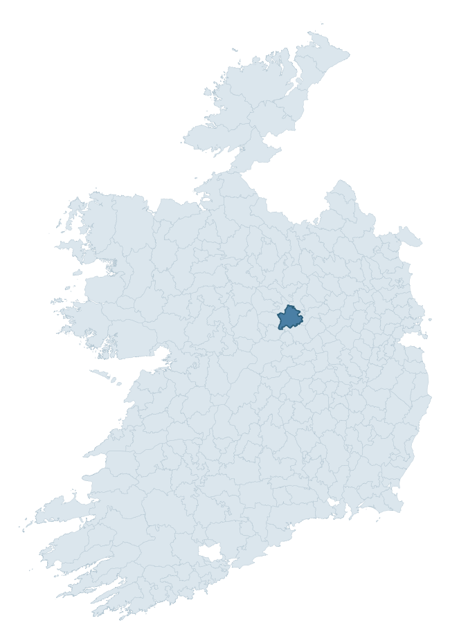
Where this barony sits in the Republic of Ireland
Geology and preservation
Bedrock geology shapes the landscape long before any settlement begins — controlling soil drainage, agricultural potential, the survival of upstanding monuments, and the preservation of buried archaeology. The figures below come from the Geological Survey Ireland 1:100,000 bedrock map.
The bedrock underlying Rathconrath is predominantly limestone (99% of the barony by area), laid down during the Carboniferous period (100% by area, around 359 to 299 million years ago). Limestone is the most heritage-rich bedrock in Ireland. It supports fertile, well-drained soils that favoured dense Early Medieval settlement and Norman manorial agriculture, and it weathers into karst features — sinkholes, caves, swallow holes, and souterrains — that frequently carry archaeology. Where peat overlies limestone, organic preservation can be exceptional. The single largest mapped unit is the Waulsortian Limestones (46% of the barony's bedrock). With only 1 distinct rock type mapped, the barony is geologically uniform compared to the rest of the Republic (1st percentile for diversity) — a single coherent bedrock landscape.
Largest mapped unit: Waulsortian Limestones (46% of the barony)
Placename evidence
Logainm records 28 heritage-diagnostic placenames for Rathconrath, drawn from townland and civil-parish names across the barony. The dominant stratum is Early Christian ecclesiastical — cill-, teampall-, and domhnach-prefixed names that record the dense network of early church foundations established between the fifth and tenth centuries. The leading diagnostic roots are cill- (8 — church), cillín- (6 — killeen), and ráth- (5 — earthen ringfort). This is broadly in line with the ROI average of 30.7 heritage placenames per barony. The presence of multiple heritage strata side by side indicates layered occupation of the landscape across successive prehistoric and historic periods. Logainm records 171 placenames for Rathconrath (predominantly townland names). Of these, 28 (16%) carry one of the diagnostic Gaelic roots tracked above; the remainder draw on more generic landscape vocabulary that does not encode a heritage period.
Pre-Christian / Early Medieval Defensive
| Root | Count | Meaning |
|---|---|---|
| ráth- | 5 | earthen ringfort |
| dún- | 4 | hilltop or promontory fort |
| lios- | 1 | ringfort or enclosure |
Early Christian Ecclesiastical
| Root | Count | Meaning |
|---|---|---|
| cill- | 8 | church (early) |
| cillín- | 6 | unconsecrated burial ground |
| teampall- | 2 | church (later medieval) |
Burial, Ritual, and Norse-Contact
| Root | Count | Meaning |
|---|---|---|
| carn- | 1 | cairn |
| sián- | 1 | fairy mound |
| gall- | 1 | foreigner — Norse settlement marker |
Other baronies in Westmeath
About this profile
Click any section below to expand.
What is a barony?
A barony is a historic administrative unit in Ireland, broadly equivalent to an English hundred. The 280 baronies used here are from the OSi 2019 National Statutory Boundaries (generalised 20m), covering the 26 counties of the Republic of Ireland. Baronies derive from the Norman period, were formalised in the 17th century, and have not been redrawn for statistical purposes. They vary enormously in area, from compact urban baronies in Dublin to vast upland baronies in Connacht, and should not be compared by raw site count without accounting for area differences.
What counts as a site?
This profile combines three distinct heritage registers, each with its own definition of what constitutes a recordable site:
- Archaeological sites (NMS). The National Monuments Service Sites and Monuments Record (SMR) catalogues every known archaeological monument or site of archaeological interest in the Republic, from prehistoric burial mounds and ringforts to medieval churches and post-medieval defensive works. Inclusion does not require legal protection — only that the site has been identified, surveyed, and assessed as having archaeological value. A separate subset of these sites lies within a recorded protection zone, which gives them statutory protection under the National Monuments Acts.
- Listed buildings (NIAH). The National Inventory of Architectural Heritage records buildings of architectural, historical, archaeological, artistic, cultural, scientific, social, or technical interest. Each surveyed structure is appraised on a five-tier scale: International, National, Regional, Local, and Record-Only. The NIAH appraisal is informational rather than strictly statutory, but it underpins local-authority Record of Protected Structures (RPS) listings.
- Heritage placenames (Logainm). Logainm is the authoritative database of Irish placenames maintained by the Placenames Branch. This profile applies a heritage-diagnostic classifier to the Irish-language form of each townland name, flagging roots that signal defensive sites (ráth-, lios-, dún-, caiseal-, cathair-), ecclesiastical foundations (cill-, teampall-, domhnach-, mainistir-), prehistoric burial-ritual features (tuaim-, carn-, leaba-), or Norse-contact settlement (gall-). Townlands without one of these diagnostic roots are not flagged here — they may still carry historical significance, but that significance is not encoded in the name itself.
Editorial principles
The narrative sections of this profile follow several explicit principles:
- Evidential. Every claim about this barony’s heritage character is anchored in the underlying register data. Where a site count, a placename count, or a percentile rank is cited, it is computed from the source datasets at export time, not estimated.
- Comparative. Counts and metrics are reported alongside their percentile rank against the other 279 ROI baronies. A barony with 50 ringforts in absolute terms could be unusually high or unusually low depending on its size and regional context; percentile ranking removes that ambiguity.
- Transparent on limits. Where a register has known coverage gaps, survey biases, or data-quality issues that affect this barony’s figures, the profile flags them rather than presenting the numbers as definitive.
- No interpretation beyond what the data supports. The narrative does not speculate about historical events, social dynamics, or cultural meaning beyond what the recorded heritage and placename evidence directly attests.
Data caveats and limits
- NMS Sites and Monuments Record is the product of survey campaigns conducted at different intensities across different counties and decades. Some baronies have been surveyed more thoroughly than others, and absolute counts should be read in that light. Sites destroyed by development before survey are typically not represented; sites in heavily forested or upland terrain are sometimes under-recorded.
- NIAH coverage is broadly complete for the Republic of Ireland but the survey was conducted on a rolling county-by-county basis, and the most recent appraisal date varies. Buildings demolished or substantially altered after their original survey may still appear in the register; conversely, recent buildings of merit may not yet have been appraised.
- Logainm classification applies a deliberately conservative pattern-matching approach to the Irish-language townland forms. The classifier prioritises true positives over recall: a townland may carry a heritage signal that the classifier doesn’t recognise, particularly where the diagnostic root has been heavily anglicised or where the townland name draws on a less common term. The 60,000+ townland records and ~9,800 classified placenames give a substantial signal at barony scale, but individual townland names should be checked against Logainm directly for definitive interpretation.
- Period attribution. The chronological distribution reflects only those NMS sites that carry a recognised period attribution in the source data. Sites listed as “Unknown” period are excluded from the dated subset.
- Boundary changes. Some baronies have undergone minor boundary adjustments since their 19th-century definition; the OSi 2019 generalised boundaries used here are the current statutory definition and may differ slightly from historical maps in border areas.
- Bedrock geology is mapped at 1:100,000 scale, which means local variation within a barony — small pockets of different rock type, mineral veins, alluvium overlying bedrock — is generalised. The dominant-system and rocktype figures are area-weighted, so a barony reading “70% Carboniferous limestone” may still contain small but archaeologically important pockets of older or younger rock. Around 3% of GSI polygons do not match the lexicon and contribute no rocktype or system attribution.
Data sources
- National Monuments Service — Sites and Monuments Record (SMR) https://data.gov.ie/dataset/national-monuments-service-archaeological-survey-of-ireland
- National Inventory of Architectural Heritage (NIAH) https://data.gov.ie/dataset/national-inventory-of-architectural-heritage-niah-national-dataset
- Logainm — Placenames Database of Ireland https://www.logainm.ie/
- Ordnance Survey Ireland — National Statutory Barony Boundaries 2019 https://data-osi.opendata.arcgis.com/
- EURODEM — European Digital Elevation Model https://www.mapsforeurope.org/datasets/euro-dem
- ESA WorldCover https://esa-worldcover.org/en
- Geological Survey Ireland — 1:100,000 Bedrock Geology https://www.gsi.ie/en-ie/data-and-maps/Pages/Bedrock.aspx
Explore more: Search any of the 280 ROI baronies, browse by historical province, or read the methodology and data sources for the full Republic of Ireland Heritage Tool.