
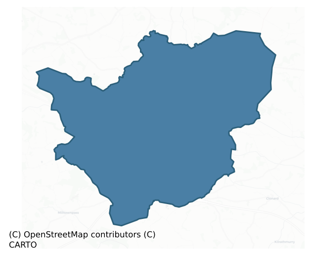
Farbill is a barony of County Westmeath, in the historical province of Leinster (Irish: Fir Bhile), covering 143 km² of land. The barony records 256 NMS archaeological sites and 112 NIAH listed buildings, placing it at around the 45th percentile among 280 ROI baronies for sites per km². This means it is in the lower half of all baronies for sites per km². Dated archaeological evidence runs from the Early Bronze Age through to the Post Medieval, spanning 6 of 9 archaeological periods, placing the barony in the 13th percentile among 280 ROI baronies for chronological depth. This means it is in the bottom fifth of all baronies for chronological depth. The largest dated subset of recorded sites dates to the Early Medieval.
Heritage at a glance
Percentile rankings throughout this profile compare each barony only against the other 279 Republic of Ireland baronies.
The recorded heritage of Farbill
The National Monuments Service Sites and Monuments Record (SMR) is the statutory inventory of archaeological sites for the Republic of Ireland, maintained by the Department of Tourism, Culture, Arts, Gaeltacht, Sport and Media. Sites recorded here include earthworks, ringforts, megalithic tombs, ecclesiastical remains, and post-medieval features; not every record is legally protected, but each is registered as a monument of archaeological interest.
The National Monuments Service records 256 archaeological sites in Farbill, putting it at the 45th percentile among 280 ROI baronies for sites per km². This means it is in the lower half of all baronies for sites per km². Protection coverage is near-universal — 249 sites (97%) fall within a recorded monument protection zone, indicating an extensively surveyed landscape. The dominant category is defensive sites — ringforts, enclosures, hillforts, and stone forts (147 sites, 57% of the record). Ringfort – rath is the most prevalent type, making up 34% of the barony's recorded sites (86 records) — well above the ROI average of 20% across all baronies where this type occurs. Ringfort – rath is an earthen ringfort enclosed by a bank and external ditch — the most common Early Medieval farmstead, broadly dated 500–1000 AD. Other significant types include Earthwork (11) and Enclosure (9). Earthwork is an unclassified earthen structure with no diagnostic features that allow a more specific classification; Enclosure is a banked or ditched feature of uncertain type, used as a catch-all where the original function cannot be determined from surface evidence. Across the barony's 143 km², this gives a recorded density of 1.78 sites per km².
Most common monument types
Hover or tap a monument type to see its definition.
| Type | Count |
|---|---|
| Ringfort – rath an earthen ringfort enclosed by a bank and external ditch — the most common Early Medieval farmstead, broadly dated 500–1000 AD | 86 |
| Earthwork an unclassified earthen structure with no diagnostic features that allow a more specific classification | 11 |
| Enclosure a banked or ditched feature of uncertain type, used as a catch-all where the original function cannot be determined from surface evidence | 9 |
| Barrow – ring-barrow a Bronze/Iron Age burial monument: a low circular area enclosed by ditch and outer bank | 8 |
| Barrow – unclassified a prehistoric burial mound where the specific barrow type cannot be determined from surface evidence | 8 |
| Ringfort – unclassified a circular Early Medieval settlement enclosure where surviving evidence does not allow distinction between earthen and stone forms | 8 |
| Structure – peatland a construction of unknown function, either extant or implied by archaeological evidence, of any date | 8 |
| Church a building used for public Christian worship, of any date from c. 500 AD onwards | 7 |
Chronological distribution
The dated archaeological record for Farbill spans from the Early Bronze Age through to the Post Medieval, with activity attested across 6 of 9 archaeological periods. This is the 13th percentile across ROI baronies — a relatively narrow chronological band, with much of Irish prehistory not represented in the dated record. Every period from earliest to latest is represented in the record — an unbroken sequence of dated activity across the full chronological span. Activity concentrates most heavily in the Early Medieval (113 sites, 54% of dated material), with the Iron Age forming a secondary peak (39 sites, 19%). A further 48 recorded sites (19% of the overall NMS register for the barony) carry no period attribution — appearing as 'Unknown' in the bar chart below. This typically reflects either records that pre-date the standardised period vocabulary or sites awaiting specialist dating review, rather than a genuine absence of chronological evidence.
Sample of recorded monuments
Show 25 sample monuments (of 256 total)
A representative sample of 25 recorded monuments drawn from the barony’s 256 total NMS entries. Sites within a recorded monument protection zone and rarer site types are prioritised so the list shows a meaningful cross-section rather than only the most common type. Each entry shows the official Sites and Monuments Record reference number and the description published by the National Monuments Service.
Bridge
Three arches survive of a seven or nine arch seventeenth century road bridge over the Kinnegad River which connected Galway to Dublin (N6) via the village of Kinnegad. The village of Kinnegad is located 90m to the NW.…
Three arches survive of a seven or nine arch seventeenth century road bridge over the Kinnegad River which connected Galway to Dublin (N6) via the village of Kinnegad. The village of Kinnegad is located 90m to the NW. The 17th century bridge has been replaced by the present concrete bridge that was constructed in 1936. A bridge over the Kinnegad River at this location is depicted on the 1654 Down Survey map of Farbill barony where it is annotated as ‘The Bridge of Kenegad’ and shown standing to the SE of Kinnegad Castle (WM027-071—-) (NLI p.7384). In 1661 this medieval bridge was replaced by a new bridge mentioned in the House of Commons Journal under the entry for the 22nd of March where it states that ‘the bridge of Kinnegad is much out of repaire and that great damage and loss hath happened to travellers and cattle in their passing over same and have ordered that two letters be written from the Speaker of the House, one to the Judges of Assize for the Co. of Meath and another to the Justices of Peace for the Co. of Westmeath to take care that according to Law a substantial bridge can be made over the said river Kinnegad’(Simington and O’Keeffe 1991, 219). Described in 1991 as ‘three arches of the 1660s’ bridge and three upstream cutwaters have survived. The river has been diverted into a new and deeper cut immediately northwest of the surviving arches of the old bridge. The bridge erected across the new channel in 1840s was replaced by the present reinforced co…
Well
Situated in a low-lying boggy area of pasture, which is cut by a deep drain. Not depicted on OS historic mapping, although a well symbol is depicted c. 20m to NNE on the 1837 OS 6-inch map. Levelled monument described…
Situated in a low-lying boggy area of pasture, which is cut by a deep drain. Not depicted on OS historic mapping, although a well symbol is depicted c. 20m to NNE on the 1837 OS 6-inch map. Levelled monument described in 1983 as no surface remains visible. No well visible today on Digital Globe aerial photography. The classification of this site is uncertain as there is a note in the SMR file which suggests that there may have been a souterrain marked 'in pencil' at this location on the Ordnance Survey field map (SMR File).
Compiled by: Alison McQueen, Vera Rahilly and Caimin O’Brien
Date of upload: 05 June 2019
Castle – motte
Situated on the summit of a high hill, in pasture, with extensive views in all directions. Enclosure (WM020-046—-) lies c. 62m to ESE. Depicted on the revised 1913 ed. OS 25-inch map as a roughly oval-shaped earthwork…
Situated on the summit of a high hill, in pasture, with extensive views in all directions. Enclosure (WM020-046—-) lies c. 62m to ESE. Depicted on the revised 1913 ed. OS 25-inch map as a roughly oval-shaped earthwork with an OS trig. point marking 503 ft. OD in the centre. According to Adams (1959, 57), a ‘mote’ is situated on Sion Hill and again Adams (1960, 25-26) references ‘an artificial platform on the highest point of Sion Hill’. Monument described in 1970 as a roughly circular-shaped earthen platform (approx. diam. 20m) defined by a high, steep-sided scarp (approx. H 2.3m). There is no visible trace of a fosse or an outer bank. A portion of the scarp has been quarried away from E-S leaving a slightly concave indent in the perimeter. The original entrance is not visible. The top of the platform has a very gentle WSW-facing slope. Within the centre is a low circular mound of earth and stones that supports an OS triangulation station. Monument is visible as a suboval-shaped earthwork on Digital Globe aerial photography.
Classification of this monument is uncertain, the flat-topped platform and gently sloping sides of the monument suggests that this may be the remains of a prehistoric burial mound or an Anglo-Norman motte. Hilltop location may suggest that this was a burial mound rather than an Anglo-Norman motte, however flat topped platform would point towards motte castle classification or medieval raised rath/ringfort.
Compiled by: Alison McQueen, Vera Rahil…
Burial mound
Situated on top of a gentle, yet prominent rise, in pasture, with good views of the surrounding landscape. Ringfort (WM020-064—-) lies c. 75m to SE. Depicted on the revised 1837 ed. OS 6-inch map as a circular-shaped…
Situated on top of a gentle, yet prominent rise, in pasture, with good views of the surrounding landscape. Ringfort (WM020-064—-) lies c. 75m to SE. Depicted on the revised 1837 ed. OS 6-inch map as a circular-shaped earthwork. Monument described in 1976 as a low, circular-shaped round topped mound (dims. 19.2m N-S; 18.9m E-W; H 1.1m). No visible trace of a fosse. Monument is not clearly visible on Digital Globe aerial photography.
Compiled by: Alison McQueen, Vera Rahilly and Caimin O’Brien
Date of upload: 05 July 2019
Flat cemetery
Situated in gently undulating pasture. Not depicted on the 1837 OS 6-inch map or the revised 1913 ed. OS 25-inch map. Holy well (WM020-042—-) known as 'Tober Lastragh' lies within the northern area. Monument is…
Situated in gently undulating pasture. Not depicted on the 1837 OS 6-inch map or the revised 1913 ed. OS 25-inch map. Holy well (WM020-042—-) known as 'Tober Lastragh' lies within the northern area. Monument is described in SMR file as a ‘flat cemetery’ containing ‘burial sites’ (NMI Index). Monument is not visible on Digital Globe aerial photography.
Compiled by Alison McQueen, Vera Rahilly and Caimin O’Brien.
Date of upload: 05 July 2019
Barrow – stepped barrow
Situated on a generally level area, in low-lying pasture, which is overlooked by higher, gently undulating pasture to E, S and W where views are restricted. A pond lies c. 45m to N and barrows…
Situated on a generally level area, in low-lying pasture, which is overlooked by higher, gently undulating pasture to E, S and W where views are restricted. A pond lies c. 45m to N and barrows (WM020-112—-/113—-/114—-) lie c. 240m to SW. Townland boundary with Rathnarrow lies 35m to S. Monument (overall diam. 27m) described in 1970 as a circular-shaped round-topped mound (approx. diam. 8m) defined by a wide berm and a shallow flat-bottomed fosse (Wth at top 3.6m; basal Wth 1.9m; D 0.4m) that is almost filled in at E and from S-W. There is a modern quarry hole on the top of the mound at W. Monument is visible as a roughly circular shaped earthwork on Digital Globe aerial photography.
Compiled by Alison McQueen, Vera Rahilly and Caimin O’Brien.
Date of upload: 08 July 2019
Designed landscape – tree-ring
Situated on a low rise, in generally level pasture, with excellent views to NW and SE. Depicted as a circular-shaped earthwork on the Longford Estate Map of 1767 and Larkin’s 1808 Map of Co. Westmeath. Depicted on the…
Situated on a low rise, in generally level pasture, with excellent views to NW and SE. Depicted as a circular-shaped earthwork on the Longford Estate Map of 1767 and Larkin’s 1808 Map of Co. Westmeath. Depicted on the 1837 OS 6-inch map as an oval-shaped tree-ring. Monument described in 1980 as a natural rise or ridge which was planted with trees in antiquity. There is a large shallow depression in the N side of the ridge where quarrying activities took place in the past. A slight mound on the top of the ridge at the S end of the depression is probably due to up-cast from the quarrying. The area of the depression and the ridge just S of it is overgrown with trees. No surface remains visible of an earthwork. This appears to be a landscape feature of Craddockstown House, which lies c. 190m to NW. The site is visible as a modern farmyard on Digital Globe aerial photography.
Compiled by: Alison McQueen, Vera Rahilly and Caimin O’Brien
Date of upload: 09 July 2019
Quarry
Situated on a slight rise, the northern part of which has been quarried. Depicted on the Longford Estate map of 1813 as an earthwork. Depicted on the revised 1913 ed. OS 25-inch map as an irregular-shaped depression…
Situated on a slight rise, the northern part of which has been quarried. Depicted on the Longford Estate map of 1813 as an earthwork. Depicted on the revised 1913 ed. OS 25-inch map as an irregular-shaped depression marked ‘Gravel Pit (disused)’. Levelled monument described in 1971 as no surface remains visible. Possibly earthwork which was quarried away as depicted on the 1837 ed. OS 6-inch map.
Compiled by Alison McQueen, Vera Rahilly and Caimin O’Brien.
Date of upload: 04 November 2019
Settlement deserted – medieval
Earthworks located to N, E and S of castle (WM027-007001-) may be the remains of a deserted medieval settlement which has been partially destroyed by quarrying. Church (WM027-009001-) and graveyard (WM027-009002-) 260m…
Earthworks located to N, E and S of castle (WM027-007001-) may be the remains of a deserted medieval settlement which has been partially destroyed by quarrying. Church (WM027-009001-) and graveyard (WM027-009002-) 260m to SE. Ringfort (WM027-066) located 55m to the S. Access road into quarry which is located to the N of the castle site can be seen on Bing Maps aerial photographs taken between 06-07 November 2011 (www.bing.com/maps). Earthworks of this levelled castle site were bulldozed in 1977 (SMR File). Site inspection carried out by the National Monuments Service in 1976 recorded that a small section of the SW angle (H c. 2m) of the castle remains upstanding. The remains of an extensive series of earthworks consisting of low earth and stone banks were noted extending out to the N, E and S of the castle. These earthworks may represent the remains of a deserted settlement of uncertain date. According to local information it was suggested that these earthworks represented the remains of the old village of Killucan (SMR File). Another local tradition recorded that these earthworks represented a clustered settlement where people lived until it was abandoned in the 19th century (SMR File). Oblique aerial photograph taken 15/07/1966 shows extent of earthworks in field prior to quarrying (CUCAP APE020/024).
See attached sketch plan of earthworks drawn by Phelim Manning.
Compiled by: Caimin O’Brien
Date of upload: 15 August 2013
This monument is subje…
Standing stone
Situated on N side of a small ridge, in pasture, with good views in all directions. Ringfort (WM027-017—-) lies c. 170m to SE. Annotated 'Stone' on 1837 ed. OS 6-inch map. Monument described in 1976 as a large,…
Situated on N side of a small ridge, in pasture, with good views in all directions. Ringfort (WM027-017—-) lies c. 170m to SE. Annotated 'Stone' on 1837 ed. OS 6-inch map. Monument described in 1976 as a large, limestone boulder (dims. 1.7m N-S; 0.75m E-W; H 2.35m) orientated N-S on its long-axis. Roughly rectangular in elevation, the surface is rough and uneven with numerous natural grooves and depressions. It has been used as a scratching post in recent times resulting in a hollow area around the base of the stone. There is an area of disturbance to the immediate N. A second, smaller stone lies prostrate a short distance to S.
Compiled by Alison McQueen, Vera Rahilly and Caimin O’Brien.
Date of upload: 06 November 2019
Castle – ringwork
Situated in relatively low lying wet pasture, c. 60m SE of a stream. Monument described in 1971 as a raised roughly circular-shaped platform (dims. 33.5m E-W; 32m N-S) defined by an inner bank, an intervening fosse and…
Situated in relatively low lying wet pasture, c. 60m SE of a stream. Monument described in 1971 as a raised roughly circular-shaped platform (dims. 33.5m E-W; 32m N-S) defined by an inner bank, an intervening fosse and an outer bank. The inner bank is high and steep on the exterior being best preserved from NNW-N-NNE and is almost reduced to a scarp from NNE-E-S-W-NNW, except at SSW and W, where it is occupied by a quarry-like depression. There is a wide and deep intervening fosse. The outer bank is substantial and is almost completely denuded from WSW-W-WNW. There is a gap (Wth at top 9.7m; basal Wth 3.10m) in the inner bank, a causeway (Wth at top 2m; overall Wth 5.6m; H 1.3m) and a gap (Wth at top 6.4m; basal Wth 3m) in the outer bank at NNE which represents the entrance. The interior is raised high above the surrounding land and the surface has slight humps and hollows. Leading from higher ground at NW there is a raised earthen causeway which intersects the outer bank at N and then seems to extend along the outside of the outer bank to the entrance. This can be followed on Digital Globe aerial photography and may have curved around running towards ringfort (WM027-025—-) indicating that the two monuments were physically connected on this wet floodplain.
Compiled by Alison McQueen, Vera Rahilly and Caimin O’Brien.
Date of upload: 06 November 2019
Crannog
Originally located on the SSE shoreline of a small lake known as ‘Lough Atrim’ as depicted on the 1837 ed. OS 6-inch map. A possible moated site (WM027-030001-) lies c. 20m to SE. The lake was drained about 1878,…
Originally located on the SSE shoreline of a small lake known as ‘Lough Atrim’ as depicted on the 1837 ed. OS 6-inch map. A possible moated site (WM027-030001-) lies c. 20m to SE. The lake was drained about 1878, exposing this mound near the centre known as ‘The Island’. This crannóg was recorded by the antiquarian Rev. William Falkiner in 1898, after it had been partially damaged by excavation to produce top-soil to spread over the old lakebed. The site apparently had a 'low, circular mound, 22ft [6.7m]in diameter’, surrounded by, and studded over with black oak piles’. A ‘rough floor of beams’ was exposed at a depth of 4ft [1.2m]. It was possibly enclosed within a plank palisade or stockade of ‘rough hewn planks, standing close together. These planks were ‘9ft [2.7m] long, 10 inches [0.25m] wide and 3 inches [0.07m] thick’. A possible midden of ‘a great quantity of ashes, burnt wood and bones’ was found near the ‘outer portion of the stockade’. Lying on the ground was ‘a quantity of bones, amongst others, those of wild swine – red deer and oxen’ as well as ‘several boar’s jaws with large tusks still remaining. Also the horns of the ancient crumpled-horned ox.’ Artefacts found on the mound included 2 ‘horn’ combs, a comb fragment, 2 bone pins, a possible ‘tracked stone’, a hammer-stone, 2 bronze pins, 1 iron object (a possible ‘hold fast’), 1 amber ring fragment and 1 wooden ladle' (O'Sullivan 2004, 59-60; Falkiner 1898-1900, 216-8).
Compiled by: Caimin O'Brien ba…
Ecclesiastical site
There is no paper file in the ASI archive for this monument. The provenance of this ‘ecclesiastical site’ is unknown.
Barrow – pond barrow
Situated on a N-facing slope, just below the summit of a steep rise, in undulating pasture, with extensive views in all directions. Depicted on the 1837 ed. OS 6-inch map and the revised 1913 ed. OS 25-inch map as a…
Situated on a N-facing slope, just below the summit of a steep rise, in undulating pasture, with extensive views in all directions. Depicted on the 1837 ed. OS 6-inch map and the revised 1913 ed. OS 25-inch map as a small, circular-shaped earthwork. Monument described as a circular-shaped round-bottomed depression (dims. 12m E-W; 11.7m N-S), which has been scooped out of a natural rise and is defined by a bank and a fosse. The earthen bank is well preserved and there is a narrow, shallow, steep-sided outer fosse. There is no recognisable entrance. Monument is visible today as a small circular-shaped tree-planted earthwork on Digital Globe aerial photography.
Compiled by Alison McQueen, Vera Rahilly and Caimin O’Brien.
Date of upload: 06 November 2019
Fulacht fia
Situated on a slight rise, in relatively low-lying, rough pasture, with a stream to the immediate E and S, restricted views of the surrounding landscape. Annotated 'fort' on the 1837 OS Fair Plan map and depicted as a…
Situated on a slight rise, in relatively low-lying, rough pasture, with a stream to the immediate E and S, restricted views of the surrounding landscape. Annotated 'fort' on the 1837 OS Fair Plan map and depicted as a very small circular-shaped enclosure. Depicted on the 1837 OS 6-inch map as a small circular-shaped earthwork. Monument described in 1971 as no surface remains visible. The site would have been suitable for a fulachta fia. Monument is not visible today on Digital Globe aerial photography.
Compiled by Alison McQueen, Vera Rahilly and Caimin O’Brien.
Date of upload: 06 November 2019
Rabbit warren
Situated on top of a steep gravel hillock, in gently undulating pasture, commanding extensive views of the surrounding landscape. The local area around the monument is annotated 'Cunnyara' on the 1837 ed. OS 6-inch…
Situated on top of a steep gravel hillock, in gently undulating pasture, commanding extensive views of the surrounding landscape. The local area around the monument is annotated 'Cunnyara' on the 1837 ed. OS 6-inch map which may suggest that this monument was a rabbit warren rather than a ringfort. Annotated 'Fort' on the 1837 OS Fair Plan map and depicted as a circular-shaped enclosure. On the revised 1913 ed. OS 25-inch map the monument is depicted as a roughly oval-shaped earthwork (approx. dims. 35m N-S; 32m E-W) on a hillock named ‘Knockmore’. Bivallate enclosure described in 1971 as a circular-shaped that has been largely quarried away of which only the E and SE quadrant survive on the edge of a disused sand pit. The perimeter of the surviving portion is defined by a bank, an intervening fosse and an outer bank from NE-E-S. The inner bank is high and steep on the exterior and is almost reduced to a scarp. There is a narrow shallow, flat-bottomed intervening fosse and slight remains of an outer earthen bank. The original entrance is not visible. The quarried sand pit has exposed a cross-section of the perimeter at S to reveal a V-shaped fosse which is clearly defined by two backfilled layers of fill. According to a field report of 1976, further quarrying was continuing in the area of the monument. Monument is visible today as a low rise of ground which has been quarried around the perimeter from S-W-N-NE, which is enclosed by irregular spoil mounds, on Digital Glo…
Burial ground
The files of the National Museum of Ireland records that in March 1965 a quantity of human remains found in the townland of Joristown Lower, Co. Westmeath was brought to the National Museum by Mrs Ruth Vandeleur (Cahill…
The files of the National Museum of Ireland records that in March 1965 a quantity of human remains found in the townland of Joristown Lower, Co. Westmeath was brought to the National Museum by Mrs Ruth Vandeleur (Cahill & Sikora 2011, vol. 2, 521). The remains had been discovered at a place known locally as 'Firloinn' and had been unearthed by badgers. The site is at the northern end of a long low ridge. According to Mrs Vandeleur, the landowner was re-burying the bones as they were found. The burials appeared to be aligned east/west and no stone settings or grave goods were noted. The remains were not retained and were reburied locally (NMI File).
Compiled by: Caimin O'Brien
Date of upload: 08 December 2010
Font
An architectural heritage assessment report carried out in 2011 recorded that the ‘medieval font was uncovered in the 19th century on the site and is currently positioned on a 19th century pedestal at the rear of the…
An architectural heritage assessment report carried out in 2011 recorded that the ‘medieval font was uncovered in the 19th century on the site and is currently positioned on a 19th century pedestal at the rear of the nave’ (Lotts 2011, 31) in the 19th century church of Ireland church dedicated to St. Etchen. This medieval font originally came from the medieval church (WM020-0128001-), the partial ruins of which are located immediately to the E of the present 19th century Church of Ireland church.
Compiled by: Caimin O'Brien
Date of upload: 08 August 2012
Kiln – corn-drying
Medieval ruins of Kilpatrick Church (WM020-049—-) stands in N quadrant of rectangular shaped graveyard (WM020-049001-) enclosed by a post-1700 stone wall with coffin stand and entrance gate at E. Curving section of…
Medieval ruins of Kilpatrick Church (WM020-049—-) stands in N quadrant of rectangular shaped graveyard (WM020-049001-) enclosed by a post-1700 stone wall with coffin stand and entrance gate at E. Curving section of graveyard boundary wall at NE follows line of early Christian ecclesiastical enclosure (WM020-049002-). St Patrick's or Scardan Well (WM020-056—-) 660m to E.
In 1980 excavations inside the graveyard were carried out by D. L. Swan and his findings were summarised as following; ' A small cutting was opened within the churchyard to the north of the church ruins (WM020-049—-), revealing the foundation of the north wall. Although there were no surface indications, in it considerable concentration of human burial was encountered at less than 40cm below the surface. In all, in a cutting 2.5 x 5m over 40 individuals were represented, infants and young children accounting for 32 of these. Of the remaining adults and adolescents, where sex could be determined, time proportions of male to female were roughly equal. Almost all of these burials were stratified between a construction layer and a collapse layer relating to a reconstruction of the church and its final collapse. Beneath the construction layer a number of enigmatic features was encountered including a deep trench and part of a rectangular feature, both cutting deeply into the boulder clay. Some postholes were also identified, which may have related to the latter feature. A number of bone pins was recover…
Bullaun stone
Situated on a steep natural rise, in gently undulating pasture, having good views in all directions. Bullaun stone described in 1970 as being within the centre of a levelled ringfort (WM020-102—-). Described in a…
Situated on a steep natural rise, in gently undulating pasture, having good views in all directions. Bullaun stone described in 1970 as being within the centre of a levelled ringfort (WM020-102—-). Described in a later field report (undated) as the enclosure having been levelled and the bullaun stone pushed up against the field fence c. 18m to SE. It is a large conglomerate boulder with a circular-shaped, deep conical depression (diam. 0.35m; D 0.3).
Compiled by Alison McQueen, Vera Rahilly and Caimin O’Brien.
Date of upload: 08 July 2019
Dovecote
Grange Beg Castle (WM021-012—-) was situated on a low rise, in gently undulating pasture, 35m NE of the River Deel and 110m W of early 18th century Grange Beg House and c. 15m to E of a late 17th/early 18th century…
Grange Beg Castle (WM021-012—-) was situated on a low rise, in gently undulating pasture, 35m NE of the River Deel and 110m W of early 18th century Grange Beg House and c. 15m to E of a late 17th/early 18th century dovecote. Grange Beg Castle described in the 1655 terrier of the Down Survey map of Farbill Barony as one of 'two castles in repaire' (NLI, MS 723-4). The castle is depicted as a tower house type structure standing on lands belonging to Nicholas Darcy in 1640 on the Down Survey map of Farbill Barony (ibid.).
Grange Beg House (NIAH Reg. No. 15402105) described in 1983 as '2 storeys over basement with an attic. The house is 5 bays, the end bays break forward having a lower roofline (no attic) & having no windows at ground level. The central doorway has a moulded architrave & is flanked by narrow side lights. Similar side lights now blocked up flank the central window overhead. Small attic windows in the gable. The house appears to be of late 17th c[entury] or very early 18th c[entury] origin'. Dovecote (NIAH Reg. No. 15402106) described in 1983 as following; 'Near the SW side of the rise [castle site] is the ruin of a circular pigeon house approx[imately] 3.5m high & 7m in diam[eter]. The pigeon house is built of limestone rubble, lined with brick within. Much of the brick now collapsed. Literally hundreds of pigeon holes can still be seen. There is a doorway in the SE side'.
Compiled by Alison McQueen, Vera Rahilly and Caimin O’Brien.
Date of uplo…
Road – hollow-way
Situated in pasture, with good views in all directions. Located approx. 15m to N of possible motte & bailey (WM027-012—-) known locally as 'Rathmore Fort' are the remains of an old trackway (Wth 5m) defined by two…
Situated in pasture, with good views in all directions. Located approx. 15m to N of possible motte & bailey (WM027-012—-) known locally as 'Rathmore Fort' are the remains of an old trackway (Wth 5m) defined by two parallel banks running E-W. Clearly visible on Digital Globe aerial photography as a linear sunken area defined by a bank on either side.
Compiled by Alison McQueen, Vera Rahilly and Caimin O’Brien.
Date of upload: 04 November 2019
Barrow – ditch barrow
Situated in pasture, which overlooks lower ground to N. Barrows (WM020-113—-/114—-) lie c. 14m to S and c. 30m to SE, respectively. Not depicted on the 1837 ed. OS 6-inch map or on the revised 1913 ed. OS 25-inch…
Situated in pasture, which overlooks lower ground to N. Barrows (WM020-113—-/114—-) lie c. 14m to S and c. 30m to SE, respectively. Not depicted on the 1837 ed. OS 6-inch map or on the revised 1913 ed. OS 25-inch map. Barely visible monument described in 1970-2 as a roughly circular-shaped area (diam. 5m N-S; 4.8m E-W) defined by a narrow, shallow fosse with no visible trace of a bank. Monument is not visible on Digital Globe aerial photography.
See attached OS 25-inch map showing location of barrow.
Compiled by Alison McQueen, Vera Rahilly and Caimin O’Brien.
Date of upload: 08 July 2019
Barrow – ditch barrow
Situated in low lying pasture, with views restricted by the surrounding landscape. Depicted on the 1913 ed. OS 6-inch map as an oval-shaped earthwork. Monument described in 1971 and 1976 as a raised roughly oval-shaped…
Situated in low lying pasture, with views restricted by the surrounding landscape. Depicted on the 1913 ed. OS 6-inch map as an oval-shaped earthwork. Monument described in 1971 and 1976 as a raised roughly oval-shaped area (dims. 23.4m N-S; 17m E-W) defined by a scarp and external fosse. The scarp is very slight as is the fosse (Wth at top 4.4m). The interior is flat and no features are discernible. There is a very slight depression running NE-SW across the monument. Levelled monument visible today as an oval-shaped cropmark on Digital Globe aerial photography.
See attached profile of monument surveyed and drawn by the ASI.
Compiled by Alison McQueen, Vera Rahilly and Caimin O’Brien.
Date of upload: 06 November 2019
Ringfort – rath
Situated in woodland immediately N of townland boundary with Lisnabin Castle (WM020-085—-) 300m to W. Depicted on the revised 1913 ed. OS 25-inch map as a roughly oval-shaped earthwork (dims. 31m WSW-ENE; 25m…
Situated in woodland immediately N of townland boundary with Lisnabin Castle (WM020-085—-) 300m to W. Depicted on the revised 1913 ed. OS 25-inch map as a roughly oval-shaped earthwork (dims. 31m WSW-ENE; 25m NNW-SSE). Referred to by Adams (1960) as ‘Packenham’s Fort’ and ‘Cup and Saucer’. Monument described in 1970 as a circular-shaped area enclosed by a poorly preserved bank and wide, shallow outer fosse. The bank has been quarried away on the NNE and appears to have been steepened on the interior and exterior in relatively modern times. There is a gap at SW. The original entrance is not recognisable. Monument is visible as a suboval-shaped tree-planted earthwork on Digital Globe aerial photography.
Compiled by Alison McQueen, Vera Rahilly and Caimin O’Brien.
Date of upload: 08 July 2019
Listed buildings
The National Inventory of Architectural Heritage (NIAH) is a state survey appraising buildings of architectural, historical, archaeological, artistic, cultural, scientific, social, or technical interest. Each surveyed structure receives a rating from International (the highest, for buildings of European importance) through National, Regional, Local, and Record-Only.
The NIAH records 112 listed buildings in Farbill (55th percentile across ROI baronies). All recorded buildings carry Regional or lower grading; the barony does not contain any structures appraised as being of National or International architectural importance. Construction dates concentrate most heavily in the Late Georgian (1800-1830) period. The most-recorded building type is house (32 examples, 29% of the listed stock).
Terrain and environment
Mean elevation across the barony is 87m — the 47th percentile among 280 ROI baronies for elevation. This means it is in the lower half of all baronies for elevation. Elevation matters for heritage because higher-altitude baronies typically favour defensive monuments — ringforts and hilltop forts placed on prominent ground — while lowland baronies are more likely to carry the dense settlement and church networks of intensive agricultural landscapes. Mean slope is 2.4° — the 23rd percentile among 280 ROI baronies for slope. This means it is in the bottom third of all baronies for slope. This is broadly flat terrain, the kind of landscape best suited to intensive agriculture. Slope is a key control on both land use and archaeological preservation: steep ground resists ploughing and tends to preserve earthworks intact, while gentle slopes favour intensive cultivation that damages or destroys surface archaeology over time. The Topographic Wetness Index averages 11.5, the 74th percentile among 280 ROI baronies for wetness. This means it is in the top third of all baronies for wetness. Drainage matters for heritage because poorly-drained ground preserves organic archaeology (wooden trackways, leather, textiles, and on rare occasions human remains) far better than free-draining soil; well-drained ground favours arable use but destroys organic material rapidly. The land-cover mosaic combines improved grassland (76%), woodland (16%), and arable farmland (6%), giving a mixed agricultural and semi-natural landscape.
Terrain measurements
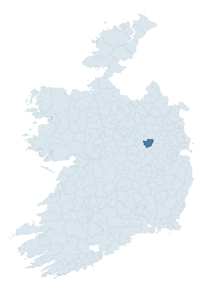
Where this barony sits in the Republic of Ireland
Geology and preservation
Bedrock geology shapes the landscape long before any settlement begins — controlling soil drainage, agricultural potential, the survival of upstanding monuments, and the preservation of buried archaeology. The figures below come from the Geological Survey Ireland 1:100,000 bedrock map.
The bedrock underlying Farbill is predominantly limestone (95% of the barony by area), laid down during the Carboniferous period (97% by area, around 359 to 299 million years ago). Limestone is the most heritage-rich bedrock in Ireland. It supports fertile, well-drained soils that favoured dense Early Medieval settlement and Norman manorial agriculture, and it weathers into karst features — sinkholes, caves, swallow holes, and souterrains — that frequently carry archaeology. Where peat overlies limestone, organic preservation can be exceptional. The single largest mapped unit is the Waulsortian Limestones (45% of the barony's bedrock). With only 2 distinct rock types mapped, the barony is geologically uniform compared to the rest of the Republic (10th percentile for diversity) — a single coherent bedrock landscape.
Rock type composition
Largest mapped unit: Waulsortian Limestones (45% of the barony)
Placename evidence
Logainm records 12 heritage-diagnostic placenames for Farbill, a modest sample drawn predominantly from the townland record. The dominant stratum is pre-christian defensive. The most frequent diagnostic roots are ráth- (4) and dún- (3). With a sample of this size the count should be treated as indicative rather than definitive.
Pre-Christian / Early Medieval Defensive
| Root | Count | Meaning |
|---|---|---|
| ráth- | 4 | earthen ringfort |
| dún- | 3 | hilltop or promontory fort |
| lios- | 1 | ringfort or enclosure |
Early Christian Ecclesiastical
| Root | Count | Meaning |
|---|---|---|
| cill- | 2 | church (early) |
| gráinseach- | 2 | monastic farm / grange |
Other baronies in Westmeath
About this profile
Click any section below to expand.
What is a barony?
A barony is a historic administrative unit in Ireland, broadly equivalent to an English hundred. The 280 baronies used here are from the OSi 2019 National Statutory Boundaries (generalised 20m), covering the 26 counties of the Republic of Ireland. Baronies derive from the Norman period, were formalised in the 17th century, and have not been redrawn for statistical purposes. They vary enormously in area, from compact urban baronies in Dublin to vast upland baronies in Connacht, and should not be compared by raw site count without accounting for area differences.
What counts as a site?
This profile combines three distinct heritage registers, each with its own definition of what constitutes a recordable site:
- Archaeological sites (NMS). The National Monuments Service Sites and Monuments Record (SMR) catalogues every known archaeological monument or site of archaeological interest in the Republic, from prehistoric burial mounds and ringforts to medieval churches and post-medieval defensive works. Inclusion does not require legal protection — only that the site has been identified, surveyed, and assessed as having archaeological value. A separate subset of these sites lies within a recorded protection zone, which gives them statutory protection under the National Monuments Acts.
- Listed buildings (NIAH). The National Inventory of Architectural Heritage records buildings of architectural, historical, archaeological, artistic, cultural, scientific, social, or technical interest. Each surveyed structure is appraised on a five-tier scale: International, National, Regional, Local, and Record-Only. The NIAH appraisal is informational rather than strictly statutory, but it underpins local-authority Record of Protected Structures (RPS) listings.
- Heritage placenames (Logainm). Logainm is the authoritative database of Irish placenames maintained by the Placenames Branch. This profile applies a heritage-diagnostic classifier to the Irish-language form of each townland name, flagging roots that signal defensive sites (ráth-, lios-, dún-, caiseal-, cathair-), ecclesiastical foundations (cill-, teampall-, domhnach-, mainistir-), prehistoric burial-ritual features (tuaim-, carn-, leaba-), or Norse-contact settlement (gall-). Townlands without one of these diagnostic roots are not flagged here — they may still carry historical significance, but that significance is not encoded in the name itself.
Editorial principles
The narrative sections of this profile follow several explicit principles:
- Evidential. Every claim about this barony’s heritage character is anchored in the underlying register data. Where a site count, a placename count, or a percentile rank is cited, it is computed from the source datasets at export time, not estimated.
- Comparative. Counts and metrics are reported alongside their percentile rank against the other 279 ROI baronies. A barony with 50 ringforts in absolute terms could be unusually high or unusually low depending on its size and regional context; percentile ranking removes that ambiguity.
- Transparent on limits. Where a register has known coverage gaps, survey biases, or data-quality issues that affect this barony’s figures, the profile flags them rather than presenting the numbers as definitive.
- No interpretation beyond what the data supports. The narrative does not speculate about historical events, social dynamics, or cultural meaning beyond what the recorded heritage and placename evidence directly attests.
Data caveats and limits
- NMS Sites and Monuments Record is the product of survey campaigns conducted at different intensities across different counties and decades. Some baronies have been surveyed more thoroughly than others, and absolute counts should be read in that light. Sites destroyed by development before survey are typically not represented; sites in heavily forested or upland terrain are sometimes under-recorded.
- NIAH coverage is broadly complete for the Republic of Ireland but the survey was conducted on a rolling county-by-county basis, and the most recent appraisal date varies. Buildings demolished or substantially altered after their original survey may still appear in the register; conversely, recent buildings of merit may not yet have been appraised.
- Logainm classification applies a deliberately conservative pattern-matching approach to the Irish-language townland forms. The classifier prioritises true positives over recall: a townland may carry a heritage signal that the classifier doesn’t recognise, particularly where the diagnostic root has been heavily anglicised or where the townland name draws on a less common term. The 60,000+ townland records and ~9,800 classified placenames give a substantial signal at barony scale, but individual townland names should be checked against Logainm directly for definitive interpretation.
- Period attribution. The chronological distribution reflects only those NMS sites that carry a recognised period attribution in the source data. Sites listed as “Unknown” period are excluded from the dated subset.
- Boundary changes. Some baronies have undergone minor boundary adjustments since their 19th-century definition; the OSi 2019 generalised boundaries used here are the current statutory definition and may differ slightly from historical maps in border areas.
- Bedrock geology is mapped at 1:100,000 scale, which means local variation within a barony — small pockets of different rock type, mineral veins, alluvium overlying bedrock — is generalised. The dominant-system and rocktype figures are area-weighted, so a barony reading “70% Carboniferous limestone” may still contain small but archaeologically important pockets of older or younger rock. Around 3% of GSI polygons do not match the lexicon and contribute no rocktype or system attribution.
Data sources
- National Monuments Service — Sites and Monuments Record (SMR) https://data.gov.ie/dataset/national-monuments-service-archaeological-survey-of-ireland
- National Inventory of Architectural Heritage (NIAH) https://data.gov.ie/dataset/national-inventory-of-architectural-heritage-niah-national-dataset
- Logainm — Placenames Database of Ireland https://www.logainm.ie/
- Ordnance Survey Ireland — National Statutory Barony Boundaries 2019 https://data-osi.opendata.arcgis.com/
- EURODEM — European Digital Elevation Model https://www.mapsforeurope.org/datasets/euro-dem
- ESA WorldCover https://esa-worldcover.org/en
- Geological Survey Ireland — 1:100,000 Bedrock Geology https://www.gsi.ie/en-ie/data-and-maps/Pages/Bedrock.aspx
Explore more: Search any of the 280 ROI baronies, browse by historical province, or read the methodology and data sources for the full Republic of Ireland Heritage Tool.