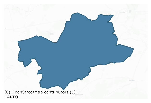
Ballyboy is a barony of County Offaly, in the historical province of Leinster (Irish: Baile Átha Buí), covering 131 km² of land. The barony records 112 NMS archaeological sites and 31 NIAH listed buildings, placing it at around the 6th percentile among 280 ROI baronies for sites per km². This means it is in the bottom tenth of all baronies for sites per km². Dated archaeological evidence runs from the Mesolithic through to the Modern, spanning 8 of 9 archaeological periods, placing the barony in the 85th percentile among 280 ROI baronies for chronological depth. This means it is in the top fifth of all baronies for chronological depth. The largest dated subset of recorded sites dates to the Early Medieval.

Heritage at a glance
Percentile rankings throughout this profile compare each barony only against the other 279 Republic of Ireland baronies.
The recorded heritage of Ballyboy
The National Monuments Service Sites and Monuments Record (SMR) is the statutory inventory of archaeological sites for the Republic of Ireland, maintained by the Department of Tourism, Culture, Arts, Gaeltacht, Sport and Media. Sites recorded here include earthworks, ringforts, megalithic tombs, ecclesiastical remains, and post-medieval features; not every record is legally protected, but each is registered as a monument of archaeological interest.
The National Monuments Service records 112 archaeological sites in Ballyboy, putting it at the 6th percentile among 280 ROI baronies for sites per km². This means it is in the bottom tenth of all baronies for sites per km². A sparse recorded total of this kind in Ireland often reflects survey priority rather than genuine absence of past activity. Protection coverage is near-universal — 108 sites (96%) fall within a recorded monument protection zone, indicating an extensively surveyed landscape. The dominant category is defensive sites — ringforts, enclosures, hillforts, and stone forts (66 sites, 59% of the record). The most diagnostically specific type is Ringfort – rath (18 records, 16% of the barony's NMS total) — compared to an ROI average of 20% across all baronies where this type occurs. Ringfort – rath is an earthen ringfort enclosed by a bank and external ditch — the most common Early Medieval farmstead, broadly dated 500–1000 AD. The broader 'Enclosure' classification — which catches unclassified ringforts and field enclosures — accounts for a further 30 records (27%) and reflects the difficulty of sub-classifying degraded earthworks from surface evidence alone. Across the barony's 131 km², this gives a recorded density of 0.85 sites per km².
Most common monument types
Hover or tap a monument type to see its definition.
| Type | Count |
|---|---|
| Enclosure a banked or ditched feature of uncertain type, used as a catch-all where the original function cannot be determined from surface evidence | 30 |
| Ringfort – rath an earthen ringfort enclosed by a bank and external ditch — the most common Early Medieval farmstead, broadly dated 500–1000 AD | 18 |
| Castle – unclassified a castle whose form cannot be precisely classified, dating somewhere between the late 12th and 16th centuries | 6 |
| Church a building used for public Christian worship, of any date from c. 500 AD onwards | 5 |
| Graveyard a burial area associated with a church, in use from the medieval period onwards | 4 |
| Ritual site – holy well a well or spring traditionally associated with a saint, often credited with healing properties; many trace earlier ritual origins but devotion is documented from the medieval period onwards | 3 |
| Mound an artificial earthen elevation of unknown date and function that cannot be classified as another known monument type | 3 |
Chronological distribution
The dated archaeological record for Ballyboy spans from the Mesolithic through to the Modern, with activity attested across 8 of 9 archaeological periods. This is the 85th percentile across ROI baronies for chronological depth — an above-average span. The record is near-continuous, with only the Neolithic period falling inside the span without any recorded sites. Activity concentrates most heavily in the Early Medieval (32 sites, 35% of dated material), with the Iron Age forming a secondary peak (31 sites, 34%). A further 20 recorded sites (18% of the overall NMS register for the barony) carry no period attribution — appearing as 'Unknown' in the bar chart below. This typically reflects either records that pre-date the standardised period vocabulary or sites awaiting specialist dating review, rather than a genuine absence of chronological evidence.
Sample of recorded monuments
Show 25 sample monuments (of 112 total)
A representative sample of 25 recorded monuments drawn from the barony’s 112 total NMS entries. Sites within a recorded monument protection zone and rarer site types are prioritised so the list shows a meaningful cross-section rather than only the most common type. Each entry shows the official Sites and Monuments Record reference number and the description published by the National Monuments Service.
Habitation site
Mesolithic habitation site discovered on the bed of Lough Boora in 1977 and excavated by the National Museum under the direction of Dr. Michael Ryan (Ryan 1978). The site appears to have been located on a fossil lake…
Mesolithic habitation site discovered on the bed of Lough Boora in 1977 and excavated by the National Museum under the direction of Dr. Michael Ryan (Ryan 1978). The site appears to have been located on a fossil lake shore formerly sealed by peat and subsequently inundated by the modern lake. The excavation revealed a number of hearths which were rich in charcoal, which included the burnt bones of mammal, bird and fish. Other evidence included the waste debris associated with the manufacture of bone tools. Over 400 objects were recovered including three polished stone axe heads, almost 200 microliths along with blades and scrapers of chert. Radiocarbon dating provided a range of dates from 7000-6500 bc.
The above description is derived from the published 'Archaeological Inventory of County Offaly' (Dublin: Stationery Office, 1997). In certain instances the entries have been revised and updated in the light of recent research.
Date of upload: 23 May 2011
Religious house – Franciscan friars
Located on a slight rise of ground in undulating countryside. Reverend Shaw (1971, 24-5) recorded that a house or convent belonging to the Franciscan friars was established at Cully shortly after 1677. In this year,…
Located on a slight rise of ground in undulating countryside. Reverend Shaw (1971, 24-5) recorded that a house or convent belonging to the Franciscan friars was established at Cully shortly after 1677. In this year, Charles O'Molloy, ruler of Firceall, wrote to the Pope requesting permission to establish a house for the Franciscans in the territory ruled by the O'Molloy's. In this letter he wrote that 'he begs your Holiness the faculty of founding, with the consent of the Local Ordinary (the Bishop of Meath), a convent of the Friars under the title of the Immaculate Conception near the already named sanctuary (Rahan), where they can reside and conserve orthodoxy in the three named baronies (Ballycowan, Ballyboy and Eglish)' (Shaw 1971, 25). According to Cogan (1867, vol. 2, 514) 'there was a Franciscan Friary here, which lasted the greater part of the last century. Many of these Fathers, in the penal times, discharged parochial duty in the neighbouring parishes'. Cogan (ibid., 514) states that this house was a 'home for the persecuted Franciscan friars in the last century. They had a farm of land attached to the Friary, and in this secluded place they observed the rules of their holy institute'. Ths farmland is depicted as the 'Convent Farm' on the 1838 edition of the Ordnance Survey six-inch map. Reverend John Egan, the last friar of Cully who was the parish priest of Eglish died in 1807 (Shaw 1971, 25).
Only the S gable survives of a 17th century house or Conv…
Inscribed stone (present location)
According to local kowledge this stone was removed from its original location at Cully (OF024-001—-). It is now incorporated into the fire surround at the Blue Ball pub nearby (OF024-002—-). The stone is inscribed…
According to local kowledge this stone was removed from its original location at Cully (OF024-001—-). It is now incorporated into the fire surround at the Blue Ball pub nearby (OF024-002—-). The stone is inscribed with the date '1641' and is dressed with pocked stone tooling very similar to the doorway of Srah castle. The locals said that it came from Derrymore House a 19th century townland house which had acquired it from the 17th century building (OF024-001—-) in the nearby townland of Cully, that is depicted as the 'Convent in Ruins' on the 1838 edition of the Ordnance Survey six-inch map.
Compiled by: Caimin O'Brien.
Date of upload: 10 December 2012
Fulacht fia
Two barely discernible grass covered spreads of burnt material in flat pasture, along N bank of stream with archaeological complex (OF024-036—-) to the N. Probably the site of two levelled fulachta fiadh. Present…
Two barely discernible grass covered spreads of burnt material in flat pasture, along N bank of stream with archaeological complex (OF024-036—-) to the N. Probably the site of two levelled fulachta fiadh. Present remains consist of a poorly preserved horseshoe shaped mound (6m N-S by 3m E-W; H 0.5m) of burnt material. The second fulacht fiadh located to the E consists of a low mound (8m WSW-ESE; 4m NNW-SSE; H 0.5m) with shallow depression running N-S across mound.
The above description is derived from the published 'Archaeological Inventory of County Offaly' (Dublin: Stationery Office, 1997). In certain instances the entries have been revised and updated in the light of recent research.
Date of upload: 23 May 2011
This monument is subject to a preservation order made under the National Monuments Acts 1930 to 2014 (PO no. 3/1986).
Barrow – ring-barrow
Located a short distance to the SE of nearby castle (SMR OF024-036002-) in flat pasture land. Poorly preserved slightly raised circular area (diam. 4m) enclosed by low barely visible bank. No other features…
Located a short distance to the SE of nearby castle (SMR OF024-036002-) in flat pasture land. Poorly preserved slightly raised circular area (diam. 4m) enclosed by low barely visible bank. No other features visible.
The above description is derived from the published 'Archaeological Inventory of County Offaly' (Dublin: Stationery Office, 1997). In certain instances the entries have been revised and updated in the light of recent research.
Date of upload: 23 May 2011
This monument is subject to a preservation order made under the National Monuments Acts 1930 to 2014 (PO no. 3/1986).
Standing stone
No evidence of any standing stone beside the holy well (OF024-040001-) (Shaw Rev. 1971, 71-2). Described by Rev. Shaw as 'At the entrance to the well is a standing stone with a hole in it, known as a 'swearing stone'.…
No evidence of any standing stone beside the holy well (OF024-040001-) (Shaw Rev. 1971, 71-2). Described by Rev. Shaw as 'At the entrance to the well is a standing stone with a hole in it, known as a 'swearing stone'. In ancient times, contracts were made binding by the two people concerned joining hands through the hole and thereby invoking a curse on themselves it they broke their word – a custom which is said to be of pagan origin. This stone came originally from Luganiska' (Shaw Rev. 1971, 72).
The above description is derived from the published 'Archaeological Inventory of County Offaly' (Dublin: Stationery Office, 1997). In certain instances the entries have been revised and updated in the light of recent research.
Date of upload: 23 May 2011
Religious house – Carmelite friars
No surface trace of Abbey founded by Odo, son of Nellan O' Molloy who died in 1454 (Flanagan 1927, 42-3). R C Church now occupies the site of the abbey with a 16th century stone sculpture representing the crucifixion…
No surface trace of Abbey founded by Odo, son of Nellan O' Molloy who died in 1454 (Flanagan 1927, 42-3). R C Church now occupies the site of the abbey with a 16th century stone sculpture representing the crucifixion with vine motif and 3 early medieval mortars embedded in the modern churchyard wall. Inside the church there is a 16th century wooden pieta of possible Italian origin (JRSAI 1947, 77). The three mortars display evidence of diagonal stone tooling with four lugs on each mortar.
The above description is derived from the published 'Archaeological Inventory of County Offaly' (Dublin: Stationery Office, 1997). In certain instances the entries have been revised and updated in the light of recent research.
Date of upload: 23 May 2011
Churchyard
Modern churchyard enclosing RC church at Kilcormac on the site of a Carmelite friary founded by Odo, son of Nellan O' Molloy who died in 1454 (Flanagan 1927, 42-3).
The above description is derived from the published…
Modern churchyard enclosing RC church at Kilcormac on the site of a Carmelite friary founded by Odo, son of Nellan O' Molloy who died in 1454 (Flanagan 1927, 42-3).
The above description is derived from the published 'Archaeological Inventory of County Offaly' (Dublin: Stationery Office, 1997). In certain instances the entries have been revised and updated in the light of recent research.
Date of upload: 23 May 2011
Crucifixion plaque
Possible 16th-century crucifixion figure with vine leaf motif, embedded into the enclosing churchyard wall of the catholic church at Kilcormac which was built on the site of the Carmelite friary (OF031-012001-).
The…
Possible 16th-century crucifixion figure with vine leaf motif, embedded into the enclosing churchyard wall of the catholic church at Kilcormac which was built on the site of the Carmelite friary (OF031-012001-).
The above description is derived from the published 'Archaeological Inventory of County Offaly' (Dublin: Stationery Office, 1997). In certain instances the entries have been revised and updated in the light of recent research.
Date of upload: 23 May 2011
Settlement cluster
Possible medieval settlement in the village of Ballyboy, cluster of dwellings depicted on the 17th centurymap of Ballyboy. A seventeenth century trade token was found in the village of Ballyboy, dated 1668 and belonged…
Possible medieval settlement in the village of Ballyboy, cluster of dwellings depicted on the 17th centurymap of Ballyboy. A seventeenth century trade token was found in the village of Ballyboy, dated 1668 and belonged to Bob Hutchinson of Ballyboy, Merch [Merchant] (Cooke 1875, 233). The Williamite chronicler, George Story, has left two accounts of an attack on Ballyboy in September 1690. In the first account he relates that ‘another Party [of Jacobites] burnt Balliboy, a village 8 miles from Birr [recte 20 miles or 16.5km], wherein there was then six companies of the Earl of Drogheda’s Regiment, who finding themselves very much outnumbered, and the village no ways tenable, they retired all to a mount nigh the middle of the same village, which they defended till the Irish were obliged to quit the place, have killed us about 28, themselves leaving 16 dead upon the streets, besides several more that were killed in plundering the houses.’ (1693, 46). His second account records that the officer in command, Lieutenant Colonel Bristow, ‘took most of his men into that open village; which the Irish having notice of, came in the night, and lay in the hedges nigh the town. Our men had heard of the designed attempt the day before, and desired Colonel Bristow to deliver out ammunition; but he apprehending no danger, took no care to prepare for such a mischief. However, our men sate upon all that night, and sent out a Lieutenant, with twenty men mounted, to learn tidings of the enemy,…
Stone head
Located on the S facing wall of a water mill outside Ballyboy village. This stone head appears to be of medieval date and may come from the nearby castle (OF031-015001-) the site of which is located across the road, or…
Located on the S facing wall of a water mill outside Ballyboy village. This stone head appears to be of medieval date and may come from the nearby castle (OF031-015001-) the site of which is located across the road, or ti may have come from the medieval church in Ballyboy. The head has sunken eyes with a flat nose and what appears to be his tongue protruding from his mouth. His cheeks are grooved which may indicate a beard or facial hair. The head has two ears incised into the stone. The grooving found on the heads cheeks is similar to other medieval heads found in Ireland. The top of the head is flat which may suggest it was used as a corbel. (Weir 1980, 63)
The above description is derived from the published 'Archaeological Inventory of County Offaly' (Dublin: Stationery Office, 1997). In certain instances the entries have been revised and updated in the light of recent research.
Date of upload: 23 May 2011
Earthwork
Located on high ground with good views. Irregular shaped flat topped mound (H 2m; diam 15m E-W) which is badly damaged on all sides with an enclosing bailey type area to the E, S and W which is defined by a low earthen…
Located on high ground with good views. Irregular shaped flat topped mound (H 2m; diam 15m E-W) which is badly damaged on all sides with an enclosing bailey type area to the E, S and W which is defined by a low earthen bank (Wth 1m; H 0.6m). Field boundaries intercept the site on its N side where there is possible evidence of a fosse enclosing the base of the mound. Overall the site has undergone much damage making interpretation difficult. The form, size and location of the mound has the appearance of a truncated motte but could just as easily be the remains of a prehistoric burial mound.
The above description is derived from the published 'Archaeological Inventory of County Offaly' (Dublin: Stationery Office, 1997). In certain instances the entries have been revised and updated in the light of recent research.
Date of upload: 23 May 2011
Souterrain
No surface remains visible of any souterrain that was reportedly located inside ringfort (OF031-031001-) that has since been levelled (Dunlevy 1975, 33).
The above description is derived from the published…
No surface remains visible of any souterrain that was reportedly located inside ringfort (OF031-031001-) that has since been levelled (Dunlevy 1975, 33).
The above description is derived from the published 'Archaeological Inventory of County Offaly' (Dublin: Stationery Office, 1997). In certain instances the entries have been revised and updated in the light of recent research.
Date of upload: 23 May 2011
Graveslab
This is a reference to post-1700 AD headstones.
The above description is derived from the published 'Archaeological Inventory of County Offaly' (Dublin: Stationery Office, 1997). In certain instances the entries have…
This is a reference to post-1700 AD headstones.
The above description is derived from the published 'Archaeological Inventory of County Offaly' (Dublin: Stationery Office, 1997). In certain instances the entries have been revised and updated in the light of recent research.
Date of upload: 23 May 2011
Water mill – unclassified
Early 17th centurymap of the area shows a mill standing upon the Silver River, possibility that Ballynacarrig Mill is built on the site of the earlier Mill (Loeber 1988 vol. 1, 58-9). 18th century corn mill located in…
Early 17th centurymap of the area shows a mill standing upon the Silver River, possibility that Ballynacarrig Mill is built on the site of the earlier Mill (Loeber 1988 vol. 1, 58-9). 18th century corn mill located in area marked on OS 6-inch map.
The above description is derived from the published 'Archaeological Inventory of County Offaly' (Dublin: Stationery Office, 1997). In certain instances the entries have been revised and updated in the light of recent research.
Date of upload: 23 May 2011
Bridge
18th century bridge now marked on six inch map as Ballynacarrig Bridge.
The above description is derived from the published 'Archaeological Inventory of County Offaly' (Dublin: Stationery Office, 1997). In certain…
18th century bridge now marked on six inch map as Ballynacarrig Bridge.
The above description is derived from the published 'Archaeological Inventory of County Offaly' (Dublin: Stationery Office, 1997). In certain instances the entries have been revised and updated in the light of recent research.
Date of upload: 23 May 2011
House – 17th century
Small late 18th-century two storey house with five bays and hipped roof built onto the front of a gable ended 17th-century three storey house over a basement with original dog-legged staircase surviving. The walls…
Small late 18th-century two storey house with five bays and hipped roof built onto the front of a gable ended 17th-century three storey house over a basement with original dog-legged staircase surviving. The walls measure approx. 0.75m thick and the attic has two small square shaped windows visible on the E gable with two blocked up attic lights on the W gable. According to local information 17th-century date revealed during restoration of house several years ago. (Garner 1985, 17; Craig 1982, 194)
The above description is derived from the published 'Archaeological Inventory of County Offaly' (Dublin: Stationery Office, 1997). In certain instances the entries have been revised and updated in the light of recent research.
Date of upload: 23 May 2011
Cross-inscribed stone
R. C. church of Ballyboy situated on site of medieval church and graveyard (OF031-044001-), possible early christian cross-inscribed slab (OF031-044002-) inside graveyard. Medieval church depicted on 17th century map of…
R. C. church of Ballyboy situated on site of medieval church and graveyard (OF031-044001-), possible early christian cross-inscribed slab (OF031-044002-) inside graveyard. Medieval church depicted on 17th century map of Ballyboy. Motte and bailey castle (OF031-015001/002-) to N of church. Presence of early-christian cross-slab confirms local tradition that this church has its origins in the Early Christian period. According to local tradition this church was founded by St Bridget. (O'Flanagan 1927 vol. 2, 104-5) Duplicate entry with OF031-067003-.
Compiled by: Caimin O'Brien.
Date of upload: 23 May 2011
Burial
The files of the National Museum of Ireland records that in November 1968 human remains were discovered at a house called 'The Hermitage' near Kilcormac, Co. Offaly (Cahill & Sikora 2011, vol. 2, 506). This house is…
The files of the National Museum of Ireland records that in November 1968 human remains were discovered at a house called 'The Hermitage' near Kilcormac, Co. Offaly (Cahill & Sikora 2011, vol. 2, 506). This house is indicated on the current edition of the OS six inch map. The remains were discovered during excavations for a septic tank on the site of a dwelling house. The site was reported to the Gardai at Kilcormac who visited the site and removed the bones, stating that they were approximately 400 years old. The landowner, Mrs Maxwell, then reported the discovery to the NMI. According to the Garda who investigated the site, the remains were approximately 0.3m below ground level and did not constitute a complete human body. The site was kept under surveillance but was not investigated by the NMI. The remains were not acquired (NMI file).
House – fortified house
On undulating land. Poorly preserved remains of a fortified house and bawn built with uncoursed limestone rubble. Only the S wall of the tower and bawn with NW circular corner tower of bawn (OF023-006002-) surviving.…
On undulating land. Poorly preserved remains of a fortified house and bawn built with uncoursed limestone rubble. Only the S wall of the tower and bawn with NW circular corner tower of bawn (OF023-006002-) surviving. The only architectural features visible are the remains of a fireplace at ground and first floor level of house with the chimney stack extending beyond the external face of the fortified house. Several musket loops visible on the NW corner tower of the bawn. Probably a 17th-century fortified house with adjoining bawn similar to Kilcolgan castle (OF015-011—-). May have been built by Peter Salconstall who was granted the land in 1622. (O' Flanagan 1933, vol. 2, 48, Shaw 1971, 64).
The above description is derived from the published 'Archaeological Inventory of County Offaly' (Dublin: Stationery Office, 1997). In certain instances the entries have been revised and updated in the light of recent research.
Date of upload: 23 May 2011
Bawn
On undulating land. Poorly preserved remains of a fortified house (OF023-006001-) and bawn built with uncoursed limestone rubble. Only the S wall of the tower and bawn with NW circular corner tower of bawn surviving.…
On undulating land. Poorly preserved remains of a fortified house (OF023-006001-) and bawn built with uncoursed limestone rubble. Only the S wall of the tower and bawn with NW circular corner tower of bawn surviving. The only architectural features visible are the remains of a fireplace at ground and first floor level of house with the chimney stack extending beyond the external face of the fortified house. Several musket loops visible on the NW corner tower of the bawn. Probably a 17th-century fortified house with adjoining bawn similar to Kilcolgan castle (OF015-011—-). May have been built by Peter Salconstall who was granted the land in 1622. (O' Flanagan 1933, vol. 2, 48, Shaw 1971, 64).
The above description is derived from the published 'Archaeological Inventory of County Offaly' (Dublin: Stationery Office, 1997). In certain instances the entries have been revised and updated in the light of recent research.
Date of upload: 23 May 2011
Armorial plaque
No surface trace visible except for a few humps and hollows in the area where the castle (OF023-011001-) was located. An armorial plaque dates the castle to the year 1684 and is incorporated into the wall of Derrydolney…
No surface trace visible except for a few humps and hollows in the area where the castle (OF023-011001-) was located. An armorial plaque dates the castle to the year 1684 and is incorporated into the wall of Derrydolney house. Probably the site of a 17th-century fortified house. The inscription reads ' This house was erected by Philip Molloy and Mary Molloy his wife in the year of our Lord God 1684, in the three and thirteenth years of the reign of Charles II, by the grace of God, King of England and Scotland, and France and Ireland. Defender of the Faith.' (ITA Survey 1942)
The above description is derived from the published 'Archaeological Inventory of County Offaly' (Dublin: Stationery Office, 1997). In certain instances the entries have been revised and updated in the light of recent research.
Date of upload: 23 May 2011
Armorial plaque
Not visible at ground level. Site of an O' Molloy castle (OF024-004001-) (Shaw Rev. 1971, 57). Armorial stone was taken from the castle to America in the 1930's (OHAS file)
The above description is derived from the…
Not visible at ground level. Site of an O' Molloy castle (OF024-004001-) (Shaw Rev. 1971, 57). Armorial stone was taken from the castle to America in the 1930's (OHAS file)
The above description is derived from the published 'Archaeological Inventory of County Offaly' (Dublin: Stationery Office, 1997). In certain instances the entries have been revised and updated in the light of recent research.
Date of upload: 23 May 2011
Castle – tower house
Situated on S facing slope of a high ridge running E-W, a lake protects the S side of the site which has good views to the S, E and W. This site consists of a circular platform (OF024-015002-) defined by an earthen bank…
Situated on S facing slope of a high ridge running E-W, a lake protects the S side of the site which has good views to the S, E and W. This site consists of a circular platform (OF024-015002-) defined by an earthen bank which is evident at W only with two wide flat bottomed fosses with high intervening earthen bank. The outer defences of the site have been greatly altered on the N and E sides while the lake provides a natural defence at S. Causeway entrance at W. In the centre of the platform are the ruins of a tower house (max. ext. dims. 10m N-S; 10m E-W; wall T 1.5m) with only the SW corner surviving to any height with wall footings elsewhere. A collpased portion of masonry displays evidence of wicker centring. No architectural features evident. This site may originally have been a large bivallate ringfort with later medieval Tower house built in the centre due to its defensive location on the side of a lake. Ancient fort of the Molloy's (Shaw 1971. 36). Early 17th centurybarony map of Ballyboy (PRO, MPF 268) shows small building at Pallas near the lake (Loeber 1988, vol. 5, 51)
The above description is derived from the published 'Archaeological Inventory of County Offaly' (Dublin: Stationery Office, 1997). In certain instances the entries have been revised and updated in the light of recent research.
Date of upload: 23 May 2011
Enclosure
Poorly preserved raised oval shaped area (34m N-S; 46m E-W) defined by a scarp (H 1.3m) and partial fosse (ext. D 0.5m; Wth 2m) surviving from N to E. Telegraph pole located in the centre of the site.
The above…
Poorly preserved raised oval shaped area (34m N-S; 46m E-W) defined by a scarp (H 1.3m) and partial fosse (ext. D 0.5m; Wth 2m) surviving from N to E. Telegraph pole located in the centre of the site.
The above description is derived from the published 'Archaeological Inventory of County Offaly' (Dublin: Stationery Office, 1997). In certain instances the entries have been revised and updated in the light of recent research.
Date of upload: 23 May 2011
Listed buildings
The National Inventory of Architectural Heritage (NIAH) is a state survey appraising buildings of architectural, historical, archaeological, artistic, cultural, scientific, social, or technical interest. Each surveyed structure receives a rating from International (the highest, for buildings of European importance) through National, Regional, Local, and Record-Only.
The NIAH records only 31 listed buildings in Ballyboy, the 15th percentile across ROI baronies — a relatively thin architectural record. All recorded buildings carry Regional or lower grading; the barony does not contain any structures appraised as being of National or International architectural importance. Construction dates concentrate most heavily in the Victorian (1830-1900) period. The most-recorded building type is house (10 examples, 32% of the listed stock).
Terrain and environment
Mean elevation across the barony is 77m — the 38th percentile among 280 ROI baronies for elevation. This means it is in the lower half of all baronies for elevation. Elevation matters for heritage because higher-altitude baronies typically favour defensive monuments — ringforts and hilltop forts placed on prominent ground — while lowland baronies are more likely to carry the dense settlement and church networks of intensive agricultural landscapes. Mean slope is 2.1° — the 11th percentile among 280 ROI baronies for slope. This means it is in the bottom fifth of all baronies for slope. This is broadly flat terrain, the kind of landscape best suited to intensive agriculture. Slope is a key control on both land use and archaeological preservation: steep ground resists ploughing and tends to preserve earthworks intact, while gentle slopes favour intensive cultivation that damages or destroys surface archaeology over time. The Topographic Wetness Index averages 11.8, the 88th percentile among 280 ROI baronies for wetness. This means it is in the top fifth of all baronies for wetness. This is wet, slow-draining ground by ROI standards — the kind of landscape that may carry waterlogged archaeological sites of unusual preservation value. Drainage matters for heritage because poorly-drained ground preserves organic archaeology (wooden trackways, leather, textiles, and on rare occasions human remains) far better than free-draining soil; well-drained ground favours arable use but destroys organic material rapidly. The land-cover mosaic combines improved grassland (74%), woodland (13%), and arable farmland (10%), giving a mixed agricultural and semi-natural landscape.
Terrain measurements
Where this barony sits in the Republic of Ireland
Geology and preservation
Bedrock geology shapes the landscape long before any settlement begins — controlling soil drainage, agricultural potential, the survival of upstanding monuments, and the preservation of buried archaeology. The figures below come from the Geological Survey Ireland 1:100,000 bedrock map.
The bedrock underlying Ballyboy is predominantly limestones (50% of the barony by area), laid down during the Carboniferous period (100% by area, around 359 to 299 million years ago). Limestone is the most heritage-rich bedrock in Ireland. It supports fertile, well-drained soils that favoured dense Early Medieval settlement and Norman manorial agriculture, and it weathers into karst features — sinkholes, caves, swallow holes, and souterrains — that frequently carry archaeology. Where peat overlies limestone, organic preservation can be exceptional. A substantial secondary geology of limestone (50%) adds further variety to the underlying landscape. The single largest mapped unit is the Visean Limestones (undifferentiated) (50% of the barony's bedrock). With only 2 distinct rock types mapped, the barony is geologically uniform compared to the rest of the Republic (19th percentile for diversity) — a single coherent bedrock landscape.
Rock type composition
Largest mapped unit: Visean Limestones (undifferentiated) (50% of the barony)
Placename evidence
Logainm records 13 heritage-diagnostic placenames for Ballyboy, a modest sample drawn predominantly from the townland record. The dominant stratum is early christian ecclesiastical. The most frequent diagnostic roots are cill- (8) and ráth- (4). With a sample of this size the count should be treated as indicative rather than definitive.
Pre-Christian / Early Medieval Defensive
| Root | Count | Meaning |
|---|---|---|
| ráth- | 4 | earthen ringfort |
Early Christian Ecclesiastical
| Root | Count | Meaning |
|---|---|---|
| cill- | 8 | church (early) |
| cillín- | 1 | unconsecrated burial ground |
Burial, Ritual, and Norse-Contact
| Root | Count | Meaning |
|---|---|---|
| gall- | 1 | foreigner — Norse settlement marker |
Other baronies in Offaly
About this profile
Click any section below to expand.
What is a barony?
A barony is a historic administrative unit in Ireland, broadly equivalent to an English hundred. The 280 baronies used here are from the OSi 2019 National Statutory Boundaries (generalised 20m), covering the 26 counties of the Republic of Ireland. Baronies derive from the Norman period, were formalised in the 17th century, and have not been redrawn for statistical purposes. They vary enormously in area, from compact urban baronies in Dublin to vast upland baronies in Connacht, and should not be compared by raw site count without accounting for area differences.
What counts as a site?
This profile combines three distinct heritage registers, each with its own definition of what constitutes a recordable site:
- Archaeological sites (NMS). The National Monuments Service Sites and Monuments Record (SMR) catalogues every known archaeological monument or site of archaeological interest in the Republic, from prehistoric burial mounds and ringforts to medieval churches and post-medieval defensive works. Inclusion does not require legal protection — only that the site has been identified, surveyed, and assessed as having archaeological value. A separate subset of these sites lies within a recorded protection zone, which gives them statutory protection under the National Monuments Acts.
- Listed buildings (NIAH). The National Inventory of Architectural Heritage records buildings of architectural, historical, archaeological, artistic, cultural, scientific, social, or technical interest. Each surveyed structure is appraised on a five-tier scale: International, National, Regional, Local, and Record-Only. The NIAH appraisal is informational rather than strictly statutory, but it underpins local-authority Record of Protected Structures (RPS) listings.
- Heritage placenames (Logainm). Logainm is the authoritative database of Irish placenames maintained by the Placenames Branch. This profile applies a heritage-diagnostic classifier to the Irish-language form of each townland name, flagging roots that signal defensive sites (ráth-, lios-, dún-, caiseal-, cathair-), ecclesiastical foundations (cill-, teampall-, domhnach-, mainistir-), prehistoric burial-ritual features (tuaim-, carn-, leaba-), or Norse-contact settlement (gall-). Townlands without one of these diagnostic roots are not flagged here — they may still carry historical significance, but that significance is not encoded in the name itself.
Editorial principles
The narrative sections of this profile follow several explicit principles:
- Evidential. Every claim about this barony’s heritage character is anchored in the underlying register data. Where a site count, a placename count, or a percentile rank is cited, it is computed from the source datasets at export time, not estimated.
- Comparative. Counts and metrics are reported alongside their percentile rank against the other 279 ROI baronies. A barony with 50 ringforts in absolute terms could be unusually high or unusually low depending on its size and regional context; percentile ranking removes that ambiguity.
- Transparent on limits. Where a register has known coverage gaps, survey biases, or data-quality issues that affect this barony’s figures, the profile flags them rather than presenting the numbers as definitive.
- No interpretation beyond what the data supports. The narrative does not speculate about historical events, social dynamics, or cultural meaning beyond what the recorded heritage and placename evidence directly attests.
Data caveats and limits
- NMS Sites and Monuments Record is the product of survey campaigns conducted at different intensities across different counties and decades. Some baronies have been surveyed more thoroughly than others, and absolute counts should be read in that light. Sites destroyed by development before survey are typically not represented; sites in heavily forested or upland terrain are sometimes under-recorded.
- NIAH coverage is broadly complete for the Republic of Ireland but the survey was conducted on a rolling county-by-county basis, and the most recent appraisal date varies. Buildings demolished or substantially altered after their original survey may still appear in the register; conversely, recent buildings of merit may not yet have been appraised.
- Logainm classification applies a deliberately conservative pattern-matching approach to the Irish-language townland forms. The classifier prioritises true positives over recall: a townland may carry a heritage signal that the classifier doesn’t recognise, particularly where the diagnostic root has been heavily anglicised or where the townland name draws on a less common term. The 60,000+ townland records and ~9,800 classified placenames give a substantial signal at barony scale, but individual townland names should be checked against Logainm directly for definitive interpretation.
- Period attribution. The chronological distribution reflects only those NMS sites that carry a recognised period attribution in the source data. Sites listed as “Unknown” period are excluded from the dated subset.
- Boundary changes. Some baronies have undergone minor boundary adjustments since their 19th-century definition; the OSi 2019 generalised boundaries used here are the current statutory definition and may differ slightly from historical maps in border areas.
- Bedrock geology is mapped at 1:100,000 scale, which means local variation within a barony — small pockets of different rock type, mineral veins, alluvium overlying bedrock — is generalised. The dominant-system and rocktype figures are area-weighted, so a barony reading “70% Carboniferous limestone” may still contain small but archaeologically important pockets of older or younger rock. Around 3% of GSI polygons do not match the lexicon and contribute no rocktype or system attribution.
Data sources
- National Monuments Service — Sites and Monuments Record (SMR) https://data.gov.ie/dataset/national-monuments-service-archaeological-survey-of-ireland
- National Inventory of Architectural Heritage (NIAH) https://data.gov.ie/dataset/national-inventory-of-architectural-heritage-niah-national-dataset
- Logainm — Placenames Database of Ireland https://www.logainm.ie/
- Ordnance Survey Ireland — National Statutory Barony Boundaries 2019 https://data-osi.opendata.arcgis.com/
- EURODEM — European Digital Elevation Model https://www.mapsforeurope.org/datasets/euro-dem
- ESA WorldCover https://esa-worldcover.org/en
- Geological Survey Ireland — 1:100,000 Bedrock Geology https://www.gsi.ie/en-ie/data-and-maps/Pages/Bedrock.aspx
Explore more: Search any of the 280 ROI baronies, browse by historical province, or read the methodology and data sources for the full Republic of Ireland Heritage Tool.