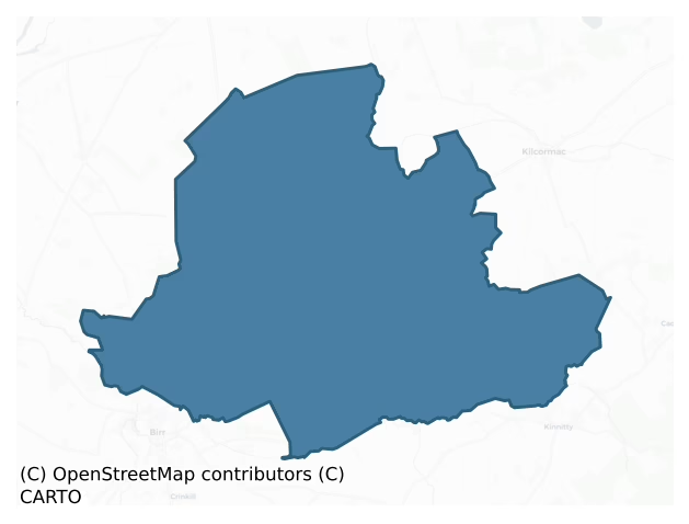
Eglish is a barony of County Offaly, in the historical province of Leinster (Irish: An Eaglais), covering 116 km² of land. The barony records 165 NMS archaeological sites and 17 NIAH listed buildings, placing it at around the 30th percentile among 280 ROI baronies for sites per km². This means it is in the bottom third of all baronies for sites per km². Dated archaeological evidence runs from the Early Bronze Age through to the Modern, spanning 6 of 9 archaeological periods, placing the barony in the 9th percentile among 280 ROI baronies for chronological depth. This means it is in the bottom tenth of all baronies for chronological depth. The largest dated subset of recorded sites dates to the Iron Age.
Heritage at a glance
Percentile rankings throughout this profile compare each barony only against the other 279 Republic of Ireland baronies.
The recorded heritage of Eglish
The National Monuments Service Sites and Monuments Record (SMR) is the statutory inventory of archaeological sites for the Republic of Ireland, maintained by the Department of Tourism, Culture, Arts, Gaeltacht, Sport and Media. Sites recorded here include earthworks, ringforts, megalithic tombs, ecclesiastical remains, and post-medieval features; not every record is legally protected, but each is registered as a monument of archaeological interest.
The National Monuments Service records 165 archaeological sites in Eglish, putting it at the 30th percentile among 280 ROI baronies for sites per km². This means it is in the bottom third of all baronies for sites per km². Of these, 118 (72%) fall within a recorded monument protection zone. The record is dominated by defensive sites — ringforts, enclosures, hillforts, and stone forts (64 sites, 39% of the total), with industrial sites forming a substantial secondary presence (56 sites, 34%). Structure – peatland is the most prevalent type, making up 34% of the barony's recorded sites (56 records) — well above the ROI average of 15% across all baronies where this type occurs. Structure – peatland is a construction of unknown function, either extant or implied by archaeological evidence, of any date. Other significant types include Enclosure (35) and Road – class 3 togher (16). Enclosure is a banked or ditched feature of uncertain type, used as a catch-all where the original function cannot be determined from surface evidence; Road – class 3 togher is a short wooden peatland trackway up to 15m long, deliberately laid to cross a small area of bog; Neolithic to medieval. Across the barony's 116 km², this gives a recorded density of 1.42 sites per km².
Most common monument types
Hover or tap a monument type to see its definition.
| Type | Count |
|---|---|
| Structure – peatland a construction of unknown function, either extant or implied by archaeological evidence, of any date | 56 |
| Enclosure a banked or ditched feature of uncertain type, used as a catch-all where the original function cannot be determined from surface evidence | 35 |
| Road – class 3 togher a short wooden peatland trackway up to 15m long, deliberately laid to cross a small area of bog; Neolithic to medieval | 16 |
| Ringfort – rath an earthen ringfort enclosed by a bank and external ditch — the most common Early Medieval farmstead, broadly dated 500–1000 AD | 14 |
| Bawn the defended courtyard of a medieval house, tower house or fortified house | 4 |
| Castle – tower house a fortified residential tower of four or five storeys, mostly built by lords in the 15th and 16th centuries and often within a defended bawn | 3 |
| Castle – unclassified a castle whose form cannot be precisely classified, dating somewhere between the late 12th and 16th centuries | 3 |
| Ritual site – holy well a well or spring traditionally associated with a saint, often credited with healing properties; many trace earlier ritual origins but devotion is documented from the medieval period onwards | 3 |
Chronological distribution
The dated archaeological record for Eglish spans from the Early Bronze Age through to the Modern, with activity attested across 6 of 9 archaeological periods. This is the 9th percentile across ROI baronies — a relatively narrow chronological band, with much of Irish prehistory not represented in the dated record. The record is near-continuous, with only the Middle Late Bronze Age period falling inside the span without any recorded sites. Activity concentrates most heavily in the Iron Age (39 sites, 49% of dated material), with the Early Medieval forming a secondary peak (22 sites, 28%). A further 85 recorded sites (52% of the overall NMS register for the barony) carry no period attribution — appearing as 'Unknown' in the bar chart below. This typically reflects either records that pre-date the standardised period vocabulary or sites awaiting specialist dating review, rather than a genuine absence of chronological evidence.
Sample of recorded monuments
Show 25 sample monuments (of 165 total)
A representative sample of 25 recorded monuments drawn from the barony’s 165 total NMS entries. Sites within a recorded monument protection zone and rarer site types are prioritised so the list shows a meaningful cross-section rather than only the most common type. Each entry shows the official Sites and Monuments Record reference number and the description published by the National Monuments Service.
Mass-rock
Mass-rock in the townland of Ballycollin that is listed in the report 'Offaly Heritage at Risk' (Offaly Historical and Archaeological Society 1978, 61). Situated in a large natural hollow close to Tobernapearla Holy…
Mass-rock in the townland of Ballycollin that is listed in the report 'Offaly Heritage at Risk' (Offaly Historical and Archaeological Society 1978, 61). Situated in a large natural hollow close to Tobernapearla Holy Wells (OF030-017—-). The rock itself lies near the top of the NW slope of the hollow. The stone (L 1.5m ; Wth 2m; H 2.5m) is mostly buried.
The above description is derived from the published 'Archaeological Inventory of County Offaly' (Dublin: Stationery Office, 1997). In certain instances the entries have been revised and updated in the light of recent research.
Date of upload: 23 May 2011
Settlement deserted – medieval
Unlocted possible deserted medieval settlement associated with the castle (OF035-002002-) at Ballindown as mentioned in the OS Letters (O'Flanagan 1927, vol. 1, 98, 101; Vol. 2, 9-10).
The above description is…
Unlocted possible deserted medieval settlement associated with the castle (OF035-002002-) at Ballindown as mentioned in the OS Letters (O'Flanagan 1927, vol. 1, 98, 101; Vol. 2, 9-10).
The above description is derived from the published 'Archaeological Inventory of County Offaly' (Dublin: Stationery Office, 1997). In certain instances the entries have been revised and updated in the light of recent research.
Date of upload: 23 May 2011
Ringfort – unclassified
According to local information this was the site of a univallate ringfort which was levelled about ten year's ago. Marked on all three editions of the OS 6-inch maps as a circular enclosure.
The above description is…
According to local information this was the site of a univallate ringfort which was levelled about ten year's ago. Marked on all three editions of the OS 6-inch maps as a circular enclosure.
The above description is derived from the published 'Archaeological Inventory of County Offaly' (Dublin: Stationery Office, 1997). In certain instances the entries have been revised and updated in the light of recent research.
Date of upload: 23 May 2011
Barrow – stepped barrow
No surface remains of mound situated on flat pastureland at the base of an esker ridge which has been partially quarried away in recent times. Depicted as a small enclosure on first two editions of the OS 6-inch maps. …
No surface remains of mound situated on flat pastureland at the base of an esker ridge which has been partially quarried away in recent times. Depicted as a small enclosure on first two editions of the OS 6-inch maps. This feature is depicted as a landscaped feature rather than as an antiquity on the 1838 ed. OS 6-inch map On the 1838 ed. OS 6-inch map this monument is depicted as a small enclosure 20m to the N of a family vault located in a demesne woodland associated with nearby Droughtville House. The monument is depicted differently on the revised 1908 ed. OS 25-inch map. On this map the monument is shown as a small mound standing on a wide berm with a similar plan to a stepped-barrow. A second enclosure or small mound (OF036-024—-) is depicted 71m to the SE. It is possible that the monument was re-used when it was landscaped in the 18th/19th century. This possible monument is located on the demesne woodland associated with Droughtville House located 730m to the SW. Alternatively this feature may have been built as a landscape feature in the 18th/19th century by the occupants of Droughtville House.
The above description is derived from the published 'Archaeological Inventory of County Offaly' (Dublin: Stationery Office, 1997). In certain instances the entries have been revised and updated in the light of recent research.
Compiled by Caimin O'Brien
Date of upload/revision: 30 December 2011
Ritual site – holy/saint's stone
Known locally as 'St. John's Rock' situated on the edge of a small wood on top of Knockbarron Hill. St Johns holy well (OF036-026—-) located 125m to the SW. The stone is roughly spherically shaped and measures 2.5m…
Known locally as 'St. John's Rock' situated on the edge of a small wood on top of Knockbarron Hill. St Johns holy well (OF036-026—-) located 125m to the SW. The stone is roughly spherically shaped and measures 2.5m across and 1.75m high. It is a weathered limestone glacial erratic with a large crevice on the S side into which are placed many religious coins and other votive offerings. It is obvious that the rock still has significant religious significance in the area. According to local information the stone was used as a mass rock during penal times. In 1934 the National Schools Survey of Holy Wells (NFC 468, 140) recorded that a pilgrimage to this site occurred on the 24th of June for 9 days, ‘ending with a pattern; but of late years the pattern and bonfire are celebrated on 29th June’ (ibid.). The devotion at the well (OF036-026—-) or pattern consisted of ‘three rounds, each round consisted of 3 Our Fathers and 3 Hail Marys, in clock [wise] direction; also prayers at Mass Rock nearby’ (ibid.). The water was used generally to cure ailments but had no special powers for any specific ailment. Votive offerings were left behind at the well including medals, pennies, bits of ribbons, beads etc. These offerings were placed on the sides of the well and on branches of the trees around the well. The votive offerings on the branches of the trees were placed here during the days of November.
The above description is derived from the published 'Archaeological I…
Cross – High cross
The circular shaped base (Wth 0.9m; H 0.5m) of the high cross which may have been an earlier millstone and is located in the W quadrant of the graveyard (OF036-028002-) a few metres to W of the W gable of Drumcullen…
The circular shaped base (Wth 0.9m; H 0.5m) of the high cross which may have been an earlier millstone and is located in the W quadrant of the graveyard (OF036-028002-) a few metres to W of the W gable of Drumcullen church (OF036-028001-). The shaft of the limestone cross is now missing and the head of the ringed cross is decorated with the crucifixion on one face and with a triskele design with interlace on the opposite face. The cross-head has been recently removed from the graveyard (OF036-028002-) by Offaly County Council for safety concerns and is now on public display inside Rath R. C. Church (OF031-072—-).
The cross was described by Harbison (1992, vol. 1, 75) as following: 'A cross-head with one arm still remaining lies close to an old church (OF036-028001-). Close by is what would appear to be an ancient mill-stone, which may have served as a base for the cross at some time. The cross-head is 96 cm high, and only 40cm broad now, but originally it would have measured about 60cm across the arms. It is 18cm thick. The directions (east/west) given below are notional.
East Face: In the centre there is a circular raised moulding enclosing spiral decoration emanating from a central circle. There is interlace decoration in the limbs of the cross. The ring, with roll moulding at the edges, has interlace decoration.
South Face: The underside of the ring has a vertical roll moulding in the centre, while the end of the arm has a panel of interlace.
West Face…
Castle – motte and bailey
Partially destroyed Motte and Bailey located on an esker ridge running N/S in undulating countryside with church (OF036-028—-) and river to the S. Steep sided flat topped mound (base diam 32m; top diam 13.7m; H 6.5m)…
Partially destroyed Motte and Bailey located on an esker ridge running N/S in undulating countryside with church (OF036-028—-) and river to the S. Steep sided flat topped mound (base diam 32m; top diam 13.7m; H 6.5m) which appears to have been scarped from the esker ridge at S side only thus making it steeper at this side. The destroyed rectangular shaped bailey was located to the N of the motte which was enclosed by an earthen bank now destroyed.
To see a 3D model of this motte and bailey castle, visit; https://skfb.ly/otuwN
The above description is derived from the published 'Archaeological Inventory of County Offaly' (Dublin: Stationery Office, 1997). In certain instances the entries have been revised and updated in the light of recent research.
Date of upload: 23 May 2011
Cross-slab
Early Christian foundation founded by St. Barrind in the sixth century (Purser 1918, 74-7). Located on low-lying land with river to the S, esker ridge to the N and E with motte (OF036-028004-) to the NW. Long…
Early Christian foundation founded by St. Barrind in the sixth century (Purser 1918, 74-7). Located on low-lying land with river to the S, esker ridge to the N and E with motte (OF036-028004-) to the NW. Long rectangular church (OF036-028001-) built of roughly coursed sandstone blocks with base batter evident at W end of N wall only. There is an upright Early Christian cross-slab (OF036-028005-) located to the SE of the church with incised double lined cross with bifurcating terminals.
The above description is derived from the published 'Archaeological Inventory of County Offaly' (Dublin: Stationery Office, 1997). In certain instances the entries have been revised and updated in the light of recent research.
Date of upload: 23 May 2011
House – fortified house
According to O' Flanagan (1933, vol. 2, 19) St. Ciaran of Saiger founded a nunnery at Killiadhuin [Killyon] in the fifth century. According to local tradition the fortified house and bawn built by Nicholas Herbert in…
According to O' Flanagan (1933, vol. 2, 19) St. Ciaran of Saiger founded a nunnery at Killiadhuin [Killyon] in the fifth century. According to local tradition the fortified house and bawn built by Nicholas Herbert in 1627 may have been built on site of the nunnery. Today all that remains are the wall footings of what appears to be a large walled area 52m N/S by 52m E/W with the fragmentary remains of a NW circular turret (H 3m; W T 0.8m) and the foundations of a SE turret with adjoining S wall (L 7m; H 3m; wall T 0.8m). Gun loops visible on S wall. Inside this courtyard area to the N are the grass covered wall footings of a long building (12m N-S by 33m E-W) orientated on an E/W axis. Overall this may be the site of a large defended fortified house (OF036-035002-) with bawn wall and circular corner towers. The presence of gun loops for defensive purposes would indicate a late medieval date for the site. Cooke (1875, 178) described the site as having a large square shaped gatehouse which opened onto a courtyard with small round flanking towers with gun loops visible. The remains represent the site of Killyon Manor which according to Cooke (1875, 182) was occupied by a person named Herbert (Harbart) in 1634. Possibly built near the site of 'Killyon Abbey' which as a result was marked on the six inch OS 6-inch map. A datestone (OF031-069—-) from this castle was moved from here to the parish hall in the nearby village of Rath. Monument entered into the Register of Histori…
Barrow – ring-barrow
Poorly preserved ring-barrow which appears to have been partly excavated and damaged by fallen trees. Circular mound (diam. 14m N-S ) with central depression (probably the result of digging) enclosed by a wide shallow…
Poorly preserved ring-barrow which appears to have been partly excavated and damaged by fallen trees. Circular mound (diam. 14m N-S ) with central depression (probably the result of digging) enclosed by a wide shallow fosse (Wth 2m) with external bank (Wth 2m; ext. H 1.5m; int. H 0.8m).
The above description is derived from the published 'Archaeological Inventory of County Offaly' (Dublin: Stationery Office, 1997). In certain instances the entries have been revised and updated in the light of recent research.
Date of upload: 23 May 2011
Burial mound
Mound situated in flat poorly drained land on E bank of the River Brosna. A circular round-topped mound (diam. At summit 11m N-S; diam. At base 20m; H 3m) of earth enclosed by a wide fosse (max. Wth 13m) which was…
Mound situated in flat poorly drained land on E bank of the River Brosna. A circular round-topped mound (diam. At summit 11m N-S; diam. At base 20m; H 3m) of earth enclosed by a wide fosse (max. Wth 13m) which was waterlogged at the time of last visit. A berm-like feature (Wth 2m) encloses the base of the mound. A shallow depression on its summit may indicate a collapsed cist-grave.
The above description is derived from the published 'Archaeological Inventory of County Offaly' (Dublin: Stationery Office, 1997). In certain instances the entries have been revised and updated in the light of recent research.
Date of upload: 23 May 2011
Architectural feature
A datestone with the inscription 'Anno Dom 1627 N H' was taken from the levelled seventeenth century fortified house (OF036-035002-) and bawn (OF036-035001-) known as Killyon Manor and was inserted into the SE corner of…
A datestone with the inscription 'Anno Dom 1627 N H' was taken from the levelled seventeenth century fortified house (OF036-035002-) and bawn (OF036-035001-) known as Killyon Manor and was inserted into the SE corner of the parish hall in the village of Rath. According to O' Flanagan (1933, vol. 2, 19) St. Ciaran of Saiger founded a nunnery at Killiadhuin [Killyon] in the fifth century. A seventeenth century fortified house and bawn is locally believed to have been built on the site of this nunnery. Cooke (1875, 178) described Killyon Castle as having a large square shaped gatehouse which opened onto a courtyard with small round flanking towers with gun loops visible. According to Cooke (1875, 182) the site of Killyon manor was occupied by a person named Herbert (Harbart) in 1634.
To see a 3D model of this date-stone, visit; https://skfb.ly/oxRWG
Compiled and revised by: Caimin O'Brien.
Date of revised upload: 4 January 2016
Cross – High cross (present location)
Head of high cross (OF036-028003-) originally located in W quadrant of Drumcullen graveyard (OF036-028002-). The shaft of the cross is missing while the circular-shaped base of the cross can still be seen standing in…
Head of high cross (OF036-028003-) originally located in W quadrant of Drumcullen graveyard (OF036-028002-). The shaft of the cross is missing while the circular-shaped base of the cross can still be seen standing in the W quadrant of the graveyard a few metres W of the W gable of the medieval church ruins (OF036-028001-). The cross-head was removed from Drumcullen graveyard by Offaly County Council for safety reasons and placed on public display inside Rath R. C. Church on the 14th of December 2015.
The cross was described by Harbison (1992, vol. 1, 75) as a 'cross-head with one arm still remaining lies close to an old church (OF036-028001-). Close by is what would appear to be an ancient mill-stone, which may have served as a base for the cross at some time. The cross-head is 96 cm high, and only 40cm broad now, but originally it would have measured about 60cm across the arms. It is 18cm thick. The directions (east/west) given below are notional.
East Face: In the centre there is a circular raised moulding enclosing spiral decoration emanating from a central circle. There is interlace decoration in the limbs of the cross. The ring, with roll moulding at the edges, has interlace decoration.
South Face: The underside of the ring has a vertical roll moulding in the centre, while the end of the arm has a panel of interlace.
West Face: Centre; The Crucifixion – Christ is shown with outstretched arms, and wearing a rope-like garment. Stephaton is probably on the left…
Designed landscape – tree-ring
Cropmark of large circular-shaped enclosure (approx. diam. 48m) visible on Digital Globe aerial photograph. This enclosure is depicted as a post-1700 tree-ring on all editions of the OS 6-inch maps.
See attached…
Cropmark of large circular-shaped enclosure (approx. diam. 48m) visible on Digital Globe aerial photograph. This enclosure is depicted as a post-1700 tree-ring on all editions of the OS 6-inch maps.
See attached image of Google Earth photograph taken 28/06/2018 which shows cropmark of the enclosure.
Compiled by: Caimin O'Brien based on details kindly provided by Terry Connolly
Date of upload: 20 February 2019
Architectural fragment
Early Christian foundation founded by St. Barrind in the sixth century (Purser 1918, 74-7). Located on low-lying land with river to the S, esker ridge to the N and E with motte (OF036-028004-) to the NW. Long…
Early Christian foundation founded by St. Barrind in the sixth century (Purser 1918, 74-7). Located on low-lying land with river to the S, esker ridge to the N and E with motte (OF036-028004-) to the NW. Long rectangular church (OF036-028001-) built of roughly coursed sandstone blocks with base batter evident at W end of N wall only.
Late medieval architectural fragment of a limestone window of fifteenth or sixteenth century date. Located to the E of the church lying on the ground beneath a table top tomb there is a single hood moulding terminal decorated with a vine leaf carved in relief. There are several fragments of window mouldings and other architectural pieces lying outside the E end of the church.
Compiled by: Caimin O'Brien.
Date of upload: 23 May 2011
Architectural fragment
Architectural fragment consisting of a sandstone voussoir of a Romanesque doorway decrorated with a chevron carved in false relief. This fragment is now lying on the ground inside the stone barrel-vaulted chamber that…
Architectural fragment consisting of a sandstone voussoir of a Romanesque doorway decrorated with a chevron carved in false relief. This fragment is now lying on the ground inside the stone barrel-vaulted chamber that has been built into the W end of the twelfth century church (OF036-028001-). Probably part of arch from Romanesque doorway of the church.
Compiled by: Caimin O'Brien.
Date of upload: 23 May 2011
Castle – tower house
Situated on natural rock outcrop (OF030-005002-) on the low-lying floodplains of a nearby river, originally located on a small island known as Castle Island or Lough Coura surrounded by wet marshy land. Little remains…
Situated on natural rock outcrop (OF030-005002-) on the low-lying floodplains of a nearby river, originally located on a small island known as Castle Island or Lough Coura surrounded by wet marshy land. Little remains of the castle except for a piece of wall fragment and loosely scattered rubble. The building appears to be the remains of a circular tower (approx. int. diam. 4m; wall T 1.2m) with no architectural features visible. To the S of this building there is a lot of loosely piled rubble lying all over the ground surface suggestive of a possible destroyed bawn wall (OF030-005003-). Known locally as Le Porte Castle (ITA Survey 1942). (Cooke 1875, 238; O' Flanagan 1933, vol. 2, 10; Loeber 1988, vol 5, 22)
The above description is derived from the published 'Archaeological Inventory of County Offaly' (Dublin: Stationery Office, 1997). In certain instances the entries have been revised and updated in the light of recent research.
Date of upload: 23 May 2011
Mound
Situated on natural rock outcrop on the low-lying floodplains of a nearby river, originally located on a small island known as Castle Island or Lough Coura surrounded by wet marshy land. Little remains of the castle…
Situated on natural rock outcrop on the low-lying floodplains of a nearby river, originally located on a small island known as Castle Island or Lough Coura surrounded by wet marshy land. Little remains of the castle except for a piece of wall fragment and loosely scattered rubble. The building appears to be the remains of a circular tower (OF030-005001-) sitting directly on rock outcrop which along with the collpased rubble gives the appearance of a mound. (Cooke 1875, 238; O' Flanagan 1933, vol. 2, 10)
The above description is derived from the published 'Archaeological Inventory of County Offaly' (Dublin: Stationery Office, 1997). In certain instances the entries have been revised and updated in the light of recent research.
Date of upload: 23 May 2011
Castle – tower house
Situated on a natural rise on the floodplains of the river located to the S of the site and site of medieval church (OF030-016—-) to SE. Poorly preserved tower house constructed with roughly coursed limestone rubble…
Situated on a natural rise on the floodplains of the river located to the S of the site and site of medieval church (OF030-016—-) to SE. Poorly preserved tower house constructed with roughly coursed limestone rubble with only portions of its N and W walls remaining with a later 18th century house attached to its N wall. The tower house is almost square in plan (ext. dims. 10.4m N-S; 9.9m E-W; wall T 1.9m) with slight base batter evident and stands two storeys high with original entrance probably located in the E wall. From a rebuilt door in the W end of the N wall at ground floor a mural stairs was accessed running upwards from W to E which gave access to the first floor now destroyed in the NE angle. Evidence of a wall walk support on the N wall above first floor. Mural passage in the W wall and possible guard room were also accessed from the rebuilt door in the W end of the N wall. First floor guardroom with musket loop directly above guard room in the NW angle at ground floor level. Running S from the SW angle and returning E the bawn wall is largely intact with several outhouses attached to the bawn (OF030-015001-). Evidence of cobblestone paving in the SW corner of the courtyard. The arrangement of medieval church (OF030-016—-) and tower house with later 18th-century house displays an interesting continuity in settlement and architecture similar to Garrycastle (OF029-006001-). (Cooke 1875, 25-6; O' Flanagan 1933, vol. 2, 2-6)
The above description is derived fr…
Church
Present remains consist of a 19th century Protestant church and modern graveyard which probably dates to the 1700s. Nothing remains of the earlier church which was located in the present graveyard (O' Flanagan 1933,…
Present remains consist of a 19th century Protestant church and modern graveyard which probably dates to the 1700s. Nothing remains of the earlier church which was located in the present graveyard (O' Flanagan 1933, vol. 2, 6). Small building in the centre of the graveyard (OF030-016001-) that is indicated on the OS 6-inch map as a 'church in ruins' and is now used as a 19th century burial structure, may have been the site of an earlier church. Located to the NW of the C of I church are the ruins of Eglish castle (OF030-015—-).
The above description is derived from the published 'Archaeological Inventory of County Offaly' (Dublin: Stationery Office, 1997). In certain instances the entries have been revised and updated in the light of recent research.
Date of upload: 23 May 2011
Ritual site – holy well
A slight depression just beside a small stream probably indicates the location of the destroyed well. (O' Flanagan 1933, vol. 2, 7)
The above description is derived from the published 'Archaeological Inventory of…
A slight depression just beside a small stream probably indicates the location of the destroyed well. (O' Flanagan 1933, vol. 2, 7)
The above description is derived from the published 'Archaeological Inventory of County Offaly' (Dublin: Stationery Office, 1997). In certain instances the entries have been revised and updated in the light of recent research.
Date of upload: 23 May 2011
Church
No surface remains visible of any church located to the rear of Tinnacross House.
The above description is derived from the published 'Archaeological Inventory of County Offaly' (Dublin: Stationery Office, 1997). In…
No surface remains visible of any church located to the rear of Tinnacross House.
The above description is derived from the published 'Archaeological Inventory of County Offaly' (Dublin: Stationery Office, 1997). In certain instances the entries have been revised and updated in the light of recent research.
Date of upload: 23 May 2011
Graveyard
No surface remains visible of any graveyard located to the rear of Tinnacross House, Graveyard depicted on first edition of the OS six inch map with church site (OF030-021—-) in centre of graveyard.
The above…
No surface remains visible of any graveyard located to the rear of Tinnacross House, Graveyard depicted on first edition of the OS six inch map with church site (OF030-021—-) in centre of graveyard.
The above description is derived from the published 'Archaeological Inventory of County Offaly' (Dublin: Stationery Office, 1997). In certain instances the entries have been revised and updated in the light of recent research.
Date of upload: 23 May 2011
Ritual site – holy well
Poorly preserved holy well , now dry and very overgrown with no features visible.
The above description is derived from the published 'Archaeological Inventory of County Offaly' (Dublin: Stationery Office, 1997). In…
Poorly preserved holy well , now dry and very overgrown with no features visible.
The above description is derived from the published 'Archaeological Inventory of County Offaly' (Dublin: Stationery Office, 1997). In certain instances the entries have been revised and updated in the light of recent research.
Date of upload: 23 May 2011
Structure – peatland
A deposit of roundwoods, brushwood and twigs (Wth 2.15m; D 1.57m) in the peat face of a private bog adjacent to the Bord na Móna bog. The elements are irregularly laid and situated within a number of peat strata. Two…
A deposit of roundwoods, brushwood and twigs (Wth 2.15m; D 1.57m) in the peat face of a private bog adjacent to the Bord na Móna bog. The elements are irregularly laid and situated within a number of peat strata. Two roundwoods bear metal-cut toolmarks. This material most likely constitutes one or more separate structures. Recorded by the Irish Archaeological Wetland Unit (University College, Dublin) in 1998. The evidence is not sufficient to warrant its acceptance as the remains of an archaeological monument.
The original survey description was compiled by the Irish Archaeological Wetland Unit (University College, Dublin). Assessed and revised by: Caimin O'Brien, Paul Walsh
Date of upload: 23 May 2011
Listed buildings
The National Inventory of Architectural Heritage (NIAH) is a state survey appraising buildings of architectural, historical, archaeological, artistic, cultural, scientific, social, or technical interest. Each surveyed structure receives a rating from International (the highest, for buildings of European importance) through National, Regional, Local, and Record-Only.
The NIAH records only 17 listed buildings in Eglish, the 5th percentile across ROI baronies — a relatively thin architectural record. The highest-graded structure include 1 of National significance. The Republic holds 937 National-graded buildings in total, so this barony accounts for around 0% of the national total. Construction dates concentrate most heavily in the Late Georgian (1800-1830) period. The most-recorded building type is country house (6 examples, 35% of the listed stock).
Terrain and environment
Mean elevation across the barony is 66m — the 28th percentile among 280 ROI baronies for elevation. This means it is in the bottom third of all baronies for elevation. This is a relatively low-lying landscape by ROI standards. Elevation matters for heritage because higher-altitude baronies typically favour defensive monuments — ringforts and hilltop forts placed on prominent ground — while lowland baronies are more likely to carry the dense settlement and church networks of intensive agricultural landscapes. A maximum elevation of 167m gives the barony meaningful vertical relief. Mean slope is 2.5° — the 26th percentile among 280 ROI baronies for slope. This means it is in the bottom third of all baronies for slope. Slope is a key control on both land use and archaeological preservation: steep ground resists ploughing and tends to preserve earthworks intact, while gentle slopes favour intensive cultivation that damages or destroys surface archaeology over time. The Topographic Wetness Index averages 11.6, the 76th percentile among 280 ROI baronies for wetness. This means it is in the top third of all baronies for wetness. This is wet, slow-draining ground by ROI standards — the kind of landscape that may carry waterlogged archaeological sites of unusual preservation value. Drainage matters for heritage because poorly-drained ground preserves organic archaeology (wooden trackways, leather, textiles, and on rare occasions human remains) far better than free-draining soil; well-drained ground favours arable use but destroys organic material rapidly. The land-cover mosaic combines improved grassland (71%), woodland (18%), and arable farmland (7%), giving a mixed agricultural and semi-natural landscape. In overall character, this is low-lying, gently-sloping terrain — characteristic of Ireland's central plain and coastal lowlands, with land use dominated by improved grassland.
Terrain measurements
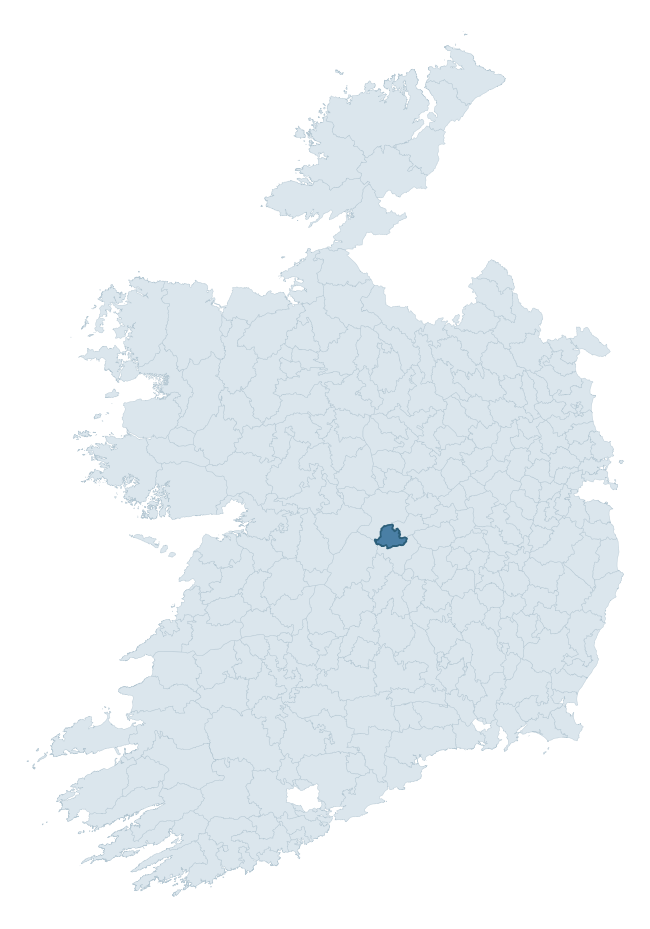
Where this barony sits in the Republic of Ireland
Geology and preservation
Bedrock geology shapes the landscape long before any settlement begins — controlling soil drainage, agricultural potential, the survival of upstanding monuments, and the preservation of buried archaeology. The figures below come from the Geological Survey Ireland 1:100,000 bedrock map.
The bedrock underlying Eglish is predominantly limestone (66% of the barony by area), laid down during the Carboniferous period (100% by area, around 359 to 299 million years ago). Limestone is the most heritage-rich bedrock in Ireland. It supports fertile, well-drained soils that favoured dense Early Medieval settlement and Norman manorial agriculture, and it weathers into karst features — sinkholes, caves, swallow holes, and souterrains — that frequently carry archaeology. Where peat overlies limestone, organic preservation can be exceptional. A substantial secondary geology of limestones (33%) adds further variety to the underlying landscape. The single largest mapped unit is the Waulsortian Limestones (37% of the barony's bedrock). With only 2 distinct rock types mapped, the barony is geologically uniform compared to the rest of the Republic (6th percentile for diversity) — a single coherent bedrock landscape.
Rock type composition
Largest mapped unit: Waulsortian Limestones (37% of the barony)
Placename evidence
Logainm records 11 heritage-diagnostic placenames for Eglish, a modest sample drawn predominantly from the townland record. The dominant stratum is pre-christian defensive. The most frequent diagnostic roots are ráth- (5) and cill- (4). With a sample of this size the count should be treated as indicative rather than definitive.
Pre-Christian / Early Medieval Defensive
| Root | Count | Meaning |
|---|---|---|
| ráth- | 5 | earthen ringfort |
| lios- | 1 | ringfort or enclosure |
| dún- | 1 | hilltop or promontory fort |
Early Christian Ecclesiastical
| Root | Count | Meaning |
|---|---|---|
| cill- | 4 | church (early) |
Burial, Ritual, and Norse-Contact
| Root | Count | Meaning |
|---|---|---|
| gall- | 2 | foreigner — Norse settlement marker |
Other baronies in Offaly
About this profile
Click any section below to expand.
What is a barony?
A barony is a historic administrative unit in Ireland, broadly equivalent to an English hundred. The 280 baronies used here are from the OSi 2019 National Statutory Boundaries (generalised 20m), covering the 26 counties of the Republic of Ireland. Baronies derive from the Norman period, were formalised in the 17th century, and have not been redrawn for statistical purposes. They vary enormously in area, from compact urban baronies in Dublin to vast upland baronies in Connacht, and should not be compared by raw site count without accounting for area differences.
What counts as a site?
This profile combines three distinct heritage registers, each with its own definition of what constitutes a recordable site:
- Archaeological sites (NMS). The National Monuments Service Sites and Monuments Record (SMR) catalogues every known archaeological monument or site of archaeological interest in the Republic, from prehistoric burial mounds and ringforts to medieval churches and post-medieval defensive works. Inclusion does not require legal protection — only that the site has been identified, surveyed, and assessed as having archaeological value. A separate subset of these sites lies within a recorded protection zone, which gives them statutory protection under the National Monuments Acts.
- Listed buildings (NIAH). The National Inventory of Architectural Heritage records buildings of architectural, historical, archaeological, artistic, cultural, scientific, social, or technical interest. Each surveyed structure is appraised on a five-tier scale: International, National, Regional, Local, and Record-Only. The NIAH appraisal is informational rather than strictly statutory, but it underpins local-authority Record of Protected Structures (RPS) listings.
- Heritage placenames (Logainm). Logainm is the authoritative database of Irish placenames maintained by the Placenames Branch. This profile applies a heritage-diagnostic classifier to the Irish-language form of each townland name, flagging roots that signal defensive sites (ráth-, lios-, dún-, caiseal-, cathair-), ecclesiastical foundations (cill-, teampall-, domhnach-, mainistir-), prehistoric burial-ritual features (tuaim-, carn-, leaba-), or Norse-contact settlement (gall-). Townlands without one of these diagnostic roots are not flagged here — they may still carry historical significance, but that significance is not encoded in the name itself.
Editorial principles
The narrative sections of this profile follow several explicit principles:
- Evidential. Every claim about this barony’s heritage character is anchored in the underlying register data. Where a site count, a placename count, or a percentile rank is cited, it is computed from the source datasets at export time, not estimated.
- Comparative. Counts and metrics are reported alongside their percentile rank against the other 279 ROI baronies. A barony with 50 ringforts in absolute terms could be unusually high or unusually low depending on its size and regional context; percentile ranking removes that ambiguity.
- Transparent on limits. Where a register has known coverage gaps, survey biases, or data-quality issues that affect this barony’s figures, the profile flags them rather than presenting the numbers as definitive.
- No interpretation beyond what the data supports. The narrative does not speculate about historical events, social dynamics, or cultural meaning beyond what the recorded heritage and placename evidence directly attests.
Data caveats and limits
- NMS Sites and Monuments Record is the product of survey campaigns conducted at different intensities across different counties and decades. Some baronies have been surveyed more thoroughly than others, and absolute counts should be read in that light. Sites destroyed by development before survey are typically not represented; sites in heavily forested or upland terrain are sometimes under-recorded.
- NIAH coverage is broadly complete for the Republic of Ireland but the survey was conducted on a rolling county-by-county basis, and the most recent appraisal date varies. Buildings demolished or substantially altered after their original survey may still appear in the register; conversely, recent buildings of merit may not yet have been appraised.
- Logainm classification applies a deliberately conservative pattern-matching approach to the Irish-language townland forms. The classifier prioritises true positives over recall: a townland may carry a heritage signal that the classifier doesn’t recognise, particularly where the diagnostic root has been heavily anglicised or where the townland name draws on a less common term. The 60,000+ townland records and ~9,800 classified placenames give a substantial signal at barony scale, but individual townland names should be checked against Logainm directly for definitive interpretation.
- Period attribution. The chronological distribution reflects only those NMS sites that carry a recognised period attribution in the source data. Sites listed as “Unknown” period are excluded from the dated subset.
- Boundary changes. Some baronies have undergone minor boundary adjustments since their 19th-century definition; the OSi 2019 generalised boundaries used here are the current statutory definition and may differ slightly from historical maps in border areas.
- Bedrock geology is mapped at 1:100,000 scale, which means local variation within a barony — small pockets of different rock type, mineral veins, alluvium overlying bedrock — is generalised. The dominant-system and rocktype figures are area-weighted, so a barony reading “70% Carboniferous limestone” may still contain small but archaeologically important pockets of older or younger rock. Around 3% of GSI polygons do not match the lexicon and contribute no rocktype or system attribution.
Data sources
- National Monuments Service — Sites and Monuments Record (SMR) https://data.gov.ie/dataset/national-monuments-service-archaeological-survey-of-ireland
- National Inventory of Architectural Heritage (NIAH) https://data.gov.ie/dataset/national-inventory-of-architectural-heritage-niah-national-dataset
- Logainm — Placenames Database of Ireland https://www.logainm.ie/
- Ordnance Survey Ireland — National Statutory Barony Boundaries 2019 https://data-osi.opendata.arcgis.com/
- EURODEM — European Digital Elevation Model https://www.mapsforeurope.org/datasets/euro-dem
- ESA WorldCover https://esa-worldcover.org/en
- Geological Survey Ireland — 1:100,000 Bedrock Geology https://www.gsi.ie/en-ie/data-and-maps/Pages/Bedrock.aspx
Explore more: Search any of the 280 ROI baronies, browse by historical province, or read the methodology and data sources for the full Republic of Ireland Heritage Tool.