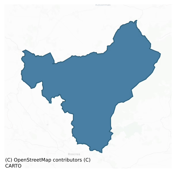
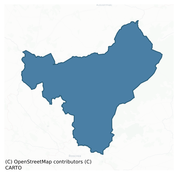
Ballybritt is a barony of County Offaly, in the historical province of Leinster (Irish: Baile an Bhriotaigh), covering 219 km² of land. The barony records 339 NMS archaeological sites and 369 NIAH listed buildings, placing it at around the 36th percentile among 280 ROI baronies for sites per km². This means it is in the lower half of all baronies for sites per km². Dated archaeological evidence runs from the Neolithic through to the Modern, spanning 8 of 9 archaeological periods, placing the barony in the 65th percentile among 280 ROI baronies for chronological depth. This means it is in the upper half of all baronies for chronological depth. The largest dated subset of recorded sites dates to the Iron Age.
Heritage at a glance
Percentile rankings throughout this profile compare each barony only against the other 279 Republic of Ireland baronies.
The recorded heritage of Ballybritt
The National Monuments Service Sites and Monuments Record (SMR) is the statutory inventory of archaeological sites for the Republic of Ireland, maintained by the Department of Tourism, Culture, Arts, Gaeltacht, Sport and Media. Sites recorded here include earthworks, ringforts, megalithic tombs, ecclesiastical remains, and post-medieval features; not every record is legally protected, but each is registered as a monument of archaeological interest.
The National Monuments Service records 339 archaeological sites in Ballybritt, putting it at the 36th percentile among 280 ROI baronies for sites per km². This means it is in the lower half of all baronies for sites per km². Protection coverage is near-universal — 322 sites (95%) fall within a recorded monument protection zone, indicating an extensively surveyed landscape. The dominant category is defensive sites — ringforts, enclosures, hillforts, and stone forts (161 sites, 47% of the record). The most diagnostically specific type is Ringfort – rath (37 records, 11% of the barony's NMS total) — compared to an ROI average of 20% across all baronies where this type occurs. Ringfort – rath is an earthen ringfort enclosed by a bank and external ditch — the most common Early Medieval farmstead, broadly dated 500–1000 AD. The broader 'Enclosure' classification — which catches unclassified ringforts and field enclosures — accounts for a further 79 records (23%) and reflects the difficulty of sub-classifying degraded earthworks from surface evidence alone. Across the barony's 219 km², this gives a recorded density of 1.55 sites per km².
Most common monument types
Hover or tap a monument type to see its definition.
| Type | Count |
|---|---|
| Enclosure a banked or ditched feature of uncertain type, used as a catch-all where the original function cannot be determined from surface evidence | 79 |
| Ringfort – rath an earthen ringfort enclosed by a bank and external ditch — the most common Early Medieval farmstead, broadly dated 500–1000 AD | 37 |
| Church a building used for public Christian worship, of any date from c. 500 AD onwards | 12 |
| Barrow – ring-barrow a Bronze/Iron Age burial monument: a low circular area enclosed by ditch and outer bank | 11 |
| Castle – unclassified a castle whose form cannot be precisely classified, dating somewhere between the late 12th and 16th centuries | 9 |
| Graveyard a burial area associated with a church, in use from the medieval period onwards | 9 |
| Castle – tower house a fortified residential tower of four or five storeys, mostly built by lords in the 15th and 16th centuries and often within a defended bawn | 8 |
Chronological distribution
The dated archaeological record for Ballybritt spans from the Neolithic through to the Modern, with activity attested across 8 of 9 archaeological periods. Every period from earliest to latest is represented in the record — an unbroken sequence of dated activity across the full chronological span. Activity concentrates most heavily in the Iron Age (106 sites, 37% of dated material), with the Early Medieval forming a secondary peak (83 sites, 29%). A further 56 recorded sites (17% of the overall NMS register for the barony) carry no period attribution — appearing as 'Unknown' in the bar chart below. This typically reflects either records that pre-date the standardised period vocabulary or sites awaiting specialist dating review, rather than a genuine absence of chronological evidence.
Sample of recorded monuments
Show 25 sample monuments (of 339 total)
A representative sample of 25 recorded monuments drawn from the barony’s 339 total NMS entries. Sites within a recorded monument protection zone and rarer site types are prioritised so the list shows a meaningful cross-section rather than only the most common type. Each entry shows the official Sites and Monuments Record reference number and the description published by the National Monuments Service.
Historic town
Birr is situated in the low-lying fertile valley of the Little Brosna River. The town developed SE of the castle (OF035-012004-) and within the bounds of a pronounced meander in the River Camcor. The Camcor joins the…
Birr is situated in the low-lying fertile valley of the Little Brosna River. The town developed SE of the castle (OF035-012004-) and within the bounds of a pronounced meander in the River Camcor. The Camcor joins the Little Brosna to NW of the town. St Brendan reputedly established a monastery (OF035-012001/003-) here in the 6th century which subsequently became a prestigious and influential foundation and one of the most celebrated members of St Columcille's great federation of churches. Located in the border area between the provinces of Munster, Meath, Leinster and Connacht and itself located in the territory of Eile in Munster, the monastic settlement was frequently chosen as a venue for the meetings of both kings and churchmen, perhaps the most significant of which were the synods of AD 697 and 1174. An Anglo-Norman castle (OF035-012009-) and settlement had been established at Birr by 1207 and continued at least until c. 1315. By the mid-14th century the settlement had reverted to the O'Carrolls of Ely. The 'Black Castle' (OF035-012010) became one of the principal seats of the ruling branch of that dynasty and remained as such until its sale to Butler of Ormond in 1594. In 1621 as part of the Plantation of Ely O'Carroll, Laurence Parsons was granted the lands, 'castle and fortilage' of Birr which became the manor of Parsonstown and a new castle (OF035-012004-) was erected by the Parsons family. It was from this time and under Laurence Parsons' direction that Birr bega…
Cross – High cross (present location)
National Monument No. 510. Poorly preserved 10th-century cross with a ringed head the ring of which is now destroyed. This sandstone cross contains biblical scenes on both its faces with the sides decorated with…
National Monument No. 510. Poorly preserved 10th-century cross with a ringed head the ring of which is now destroyed. This sandstone cross contains biblical scenes on both its faces with the sides decorated with geometric patterns (Harbison 1970, 201). The cross stands in a truncated pyramidal base with bands of interlace decoration. Not marked on the first two editions of the OS 6-inch maps and may have been removed from original location and probably erected at present location in the 19th-century. A 3D model of the high cross can be downloaded from Offaly County Council website at www.offaly.ie/eng/Services/Heritage/Archaeology/3D_Surveying_of_Archaeological_Monuments/
Described by Harbison (1992, vol. 1, 35-6) as following; 'The fragmentary cross now erected on the edge of a valley in the grounds of Castle Bernard is saids to have come from Kinnitty graveyard, and is therefore often referred to as the Kinnitty Cross. It stands on a base measuring 1.05m by 0.80cm at ground level, and is 84cm high. The base is decorated on all four sides with two horizontal bands of single-strand interlace framed above and below by a raised rib. The cross, which now lacks its arms and ring, stands to a height of 2.10m. The shaft is 45cm wide, and its thickness varies from 13cm to 19cm. There are roll mouldings at the edge, and the panels on the faces and sides are seperated by the mouldings surrounding them, which turn back on themselves without meeting at the centre.
East Side:
E…
Graveslab
No evidence of any graveslabs in the area marked on the 6-inch ordnance survey map. According to Feehan several graveslabs were recovered from the moat (OF036-044003-) to the SW of Castle Bernard (Feehan 1979,…
No evidence of any graveslabs in the area marked on the 6-inch ordnance survey map. According to Feehan several graveslabs were recovered from the moat (OF036-044003-) to the SW of Castle Bernard (Feehan 1979, 185).
The above description is derived from the published 'Archaeological Inventory of County Offaly' (Dublin: Stationery Office, 1997). In certain instances the entries have been revised and updated in the light of recent research.
Date of upload: 23 May 2011
Stone trough
A stone trough consisting of an oval shaped limestone trough (L 0.9m x B 0.6m x T 0.05m; H 0.35m), the spout or opening at one end has a face carved into the end of the trough (Feehan 1979, 159-62). The trough probably…
A stone trough consisting of an oval shaped limestone trough (L 0.9m x B 0.6m x T 0.05m; H 0.35m), the spout or opening at one end has a face carved into the end of the trough (Feehan 1979, 159-62). The trough probably dates from the post-AD 1700 period.
Compiled by: Caimin O'Brien
Date of upload: 23 May 2011
Mass-rock
Mass-rock in the Slieve Bloom Mountains, no other features visible (Feehan 1979, 210).
The above description is derived from the published 'Archaeological Inventory of County Offaly' (Dublin: Stationery Office,…
Mass-rock in the Slieve Bloom Mountains, no other features visible (Feehan 1979, 210).
The above description is derived from the published 'Archaeological Inventory of County Offaly' (Dublin: Stationery Office, 1997). In certain instances the entries have been revised and updated in the light of recent research.
Date of upload: 23 May 2011
Millstone quarry
Located on the bed of the Silver River there are rough cut outs visible in the bedrock of the river, these millstones were used in the nearby mill of 18th century date. Post 1700 feature.
The above description is…
Located on the bed of the Silver River there are rough cut outs visible in the bedrock of the river, these millstones were used in the nearby mill of 18th century date. Post 1700 feature.
The above description is derived from the published 'Archaeological Inventory of County Offaly' (Dublin: Stationery Office, 1997). In certain instances the entries have been revised and updated in the light of recent research.
Date of upload: 23 May 2011
Stone head
The stone sculptures consist of one carved head which was used as a corbel in the Romanesque Church of Letter (OF037-002001-) and the other is a Hood moulding terminal (OF037-013003-) with Hiberno-Romanesque decoration.…
The stone sculptures consist of one carved head which was used as a corbel in the Romanesque Church of Letter (OF037-002001-) and the other is a Hood moulding terminal (OF037-013003-) with Hiberno-Romanesque decoration. Both of these pieces were inserted into the W gable of Cadamstown Church in the 19th-century. Recent replastering of the W gable revealed Early Christian cross inscribed slab (OF037-013002-).
Cross referenced with OF037-002005.
The above description is derived from the published 'Archaeological Inventory of County Offaly' (Dublin: Stationery Office, 1997). In certain instances the entries have been revised and updated in the light of recent research.
Date of upload: 23 May 2011
Inauguration stone (present location)
Now situated in the village of Cadamstown, this stone is known locally as the 'Ballykelly Stone' and is locally believed to be the inauguration stone of the O'Flanagans (Feehan 1979, 143). Site consists of a large…
Now situated in the village of Cadamstown, this stone is known locally as the 'Ballykelly Stone' and is locally believed to be the inauguration stone of the O'Flanagans (Feehan 1979, 143). Site consists of a large irregular and well weathered limestone boulder. Moved from its original location in the townland of Coolcreen to its present location in 1978.
The above description is derived from the published 'Archaeological Inventory of County Offaly' (Dublin: Stationery Office, 1997). In certain instances the entries have been revised and updated in the light of recent research.
Date of upload: 23 May 2011
House – 17th century
Two storey high gable ended house with high pitched roof and rendered walls with two large protruding chimney stacks at rear of house. According to local information facade of house was rebuilt in the 19th-century.…
Two storey high gable ended house with high pitched roof and rendered walls with two large protruding chimney stacks at rear of house. According to local information facade of house was rebuilt in the 19th-century. Probable late 17th century house with 19th-century facade. Letter was in the possession of the Adair family in the 17th centuryand later passed into the ownership of the Manifold family the latter may have been responsible for building Letter House (Feehan 1979, 143)
The above description is derived from the published 'Archaeological Inventory of County Offaly' (Dublin: Stationery Office, 1997). In certain instances the entries have been revised and updated in the light of recent research.
Date of upload: 23 May 2011
Settlement deserted – medieval
National Monument No. 497, consisting of a poorly preserved church (OF039-003005-), base of round tower (OF039-003003-), low motte (OF039-003009-), possible souterrain (OF039-003026-) and building (OF039-003008-) all…
National Monument No. 497, consisting of a poorly preserved church (OF039-003005-), base of round tower (OF039-003003-), low motte (OF039-003009-), possible souterrain (OF039-003026-) and building (OF039-003008-) all of which is contained within the impressive remains of a bivallate ecclesiastical enclosure (OF039-003001-). Founded by St. Kieran the elder in the fifth century (ITA Survey 1943). Medieval earthworks marked on OS 6-inch map as 'Ramparts' enclose the ecclesiastical remains with square shaped motte (OF039-003009-) to the SW of the church. The earthworks consist of two well preserved earthen banks with wide deep intervening fosse and possible ramped entrance at N. Inside the enclosure are several earthen banks which may act as internal divisions. Possible wall footings of a rectangular building orientated on a N/S axis located outside SE angle of graveyard wall as indicated on the OS 6-inch map. An Inquisition of 1568 recorded 'The Villa of Shyre belonged to the Canons, in which were six cottages and forty acres of arable and pasture lands, of the annual value of 6s. 8d.' Surviving evidence suggests an early Christian foundation with early medieval priory, low motte and earthworks which enclose the priory which was later fortified by the addition of a gun turret to the SE angle possibly in the 16th-century. The monastic remains are described in 1568 as consisting of 'The Prior was found seized of the site of the Priory containing one acre, in which were the wal…
Crannog
Situated within the floodplain of the Fuarawn river which lies to the W of site. Rectangular-shaped platform earthwork (ext. dims E-W 15.60m x 34m N-S) with no evidence of an enclosing bank or fosse and no entrance…
Situated within the floodplain of the Fuarawn river which lies to the W of site. Rectangular-shaped platform earthwork (ext. dims E-W 15.60m x 34m N-S) with no evidence of an enclosing bank or fosse and no entrance feature. The summit of the mound (dims. 24m x 8m) is quite level. It is not clear if this earthwork may have been the site of a crannog described in 1979 as, 'in the townland of Ballycurragh; all that remains now is an oval platform of clay in the bog' (Feehan 1979, 94).
The above description is derived from the published 'Archaeological Inventory of County Offaly' (Dublin: Stationery Office, 1997). In certain instances the entries have been revised and updated in the light of recent research.
Date of upload/revision: 30 December 2011
Cist
Situated on a natural rise overlooking river to the N. Cist burial (L 7ft by 3.5 ft) discovered 0.7m to the NE of a standing stone (OF043-006002-) in the early 1900's (Gilling 1938 Vol. 8, 161). No skeletal remains or…
Situated on a natural rise overlooking river to the N. Cist burial (L 7ft by 3.5 ft) discovered 0.7m to the NE of a standing stone (OF043-006002-) in the early 1900's (Gilling 1938 Vol. 8, 161). No skeletal remains or any evidence of pottery survived.
Archaeological test trenching of the footprint for a house 60m from the standing stone (OF043-006002-) was carried out by Chris Read under licence no. 00E0746. No archaeological material was uncovered during testing.
The above description is derived from the published 'Archaeological Inventory of County Offaly' (Dublin: Stationery Office, 1997). In certain instances the entries have been revised and updated in the light of recent research.
Date of upload: 23 May 2011
Moated site
51m E-W ) enclosed by two earthen banks with wide flat bottomed intervening fosse (Wth 5m; ext. D 0.7m) which was water filled at time of visit and possible entrance feature (Wth 3m) at N end of W side. The inner bank…
51m E-W ) enclosed by two earthen banks with wide flat bottomed intervening fosse (Wth 5m; ext. D 0.7m) which was water filled at time of visit and possible entrance feature (Wth 3m) at N end of W side. The inner bank (Wth 3m; int. H 0.3m; ext. H 1.7m) is best preserved while the fosse and outer bank (Wth 3m) are both destroyed from W through N to NE.
The above description is derived from the published 'Archaeological Inventory of County Offaly' (Dublin: Stationery Office, 1997). In certain instances the entries have been revised and updated in the light of recent research.
Date of upload: 23 May 2011
Cairn – clearance cairn
Potential enclosure identified from aerial photographs (GSI S 553/2), remains of possible clearance cairns.
The above description is derived from the published 'Archaeological Inventory of County Offaly' (Dublin:…
Potential enclosure identified from aerial photographs (GSI S 553/2), remains of possible clearance cairns.
The above description is derived from the published 'Archaeological Inventory of County Offaly' (Dublin: Stationery Office, 1997). In certain instances the entries have been revised and updated in the light of recent research.
Date of upload: 23 May 2011
Quarry
No surface remains visible. Depicted as a semi-circular shaped face of a small quarry associated with a lime-kiln located immediately to the E on the 1838 ed. OS 6-inch map. This was a small quarry of post-1700 date…
No surface remains visible. Depicted as a semi-circular shaped face of a small quarry associated with a lime-kiln located immediately to the E on the 1838 ed. OS 6-inch map. This was a small quarry of post-1700 date associated with the adjoining lime-kiln as depicted on the 1838 ed. OS 6-inch map.
The above description is derived from the published 'Archaeological Inventory of County Offaly' (Dublin: Stationery Office, 1997). In certain instances the entries have been revised and updated in the light of recent research.
Date of upload/revision: 04 January 2012
Burnt mound
On flat poorly drained land in upland area. Large irregular shaped flat topped mound (diam. 30m; H 2m) enclosed by a fosse (Wth 1m) best preserved from S through W to N. Recent livestock grazing has removed top soil…
On flat poorly drained land in upland area. Large irregular shaped flat topped mound (diam. 30m; H 2m) enclosed by a fosse (Wth 1m) best preserved from S through W to N. Recent livestock grazing has removed top soil exposing burnt material. Nearby fulacht fiadh located to the S (OF043-036—-)
The above description is derived from the published 'Archaeological Inventory of County Offaly' (Dublin: Stationery Office, 1997). In certain instances the entries have been revised and updated in the light of recent research.
Date of upload: 23 May 2011
Castle – ringwork
Situated on a slight ridge in upland area. Circular platform (diam 31m N-S; ext. H 1.75m) enclosed by a wide flat bottomed water filled fosse (Wth 12.5m), earthen bank (Wth 4.6m; ext. H 2m; int. H 1m) and external fosse…
Situated on a slight ridge in upland area. Circular platform (diam 31m N-S; ext. H 1.75m) enclosed by a wide flat bottomed water filled fosse (Wth 12.5m), earthen bank (Wth 4.6m; ext. H 2m; int. H 1m) and external fosse (Wth 7m) with causewayed entrance (Wth 4.6m) at W. Field fence runs across interior from E to W. Traces of possible stone wall enclosing platform area. Presence of wide water filled fosse may indicate medieval date.
The above description is derived from the published 'Archaeological Inventory of County Offaly' (Dublin: Stationery Office, 1997). In certain instances the entries have been revised and updated in the light of recent research.
Date of upload: 23 May 2011
Stone sculpture – iconic
Glacial limestone erratic (H 1.45m; Wth 1.3m; T 0.27-0.65m) that has a stone head carved onto its surface which originally was located in a field near to Killavilla House and has since been removed from its original…
Glacial limestone erratic (H 1.45m; Wth 1.3m; T 0.27-0.65m) that has a stone head carved onto its surface which originally was located in a field near to Killavilla House and has since been removed from its original location and is now housed in the National Museum of Ireland (see DU018-209—-) when it was acquired from the landowner in 1944. The adjoining field to where the stone was located was known locally as the cillín and in this field there was a low mound (diam. 41m; H 0.6m) surrounded by a shallow fosse (OF043-057—-). The upper part of the stone head is pointed and rises to a peak above the forehead (Roe 1945, 263-66).
The above description is derived from the published 'Archaeological Inventory of County Offaly' (Dublin: Stationery Office, 1997). In certain instances the entries have been revised and updated in the light of recent research.
Date of upload: 23 May 2011
Cultivation ridges
Cultivation ridges associated with field clearance cairns (OF043-014001-) which may date from before 1700.
Compiled by: Caimin O'Brien.
Date of upload: 23 May 2011
Road – hollow-way
Situated on a natural rise of ground in upland area. Irregular shaped graveyard enclosed by stone wall with church (OF043-023—-) located in N sector of graveyard (OF043-023001-). Roadway consists of a linear earthwork…
Situated on a natural rise of ground in upland area. Irregular shaped graveyard enclosed by stone wall with church (OF043-023—-) located in N sector of graveyard (OF043-023001-). Roadway consists of a linear earthwork or sunken way (Wth. 13m) located to the E of the church running along a NE-SW axis which is flanked on either side by an earthen bank. Motte (OF043-020—-) located approx. 500m to NW.
Compiled by: Caimin O'Brien.
Date of upload: 23 May 2011
Barrow – pond barrow
Located on top of high ground in mountainous area with good views in all directions. One of a group of 5 barrows (OF038-008001/002/003/004-) located in close proximity to each other. According to local tradition these…
Located on top of high ground in mountainous area with good views in all directions. One of a group of 5 barrows (OF038-008001/002/003/004-) located in close proximity to each other. According to local tradition these barrows are located on a hilltop which was the inauguration site of the O’Flanagans of Cinél Arga (Feehan 1979, 143). It is possible that these burial mounds form part of a ritual landscape associated with this inauguration site.
Compiled by: Caimin O'Brien.
Date of upload: 09 August 2012
Ecclesiastical site
Birr is situated in the low-lying fertile valley of the Little Brosna River. The town (OF035-012—-) developed SE of the castle (OF035-012004-) and within the bounds of a pronounced meander in the River Camcor. The…
Birr is situated in the low-lying fertile valley of the Little Brosna River. The town (OF035-012—-) developed SE of the castle (OF035-012004-) and within the bounds of a pronounced meander in the River Camcor. The Camcor joins the Little Brosna to NW of the town. St Brendan reputedly established a monastery here in the 6th century which subsequently became a prestigious and influential foundation and one of the most celebrated members of St Columcille's great federation of churches. Ancient monastic site founded by St. Brendan in the seventh century associated with the illuminated manuscript known as the 'Gospels of Mac Regol' now housed in the Bodleian Library, Oxford (Bradley 1986, 20). Located in the border area between the provinces of Munster, Meath, Leinster and Connacht and itself located in the territory of Eile in Munster, the monastic settlement was frequently chosen as a venue for the meetings of both kings and churchmen, perhaps the most significant of which were the synods of AD 697 and 1174. Present remains consist of a poorly preserved remains of multiperiod square shaped church (OF035-012001-) built with roughly coursed limestone with large sandstone quoin stones with 17th-century tower three storeys high added to the S end of W wall which is located in centre of a large irregular shaped graveyard containing 18th and 19th century memorials. The church (OF035-012001-) and graveyard (OF035-012002-) were possibly built on the site of the ancient monastery of…
Town defences
Birr is situated in the low-lying fertile valley of the Little Brosna River. The town developed SE of the castle (OF035-012004-) and within the bounds of a pronounced meander in the River Camcor. The Camcor joins the…
Birr is situated in the low-lying fertile valley of the Little Brosna River. The town developed SE of the castle (OF035-012004-) and within the bounds of a pronounced meander in the River Camcor. The Camcor joins the Little Brosna to NW of the town. St Brendan reputedly established a monastery (OF035-012001/003-) here in the 6th century which subsequently became a prestigious and influential foundation and one of the most celebrated members of St Columcille's great federation of churches. Located in the border area between the provinces of Munster, Meath, Leinster and Connacht and itself located in the territory of Eile in Munster, the monastic settlement was frequently chosen as a venue for the meetings of both kings and churchmen, perhaps the most significant of which were the synods of AD 697 and 1174. An Anglo-Norman castle (OF035-012009-) and settlement had been established at Birr by 1207 and continued at least until c. 1315. By the mid-14th century the settlement had reverted to the O'Carrolls of Ely. The 'Black Castle' (OF035-012010) became one of the principal seats of the ruling branch of that dynasty and remained as such until its sale to Butler of Ormond in 1594. In 1621 as part of the Plantation of Ely O'Carroll, Laurence Parsons was granted the lands, 'castle and fortilage' of Birr which became the manor of Parsonstown and a new castle (OF035-012004-) was erected by the Parsons family. It was from this time and under Laurence Parsons' direction that Birr bega…
Round tower
National Monument No. 497, consisting of a poorly preserved church (OF039-003005-), base of round tower (OF039-003003-), low motte (OF039-003009-), possible souterrain (OF039-003026-) and building (OF039-003008-) all…
National Monument No. 497, consisting of a poorly preserved church (OF039-003005-), base of round tower (OF039-003003-), low motte (OF039-003009-), possible souterrain (OF039-003026-) and building (OF039-003008-) all of which is contained within the impressive remains of a bivallate ecclesiastical enclosure (OF039-003001-). Founded by St. Kieran the elder in the fifth century (ITA Survey 1943). Only the base of a round tower (int. diam. 2.86m; wall T 1.2m) located at the W end of the N wall of the Augustinian priory on the NW angle of the priory (OF039-003004-) which has been recently restored.
Compiled by: Caimin O'Brien.
Date of upload: 23 May 2011
Enclosure
Situated on W face of hill in upland area. The E half of this site is totally destroyed by a modern laneway. All that remains is the W half of a circular area (diam 35m approx.) enclosed by an earthen bank (Wth 1.5m;…
Situated on W face of hill in upland area. The E half of this site is totally destroyed by a modern laneway. All that remains is the W half of a circular area (diam 35m approx.) enclosed by an earthen bank (Wth 1.5m; int. H 0.5m; ext. H 1.5m) with no evidence of an outer fosse or entrance feature.
The above description is derived from the published 'Archaeological Inventory of County Offaly' (Dublin: Stationery Office, 1997). In certain instances the entries have been revised and updated in the light of recent research.
Date of upload: 23 May 2011
Listed buildings
The National Inventory of Architectural Heritage (NIAH) is a state survey appraising buildings of architectural, historical, archaeological, artistic, cultural, scientific, social, or technical interest. Each surveyed structure receives a rating from International (the highest, for buildings of European importance) through National, Regional, Local, and Record-Only.
The National Inventory of Architectural Heritage records 369 listed buildings in Ballybritt, placing it in the top 9% of ROI baronies for listed-building density. Among these, 5 are graded National — buildings of interest to the whole of Ireland rather than only its region. The Republic holds 937 National-graded buildings in total, so this barony accounts for around 1% of the national total. Construction dates concentrate most heavily in the Victorian (1830-1900) period. The most-recorded building type is house (217 examples, 59% of the listed stock).
Terrain and environment
Mean elevation across the barony is 173m — the 93rd percentile among 280 ROI baronies for elevation. This means it is in the top tenth of all baronies for elevation. This is a relatively elevated landscape by ROI standards. Elevation matters for heritage because higher-altitude baronies typically favour defensive monuments — ringforts and hilltop forts placed on prominent ground — while lowland baronies are more likely to carry the dense settlement and church networks of intensive agricultural landscapes. The barony reaches 524m at its highest point — a vertical span of more than 351m within its boundary, indicating significant topographic diversity. Mean slope is 5.2° — the 76th percentile among 280 ROI baronies for slope. This means it is in the top third of all baronies for slope. This is consistently steep terrain by ROI standards, the kind of landscape that tends to preserve upstanding archaeological features well. Slope is a key control on both land use and archaeological preservation: steep ground resists ploughing and tends to preserve earthworks intact, while gentle slopes favour intensive cultivation that damages or destroys surface archaeology over time. The Topographic Wetness Index averages 10.2, the 27th percentile among 280 ROI baronies for wetness. This means it is in the bottom third of all baronies for wetness. Drainage matters for heritage because poorly-drained ground preserves organic archaeology (wooden trackways, leather, textiles, and on rare occasions human remains) far better than free-draining soil; well-drained ground favours arable use but destroys organic material rapidly. The land cover is dominated by improved grassland (68%) and woodland (28%). In overall character, this is an upland landscape of steep, elevated terrain, with land use dominated by improved grassland.
Terrain measurements
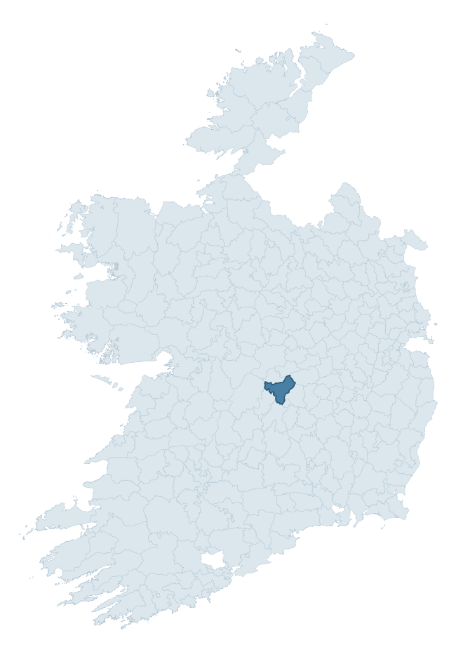
Where this barony sits in the Republic of Ireland
Geology and preservation
Bedrock geology shapes the landscape long before any settlement begins — controlling soil drainage, agricultural potential, the survival of upstanding monuments, and the preservation of buried archaeology. The figures below come from the Geological Survey Ireland 1:100,000 bedrock map.
The bedrock underlying Ballybritt is predominantly limestone (39% of the barony by area), with much of the rock dating to the Carboniferous period. Limestone is the most heritage-rich bedrock in Ireland. It supports fertile, well-drained soils that favoured dense Early Medieval settlement and Norman manorial agriculture, and it weathers into karst features — sinkholes, caves, swallow holes, and souterrains — that frequently carry archaeology. Where peat overlies limestone, organic preservation can be exceptional. A substantial secondary geology of sandstone (27%) and grey sandstone, siltstone, mudstone (17%) adds further variety to the underlying landscape. The single largest mapped unit is the Cadamstown Formation (27% of the barony's bedrock). With 7 distinct rock types mapped, the barony sits in the top third of ROI baronies for geological diversity (71st percentile) — typically a sign of complex tectonic history or coastal mosaics of differing rock units.
Rock type composition
Largest mapped unit: Cadamstown Formation (27% of the barony)
Placename evidence
Logainm records 13 heritage-diagnostic placenames for Ballybritt, a modest sample drawn predominantly from the townland record. The dominant stratum is early christian ecclesiastical. The most frequent diagnostic roots are cill- (6) and lios- (2). With a sample of this size the count should be treated as indicative rather than definitive.
Pre-Christian / Early Medieval Defensive
| Root | Count | Meaning |
|---|---|---|
| lios- | 2 | ringfort or enclosure |
| dún- | 1 | hilltop or promontory fort |
Early Christian Ecclesiastical
| Root | Count | Meaning |
|---|---|---|
| cill- | 6 | church (early) |
| cillín- | 2 | unconsecrated burial ground |
| gráinseach- | 1 | monastic farm / grange |
Other baronies in Offaly
About this profile
Click any section below to expand.
What is a barony?
A barony is a historic administrative unit in Ireland, broadly equivalent to an English hundred. The 280 baronies used here are from the OSi 2019 National Statutory Boundaries (generalised 20m), covering the 26 counties of the Republic of Ireland. Baronies derive from the Norman period, were formalised in the 17th century, and have not been redrawn for statistical purposes. They vary enormously in area, from compact urban baronies in Dublin to vast upland baronies in Connacht, and should not be compared by raw site count without accounting for area differences.
What counts as a site?
This profile combines three distinct heritage registers, each with its own definition of what constitutes a recordable site:
- Archaeological sites (NMS). The National Monuments Service Sites and Monuments Record (SMR) catalogues every known archaeological monument or site of archaeological interest in the Republic, from prehistoric burial mounds and ringforts to medieval churches and post-medieval defensive works. Inclusion does not require legal protection — only that the site has been identified, surveyed, and assessed as having archaeological value. A separate subset of these sites lies within a recorded protection zone, which gives them statutory protection under the National Monuments Acts.
- Listed buildings (NIAH). The National Inventory of Architectural Heritage records buildings of architectural, historical, archaeological, artistic, cultural, scientific, social, or technical interest. Each surveyed structure is appraised on a five-tier scale: International, National, Regional, Local, and Record-Only. The NIAH appraisal is informational rather than strictly statutory, but it underpins local-authority Record of Protected Structures (RPS) listings.
- Heritage placenames (Logainm). Logainm is the authoritative database of Irish placenames maintained by the Placenames Branch. This profile applies a heritage-diagnostic classifier to the Irish-language form of each townland name, flagging roots that signal defensive sites (ráth-, lios-, dún-, caiseal-, cathair-), ecclesiastical foundations (cill-, teampall-, domhnach-, mainistir-), prehistoric burial-ritual features (tuaim-, carn-, leaba-), or Norse-contact settlement (gall-). Townlands without one of these diagnostic roots are not flagged here — they may still carry historical significance, but that significance is not encoded in the name itself.
Editorial principles
The narrative sections of this profile follow several explicit principles:
- Evidential. Every claim about this barony’s heritage character is anchored in the underlying register data. Where a site count, a placename count, or a percentile rank is cited, it is computed from the source datasets at export time, not estimated.
- Comparative. Counts and metrics are reported alongside their percentile rank against the other 279 ROI baronies. A barony with 50 ringforts in absolute terms could be unusually high or unusually low depending on its size and regional context; percentile ranking removes that ambiguity.
- Transparent on limits. Where a register has known coverage gaps, survey biases, or data-quality issues that affect this barony’s figures, the profile flags them rather than presenting the numbers as definitive.
- No interpretation beyond what the data supports. The narrative does not speculate about historical events, social dynamics, or cultural meaning beyond what the recorded heritage and placename evidence directly attests.
Data caveats and limits
- NMS Sites and Monuments Record is the product of survey campaigns conducted at different intensities across different counties and decades. Some baronies have been surveyed more thoroughly than others, and absolute counts should be read in that light. Sites destroyed by development before survey are typically not represented; sites in heavily forested or upland terrain are sometimes under-recorded.
- NIAH coverage is broadly complete for the Republic of Ireland but the survey was conducted on a rolling county-by-county basis, and the most recent appraisal date varies. Buildings demolished or substantially altered after their original survey may still appear in the register; conversely, recent buildings of merit may not yet have been appraised.
- Logainm classification applies a deliberately conservative pattern-matching approach to the Irish-language townland forms. The classifier prioritises true positives over recall: a townland may carry a heritage signal that the classifier doesn’t recognise, particularly where the diagnostic root has been heavily anglicised or where the townland name draws on a less common term. The 60,000+ townland records and ~9,800 classified placenames give a substantial signal at barony scale, but individual townland names should be checked against Logainm directly for definitive interpretation.
- Period attribution. The chronological distribution reflects only those NMS sites that carry a recognised period attribution in the source data. Sites listed as “Unknown” period are excluded from the dated subset.
- Boundary changes. Some baronies have undergone minor boundary adjustments since their 19th-century definition; the OSi 2019 generalised boundaries used here are the current statutory definition and may differ slightly from historical maps in border areas.
- Bedrock geology is mapped at 1:100,000 scale, which means local variation within a barony — small pockets of different rock type, mineral veins, alluvium overlying bedrock — is generalised. The dominant-system and rocktype figures are area-weighted, so a barony reading “70% Carboniferous limestone” may still contain small but archaeologically important pockets of older or younger rock. Around 3% of GSI polygons do not match the lexicon and contribute no rocktype or system attribution.
Data sources
- National Monuments Service — Sites and Monuments Record (SMR) https://data.gov.ie/dataset/national-monuments-service-archaeological-survey-of-ireland
- National Inventory of Architectural Heritage (NIAH) https://data.gov.ie/dataset/national-inventory-of-architectural-heritage-niah-national-dataset
- Logainm — Placenames Database of Ireland https://www.logainm.ie/
- Ordnance Survey Ireland — National Statutory Barony Boundaries 2019 https://data-osi.opendata.arcgis.com/
- EURODEM — European Digital Elevation Model https://www.mapsforeurope.org/datasets/euro-dem
- ESA WorldCover https://esa-worldcover.org/en
- Geological Survey Ireland — 1:100,000 Bedrock Geology https://www.gsi.ie/en-ie/data-and-maps/Pages/Bedrock.aspx
Explore more: Search any of the 280 ROI baronies, browse by historical province, or read the methodology and data sources for the full Republic of Ireland Heritage Tool.