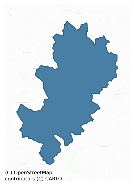
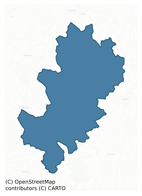
Clonlisk is a barony of County Offaly, in the historical province of Leinster (Irish: Cluain Leisc), covering 199 km² of land. The barony records 264 NMS archaeological sites and 102 NIAH listed buildings, placing it at around the 24th percentile among 280 ROI baronies for sites per km². This means it is in the bottom third of all baronies for sites per km². Dated archaeological evidence runs from the Neolithic through to the Modern, spanning 8 of 9 archaeological periods, placing the barony in the 71st percentile among 280 ROI baronies for chronological depth. This means it is in the top third of all baronies for chronological depth. The largest dated subset of recorded sites dates to the Early Medieval. Logainm flags 27 placenames in the barony as carrying a recognised heritage root; the largest share — around 56% — are names associated with early Christian church and monastic foundations.
Heritage at a glance
Percentile rankings throughout this profile compare each barony only against the other 279 Republic of Ireland baronies.
The recorded heritage of Clonlisk
The National Monuments Service Sites and Monuments Record (SMR) is the statutory inventory of archaeological sites for the Republic of Ireland, maintained by the Department of Tourism, Culture, Arts, Gaeltacht, Sport and Media. Sites recorded here include earthworks, ringforts, megalithic tombs, ecclesiastical remains, and post-medieval features; not every record is legally protected, but each is registered as a monument of archaeological interest.
The National Monuments Service records 264 archaeological sites in Clonlisk, putting it at the 24th percentile among 280 ROI baronies for sites per km². This means it is in the bottom third of all baronies for sites per km². Protection coverage is near-universal — 254 sites (96%) fall within a recorded monument protection zone, indicating an extensively surveyed landscape. The dominant category is defensive sites — ringforts, enclosures, hillforts, and stone forts (158 sites, 60% of the record). Ringfort – rath is the most prevalent type, making up 24% of the barony's recorded sites (63 records), broadly in line with the ROI average of 20% across all baronies where this type occurs. Ringfort – rath is an earthen ringfort enclosed by a bank and external ditch — the most common Early Medieval farmstead, broadly dated 500–1000 AD. Other significant types include Enclosure (36) and Ringfort – unclassified (15). Enclosure is a banked or ditched feature of uncertain type, used as a catch-all where the original function cannot be determined from surface evidence; Ringfort – unclassified is a circular Early Medieval settlement enclosure where surviving evidence does not allow distinction between earthen and stone forms. Across the barony's 199 km², this gives a recorded density of 1.33 sites per km².
Most common monument types
Hover or tap a monument type to see its definition.
| Type | Count |
|---|---|
| Ringfort – rath an earthen ringfort enclosed by a bank and external ditch — the most common Early Medieval farmstead, broadly dated 500–1000 AD | 63 |
| Enclosure a banked or ditched feature of uncertain type, used as a catch-all where the original function cannot be determined from surface evidence | 36 |
| Ringfort – unclassified a circular Early Medieval settlement enclosure where surviving evidence does not allow distinction between earthen and stone forms | 15 |
| Church a building used for public Christian worship, of any date from c. 500 AD onwards | 11 |
| Fulacht fia a horseshoe-shaped Bronze Age burnt mound built around a sunken trough beside a water source, traditionally interpreted as a cooking site | 11 |
| Graveyard a burial area associated with a church, in use from the medieval period onwards | 10 |
| Castle – unclassified a castle whose form cannot be precisely classified, dating somewhere between the late 12th and 16th centuries | 9 |
Chronological distribution
The dated archaeological record for Clonlisk spans from the Neolithic through to the Modern, with activity attested across 8 of 9 archaeological periods. This is the 71st percentile across ROI baronies for chronological depth — an above-average span. Every period from earliest to latest is represented in the record — an unbroken sequence of dated activity across the full chronological span. Activity concentrates most heavily in the Early Medieval (103 sites, 48% of dated material), with the Iron Age forming a secondary peak (48 sites, 23%). A further 51 recorded sites (19% of the overall NMS register for the barony) carry no period attribution — appearing as 'Unknown' in the bar chart below. This typically reflects either records that pre-date the standardised period vocabulary or sites awaiting specialist dating review, rather than a genuine absence of chronological evidence.
Sample of recorded monuments
Show 25 sample monuments (of 264 total)
A representative sample of 25 recorded monuments drawn from the barony’s 264 total NMS entries. Sites within a recorded monument protection zone and rarer site types are prioritised so the list shows a meaningful cross-section rather than only the most common type. Each entry shows the official Sites and Monuments Record reference number and the description published by the National Monuments Service.
Cairn – unclassified
On E facing slope of high ground overlooking valley to the NE. Irregular shaped flat topped cairn (diam. 19.5m E-W ;ext. H 1.5m) of stone construction with sod covering. Top of mound has been partially quarried away…
On E facing slope of high ground overlooking valley to the NE. Irregular shaped flat topped cairn (diam. 19.5m E-W ;ext. H 1.5m) of stone construction with sod covering. Top of mound has been partially quarried away revealing cairn construction.
The above description is derived from the published 'Archaeological Inventory of County Offaly' (Dublin: Stationery Office, 1997). In certain instances the entries have been revised and updated in the light of recent research.
Date of upload: 23 May 2011
Barrow – ring-barrow
On top of a N-S ridge in undulating countryside. Roughly circular domed area (diam. 51m) enclosed by a wide shallow fosse (Wth 6m; ext. D 0.5m) with external bank (Wth 4m; ext. H 0.7m). W side of external bank acts as a…
On top of a N-S ridge in undulating countryside. Roughly circular domed area (diam. 51m) enclosed by a wide shallow fosse (Wth 6m; ext. D 0.5m) with external bank (Wth 4m; ext. H 0.7m). W side of external bank acts as a field boundary while the SE sector of the inner fosse and external bank is destroyed. Indicated on 1840 edition of OS 6-inch map as an irregularly shaped earthwork.
The above description is derived from the published 'Archaeological Inventory of County Offaly' (Dublin: Stationery Office, 1997). In certain instances the entries have been revised and updated in the light of recent research.
Date of upload: 23 May 2011
Ritual site – holy/saint's stone
Early Christian monastery (OF041-004001-) founded by St. Cuimín in the seventh century (Cooke 1875, 209-14). Situated on a natural rise of ground overlooking river to the E. Located in the centre of the graveyard…
Early Christian monastery (OF041-004001-) founded by St. Cuimín in the seventh century (Cooke 1875, 209-14). Situated on a natural rise of ground overlooking river to the E. Located in the centre of the graveyard (OF041-004002-) are the poorly preserved remains of a rectangular church (OF041-004—-). Three large grass covered flagstones in the W sector of the graveyard (OF041-004002-) are marked on the OS 6-inch map as 'St. Cuimin's Seat' (Herity 2008, 183). Early Christian cross inscribed slab (OF041-004006-) located close to SE corner of graveyard.
The above description is derived from the published 'Archaeological Inventory of County Offaly' (Dublin: Stationery Office, 1997). In certain instances the entries have been revised and updated in the light of recent research.
Compiled by: Caimin O'Brien
Date of upload: 12 June 2014
House – fortified house
Situated on a slight rise in undulating countryside. Poorly preserved remains of a three storey rectangular block (ext. dims. 20.7m N-S; wall T 1.3m) with only the W half surviving intact with the remains of two…
Situated on a slight rise in undulating countryside. Poorly preserved remains of a three storey rectangular block (ext. dims. 20.7m N-S; wall T 1.3m) with only the W half surviving intact with the remains of two circular flanking towers (ext. dims 4.8m; wall T 0.9m) at the NW and SW angles which were connected by the W wall of the central block. The towers are three storeys high and were accessed from the central block. All the floors of the towers were carried on wooden beams and the original wooden lintels above the doors still survive. The external walls of the tower facing away from the building are peppered with musket loops at all levels. Originally there were four flanking towers connected to a rectangular central block. The musket loops and plan of this building would indicate a late 16th/17th-century date probably associated with the 1619 plantation.
The above description is derived from the published 'Archaeological Inventory of County Offaly' (Dublin: Stationery Office, 1997). In certain instances the entries have been revised and updated in the light of recent research.
Date of upload: 23 May 2011
Designed landscape – folly
Situated on top of a steep hill overlooking the village of Shinrone with site of medieval church (OF042-026—-) to N. Mistakenly identified by T. L. Cooke in 1875 as the remains of a possible castle in the 19th…
Situated on top of a steep hill overlooking the village of Shinrone with site of medieval church (OF042-026—-) to N. Mistakenly identified by T. L. Cooke in 1875 as the remains of a possible castle in the 19th century. This structure appears to be the remains of an 18th century folly standing on top of a steep hill at the western end of the village of Shinrone [insert photo]. This folly known as Oldhams Tower overlooks the site of the medieval church of Shinrone that was situated 180m to the north. In the 19th century this castle was in the centre of a walled garden to the rear of a house then in the ownership of George Percy Poe. This building is depicted on the 1838-40 OS 6” map as 'Oldhams Tower' [insert 1st ed. OS 6-inch map]. Only one castle is shown on the 1654 Down Survey parish map of Shinrone which traditionally has been identified as the castle in the centre of the village which suggests that the structure at Cloghmoyle was subsequently constructed in the second half of the 17th century or more likely in the 18th century. This building or watch-tower was described by Sir Charles Coote in 1801 as 'At Shinrone are vestiges of some places of considerable strength, with the ruins of a watch-tower on an artificial eminence, at some distance, but I cannot learn any historical tradition of it; and in the neighbourhood are also strong circular buildings, all situate on gravelly hills, which are rapidly undermining; they were converted into cock-pits long since, but all…
Megalithic tomb – unclassified
The monument stands in a copse at the southern edge of a stretch of lowlying, marshy land and is overlooked from the S by higher ground. The surviving remains indicate the presence of a rectangular chamber deeply buried…
The monument stands in a copse at the southern edge of a stretch of lowlying, marshy land and is overlooked from the S by higher ground. The surviving remains indicate the presence of a rectangular chamber deeply buried at the approximate centre of a substantial, subcircular, stony mound (diam. 11-12m; H 0.8m). The chamber (L 3.3m; Wth 1.5m), aligned roughly ESE-WNW, is represented by four set stones. An inward-leaning, somewhat gable-topped example marks the ESE end of the structure while a stone on the more northerly side of the chamber adjoins one end of the last, and another on the southern side which leans inwards, adjoins its opposite end. A second stone on the S side, just over 1m to the W, is taller than the other set stones. A large and now dislodged roofstone (L 3.2m; max. Wth 2.8m; T 0.3m) partly overlies the western end of the chamber. Another large stone lying prostrate and broken underneath the roofstone may have formed part of the structure as also may some of the sizable slabs lying on the mound.
The above description is derived from the published 'Archaeological Inventory of County Offaly' (Dublin: Stationery Office, 1997). In certain instances the entries have been revised and updated in the light of recent research.
Date of upload: 13 January 2010
Settlement deserted – medieval
In 1185 Dunkerrin was granted to Theobald Butler by Prince John and by 1200 Theobald appears to have beein in possession of these lands (Orpen 1911-20 ii, 102; Gwynn and Gleeson (1961 174-6). Dunkerrin became a manorial…
In 1185 Dunkerrin was granted to Theobald Butler by Prince John and by 1200 Theobald appears to have beein in possession of these lands (Orpen 1911-20 ii, 102; Gwynn and Gleeson (1961 174-6). Dunkerrin became a manorial town in the Gaelic territory of Éile under Anglo-Norman rule in the thirteenth century. During this time a timber castle (OF045-022001-) may have been built here. On the moat farm in the village of Dunkerrin there is a circular earthwork or ringwork that could have been the outer defences of an Anglo-Norman timber castle. In 1305 Dunkerrin is listed as an important Butler manor (White 1932, 147-54). According to this extent the manor consisted of a grange, a cowshed, a sheepfold, a kitchen and a mill (White 1932, 148). A record of burgage returns paid by the burgesses indicates the existence of a borough there in 1305 (White 1932, 151). In the fifteenth and sixteenth centuries a new stone castle (OF045-045) may have been built at Dunkerrin as the fortified residence of the O'Carrolls.
There are no surviving earthworks of the borough but it is likely that it was situated between the church (OF045-022002-) and the site of the timber castle (OF045-022001-) (Bradley 1987, 42).
Trial-trenching carried out by Brian Hodkinson under licence no. 98E0061 on a site for a new house, just east of the Church of Ireland church in Dunkerrin village, revealed no features of archaeological significance. An old north-south field boundary was noted and dated to the 18th c…
Ritual site – holy well
Not visible at ground level.
The above description is derived from the published 'Archaeological Inventory of County Offaly' (Dublin: Stationery Office, 1997). In certain instances the entries have been revised and…
Not visible at ground level.
The above description is derived from the published 'Archaeological Inventory of County Offaly' (Dublin: Stationery Office, 1997). In certain instances the entries have been revised and updated in the light of recent research.
Date of upload: 23 May 2011
Mound
On flat land in undulating countryside. Flat topped mound of rubble material which may be the remains of a tower\windmill associated with the nearby tower house and bawn (OF046-008—-). Not marked on any edition of the…
On flat land in undulating countryside. Flat topped mound of rubble material which may be the remains of a tower\windmill associated with the nearby tower house and bawn (OF046-008—-). Not marked on any edition of the six inch OS 6-inch maps.
The above description is derived from the published 'Archaeological Inventory of County Offaly' (Dublin: Stationery Office, 1997). In certain instances the entries have been revised and updated in the light of recent research.
Date of upload: 23 May 2011
Glass works
Present remains consist of a 17th century barrel-vaulted wood-fired glass furnace belonging to Huguenot glassmakers. Site was excavated by Jean Farrelly and Caimin O'Brien under licence no. 99E0191 (Farrelly, O'Brien,…
Present remains consist of a 17th century barrel-vaulted wood-fired glass furnace belonging to Huguenot glassmakers. Site was excavated by Jean Farrelly and Caimin O'Brien under licence no. 99E0191 (Farrelly, O'Brien, Paynter and Willmott 2014, 45-89). A 3D model of the glassmaking furnace can be downloaded from Offaly County Council website at www.offaly.ie/eng/Services/Heritage/Archaeology/3D_Surveying_of_Archaeological_Monuments/
An upstanding forest glass furnace near Shinrone became the focal point for investigating 17th-century glass manufacturing. Several families of French Huguenot glassmakers from Lorraine had been manufacturing glass in England in the late 16th and early 17th centuries. Members of two of these families, Bigos and Henseys (de Hennezels), are known to have held land in Offaly during this period. The Henseys are the most likely to have run the Shinrone glasshouse as they owned the townlands surrounding the upstanding furnace. In 1615 the manufacture of glass in wood-fired forest-glass furnaces was banned in England, though not in Ireland. However, in 1638-9 the exportation and manufacture of glass in Ireland was prohibited, and in 1641 another bill prohibited the felling of trees as a fuel supply for glass furnaces. Before the excavation a magnetic gradiometry survey was conducted by Joe Fenwick (Centre for Archaeological Survey, Department of Archaeology, NUI Galway) over an area 40m x 40m centring on the upstanding furnace. It was hoped that mag…
Graveslab
Present remains consist of 19th-Century Cof I church probably built on the site of a medieval church (OF045-022002-). 17th-century graveslab (2.1m by 0.8m by 0.3m) in graveyard (OF045-022003-) to S of church dedicated…
Present remains consist of 19th-Century Cof I church probably built on the site of a medieval church (OF045-022002-). 17th-century graveslab (2.1m by 0.8m by 0.3m) in graveyard (OF045-022003-) to S of church dedicated to John Carroll who died in 1681. Inscription in roman capitals carved in false relief above an incised iona-style cross with an engrailed shaft (Bradley 1987, 42-3). The inscription reads 'Sir Anthony O'Carroll placed this stone above the body of his father John O'Carroll of Cullenwaine who died 12 March 1681. May his soul rest in peace. Amen' (Bradley 1987, 43).
Compiled by: Caimin O'Brien.
Date of upload: 23 May 2011
Field system
Low linear earthworks possibly beloning ot a field system survive in the adjoining field immediately to the N of the church (OF045-022002-) and graveyard (OF045-022003-) at Dunkerrin, may have been assoicated with the…
Low linear earthworks possibly beloning ot a field system survive in the adjoining field immediately to the N of the church (OF045-022002-) and graveyard (OF045-022003-) at Dunkerrin, may have been assoicated with the medieval settlement (OF045-022—-).
Compiled by: Caimin O'Brien.
Date of upload/revision: 04 January 2012
Burnt mound
Phase 2 excavations along 17.1km (Contract 1) of the 35km N7 Castletown to Nenagh (Derrinsallagh to Ballintotty) national road scheme were commissioned by Laois County Council and the National Roads Authority. Contract…
Phase 2 excavations along 17.1km (Contract 1) of the 35km N7 Castletown to Nenagh (Derrinsallagh to Ballintotty) national road scheme were commissioned by Laois County Council and the National Roads Authority. Contract 1 comprises the western half of the scheme and runs from Clashnevin to Castelroan, passing along the Tipperary North and Offaly county border regions. Six areas of archaeology were uncovered during Contract 1 trial-trench testing. Cullenwaine 1, Area 5.1, was originally tested under licence E3377 in 2007.
The excavation at Cullenwaine 1 revealed a concentration of prehistoric activity that comprised three spreads of burnt-mound material, ten troughs, one post-hole, eleven stake-holes, two ditches, two hearths, numerous layers, four cremation pits (OF047-028002-/005-) and five possible cremation pyres. The majority of the features cut the subsoil. Two ditches truncated the area of the site; they were orientated north-east/south-west. Six of the troughs were located in close proximity to each other at the north-west end of the site. A hearth was located to the south of the group of pits. Four additional troughs were located further to the south. There was no evidence of timber lining in any of the troughs. A hearth was located to the north-east of the troughs.
A total of seven of the pits were located in the eastern portion of the site, unassociated with the layers of burnt-mound material. The four cremation pits were located in close proximity to each oth…
Field boundary
The N end of a possible enclosure (ringfort?) enters the site. The converging ditches do not join but form a type of staggered entrance along a flattish N side. The ditches
are around 1.5m wide max. and would form an…
The N end of a possible enclosure (ringfort?) enters the site. The converging ditches do not join but form a type of staggered entrance along a flattish N side. The ditches
are around 1.5m wide max. and would form an enclosure of perhaps 20m wide that
enters the site by around 10m.
Compiled by: Caimin O'Brien.
Date of upload: 23 May 2011
House – Bronze Age
Phase 2 excavations by John Tierney of Eachtra Archaeological Projects under licence No. E3773 along 17.1km (Contact 1) of the 35km N7 Castletown to Nenagh (Derrinsallagh to Ballintotty) national road scheme were…
Phase 2 excavations by John Tierney of Eachtra Archaeological Projects under licence No. E3773 along 17.1km (Contact 1) of the 35km N7 Castletown to Nenagh (Derrinsallagh to Ballintotty) national road scheme were commissioned by Laois County Council and the National Roads Authority. Contract 1 comprises the western half of the scheme and runs from Clashnevin to Castelroan, passing along the Tipperary North and Offaly county border regions. Six areas of archaeology were uncovered during Contract 1 trial-trench testing. Drumroe 1, Area 6.4, was originally tested under licence E3376 (see No. 1661 below) in 2007. The excavated remains comprised a Bronze Age house, a group of pits, a number of medieval field boundaries (OF047-018—-) and modern field boundaries. The area of excavation measured 35m north–south by 110m.
The Bronze Age house was located at the eastern end of the site. Nine ditches and field boundaries were recorded in the area of the excavation. One of the boundaries was a possible medieval field boundary which measured 0.89–1.3m in width and 0.32–0.5m in depth. It was c. 50m long, extending beyond the area of the excavation to the west, and it was aligned east–west. An entrance was located roughly at the centre of the excavated portion of the ditch. This was c. 1m wide, located between two ditch terminals. The entrance between the two terminals did not follow a straight line but was staggered, and the pathway between the ditch terminals zigzagged slightly. T…
Burial ground
In 2006 archaeological investigations were carried out by Colm Moloney, Headland Archaeology Ltd, under licence No. 06E0321, on the site of a proposed housing development in the townland of Moneygall, Co. Offaly. The…
In 2006 archaeological investigations were carried out by Colm Moloney, Headland Archaeology Ltd, under licence No. 06E0321, on the site of a proposed housing development in the townland of Moneygall, Co. Offaly. The site consisted of a circular enclosure ditch which measured 100m in diameter. The ditch was U-shaped in section with a maximum width of 2.7m and a maximum depth of 1.1m. No entrance was identified, but it would seem probable it is located in an area which is not being impacted on by the current development. Within the south-eastern area of the enclosure a burial-ground was uncovered. A total of 42 inhumations were excavated. It is probable that there are more inhumations in the area, which will not be disturbed as part of this development. Underneath some of the burials and enclosing others was a rectangular V-shaped ditch with an entrance to the west. This enclosure measured 14m east–west by 12m. The entrance measured 3m wide and may possibly have been a cemetery enclosure. Within the outer enclosure ditch a number of metalworking areas were revealed, which included probable furnace pits and other metalworking pits (OF046-029002-). There were a number of pits where waste material and post-holes were uncovered but not in substantial enough numbers to show an area of clear settlement. Outside the area of the enclosure to the north-east and north-west there were a number of penannular ditches. The two ditches in the north-east had an internal diameter of 3.8m…
Burial
Phase 2 excavation carried out by Tori McMorran for Eachtra Archaeological Projects in 2007 under licence No. E3661 along 17.1km (Contact 1) of the 35km N7 Castletown to Nenagh (Derrinsallagh to Ballintotty) national…
Phase 2 excavation carried out by Tori McMorran for Eachtra Archaeological Projects in 2007 under licence No. E3661 along 17.1km (Contact 1) of the 35km N7 Castletown to Nenagh (Derrinsallagh to Ballintotty) national road scheme were commissioned by Laois County Council and the National Roads Authority. Contract 1 comprises the western half of the scheme and runs from Clashnevin to Castelroan, passing along the Tipperary North and Offaly county border regions. The excavation revealed a complex multi-period site. The site is located at around 140m OD overlooking a wide area of marshy ground to the north-east and east. Ground level drops sharply to the north to a small but fast-flowing stream. One of the earliest uses of this site was as a centre of cereal processing, including cereal drying and storage. A total of fifteen earth-cut, unlined possible figure-of-eight- or dumbbell-shaped kilns (OF047-017006-/020-) were discovered.
The second phase of activity was the enclosing of certain areas of the site through the construction of deep, wide ditches. It is unclear at this point whether this was to enclose the cereal-processing centre or whether this activity had already ended. It is clear that the construction of the ditches did not always respect the location of the kilns, with many of these being truncated at this time. Several structures which are present within the interior of this enclosed area may relate to this time. At least one of these truncates a kiln. No kiln…
Charcoal-making site
Archaeological investigations were carried out by Billy Quinn of Moore Archaeological & Environmental Services Ltd under licence No. 04E1359ext. at Springfield, Moneygall, Co. Offaly, between 16 and 26 October 2007. The…
Archaeological investigations were carried out by Billy Quinn of Moore Archaeological & Environmental Services Ltd under licence No. 04E1359ext. at Springfield, Moneygall, Co. Offaly, between 16 and 26 October 2007. The proposed development involved the erection of fifteen houses, new entrance and ancillary siteworks on a greenfield site near OF046–017001, classified as an earthwork. Outline permission to build was originally granted in 2004 subject to pre-development testing. An initial testing phase was carried out by Brian Halpin (National Archaeological Services Ltd) in October 2004 (Excavations 2004, No. 1421). Four trenches running north-north-west/south-south-east were excavated across the site that ‘uncovered a series of linear features of unknown date and a subcircular feature, the possible remains of a Bronze Age burnt spread or potboiler. There were no traces of the earthwork uncovered.’ On the basis of these findings a further investigation was recommended. Following this, Moore Group were commissioned to undertake the monitoring of topsoil-stripping under a licence transfer. During the course of the monitoring brief on 10 September 2007 (Excavations 2007, No. 1463) excavation exposed the remains of the southern portion of an enclosing ditch associated with the earthwork (OF046–017—-). Following consultations with archaeologist Hugh Carey for the National Monuments Service, DEHLG, it was agreed that the monument be preserved in situ by covering the exposed r…
Stone head (present location)
Small sandstone carved head (H 0.2m; Wth 0.18m) with almond-shaped eyes, pointed angular nose and slit mouth which has been incorporated into a concrete block boundary wall of a modern bungalow. This head is locally…
Small sandstone carved head (H 0.2m; Wth 0.18m) with almond-shaped eyes, pointed angular nose and slit mouth which has been incorporated into a concrete block boundary wall of a modern bungalow. This head is locally believed to have come from the medieval church (OF039-055—-) at Roscomroe (pers. comm. Paddy Murray).
Compiled by: Caimin O’Brien
Date of upload: 16 June 2012
Cross-slab
Early Christian monastery (OF041-004001-) founded by St Cuimín in the seventh century (Cooke 1875, 209-14). Kilcomin [Ceall Chuimín/Cill Chuimín/church of Cuimín] named after Cuimín Fada [long] a seventh century saint…
Early Christian monastery (OF041-004001-) founded by St Cuimín in the seventh century (Cooke 1875, 209-14). Kilcomin [Ceall Chuimín/Cill Chuimín/church of Cuimín] named after Cuimín Fada [long] a seventh century saint who was born in the territory of Caoille Conaill, located between Rathfran bay and Lacken Bay, in the barony of Tirawley, Co. Mayo where his family operated a school (Ó Riain 2011, 245). The Ordnance Survey Letters of 1838 identified Kilcommon old churchyard with ‘Disert Chuimin’ which was located close to the borders of Leinster and Munster (Herity 2008, 182).
Situated on a natural rise of ground overlooking river to the E. Located in the centre of the graveyard (OF041-004002-) are the poorly preserved remains of a rectangular church (OF041-004—-). Three large grass covered flagstones in the W sector of the graveyard (OF041-004002-) are marked on the OS 6-inch map as 'St. Cuimin's Seat'. The lower half of a sandstone Early Christian cross-slab has been recently mounted on a plinth and placed up against the internal face of the S graveyard wall, located close to the SE corner of the graveyard. A new limestone upper portion of the cross has been carved and placed on top of the original lower half.
The above description is derived from the published 'Archaeological Inventory of County Offaly' (Dublin: Stationery Office, 1997). In certain instances the entries have been revised and updated in the light of recent research.
Compiled by: Caimin O'B…
Cliff-edge fort
Cropmark of semi-circular-shaped enclosure (approx. diam. 30m) running off stream/ravine visible on Google earth aerial imagery.
See attached image taken from Google Earth aerial photographs taken…
Cropmark of semi-circular-shaped enclosure (approx. diam. 30m) running off stream/ravine visible on Google earth aerial imagery.
See attached image taken from Google Earth aerial photographs taken 10/07/2018
Compiled by: Caimin O'Brien based on details provided by Jean-Charles Caillère
Date of upload: 29 May 2019
Ring-ditch
Cropmark of circular-shaped area (diam. c. 9m) defined by a ditch visible on Google Earth photograph taken 10/07/2018.
See attached Google Earth orthoimages
Compiled by: Caimin O'Brien based on details provided…
Cropmark of circular-shaped area (diam. c. 9m) defined by a ditch visible on Google Earth photograph taken 10/07/2018.
See attached Google Earth orthoimages
Compiled by: Caimin O'Brien based on details provided by Jean-Charles Caillère
Date of upload: 14 January 2022
Ringfort – cashel
Situated on E facing slope in upland area. Only the W half of the site survives from S through W to N consisting of a semicircular area (approx. 62m diam) enclosed by an impressive bank of mainly stone with a sod…
Situated on E facing slope in upland area. Only the W half of the site survives from S through W to N consisting of a semicircular area (approx. 62m diam) enclosed by an impressive bank of mainly stone with a sod covering (Wth 2m; int. H 1.7m). Originally the site must have been a large enclosure with an impressive stone bank.
The above description is derived from the published 'Archaeological Inventory of County Offaly' (Dublin: Stationery Office, 1997). In certain instances the entries have been revised and updated in the light of recent research.
Date of upload: 23 May 2011
Ringfort – cashel
Situated on W facing slope of natural hillock in upland area. Large circular area (diam 70m E-W) enclosed by an inner bank (Wth 2m; int. H 0.2m; ext. H 2.5m) of mainly stone construction destroyed by a modern road from…
Situated on W facing slope of natural hillock in upland area. Large circular area (diam 70m E-W) enclosed by an inner bank (Wth 2m; int. H 0.2m; ext. H 2.5m) of mainly stone construction destroyed by a modern road from W to N, outer fosse (Wth 1.5 – 2.5m; ext. D 0.4m) also destroyed by the road with an external bank (Wth 3m) only visible from E through S to SW. The interior of the site follows the natural slope of the hillock. Possible entrance gap (Wth 1.5m) at E. Large quarry pit in the W sector of the interior.
The above description is derived from the published 'Archaeological Inventory of County Offaly' (Dublin: Stationery Office, 1997). In certain instances the entries have been revised and updated in the light of recent research.
Date of upload: 23 May 2011
Ringfort – rath
Situated on high ground in upland area. Large circular area (diam 40m N-S) enclosed by two earth and stone banks with intervening fosse (Wth 3m) and impressive causewayed entrance (Wth 4m) at SW. The inner bank (Wth 2m;…
Situated on high ground in upland area. Large circular area (diam 40m N-S) enclosed by two earth and stone banks with intervening fosse (Wth 3m) and impressive causewayed entrance (Wth 4m) at SW. The inner bank (Wth 2m; ext. H 0.7m) is reduced to a scarp in places and has a modern gap (Wth 3m) at N. There is a large quantity of stone in the better preserved outer bank (Wth 3m; ext. H 0.5m; int. H 0.75m) which may be due to field clearance debris. There is no evidence of an external fosse.
The above description is derived from the published 'Archaeological Inventory of County Offaly' (Dublin: Stationery Office, 1997). In certain instances the entries have been revised and updated in the light of recent research.
Date of upload: 23 May 2011
Listed buildings
The National Inventory of Architectural Heritage (NIAH) is a state survey appraising buildings of architectural, historical, archaeological, artistic, cultural, scientific, social, or technical interest. Each surveyed structure receives a rating from International (the highest, for buildings of European importance) through National, Regional, Local, and Record-Only.
The NIAH records 102 listed buildings in Clonlisk (51st percentile across ROI baronies). The highest-graded structures include 2 of National significance. The Republic holds 937 National-graded buildings in total, so this barony accounts for around 0% of the national total. Construction dates concentrate most heavily in the Victorian (1830-1900) period.
Terrain and environment
Mean elevation across the barony is 93m — the 53rd percentile among 280 ROI baronies for elevation. This means it is in the upper half of all baronies for elevation. Elevation matters for heritage because higher-altitude baronies typically favour defensive monuments — ringforts and hilltop forts placed on prominent ground — while lowland baronies are more likely to carry the dense settlement and church networks of intensive agricultural landscapes. A maximum elevation of 277m gives the barony meaningful vertical relief. Mean slope is 3.0° — the 37th percentile among 280 ROI baronies for slope. This means it is in the lower half of all baronies for slope. Slope is a key control on both land use and archaeological preservation: steep ground resists ploughing and tends to preserve earthworks intact, while gentle slopes favour intensive cultivation that damages or destroys surface archaeology over time. The Topographic Wetness Index averages 11.1, the 62nd percentile among 280 ROI baronies for wetness. This means it is in the upper half of all baronies for wetness. Drainage matters for heritage because poorly-drained ground preserves organic archaeology (wooden trackways, leather, textiles, and on rare occasions human remains) far better than free-draining soil; well-drained ground favours arable use but destroys organic material rapidly. The land-cover mosaic combines improved grassland (77%), woodland (16%), and arable farmland (6%), giving a mixed agricultural and semi-natural landscape.
Terrain measurements
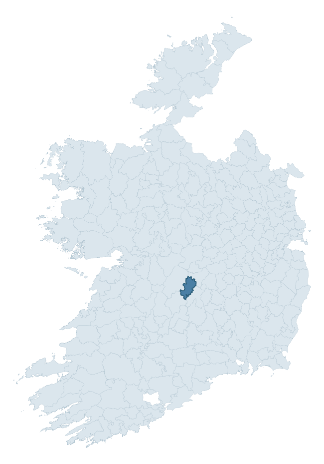
Where this barony sits in the Republic of Ireland
Geology and preservation
Bedrock geology shapes the landscape long before any settlement begins — controlling soil drainage, agricultural potential, the survival of upstanding monuments, and the preservation of buried archaeology. The figures below come from the Geological Survey Ireland 1:100,000 bedrock map.
The bedrock underlying Clonlisk is predominantly limestone (89% of the barony by area), laid down during the Carboniferous period (91% by area, around 359 to 299 million years ago). Limestone is the most heritage-rich bedrock in Ireland. It supports fertile, well-drained soils that favoured dense Early Medieval settlement and Norman manorial agriculture, and it weathers into karst features — sinkholes, caves, swallow holes, and souterrains — that frequently carry archaeology. Where peat overlies limestone, organic preservation can be exceptional. The single largest mapped unit is the Ballysteen Formation (58% of the barony's bedrock).
Rock type composition
Largest mapped unit: Ballysteen Formation (58% of the barony)
Placename evidence
Logainm records 27 heritage-diagnostic placenames for Clonlisk, drawn from townland and civil-parish names across the barony. The dominant stratum is Early Christian ecclesiastical — cill-, teampall-, and domhnach-prefixed names that record the dense network of early church foundations established between the fifth and tenth centuries. The leading diagnostic roots are cill- (11 — church), ráth- (6 — earthen ringfort), and lios- (3 — ringfort or enclosure). This is broadly in line with the ROI average of 30.7 heritage placenames per barony. The presence of multiple heritage strata side by side indicates layered occupation of the landscape across successive prehistoric and historic periods. Logainm records 161 placenames for Clonlisk (predominantly townland names). Of these, 27 (17%) carry one of the diagnostic Gaelic roots tracked above; the remainder draw on more generic landscape vocabulary that does not encode a heritage period.
Pre-Christian / Early Medieval Defensive
| Root | Count | Meaning |
|---|---|---|
| ráth- | 6 | earthen ringfort |
| lios- | 3 | ringfort or enclosure |
| dún- | 2 | hilltop or promontory fort |
| caiseal- | 1 | stone ringfort |
Early Christian Ecclesiastical
| Root | Count | Meaning |
|---|---|---|
| cill- | 11 | church (early) |
| teampall- | 2 | church (later medieval) |
| domhnach- | 1 | pre-Patrician or earliest Patrician church |
| cillín- | 1 | unconsecrated burial ground |
Burial, Ritual, and Norse-Contact
| Root | Count | Meaning |
|---|---|---|
| gall- | 2 | foreigner — Norse settlement marker |
Other baronies in Offaly
About this profile
Click any section below to expand.
What is a barony?
A barony is a historic administrative unit in Ireland, broadly equivalent to an English hundred. The 280 baronies used here are from the OSi 2019 National Statutory Boundaries (generalised 20m), covering the 26 counties of the Republic of Ireland. Baronies derive from the Norman period, were formalised in the 17th century, and have not been redrawn for statistical purposes. They vary enormously in area, from compact urban baronies in Dublin to vast upland baronies in Connacht, and should not be compared by raw site count without accounting for area differences.
What counts as a site?
This profile combines three distinct heritage registers, each with its own definition of what constitutes a recordable site:
- Archaeological sites (NMS). The National Monuments Service Sites and Monuments Record (SMR) catalogues every known archaeological monument or site of archaeological interest in the Republic, from prehistoric burial mounds and ringforts to medieval churches and post-medieval defensive works. Inclusion does not require legal protection — only that the site has been identified, surveyed, and assessed as having archaeological value. A separate subset of these sites lies within a recorded protection zone, which gives them statutory protection under the National Monuments Acts.
- Listed buildings (NIAH). The National Inventory of Architectural Heritage records buildings of architectural, historical, archaeological, artistic, cultural, scientific, social, or technical interest. Each surveyed structure is appraised on a five-tier scale: International, National, Regional, Local, and Record-Only. The NIAH appraisal is informational rather than strictly statutory, but it underpins local-authority Record of Protected Structures (RPS) listings.
- Heritage placenames (Logainm). Logainm is the authoritative database of Irish placenames maintained by the Placenames Branch. This profile applies a heritage-diagnostic classifier to the Irish-language form of each townland name, flagging roots that signal defensive sites (ráth-, lios-, dún-, caiseal-, cathair-), ecclesiastical foundations (cill-, teampall-, domhnach-, mainistir-), prehistoric burial-ritual features (tuaim-, carn-, leaba-), or Norse-contact settlement (gall-). Townlands without one of these diagnostic roots are not flagged here — they may still carry historical significance, but that significance is not encoded in the name itself.
Editorial principles
The narrative sections of this profile follow several explicit principles:
- Evidential. Every claim about this barony’s heritage character is anchored in the underlying register data. Where a site count, a placename count, or a percentile rank is cited, it is computed from the source datasets at export time, not estimated.
- Comparative. Counts and metrics are reported alongside their percentile rank against the other 279 ROI baronies. A barony with 50 ringforts in absolute terms could be unusually high or unusually low depending on its size and regional context; percentile ranking removes that ambiguity.
- Transparent on limits. Where a register has known coverage gaps, survey biases, or data-quality issues that affect this barony’s figures, the profile flags them rather than presenting the numbers as definitive.
- No interpretation beyond what the data supports. The narrative does not speculate about historical events, social dynamics, or cultural meaning beyond what the recorded heritage and placename evidence directly attests.
Data caveats and limits
- NMS Sites and Monuments Record is the product of survey campaigns conducted at different intensities across different counties and decades. Some baronies have been surveyed more thoroughly than others, and absolute counts should be read in that light. Sites destroyed by development before survey are typically not represented; sites in heavily forested or upland terrain are sometimes under-recorded.
- NIAH coverage is broadly complete for the Republic of Ireland but the survey was conducted on a rolling county-by-county basis, and the most recent appraisal date varies. Buildings demolished or substantially altered after their original survey may still appear in the register; conversely, recent buildings of merit may not yet have been appraised.
- Logainm classification applies a deliberately conservative pattern-matching approach to the Irish-language townland forms. The classifier prioritises true positives over recall: a townland may carry a heritage signal that the classifier doesn’t recognise, particularly where the diagnostic root has been heavily anglicised or where the townland name draws on a less common term. The 60,000+ townland records and ~9,800 classified placenames give a substantial signal at barony scale, but individual townland names should be checked against Logainm directly for definitive interpretation.
- Period attribution. The chronological distribution reflects only those NMS sites that carry a recognised period attribution in the source data. Sites listed as “Unknown” period are excluded from the dated subset.
- Boundary changes. Some baronies have undergone minor boundary adjustments since their 19th-century definition; the OSi 2019 generalised boundaries used here are the current statutory definition and may differ slightly from historical maps in border areas.
- Bedrock geology is mapped at 1:100,000 scale, which means local variation within a barony — small pockets of different rock type, mineral veins, alluvium overlying bedrock — is generalised. The dominant-system and rocktype figures are area-weighted, so a barony reading “70% Carboniferous limestone” may still contain small but archaeologically important pockets of older or younger rock. Around 3% of GSI polygons do not match the lexicon and contribute no rocktype or system attribution.
Data sources
- National Monuments Service — Sites and Monuments Record (SMR) https://data.gov.ie/dataset/national-monuments-service-archaeological-survey-of-ireland
- National Inventory of Architectural Heritage (NIAH) https://data.gov.ie/dataset/national-inventory-of-architectural-heritage-niah-national-dataset
- Logainm — Placenames Database of Ireland https://www.logainm.ie/
- Ordnance Survey Ireland — National Statutory Barony Boundaries 2019 https://data-osi.opendata.arcgis.com/
- EURODEM — European Digital Elevation Model https://www.mapsforeurope.org/datasets/euro-dem
- ESA WorldCover https://esa-worldcover.org/en
- Geological Survey Ireland — 1:100,000 Bedrock Geology https://www.gsi.ie/en-ie/data-and-maps/Pages/Bedrock.aspx
Explore more: Search any of the 280 ROI baronies, browse by historical province, or read the methodology and data sources for the full Republic of Ireland Heritage Tool.