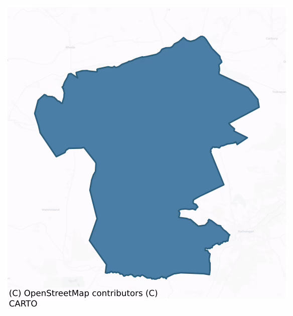
Coolestown is a barony of County Offaly, in the historical province of Leinster (Irish: Baile an Chúlaígh), covering 194 km² of land. The barony records 194 NMS archaeological sites and 102 NIAH listed buildings, placing it at around the 12th percentile among 280 ROI baronies for sites per km². This means it is in the bottom fifth of all baronies for sites per km². Dated archaeological evidence runs from the Early Bronze Age through to the Modern, spanning 6 of 9 archaeological periods, placing the barony in the 12th percentile among 280 ROI baronies for chronological depth. This means it is in the bottom fifth of all baronies for chronological depth. The largest dated subset of recorded sites dates to the Iron Age. Logainm flags 19 placenames in the barony as carrying a recognised heritage root; the largest share — around 58% — are names associated with early Christian church and monastic foundations.

Heritage at a glance
Percentile rankings throughout this profile compare each barony only against the other 279 Republic of Ireland baronies.
The recorded heritage of Coolestown
The National Monuments Service Sites and Monuments Record (SMR) is the statutory inventory of archaeological sites for the Republic of Ireland, maintained by the Department of Tourism, Culture, Arts, Gaeltacht, Sport and Media. Sites recorded here include earthworks, ringforts, megalithic tombs, ecclesiastical remains, and post-medieval features; not every record is legally protected, but each is registered as a monument of archaeological interest.
The National Monuments Service records 194 archaeological sites in Coolestown, putting it at the 12th percentile among 280 ROI baronies for sites per km². This means it is in the bottom fifth of all baronies for sites per km². A sparse recorded total of this kind in Ireland often reflects survey priority rather than genuine absence of past activity. Of these, 93 (48%) fall within a recorded monument protection zone — a modest share, suggesting many records await formal designation. The record is dominated by industrial sites — mills, kilns, and quarries (67 sites, 35% of the total), with transport features forming a substantial secondary presence (41 sites, 21%). Structure – peatland is the most prevalent type, making up 34% of the barony's recorded sites (66 records) — well above the ROI average of 15% across all baronies where this type occurs. Structure – peatland is a construction of unknown function, either extant or implied by archaeological evidence, of any date. Other significant types include Road – class 3 togher (41) and Enclosure (21). Road – class 3 togher is a short wooden peatland trackway up to 15m long, deliberately laid to cross a small area of bog; Neolithic to medieval; Enclosure is a banked or ditched feature of uncertain type, used as a catch-all where the original function cannot be determined from surface evidence. Across the barony's 194 km², this gives a recorded density of 1.00 sites per km².
Most common monument types
Hover or tap a monument type to see its definition.
| Type | Count |
|---|---|
| Structure – peatland a construction of unknown function, either extant or implied by archaeological evidence, of any date | 66 |
| Road – class 3 togher a short wooden peatland trackway up to 15m long, deliberately laid to cross a small area of bog; Neolithic to medieval | 41 |
| Enclosure a banked or ditched feature of uncertain type, used as a catch-all where the original function cannot be determined from surface evidence | 21 |
| Graveyard a burial area associated with a church, in use from the medieval period onwards | 8 |
| Church a building used for public Christian worship, of any date from c. 500 AD onwards | 8 |
| Ringfort – rath an earthen ringfort enclosed by a bank and external ditch — the most common Early Medieval farmstead, broadly dated 500–1000 AD | 5 |
| Castle – unclassified a castle whose form cannot be precisely classified, dating somewhere between the late 12th and 16th centuries | 3 |
Chronological distribution
The dated archaeological record for Coolestown spans from the Early Bronze Age through to the Modern, with activity attested across 6 of 9 archaeological periods. This is the 12th percentile across ROI baronies — a relatively narrow chronological band, with much of Irish prehistory not represented in the dated record. The record is near-continuous, with only the Post Medieval period falling inside the span without any recorded sites. Activity concentrates most heavily in the Iron Age (28 sites, 47% of dated material), with the Medieval forming a secondary peak (14 sites, 24%). A further 135 recorded sites (70% of the overall NMS register for the barony) carry no period attribution — appearing as 'Unknown' in the bar chart below. This typically reflects either records that pre-date the standardised period vocabulary or sites awaiting specialist dating review, rather than a genuine absence of chronological evidence.
Sample of recorded monuments
Show 25 sample monuments (of 194 total)
A representative sample of 25 recorded monuments drawn from the barony’s 194 total NMS entries. Sites within a recorded monument protection zone and rarer site types are prioritised so the list shows a meaningful cross-section rather than only the most common type. Each entry shows the official Sites and Monuments Record reference number and the description published by the National Monuments Service.
Religious house – Franciscan friars
Featureless late medieval parish church (ext. dims. c. 9m E-W, c. 26m N-S) built with limestone rubble. Small double bell cote on W gable, E window destroyed and built up. Possibly part of the Franciscan friary that was…
Featureless late medieval parish church (ext. dims. c. 9m E-W, c. 26m N-S) built with limestone rubble. Small double bell cote on W gable, E window destroyed and built up. Possibly part of the Franciscan friary that was later converted into a parish church. Franciscan Friary founded 1325 (Gwynn and Hadcock 1988, 255). The remains of the Franciscan friary of Monasteroris, also known as Castro Petre de Mortoto and Totmoy (Tuath muighe). The record of its founding describes how the minister provincial and Friars Minor in Ireland accepted de Bermingham's invitation to build a chapel and dwellings in his town of 'Totemoy' in the diocese of Kildare (CPR, vol. 2, 1305-42, 245; Fitzpatrick and O'Brien 1988, 107-8). The 1550 survey of Offaly recorded that there were two castles at Monasteroris, 'one newlie builded and thother all runyose', in addition to the ruined walls of the friary 'burnyd and rasid' and a mill and orchard (Curtis 1929, 326, Fitzpatrick and O'Brien 1998, 108-9).
Located on flat ground with good extensive views. In NE corner of graveyard (OF011-009002-), ruins of long rectangular church (int. dims 22m E-W; 7.4m N-S; wall T 1m) built with roughly coursed limestone rubble. The church interior has been altered by the insertion of three crypts of 19th-century date and 19th-century railing has been inserted into the E gable destroying the original window the N splay of which is still visible. A crypt has also been added externally to the N side of the W gable. The…
Castle – motte
Low mound (max. H 5-6m, diam. base c. 35m E-W) with remains of stone building (max. dims. 8.40m N-S, 8m E-W) on top marked as pigeon house (OF011-01003-). Bank with mainly stone in it surrounds base of mound and appears…
Low mound (max. H 5-6m, diam. base c. 35m E-W) with remains of stone building (max. dims. 8.40m N-S, 8m E-W) on top marked as pigeon house (OF011-01003-). Bank with mainly stone in it surrounds base of mound and appears mostly as a berm. The building on top could be a late medieval pigeon house. Extensive earthworks to E of site.
Located on flat land with good views in all directions. Flat topped mound (H 4m; base diam 24.5m; top diam 4m) with enclosing berm visible at base of mound on S side only. On top of the mound there are the poorly preserved remains of a building marked on the OS 6-inch map as 'Pigeon House' probably associated with the nearby monastery (OF011-009001-).
The above description is derived from the published 'Archaeological Inventory of County Offaly' (Dublin: Stationery Office, 1997). In certain instances the entries have been revised and updated in the light of recent research.
Date of upload: 23 May 2011
Dovecote
Low mound (OF011-010001-) with remains of stone building (max. dims. 8.4m N-S, 8m E-W) on top marked as pigeon house. Bank with mainly stone in it surrounds base of mound and appears mostly as a berm. The building on…
Low mound (OF011-010001-) with remains of stone building (max. dims. 8.4m N-S, 8m E-W) on top marked as pigeon house. Bank with mainly stone in it surrounds base of mound and appears mostly as a berm. The building on top could be a late medieval pigeon house. Extensive earthworks to E of site.
Located on flat land with good views in all directions. Flat topped mound (H 4m; base diam 24.5m; top diam 4m) with enclosing berm visible at base of mound on S side only. On top of the mound there are the poorly preserved remains of a building marked on the OS 6-inch map as 'Pigeon House' probably associated with the nearby monastery (OF011-009001-).
The above description is derived from the published 'Archaeological Inventory of County Offaly' (Dublin: Stationery Office, 1997). In certain instances the entries have been revised and updated in the light of recent research.
Date of upload: 23 May 2011
Designed landscape – tea house
Large bi-vallate enclosure (OF011-035001-) consisting of a central flat area raised well above the surrounding ground surface and delimited by two large fosses and an intervening bank. Some evidence for an outer bank.…
Large bi-vallate enclosure (OF011-035001-) consisting of a central flat area raised well above the surrounding ground surface and delimited by two large fosses and an intervening bank. Some evidence for an outer bank. Entrance gap with ramp at E. Small earthen mound (H. c. 3.5m; Dims at top 1m x 8m) outside line of inner fosse would appear to have been built by the Marquis of Downshire c. 1825 (O'Flanagan 1927 34). The bank is very wide and flat-topped and was probably landscaped at the same time.
Described in the OS Letters of 1838 as 'In Ballykillan [see Archaeological Inventory of County Offaly pp.28 ] Townland in this parish, there is a moat, which was planted about twelve years ago by the Marquis of Downshire, to whom a small moat 12 yards = 36 feet by 8 yards = 24 feet in extent, being of an oblong form and made in the foss on the west side of the large moat, owes its erection. On the summit of this small moat is a cavity made by persons who were digging into its centre for treasure, of which they are said to have dreamed; and in this cavity lie some stones thrown up during the process of digging, which circumstance indicates the moat to be composed of stones and earth. How preposterous to go search for treasure in a monument erected merely for curiosity at so late a period! The large moat is about 40 yards = 120 feet in diameter, and is surrounded with a ditch 4 yards = 12 feet wide at bottom, and with a foss 230 or 240 yards = 690 or 720 feet in circumference. N…
Mine
Unlocated silver mines in the vicinity of the tower house (OF012-003001-) that were described by Comerford as adjoining the castle of Edenderry (Comerford 1883, 138).
Compiled by: Caimin O'Brien.
Date of upload:…
Unlocated silver mines in the vicinity of the tower house (OF012-003001-) that were described by Comerford as adjoining the castle of Edenderry (Comerford 1883, 138).
Compiled by: Caimin O'Brien.
Date of upload: 23 May 2011
Castle – motte and bailey
Flat topped mound (8m E-W, 8.50m N-S, H c. 5m, max basal diam. c. 27m)in prominent position, remains of ditch at S, SW and E situated 3m out from base of mound, may be of fairly recent origin. Burial ground and possible…
Flat topped mound (8m E-W, 8.50m N-S, H c. 5m, max basal diam. c. 27m)in prominent position, remains of ditch at S, SW and E situated 3m out from base of mound, may be of fairly recent origin. Burial ground and possible church site (OF012-005001-) lies just to the W.
Located on top of Drumcooly Hill with good extensive views and nearby burial ground and church site (OF012-005001-) to the E with ballykilleen multi-ramparted ringfort (OF011-035—-) visible to the S. The site consists of a circular flat topped mound (H 3.9m; diam top 8m; base diam 27m) enclosed by a partially filled in fosse (Wth 1.5m; D 0.5m) visible from E to S only with attached D-shaped Bailey (100m E-W; 50m N-S) enclosed by an earthen bank (Wth 3.5m; ext. H 1.5m; int. H 1m). A modern feature to the site was the construction of a water tower within the bailey to the W of the motte. It may have been during its construction that the fosse was filled in. Another alteration to the site seems to have been the building of a road to the S of the motte which clips the S bank of the bailey. Prior to the construction of this road the bailey may have extended further S to encompass the top of Drumcooly hill. The bailey is depicted as being circular on the first edition of the OS 6-inch map before later road alterations. The faint outline of the levelled bailey can still be seen in the field to the S of the public road.
The above description is derived from the published 'Archaeological Inventory of County Off…
Standing stone
Limestone standing stone (max. H c. 1.2m, W at base 0.5m N-S, c. 1m E-W) in low lying area. Slopes upwards from E to W.
Situated on wet marshy land with good views in all directions. Triangular shaped stone (H 1.2m;…
Limestone standing stone (max. H c. 1.2m, W at base 0.5m N-S, c. 1m E-W) in low lying area. Slopes upwards from E to W.
Situated on wet marshy land with good views in all directions. Triangular shaped stone (H 1.2m; 1.14m x 0.5m) with tapering top from E to W with inscription on its face which reads D.H 1876.
The above description is derived from the published 'Archaeological Inventory of County Offaly' (Dublin: Stationery Office, 1997). In certain instances the entries have been revised and updated in the light of recent research.
Date of upload: 23 May 2011
Font (present location)
Now situated on a pillar at the back of the R C church in Edenderry but said to have come from Monasteroris church (OF011-009007-). Medieval octagonal shaped font (max. ext. Wth 0.4m; max. H 0.35m; diam. of bowl 0.33m;…
Now situated on a pillar at the back of the R C church in Edenderry but said to have come from Monasteroris church (OF011-009007-). Medieval octagonal shaped font (max. ext. Wth 0.4m; max. H 0.35m; diam. of bowl 0.33m; D 0.25m) with evidence of diagonal tooling on its outer faces which indicates early medieval date. Inscription on one face of the font reads 'MF O S F 1290', which is probably a later addition.
The above description is derived from the published 'Archaeological Inventory of County Offaly' (Dublin: Stationery Office, 1997). In certain instances the entries have been revised and updated in the light of recent research.
Date of upload: 23 May 2011
Ecclesiastical site
Previously classified as a Monastic complex, this term is now obsolete and no longer used by the Archaeological Survey of Ireland. Re-classified as Ecclesiastical site.
The above description is derived from the…
Previously classified as a Monastic complex, this term is now obsolete and no longer used by the Archaeological Survey of Ireland. Re-classified as Ecclesiastical site.
The above description is derived from the published 'Archaeological Inventory of County Offaly' (Dublin: Stationery Office, 1997). In certain instances the entries have been revised and updated in the light of recent research.
Date of upload: 23 May 2011
Ritual site – holy tree/bush
Located on flat pasture land to the SE of Clonsast Church (OF027-008002-). This White thorn bush is marked on the OS 6-inch map beside St. Broghan's stone (OF027-009002-) which has been removed. There are no pieces of…
Located on flat pasture land to the SE of Clonsast Church (OF027-008002-). This White thorn bush is marked on the OS 6-inch map beside St. Broghan's stone (OF027-009002-) which has been removed. There are no pieces of cloth attached to the bush, which indicates that there has been no pattern day to this site for quite a while.
The above description is derived from the published 'Archaeological Inventory of County Offaly' (Dublin: Stationery Office, 1997). In certain instances the entries have been revised and updated in the light of recent research.
Date of upload: 23 May 2011
Bullaun stone
Large limestone boulder now broken across the area of the basin (D 0.15m,diam. 0.25m) and situated in corner of field SW of church (OF027-008002-). Cairn (OF027-008003-) marked beside it does not now exist and maybe the…
Large limestone boulder now broken across the area of the basin (D 0.15m,diam. 0.25m) and situated in corner of field SW of church (OF027-008002-). Cairn (OF027-008003-) marked beside it does not now exist and maybe the same as one that is marked on the first edition of the OS 6-inch map to the W.
Originally located to the SE of Clonsast Church (OF027-008002-) as marked on OS 6-inch map but now located to SW of the church where a destroyed cairn (OF027-009003-) was located. Large limestone boulder now broken across the area of the basin (D 0.15m; diam 0.25m) which according to Comerford (1883, 124-5) was formed by the impression of the saints head and which was resorted to for the purpose of the cure of a head-ache.
The above description is derived from the published 'Archaeological Inventory of County Offaly' (Dublin: Stationery Office, 1997). In certain instances the entries have been revised and updated in the light of recent research.
Date of upload: 23 May 2011
Sheela-na-gig (present location)
The original location of this sheela-na-gig is unknown. The sheela-na-gig was discovered underneath Kilcumber bridge in the Figile River about 20 years ago (King 1993, 13; Freitag 2004, 129). The spandrel of a twin…
The original location of this sheela-na-gig is unknown. The sheela-na-gig was discovered underneath Kilcumber bridge in the Figile River about 20 years ago (King 1993, 13; Freitag 2004, 129). The spandrel of a twin light ogee headed window was also found in the river. The sheela-na-gig is carved in relief on a limestone quoin (dims. 0.28m x 0.44m x 0.19m) at an angle so as to fit the stone. The figure was that of a grotesque female with grooved face, large head and hands pulling her vulva apart. It is possible that this figure along with the window came from a destroyed church the rubble of which was thrown into the river. A possible site for this church comes from the folklore of the area which identifies the field on the left hand side of the road as you come from Clonbullogue village, as the 'Church field'. The locals also remember a cross inscribed stone which is now destroyed which used to be located in this field. Now housed in the Public Library in Edenderry (on loan from National Museum of Ireland). Cross referenced with OF020-006—-.
Compiled and revised by: Caimin O'Brien
Date of upload/revision: 19 January 2015
Settlement deserted – medieval
Extensive earthworks survive which possibly are the remains of a deserted medieval village associated with the Franciscan Friary (OF011-009—-) and de Bermingham Anglo-Norman (OF011-011—-). May be the remains of the…
Extensive earthworks survive which possibly are the remains of a deserted medieval village associated with the Franciscan Friary (OF011-009—-) and de Bermingham Anglo-Norman (OF011-011—-). May be the remains of the town of Tethmoy or Totmoy that is mentioned in the 1550 Survey and other documentary sources for the area.
The remains of the Franciscan friary of Monasteroris, also known as Castro Petre de Mortoto and Totmoy (Tuath muighe). The record of its founding describes how the minister provincial and Friars Minor in Ireland accepted de Bermingham's invitation to build a chapel and dwellings in his town of 'Totemoy' in the diocese of Kildare (CPR, vol. 2, 1305-42, 245; Fitzpatrick and O'Brien 1988, 107-8). The earthworks in these fields to the West of the church and graveyard (OF011-009001/002-) may be the remains of this medieval town.
Compiled by: Caimin O'Brien.
Date of upload: 23 May 2011
Mill – unclassified
Medieval mill that is depicted on the Down Survey (1655-6) parish map of Monasteroris and Ballynakill (Fitzpatrick and O'Brien 1998, 108) may have been located in the vicinity of Mill Mount House. A disused mill-race…
Medieval mill that is depicted on the Down Survey (1655-6) parish map of Monasteroris and Ballynakill (Fitzpatrick and O'Brien 1998, 108) may have been located in the vicinity of Mill Mount House. A disused mill-race runs past Mill Mount House and acts as a defensive moat in front of the gatehouse into Monasteroris castle (OF011-011—-). The 1550 survey of Offaly recorded that there were two castles at Monasteroris, 'one newlie builded and thother all runyose', in addition to the ruined walls of the friary 'burnyd and rasid' and a mill and orchard (Curtis 1929, 326, Fitzpatrick and O'Brien 1998, 108-9). In 1574 a second land grant to Nicholas Harberte included the old town of Monasteroris with its dissolved friary, two castles and 20 cottages which was then renamed Harbartiston ( Fiants, vol. 2, no. 485; Fitzpatrick and O'Brien 1988, 109).
Compiled by: Caimin O'Brien.
Date of upload: 23 May 2011
Font
Now situated on a pillar at the back of R.C. church in Edenderry but said to have come from Monasteroris (OF011-009007-), medieval octagonal shaped font (max W. 0.4m,H. 0.35m) with circular basin (D. 0.25m, diam 0.33m).…
Now situated on a pillar at the back of R.C. church in Edenderry but said to have come from Monasteroris (OF011-009007-), medieval octagonal shaped font (max W. 0.4m,H. 0.35m) with circular basin (D. 0.25m, diam 0.33m). Diagonal tooling on its outer faces indicating a 12th or 13th century date. Inscription on one face of the font reads 'MF O S F 1290', which is probably a later addition.
Earthwork
Outline of circular-shaped earthwork (approx. diam. 53m) visible on Digital Globe aerial imagery taken 2011-13. Cropmark of earthwork visible on Google Earth orthophoto taken 29/09/2015.
See attached image taken from…
Outline of circular-shaped earthwork (approx. diam. 53m) visible on Digital Globe aerial imagery taken 2011-13. Cropmark of earthwork visible on Google Earth orthophoto taken 29/09/2015.
See attached image taken from Google Earth aerial photographs taken 29/09/2015
Compiled by: Caimin O'Brien based on details provided by Redmond Tobin
Date of upload: 3 June 2020
Burnt mound
Burnt mound (dims. 1.95m E-W x 1.87m N-S) material was discovered in Trench 1 (L. 56m x Wth 1.8m x D 0.25-0.3m) during archaeological test trenching that was undertaken under licence no. 22E0543 by Caoimhe Ní Thóibín on…
Burnt mound (dims. 1.95m E-W x 1.87m N-S) material was discovered in Trench 1 (L. 56m x Wth 1.8m x D 0.25-0.3m) during archaeological test trenching that was undertaken under licence no. 22E0543 by Caoimhe Ní Thóibín on the 21st of August 2022 on foot of a planning condition in advance of construction of a dwelling house, at Ballynakill, Edenderry, Co. Offaly. The results of the test trenching were summarised as follows; 'Pre-construction archaeological test trenching was carried out across the footprint of the development including the percolation area and driveway. The archaeological test trench layout included four linear trenches. These were excavated by a mechanical digger with a 1.8m grading bucket and hand cleaned. Identified during the works was a burnt mound spread measuring 4.24m north-south by 1.05 to 1.95m east-west. This was discovered in the southern end of trench one excavated along the alignment of the proposed driveway. The burnt mound was extensively cleaned back and the limits present within the trench identified. A small hand-dug test trench was put through a mid-section of the visible mound material. It measured 0.91m northeast/southwest by 0.14m northwest/southeast and was 0.03m in depth. The material was very shallow which may indicate that this is the edge of a larger mound or represent a shallow spread. The burnt mound was recorded and covered with geotextile before backfilling the trench. It is recommended that the proposed driveway be raised u…
Ritual site – holy well
Small flat-headed recess at side of road marks position of well – now filled-in. Does not appear to be of archaeological significance. Not visible at ground level. No local tradition of holy well in area marked on OS…
Small flat-headed recess at side of road marks position of well – now filled-in. Does not appear to be of archaeological significance. Not visible at ground level. No local tradition of holy well in area marked on OS 6-inch map.
The above description is derived from the published 'Archaeological Inventory of County Offaly' (Dublin: Stationery Office, 1997). In certain instances the entries have been revised and updated in the light of recent research.
Date of upload: 23 May 2011
Castle – tower house
Probably a tower house but nothing remains except a few pieces of medieval stonework in secondary position in remains of old house. Shown on Down Survey (1655-6). (O'Flanagan 1933, 34). Located on good pasture land with…
Probably a tower house but nothing remains except a few pieces of medieval stonework in secondary position in remains of old house. Shown on Down Survey (1655-6). (O'Flanagan 1933, 34). Located on good pasture land with extensive views all round. Not visible at ground level. Large shed has been built on site of castle.
The above description is derived from the published 'Archaeological Inventory of County Offaly' (Dublin: Stationery Office, 1997). In certain instances the entries have been revised and updated in the light of recent research.
Date of upload: 23 May 2011
Field system
Located on a slight rise of ground with good views in all directions. Ballinrath Castle (OF011-032—-) located 590m to WSW and Ballykilleen ringfort (OF011-035001-) 950m to E. Only the W wall and NW angle now remain…
Located on a slight rise of ground with good views in all directions. Ballinrath Castle (OF011-032—-) located 590m to WSW and Ballykilleen ringfort (OF011-035001-) 950m to E. Only the W wall and NW angle now remain upstanding of this medieval church (OF011-034001-) standing in the centre of a roughly square-shaped graveyard (OF011-034002-). Earthworks (OF011-034003-) outside the graveyard (OF011-034002-) wall were described in 1977 as 'some low banks & scarps indicate the remains of enclosures outside the graveyard' (SMR file 1977). These earthworks or enclosures may represent the remains of an old field system.
The above description is derived from the published 'Archaeological Inventory of County Offaly' (Dublin: Stationery Office, 1997). In certain instances the entries have been revised and updated in the light of recent research.
Compiled by Caimin O'Brien
Date of upload/revision: 24 July 2014
Castle – tower house
Located on top of Blundell Hill with extensive views of surrounding land. Only the E and S walls of this three storeys high rectangular Tower house (14m N-S; 11m E-W; wall T 1.5m) survives. The walls of the Tower house…
Located on top of Blundell Hill with extensive views of surrounding land. Only the E and S walls of this three storeys high rectangular Tower house (14m N-S; 11m E-W; wall T 1.5m) survives. The walls of the Tower house have been built with randomly coursed limestone rubble. A later building has been added to the SW angle. Slight base batter evident on the S and E walls. At N end of the E wall a later fireplace has been inserted at ground floor level, the building of this fireplace has reduced the thickness of the N returning wall. Three rectangular slit windows set in segmental arched embrasures on S wall at ground floor level. Later blocked fireplace on S wall at first floor level with earlier double garderobe chute directly behind fireplace exiting outer face of S wall at first floor level. Large square shaped window at E end of S wall at first floor level. No evidence of stairwell or vaulting, floors must have been wooden carried in the thickness of the wall. Probable late medieval Tower house with later alterations such as the insertions of fireplaces. (Comerford 1883, 138; O' Flanagan 1933, vol. 1, 30-1)
The above description is derived from the published 'Archaeological Inventory of County Offaly' (Dublin: Stationery Office, 1997). In certain instances the entries have been revised and updated in the light of recent research.
Date of upload: 23 May 2011
Ritual site – holy well
Located on flat pasture land with bog to the N and St. Broghan's church (OF027-008—-) nearby. Over the well there is a modern stone built cover with a statue of St. Broghan standing inside this house like structure.…
Located on flat pasture land with bog to the N and St. Broghan's church (OF027-008—-) nearby. Over the well there is a modern stone built cover with a statue of St. Broghan standing inside this house like structure. There are several hawthorn bushes beside the well all of which is enclosed by an irregular shape concrete wall. Associated with St. Broghan whose feast day is the 4th of December (Comerford 1883, 124-6).
In 1934 the National Schools Survey of Holy Wells recorded that this pattern ‘is one of the most ancient in Ireland having been in existence over nine hundred years. It was suppressed about eighty years ago. A very beautiful and very ancient litany of the B.V.M. composed by Saint Brochan is recited at the well. The pattern was resuscitated by the Revd. J. Breen C.C. Clonbulloge in 1926’ (NFC 468, 141). In 1934 it was recorded in a local newspaper that ‘over 1,500 people attended the annual Pattern of St. Brochan, Clonsast, Offaly on Sunday’ (ibid.). According to this report the pattern ‘attracts large numbers annually from all the surrounding counties. The Rosary having been recited at the holy well, and the ancient Litany of the Blessed Virgin, composed by St. Brochan, an aeridheacht, followed by football and camogie matches and a boxing exhibition by the Portarlington Boxing Club was held. The Wolf Tone pipe and drum band, Carbury, was present’ (ibid.). The well was described in 1934 as ‘there is a protecting concrete wall around the well and the w…
Cairn – unclassified
Marked on the most recent ed. OS 6-inch map close to St Broghan's stone but on the first ed. in a field fence to the W. It is not now to be seen at either location. According to Comerford (1883, 124-5) it was situated…
Marked on the most recent ed. OS 6-inch map close to St Broghan's stone but on the first ed. in a field fence to the W. It is not now to be seen at either location. According to Comerford (1883, 124-5) it was situated beside St Broghans stone (OF027-009002-) and was possibly of recent origin.
The above description is derived from the published 'Archaeological Inventory of County Offaly' (Dublin: Stationery Office, 1997). In certain instances the entries have been revised and updated in the light of recent research.
Date of upload: 23 May 2011
Cairn – unclassified
Not visible at ground level. Marked on 1908 edition of OS 25-inch map as 'Carn' located 110m to the SSE of nearby church (OF027-00008002-), however on the 1838 ed. OS 6-inch map the carn is depicted at a different…
Not visible at ground level. Marked on 1908 edition of OS 25-inch map as 'Carn' located 110m to the SSE of nearby church (OF027-00008002-), however on the 1838 ed. OS 6-inch map the carn is depicted at a different location. On this map the cairn is shown located 100m to the SSW of the church, where it is annotated as a 'Carn' standing in the SW corner of the field where the church and graveyard is located. Comerford (1883, 124-5) was not certain whether the carn marked a grave or was raised by pilgrims visiting the nearby church (OF027-008002-).
The above description is derived from the published 'Archaeological Inventory of County Offaly' (Dublin: Stationery Office, 1997). In certain instances the entries have been revised and updated in the light of recent research.
Date of upload: 23 May 2011
Structure – peatland
This site was located in the industrial peatlands of Cloncreen Bog. It was recorded in the 2013 Peatland Reassessment Survey as a structure, located in the NE extent of the bog, and described to be composed of possibly…
This site was located in the industrial peatlands of Cloncreen Bog. It was recorded in the 2013 Peatland Reassessment Survey as a structure, located in the NE extent of the bog, and described to be composed of possibly displaced E-W orientated timber, roundwood, and brushwood, as well as a single N-S orientated brushwood. It was found in moderately humified Sphagnum peat (Whitaker 2014).
The original find spot was relocated by GPS in 2014 (excavation licence: 14E0255), but no in situ remains were visible.
A fragment of ash was chosen for AMS dating and returned a result of cal. 1929-1750 BC (UB 26602).
Compiled by: Jane Whitaker/Femke Vleeshouwer
Date of upload: 25/02/2020
Listed buildings
The National Inventory of Architectural Heritage (NIAH) is a state survey appraising buildings of architectural, historical, archaeological, artistic, cultural, scientific, social, or technical interest. Each surveyed structure receives a rating from International (the highest, for buildings of European importance) through National, Regional, Local, and Record-Only.
The NIAH records 102 listed buildings in Coolestown (50th percentile across ROI baronies). All recorded buildings carry Regional or lower grading; the barony does not contain any structures appraised as being of National or International architectural importance. Construction dates concentrate most heavily in the Victorian (1830-1900) period. The most-recorded building type is house (25 examples, 25% of the listed stock).
Terrain and environment
Mean elevation across the barony is 71m — the 33rd percentile among 280 ROI baronies for elevation. This means it is in the lower half of all baronies for elevation. Elevation matters for heritage because higher-altitude baronies typically favour defensive monuments — ringforts and hilltop forts placed on prominent ground — while lowland baronies are more likely to carry the dense settlement and church networks of intensive agricultural landscapes. Mean slope is 1.8° — the 1st percentile among 280 ROI baronies for slope. This means it is in the bottom tenth of all baronies for slope. This is broadly flat terrain, the kind of landscape best suited to intensive agriculture. Slope is a key control on both land use and archaeological preservation: steep ground resists ploughing and tends to preserve earthworks intact, while gentle slopes favour intensive cultivation that damages or destroys surface archaeology over time. The Topographic Wetness Index averages 12.1, the 99th percentile among 280 ROI baronies for wetness. This means it is in the top tenth of all baronies for wetness. This is wet, slow-draining ground by ROI standards — the kind of landscape that may carry waterlogged archaeological sites of unusual preservation value. Drainage matters for heritage because poorly-drained ground preserves organic archaeology (wooden trackways, leather, textiles, and on rare occasions human remains) far better than free-draining soil; well-drained ground favours arable use but destroys organic material rapidly. The land-cover mosaic combines improved grassland (73%), woodland (19%), and arable farmland (6%), giving a mixed agricultural and semi-natural landscape.
Terrain measurements
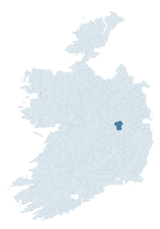
Where this barony sits in the Republic of Ireland
Geology and preservation
Bedrock geology shapes the landscape long before any settlement begins — controlling soil drainage, agricultural potential, the survival of upstanding monuments, and the preservation of buried archaeology. The figures below come from the Geological Survey Ireland 1:100,000 bedrock map.
The bedrock underlying Coolestown is predominantly limestone (57% of the barony by area), laid down during the Carboniferous period (100% by area, around 359 to 299 million years ago). Limestone is the most heritage-rich bedrock in Ireland. It supports fertile, well-drained soils that favoured dense Early Medieval settlement and Norman manorial agriculture, and it weathers into karst features — sinkholes, caves, swallow holes, and souterrains — that frequently carry archaeology. Where peat overlies limestone, organic preservation can be exceptional. A substantial secondary geology of oolitic limestone (43%) adds further variety to the underlying landscape. The single largest mapped unit is the Lucan Formation (44% of the barony's bedrock). With only 2 distinct rock types mapped, the barony is geologically uniform compared to the rest of the Republic (9th percentile for diversity) — a single coherent bedrock landscape.
Rock type composition
Largest mapped unit: Lucan Formation (44% of the barony)
Placename evidence
Logainm records 19 heritage-diagnostic placenames for Coolestown, drawn from townland and civil-parish names across the barony. The dominant stratum is Early Christian ecclesiastical — cill-, teampall-, and domhnach-prefixed names that record the dense network of early church foundations established between the fifth and tenth centuries. The leading diagnostic roots are ráth- (7 — earthen ringfort), cill- (7 — church), and mainistir- (2 — monastery). This is below the ROI average of 30.7 heritage placenames per barony, suggesting either lighter survey coverage or a townland-naming tradition that draws more on generic landscape vocabulary. The presence of multiple heritage strata side by side indicates layered occupation of the landscape across successive prehistoric and historic periods. Logainm records 87 placenames for Coolestown (predominantly townland names). Of these, 19 (22%) carry one of the diagnostic Gaelic roots tracked above; the remainder draw on more generic landscape vocabulary that does not encode a heritage period.
Pre-Christian / Early Medieval Defensive
| Root | Count | Meaning |
|---|---|---|
| ráth- | 7 | earthen ringfort |
Early Christian Ecclesiastical
| Root | Count | Meaning |
|---|---|---|
| cill- | 7 | church (early) |
| mainistir- | 2 | monastery |
| cillín- | 2 | unconsecrated burial ground |
Burial, Ritual, and Norse-Contact
| Root | Count | Meaning |
|---|---|---|
| sián- | 1 | fairy mound |
Other baronies in Offaly
About this profile
Click any section below to expand.
What is a barony?
A barony is a historic administrative unit in Ireland, broadly equivalent to an English hundred. The 280 baronies used here are from the OSi 2019 National Statutory Boundaries (generalised 20m), covering the 26 counties of the Republic of Ireland. Baronies derive from the Norman period, were formalised in the 17th century, and have not been redrawn for statistical purposes. They vary enormously in area, from compact urban baronies in Dublin to vast upland baronies in Connacht, and should not be compared by raw site count without accounting for area differences.
What counts as a site?
This profile combines three distinct heritage registers, each with its own definition of what constitutes a recordable site:
- Archaeological sites (NMS). The National Monuments Service Sites and Monuments Record (SMR) catalogues every known archaeological monument or site of archaeological interest in the Republic, from prehistoric burial mounds and ringforts to medieval churches and post-medieval defensive works. Inclusion does not require legal protection — only that the site has been identified, surveyed, and assessed as having archaeological value. A separate subset of these sites lies within a recorded protection zone, which gives them statutory protection under the National Monuments Acts.
- Listed buildings (NIAH). The National Inventory of Architectural Heritage records buildings of architectural, historical, archaeological, artistic, cultural, scientific, social, or technical interest. Each surveyed structure is appraised on a five-tier scale: International, National, Regional, Local, and Record-Only. The NIAH appraisal is informational rather than strictly statutory, but it underpins local-authority Record of Protected Structures (RPS) listings.
- Heritage placenames (Logainm). Logainm is the authoritative database of Irish placenames maintained by the Placenames Branch. This profile applies a heritage-diagnostic classifier to the Irish-language form of each townland name, flagging roots that signal defensive sites (ráth-, lios-, dún-, caiseal-, cathair-), ecclesiastical foundations (cill-, teampall-, domhnach-, mainistir-), prehistoric burial-ritual features (tuaim-, carn-, leaba-), or Norse-contact settlement (gall-). Townlands without one of these diagnostic roots are not flagged here — they may still carry historical significance, but that significance is not encoded in the name itself.
Editorial principles
The narrative sections of this profile follow several explicit principles:
- Evidential. Every claim about this barony’s heritage character is anchored in the underlying register data. Where a site count, a placename count, or a percentile rank is cited, it is computed from the source datasets at export time, not estimated.
- Comparative. Counts and metrics are reported alongside their percentile rank against the other 279 ROI baronies. A barony with 50 ringforts in absolute terms could be unusually high or unusually low depending on its size and regional context; percentile ranking removes that ambiguity.
- Transparent on limits. Where a register has known coverage gaps, survey biases, or data-quality issues that affect this barony’s figures, the profile flags them rather than presenting the numbers as definitive.
- No interpretation beyond what the data supports. The narrative does not speculate about historical events, social dynamics, or cultural meaning beyond what the recorded heritage and placename evidence directly attests.
Data caveats and limits
- NMS Sites and Monuments Record is the product of survey campaigns conducted at different intensities across different counties and decades. Some baronies have been surveyed more thoroughly than others, and absolute counts should be read in that light. Sites destroyed by development before survey are typically not represented; sites in heavily forested or upland terrain are sometimes under-recorded.
- NIAH coverage is broadly complete for the Republic of Ireland but the survey was conducted on a rolling county-by-county basis, and the most recent appraisal date varies. Buildings demolished or substantially altered after their original survey may still appear in the register; conversely, recent buildings of merit may not yet have been appraised.
- Logainm classification applies a deliberately conservative pattern-matching approach to the Irish-language townland forms. The classifier prioritises true positives over recall: a townland may carry a heritage signal that the classifier doesn’t recognise, particularly where the diagnostic root has been heavily anglicised or where the townland name draws on a less common term. The 60,000+ townland records and ~9,800 classified placenames give a substantial signal at barony scale, but individual townland names should be checked against Logainm directly for definitive interpretation.
- Period attribution. The chronological distribution reflects only those NMS sites that carry a recognised period attribution in the source data. Sites listed as “Unknown” period are excluded from the dated subset.
- Boundary changes. Some baronies have undergone minor boundary adjustments since their 19th-century definition; the OSi 2019 generalised boundaries used here are the current statutory definition and may differ slightly from historical maps in border areas.
- Bedrock geology is mapped at 1:100,000 scale, which means local variation within a barony — small pockets of different rock type, mineral veins, alluvium overlying bedrock — is generalised. The dominant-system and rocktype figures are area-weighted, so a barony reading “70% Carboniferous limestone” may still contain small but archaeologically important pockets of older or younger rock. Around 3% of GSI polygons do not match the lexicon and contribute no rocktype or system attribution.
Data sources
- National Monuments Service — Sites and Monuments Record (SMR) https://data.gov.ie/dataset/national-monuments-service-archaeological-survey-of-ireland
- National Inventory of Architectural Heritage (NIAH) https://data.gov.ie/dataset/national-inventory-of-architectural-heritage-niah-national-dataset
- Logainm — Placenames Database of Ireland https://www.logainm.ie/
- Ordnance Survey Ireland — National Statutory Barony Boundaries 2019 https://data-osi.opendata.arcgis.com/
- EURODEM — European Digital Elevation Model https://www.mapsforeurope.org/datasets/euro-dem
- ESA WorldCover https://esa-worldcover.org/en
- Geological Survey Ireland — 1:100,000 Bedrock Geology https://www.gsi.ie/en-ie/data-and-maps/Pages/Bedrock.aspx
Explore more: Search any of the 280 ROI baronies, browse by historical province, or read the methodology and data sources for the full Republic of Ireland Heritage Tool.