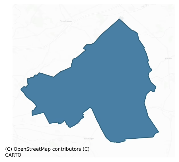
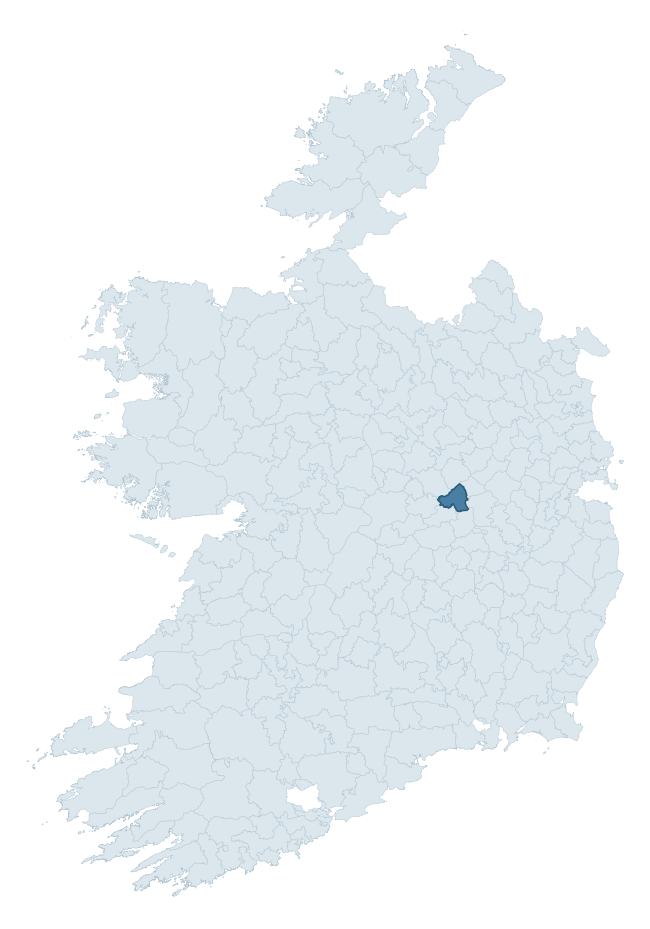
Philipstown Lower is a barony of County Offaly, in the historical province of Leinster (Irish: An Daingean Íochtarach), covering 124 km² of land. The barony records 640 NMS archaeological sites and 52 NIAH listed buildings, placing it at around the 96th percentile among 280 ROI baronies for sites per km². This means it is in the top tenth of all baronies for sites per km². Dated archaeological evidence runs from the Early Bronze Age through to the Modern, spanning 7 of 9 archaeological periods, placing the barony in the 32nd percentile among 280 ROI baronies for chronological depth. This means it is in the bottom third of all baronies for chronological depth. The largest dated subset of recorded sites dates to the Iron Age.

Heritage at a glance
Percentile rankings throughout this profile compare each barony only against the other 279 Republic of Ireland baronies.
The recorded heritage of Philipstown Lower
The National Monuments Service Sites and Monuments Record (SMR) is the statutory inventory of archaeological sites for the Republic of Ireland, maintained by the Department of Tourism, Culture, Arts, Gaeltacht, Sport and Media. Sites recorded here include earthworks, ringforts, megalithic tombs, ecclesiastical remains, and post-medieval features; not every record is legally protected, but each is registered as a monument of archaeological interest.
The National Monuments Service records 640 archaeological sites in Philipstown Lower, putting it at the 96th percentile among 280 ROI baronies for sites per km². This means it is in the top tenth of all baronies for sites per km². Of these, 276 (43%) fall within a recorded monument protection zone — a modest share, suggesting many records await formal designation. The dominant category is industrial sites — mills, kilns, and quarries (437 sites, 68% of the record). Structure – peatland is the most prevalent type, making up 68% of the barony's recorded sites (436 records) — well above the ROI average of 15% across all baronies where this type occurs. Structure – peatland is a construction of unknown function, either extant or implied by archaeological evidence, of any date. Other significant types include Road – class 3 togher (55) and Enclosure (24). Road – class 3 togher is a short wooden peatland trackway up to 15m long, deliberately laid to cross a small area of bog; Neolithic to medieval; Enclosure is a banked or ditched feature of uncertain type, used as a catch-all where the original function cannot be determined from surface evidence. Across the barony's 124 km², this gives a recorded density of 5.16 sites per km².
Most common monument types
Hover or tap a monument type to see its definition.
| Type | Count |
|---|---|
| Structure – peatland a construction of unknown function, either extant or implied by archaeological evidence, of any date | 436 |
| Road – class 3 togher a short wooden peatland trackway up to 15m long, deliberately laid to cross a small area of bog; Neolithic to medieval | 55 |
| Enclosure a banked or ditched feature of uncertain type, used as a catch-all where the original function cannot be determined from surface evidence | 24 |
| Church a building used for public Christian worship, of any date from c. 500 AD onwards | 10 |
| Graveyard a burial area associated with a church, in use from the medieval period onwards | 6 |
| Ritual site – holy well a well or spring traditionally associated with a saint, often credited with healing properties; many trace earlier ritual origins but devotion is documented from the medieval period onwards | 6 |
Chronological distribution
The dated archaeological record for Philipstown Lower spans from the Early Bronze Age through to the Modern, with activity attested across 7 of 9 archaeological periods. Every period from earliest to latest is represented in the record — an unbroken sequence of dated activity across the full chronological span. Activity concentrates most heavily in the Iron Age (34 sites, 34% of dated material), with the Early Medieval forming a secondary peak (19 sites, 19%). A further 540 recorded sites (84% of the overall NMS register for the barony) carry no period attribution — appearing as 'Unknown' in the bar chart below. This typically reflects either records that pre-date the standardised period vocabulary or sites awaiting specialist dating review, rather than a genuine absence of chronological evidence.
Sample of recorded monuments
Show 25 sample monuments (of 640 total)
A representative sample of 25 recorded monuments drawn from the barony’s 640 total NMS entries. Sites within a recorded monument protection zone and rarer site types are prioritised so the list shows a meaningful cross-section rather than only the most common type. Each entry shows the official Sites and Monuments Record reference number and the description published by the National Monuments Service.
Cairn – unclassified
Modern bungalow located on site of destroyed cairn situated on top of high ground with good extensive views with bullaun stone (OF009-027002-) immediately to the N. According to the landowner two skeletons were…
Modern bungalow located on site of destroyed cairn situated on top of high ground with good extensive views with bullaun stone (OF009-027002-) immediately to the N. According to the landowner two skeletons were uncovered while digging the foundation of the house. He was also told by a diviner that there was another burial in the area where his front garden is now. This site may have been a burial mound with multiple burials.
The above description is derived from the published 'Archaeological Inventory of County Offaly' (Dublin: Stationery Office, 1997). In certain instances the entries have been revised and updated in the light of recent research.
Date of upload: 23 May 2011
Bullaun stone
Large bullaun stone located on top of high ground with good extensive views with destroyed cairn (OF009-027001-) immediately to the S. According to the landowner people from all over Ireland come to visit this stone…
Large bullaun stone located on top of high ground with good extensive views with destroyed cairn (OF009-027001-) immediately to the S. According to the landowner people from all over Ireland come to visit this stone because of its curative powers. The stone is embedded in a flower bed, the visible portion of the stone (H 0.5m; top diam. 0.8m) has a hollow depression (Wth 0.3m; D 0.3m) which contains several votive offerings.
The above description is derived from the published 'Archaeological Inventory of County Offaly' (Dublin: Stationery Office, 1997). In certain instances the entries have been revised and updated in the light of recent research.
Date of upload: 23 May 2011
Stone head (present location)
Located on the front wall of a Rathdrum House which has been recently plastered. As a result it was impossible to say if this carved head (OF009-029003-) was part of a Sheela-na-gig, however the farmer informed us that…
Located on the front wall of a Rathdrum House which has been recently plastered. As a result it was impossible to say if this carved head (OF009-029003-) was part of a Sheela-na-gig, however the farmer informed us that there was a carved figure on the exterior of the house.
The site of Rathdrum Castle (OF009-029001-) is situated on top of a circular mound which may been the remains of an Anglo-Norman motte (OF009-029002-). Rathdrum House which is located immediately to the SW of the castle site may have been built with stone taken from the levelled castle (OF009-029001-). A stone head incorporated into the fabric of the house may have originally come from the castle. This stone head (OF009-028—-) was described in 1944 as 'over the door of Rathdrum House adjoining is a very crude oval head with features only just shown. The work seems so bad that I doubt if it is older than XVIIIc [18th century]; but it might have stood in the castle' (ITA Survey 1942, SMR File). This stone head was listed in the SMR as a possible sheela-na-gig that was originally incorporated into the fabric of Rathdrum Castle (SMR file). Today there is not enough of the carving visible to classify this carved head as a sheela-na-gig, although it is possible that this carving may originally have been carved as a sheela-na-gig.
The above description is derived from the published 'Archaeological Inventory of County Offaly' (Dublin: Stationery Office, 1997). In certain instances the entries ha…
Castle – motte
Situated on well drained pasture land with good views of the surrounding countryside. The site of Rathdrum Castle (OF009-029001-) is situated on top of a circular mound which may been the remains of an Anglo-Norman…
Situated on well drained pasture land with good views of the surrounding countryside. The site of Rathdrum Castle (OF009-029001-) is situated on top of a circular mound which may been the remains of an Anglo-Norman motte. Alternatively this circular flat-topped mound may have been a natural hillock which was scarped and flattened on top to provide a flat surface for the construction of Rathdrum Castle. A lime-kiln appears to be indicated immediately to the NE of the mound on the 1838 ed. of the OS 6-inch map. There are no surface remains of Rathdrum Castle and part of the mound may have been formed from the collapsed debris of the castle. This monument is depicted as a circular platform or mound on the 1838 edition of the OS 6-inch map. The revised 1908 ed. OS 6-inch map shows that the mound or motte was damaged on the S side by the construction of a building which had been built into the base of the mound on the S side. the OS 25-inch map of 1908 shows that the castle mound had by that time been damaged or cut into on the W side as well as the s side of the mound. This building is not indicated on the 1838 ed. OS 6-inch map. Described in 1942 as, 'A prominent mound of boulder-clay in undulating countryside with good view; good pasture around. No fosse visible. The mound sides have been scarped vertically to 5-7' [1.5-2.1m] high; on the faces no habitation earth and little humus are visible. The top is oval, 26 [23.5m] x 40 [36m] yds. a little encroached on by…
Settlement deserted – medieval
National Monument No. 617. Situated on the SW downslope of Croghan Hill with a church and graveyard (OF010-010006/007-) immediately W and a fortified house (OF010-010003-) nearby to SW. The remains of this deserted…
National Monument No. 617. Situated on the SW downslope of Croghan Hill with a church and graveyard (OF010-010006/007-) immediately W and a fortified house (OF010-010003-) nearby to SW. The remains of this deserted settlement of probable medieval date comprises a large rectangular enclosure (dims. 36m N-S x 45m E-W) defined by grass-covered wall-footings (Wth 3m) to which a series of additional enclosures are adjoined on its N, E and S sides. Grass-covered banks in the E part of the interior of the main enclosure indicate that it may have been divided internally at some stage. An annexe with entrance on its E side (Wth 3m) attached to the S side of the main enclosure may also be a later addition. Its W half overlain by a later field wall. To S of this there are the remains of a possible rectangular house site (int. dims. 12m N-S x 2.5m E-W). An oval-shaped area (dims. 17m N-S x 27m E-W) enclosed by a bank (Wth 3m) and intersected by a modern road on its N side, lies to N of the main enclosure and a burial mound (OF010-010002-) or motte surrounded by a wide shallow fosse, is situated at E. Approximately 200m E of this again there are the remains of a square enclosure (int. dims. 12.5m N-S x 10.5m E-W). In the 1940s unburnt animal bone and pottery was discovered in an area which had been quarried to S of the village.
Present remains consist of four enclosures and a mound, possibly of earlier date. There are numerous rock quarry holes. The enclosures are widely spaced, thr…
House – fortified house
Remains of tower house incorporated in farmyard buildings situated in low-lying area S of Croghan hill. W end of N wall (c. 6.3m) built of rubble limestone with top of wall with modern battlements. SE angle tower…
Remains of tower house incorporated in farmyard buildings situated in low-lying area S of Croghan hill. W end of N wall (c. 6.3m) built of rubble limestone with top of wall with modern battlements. SE angle tower situated SSE of castle appears to be part of bawn wall (Fitzgerald 1917, 385; ITA Survey 1942).
Situated at the base of Croghan Hill with good extensive views in all directions, except to N which is hindered by Croghan Hill with church (OF010-010006-) and deserted medieval village (OF010-010001-) to the N. All that remains of the castle are the NW and SE corners which stand to battlement height. The remains are incorporated into farmyard buildings making detailed examination difficult. The top of the NW corner has modernised battlements which contain bricks. Just below the battlements there is a chimney which is connected to a fireplace on the second floor. The fireplace measures 2.1m wide and 3.8m high. There is evidence of punch dressed stone in its construction. The S corner tower has evidence of a base batter on the S facing wall, this however may be a later addition. There is a wall attached to the W side of this tower with two openings which look like destroyed windows. This wall was probably part of the original castle. There is evidence of a wall walk inside the battlements of both towers. From these ruins it is possible to estimate that the tower house was three storeys high with a wall walk inside its battlements. The castle probably had external dimens…
Well
Surface spring which rises in flat pasture land. Well is unenclosed and has no features of archaeological interest (OS Letters Vol. I 113).
No surface trace visible of well which was located on the W facing slope of…
Surface spring which rises in flat pasture land. Well is unenclosed and has no features of archaeological interest (OS Letters Vol. I 113).
No surface trace visible of well which was located on the W facing slope of Croghan hill with medieval church (OF010-010) and castle (OF010-010) to the N and NW. (O' Flanagan 1933, vol. 1, 40; Comerford 1883, 320-2)
The above description is derived from the published 'Archaeological Inventory of County Offaly' (Dublin: Stationery Office, 1997). In certain instances the entries have been revised and updated in the light of recent research.
Date of upload: 23 May 2011
Barrow – ring-barrow
Situated at the base of the S facing slope of Croghan Hill with two burial mounds (OF010-010002 / OF010-0040001 ) to the N and NE respectively. Partially destroyed subrectangular shaped mound (H 1.5m; diam. 20m)…
Situated at the base of the S facing slope of Croghan Hill with two burial mounds (OF010-010002 / OF010-0040001 ) to the N and NE respectively. Partially destroyed subrectangular shaped mound (H 1.5m; diam. 20m) enclosed by a shallow fosse with wide external bank (Wth 2m). Fosse destroyed at W with mound poorly preserved at S.
The above description is derived from the published 'Archaeological Inventory of County Offaly' (Dublin: Stationery Office, 1997). In certain instances the entries have been revised and updated in the light of recent research.
Date of upload: 23 May 2011
Souterrain
Not visible at ground level. Local tradition of underground passage from Castle (OF010-010003-) to Church (OF010-010006-) (Davies 1942).
The above description is derived from the published 'Archaeological Inventory…
Not visible at ground level. Local tradition of underground passage from Castle (OF010-010003-) to Church (OF010-010006-) (Davies 1942).
The above description is derived from the published 'Archaeological Inventory of County Offaly' (Dublin: Stationery Office, 1997). In certain instances the entries have been revised and updated in the light of recent research.
Date of upload: 23 May 2011
Children's burial ground
Univallate ringfort (max. int. diam. 43.5m E-W) situated on summit of N-S ridge E face and defined by a fosse and internal bank of earth and stone. Ramped entrance at SE. No evidence of burial but small mound (diam.…
Univallate ringfort (max. int. diam. 43.5m E-W) situated on summit of N-S ridge E face and defined by a fosse and internal bank of earth and stone. Ramped entrance at SE. No evidence of burial but small mound (diam. 4.5m N-S, H c. 0.5m) in NE quadrant may have some connection.
Located on the E facing slope of a N-S ridge in upland area with good views of undulating countryside. Bivallate ringfort (OF010-016002-) with small earthen mound located in the N sector of the sites interior which according to local information is the site of a childrens burial ground.
The above description is derived from the published 'Archaeological Inventory of County Offaly' (Dublin: Stationery Office, 1997). In certain instances the entries have been revised and updated in the light of recent research.
Date of upload: 23 May 2011
Hilltop enclosure
Enclosure (max. int. diam. NW-SE c. 45m) situated on highest point of hill defined by bank at W, scarp at S and E, N side levelled. Originally had a bank with exterior fosse all the way round but now much…
Enclosure (max. int. diam. NW-SE c. 45m) situated on highest point of hill defined by bank at W, scarp at S and E, N side levelled. Originally had a bank with exterior fosse all the way round but now much degraded.
Recently described in the Atlas of Hillforts of Britain and Ireland as following; 'Sub-rectangular contour fort with a total site footprint of approximately 0.4ha positioned at summit of domed hilltop at the E edge of an isolated hill ridge. Univallate for the entire circuit with no obvious entrance features recorded. No evidence for any internal features on the surface. Rampart has been heavily affected by ploughing and is visible as a low scarp at the E, S and W. Originally the enclosing elements had an external ditch (O'Brien and Sweetman, 1997). First map depiction in first edition Ordnance Survey mapping. More detailed earthwork survey in second edition Ordnance Survey mapping. Site survey by O'Brien and Sweetman in 1997.' (http://hillforts.arch.ox.ac.uk/records/IR0987.html)
The above description is derived from the published 'Archaeological Inventory of County Offaly' (Dublin: Stationery Office, 1997). In certain instances the entries have been revised and updated in the light of recent research.
Compiled and revised by: Caimin O'Brien
Date of revised upload: 6 February 2020
Gateway
19th century round-headed gateway flanked by V-shaped stone stile either side of gateway located at the W end of the S boundary of Killaderry graveyard (OF010-035003-) which is enclosed by an earth and stone bank, the…
19th century round-headed gateway flanked by V-shaped stone stile either side of gateway located at the W end of the S boundary of Killaderry graveyard (OF010-035003-) which is enclosed by an earth and stone bank, the grass covered wall footings of a medieval church site (OF010-035002-) are located in N quadrant. The gateway has a round arch with pediment above carried on 13 corbels with carved faces and a letter beneath each face. Above these corbels there is a carved stone plaque depicting symbols of death and resurrection with Latin inscription the Latin text ‘Domus mea est Domus oblivionis’ meaning ‘my house is the house of oblivion’. Beneath the skull and cross-bones there is a Latin inscription which reads 'Saltim vos amici mei reminisce mini mei – Saltim vos amici mei miseremini mei – Mortuis ex vivis anno 1815'. On the reverse side the plaque contains a trumpeting angel with a coffin beneath with Latin inscription roughly translated as 'What you are, I was: I am what you will be'.
To see a 3D model of this gateway visit: https://skfb.ly/ox7yp
The above description is derived from the published 'Archaeological Inventory of County Offaly' (Dublin: Stationery Office, 1997). In certain instances the entries have been revised and updated in the light of recent research.
Date of upload: 23 May 2011
Field system
Series of low banks, ditches and scarped raised areas. Large almost centrally placed rectangular shaped raised area (8m E-W, 16 N-S). Entire central area of modern field filled with drainage-like earthworks possibly of…
Series of low banks, ditches and scarped raised areas. Large almost centrally placed rectangular shaped raised area (8m E-W, 16 N-S). Entire central area of modern field filled with drainage-like earthworks possibly of 17th century date. Aerial photo (GSI 547/546) clearly shows central raised area.
The above description is derived from the published 'Archaeological Inventory of County Offaly' (Dublin: Stationery Office, 1997). In certain instances the entries have been revised and updated in the light of recent research.
Date of upload/revision: 23 December 2011
Designed landscape – tree-ring
Indicated as a tree-ring or landscaped feature associated with Mount Briscoe House and has the appearance of a partially levelled tree-ring (ASI file 1977).
The above description is derived from the published…
Indicated as a tree-ring or landscaped feature associated with Mount Briscoe House and has the appearance of a partially levelled tree-ring (ASI file 1977).
The above description is derived from the published 'Archaeological Inventory of County Offaly' (Dublin: Stationery Office, 1997). In certain instances the entries have been revised and updated in the light of recent research.
Date of upload: 23 May 2011
Kiln – lime
This is the remains of a quarry, with a limekiln and building attached associated with Mount Briscoe House, structure belongs to the post-1700 period.
The above description is derived from the published…
This is the remains of a quarry, with a limekiln and building attached associated with Mount Briscoe House, structure belongs to the post-1700 period.
The above description is derived from the published 'Archaeological Inventory of County Offaly' (Dublin: Stationery Office, 1997). In certain instances the entries have been revised and updated in the light of recent research.
Date of upload: 23 May 2011
Inscribed stone
Finely carved head (OF010-057—-) protruding from the external wall of an outhouse which is constructed from rubble of a medieval building of unknown origin or unknown location. The head has bulging eyes, a stiff…
Finely carved head (OF010-057—-) protruding from the external wall of an outhouse which is constructed from rubble of a medieval building of unknown origin or unknown location. The head has bulging eyes, a stiff mouth, prominent eyebrows with broken chin. The top of the head is flat suggesting possible use as a corbel. To the right of the head on the wall there is a wall plaque with inscription which reads TM 1681. Outhouse is possibly built on the site of a castle owned by George Moore in 1598, the rubble of which was incorporated into the outhouse.
Late medieval limestone head set into farmyard wall. Appears to have chain-mail. Walls also contain late-medieval cut stone and a plaque with date of 1681 and initials J.M. (OF010-057001-).
The above description is derived from the published 'Archaeological Inventory of County Offaly' (Dublin: Stationery Office, 1997). In certain instances the entries have been revised and updated in the light of recent research.
Date of upload: 23 May 2011
Historic town
The earlier fort of Daingean (OF018-006001-) which was an important O'Conor stronghold, with its associated church of 'Cill O Duirthi' [Killaderry] (OF010-035002-), is likely to have had an attendant native Irish…
The earlier fort of Daingean (OF018-006001-) which was an important O'Conor stronghold, with its associated church of 'Cill O Duirthi' [Killaderry] (OF010-035002-), is likely to have had an attendant native Irish settlement. However, the true town of Daingean had its origins in plantation policy commencing with the building of Fort Governor by Sir William Brabazon in 1546, around which a settlement steadily grew despite attacks from the O'More's and O'Conor's. With the shiring of the territory of Ui Failge in 1556, Fort Falkland and its settlement was renamed Philipstown in honour of Philip II of Spain. In 1567 it was incorporated by charter and granted a weekly market. The corporation was requested to fortify the town with fosses and stone wall and although nothing of these walls survive, there are indications of the former fosse on the E, S and W sides of the town. A further grant of c. 1570 refers to 12 messuages and a water mill within it and in 1598 there is mention of a gaol. The street plan is linear, Main St. running on a N-S axis off which the burgage plots extended. Fort Governor stood at the SE end of the street and at the E end of Fort Lane. Two armorial plaques bearing the arms of the Earl of Sussex and Mary Tudor formerly grace the gate entrance to the fort. Additional charters were granted in 1673 and 1688-9, but this walled town unlike its counterpart at Maryborough [Portlaoise] never really flourished and it received a setback, when it was burnt by the O'C…
Quarry
Earthworks to the W of the site of Castle Barnagh (OF018-009001-) are the remains of rock outcrop that has been partially quarried away and may have provided stone for the building of Castle Barnagh.
The above…
Earthworks to the W of the site of Castle Barnagh (OF018-009001-) are the remains of rock outcrop that has been partially quarried away and may have provided stone for the building of Castle Barnagh.
The above description is derived from the published 'Archaeological Inventory of County Offaly' (Dublin: Stationery Office, 1997). In certain instances the entries have been revised and updated in the light of recent research.
Date of upload/revision: 29 December 2011
House – 18th/19th century
Clonarrow House of 18th or 19th century in date.
The above description is derived from the published 'Archaeological Inventory of County Offaly' (Dublin: Stationery Office, 1997). In certain instances the entries…
Clonarrow House of 18th or 19th century in date.
The above description is derived from the published 'Archaeological Inventory of County Offaly' (Dublin: Stationery Office, 1997). In certain instances the entries have been revised and updated in the light of recent research.
Date of upload: 23 May 2011
Town defences
The present town of Daingean had its origins in plantation policy commencing with the building of Fort Governor (OF018-006001-) by Sir William Brabazon in 1546, around which a settlement steadily grew despite attacks…
The present town of Daingean had its origins in plantation policy commencing with the building of Fort Governor (OF018-006001-) by Sir William Brabazon in 1546, around which a settlement steadily grew despite attacks from the O'More's and O'Conor's. With the shiring of the territory of Ui Failge in 1556, Fort Falkland and its settlement was renamed Philipstown in honour of Philip II of Spain. In 1567 it was incorporated by charter and granted a weekly market. The corporation was requested to fortify the town with fosses and stone wall and although nothing of these walls survive, there are indications of the former fosse on the E, S and W sides of the town. A further grant of c. 1570 refers to 12 messuages and a water mill (OF018-006006-) within it and in 1598 there is mention of a gaol (OF018-006008-). The street plan is linear, Main St. running on a N-S axis off which the burgage plots extended. Additional charters were granted in 1673 and 1688-9, but this walled town unlike its counterpart at Maryborough [Portlaoise] never really flourished and it received a setback, when it was burnt by the O'Conors during the Jacobite wars. (Comerford 1885, 303; Bradley 1986, 35-8; Loeber 1991, 16-18)
Compiled by: Caimin O'Brien.
Date of upload: 23 May 2011
Road – road/trackway
Low linear earthwork in field adjoining the sixteenth century fortification located to the E may be the remains of a medieval roadway which gave access to Fort Governor.
Compiled by: Caimin O'Brien.
Date of…
Low linear earthwork in field adjoining the sixteenth century fortification located to the E may be the remains of a medieval roadway which gave access to Fort Governor.
Compiled by: Caimin O'Brien.
Date of upload: 23 May 2011
Burnt mound
Situated on flat poorly drained land with stream 20m to N and ring-barrow (OF010-010008-) 70m to SE. Small roughly circular mound (H 0.7m; base diam. 9m NE-SW; top diam. 3.5m NE-SW) of burnt material with possible small…
Situated on flat poorly drained land with stream 20m to N and ring-barrow (OF010-010008-) 70m to SE. Small roughly circular mound (H 0.7m; base diam. 9m NE-SW; top diam. 3.5m NE-SW) of burnt material with possible small semi-circular berm (H 0.5m; Wth 2.2m) encircling base of mound from NE through E to SW only.
Compiled by: Caimin O'Brien.
Date of upload: 23 May 2011
Burnt spread
Archaeological monitoring of drainage works carried out by Gort Archaeology prior to the planned afforestation of this area revealed the presence of a burnt spread which was identified in the excavated shallow drain at…
Archaeological monitoring of drainage works carried out by Gort Archaeology prior to the planned afforestation of this area revealed the presence of a burnt spread which was identified in the excavated shallow drain at the central northern portion of Field 3. The area was marked off with a 20m buffer and no planting took place within the buffer zone. No artefacts were discovered in the excavated material that was mounded on the field surface. The excavation of the shallow drain did minimal disturbance to the archaeological feature. No other archaeological features or soils were encountered in the remaining areas of the site.
There is a marked curving area in the northern portion of the field surface, with an accompanying lower area adjacent to the south east. This is a shallow (c.0.20m) natural landscape feature and does not occur in the adjacent area. Close to the shallow break of slope of the natural marked curved area (referred to as 3 above), the mounding revealed a burnt spread of stones directly overlain by shallow topsoil (c.0.10m). The burnt spread consisted predominantly of sandstone and measured a maximum of 8m (NE/SW). The burnt spread did not appear in the parallel drains to the east and west of the site. The spread is c.0.10m in depth. No features were identified in the exposed spread indicative of a trough. No artefacts were encountered in the surface inspection of the drain and the mounded material (O'Sullivan 2018, 5).
See attached photos of burnt sp…
Ring-ditch
Cropmark of circular-shaped ring-ditch visible on Apple Maps aerial imagery. Cropmark of large oval-shaped enclosure (OF010-503—-) of uncertain antiquity to S.
See attached image taken from Apple Maps aerial…
Cropmark of circular-shaped ring-ditch visible on Apple Maps aerial imagery. Cropmark of large oval-shaped enclosure (OF010-503—-) of uncertain antiquity to S.
See attached image taken from Apple Maps aerial coverage
Compiled by: Caimin O'Brien based on details provided by Jean-Charles Caillère
Date of upload: 14 April 2020
Structure – peatland
This site is located in the industrial peatlands of Daingean South Bog. It was recorded in the 2013 Reassessment Peatland Survey as a single plank exposed on the field surface near the drain edge (Whitaker 2014). From…
This site is located in the industrial peatlands of Daingean South Bog. It was recorded in the 2013 Reassessment Peatland Survey as a single plank exposed on the field surface near the drain edge (Whitaker 2014). From examination of the IAWU Survey (IAWU 2002) and the ADS excavation report (Whitaker and Turrell 2005) it seems likely that this site was part of an earlier recorded IAWU sighting (OF-RDM047) which was subsequently excavated by ADS under licence number 05E0557. The site was dated cal. AD 259-538 (UBA 26592).
A single cutting, measuring 4 x 2m, was opened for excavation in 2014 (licence 14E0301). The remains of the N-S orientated oak plank were fully exposed; the upper surface was machine-damaged. The wood measured 1.08 x 0.3m and had a depth of 0.07m. Three associated roundwood pegs were found alongside the plank, and were worked into chisel points with flat toolmarks. One of the pegs was a boxed squared split ash timber. No peat cover remained, but the site was underlain by poorly humified Sphagnum peat (Whitaker 2017).
Compiled by: Jane Whitaker/Femke Vleeshouwer
Date of upload: 25 February 2020
Listed buildings
The National Inventory of Architectural Heritage (NIAH) is a state survey appraising buildings of architectural, historical, archaeological, artistic, cultural, scientific, social, or technical interest. Each surveyed structure receives a rating from International (the highest, for buildings of European importance) through National, Regional, Local, and Record-Only.
The NIAH records 52 listed buildings in Philipstown Lower (25th percentile across ROI baronies). All recorded buildings carry Regional or lower grading; the barony does not contain any structures appraised as being of National or International architectural importance. Construction dates concentrate most heavily in the Victorian (1830-1900) period.
Terrain and environment
Mean elevation across the barony is 87m — the 48th percentile among 280 ROI baronies for elevation. This means it is in the lower half of all baronies for elevation. Elevation matters for heritage because higher-altitude baronies typically favour defensive monuments — ringforts and hilltop forts placed on prominent ground — while lowland baronies are more likely to carry the dense settlement and church networks of intensive agricultural landscapes. A maximum elevation of 228m gives the barony meaningful vertical relief. Mean slope is 2.1° — the 9th percentile among 280 ROI baronies for slope. This means it is in the bottom tenth of all baronies for slope. This is broadly flat terrain, the kind of landscape best suited to intensive agriculture. Slope is a key control on both land use and archaeological preservation: steep ground resists ploughing and tends to preserve earthworks intact, while gentle slopes favour intensive cultivation that damages or destroys surface archaeology over time. The Topographic Wetness Index averages 11.8, the 92nd percentile among 280 ROI baronies for wetness. This means it is in the top tenth of all baronies for wetness. This is wet, slow-draining ground by ROI standards — the kind of landscape that may carry waterlogged archaeological sites of unusual preservation value. Drainage matters for heritage because poorly-drained ground preserves organic archaeology (wooden trackways, leather, textiles, and on rare occasions human remains) far better than free-draining soil; well-drained ground favours arable use but destroys organic material rapidly. The land-cover mosaic combines improved grassland (77%), woodland (15%), and arable farmland (6%), giving a mixed agricultural and semi-natural landscape.
Terrain measurements
Where this barony sits in the Republic of Ireland
Geology and preservation
Bedrock geology shapes the landscape long before any settlement begins — controlling soil drainage, agricultural potential, the survival of upstanding monuments, and the preservation of buried archaeology. The figures below come from the Geological Survey Ireland 1:100,000 bedrock map.
The bedrock underlying Philipstown Lower is predominantly limestone (80% of the barony by area), laid down during the Carboniferous period (98% by area, around 359 to 299 million years ago). Limestone is the most heritage-rich bedrock in Ireland. It supports fertile, well-drained soils that favoured dense Early Medieval settlement and Norman manorial agriculture, and it weathers into karst features — sinkholes, caves, swallow holes, and souterrains — that frequently carry archaeology. Where peat overlies limestone, organic preservation can be exceptional. The single largest mapped unit is the Lucan Formation (74% of the barony's bedrock).
Rock type composition
Largest mapped unit: Lucan Formation (74% of the barony)
Placename evidence
Logainm records 13 heritage-diagnostic placenames for Philipstown Lower, a modest sample drawn predominantly from the townland record. The dominant stratum is early christian ecclesiastical. The most frequent diagnostic roots are cill- (6) and ráth- (3). With a sample of this size the count should be treated as indicative rather than definitive.
Pre-Christian / Early Medieval Defensive
| Root | Count | Meaning |
|---|---|---|
| ráth- | 3 | earthen ringfort |
Early Christian Ecclesiastical
| Root | Count | Meaning |
|---|---|---|
| cill- | 6 | church (early) |
| tobar- | 1 | holy well |
| cillín- | 1 | unconsecrated burial ground |
Burial, Ritual, and Norse-Contact
| Root | Count | Meaning |
|---|---|---|
| feart- | 2 | grave mound |
Other baronies in Offaly
About this profile
Click any section below to expand.
What is a barony?
A barony is a historic administrative unit in Ireland, broadly equivalent to an English hundred. The 280 baronies used here are from the OSi 2019 National Statutory Boundaries (generalised 20m), covering the 26 counties of the Republic of Ireland. Baronies derive from the Norman period, were formalised in the 17th century, and have not been redrawn for statistical purposes. They vary enormously in area, from compact urban baronies in Dublin to vast upland baronies in Connacht, and should not be compared by raw site count without accounting for area differences.
What counts as a site?
This profile combines three distinct heritage registers, each with its own definition of what constitutes a recordable site:
- Archaeological sites (NMS). The National Monuments Service Sites and Monuments Record (SMR) catalogues every known archaeological monument or site of archaeological interest in the Republic, from prehistoric burial mounds and ringforts to medieval churches and post-medieval defensive works. Inclusion does not require legal protection — only that the site has been identified, surveyed, and assessed as having archaeological value. A separate subset of these sites lies within a recorded protection zone, which gives them statutory protection under the National Monuments Acts.
- Listed buildings (NIAH). The National Inventory of Architectural Heritage records buildings of architectural, historical, archaeological, artistic, cultural, scientific, social, or technical interest. Each surveyed structure is appraised on a five-tier scale: International, National, Regional, Local, and Record-Only. The NIAH appraisal is informational rather than strictly statutory, but it underpins local-authority Record of Protected Structures (RPS) listings.
- Heritage placenames (Logainm). Logainm is the authoritative database of Irish placenames maintained by the Placenames Branch. This profile applies a heritage-diagnostic classifier to the Irish-language form of each townland name, flagging roots that signal defensive sites (ráth-, lios-, dún-, caiseal-, cathair-), ecclesiastical foundations (cill-, teampall-, domhnach-, mainistir-), prehistoric burial-ritual features (tuaim-, carn-, leaba-), or Norse-contact settlement (gall-). Townlands without one of these diagnostic roots are not flagged here — they may still carry historical significance, but that significance is not encoded in the name itself.
Editorial principles
The narrative sections of this profile follow several explicit principles:
- Evidential. Every claim about this barony’s heritage character is anchored in the underlying register data. Where a site count, a placename count, or a percentile rank is cited, it is computed from the source datasets at export time, not estimated.
- Comparative. Counts and metrics are reported alongside their percentile rank against the other 279 ROI baronies. A barony with 50 ringforts in absolute terms could be unusually high or unusually low depending on its size and regional context; percentile ranking removes that ambiguity.
- Transparent on limits. Where a register has known coverage gaps, survey biases, or data-quality issues that affect this barony’s figures, the profile flags them rather than presenting the numbers as definitive.
- No interpretation beyond what the data supports. The narrative does not speculate about historical events, social dynamics, or cultural meaning beyond what the recorded heritage and placename evidence directly attests.
Data caveats and limits
- NMS Sites and Monuments Record is the product of survey campaigns conducted at different intensities across different counties and decades. Some baronies have been surveyed more thoroughly than others, and absolute counts should be read in that light. Sites destroyed by development before survey are typically not represented; sites in heavily forested or upland terrain are sometimes under-recorded.
- NIAH coverage is broadly complete for the Republic of Ireland but the survey was conducted on a rolling county-by-county basis, and the most recent appraisal date varies. Buildings demolished or substantially altered after their original survey may still appear in the register; conversely, recent buildings of merit may not yet have been appraised.
- Logainm classification applies a deliberately conservative pattern-matching approach to the Irish-language townland forms. The classifier prioritises true positives over recall: a townland may carry a heritage signal that the classifier doesn’t recognise, particularly where the diagnostic root has been heavily anglicised or where the townland name draws on a less common term. The 60,000+ townland records and ~9,800 classified placenames give a substantial signal at barony scale, but individual townland names should be checked against Logainm directly for definitive interpretation.
- Period attribution. The chronological distribution reflects only those NMS sites that carry a recognised period attribution in the source data. Sites listed as “Unknown” period are excluded from the dated subset.
- Boundary changes. Some baronies have undergone minor boundary adjustments since their 19th-century definition; the OSi 2019 generalised boundaries used here are the current statutory definition and may differ slightly from historical maps in border areas.
- Bedrock geology is mapped at 1:100,000 scale, which means local variation within a barony — small pockets of different rock type, mineral veins, alluvium overlying bedrock — is generalised. The dominant-system and rocktype figures are area-weighted, so a barony reading “70% Carboniferous limestone” may still contain small but archaeologically important pockets of older or younger rock. Around 3% of GSI polygons do not match the lexicon and contribute no rocktype or system attribution.
Data sources
- National Monuments Service — Sites and Monuments Record (SMR) https://data.gov.ie/dataset/national-monuments-service-archaeological-survey-of-ireland
- National Inventory of Architectural Heritage (NIAH) https://data.gov.ie/dataset/national-inventory-of-architectural-heritage-niah-national-dataset
- Logainm — Placenames Database of Ireland https://www.logainm.ie/
- Ordnance Survey Ireland — National Statutory Barony Boundaries 2019 https://data-osi.opendata.arcgis.com/
- EURODEM — European Digital Elevation Model https://www.mapsforeurope.org/datasets/euro-dem
- ESA WorldCover https://esa-worldcover.org/en
- Geological Survey Ireland — 1:100,000 Bedrock Geology https://www.gsi.ie/en-ie/data-and-maps/Pages/Bedrock.aspx
Explore more: Search any of the 280 ROI baronies, browse by historical province, or read the methodology and data sources for the full Republic of Ireland Heritage Tool.