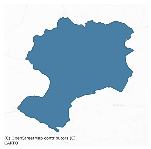
Garrycastle is a barony of County Offaly, in the historical province of Leinster (Irish: Garraí an Chaisleáin), covering 420 km² of land. The barony records 2,146 NMS archaeological sites and 140 NIAH listed buildings, placing it at around the 95th percentile among 280 ROI baronies for sites per km². This means it is in the top tenth of all baronies for sites per km². Dated archaeological evidence runs from the Early Bronze Age through to the Modern, spanning 7 of 9 archaeological periods, placing the barony in the 23rd percentile among 280 ROI baronies for chronological depth. This means it is in the bottom third of all baronies for chronological depth. The largest dated subset of recorded sites dates to the Early Medieval. Logainm flags 29 placenames in the barony as carrying a recognised heritage root; the largest share — around 55% — are names associated with early Christian church and monastic foundations.

Heritage at a glance
Percentile rankings throughout this profile compare each barony only against the other 279 Republic of Ireland baronies.
The recorded heritage of Garrycastle
The National Monuments Service Sites and Monuments Record (SMR) is the statutory inventory of archaeological sites for the Republic of Ireland, maintained by the Department of Tourism, Culture, Arts, Gaeltacht, Sport and Media. Sites recorded here include earthworks, ringforts, megalithic tombs, ecclesiastical remains, and post-medieval features; not every record is legally protected, but each is registered as a monument of archaeological interest.
The National Monuments Service records 2,146 archaeological sites in Garrycastle, putting it at the 95th percentile among 280 ROI baronies for sites per km². This means it is in the top tenth of all baronies for sites per km². Of these, 1,508 (70%) fall within a recorded monument protection zone. The record is dominated by ecclesiastical sites — churches, graveyards, and holy wells (940 sites, 44% of the total), with industrial sites forming a substantial secondary presence (594 sites, 28%). Cross-slab is the most prevalent type, making up 40% of the barony's recorded sites (852 records) — well above the ROI average of 5% across all baronies where this type occurs. Cross-slab is a stone slab inscribed with a cross, used as a grave-marker or memorial, dated pre-1200 AD. Other significant types include Structure – peatland (594) and Road – class 3 togher (190). Structure – peatland is a construction of unknown function, either extant or implied by archaeological evidence, of any date; Road – class 3 togher is a short wooden peatland trackway up to 15m long, deliberately laid to cross a small area of bog; Neolithic to medieval. Across the barony's 420 km², this gives a recorded density of 5.11 sites per km².
Most common monument types
Hover or tap a monument type to see its definition.
| Type | Count |
|---|---|
| Cross-slab a stone slab inscribed with a cross, used as a grave-marker or memorial, dated pre-1200 AD | 852 |
| Structure – peatland a construction of unknown function, either extant or implied by archaeological evidence, of any date | 594 |
| Road – class 3 togher a short wooden peatland trackway up to 15m long, deliberately laid to cross a small area of bog; Neolithic to medieval | 190 |
| Enclosure a banked or ditched feature of uncertain type, used as a catch-all where the original function cannot be determined from surface evidence | 96 |
| Ringfort – rath an earthen ringfort enclosed by a bank and external ditch — the most common Early Medieval farmstead, broadly dated 500–1000 AD | 27 |
| Church a building used for public Christian worship, of any date from c. 500 AD onwards | 24 |
| Ritual site – holy well a well or spring traditionally associated with a saint, often credited with healing properties; many trace earlier ritual origins but devotion is documented from the medieval period onwards | 19 |
Chronological distribution
The dated archaeological record for Garrycastle spans from the Early Bronze Age through to the Modern, with activity attested across 7 of 9 archaeological periods. This is the 23rd percentile across ROI baronies — a relatively narrow chronological band, with much of Irish prehistory not represented in the dated record. Every period from earliest to latest is represented in the record — an unbroken sequence of dated activity across the full chronological span. Activity concentrates most heavily in the Early Medieval (976 sites, 82% of dated material), with the Iron Age forming a secondary peak (112 sites, 9%). A further 960 recorded sites (45% of the overall NMS register for the barony) carry no period attribution — appearing as 'Unknown' in the bar chart below. This typically reflects either records that pre-date the standardised period vocabulary or sites awaiting specialist dating review, rather than a genuine absence of chronological evidence.
Sample of recorded monuments
Show 25 sample monuments (of 2,146 total)
A representative sample of 25 recorded monuments drawn from the barony’s 2,146 total NMS entries. Sites within a recorded monument protection zone and rarer site types are prioritised so the list shows a meaningful cross-section rather than only the most common type. Each entry shows the official Sites and Monuments Record reference number and the description published by the National Monuments Service.
Castle – Anglo-Norman masonry castle
National Monument No. 81. Situated on the low-lying floodplain of the River Shannon which overlooks it to the N. The monastic site (OF005-004—-) of Clonmacnoise lies nearby to E. In 1215 Ralph de Derevaus and Walter…
National Monument No. 81. Situated on the low-lying floodplain of the River Shannon which overlooks it to the N. The monastic site (OF005-004—-) of Clonmacnoise lies nearby to E. In 1215 Ralph de Derevaus and Walter Reboth who held the custody of the castle of Clonmacnoise were requested to deliver it to Geoffrey de Mariscis (Cal. doc. Ire., 94). The stone castle constructed in the early 13th century comprises a rectangular, three-storey stone keep with adjoining courtyard area, built within a D-shaped earthwork (dims. 32m N-S x 37m E-W) defined by two earthen banks and a wide flat bottomed intervening fosse (Wth 5.9m). The inner bank (Wth 3.7m) is visible at NW only, while the bettere preserved external bank (Wth 6m; int. H 6.25m; ext. H 3-6m) is upstanding from E-S-SW. A possible ramped entrance feature is located at N. The keep (dims. 11.3m N-S x 19m E-W; wall T 2.2m) is constructed of uncoursed limestone rubble and comprises just the N and S walls with wall-footings elsewhere. A fore-building set laterally to the N wall of the keep and which contained the drawbridge, was reached from the wall-walk and led to the main entrance at first floor level. A vaulted support at the W end of the N wall of the keep reinforced the drawbridge. This fore-building which was illustrated by Blaymires in 1739 (Manning 1994, 18) has long since collapsed with just the drawbridge slots remaining. The first floor of the keep was lit by narrow slit opes set within widely splayed segmental…
Cathedral
National Monument No. 81. Rectangular church (ext. dims. 22m E-W; 10.9m N-S; wall T 0.9m) built with roughly coursed rubble with four distinct building phases evident. The earliest 10th/11th-century phase (int. dims.…
National Monument No. 81. Rectangular church (ext. dims. 22m E-W; 10.9m N-S; wall T 0.9m) built with roughly coursed rubble with four distinct building phases evident. The earliest 10th/11th-century phase (int. dims. N-S 10.9m; E-W 19m) is indicated by the presence of Antae at both ends of the church (Clapham 1939, 17). The next phase appears in the 13th-century with the insertion of the W doorway (Manning 1994, 25) with four orders and the sacristy or chapter house (ext. dims. 6.45m N-S; 6.8m E-W) which was added to the E end of the S wall. The sacristy/chapter house which is marked as 'Black Cell' on Balymires map 1738 is lit by two single light round headed windows set in widely splayed embrasures. The doorway from the sacristy/chapter house to the church has a pointed arch with concave hood moulding above with diagonal stone tooled jambs indicating early medieval date. The hood moulding is similar to the hood moulding which survives over the door in the nearby Temple Ri (OF005-007001-) which is also dated to the early 13th-century (Leask 1966, vol. 2, 59). In the late 13th/14th-century the S wall was moved Northwards (pers. comm. Manning) with the insertion of a single light gothic style lancet the rear arch of which still survives at the E end of the S wall. The sacristy/chapter house was extended northwards with the insertion of the double sedilia in the S wall. The fourth and final phase was in the mid 15th-century when a simple twin light Y tracery window was in…
Memorial stone
National Monument No. 81. 17th century inscribed stone dedicated to the restoration work on the cathedral church carried out by Charles Coghlan, Vicar of Clonmacnoise, in 1647. This stone or plaque is incorporated…
National Monument No. 81. 17th century inscribed stone dedicated to the restoration work on the cathedral church carried out by Charles Coghlan, Vicar of Clonmacnoise, in 1647. This stone or plaque is incorporated into the N wall at the E end of the cathedral church (OF005-004001-). The inscribed stone was described by John O’Donovan in 1856-7 when he recorded that ‘on the north side wall within the Church this Inscripcion. Hoc Ecclia restaurata erat p Carolum Coghlan Vicarium General Anno 1617 propriis impensis’ (O’Donovan 1856-7, 447). In 1907, Westropp recorded this inscribed stone which he recorded dated from 1647 and not 1617 as recorded by O’Donovan in 1856/7 (Westropp 1907a, 282-5). Westropp recorded this inscription as a slab with an inscription in ‘raised capitals, the words, “Carolus Coghlanus, Vicarius Generalis | Cluanmacnose, propriis impendiis, hanc | dirutam ecclesiam restauravit….| Anno Domini, 1647” (Westropp 1907a, 282-5)
Compiled by: Caimin O’Brien
Date of upload: 09 August 2012
Exhibitionist figure (present location)
National Monument No. 81. In store room adjoining cathedral (OF005-004001-). According to Guest this figure originally came from Burgesbeg church (TN028-035001-) (Guest 1939, 48; McMahon and Roberts 2001, 119). Carved…
National Monument No. 81. In store room adjoining cathedral (OF005-004001-). According to Guest this figure originally came from Burgesbeg church (TN028-035001-) (Guest 1939, 48; McMahon and Roberts 2001, 119). Carved in relief on one face of octagonal stone (dims. H 0.25m x Wth 0.21m), all other sides smooth and without decoration. Huge earless head with bulbous eyes and a biggish chin. Angular shoulder; clearly incised ribs, no breasts. Left hand resting on thigh, right arm raised with hand held to side of face. Deep hole indicating vulva with clitoris (?) at upper end. Legs slightly apart and bent with both feet facing the same way (Freitag 2004, 129-30). According to Weir there was 'a small protuberance, like an uvula [which is described as a 'hesitant penis'] immediately below what is a small deep hole which most likely represents the anus'(McMahon and Roberts 2001,119). This figure has been described by Cherry as an exhibitionist figure that has been mistakenly identified as a sheela-na-gig (Cherry 1992, 10). Cross-referenced with TN025-038004-.
The above description is derived from the published 'Archaeological Inventory of County Offaly' (Dublin: Stationery Office, 1997). In certain instances the entries have been revised and updated in the light of recent research.
Compiled by: Caimin O'Brien
Date of upload/revision: 02 July 2012
Hospital
National Monument No. 81. Unlocated hospital within the monastery of Clonmacnoise which is referred to in the annals in 1087 AD as 'the hospital of St Kieran'.
The above description is derived from the published…
National Monument No. 81. Unlocated hospital within the monastery of Clonmacnoise which is referred to in the annals in 1087 AD as 'the hospital of St Kieran'.
The above description is derived from the published 'Archaeological Inventory of County Offaly' (Dublin: Stationery Office, 1997). In certain instances the entries have been revised and updated in the light of recent research.
Date of upload: 23 May 2011
Round tower
National Monument No. 81. Circular tower (diam. at base 5.6m; wall T 1.12m; H 19m) five storeys high built with coursed finely cut ashlar blocks of limestone on a protruding plinth. The top storey which was rebuilt in…
National Monument No. 81. Circular tower (diam. at base 5.6m; wall T 1.12m; H 19m) five storeys high built with coursed finely cut ashlar blocks of limestone on a protruding plinth. The top storey which was rebuilt in the medieval period has 8 rectangular slits. Round headed door at first floor level, facing SE. Conical cap now destroyed, wooden floors carried on corbels at every level. One simple flat headed window at second and third floors facing SW and N respectively. Locally known as O' Rourke's tower which according to the Annals of Clonmacnoise was built in the year 1124, the roof of which was struck by lightning in 1135 (Barrow 1979, 173-5). English soldiers carried off the bell of the Round tower in 1552 (Harbison 1972, 202-4). Depicted on the first two editions of the OS 6-inch map but not on the last edition. (Cooke 1875, 372; Monahan 1886, 66-8; Westropp 1907, 290; MacAlister 1910, 20-7; O' Flanagan 1933 vol. 1, 65)
The above description is derived from the published 'Archaeological Inventory of County Offaly' (Dublin: Stationery Office, 1997). In certain instances the entries have been revised and updated in the light of recent research.
Date of upload: 23 May 2011
House – medieval
National Monument No. 81. Only the wall footings survive of the building or buildings marked on Blaymire's 17th century plan of Clonmacnoise dating from 1658 which identified this building as the ‘Residentiary house…
National Monument No. 81. Only the wall footings survive of the building or buildings marked on Blaymire's 17th century plan of Clonmacnoise dating from 1658 which identified this building as the ‘Residentiary house of the Dean, Archdeacon etc.’ (Manning 1998, 17). This 1658 plan of Clonmacnoise which is now housed in the British Library (Add. MS 4787 f276) is based on an original plan dating from 1621 (Manning 1998, 16). On this plan at least two buildings are shown located on the external or SE face of the enclosing boundary of Clonmacnoise graveyard. The plan also depicts entrances into this building facing north, south, east and west; those to the west and south are shown as gaps, but the other two are depicted as arched openings (Manning 1998, 17).
This building is depicted on the 1838 edition of the OS 6-inch map as a square-shaped structure, located in the SE quadrant of Clonmacnoise graveyard that is now shown against the W face of the wall enclosing the graveyard. On this 6-inch map the building is depicted as the ‘Residentiary Houses of the Dean, Archdeacon & c.’. On the revised 1908 ed. OS 6-inch map the building is depicted as a two room long rectangular building aligned NNE-SSW and is now annotated on the map as, ‘houses of the Dean, Archdeacon & c. (in Ruins)’.
Compiled by: Caimin O’Brien
Date of upload: 09 August 2012
Crucifixion plaque
National Monument No. 81. Around the perimeter of St Kierans holy well (OF005-035001-) there is an Early Christian cross inscribed slab (OF005-035004-) with an incised cross with expanded terminals and partial OR DO…
National Monument No. 81. Around the perimeter of St Kierans holy well (OF005-035001-) there is an Early Christian cross inscribed slab (OF005-035004-) with an incised cross with expanded terminals and partial OR DO inscription visible. Beside this slab there is a triangular shaped stone with the faint outline of a carving of unknown shape. To the SE of the well there is what appears to be a vernacular representation of the crucifixion with a simple figure of Christ with Breath of life motif on chest with inscription over head reading 'Repent and do penance'. To the E of the well there is what appears to be a late medieval carved bust possibly contemporary with the crucifixion because both have the same inscription. The bust is broken showing us how the head was attached to the body by a metal spike. The head was that of a female with what appears to be a medieval headress on top. The inscription 'Repent do penance' appears on the front of the bust.
The above description is derived from the published 'Archaeological Inventory of County Offaly' (Dublin: Stationery Office, 1997). In certain instances the entries have been revised and updated in the light of recent research.
Date of upload: 23 May 2011
Stone sculpture
There is no reference to any standing stone in the file for this area, it may have been mistakenly identified from the reference to the bust of post-1700 AD date that was located beside the holy well.
The above…
There is no reference to any standing stone in the file for this area, it may have been mistakenly identified from the reference to the bust of post-1700 AD date that was located beside the holy well.
The above description is derived from the published 'Archaeological Inventory of County Offaly' (Dublin: Stationery Office, 1997). In certain instances the entries have been revised and updated in the light of recent research.
Date of upload: 23 May 2011
Rock art
National Monument No. 336. Located on SW facing slope of rising pasture with good views of Fin Lough located 360m to SW. Large earthfast boulder (dims. 3m E-W x 2.8m N-S; max. H 0.75m) known today as 'The Clonfinlough…
National Monument No. 336. Located on SW facing slope of rising pasture with good views of Fin Lough located 360m to SW. Large earthfast boulder (dims. 3m E-W x 2.8m N-S; max. H 0.75m) known today as 'The Clonfinlough Stone' and previously known as the ‘Fairy’s Stone’ and the ‘The Horseman’s Stone’ (Graves 1865, 360) the surface of which is covered with water solution holes, incised lines and several other unusual symbols or features such as elongated crosses some of which may be artificial while others are the result of natural weathering. It has been suggested that similar decorated stones in NW Spain have been dated to the Bronze Age (Jackson 1967, 11-19). The surface of the stone is decorated with a series of cruciform shapes, incomplete T-shaped lines, a possible representation of a footprint and several longitudinal and transverse lines. It has been suggested that many of these symbols or lines may be fortuitous, the result of dip and strike joints modified and deepened by chemical solution. However, it has also been concluded that some or all of the original solution-modified grooves may have been retouched or deepened artificially (ibid. 11-19). Graves suggested that the footprint on the surface of the stone may indicate that the boulder was used as an Inauguration stone (Graves 1865, 361; Fitzpatrick 2004, 115, 239). The lower part of the stone contains eleven motifs called ‘phi figures’ which consists of an oval shape similar to a Greek letter φ with ver…
Causeway
Situated at the centre of Fin Lough lake with a recently exacavated Late Bronze Age lakeside settlement (6:75) along the shoreline to the S. Island not accessible.
The above description is derived from the published…
Situated at the centre of Fin Lough lake with a recently exacavated Late Bronze Age lakeside settlement (6:75) along the shoreline to the S. Island not accessible.
The above description is derived from the published 'Archaeological Inventory of County Offaly' (Dublin: Stationery Office, 1997). In certain instances the entries have been revised and updated in the light of recent research.
Date of upload: 23 May 2011
Habitation site
A settlement (L 50m; Wth 40m) situated between Finlough and Blackwater bog. It consisted of two house platforms, each 9m in maximum diameter, a hut platform and a working platform partially enclosed by a palisade of ash…
A settlement (L 50m; Wth 40m) situated between Finlough and Blackwater bog. It consisted of two house platforms, each 9m in maximum diameter, a hut platform and a working platform partially enclosed by a palisade of ash posts. The houses were large structures, built up from the surface of the bog with a boxed wattle substructure, timber and stone floors, doubled wattle walls and porch entrances. The palisade enclosed an oval area 50m by 40m. It consisted of a single line of ash posts. Finds included several flat-bottomed coarse ware pots, amber beads, saddle querns and rubbing stones, a stone adze, a possible churn piece, several enigmatic grooved timbers, wicker baskets and the damaged remains of a pair of large perforated paddles. The site was dated to 908±9 BC or later (Q8225) with a repair to one of the house platforms at 886 BC (Q8496). Excavated by the I.A.W.U. in 1990 and 1991. (Irish Archaeological Wetland Unit (UCD) 1993)
Compiled by: Irish Archaeological Wetland Unit (University College Dublin).
Date of upload: 23 May 2011
Moated site
Situated on low-lying poorly drained land with higher ground to the NE. Square shaped area (diam 38m N-S) defined by a scarp (H 2m), wide flat bottomed fosse (Wth 3m; ext. H 1m) with possible ramped entrance (Wth 3m) at…
Situated on low-lying poorly drained land with higher ground to the NE. Square shaped area (diam 38m N-S) defined by a scarp (H 2m), wide flat bottomed fosse (Wth 3m; ext. H 1m) with possible ramped entrance (Wth 3m) at E, with no evidence of an external bank. The site is not marked on the first two editions of the six inch maps which makes classification tentative. Its shape and location indicate that it is a moated site.
The above description is derived from the published 'Archaeological Inventory of County Offaly' (Dublin: Stationery Office, 1997). In certain instances the entries have been revised and updated in the light of recent research.
Date of upload: 23 May 2011
Castle – motte
Natural flat topped mound(diam. 22m; ext.H. 2m) with gently sloping sides and gazebo of 18-19th century date built on top of mound. Impossible to tell whether mound is a motte or whether it was just landscaped for the…
Natural flat topped mound(diam. 22m; ext.H. 2m) with gently sloping sides and gazebo of 18-19th century date built on top of mound. Impossible to tell whether mound is a motte or whether it was just landscaped for the gazebo in the 19th century. There is no evidence of a bailey or enclosing fosse. Described in 1977 as 'sub-circular mound with gently sloping sides and a wide top. The top is fairly flat with a slightly raised platform in the northern part. This platform supports an 18th century folly or low circular tower. The top of the mound is approx. 22m in diam. North-South and 16m in diam. E-W. There is a slight fosse at the foot of the mound on the western side. This earthwork is built on sloping ground and is approx. 2m high on the western side while it is approx. 4m high on the eastern side. It is unclear what type of monument this is. It could be a small motte' (ASI file 1977).
The above description is derived from the published 'Archaeological Inventory of County Offaly' (Dublin: Stationery Office, 1997). In certain instances the entries have been revised and updated in the light of recent research.
Date of upload: 23 May 2011
Hilltop enclosure
This is a large circular feld boundary defined by a dry stone wall enclosing a large circular area as shown on OS 6-inch maps. The field boundary encloses the base of a hillock going around the hillock and forming a…
This is a large circular feld boundary defined by a dry stone wall enclosing a large circular area as shown on OS 6-inch maps. The field boundary encloses the base of a hillock going around the hillock and forming a large circular enclosure. On the first edition of the OS 6-inch map there is a larger outer enclosure depicted. If both enclosures are contemporary this would be the site of a large hilltop enclosure or concentric enclosure possible. Unsure about the antiquity of this enclosure, may be just the remains of field boundaries of 17th or 18th century date.
The above description is derived from the published 'Archaeological Inventory of County Offaly' (Dublin: Stationery Office, 1997). In certain instances the entries have been revised and updated in the light of recent research.
Date of upload: 23 May 2011
Altar
Located on poorly drained low-lying land with holy well (OF014-019—-) immediately to the E and Church (OF014-017001-) to the N. Known locally as the 'Druids Altar' the site consists of a small sunken circular area…
Located on poorly drained low-lying land with holy well (OF014-019—-) immediately to the E and Church (OF014-017001-) to the N. Known locally as the 'Druids Altar' the site consists of a small sunken circular area (Diam. 6.3m) enclosed by a low stone bank (Wth 1.6m; ext. H 0.6m) with one erect orthostat on the S side of the bank with no evidence of an outer fosse or entrance feature. No evidence of any large stone that may have served as an altar in the interior of the site. May be associated with nearby Holy Well and Church.
The above description is derived from the published 'Archaeological Inventory of County Offaly' (Dublin: Stationery Office, 1997). In certain instances the entries have been revised and updated in the light of recent research.
Date of upload: 23 May 2011
Religious house – Augustinian canons
Situated on a slight rise with river to the E. The ecclesiastical remains consist of an medieval church (OF014-029008-), early Christian cross-slabs (OF014-029003-), graveyard (OF014-029002-) and a bullaun stone…
Situated on a slight rise with river to the E. The ecclesiastical remains consist of an medieval church (OF014-029008-), early Christian cross-slabs (OF014-029003-), graveyard (OF014-029002-) and a bullaun stone (OF014-029005-). The Abbey which was built near the site of an Early Christian monastery founded by St. Canoc in 492 is now in a ruinous condition consisting of a long rectangular church (ext. dims. 23.9m E-W; 8.4m N-S; wall T 0.8m) built with roughly coursed limestone rubble with no architectural features evident. There is a N transept now blocked at the E end of the N wall (int. 7.5m N-S; 4.4m E-W; wall T 0.8m) with a destroyed window in the N gable. The interior of the abbey and sacristy are used as burial plots with a burial vault added to the W end of the S wall. There were several architectural fragments lying in the collapsed rubble along the walls of the church. The date of this church probably belongs to the 15th-century as mentioned by Armstrong (1908) who assigned such a date via the flamboyant E window which was recently destroyed by workers during recent graveyard clean up. The Early Christian cross-slabs are described by Lionard (1961 Vol. 61, 95-169) and are on display in a field to the N of the abbey on the site of a small 11th/13th-century church discovered during excavations by Kendrick in 1934-35. A small graveyard (OF014-029002-) was associated with the long rectangular church (ext. 71ft E-W; 24ft N-S ) which had a small rectangular sacristy (in…
Cross-inscribed pillar
National Monument No. 504. Early Christian monastery founded by St. Canoc in 492. Erect slab (H 2.5m; T 0.15m; Wth 0.8m) with projecting rounded tenon with rounded perforation just below. Decorated on one face only…
National Monument No. 504. Early Christian monastery founded by St. Canoc in 492. Erect slab (H 2.5m; T 0.15m; Wth 0.8m) with projecting rounded tenon with rounded perforation just below. Decorated on one face only which is divided into two panels decorated with interlaced cross and confronted animals with interlaced tails surrounded by a fret pattern (Kendrick 1939, 1-20). Cross was discovered during an excavation and is now on display in the centre of the excavated church (OF014-029008-) (Kendrick 1939, 1-20).
The above description is derived from the published 'Archaeological Inventory of County Offaly' (Dublin: Stationery Office, 1997). In certain instances the entries have been revised and updated in the light of recent research.
Inventory of Carved Stone ID 000028
Date of upload: 23 May 2011
Ecclesiastical site
No evidence of a monastic complex or ecclesiastical site was found in the area marked on the OS 6-inch maps. Of doubtful antiquity. According to the Ardagh and Clonmacnoise Antiquarian Journal 'At Killagally near Glin…
No evidence of a monastic complex or ecclesiastical site was found in the area marked on the OS 6-inch maps. Of doubtful antiquity. According to the Ardagh and Clonmacnoise Antiquarian Journal 'At Killagally near Glin and now the residence of the Seymour family are also ruins. Here St. Trena was abbott. The two latter seem to be branch houses of Gallen' (Anon vol. 1, no. 3 p. 70-2). According to the ITA Survey this was supposedly the site of a late fifth or early sixth century monastery and the remains were described as 'a spot in the townland where the ruins of a building stand. Small mounds of grass covered stonework mark the outline of buildings and at one point a gable wall containing a brick lined Gothic window towers above the scene. The height of the wall is about 30ft. and 24ft. in width. The outline of the buildings of which this wall formed a section may be traced by small grass covered sections of stone walls and I have reached the conclusion that the original building was about 55ft. long by 25ft. wide. Most of the local people call these ruins those of Killegally Monastery but one man in the neighbourhood asserted that these ruins were not that of Killegally monastery and his statement was as follows 'Killegally House or Killegally Park was built by a Rev. Mr. Mahon who was protestant rector in this parish. Before building the present Killegally Park this man said that he commenced building his house where the ruins now stand and not being satisfied with the…
Settlement deserted – medieval
Situated on a slight rise in poorly drained flat land. Archaeological complex consists of an early christian ecclesiastical enclosure (OF015-004008-), tower house (OF015-004001-), multi-period church (OF015-004003-)…
Situated on a slight rise in poorly drained flat land. Archaeological complex consists of an early christian ecclesiastical enclosure (OF015-004008-), tower house (OF015-004001-), multi-period church (OF015-004003-) dating from the romanesque and late medieval date with several early christian cross-slabs (OF015-004005-) and architectural fragments in the interior of the church. To the NW there is a rectangular building (OF015-004009-) possibly of late medieval date. Holy well (OF015-004007-) and possible oratory or hermitage (OF015-004006-) and togher (OF015-004011-) located to the southeast of the main church.
No surface remains visible of any clustered settlement in the area around Lemanaghan church and graveyard. A group of dwellings and Lemanaghan Castle (OF015-004001-) are depicted standing in close proximity to Lemanaghan church on the 1655 Down Survey map of Garrycastle barony.
Monitoring under licence no. 02E1437 was required as part of the planning permission for a house on a greenfield site. The development was near the Early Christian enclosure of Lemanaghan (OF015-004008-). No features or finds of archaeological significance were revealed.
John Purcell, Ballinvalley, Killeigh, Co. Offaly.
The above description is derived from the published 'Archaeological Inventory of County Offaly' (Dublin: Stationery Office, 1997). In certain instances the entries have been revised and updated in the light of recent research.
Date of upload: 23 May 2011
Decorated stone
A monastery at Lemanaghan (Liath Manchán) was founded in the 7th century by Manchán whose feastday is celebrated on the 24th of January (Ó Riain 2011, 429). Early Christian decorated stone erected as a headstone in…
A monastery at Lemanaghan (Liath Manchán) was founded in the 7th century by Manchán whose feastday is celebrated on the 24th of January (Ó Riain 2011, 429). Early Christian decorated stone erected as a headstone in Lemanaghan graveyard (OF015-004004-) SW of the church (OF015-004003-).
The surface of this stone is decorated with a diagonal key-pattern with interlocking spirals or swirling spirals framed within diamond shaped panels, except for a single diamond in the middle of the stone which contains a maze like pattern. The decoration is similar to the key-pattern found on a decorated stone at Gallen (OF014-029006-) and on a panel of the ninth century Pictish cross-slab from Nigg Church in Ross and Cromarty Scotland. This key-pattern was also used as a decorative border on early Christian illuminated manuscripts. The swirling spirals can also be compared with a ninth century Pictish cross-slab known as the Shandwick Stone also located in the county of Ross and Cromarty, Scotland.
Described by Crawford (1911, 155-6) as ‘a stone which differs entirely from the others, and is not, perhaps, a sepulchral monument at all. It is a thick slab of fine, brown sandstone, 17 inches (0.43m) wide, 8 inches (0.2m) thick, and standing 30 inches (0.76m) above ground. The back is rough and the edges and front squared; the latter being covered entirely by a rectangular panel containing a continuous diagonal key pattern, which goes below the present ground-level. The centres of…
Hermitage
A monastery at Lemanaghan (Liath Manchán) was founded in the 7th century by Manchán whose feastday is celebrated on the 24th of January (Ó Riain 2011, 429). Situated on a slight rise of ground with stone lined causeway…
A monastery at Lemanaghan (Liath Manchán) was founded in the 7th century by Manchán whose feastday is celebrated on the 24th of January (Ó Riain 2011, 429). Situated on a slight rise of ground with stone lined causeway (OF015-004011-), church (OF015-004003-) and tower house (OF015-004001-) to the W.
A 10th / 11th century oratory named after St. Manchan’s mother stands inside a rectangular shaped monastic cashel (dims. 41.7m by 30.7m ) with walls measuring 1.6m thick. Small rectangular shaped oratory (dims. 4.8m N-S; 7.3m E-W; wall T 0.8m) built from large uncoursed limestone boulders with lintelled trabeate door (H 1.75m; Wth 0.75m) at centre of W gable illustrated by Graves (1874, 140). According to Graves (1874, 141) there were no windows on the side walls. The oratory is situated in the centre of a large rectangular-shaped enclosure/cashel (43m E-W; 35.5m N-S) defined by large upright boulders (1.6m x 1m x 0.5m) of varying size and shape which gives the appearance of megalithic construction indicative of Early Christian architecture. The stone lined causeway connects the oratory to the main ecclesiastical remains located to the W.
This structure may have served as a small nunnery church (Ó Carragáin 2010, 223). Local folklore from 1938 recorded that ‘St. Mella's house is about a quarter of a mile from the church on the east side in a place called Kell. It is connected with the church by St. Manchan's Tochar. The four walls are standing but the roof is gone….
Font
A monastery at Lemanaghan (Liath Manchán) was founded in the 7th century by Manchán whose feastday is celebrated on the 24th of January (Ó Riain 2011, 429). Remains of medieval font from Lemanaghan church…
A monastery at Lemanaghan (Liath Manchán) was founded in the 7th century by Manchán whose feastday is celebrated on the 24th of January (Ó Riain 2011, 429). Remains of medieval font from Lemanaghan church (OF015-004003-) currently located inside the disused Lemanaghan schoolhouse.
The font is part of an archaeological complex consisting of an ecclesiastical enclosure (OF015-004008-),a tower house (OF015-004001-), church (OF015-004003-), several early christian cross-slabs (OF015-004005-/032-) and architectural fragments in the interior of the church. To the NW there is a rectangular building (OF015-004009-) possibly of late medieval date. Possible oratory or hermitage (OF015-004006-) and togher (OF015-004011) located to the SE of the church.
The above description is derived from the published 'Archaeological Inventory of County Offaly' (Dublin: Stationery Office, 1997). In certain instances the entries have been revised and updated in the light of recent research.
Compiled by: Caimin O'Brien
Date of upload: 25 April 2014
Architectural feature
There are three pieces of stone sculpture embedded in the courtyard walls of Ballylin Demesne. The first piece is located on the N face of the N wall over an archway, it is a armorial plaque (OF015-008002-) with a coat…
There are three pieces of stone sculpture embedded in the courtyard walls of Ballylin Demesne. The first piece is located on the N face of the N wall over an archway, it is a armorial plaque (OF015-008002-) with a coat of arms depicting the crucifixion with a date above of 1688. There is a second armorial plaque on the S face of the N wall with a coat of arms of three lions rampant (OF015-008003-). On the N face of the S wall there is a round arched hammer dressed limestone doorway (OF015-008001-) of late medieval date believed to have come from a destroyed church near Kilreghan cemetery (OF014-031—-) (Dunne 1874-5, 161-5). Above this doorway there is a poorly preserved coat of arms (OF015-008004-) with a large stone mortar which has four semicircular lugs (OF015-008005-). All these remains possibly came from the destroyed late medieval church (OF014-031002-) near Kilreghan cemetery.
This monument is the same as OF014-031004
The above description is derived from the published 'Archaeological Inventory of County Offaly' (Dublin: Stationery Office, 1997). In certain instances the entries have been revised and updated in the light of recent research.
Date of upload: 23 May 2011
Cross-slab
Early Christian monastery known as Teach Sáráin [Tisaran/House of Saran] founded by Sárán, son of Brógán of the Dál gCais of Thomond in the seventh century (Ó Riain 2011, 547-8; ITA Survey 1942). Situated on a natural…
Early Christian monastery known as Teach Sáráin [Tisaran/House of Saran] founded by Sárán, son of Brógán of the Dál gCais of Thomond in the seventh century (Ó Riain 2011, 547-8; ITA Survey 1942). Situated on a natural rise on low-lying land with N bank of River Brosna 350m to SSE. Graveyard (OF022-004001-) contains 18th/19th-century headstones and is enclosed by a post-1700 stone wall. Early Christian cross-slab (OF022-004003-) recorded by Crawford (1913, 262-5) that was moved from Tisaran graveyard and is now located inside High St. RC church (OF014-052—-) near Belmont village.
Cross-slab described by Crawford as, 'A small slab incised with a double-line ringed cross. Immediately below the shaft is a small circle. The inscription or do bran runs across the top and down the sinister side' (Crawford 1913, 265). Recorded by Macalister as following; 'Slab, 2 feet 4 inches [0.71m] x 1 foot 1 inch [0.33m] x 0 foot 7 inches [0.17m], bearing a wheel-cross with a circle added to the lower terminal. Inscription on top and sinister side 'or do bran'. In the oval sinkings in the contours of the cross there appears to have been originally extremely fine patterns of interlacement, in minuteness recalling manuscript work. They are, however, too much weathered to be restored with any approach to certainty. The stone, which was lying in the old cemetery in this parish, has now been transferred safely to the modern church' (Macalister 1949, vol. 2, 78).
Macalister, R. 1949, 78, Pla…
Listed buildings
The National Inventory of Architectural Heritage (NIAH) is a state survey appraising buildings of architectural, historical, archaeological, artistic, cultural, scientific, social, or technical interest. Each surveyed structure receives a rating from International (the highest, for buildings of European importance) through National, Regional, Local, and Record-Only.
The NIAH records 140 listed buildings in Garrycastle (64th percentile across ROI baronies). The highest-graded structures include 4 of National significance. The Republic holds 937 National-graded buildings in total, so this barony accounts for around 0% of the national total. Construction dates concentrate most heavily in the Victorian (1830-1900) period. The most-recorded building type is house (38 examples, 27% of the listed stock).
Terrain and environment
Mean elevation across the barony is 48m — the 15th percentile among 280 ROI baronies for elevation. This means it is in the bottom fifth of all baronies for elevation. This is a relatively low-lying landscape by ROI standards. Elevation matters for heritage because higher-altitude baronies typically favour defensive monuments — ringforts and hilltop forts placed on prominent ground — while lowland baronies are more likely to carry the dense settlement and church networks of intensive agricultural landscapes. A maximum elevation of 150m gives the barony meaningful vertical relief. Mean slope is 2.0° — the 6th percentile among 280 ROI baronies for slope. This means it is in the bottom tenth of all baronies for slope. This is broadly flat terrain, the kind of landscape best suited to intensive agriculture. Slope is a key control on both land use and archaeological preservation: steep ground resists ploughing and tends to preserve earthworks intact, while gentle slopes favour intensive cultivation that damages or destroys surface archaeology over time. The Topographic Wetness Index averages 11.9, the 94th percentile among 280 ROI baronies for wetness. This means it is in the top tenth of all baronies for wetness. This is wet, slow-draining ground by ROI standards — the kind of landscape that may carry waterlogged archaeological sites of unusual preservation value. Drainage matters for heritage because poorly-drained ground preserves organic archaeology (wooden trackways, leather, textiles, and on rare occasions human remains) far better than free-draining soil; well-drained ground favours arable use but destroys organic material rapidly. The land cover is dominated by improved grassland (78%) and woodland (16%). In overall character, this is low-lying, gently-sloping terrain — characteristic of Ireland's central plain and coastal lowlands, with land use dominated by improved grassland.
Terrain measurements
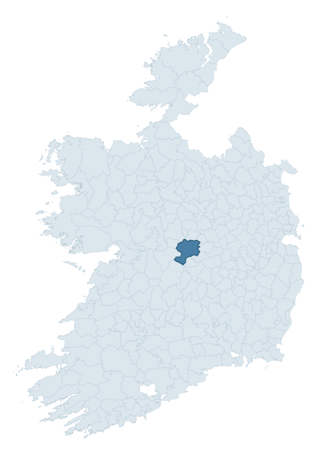
Where this barony sits in the Republic of Ireland
Geology and preservation
Bedrock geology shapes the landscape long before any settlement begins — controlling soil drainage, agricultural potential, the survival of upstanding monuments, and the preservation of buried archaeology. The figures below come from the Geological Survey Ireland 1:100,000 bedrock map.
The bedrock underlying Garrycastle is predominantly limestone (94% of the barony by area), laid down during the Carboniferous period (97% by area, around 359 to 299 million years ago). Limestone is the most heritage-rich bedrock in Ireland. It supports fertile, well-drained soils that favoured dense Early Medieval settlement and Norman manorial agriculture, and it weathers into karst features — sinkholes, caves, swallow holes, and souterrains — that frequently carry archaeology. Where peat overlies limestone, organic preservation can be exceptional. The single largest mapped unit is the Waulsortian Limestones (56% of the barony's bedrock).
Rock type composition
Largest mapped unit: Waulsortian Limestones (56% of the barony)
Placename evidence
Logainm records 29 heritage-diagnostic placenames for Garrycastle, drawn from townland and civil-parish names across the barony. The dominant stratum is Early Christian ecclesiastical — cill-, teampall-, and domhnach-prefixed names that record the dense network of early church foundations established between the fifth and tenth centuries. The leading diagnostic roots are cill- (15 — church), lios- (6 — ringfort or enclosure), and ráth- (3 — earthen ringfort). This is broadly in line with the ROI average of 30.7 heritage placenames per barony. The presence of multiple heritage strata side by side indicates layered occupation of the landscape across successive prehistoric and historic periods. Logainm records 240 placenames for Garrycastle (predominantly townland names). Of these, 29 (12%) carry one of the diagnostic Gaelic roots tracked above; the remainder draw on more generic landscape vocabulary that does not encode a heritage period.
Pre-Christian / Early Medieval Defensive
| Root | Count | Meaning |
|---|---|---|
| lios- | 6 | ringfort or enclosure |
| ráth- | 3 | earthen ringfort |
| dún- | 1 | hilltop or promontory fort |
Early Christian Ecclesiastical
| Root | Count | Meaning |
|---|---|---|
| cill- | 15 | church (early) |
| cillín- | 1 | unconsecrated burial ground |
Burial, Ritual, and Norse-Contact
| Root | Count | Meaning |
|---|---|---|
| gall- | 3 | foreigner — Norse settlement marker |
| carn- | 2 | cairn |
| tuaim- | 1 | burial mound |
Other baronies in Offaly
About this profile
Click any section below to expand.
What is a barony?
A barony is a historic administrative unit in Ireland, broadly equivalent to an English hundred. The 280 baronies used here are from the OSi 2019 National Statutory Boundaries (generalised 20m), covering the 26 counties of the Republic of Ireland. Baronies derive from the Norman period, were formalised in the 17th century, and have not been redrawn for statistical purposes. They vary enormously in area, from compact urban baronies in Dublin to vast upland baronies in Connacht, and should not be compared by raw site count without accounting for area differences.
What counts as a site?
This profile combines three distinct heritage registers, each with its own definition of what constitutes a recordable site:
- Archaeological sites (NMS). The National Monuments Service Sites and Monuments Record (SMR) catalogues every known archaeological monument or site of archaeological interest in the Republic, from prehistoric burial mounds and ringforts to medieval churches and post-medieval defensive works. Inclusion does not require legal protection — only that the site has been identified, surveyed, and assessed as having archaeological value. A separate subset of these sites lies within a recorded protection zone, which gives them statutory protection under the National Monuments Acts.
- Listed buildings (NIAH). The National Inventory of Architectural Heritage records buildings of architectural, historical, archaeological, artistic, cultural, scientific, social, or technical interest. Each surveyed structure is appraised on a five-tier scale: International, National, Regional, Local, and Record-Only. The NIAH appraisal is informational rather than strictly statutory, but it underpins local-authority Record of Protected Structures (RPS) listings.
- Heritage placenames (Logainm). Logainm is the authoritative database of Irish placenames maintained by the Placenames Branch. This profile applies a heritage-diagnostic classifier to the Irish-language form of each townland name, flagging roots that signal defensive sites (ráth-, lios-, dún-, caiseal-, cathair-), ecclesiastical foundations (cill-, teampall-, domhnach-, mainistir-), prehistoric burial-ritual features (tuaim-, carn-, leaba-), or Norse-contact settlement (gall-). Townlands without one of these diagnostic roots are not flagged here — they may still carry historical significance, but that significance is not encoded in the name itself.
Editorial principles
The narrative sections of this profile follow several explicit principles:
- Evidential. Every claim about this barony’s heritage character is anchored in the underlying register data. Where a site count, a placename count, or a percentile rank is cited, it is computed from the source datasets at export time, not estimated.
- Comparative. Counts and metrics are reported alongside their percentile rank against the other 279 ROI baronies. A barony with 50 ringforts in absolute terms could be unusually high or unusually low depending on its size and regional context; percentile ranking removes that ambiguity.
- Transparent on limits. Where a register has known coverage gaps, survey biases, or data-quality issues that affect this barony’s figures, the profile flags them rather than presenting the numbers as definitive.
- No interpretation beyond what the data supports. The narrative does not speculate about historical events, social dynamics, or cultural meaning beyond what the recorded heritage and placename evidence directly attests.
Data caveats and limits
- NMS Sites and Monuments Record is the product of survey campaigns conducted at different intensities across different counties and decades. Some baronies have been surveyed more thoroughly than others, and absolute counts should be read in that light. Sites destroyed by development before survey are typically not represented; sites in heavily forested or upland terrain are sometimes under-recorded.
- NIAH coverage is broadly complete for the Republic of Ireland but the survey was conducted on a rolling county-by-county basis, and the most recent appraisal date varies. Buildings demolished or substantially altered after their original survey may still appear in the register; conversely, recent buildings of merit may not yet have been appraised.
- Logainm classification applies a deliberately conservative pattern-matching approach to the Irish-language townland forms. The classifier prioritises true positives over recall: a townland may carry a heritage signal that the classifier doesn’t recognise, particularly where the diagnostic root has been heavily anglicised or where the townland name draws on a less common term. The 60,000+ townland records and ~9,800 classified placenames give a substantial signal at barony scale, but individual townland names should be checked against Logainm directly for definitive interpretation.
- Period attribution. The chronological distribution reflects only those NMS sites that carry a recognised period attribution in the source data. Sites listed as “Unknown” period are excluded from the dated subset.
- Boundary changes. Some baronies have undergone minor boundary adjustments since their 19th-century definition; the OSi 2019 generalised boundaries used here are the current statutory definition and may differ slightly from historical maps in border areas.
- Bedrock geology is mapped at 1:100,000 scale, which means local variation within a barony — small pockets of different rock type, mineral veins, alluvium overlying bedrock — is generalised. The dominant-system and rocktype figures are area-weighted, so a barony reading “70% Carboniferous limestone” may still contain small but archaeologically important pockets of older or younger rock. Around 3% of GSI polygons do not match the lexicon and contribute no rocktype or system attribution.
Data sources
- National Monuments Service — Sites and Monuments Record (SMR) https://data.gov.ie/dataset/national-monuments-service-archaeological-survey-of-ireland
- National Inventory of Architectural Heritage (NIAH) https://data.gov.ie/dataset/national-inventory-of-architectural-heritage-niah-national-dataset
- Logainm — Placenames Database of Ireland https://www.logainm.ie/
- Ordnance Survey Ireland — National Statutory Barony Boundaries 2019 https://data-osi.opendata.arcgis.com/
- EURODEM — European Digital Elevation Model https://www.mapsforeurope.org/datasets/euro-dem
- ESA WorldCover https://esa-worldcover.org/en
- Geological Survey Ireland — 1:100,000 Bedrock Geology https://www.gsi.ie/en-ie/data-and-maps/Pages/Bedrock.aspx
Explore more: Search any of the 280 ROI baronies, browse by historical province, or read the methodology and data sources for the full Republic of Ireland Heritage Tool.