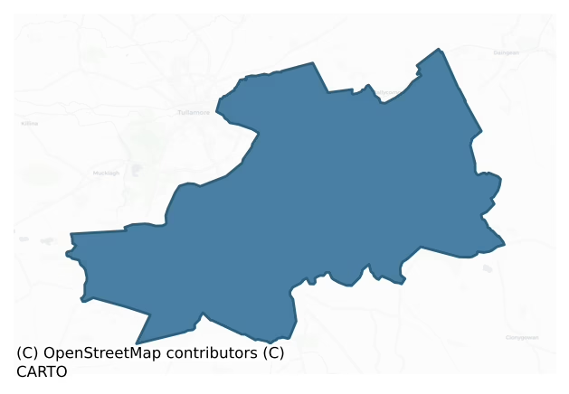
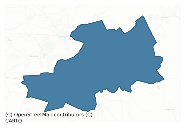
Geashill is a barony of County Offaly, in the historical province of Leinster (Irish: Géisill), covering 125 km² of land. The barony records 113 NMS archaeological sites and 67 NIAH listed buildings, placing it at around the 9th percentile among 280 ROI baronies for sites per km². This means it is in the bottom tenth of all baronies for sites per km². Dated archaeological evidence runs from the Early Bronze Age through to the Modern, spanning 7 of 9 archaeological periods, placing the barony in the 46th percentile among 280 ROI baronies for chronological depth. This means it is in the lower half of all baronies for chronological depth. The largest dated subset of recorded sites dates to the Iron Age.
Heritage at a glance
Percentile rankings throughout this profile compare each barony only against the other 279 Republic of Ireland baronies.
The recorded heritage of Geashill
The National Monuments Service Sites and Monuments Record (SMR) is the statutory inventory of archaeological sites for the Republic of Ireland, maintained by the Department of Tourism, Culture, Arts, Gaeltacht, Sport and Media. Sites recorded here include earthworks, ringforts, megalithic tombs, ecclesiastical remains, and post-medieval features; not every record is legally protected, but each is registered as a monument of archaeological interest.
The National Monuments Service records 113 archaeological sites in Geashill, putting it at the 9th percentile among 280 ROI baronies for sites per km². This means it is in the bottom tenth of all baronies for sites per km². A sparse recorded total of this kind in Ireland often reflects survey priority rather than genuine absence of past activity. Of these, 101 (89%) fall within a recorded monument protection zone. The record is dominated by defensive sites — ringforts, enclosures, hillforts, and stone forts (48 sites, 42% of the total), with ecclesiastical sites forming a substantial secondary presence (32 sites, 28%). The most diagnostically specific type is Ritual site – holy well (6 records, 5% of the barony's NMS total) — compared to an ROI average of 3% across all baronies where this type occurs. Ritual site – holy well is a well or spring traditionally associated with a saint, often credited with healing properties; many trace earlier ritual origins but devotion is documented from the medieval period onwards. The broader 'Enclosure' classification — which catches unclassified ringforts and field enclosures — accounts for a further 31 records (27%) and reflects the difficulty of sub-classifying degraded earthworks from surface evidence alone. Across the barony's 125 km², this gives a recorded density of 0.90 sites per km².
Most common monument types
Hover or tap a monument type to see its definition.
| Type | Count |
|---|---|
| Enclosure a banked or ditched feature of uncertain type, used as a catch-all where the original function cannot be determined from surface evidence | 31 |
| Ritual site – holy well a well or spring traditionally associated with a saint, often credited with healing properties; many trace earlier ritual origins but devotion is documented from the medieval period onwards | 6 |
| Graveslab a recumbent grave-marking slab, dated 1200–1700 AD | 6 |
| Bullaun stone a boulder or rock outcrop with hemispherical hollows ('bulláin'), commonly associated with ecclesiastical sites and holy wells | 5 |
| Church a building used for public Christian worship, of any date from c. 500 AD onwards | 5 |
| Graveyard a burial area associated with a church, in use from the medieval period onwards | 5 |
| Burial ground an area set apart for burial that is not associated with a church, in use from the medieval period onwards | 4 |
| Mound an artificial earthen elevation of unknown date and function that cannot be classified as another known monument type | 3 |
Chronological distribution
The dated archaeological record for Geashill spans from the Early Bronze Age through to the Modern, with activity attested across 7 of 9 archaeological periods. Every period from earliest to latest is represented in the record — an unbroken sequence of dated activity across the full chronological span. Activity concentrates most heavily in the Iron Age (36 sites, 43% of dated material), with the Early Medieval forming a secondary peak (22 sites, 26%). A further 29 recorded sites (26% of the overall NMS register for the barony) carry no period attribution — appearing as 'Unknown' in the bar chart below. This typically reflects either records that pre-date the standardised period vocabulary or sites awaiting specialist dating review, rather than a genuine absence of chronological evidence.
Sample of recorded monuments
Show 25 sample monuments (of 113 total)
A representative sample of 25 recorded monuments drawn from the barony’s 113 total NMS entries. Sites within a recorded monument protection zone and rarer site types are prioritised so the list shows a meaningful cross-section rather than only the most common type. Each entry shows the official Sites and Monuments Record reference number and the description published by the National Monuments Service.
Hut site
No surface remains visible at ground level. Possible hut site identified and described by the Offaly Historical and Archaeological Society in 1974 as, 'a circular platform curved on the edge of the hill. Used as a venue…
No surface remains visible at ground level. Possible hut site identified and described by the Offaly Historical and Archaeological Society in 1974 as, 'a circular platform curved on the edge of the hill. Used as a venue for Maypole dancing up to 1940s. There are traces of rectangular lines on the ground' (OHAS file 1974; SMR File). This circular platform appears to have been the result of quarrying for gravel extraction from the side of the hill for local road building purposes. Of doubtful antiquity.
The above description is derived from the published 'Archaeological Inventory of County Offaly' (Dublin: Stationery Office, 1997). In certain instances the entries have been revised and updated in the light of recent research.
Date of upload/revision: 28 December 2011
Earthwork
Earthwork which acted as a railway embankment for a railiway line of post-1700 AD date (OHAS file 1974).
The above description is derived from the published 'Archaeological Inventory of County Offaly' (Dublin:…
Earthwork which acted as a railway embankment for a railiway line of post-1700 AD date (OHAS file 1974).
The above description is derived from the published 'Archaeological Inventory of County Offaly' (Dublin: Stationery Office, 1997). In certain instances the entries have been revised and updated in the light of recent research.
Date of upload: 23 May 2011
Cross
This cross was removed by persons unknown several years ago. Described in 1974 as 'The cross now seems to be gone' (OHAS file 1974). According to the OS Letters of 1838-40 'There was formerly a stone cross near to the…
This cross was removed by persons unknown several years ago. Described in 1974 as 'The cross now seems to be gone' (OHAS file 1974). According to the OS Letters of 1838-40 'There was formerly a stone cross near to the stone [ninehole stone SMR OF017-018]; but the cross has been removed' (OS Field Name Books 1838-40, vol. 2).
The above description is derived from the published 'Archaeological Inventory of County Offaly' (Dublin: Stationery Office, 1997). In certain instances the entries have been revised and updated in the light of recent research.
Date of upload: 23 May 2011
Quarry
This quarry was identiifed and recorded in 1974 by the Offaly Historical and Archaeological Society. The site consists of a rectangular shaped platform enclosed by a wide flat bottomed fosse (Wth 1.3m; Int. D 0.50m)…
This quarry was identiifed and recorded in 1974 by the Offaly Historical and Archaeological Society. The site consists of a rectangular shaped platform enclosed by a wide flat bottomed fosse (Wth 1.3m; Int. D 0.50m) which itself is enclosed by and earthen and stone bank (H 1m; Wth 0.5m). Overall the site measures 22m E-W by 50m N-S, internal dimension of platform is impossible to attain due to dense overgrowth. This site is unusual in its size and its function and date are unknown. Described in 1974 as 'a quarrylike earthwork. It seems to have been formed when all the rocks in the area were extracted and smashed into small pieces and laid down as a support for nearby railway line' (OHAS file 1974). Post 1700 monument.
The above description is derived from the published 'Archaeological Inventory of County Offaly' (Dublin: Stationery Office, 1997). In certain instances the entries have been revised and updated in the light of recent research.
Date of upload/revision: 29 December 2011
Barrow – ring-barrow
On flat low-lying pasture with river nearby and extensive views in all directions. Low sub triangular shaped flat topped mound (H 0.3m; diam. 6m N-S; 5m E-W) with slight evidence of an enclosing fosse at N.
The above…
On flat low-lying pasture with river nearby and extensive views in all directions. Low sub triangular shaped flat topped mound (H 0.3m; diam. 6m N-S; 5m E-W) with slight evidence of an enclosing fosse at N.
The above description is derived from the published 'Archaeological Inventory of County Offaly' (Dublin: Stationery Office, 1997). In certain instances the entries have been revised and updated in the light of recent research.
Date of upload: 23 May 2011
Ritual site – holy tree/bush
No surface remains visible of any holy bush or tree in the vicinity of the medieval church (OF024-022001-).
The above description is derived from the published 'Archaeological Inventory of County Offaly' (Dublin:…
No surface remains visible of any holy bush or tree in the vicinity of the medieval church (OF024-022001-).
The above description is derived from the published 'Archaeological Inventory of County Offaly' (Dublin: Stationery Office, 1997). In certain instances the entries have been revised and updated in the light of recent research.
Date of upload: 23 May 2011
Moated site
Located just below the top of a hill with extensive views to the N, S and the E. Only half of this site survives with the E and S sides destroyed. From the surviving evidence it is possible to classify this site as a…
Located just below the top of a hill with extensive views to the N, S and the E. Only half of this site survives with the E and S sides destroyed. From the surviving evidence it is possible to classify this site as a moated site due to its rounded corners, wide flat bottomed water filled fosse and its square shape. The site consists of a raised platform (48m E-W; 41m N-S) enclosed by a wide fosse (Wth 3m; D 1.3m) with slight evidence of an external bank at Wand N. The fosse and platform have been badly damaged by cattle and this gives the fosse a very ragged edge. There is a field drain attached to the NE angle which may have acted as the water supply for the fosse which is presently filled with water.
The above description is derived from the published 'Archaeological Inventory of County Offaly' (Dublin: Stationery Office, 1997). In certain instances the entries have been revised and updated in the light of recent research.
Date of upload: 23 May 2011
Religious house – Franciscan friars
Associated with St. Sinchell who founded a monastery here in the sixth century. The church and convent marked on the OS 6-inch map are the same buildings which represent the remains of a large Franciscan Abbey formerly…
Associated with St. Sinchell who founded a monastery here in the sixth century. The church and convent marked on the OS 6-inch map are the same buildings which represent the remains of a large Franciscan Abbey formerly the site of an Augustinian Priory (OF025-017003-) which is today incorporated into a guest house (OF025-030—-) and a C of I church. The site has undergone many alterations as can be seen from the different stonework throughout the site which suggests that the abbey may originally have been a 12th-century Augustinian priory. The Abbey now consists of a main Church which is today used by the Church of Ireland as a place of worship which has been shortened on its E end. Evidence of a large E window probably of the triple light lancet type at the E end of the Abbey is now incorporated into the graveyard wall. From a drawing in 1896 the church had a central belfry tower and a S transept off the W end of the S wall of which today there are no remains. There is a barrel vaulted chapter house at the E end of the N wall of the Abbey with later doorway and mural stairways which gives access to the floor above chapter house with several musket loops visible on the E wall and possible garderobe chute in NE angle. The chapter house (int. dims. 12.2m E-W; 5.15m N-S; wall T 1.2m) has a cobblestone floor with 3 engaged columns of varying profiles on the N and S walls with a large partially destroyed round arched window in the E wall. The barrel vault along with the inner…
Religious house – Augustinian nuns
Associated with St. Sinchell who founded a monastery here in the sixth century. The church and convent marked on the OS 6-inch map are the same buildings which represent the remains of a large Franciscan Abbey formerly…
Associated with St. Sinchell who founded a monastery here in the sixth century. The church and convent marked on the OS 6-inch map are the same buildings which represent the remains of a large Franciscan Abbey formerly the site of an Augustinian Priory (OF025-017003-) which is today incorporated into a guest house (OF025-030—-) and a C of I church.
Site of Augustinian nunnery defined by well preserved large impressive earthwork consisting of two earthen banks with a deep wide flat bottomed intervening fosse which form an annexe to the main ecclesiastical enclosure on the SE side. No remains of any buildings within this annexe survives.
The above description is derived from the published 'Archaeological Inventory of County Offaly' (Dublin: Stationery Office, 1997). In certain instances the entries have been revised and updated in the light of recent research.
Date of upload: 23 May 2011
Religious house – Augustinian canons
Associated with St. Sinchell who founded a monastery here in the sixth century. The church and convent marked on the OS 6-inch map are the same buildings which represent the remains of a large Franciscan Abbey formerly…
Associated with St. Sinchell who founded a monastery here in the sixth century. The church and convent marked on the OS 6-inch map are the same buildings which represent the remains of a large Franciscan Abbey formerly the site of an Augustinian Priory (OF025-017003-) which is today incorporated into a guest house (OF025-030—-) and a C of I church.
Site of Augustinian priory founded in the 12th-century later occupied by late 14th-century Franciscan foundation (OF025-017—-) which would explain wide range of dates from the surviving architectural fragments.
Compiled by: Caimin O'Brien.
Date of upload: 23 May 2011
Souterrain
Local tradition of a tunnel beneath the abbey (O. Davies 1942, ITA Survey) in the vicinity of the Franciscan Friary which may have been confused with either a silted up box drain or mill race associated with the friary…
Local tradition of a tunnel beneath the abbey (O. Davies 1942, ITA Survey) in the vicinity of the Franciscan Friary which may have been confused with either a silted up box drain or mill race associated with the friary or drainage works associated with the friary (Byrne 1979, 15).
The above description is derived from the published 'Archaeological Inventory of County Offaly' (Dublin: Stationery Office, 1997). In certain instances the entries have been revised and updated in the light of recent research.
Date of upload: 23 May 2011
Stone head
Sculpture of a nun's head found at Killeigh in 1978, was in Offaly County Library but now unlocated.
The above description is derived from the published 'Archaeological Inventory of County Offaly' (Dublin: Stationery…
Sculpture of a nun's head found at Killeigh in 1978, was in Offaly County Library but now unlocated.
The above description is derived from the published 'Archaeological Inventory of County Offaly' (Dublin: Stationery Office, 1997). In certain instances the entries have been revised and updated in the light of recent research.
Date of upload: 23 May 2011
Castle – tower house
Situated at the NW end of a 19th-century house and appears to have been considerably altered by the occupiers of the house. The remains of the castle are situated on top of a motte-like earthwork (OF026-005002-) with…
Situated at the NW end of a 19th-century house and appears to have been considerably altered by the occupiers of the house. The remains of the castle are situated on top of a motte-like earthwork (OF026-005002-) with possible surrounding bawn wall which is visible at E angle. Only the W wall of this tower house (dims. c. 7.5m x 8m) remains with a later door inserted into the W gable. The Tower house survives three storeys high and is built with roughly coursed limestone boulders with slight base batter visible. 19th-century church located on site of medieval church (OF026-004001-) to SW of castle. Fireplace and chimney stack at SW angle with possible curtain tower at E angle of bawn (OF026-005003-). Attacked by the Irish confederate army in 1641 when it was occupied by Lettice, Lady Offaly (Fitzgerald 1918-22, 27-8). According to Leask (1918, 4) ground floor was vaulted. (Cooke 1875, 43: O' Flanagan 1933, vol. 1, 53-6)
Testing was carried out under licence no. 04E0076 as part of the planning schedule for a housing development adjacent to a tower-house (SMR 26:5(01)). A series of trenches were excavated by mechanical digger at the house sites, roadways and ancillary works. No features or finds of archaeological significance were revealed.
John Purcell, 17 Balmoral Terrace, Dillon's Cross, Cork.
The above description is derived from the published 'Archaeological Inventory of County Offaly' (Dublin: Stationery Office, 1997). In certain instances the entries have been r…
Bawn
Situated at the NW end of a 19th-century house and appears to have been considerably altered by the occupiers of the house. The remains of the castle are situated on top of a motte-like earthwork (OF026-005002-) with…
Situated at the NW end of a 19th-century house and appears to have been considerably altered by the occupiers of the house. The remains of the castle are situated on top of a motte-like earthwork (OF026-005002-) with possible surrounding bawn wall which is visible at E angle. Only the W wall of this Tower house (OF026-005001-) remains with a later door inserted into the W gable. The Tower house survives three storeys high and is built with roughly coursed limestone boulders with slight base batter visible. 19th-century church located on site of medieval church (OF026-004001-) to SW of castle. Fireplace and chimney stack at SW angle with possible curtain tower at E angle of bawn. Attacked by the Irish confederate army in 1641 when it was occupied by Lettice, Lady Offaly (Fitzgerald 1918-22, 27-8). According to Leask (1918, 4) ground floor was vaulted. (Cooke 1875, 43: O' Flanagan 1933, vol. 1, 53-6)
The above description is derived from the published 'Archaeological Inventory of County Offaly' (Dublin: Stationery Office, 1997). In certain instances the entries have been revised and updated in the light of recent research.
Date of upload: 23 May 2011
Stone sculpture
The Church of Ireland church (OF025-017001-) houses a boldly sculpted angel holding a shield, the sinister side of which is impaled with a double fleur-de-lis (Fitzpatrick and O'Brien 1998, 97).
Compiled by: Caimin…
The Church of Ireland church (OF025-017001-) houses a boldly sculpted angel holding a shield, the sinister side of which is impaled with a double fleur-de-lis (Fitzpatrick and O'Brien 1998, 97).
Compiled by: Caimin O'Brien.
Date of upload: 23 May 2011
Children's burial ground
Situated on a slight rise in an area of undulating countryside with good views. Poorly preserved ruins of a rectangular church (OF024-022001-). Bullaun stone (OF024-022002-) located at W end of church. No surface trace…
Situated on a slight rise in an area of undulating countryside with good views. Poorly preserved ruins of a rectangular church (OF024-022001-). Bullaun stone (OF024-022002-) located at W end of church. No surface trace of earthworks (OF024-022003-) depicted on OS 6-inch map to E and S of church. According to Comerford (1883, 196-7) there was a burial ground (OF024-022005-) located here which was abandoned in the mid-19th-century and was used subsequently as a burial place for unbaptised children with castle (OF024-055) located nearby. No surface trace of any burial ground or castle survives.
Compiled by: Caimin O'Brien.
Date of upload: 23 May 2011
Crannog
Situated on wet poorly drained bogland. Outline of circular shaped tree-planted area (approx. diam. 60m) at W end of coniferous tree plantation visible on Digital Globe aerial photograph taken 20/03/2019. Circular…
Situated on wet poorly drained bogland. Outline of circular shaped tree-planted area (approx. diam. 60m) at W end of coniferous tree plantation visible on Digital Globe aerial photograph taken 20/03/2019. Circular grove of trees standing on bogland to the W of Derrynaslingue wood depicted on revised ed. OS 6-inch map.
See attached image of Google Earth photograph taken 18/01/2019
Compiled by: Caimin O'Brien based on details provided by Ed O'Donovan
Date of upload: 09 April 2019
Barrow – ditch barrow
Cropmark of ring-ditch (diam. c. 5m) Google Earth photograph taken 18/01/2019.
See attached Google Earth orthoimages
Compiled by: Caimin O'Brien based on details provided by Jean-Charles Caillère
Date of…
Cropmark of ring-ditch (diam. c. 5m) Google Earth photograph taken 18/01/2019.
See attached Google Earth orthoimages
Compiled by: Caimin O'Brien based on details provided by Jean-Charles Caillère
Date of upload: 14 January 2022
Structure – peatland
Possible peatland structure identified by Eoin and Barbara Sullivan in worked peatland bog which was described as follows; 'visible in section of freshly dug drain (dug in late April/ early May 2023). Worked wood…
Possible peatland structure identified by Eoin and Barbara Sullivan in worked peatland bog which was described as follows; 'visible in section of freshly dug drain (dug in late April/ early May 2023). Worked wood exposed and visible in lower part of section of a newly dug drain between two plots. A surface find of a 10th/11th century leather shoe was made at ITM 643522 719250 (retrieved by Barbara Sullivan April 2023 and identified and recorded by John Nicholl; shoe is in possession of NMI from 9/5/2023). Drain was dug after the shoe was located and retrieved, so unassociated. Active peat cutting area, turf bank on the plot being prepared by new drainage channels. Bucket of machine left on site. Recent widening and deepening of an existing bog drain led to the identification of a pronounced area of marl at the base of the drain. The site consists of a spread of what appears to be tree roots and branches, measuring c. 45m in length and located c.1m below the present level of the bog. There are two possible wooden uprights visible in the exposed bank face and probable shaped timbers at the base. The deposited mechanically excavated material, that was dumped on the western side of the drain, was found to contain one small piece of split oak and a possible piece of charred oak. A large piece of oak was located on the surface of the mound of excavated material is oak and measured c.1m in length and was split oak. It is probable that this is a circular shaped site extendi…
Ringfort – unclassified
No surface remains visible. Possible ringfort site identified and described in 1974 by the Offaly Historical and Archaeological Society as 'small rath' consisting of an 'earthwork almost entirely erased' (OHAS file…
No surface remains visible. Possible ringfort site identified and described in 1974 by the Offaly Historical and Archaeological Society as 'small rath' consisting of an 'earthwork almost entirely erased' (OHAS file 1974). Of doubtful antiquity.
The above description is derived from the published 'Archaeological Inventory of County Offaly' (Dublin: Stationery Office, 1997). In certain instances the entries have been revised and updated in the light of recent research.
Date of upload/revision: 28 December 2011
Castle – motte
Oval-shaped flat-topped mound (max H 3.50m, max W at top N-S c. 20m, 14mE-W, max basal dims N-S c. 31m, E-W c. 25m) situated in low lying area in N sector of graveyard and delimited by a wide shallow fosse. Steep sided…
Oval-shaped flat-topped mound (max H 3.50m, max W at top N-S c. 20m, 14mE-W, max basal dims N-S c. 31m, E-W c. 25m) situated in low lying area in N sector of graveyard and delimited by a wide shallow fosse. Steep sided at N and quarried at W side. Possible motte.
Poorly preserved low square shaped motte (H 3.5m; top diam 14 – 20m; base diam 30m) located in the N sector of Annagharvey graveyard (OF018-017001-) enclosed by a wide flat bottomed fosse with no evidence of a bailey.
The above description is derived from the published 'Archaeological Inventory of County Offaly' (Dublin: Stationery Office, 1997). In certain instances the entries have been revised and updated in the light of recent research.
Date of upload: 23 May 2011
Castle – unclassified
All that remains of this site is a raised square shaped platform (Dims. 9m E-W by 10m N-S). A curious ridge runs off the Eastern side of the platform, this ridge measures 2.5m wide and may have been the original roadway…
All that remains of this site is a raised square shaped platform (Dims. 9m E-W by 10m N-S). A curious ridge runs off the Eastern side of the platform, this ridge measures 2.5m wide and may have been the original roadway to the castle. There is no evidence of cut or decorated stone and no evidence of a bawn wall although this may have been located to the east of the castle where the modern orchard is located. The outhouses to the east of the castle displayed no evidence of worked stone from the castle in their walls (O' Flanagan 1933, vol. 1, 74-5).
The above description is derived from the published 'Archaeological Inventory of County Offaly' (Dublin: Stationery Office, 1997). In certain instances the entries have been revised and updated in the light of recent research.
Date of upload: 23 May 2011
Ringfort – rath
Described by O. Davies in 1942 as a rath situated 'on limestone with generally good pasture. Restricted view. No fosse. The bank is 2 feet feet high outside and level inside. Centre level. Rath circ. 15 yds.'
The…
Described by O. Davies in 1942 as a rath situated 'on limestone with generally good pasture. Restricted view. No fosse. The bank is 2 feet feet high outside and level inside. Centre level. Rath circ. 15 yds.'
The above description is derived from the published 'Archaeological Inventory of County Offaly' (Dublin: Stationery Office, 1997). In certain instances the entries have been revised and updated in the light of recent research.
Date of upload: 23 May 2011
Ecclesiastical enclosure
Associated with St. Sinchell who founded a monastery here in the sixth century. The church and convent marked on the OS 6-inch map are the same buildings which represent the remains of a large Franciscan Abbey formerly…
Associated with St. Sinchell who founded a monastery here in the sixth century. The church and convent marked on the OS 6-inch map are the same buildings which represent the remains of a large Franciscan Abbey formerly the site of an Augustinian Priory (OF025-017003-) which is today incorporated into a guest house (OF025-030—-) and a C of I church. To the SW are the remains of an earthwork marked on the OS 6-inch map as 'Entrenchment' which may represent a medieval fortification of the site (1550 Survey) or perhaps the remains of an Early Christian enclosure (OF025-017011). The earthwork consists of two earthen banks with intervening wide flat bottomed fosse similar to the earthworks enclosing the Abbey at Seir Kieran (OF039-003—-).
In 1991 four trial trenches in an area to the N of the Fair Green on the N side of the main road (NGR 236764/218313) through the village of Killeigh were opened by Helen Keogh for ADS Ltd, but nothing of archaeological interest was noted in any of them, any disturbance noted being of modern date.
In 1995 pre-development testing at the site of a proposed dwelling house extension was undertaken in January 1995 by Dominic Delany under licence no. 95E15. The site is located on the north side of the village fairgreen (NGR 236721/218328) about 150m north-east of the present Protestant church, which incorporates fragmentary remains of a 12th-century Augustinian abbey. No archaeological deposits or features were noted.
Archaeological tes…
Enclosure
No surface remains of any enclosure indicated from GSI aerial photographs (GSI N 181/80) taken in 1973.
The above description is derived from the published 'Archaeological Inventory of County Offaly' (Dublin:…
No surface remains of any enclosure indicated from GSI aerial photographs (GSI N 181/80) taken in 1973.
The above description is derived from the published 'Archaeological Inventory of County Offaly' (Dublin: Stationery Office, 1997). In certain instances the entries have been revised and updated in the light of recent research.
Date of upload: 23 May 2011
Listed buildings
The National Inventory of Architectural Heritage (NIAH) is a state survey appraising buildings of architectural, historical, archaeological, artistic, cultural, scientific, social, or technical interest. Each surveyed structure receives a rating from International (the highest, for buildings of European importance) through National, Regional, Local, and Record-Only.
The NIAH records 67 listed buildings in Geashill (36th percentile across ROI baronies). The highest-graded structure include 1 of National significance. The Republic holds 937 National-graded buildings in total, so this barony accounts for around 0% of the national total. Construction dates concentrate most heavily in the Victorian (1830-1900) period. The most-recorded building type is house (19 examples, 28% of the listed stock).
Terrain and environment
Mean elevation across the barony is 81m — the 41st percentile among 280 ROI baronies for elevation. This means it is in the lower half of all baronies for elevation. Elevation matters for heritage because higher-altitude baronies typically favour defensive monuments — ringforts and hilltop forts placed on prominent ground — while lowland baronies are more likely to carry the dense settlement and church networks of intensive agricultural landscapes. Mean slope is 2.0° — the 8th percentile among 280 ROI baronies for slope. This means it is in the bottom tenth of all baronies for slope. This is broadly flat terrain, the kind of landscape best suited to intensive agriculture. Slope is a key control on both land use and archaeological preservation: steep ground resists ploughing and tends to preserve earthworks intact, while gentle slopes favour intensive cultivation that damages or destroys surface archaeology over time. The Topographic Wetness Index averages 11.8, the 93rd percentile among 280 ROI baronies for wetness. This means it is in the top tenth of all baronies for wetness. This is wet, slow-draining ground by ROI standards — the kind of landscape that may carry waterlogged archaeological sites of unusual preservation value. Drainage matters for heritage because poorly-drained ground preserves organic archaeology (wooden trackways, leather, textiles, and on rare occasions human remains) far better than free-draining soil; well-drained ground favours arable use but destroys organic material rapidly. The land-cover mosaic combines improved grassland (73%), woodland (13%), and arable farmland (13%), giving a mixed agricultural and semi-natural landscape.
Terrain measurements
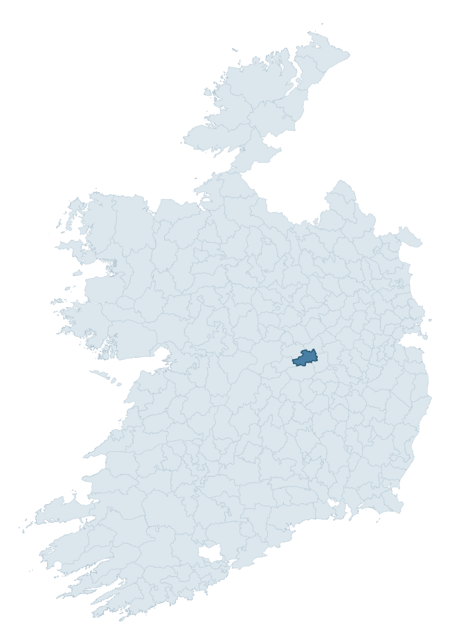
Where this barony sits in the Republic of Ireland
Geology and preservation
Bedrock geology shapes the landscape long before any settlement begins — controlling soil drainage, agricultural potential, the survival of upstanding monuments, and the preservation of buried archaeology. The figures below come from the Geological Survey Ireland 1:100,000 bedrock map.
The bedrock underlying Geashill is predominantly limestone (100% of the barony by area), laid down during the Carboniferous period (100% by area, around 359 to 299 million years ago). Limestone is the most heritage-rich bedrock in Ireland. It supports fertile, well-drained soils that favoured dense Early Medieval settlement and Norman manorial agriculture, and it weathers into karst features — sinkholes, caves, swallow holes, and souterrains — that frequently carry archaeology. Where peat overlies limestone, organic preservation can be exceptional. The single largest mapped unit is the Lucan Formation (88% of the barony's bedrock). With only 1 distinct rock type mapped, the barony is geologically uniform compared to the rest of the Republic (4th percentile for diversity) — a single coherent bedrock landscape.
Largest mapped unit: Lucan Formation (88% of the barony)
Placename evidence
Logainm records 9 heritage-diagnostic placenames for Geashill, a modest sample drawn predominantly from the townland record. The dominant stratum is early christian ecclesiastical. The most frequent diagnostic roots are cill- (4) and ráth- (1). With a sample of this size the count should be treated as indicative rather than definitive.
Pre-Christian / Early Medieval Defensive
| Root | Count | Meaning |
|---|---|---|
| ráth- | 1 | earthen ringfort |
Early Christian Ecclesiastical
| Root | Count | Meaning |
|---|---|---|
| cill- | 4 | church (early) |
| tobar- | 1 | holy well |
| cillín- | 1 | unconsecrated burial ground |
| gráinseach- | 1 | monastic farm / grange |
Other baronies in Offaly
About this profile
Click any section below to expand.
What is a barony?
A barony is a historic administrative unit in Ireland, broadly equivalent to an English hundred. The 280 baronies used here are from the OSi 2019 National Statutory Boundaries (generalised 20m), covering the 26 counties of the Republic of Ireland. Baronies derive from the Norman period, were formalised in the 17th century, and have not been redrawn for statistical purposes. They vary enormously in area, from compact urban baronies in Dublin to vast upland baronies in Connacht, and should not be compared by raw site count without accounting for area differences.
What counts as a site?
This profile combines three distinct heritage registers, each with its own definition of what constitutes a recordable site:
- Archaeological sites (NMS). The National Monuments Service Sites and Monuments Record (SMR) catalogues every known archaeological monument or site of archaeological interest in the Republic, from prehistoric burial mounds and ringforts to medieval churches and post-medieval defensive works. Inclusion does not require legal protection — only that the site has been identified, surveyed, and assessed as having archaeological value. A separate subset of these sites lies within a recorded protection zone, which gives them statutory protection under the National Monuments Acts.
- Listed buildings (NIAH). The National Inventory of Architectural Heritage records buildings of architectural, historical, archaeological, artistic, cultural, scientific, social, or technical interest. Each surveyed structure is appraised on a five-tier scale: International, National, Regional, Local, and Record-Only. The NIAH appraisal is informational rather than strictly statutory, but it underpins local-authority Record of Protected Structures (RPS) listings.
- Heritage placenames (Logainm). Logainm is the authoritative database of Irish placenames maintained by the Placenames Branch. This profile applies a heritage-diagnostic classifier to the Irish-language form of each townland name, flagging roots that signal defensive sites (ráth-, lios-, dún-, caiseal-, cathair-), ecclesiastical foundations (cill-, teampall-, domhnach-, mainistir-), prehistoric burial-ritual features (tuaim-, carn-, leaba-), or Norse-contact settlement (gall-). Townlands without one of these diagnostic roots are not flagged here — they may still carry historical significance, but that significance is not encoded in the name itself.
Editorial principles
The narrative sections of this profile follow several explicit principles:
- Evidential. Every claim about this barony’s heritage character is anchored in the underlying register data. Where a site count, a placename count, or a percentile rank is cited, it is computed from the source datasets at export time, not estimated.
- Comparative. Counts and metrics are reported alongside their percentile rank against the other 279 ROI baronies. A barony with 50 ringforts in absolute terms could be unusually high or unusually low depending on its size and regional context; percentile ranking removes that ambiguity.
- Transparent on limits. Where a register has known coverage gaps, survey biases, or data-quality issues that affect this barony’s figures, the profile flags them rather than presenting the numbers as definitive.
- No interpretation beyond what the data supports. The narrative does not speculate about historical events, social dynamics, or cultural meaning beyond what the recorded heritage and placename evidence directly attests.
Data caveats and limits
- NMS Sites and Monuments Record is the product of survey campaigns conducted at different intensities across different counties and decades. Some baronies have been surveyed more thoroughly than others, and absolute counts should be read in that light. Sites destroyed by development before survey are typically not represented; sites in heavily forested or upland terrain are sometimes under-recorded.
- NIAH coverage is broadly complete for the Republic of Ireland but the survey was conducted on a rolling county-by-county basis, and the most recent appraisal date varies. Buildings demolished or substantially altered after their original survey may still appear in the register; conversely, recent buildings of merit may not yet have been appraised.
- Logainm classification applies a deliberately conservative pattern-matching approach to the Irish-language townland forms. The classifier prioritises true positives over recall: a townland may carry a heritage signal that the classifier doesn’t recognise, particularly where the diagnostic root has been heavily anglicised or where the townland name draws on a less common term. The 60,000+ townland records and ~9,800 classified placenames give a substantial signal at barony scale, but individual townland names should be checked against Logainm directly for definitive interpretation.
- Period attribution. The chronological distribution reflects only those NMS sites that carry a recognised period attribution in the source data. Sites listed as “Unknown” period are excluded from the dated subset.
- Boundary changes. Some baronies have undergone minor boundary adjustments since their 19th-century definition; the OSi 2019 generalised boundaries used here are the current statutory definition and may differ slightly from historical maps in border areas.
- Bedrock geology is mapped at 1:100,000 scale, which means local variation within a barony — small pockets of different rock type, mineral veins, alluvium overlying bedrock — is generalised. The dominant-system and rocktype figures are area-weighted, so a barony reading “70% Carboniferous limestone” may still contain small but archaeologically important pockets of older or younger rock. Around 3% of GSI polygons do not match the lexicon and contribute no rocktype or system attribution.
Data sources
- National Monuments Service — Sites and Monuments Record (SMR) https://data.gov.ie/dataset/national-monuments-service-archaeological-survey-of-ireland
- National Inventory of Architectural Heritage (NIAH) https://data.gov.ie/dataset/national-inventory-of-architectural-heritage-niah-national-dataset
- Logainm — Placenames Database of Ireland https://www.logainm.ie/
- Ordnance Survey Ireland — National Statutory Barony Boundaries 2019 https://data-osi.opendata.arcgis.com/
- EURODEM — European Digital Elevation Model https://www.mapsforeurope.org/datasets/euro-dem
- ESA WorldCover https://esa-worldcover.org/en
- Geological Survey Ireland — 1:100,000 Bedrock Geology https://www.gsi.ie/en-ie/data-and-maps/Pages/Bedrock.aspx
Explore more: Search any of the 280 ROI baronies, browse by historical province, or read the methodology and data sources for the full Republic of Ireland Heritage Tool.