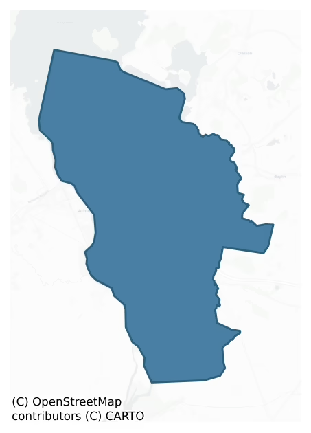
Brawny is a barony of County Westmeath, in the historical province of Leinster (Irish: Breámhaine), covering 46.4 km² of land. The barony records 59 NMS archaeological sites and 100 NIAH listed buildings, placing it at around the 22nd percentile among 280 ROI baronies for sites per km². This means it is in the bottom third of all baronies for sites per km². Dated archaeological evidence runs from the Early Bronze Age through to the Medieval, spanning 4 of 9 archaeological periods, placing the barony in the 3rd percentile among 280 ROI baronies for chronological depth. This means it is in the bottom tenth of all baronies for chronological depth. The largest dated subset of recorded sites dates to the Early Medieval.
Heritage at a glance
Percentile rankings throughout this profile compare each barony only against the other 279 Republic of Ireland baronies.
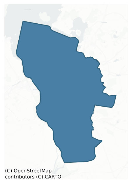
The recorded heritage of Brawny
The National Monuments Service Sites and Monuments Record (SMR) is the statutory inventory of archaeological sites for the Republic of Ireland, maintained by the Department of Tourism, Culture, Arts, Gaeltacht, Sport and Media. Sites recorded here include earthworks, ringforts, megalithic tombs, ecclesiastical remains, and post-medieval features; not every record is legally protected, but each is registered as a monument of archaeological interest.
The National Monuments Service records 59 archaeological sites in Brawny, putting it at the 22nd percentile among 280 ROI baronies for sites per km². This means it is in the bottom third of all baronies for sites per km². Protection coverage is near-universal — 56 sites (95%) fall within a recorded monument protection zone, indicating an extensively surveyed landscape. The record is dominated by defensive sites — ringforts, enclosures, hillforts, and stone forts (15 sites, 25% of the total), with ecclesiastical sites forming a substantial secondary presence (13 sites, 22%). Ringfort – rath is the most prevalent type, making up 12% of the barony's recorded sites (7 records) — below the ROI average of 20% across all baronies where this type occurs. Ringfort – rath is an earthen ringfort enclosed by a bank and external ditch — the most common Early Medieval farmstead, broadly dated 500–1000 AD. Other significant types include Cross-slab (4) and House – 17th century (3). Cross-slab is a stone slab inscribed with a cross, used as a grave-marker or memorial, dated pre-1200 AD; House – 17th century is a habitation building dated to the 17th century AD. Across the barony's 46.4 km², this gives a recorded density of 1.27 sites per km².
Most common monument types
Hover or tap a monument type to see its definition.
| Type | Count |
|---|---|
| Ringfort – rath an earthen ringfort enclosed by a bank and external ditch — the most common Early Medieval farmstead, broadly dated 500–1000 AD | 7 |
| Cross-slab a stone slab inscribed with a cross, used as a grave-marker or memorial, dated pre-1200 AD | 4 |
| House – 17th century a habitation building dated to the 17th century AD | 3 |
| Earthwork an unclassified earthen structure with no diagnostic features that allow a more specific classification | 3 |
| Castle – unclassified a castle whose form cannot be precisely classified, dating somewhere between the late 12th and 16th centuries | 2 |
| Castle – tower house a fortified residential tower of four or five storeys, mostly built by lords in the 15th and 16th centuries and often within a defended bawn | 2 |
| Church a building used for public Christian worship, of any date from c. 500 AD onwards | 2 |
Chronological distribution
The dated archaeological record for Brawny spans from the Early Bronze Age through to the Medieval, with activity attested across 4 of 9 archaeological periods. This is the 3rd percentile across ROI baronies — a relatively narrow chronological band, with much of Irish prehistory not represented in the dated record. The record is near-continuous, with only the Middle Late Bronze Age period falling inside the span without any recorded sites. Activity concentrates most heavily in the Early Medieval (24 sites, 57% of dated material), with the Medieval forming a secondary peak (10 sites, 24%). A further 17 recorded sites (29% of the overall NMS register for the barony) carry no period attribution — appearing as 'Unknown' in the bar chart below. This typically reflects either records that pre-date the standardised period vocabulary or sites awaiting specialist dating review, rather than a genuine absence of chronological evidence.
Sample of recorded monuments
Show 25 sample monuments (of 59 total)
A representative sample of 25 recorded monuments drawn from the barony’s 59 total NMS entries. Sites within a recorded monument protection zone and rarer site types are prioritised so the list shows a meaningful cross-section rather than only the most common type. Each entry shows the official Sites and Monuments Record reference number and the description published by the National Monuments Service.
Standing stone – pair
Sited on top of a natural pointed hillock (which appears to be scarped slightly at its base) are two large limestone slabs/boulders (E stone L. 3.8m x 1.25m; W stone L. 3.1m x 1.7m). One lies flat and the on the E side…
Sited on top of a natural pointed hillock (which appears to be scarped slightly at its base) are two large limestone slabs/boulders (E stone L. 3.8m x 1.25m; W stone L. 3.1m x 1.7m). One lies flat and the on the E side is on its edge but is tilted westwards towards the W slab/stone. The top of the hillcok has a small circular flat shape. There is a quarry on the SE siude of the hillock and a fairly gentle slope to the hillock at the W and N. Known locally as the 'Druid's Altar' (English, N. W. JOAS, 1, 1969, 4).
Rabbit warren
Situated at the end of a low rise, with good views of the surrounding countryside. Annotated Depicted ‘Rabbit Burrow’ on the 1837 OS 6-inch map and depicted as a large circular-shaped shaded area delimited by a…
Situated at the end of a low rise, with good views of the surrounding countryside. Annotated Depicted ‘Rabbit Burrow’ on the 1837 OS 6-inch map and depicted as a large circular-shaped shaded area delimited by a perforated line. Monument described in 1973 as no surface remains visible. No surface remains visible today of rabbit Burrow on Digital Globe aerial photography.
Compiled by Alison McQueen, Vera Rahilly and Caimin O’Brien.
Date of upload: 06 November 2019
Market-house
The medieval market place of the east town of Athone was located in the area now known as Custume Place. Around 1586-7 a timber market house was constructed in the market place. In 1703 a 'three-storey high arcaded…
The medieval market place of the east town of Athone was located in the area now known as Custume Place. Around 1586-7 a timber market house was constructed in the market place. In 1703 a 'three-storey high arcaded stone tholsel and market house, with tower surmounted by a cross' was built in the market place replacing the old market house (Murtagh 1994, 12). In 1837 the Tholsel was demolished. Today there are no surface remains visible of the Tholsel or of the earlier market house in Custume Place. The location of the Tholsel is depicted on Thomas Sheppard's map of Athlone dating from 1784 (Murtagh 1994, 12). In 1578, a 21 year lease was granted to Edmund O'Fallon a merchant of Athlone, which included ‘a castle in Athlone called the east gate [Dublin Gate], near the church yard of the parish church [WM029-042021-], and a parcel of land adjoining the said castle, lying in breadth from the east towards the market place of the town 60 feet [18m], and in length towards the Shynnyn 200 feet [61m]’ (Nicholls 1994, 467). In the same year there is another reference to the location of this market place in a lease to Henry Brande which included 'Two tenements in Athelone, in co. Westmeath, in the tenure of Rob. Damporte, near the castle or gate called the north gate, by the house of the friars [WM029-042042-], containing in breadth 106 feet [32m], and from the street towards the town wall in length 160 feet [49m], and a castle or gatehouse in the north part of the said town…
Town defences
The following description of the town defences is mainly taken from the Urban Survey of Co. Westmeath (Bradley et. al. 1985, 37-41) with additional material from the Athlone Town Walls Conservation Plan 2005. In 1251…
The following description of the town defences is mainly taken from the Urban Survey of Co. Westmeath (Bradley et. al. 1985, 37-41) with additional material from the Athlone Town Walls Conservation Plan 2005. In 1251 the King of England ordered the payment of ‘80 marks of the K.’s money in aid of the inclosure of the K.’s vills (WM029-042—-) of Adlon [Athlone] and Rendun [Rindown, Co. Roscommon], and repair of their castles (WM029-042002-) (Cal. doc. Ire., 469). It is not clear however whether this money was applied to the Leinster or Connacht side or to both. Further information on the walls is lacking until the late sixteenth century by which time the walls had probably fallen into considerable disrepair. Proposals to rebuild the wall were made by Sir Nicholas Malby in 1576 but these appear to have remained in the draft stage. Some work however was carried out on the defences at this time, particularly on the E and N gates. Extensive rebuilding of the wall may been completed 1619 when the walls of the Leinster town were reconstructed as part of Wilmot's rebuilding scheme for the town. The walls may have been completed by 1619 for in this year a land grant to Robert Dillon included 'a house and garden, lately Tho. Wolfe’s and Shane Bragan’s, and the parcel of Clonen, 2a, near the town wall' (Cal. pat. rolls Ire., Jas I, 421) and also 'a garden near the N. wall, lately Mich. Pickering’s; all in Athlone' (ibid.). The state papers of Charles I records the role Lord…
Boundary stone
This fragment most likely belongs to the eighteenth century bridge. Now inserted into the porch wall of St. Mary's Parish Church (WM029-042021-). It has an incised line showing the border between County Westmeath and…
This fragment most likely belongs to the eighteenth century bridge. Now inserted into the porch wall of St. Mary's Parish Church (WM029-042021-). It has an incised line showing the border between County Westmeath and County Roscommon (Bradley et. al. 1985, 34).
Compiled by: Caimin O'Brien
Date of upload/revision 15 October 2010
Ritual site – holy well
Situated in a complex of buildings, on Brideswell Street, on the SE side of Athlone town. Annotated ‘Brides Well’ on the 1837 OS 6-inch map and the revised 1910 ed. OS 25-inch map where it is depicted as a circular…
Situated in a complex of buildings, on Brideswell Street, on the SE side of Athlone town. Annotated ‘Brides Well’ on the 1837 OS 6-inch map and the revised 1910 ed. OS 25-inch map where it is depicted as a circular feature. Well described in 1982 as no surface remains visible. The area where it is indicated on OS mapping is occupied by a small garage. A small stream lies c. 20m to SW and the land beyond to S is marshy. Monument is not visible today on Digital Globe aerial photography.
Compiled by Alison McQueen, Vera Rahilly and Caimin O’Brien.
Date of upload: 07 November 2019
Military camp
Situated in a low-lying area, now occupied by a housing estate, on the E side of Athlone town. Depicted on the 1837 ed. OS 6-inch map as a small oval-shaped pond, known locally as the ‘The Doctor’s Pool’. Depicted on…
Situated in a low-lying area, now occupied by a housing estate, on the E side of Athlone town. Depicted on the 1837 ed. OS 6-inch map as a small oval-shaped pond, known locally as the ‘The Doctor’s Pool’. Depicted on the revised 1910 ed. OS 25-inch map as a perfectly circular-shaped feature. Area named ‘Cannonsfield’ on the revised 1953 OS 6-inch map. According to Murtagh (1970, 84, 87), the Williamites arrived in Athlone on 17 July 1690 and established a military camp about a quarter of a mile from the town. Strong local tradition confirms that the encampment was at a pond called ‘The Doctor’s Pool’ where the troops washed their clothes and tended their wounds. Burials of soldiers killed in the siege were interred in the immediate vicinity of the pond. It is possible that the locality was similarly utilised during the second siege in 1691. Monument is described in 1983 as a natural depression which is currently dried out, yet is likely to be waterlogged in winter. Pond is not visible today on Digital Globe aerial photography as the area is occupied by a modern housing estate.
Compiled by Alison McQueen, Vera Rahilly and Caimin O’Brien.
Date of upload: 07 November 2019
House – fortified house
Garrycastle also known as Caislean Barrcha or Carrick Castle as annotated on the 1654-7 Down Survey map of Brawny barony (Hib. Reg.). The terrier of this map recorded that in 1640 this castle stood on unforfeited lands…
Garrycastle also known as Caislean Barrcha or Carrick Castle as annotated on the 1654-7 Down Survey map of Brawny barony (Hib. Reg.). The terrier of this map recorded that in 1640 this castle stood on unforfeited lands belonging to Barnaby O'Bryan, who is listed as a Protestant landowner (NLI, MS 723-4). Castle situated on a slight rise, overlooking stream immediately to N, on the E edge of Athlone town. Depicted on the 1837 ed. OS 6-inch map as a rectangular-shaped building with its long axis aligned NE-SW, annotated ‘Garrycastle’. A second L-shaped building annotated 'Garrycastle Old Ho.' is shown standing 70m to SW. No surface remains survive of this building annotated 'Garrycastle Old Ho.'. This latter site was archaeologically tested in 2001. On the revised 1910 ed. OS 25-inch map the NW side wall of the castle is no longer upstanding and the other three walls of the castle are shown intact. In 1837 the Ordnance Survey Letters recorded the tradition that the castles of Coosan (WM029-001—-) and Garrycastle were built by the O'Breen's [O'Bryan] (OSL vol. 1, 67). According to N.W. English (1968), these are the ruins of a fortified house reputed to be the residence of the Galborne family constructed during the period 1660-1700. Pinkman (1945, 42, 45) recorded that the medieval castle at Garrycastle consisted of a 'site and some remains' which are still pointed out. It is possible that there was a medieval Gaelic castle located on or close to the site of the 17…
Barrow – bowl-barrow
Situated on a low rise, on a NW-facing slope, in low-lying wet pasture, overlooking a stream c. 45m to NW. A castle site (WM029-034—-) lies c. 40m to E. Depicted on the revised 1910 ed. OS 25-inch map as a small…
Situated on a low rise, on a NW-facing slope, in low-lying wet pasture, overlooking a stream c. 45m to NW. A castle site (WM029-034—-) lies c. 40m to E. Depicted on the revised 1910 ed. OS 25-inch map as a small oval-shaped earthwork (approx. dims. 10m NE-SW; 8m NW-SE). Monument described in 1973 as a small, roughly circular-shaped mound of earth and stone the base of which is enclosed by traces of a fosse which is best preserved from SE-S-SW. The top of the mound is gently rounded. There are the remains of a square-shaped building (dims. 4m x 4m) at S which is defined by stone walls (H 2m) that are best preserved to S and W. Only the base of the N and E walls survive. Monument is visible today as a roughly oval-shaped tree-planted earthwork on Digital Globe aerial photography.
Compiled by Alison McQueen, Vera Rahilly and Caimin O’Brien.
Date of upload: 07 November 2019
Barrow – mound barrow
Situated at N end of natural ridge in undulating pasture with good views in all directions. High oval-shaped flat-topped mound (top dims. 7.8m x 6.28m; base diam. c. 31m NE-SW x 24m NW-SE) of earth and stones with no…
Situated at N end of natural ridge in undulating pasture with good views in all directions. High oval-shaped flat-topped mound (top dims. 7.8m x 6.28m; base diam. c. 31m NE-SW x 24m NW-SE) of earth and stones with no evidence of an enclosing fosse or any other feature associated with the mound. The sides of the mound are quite steep on W, N and E sides. The NE side of the mound has been damaged by quarrying and there are some thorn bushes growing on the monument at this location. Possible mound barrow classification as it would appear to be too small to classify as a small motte (SMR File 06/06/1985). Mound barrow placed on the Register of Historic Monuments on the 18/06/1986.
Compiled by: Caimin O’Brien
Date of upload: 20 July 2015
Road – class 3 togher
The site is orientated E-W and consists of a narrow walkway (L 770m; Wth 0.4m; D 0.09m) of between two and four longitudinal roundwoods (av. diam 0.056m) of ash and alder. At one sighting, a peg was evident in section…
The site is orientated E-W and consists of a narrow walkway (L 770m; Wth 0.4m; D 0.09m) of between two and four longitudinal roundwoods (av. diam 0.056m) of ash and alder. At one sighting, a peg was evident in section and tool marks were noted on a number of pieces.
Souterrain
Situated on a gentle E-facing slope, in pasture with good views overlooking Coosan Lough to E. Annotated 'Cave' on all editions of the OS 6-inch maps. Souterrain described in 1971 as located within the W quadrant of a…
Situated on a gentle E-facing slope, in pasture with good views overlooking Coosan Lough to E. Annotated 'Cave' on all editions of the OS 6-inch maps. Souterrain described in 1971 as located within the W quadrant of a ringfort (WM022-038—-), a depression full of small stones and debris amongst which part of the lintel of a souterrain is visible. It is no longer accessible. Monument described in 1976 as site of souterrain in W quadrant of ringfort visible as a depression in the ground with a very narrow entrance (approx. H 0.2m; Wth 0.3m).
Compiled by: Alison McQueen, Vera Rahilly and Caimin O’Brien
Date of upload: 17 July 2019
Inscribed stone
Datestone above the doorway of 'Ginkel's House' (WM029-042030-) recorded 1626 as the foundation date of the building. Unfortunately the house was demolished in 1939, and as a result, the present whereabouts of the…
Datestone above the doorway of 'Ginkel's House' (WM029-042030-) recorded 1626 as the foundation date of the building. Unfortunately the house was demolished in 1939, and as a result, the present whereabouts of the datestone is unknown (English 1972-3, 187).
Compiled by: Rachel Barrett
Date of upload: 04 October 2010
Armorial plaque (present location)
The Wilmot Plaque which was located to the rear of the property but was moved to its current location as a result of the development works carried out in 2006 to the rear of the property. Seventeenth century armorial…
The Wilmot Plaque which was located to the rear of the property but was moved to its current location as a result of the development works carried out in 2006 to the rear of the property. Seventeenth century armorial plaque (dims. H 0.8m, Wth 0.6m) located over doorway of building on N side of Church Street opposite building immediately W of Lloyd's Lane. Rectangular plaque decorated with an achievement of arms in relief. Heater-shaped shield with a mantling consisting of a torn and folded parchment decorated with rosettes. Three eagles heads couped and three scallops per fess. The arms may be those of Charles Wilmot, Lord President of Connacht (1616-25) or Henry Wilmot, Commissioner of the Presidency of Connacht (1644) (Bradley et. al. 1985, 28).
Compiled by: Rachel Barrett and Caimin O'Brien
Date of upload: 30 October 2013
Wall monument
Ann and Richard St. George wall memorial dating from 1686. On the E end of the N wall of the nave of the 19th century St. Mary's C of I church. It consists of large blocks of stone painted black with some gold…
Ann and Richard St. George wall memorial dating from 1686. On the E end of the N wall of the nave of the 19th century St. Mary's C of I church. It consists of large blocks of stone painted black with some gold decoration. The centre tablet is divided in two with an achievement of arms above and an inscription below. The monument (dims. H c. 4m; Wth 2.58m) is flanked by pilasters which support a cornice with triangular pediment. A heart-shaped panel rises from a central console within the pediment, and protrudes above the apex. The panel is decorated with a shield bearing a golden lion rampant and a small heart below. There are two rosette-like roundels on wither side of the panel. The achievement of arms is in six quarters. (1) Per fess a lion gules with a crown or overall. (2) Argent an equal armed cross with fleur-de-lis terminals sable. (3) Three covered cups argent gules. (4) Six circles and a rectangle gules argent. (5) Six scallops azure and a fess dancette argent. (6) The sun or an estoile sable argent. The crest is a demi-lion rampant gules with a crown or. The inscription is in gold conjoined script: NEER THIS PLACE LYETH THE BODYS OF CAPTAIN RICH/ ST. GEORGE AND HIS PIOUS WIFE ANN ELDEST DAUGHTER/ OF MICHAEL PENNOCK OF TURROCK IN THE COUNTY OF/ ROSCOMON ESQ. HE WAS FOR SEVERAL YEARS GO/ VERNOR OF ATHLONE THIRD SON OF SR RICHARD ST GE/ ORGE KNt CLARENCEUX KING OF ARMS BY ELIZABET/ HIS WIFE DAUGHTER OF NICHOLAS ST IOHN OF LIDI/ ARD TREGOZ IN WILTSHIRE ESQ B…
Tomb – table tomb
In the mortuary chapel at the SE end of the graveyard (WM029-042092-) of the Franciscan abbey (WM029-042001-). Large rectangular slab (dims. L 2.16m, Wth 0.77m, D 0.15m) from a table tomb with a vertebrate border of…
In the mortuary chapel at the SE end of the graveyard (WM029-042092-) of the Franciscan abbey (WM029-042001-). Large rectangular slab (dims. L 2.16m, Wth 0.77m, D 0.15m) from a table tomb with a vertebrate border of stems and fleur-de-lis in false relief. The centre of the slab has two oval medallions within a rectangular frame with a spray of foliage in the spandrels. Inscription in Roman capitals in the left medallion: HEERE LYETH THE BODYES/ OF BRIAN MAC GANLEY & BENMON HIS WIFE. The inscription in the right medallion was added later: PRAY FOR THE SOVL OF CHRIS GANLY DEESESD Ye/ 16 OF MARCH 1701 & ANN RYAN/ HIS WIFE. The left end of the slab was subsequently smoothed down and carries and incised inscription in Roman capitals: PRAY FOR Ye/ SOVL OF MA/ RK BEGG WHO/ DEPARTED Ys/ LIFE AVGVST/ Y 11 16.. AG/ ED 36 YEARS/ & MARGRETT/ MC DERMOTT/ HIS WIFE (Bradley et. al. 1985, 46-7; Bigger and Hughes 1898-1900, 493-4; Fitzgerald 1904-6, 160).
Compiled by: Rachel Barrett and Caimin O'Brien
Date of upload: 30 October 2013
Ecclesiastical site
The discovery of four Early Christian cross-inscribed slabs (WM029-042043-/-44-/045-/047-) between 1845 and the 1970s in the graveyard (WM029-042092-) of the Franciscan abbey (WM029-042001-) suggests that the abbey…
The discovery of four Early Christian cross-inscribed slabs (WM029-042043-/-44-/045-/047-) between 1845 and the 1970s in the graveyard (WM029-042092-) of the Franciscan abbey (WM029-042001-) suggests that the abbey church may have been built on the site of an Early Christian monastery. Three of these cross-slabs are now on display in Athlone Castle Museum while the fourth cross-slab (WM029-042047-) has been missing since the late 1800's (Fanning and Ó hÉailidhe 1980, 5-9).
Compiled by: Rachel Barrett and Caimin O'Brien
Date of upload: 30 October 2013
Well
Marked as 'Arcadin Well' on all editions of the Ordnance Survey maps.
Compiled by: Rachel Barrett
Date of upload: 15 October 2010
Fortification
Demi-bastion to SE. A demi-bastion, constructed in the Cromwellian period, was built onto made ground, on the E bank of the river. The demi-bastion abutted the medieval wall, which ran SW – NE along the E side of the…
Demi-bastion to SE. A demi-bastion, constructed in the Cromwellian period, was built onto made ground, on the E bank of the river. The demi-bastion abutted the medieval wall, which ran SW – NE along the E side of the back of the original Friary complex. There are no traces of the demi-bastion which was located on the riverbank. ('Athlone Town Walls & Defences Conservation Plan – An Action of the Co. Westmeath Heritage Plan 2003-2007', Athlone Town Council, Oxford Archaeology, 2005, 43).
Compiled by: Rachel Barrett
Date of upload: 15 October 2010
Inauguration site
Situated on low-lying pasture, on the edge of the floodplain of the River Shannon. An enclosure (WM029-032—-) lies close to SE. Monument described in 1973 as a large, roughly circular-shaped, flat-topped rock which…
Situated on low-lying pasture, on the edge of the floodplain of the River Shannon. An enclosure (WM029-032—-) lies close to SE. Monument described in 1973 as a large, roughly circular-shaped, flat-topped rock which lies on the E bank of the River Shannon. According to English (1945, 2), this was an inauguration place of the local O’Breen [O'Bryan/O'Brien] chieftains. The monument is also known locally as O’Brien’s Rock.
Compiled by Alison McQueen, Vera Rahilly and Caimin O’Brien.
Date of upload: 07 November 2019
Designed landscape – tree-ring
In rough grassland. Outline of circular-shaped area (approx. diam. 40m) visible on Digital Globe orthophoto taken 2011-13. Depicted as a post-1700 tree-ring on the 1837 ed. OS 6-inch map. May have been a ringfort…
In rough grassland. Outline of circular-shaped area (approx. diam. 40m) visible on Digital Globe orthophoto taken 2011-13. Depicted as a post-1700 tree-ring on the 1837 ed. OS 6-inch map. May have been a ringfort that was reused as a post-1700 tree-ring.
Compiled by: Caimin O’Brien
Date of upload: 17 June 2020
Castle – unclassified
No surface remains of a castle depicted at this location on Larkin's 1808 map of Co. Westmeath (NLI, MS 46,580).
Compiled by: Caimin O'Brien
Date of upload: 10 October 2016
Castle – tower house
Site of 16th century O’Brien castle probably a tower house that was visited in 1979 and described as following: ‘Nothing is now visible of any structure or enclosure. The nearby field boundaries are modern field…
Site of 16th century O’Brien castle probably a tower house that was visited in 1979 and described as following: ‘Nothing is now visible of any structure or enclosure. The nearby field boundaries are modern field fences’ (SMR file). A dry stone wall forms the W boundary of the field in which the castle was situated. A new school has been built in the adjoining field to the W of the castle site. On the 1837 ed. OS 6-inch map Coosan Castle is depicted as a rectangular building aligned E-W with field boundaries running off the SE and SW angles of the castle. No castle building is depicted at this location on the revised 1876 ed. OS 6-inch map or on the 1910 ed. OS 25-inch map. Coosan Castle was the residence of Donell Reogh O’Brian who died on the 6th of February 1599/1600 (Nicholls 1970, 114). During his lifetime Donell O’Brian along with his younger brother Many O’Brian of Cornamagh helped ‘his said brother to build and make upp a castle’ at Coosan (Nicholls 1970, 114).
Compiled by: Caimin O’Brien
Date of upload: 08 May 2014
Religious house – Franciscan friars
The Annals of the Four Masters record the founding of the monastery (WM029-042042-) of St. Francis at Athlone by Cathal Crobderg O Conchobhair in 1224 but this date has been rejected by Gwynn and Hadcock (1970, 243) on…
The Annals of the Four Masters record the founding of the monastery (WM029-042042-) of St. Francis at Athlone by Cathal Crobderg O Conchobhair in 1224 but this date has been rejected by Gwynn and Hadcock (1970, 243) on the basis that the Franciscans did not arrive in Ireland until c.1224-6, when their first house was established at Youghal. The consecration of the church of the Friars Minor of Athlone in 1241 by Albert of Cologne, archbishop of Armagh, suggests that it was not founded until c. 1240 (Ann. Conn.; AFM; Ann. Clon.; ALC). The friary was apparently destroyed in 1567-8 and its site was leased to Andrew Brereton of Monketon, Co. Meath, in 1570 (Gwynn and Hadcock 1970, 243). A Franciscan residence was re-established in 1626 (Millett 1972-3, 161) and in the late seventeenth century, probably the 1680s, work began on a new friary church (WM029-042001-). This building was never completed because of the fall of James II and the consequent political upheavals (Conlan 1978, 79; Grannell 1978, 52-3). This 1680s Franciscan friary church is to be seen on the north side of the town, where it is delimited by the Abbey lane at the south end of the graveyard (WM029-042092-), Abbey road and Coosan Road and the back of the houses in Lucas Lane.
Of the five Early Christian cross-inscribed slabs (WM029-042095-; WM029-042096-; WM029-042097-; WM029-042047-) found in Athlone, four were found in the graveyard (WM029-042092-) of the Franciscan Friary graveyard. The cross-slabs d…
Ringfort – rath
Situated on a slight rise, in pasture. Monument described in 1971 as a small oval-shaped area (approx. dims. 42m N-S; 39m E-W) defined by a low scarp. There is no visible trace of an outer fosse. The perimeter is formed…
Situated on a slight rise, in pasture. Monument described in 1971 as a small oval-shaped area (approx. dims. 42m N-S; 39m E-W) defined by a low scarp. There is no visible trace of an outer fosse. The perimeter is formed by a relatively modern rubble wall from NW-N-NNE. There is no entrance feature visible. The interior is not readily visible as it is obscured by dense overgrowth.
Compiled by: Alison McQueen, Vera Rahilly and Caimin O’Brien
Date of upload: 16 July 2019
Listed buildings
The National Inventory of Architectural Heritage (NIAH) is a state survey appraising buildings of architectural, historical, archaeological, artistic, cultural, scientific, social, or technical interest. Each surveyed structure receives a rating from International (the highest, for buildings of European importance) through National, Regional, Local, and Record-Only.
The NIAH records 100 listed buildings in Brawny (50th percentile across ROI baronies). The highest-graded structures include 2 of National significance. The Republic holds 937 National-graded buildings in total, so this barony accounts for around 0% of the national total. Construction dates concentrate most heavily in the Victorian (1830-1900) period. The most-recorded building type is house (50 examples, 50% of the listed stock).
Terrain and environment
Mean elevation across the barony is 43m — the 12th percentile among 280 ROI baronies for elevation. This means it is in the bottom fifth of all baronies for elevation. This is a relatively low-lying landscape by ROI standards. Elevation matters for heritage because higher-altitude baronies typically favour defensive monuments — ringforts and hilltop forts placed on prominent ground — while lowland baronies are more likely to carry the dense settlement and church networks of intensive agricultural landscapes. Mean slope is 2.3° — the 18th percentile among 280 ROI baronies for slope. This means it is in the bottom fifth of all baronies for slope. This is broadly flat terrain, the kind of landscape best suited to intensive agriculture. Slope is a key control on both land use and archaeological preservation: steep ground resists ploughing and tends to preserve earthworks intact, while gentle slopes favour intensive cultivation that damages or destroys surface archaeology over time. The Topographic Wetness Index averages 11.7, the 86th percentile among 280 ROI baronies for wetness. This means it is in the top fifth of all baronies for wetness. This is wet, slow-draining ground by ROI standards — the kind of landscape that may carry waterlogged archaeological sites of unusual preservation value. Drainage matters for heritage because poorly-drained ground preserves organic archaeology (wooden trackways, leather, textiles, and on rare occasions human remains) far better than free-draining soil; well-drained ground favours arable use but destroys organic material rapidly. Urban land covers 8% of the barony (the 93rd percentile among 280 ROI baronies for urban cover. This means it is in the top tenth of all baronies for urban cover). Heavy urban coverage compresses heritage analysis: many archaeological features have been buried or destroyed by development, but the surviving record is concentrated in protected city-centre cores, and the NIAH listed-buildings count is typically high. The land-cover mosaic combines improved grassland (61%), woodland (19%), and open water (10%), giving a mixed agricultural and semi-natural landscape. In overall character, this is low-lying, gently-sloping terrain — characteristic of Ireland's central plain and coastal lowlands, with land use dominated by improved grassland.
Terrain measurements
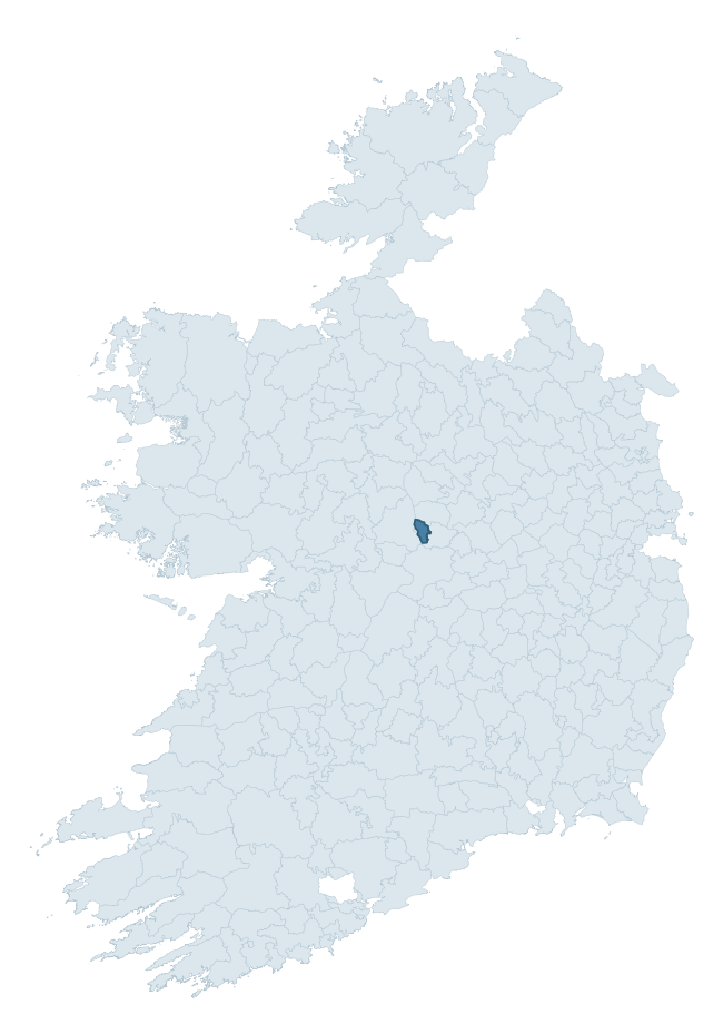
Where this barony sits in the Republic of Ireland
Geology and preservation
Bedrock geology shapes the landscape long before any settlement begins — controlling soil drainage, agricultural potential, the survival of upstanding monuments, and the preservation of buried archaeology. The figures below come from the Geological Survey Ireland 1:100,000 bedrock map.
The bedrock underlying Brawny is predominantly limestone (91% of the barony by area), laid down during the Carboniferous period (100% by area, around 359 to 299 million years ago). Limestone is the most heritage-rich bedrock in Ireland. It supports fertile, well-drained soils that favoured dense Early Medieval settlement and Norman manorial agriculture, and it weathers into karst features — sinkholes, caves, swallow holes, and souterrains — that frequently carry archaeology. Where peat overlies limestone, organic preservation can be exceptional. The single largest mapped unit is the Waulsortian Limestones (58% of the barony's bedrock). With only 2 distinct rock types mapped, the barony is geologically uniform compared to the rest of the Republic (12th percentile for diversity) — a single coherent bedrock landscape.
Rock type composition
Largest mapped unit: Waulsortian Limestones (58% of the barony)
Placename evidence
Logainm records 6 heritage-diagnostic placenames for Brawny, a modest sample drawn predominantly from the townland record. The dominant stratum is early christian ecclesiastical. The most frequent diagnostic roots are cill- (5) and lios- (1). With a sample of this size the count should be treated as indicative rather than definitive.
Pre-Christian / Early Medieval Defensive
| Root | Count | Meaning |
|---|---|---|
| lios- | 1 | ringfort or enclosure |
Early Christian Ecclesiastical
| Root | Count | Meaning |
|---|---|---|
| cill- | 5 | church (early) |
Other baronies in Westmeath
About this profile
Click any section below to expand.
What is a barony?
A barony is a historic administrative unit in Ireland, broadly equivalent to an English hundred. The 280 baronies used here are from the OSi 2019 National Statutory Boundaries (generalised 20m), covering the 26 counties of the Republic of Ireland. Baronies derive from the Norman period, were formalised in the 17th century, and have not been redrawn for statistical purposes. They vary enormously in area, from compact urban baronies in Dublin to vast upland baronies in Connacht, and should not be compared by raw site count without accounting for area differences.
What counts as a site?
This profile combines three distinct heritage registers, each with its own definition of what constitutes a recordable site:
- Archaeological sites (NMS). The National Monuments Service Sites and Monuments Record (SMR) catalogues every known archaeological monument or site of archaeological interest in the Republic, from prehistoric burial mounds and ringforts to medieval churches and post-medieval defensive works. Inclusion does not require legal protection — only that the site has been identified, surveyed, and assessed as having archaeological value. A separate subset of these sites lies within a recorded protection zone, which gives them statutory protection under the National Monuments Acts.
- Listed buildings (NIAH). The National Inventory of Architectural Heritage records buildings of architectural, historical, archaeological, artistic, cultural, scientific, social, or technical interest. Each surveyed structure is appraised on a five-tier scale: International, National, Regional, Local, and Record-Only. The NIAH appraisal is informational rather than strictly statutory, but it underpins local-authority Record of Protected Structures (RPS) listings.
- Heritage placenames (Logainm). Logainm is the authoritative database of Irish placenames maintained by the Placenames Branch. This profile applies a heritage-diagnostic classifier to the Irish-language form of each townland name, flagging roots that signal defensive sites (ráth-, lios-, dún-, caiseal-, cathair-), ecclesiastical foundations (cill-, teampall-, domhnach-, mainistir-), prehistoric burial-ritual features (tuaim-, carn-, leaba-), or Norse-contact settlement (gall-). Townlands without one of these diagnostic roots are not flagged here — they may still carry historical significance, but that significance is not encoded in the name itself.
Editorial principles
The narrative sections of this profile follow several explicit principles:
- Evidential. Every claim about this barony’s heritage character is anchored in the underlying register data. Where a site count, a placename count, or a percentile rank is cited, it is computed from the source datasets at export time, not estimated.
- Comparative. Counts and metrics are reported alongside their percentile rank against the other 279 ROI baronies. A barony with 50 ringforts in absolute terms could be unusually high or unusually low depending on its size and regional context; percentile ranking removes that ambiguity.
- Transparent on limits. Where a register has known coverage gaps, survey biases, or data-quality issues that affect this barony’s figures, the profile flags them rather than presenting the numbers as definitive.
- No interpretation beyond what the data supports. The narrative does not speculate about historical events, social dynamics, or cultural meaning beyond what the recorded heritage and placename evidence directly attests.
Data caveats and limits
- NMS Sites and Monuments Record is the product of survey campaigns conducted at different intensities across different counties and decades. Some baronies have been surveyed more thoroughly than others, and absolute counts should be read in that light. Sites destroyed by development before survey are typically not represented; sites in heavily forested or upland terrain are sometimes under-recorded.
- NIAH coverage is broadly complete for the Republic of Ireland but the survey was conducted on a rolling county-by-county basis, and the most recent appraisal date varies. Buildings demolished or substantially altered after their original survey may still appear in the register; conversely, recent buildings of merit may not yet have been appraised.
- Logainm classification applies a deliberately conservative pattern-matching approach to the Irish-language townland forms. The classifier prioritises true positives over recall: a townland may carry a heritage signal that the classifier doesn’t recognise, particularly where the diagnostic root has been heavily anglicised or where the townland name draws on a less common term. The 60,000+ townland records and ~9,800 classified placenames give a substantial signal at barony scale, but individual townland names should be checked against Logainm directly for definitive interpretation.
- Period attribution. The chronological distribution reflects only those NMS sites that carry a recognised period attribution in the source data. Sites listed as “Unknown” period are excluded from the dated subset.
- Boundary changes. Some baronies have undergone minor boundary adjustments since their 19th-century definition; the OSi 2019 generalised boundaries used here are the current statutory definition and may differ slightly from historical maps in border areas.
- Bedrock geology is mapped at 1:100,000 scale, which means local variation within a barony — small pockets of different rock type, mineral veins, alluvium overlying bedrock — is generalised. The dominant-system and rocktype figures are area-weighted, so a barony reading “70% Carboniferous limestone” may still contain small but archaeologically important pockets of older or younger rock. Around 3% of GSI polygons do not match the lexicon and contribute no rocktype or system attribution.
Data sources
- National Monuments Service — Sites and Monuments Record (SMR) https://data.gov.ie/dataset/national-monuments-service-archaeological-survey-of-ireland
- National Inventory of Architectural Heritage (NIAH) https://data.gov.ie/dataset/national-inventory-of-architectural-heritage-niah-national-dataset
- Logainm — Placenames Database of Ireland https://www.logainm.ie/
- Ordnance Survey Ireland — National Statutory Barony Boundaries 2019 https://data-osi.opendata.arcgis.com/
- EURODEM — European Digital Elevation Model https://www.mapsforeurope.org/datasets/euro-dem
- ESA WorldCover https://esa-worldcover.org/en
- Geological Survey Ireland — 1:100,000 Bedrock Geology https://www.gsi.ie/en-ie/data-and-maps/Pages/Bedrock.aspx
Explore more: Search any of the 280 ROI baronies, browse by historical province, or read the methodology and data sources for the full Republic of Ireland Heritage Tool.