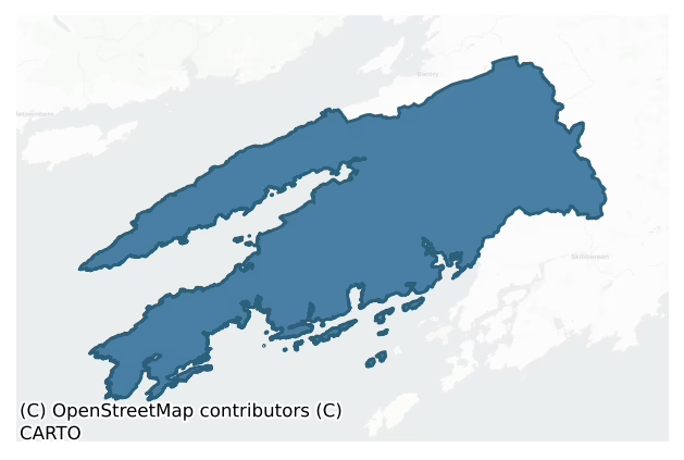
Carbery West (West Division) is a barony of County Cork, in the historical province of Munster (Irish: Cairbrigh Thiar (an Roinn Thiar)), covering 445 km² of land. The barony records 823 NMS archaeological sites and 159 NIAH listed buildings, placing it at around the 48th percentile among 280 ROI baronies for sites per km². This means it is in the lower half of all baronies for sites per km². Dated archaeological evidence runs from the Neolithic through to the Modern, spanning 8 of 9 archaeological periods, placing the barony in the 48th percentile among 280 ROI baronies for chronological depth. This means it is in the lower half of all baronies for chronological depth. The largest dated subset of recorded sites dates to the Early Medieval. Logainm flags 68 placenames in the barony as carrying a recognised heritage root; the largest share — around 56% — are names associated with pre-christian defensive.
Heritage at a glance
Percentile rankings throughout this profile compare each barony only against the other 279 Republic of Ireland baronies.
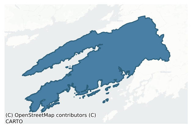
The recorded heritage of Carbery West (west Division)
The National Monuments Service Sites and Monuments Record (SMR) is the statutory inventory of archaeological sites for the Republic of Ireland, maintained by the Department of Tourism, Culture, Arts, Gaeltacht, Sport and Media. Sites recorded here include earthworks, ringforts, megalithic tombs, ecclesiastical remains, and post-medieval features; not every record is legally protected, but each is registered as a monument of archaeological interest.
The National Monuments Service records 823 archaeological sites in Carbery West (West Division), putting it at the 48th percentile among 280 ROI baronies for sites per km². This means it is in the lower half of all baronies for sites per km². Protection coverage is near-universal — 779 sites (95%) fall within a recorded monument protection zone, indicating an extensively surveyed landscape. The dominant category is defensive sites — ringforts, enclosures, hillforts, and stone forts (258 sites, 31% of the record). Ringfort – rath is the most prevalent type, making up 17% of the barony's recorded sites (137 records), broadly in line with the ROI average of 20% across all baronies where this type occurs. Ringfort – rath is an earthen ringfort enclosed by a bank and external ditch — the most common Early Medieval farmstead, broadly dated 500–1000 AD. Other significant types include Standing stone (84) and Burial ground (72). Standing stone is a deliberately set upright stone, used variously as a Bronze/Iron Age burial marker, route marker or commemorative monument; Burial ground is an area set apart for burial that is not associated with a church, in use from the medieval period onwards. Across the barony's 445 km², this gives a recorded density of 1.85 sites per km².
Most common monument types
Hover or tap a monument type to see its definition.
| Type | Count |
|---|---|
| Ringfort – rath an earthen ringfort enclosed by a bank and external ditch — the most common Early Medieval farmstead, broadly dated 500–1000 AD | 137 |
| Standing stone a deliberately set upright stone, used variously as a Bronze/Iron Age burial marker, route marker or commemorative monument | 84 |
| Burial ground an area set apart for burial that is not associated with a church, in use from the medieval period onwards | 72 |
| Souterrain an underground stone-built passage and chamber, generally Early Medieval and often associated with ringforts as a defensive or storage feature | 53 |
| Hut site a low stone or earthen foundation enclosing a small circular or oval area, generally interpreted as a former dwelling, of any date from prehistory to the medieval period | 33 |
| Enclosure a banked or ditched feature of uncertain type, used as a catch-all where the original function cannot be determined from surface evidence | 30 |
Chronological distribution
The dated archaeological record for Carbery West (West Division) spans from the Neolithic through to the Modern, with activity attested across 8 of 9 archaeological periods. Every period from earliest to latest is represented in the record — an unbroken sequence of dated activity across the full chronological span. Activity concentrates most heavily in the Early Medieval (228 sites, 41% of dated material), with the Early Bronze Age forming a secondary peak (136 sites, 24%). A further 262 recorded sites (32% of the overall NMS register for the barony) carry no period attribution — appearing as 'Unknown' in the bar chart below. This typically reflects either records that pre-date the standardised period vocabulary or sites awaiting specialist dating review, rather than a genuine absence of chronological evidence.
Sample of recorded monuments
Show 25 sample monuments (of 823 total)
A representative sample of 25 recorded monuments drawn from the barony’s 823 total NMS entries. Sites within a recorded monument protection zone and rarer site types are prioritised so the list shows a meaningful cross-section rather than only the most common type. Each entry shows the official Sites and Monuments Record reference number and the description published by the National Monuments Service.
Penitential station
In rough pasture, on S-facing slope. Holy well (CO118-071001-) to NW. Low square spread of stones (3m N-S; 3m E-W) with standing stone (H 1.2m; 1.5m; 0.16m) at SE end. Low roughly-cut upright stone (H 0.48m; 0.45m;…
In rough pasture, on S-facing slope. Holy well (CO118-071001-) to NW. Low square spread of stones (3m N-S; 3m E-W) with standing stone (H 1.2m; 1.5m; 0.16m) at SE end. Low roughly-cut upright stone (H 0.48m; 0.45m; 0.2m), 2.5m to SW. Large quartz boulder (H 0.86m; 1.3m; 1.2m), c. 8.5m from largest standing stone atop earthen mound. Another small standing stone (H 0.93m; 1m; 0.3m) to SW. Holy well (CO118-071001-) to NW.
The above description is derived from the published 'Archaeological Inventory of County Cork. Volume 1: West Cork' (Dublin: Stationery Office, 1992). In certain instances the entries have been revised and updated in the light of recent research.
Date of upload/revision: 14 January 2009
Images provided by and copyright of Amanda Clarke 2016-2022 https://holywellscorkandkerry.com/
School
On hillside overlooking Dunmanus Bay to E. Depicted on OS 6-inch map (1842) as group of houses '(in ruins)'. Remains consist of wall (H 2.4m; L 5.1m; Wth 0.95m), against N gable of dwelling house; batter on NE corner,…
On hillside overlooking Dunmanus Bay to E. Depicted on OS 6-inch map (1842) as group of houses '(in ruins)'. Remains consist of wall (H 2.4m; L 5.1m; Wth 0.95m), against N gable of dwelling house; batter on NE corner, and one rectangular window.
The above description is derived from the published 'Archaeological Inventory of County Cork. Volume 1: West Cork' (Dublin: Stationery Office, 1992). In certain instances the entries have been revised and updated in the light of recent research.
Date of upload/revision: 14 January 2009
House – fortified house
Two-storey house with attic, on ground sloping gently up from N shore of Dunmanus Bay; overlooked from N. Building of U-plan; main block (17.6m NW-SE; 7.8m SW-NE) with arms projecting from NW (6.5m SW-SE; 5.5m NW-SE)…
Two-storey house with attic, on ground sloping gently up from N shore of Dunmanus Bay; overlooked from N. Building of U-plan; main block (17.6m NW-SE; 7.8m SW-NE) with arms projecting from NW (6.5m SW-SE; 5.5m NW-SE) and SE (6.3m SW-NE; 5.6m NW-SE) ends of NE wall. All walls stand to full height except SW of which only ground floor stands. Original gables survive atop centre of NE wall, NW and SE ends of main block; at NE ends of both arms. Plain masonry stack atop gable at NE; main SE stack ivy-clad; remaining three stacks are more elaborate with oversailing caps. Machicolations on side walls of projecting arms poorly preserved; tapering masonry corbels with intervening lintels survive. House adapted as farmbuilding and dwelling for nearby Durrus Court; all window and door opes adapted for wooden frames. Inserted elliptical archway in NW wall gaveaccess to lean-to built inside house (some support walling survives); NW arm converted into dwelling with inserted dividing wall from main block. Original fireplace with bread oven at ground floor in SE wall; gun loop in SW wall beside fireplace. House built by MacCarthy Muclaghs, minor sub-sept of MacCarthy Riabhach (O'Donoghue 1986, 58) probably in early decades 17th century.
The above description is derived from the published 'Archaeological Inventory of County Cork. Volume 1: West Cork' (Dublin: Stationery Office, 1992). In certain instances the entries have been revised and updated in the light of recent research.
Date…
Midden
On S side small inlet 6m N of Dunbeacon Castle (CO130-025002-). Thin layer of shells (L 14m; D 0.07m) 0.6m below surface, exposed in section on coastline. Shell remains include periwinkle, oyster and cockle. (Westropp…
On S side small inlet 6m N of Dunbeacon Castle (CO130-025002-). Thin layer of shells (L 14m; D 0.07m) 0.6m below surface, exposed in section on coastline. Shell remains include periwinkle, oyster and cockle. (Westropp 1915, 282).
The above description is derived from the published 'Archaeological Inventory of County Cork. Volume 1: West Cork' (Dublin: Stationery Office, 1992). In certain instances the entries have been revised and updated in the light of recent research.
Date of upload/revision: 14 January 2009
Inscribed stone
In pasture, on N-facing slope, immediately N of Fort View House. Upright standing stone (H 1.7m; Wth 0.2m), with inscription 'JAMES SWANTON DEC 1800', whose grave it is said locally to mark; below this '1747' and some…
In pasture, on N-facing slope, immediately N of Fort View House. Upright standing stone (H 1.7m; Wth 0.2m), with inscription 'JAMES SWANTON DEC 1800', whose grave it is said locally to mark; below this '1747' and some initials.
The above description is derived from the published 'Archaeological Inventory of County Cork. Volume 1: West Cork' (Dublin: Stationery Office, 1992). In certain instances the entries have been revised and updated in the light of recent research.
Date of upload/revision: 14 January 2009
Metalworking site
Scatter of hone stones and slag; possible 17th century iron-working area. No other surface evidence. Housed in Bantry Museum. (UCC).
The above description is derived from the published 'Archaeological Inventory of…
Scatter of hone stones and slag; possible 17th century iron-working area. No other surface evidence. Housed in Bantry Museum. (UCC).
The above description is derived from the published 'Archaeological Inventory of County Cork. Volume 1: West Cork' (Dublin: Stationery Office, 1992). In certain instances the entries have been revised and updated in the light of recent research.
Date of upload/revision: 14 January 2009
Sweathouse
In low overgrown sub-rectangular mound (3.6m NE-SE; 4m NW-SE) to S of Ballyourane Castle (CO132-009001-). Indicated on OS 6-inch map (1842) as rectangular structure. Dry stone-lined circular chamber (diam. 1.42m; H…
In low overgrown sub-rectangular mound (3.6m NE-SE; 4m NW-SE) to S of Ballyourane Castle (CO132-009001-). Indicated on OS 6-inch map (1842) as rectangular structure. Dry stone-lined circular chamber (diam. 1.42m; H 0.8m) with corbelled roof; entered by low lintelled passage (Wth 0.45m; L c. 1m) on SE side of mound. Second parallel passage occurs to NW, interior of which has collapsed.
The above description is derived from the published 'Archaeological Inventory of County Cork. Volume 1: West Cork' (Dublin: Stationery Office, 1992). In certain instances the entries have been revised and updated in the light of recent research.
Date of upload/revision: 14 January 2009
Holed stone
On top of a E-W ridge on S-facing slope, at E side of ringfort (CO138-002001-). Fallen, partially embedded slab (L 2.35m; min. 0.8m x 0.12m) with circular hole (diam. 0.14m). According to Weir (1980, 113), stone used…
On top of a E-W ridge on S-facing slope, at E side of ringfort (CO138-002001-). Fallen, partially embedded slab (L 2.35m; min. 0.8m x 0.12m) with circular hole (diam. 0.14m). According to Weir (1980, 113), stone used for healing purposes. According to local information, the stone was re-erected sometime in the last 20 years (prior 2023.
The above description is derived from the published 'Archaeological Inventory of County Cork. Volume 1: West Cork' (Dublin: Stationery Office, 1992). In certain instances the entries have been revised and updated in the light of recent research.
Date of upload/revision: 22 June 2023
Image uploaded courtesy of Clíodhna O’Leary (archaeologist)
This monument is subject to a preservation order made under the National Monuments Acts 1930 to 2014 (PO no. 83/1939).
Habitation site
According to local information, possible hearth site was discovered c. 1980 while lowering level of yard of dwelling house. Fragments of rotary quern and iron slag also found.
The above description is derived from…
According to local information, possible hearth site was discovered c. 1980 while lowering level of yard of dwelling house. Fragments of rotary quern and iron slag also found.
The above description is derived from the published 'Archaeological Inventory of County Cork. Volume 1: West Cork' (Dublin: Stationery Office, 1992). In certain instances the entries have been revised and updated in the light of recent research.
Date of upload/revision: 14 January 2009
Cliff-edge fort
In rough pasture on cliff edge (eroding), overlooking Dunmanus Bay to SSW. D-shaped raised area (32.2m N-S; 21.7m E-W) truncated by cliff edge to W defined N->S by scarp (H 1.2m) topped by stone wall (H 1m); external…
In rough pasture on cliff edge (eroding), overlooking Dunmanus Bay to SSW. D-shaped raised area (32.2m N-S; 21.7m E-W) truncated by cliff edge to W defined N->S by scarp (H 1.2m) topped by stone wall (H 1m); external fosse (D 0.8m). Outer arc defined by narrow stone bank (H 0.8m) concentric with and 26.8m from scarp. Radial wall (ENE-WSW) joins two enclosing elements. Remains of castle (CO139-014002-) survive where inner wall reaches cliff edge to S.
The above description is derived from the published 'Archaeological Inventory of County Cork. Volume 1: West Cork' (Dublin: Stationery Office, 1992). In certain instances the entries have been revised and updated in the light of recent research.
Date of upload/revision: 14 January 2009
Megalithic tomb – unclassified
Prominently situated on crest of exposed rocky ridge of Knocknageeha at SW extremity Mount Gabriel. Ruined chamber (L 3.1m; Wth 2.2m at W end, c. 0.6m at E) aligned ENE-WSW, formed of inclined slabs. Structure…
Prominently situated on crest of exposed rocky ridge of Knocknageeha at SW extremity Mount Gabriel. Ruined chamber (L 3.1m; Wth 2.2m at W end, c. 0.6m at E) aligned ENE-WSW, formed of inclined slabs. Structure incorporated in circular cairn. Traces of low dry-stone kerb survive at N, W and S. (Roberts 1988, Ch. 4, no. 15; O Nualláin 1989, 141)
The above description is derived from the published 'Archaeological Inventory of County Cork. Volume 1: West Cork' (Dublin: Stationery Office, 1992). In certain instances the entries have been revised and updated in the light of recent research.
Date of upload/revision: 14 January 2009
Industrial chimney
The Archaeological Survey of Ireland (ASI) is in the process of providing information on all monuments on The Historic Environment Viewer (HEV). Currently the information for this record has not been uploaded. To…
The Archaeological Survey of Ireland (ASI) is in the process of providing information on all monuments on The Historic Environment Viewer (HEV). Currently the information for this record has not been uploaded. To access available information for research purposes please make an appointment in advance with the Archive Unit (open Fridays 10.00 am – 5.00 pm), Department of Culture, Heritage and the Gaeltacht, The Custom House, Dublin 1 D01W6XO or email nmarchive@chg.gov.ie.
Cross-inscribed stone
On S shoulder of Knockatassonig. Latin cross deeply incised on E face of rock outcrop; terminals rounded (H 0.24m; Wth 0.2m).
The above description is derived from the published 'Archaeological Inventory of County…
On S shoulder of Knockatassonig. Latin cross deeply incised on E face of rock outcrop; terminals rounded (H 0.24m; Wth 0.2m).
The above description is derived from the published 'Archaeological Inventory of County Cork. Volume 1: West Cork' (Dublin: Stationery Office, 1992). In certain instances the entries have been revised and updated in the light of recent research.
Date of upload/revision: 14 January 2009
Rock scribing
Overlooking Crook Haven. Sandstone boulder (H 0.93m; max. Wth 0.3m), part of field fence running N-S, with "ogham-like" grooves on N surface (UCC). The grooves do not use the edge of the stone as a stem but run down…
Overlooking Crook Haven. Sandstone boulder (H 0.93m; max. Wth 0.3m), part of field fence running N-S, with "ogham-like" grooves on N surface (UCC). The grooves do not use the edge of the stone as a stem but run down face. Length of groove c. 0.06m; cut c. 5mm deep. Some X and Y patterns can be made out.
The above description is derived from the published 'Archaeological Inventory of County Cork. Volume 1: West Cork' (Dublin: Stationery Office, 1992). In certain instances the entries have been revised and updated in the light of recent research.
Date of upload/revision: 14 January 2009
Cross
Stone (H 0.38m; 0.36m x 0.08m) standing inside door of church (CO147-024002-) within graveyard (CO147-024002-). Plain Latin cross (H 0.27m; Wth 0.25m) incised on E face; stem now partially buried beneath ground…
Stone (H 0.38m; 0.36m x 0.08m) standing inside door of church (CO147-024002-) within graveyard (CO147-024002-). Plain Latin cross (H 0.27m; Wth 0.25m) incised on E face; stem now partially buried beneath ground level.
The above description is derived from the published 'Archaeological Inventory of County Cork. Volume 1: West Cork' (Dublin: Stationery Office, 1992). In certain instances the entries have been revised and updated in the light of recent research.
Date of upload/revision: 14 January 2009
Megalithic tomb – portal tomb
Facing into foot of cliff, on small level area grassland. Entire structure leans to the S. Narrow chamber (L 2m; Wth c. 0.8m) aligned NE-SW, covered by two overlapping roofstones. Entrance to NE marked by two tall…
Facing into foot of cliff, on small level area grassland. Entire structure leans to the S. Narrow chamber (L 2m; Wth c. 0.8m) aligned NE-SW, covered by two overlapping roofstones. Entrance to NE marked by two tall portal-stones and tall door stone. Sides and back of chamber of single stones. Incorporated in low oval mound, 10m by 8m. (deValera and O Nualláin 1982, 41-2, Co. 62; Roberts 1988, Chp. 4, No. 18)
The above description is derived from the published 'Archaeological Inventory of County Cork. Volume 1: West Cork' (Dublin: Stationery Office, 1992). In certain instances the entries have been revised and updated in the light of recent research.
Date of upload/revision: 14 January 2009
See linked document with details from Ruaidhrí de Valera and Seán Ó Nualláin, Survey of the Megalithic Tombs of Ireland. Volume IV. Counties Cork, Kerry, Limerick, Tipperary. (Dublin: Stationery Office, 1982)
Battery
In pasture overlooking salt marsh to S. Indicated on OS 6-inch map (1842) as 'Old Battery'. Stone-faced platform (H c.4m; 19.77m NE-SW; 8.2m NW-SE). NW elevation partially collapsed exposing earthen/rubble core. Low…
In pasture overlooking salt marsh to S. Indicated on OS 6-inch map (1842) as 'Old Battery'. Stone-faced platform (H c.4m; 19.77m NE-SW; 8.2m NW-SE). NW elevation partially collapsed exposing earthen/rubble core. Low stone wall(H c. 0.5m; Wth c. 3.0.9m) encloses raised area on top of platform.
The above description is derived from the published 'Archaeological Inventory of County Cork. Volume 1: West Cork' (Dublin: Stationery Office, 1992). In certain instances the entries have been revised and updated in the light of recent research.
Date of upload/revision: 14 January 2009
Walled garden
The Archaeological Survey of Ireland (ASI) is in the process of providing information on all monuments on The Historic Environment Viewer (HEV). Currently the information for this record has not been uploaded. To…
The Archaeological Survey of Ireland (ASI) is in the process of providing information on all monuments on The Historic Environment Viewer (HEV). Currently the information for this record has not been uploaded. To access available information for research purposes please make an appointment in advance with the Archive Unit (open Fridays 10.00 am – 5.00 pm), Department of Culture, Heritage and the Gaeltacht, The Custom House, Dublin 1 D01W6XO or email nmarchive@chg.gov.ie.
Historic town
A relatively large settlement cluster is shown on the Down Survey (1655-9) Barony map in Crookhaven townland (Hib. Reg.). The 1655-9 Down Survey map of Kilmoe parish depicted a double row of linear houses with a large…
A relatively large settlement cluster is shown on the Down Survey (1655-9) Barony map in Crookhaven townland (Hib. Reg.). The 1655-9 Down Survey map of Kilmoe parish depicted a double row of linear houses with a large tower house like castle standing between the dwellings (NLI, MS 712-3). The terrier of the 1655-9 Down Survey parish map recorded that, ‘there is in this parish a very good Harbour called Crookhaven having, a Fort [CO147-066—-] Commandinge the Entrance in which Shipps may lye securely, Theres likewise a Towne neere to this Harbour called Crookehaven in which Stands a Castle [CO147-063—-] and many Cabbins’ (NLI, MS 712-3).
There is no local knowledge of the settlement but it probably represents a mid-17th century precursor of the present Crookhaven village. The linear nature of the modern settlement of Crookhaven resembles closely the linear settlement depicted on the Down Survey maps. According to Breen (2007, 34), Sir Thomas Roper established a fishery station at Crookhaven and hundreds of families were 'planted' there in the early 1600s. In addition, Roper also established a garrison of soldiers in Crookhaven in 1622 (Kerrigan 1995, 79-80). A fortification (CO147-066—-), which was probably associated with this garrison, is also shown on the Down Survey Barony map in the vicinity of the village. The castle site (CO147-063—-) which stood in the centre of the town of Crookhaven has not been precisely located while the present church and graveyard…
Cross-inscribed pillar
The lower portion (H 0.7m; 0.3m x 0.18m) of an upright sandstone pillar, orientated N-S, stands in a children's burial ground (CO149-001—-). The two narrow sides of the pillar are undecorated but both faces have been…
The lower portion (H 0.7m; 0.3m x 0.18m) of an upright sandstone pillar, orientated N-S, stands in a children's burial ground (CO149-001—-). The two narrow sides of the pillar are undecorated but both faces have been carved. In the centre of the E face is a tall narrow panel in raised relief, framed by a flat corner moulding in lower relief. Despite an apparent fracture in the upper right-hand corner of the panel 'it is likely to have been the shaft of a cross, probably ringed' (pers. comm. Peter Harbison). The bottom end of the moulding links with a simple Greek meander motif extending across the bottom of the stone and which is of the same high relief as the cross-shaft which rests upon it.
Into the W face of the pillar an upright panel has been sunk, its vertical sides framed by a slightly rounded moulding, with incised grooves. Slightly more than the lower two-thirds of this sunken panel is occupied by a 'boxed set' of four squares (each 0.11m x 0.11m), that though badly weathered have been interpreted as 'probably bearing angular fretwork patterns' (pers. comm. Peter Harbison). A horizontal moulding runs across the top of the squares, above which there is a further carved panel too fragmentary for its decoration to be made out. The lower end of the W face has a rough striated surface.
A 9th-century date has been suggested for the cross-shaft and the meander motif on the E face of the pillar and a later, possibly 12th-century date, for the decoration on the W face…
Watchman's hut – burial ground
In graveyard (CO147-024001-). Ruined structure in SE corner; heavily overgrown; possibly remains of watchman's hut.
The above description is derived from the published 'Archaeological Inventory of County Cork. Volume…
In graveyard (CO147-024001-). Ruined structure in SE corner; heavily overgrown; possibly remains of watchman's hut.
The above description is derived from the published 'Archaeological Inventory of County Cork. Volume 1: West Cork' (Dublin: Stationery Office, 1992). In certain instances the entries have been revised and updated in the light of recent research.
Date of upload/revision: 14 January 2009
Radial-stone enclosure
On NW side of Spratt hill in basin of headwaters of Durrus river. Eight radially-set stones (H 0.3m – 0.6m) visible in low bank of earth and stone which encloses circular area (diam. c. 10m). The interior has been used…
On NW side of Spratt hill in basin of headwaters of Durrus river. Eight radially-set stones (H 0.3m – 0.6m) visible in low bank of earth and stone which encloses circular area (diam. c. 10m). The interior has been used as a cillin or burial ground (CO118-043—).
The above description is derived from the published 'Archaeological Inventory of County Cork. Volume 1: West Cork' (Dublin: Stationery Office, 1992). In certain instances the entries have been revised and updated in the light of recent research.
Date of upload/revision: 14 January 2009
Mill – unclassified
Large late 19th century mill incorporating part of earlier structure, built into slope overlooking Owennashingann river. Five-bay, 2-storey with broad 5-bay gable ends; windows brick dressed. Cast iron overshot…
Large late 19th century mill incorporating part of earlier structure, built into slope overlooking Owennashingann river. Five-bay, 2-storey with broad 5-bay gable ends; windows brick dressed. Cast iron overshot waterwheel (Wth 1.9m; radius 3.65m) along S elev.; segment wheel attached to outside shrouding, pinion engaged externally. Interior has large central stairs up to 1st. floor; no internal machinery survives.
The above description is derived from the published 'Archaeological Inventory of County Cork. Volume 1: West Cork' (Dublin: Stationery Office, 1992). In certain instances the entries have been revised and updated in the light of recent research.
Date of upload/revision: 14 January 2009
Stone circle – multiple-stone
Situated in an area of outcropping rock with dense furze and brambles, overlooking Dunmanus Bay to the S. The monument was cleared of vegetation on rediscovery in 1995 (see Power et al. 1992, 43). The circle is…
Situated in an area of outcropping rock with dense furze and brambles, overlooking Dunmanus Bay to the S. The monument was cleared of vegetation on rediscovery in 1995 (see Power et al. 1992, 43). The circle is incomplete: four erect and seven prostrate slabs indicate a circle of eleven stones. Both entrance stones and the axial stone are prostrate and the sockets for three fallen stones are visible with some packing-stones still in situ. Orthostats are 0.9m to 1.4m L, 0.2m to 0.55m T and 0.8m to 1.4m H. The internal measurement along the main axis, aligned NE-SW, is c. 7.5m. Two shallow pits were dug within the circle in modern times, one at the centre and the other beside an orthostat to S. The cover-stone of a possible boulder-burial (CO130-016001-) stands in the NW quadrant of the circle and a second example (CO130-043—-) stands immediately outside the circle to S.
The above description is derived from 'The Archaeological Inventory of County Cork. Volume 5' (Dublin: Stationery Office, 2009).
Date of upload: 22 December 2009
Ringfort – rath
In pasture, atop natural knoll. Circular area (41m N-S; 40m E-W) enclosed by earthen bank (H 1.6m) with shallow external fosse. Interior raised on S side to compensate for hill slope.
The above description is derived…
In pasture, atop natural knoll. Circular area (41m N-S; 40m E-W) enclosed by earthen bank (H 1.6m) with shallow external fosse. Interior raised on S side to compensate for hill slope.
The above description is derived from the published 'Archaeological Inventory of County Cork. Volume 1: West Cork' (Dublin: Stationery Office, 1992). In certain instances the entries have been revised and updated in the light of recent research.
Date of upload/revision: 14 January 2009
Listed buildings
The National Inventory of Architectural Heritage (NIAH) is a state survey appraising buildings of architectural, historical, archaeological, artistic, cultural, scientific, social, or technical interest. Each surveyed structure receives a rating from International (the highest, for buildings of European importance) through National, Regional, Local, and Record-Only.
The NIAH records 159 listed buildings in Carbery West (West Division) (69th percentile across ROI baronies). The highest-graded structures include 2 of National significance. The Republic holds 937 National-graded buildings in total, so this barony accounts for around 0% of the national total. Construction dates concentrate most heavily in the Victorian (1830-1900) period. The most-recorded building type is house (72 examples, 45% of the listed stock).
Terrain and environment
Mean elevation across the barony is 88m — the 49th percentile among 280 ROI baronies for elevation. This means it is in the lower half of all baronies for elevation. Elevation matters for heritage because higher-altitude baronies typically favour defensive monuments — ringforts and hilltop forts placed on prominent ground — while lowland baronies are more likely to carry the dense settlement and church networks of intensive agricultural landscapes. The barony reaches 403m at its highest point — a vertical span of more than 315m within its boundary, indicating significant topographic diversity. Mean slope is 7.3° — the 92nd percentile among 280 ROI baronies for slope. This means it is in the top tenth of all baronies for slope. This is consistently steep terrain by ROI standards, the kind of landscape that tends to preserve upstanding archaeological features well. Slope is a key control on both land use and archaeological preservation: steep ground resists ploughing and tends to preserve earthworks intact, while gentle slopes favour intensive cultivation that damages or destroys surface archaeology over time. Localised maximum slopes reach 19°, typical of stream-cut valleys, escarpments, or coastal bluffs within the wider landscape. The Topographic Wetness Index averages 9.3, the 6th percentile among 280 ROI baronies for wetness. This means it is in the bottom tenth of all baronies for wetness. This is well-drained ground by ROI standards — typical of upland or steeply-sloping country that sheds water rapidly. Drainage matters for heritage because poorly-drained ground preserves organic archaeology (wooden trackways, leather, textiles, and on rare occasions human remains) far better than free-draining soil; well-drained ground favours arable use but destroys organic material rapidly. The land cover is dominated by improved grassland (78%) and woodland (21%). In overall character, this is steeply-sloping terrain at modest elevation, with land use dominated by improved grassland.
Terrain measurements
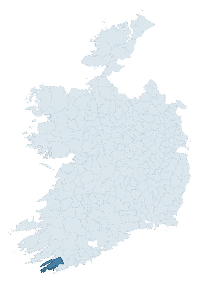
Where this barony sits in the Republic of Ireland
Geology and preservation
Bedrock geology shapes the landscape long before any settlement begins — controlling soil drainage, agricultural potential, the survival of upstanding monuments, and the preservation of buried archaeology. The figures below come from the Geological Survey Ireland 1:100,000 bedrock map.
The bedrock underlying Carbery West (West Division) is predominantly siltstone (55% of the barony by area), laid down during the Devonian period (90% by area, around 419 to 359 million years ago). Siltstone weathers to fertile, moderately heavy soils that supported Early Medieval ringfort agriculture, often interbedded with mudstone in lowland landscapes. A substantial secondary geology of sandstone (43%) adds further variety to the underlying landscape. The single largest mapped unit is the Castlehaven Formation (55% of the barony's bedrock).
Rock type composition
Largest mapped unit: Castlehaven Formation (55% of the barony)
Placename evidence
Logainm records 68 heritage-diagnostic placenames for Carbery West (West Division), drawn from townland and civil-parish names across the barony. The dominant stratum is pre-Christian and Early Medieval defensive — ráth-, lios-, dún-, and caiseal-prefixed names that mark Iron Age and early historic settlement. The leading diagnostic roots are cill- (23 — church), caiseal- (11 — stone ringfort), and ráth- (9 — earthen ringfort). This is well above the ROI average of 30.7 heritage placenames per barony — around 2.2× the typical figure. The presence of multiple heritage strata side by side indicates layered occupation of the landscape across successive prehistoric and historic periods. Logainm records 344 placenames for Carbery West (West Division) (predominantly townland names). Of these, 68 (20%) carry one of the diagnostic Gaelic roots tracked above; the remainder draw on more generic landscape vocabulary that does not encode a heritage period.
Pre-Christian / Early Medieval Defensive
| Root | Count | Meaning |
|---|---|---|
| caiseal- | 11 | stone ringfort |
| ráth- | 9 | earthen ringfort |
| lios- | 8 | ringfort or enclosure |
| dún- | 6 | hilltop or promontory fort |
| cathair- | 4 | stone fort |
Early Christian Ecclesiastical
| Root | Count | Meaning |
|---|---|---|
| cill- | 23 | church (early) |
| cillín- | 4 | unconsecrated burial ground |
Burial, Ritual, and Norse-Contact
| Root | Count | Meaning |
|---|---|---|
| carn- | 2 | cairn |
| gall- | 2 | foreigner — Norse settlement marker |
| dumha- | 1 | mound |
Other baronies in Cork
- Duhallow
- Carbery East (west Division)
- Kinalmeaky
- Fermoy
- Bear
- Condons And Clangibbon
- Muskerry West
- Kinalea
- Carbery East (east Division)
- Clanwilliam — Tipperary
See all 280 baronies in the Republic of Ireland Heritage Tool.

Explore further
Grounding History: 10 Maps of Northern Ireland’s Past
If you’re interested in Irish heritage more widely, the companion report for Northern Ireland brings together the analysis of all 462 NI wards into one place through 10 high-quality maps — covering monument density, archaeological periods, placename heritage, terrain, wetland, and the historic landscape at first survey. Take a look.
About this profile
Click any section below to expand.
What is a barony?
A barony is a historic administrative unit in Ireland, broadly equivalent to an English hundred. The 280 baronies used here are from the OSi 2019 National Statutory Boundaries (generalised 20m), covering the 26 counties of the Republic of Ireland. Baronies derive from the Norman period, were formalised in the 17th century, and have not been redrawn for statistical purposes. They vary enormously in area, from compact urban baronies in Dublin to vast upland baronies in Connacht, and should not be compared by raw site count without accounting for area differences.
What counts as a site?
This profile combines three distinct heritage registers, each with its own definition of what constitutes a recordable site:
- Archaeological sites (NMS). The National Monuments Service Sites and Monuments Record (SMR) catalogues every known archaeological monument or site of archaeological interest in the Republic, from prehistoric burial mounds and ringforts to medieval churches and post-medieval defensive works. Inclusion does not require legal protection — only that the site has been identified, surveyed, and assessed as having archaeological value. A separate subset of these sites lies within a recorded protection zone, which gives them statutory protection under the National Monuments Acts.
- Listed buildings (NIAH). The National Inventory of Architectural Heritage records buildings of architectural, historical, archaeological, artistic, cultural, scientific, social, or technical interest. Each surveyed structure is appraised on a five-tier scale: International, National, Regional, Local, and Record-Only. The NIAH appraisal is informational rather than strictly statutory, but it underpins local-authority Record of Protected Structures (RPS) listings.
- Heritage placenames (Logainm). Logainm is the authoritative database of Irish placenames maintained by the Placenames Branch. This profile applies a heritage-diagnostic classifier to the Irish-language form of each townland name, flagging roots that signal defensive sites (ráth-, lios-, dún-, caiseal-, cathair-), ecclesiastical foundations (cill-, teampall-, domhnach-, mainistir-), prehistoric burial-ritual features (tuaim-, carn-, leaba-), or Norse-contact settlement (gall-). Townlands without one of these diagnostic roots are not flagged here — they may still carry historical significance, but that significance is not encoded in the name itself.
Editorial principles
The narrative sections of this profile follow several explicit principles:
- Evidential. Every claim about this barony’s heritage character is anchored in the underlying register data. Where a site count, a placename count, or a percentile rank is cited, it is computed from the source datasets at export time, not estimated.
- Comparative. Counts and metrics are reported alongside their percentile rank against the other 279 ROI baronies. A barony with 50 ringforts in absolute terms could be unusually high or unusually low depending on its size and regional context; percentile ranking removes that ambiguity.
- Transparent on limits. Where a register has known coverage gaps, survey biases, or data-quality issues that affect this barony’s figures, the profile flags them rather than presenting the numbers as definitive.
- No interpretation beyond what the data supports. The narrative does not speculate about historical events, social dynamics, or cultural meaning beyond what the recorded heritage and placename evidence directly attests.
Data caveats and limits
- NMS Sites and Monuments Record is the product of survey campaigns conducted at different intensities across different counties and decades. Some baronies have been surveyed more thoroughly than others, and absolute counts should be read in that light. Sites destroyed by development before survey are typically not represented; sites in heavily forested or upland terrain are sometimes under-recorded.
- NIAH coverage is broadly complete for the Republic of Ireland but the survey was conducted on a rolling county-by-county basis, and the most recent appraisal date varies. Buildings demolished or substantially altered after their original survey may still appear in the register; conversely, recent buildings of merit may not yet have been appraised.
- Logainm classification applies a deliberately conservative pattern-matching approach to the Irish-language townland forms. The classifier prioritises true positives over recall: a townland may carry a heritage signal that the classifier doesn’t recognise, particularly where the diagnostic root has been heavily anglicised or where the townland name draws on a less common term. The 60,000+ townland records and ~9,800 classified placenames give a substantial signal at barony scale, but individual townland names should be checked against Logainm directly for definitive interpretation.
- Period attribution. The chronological distribution reflects only those NMS sites that carry a recognised period attribution in the source data. Sites listed as “Unknown” period are excluded from the dated subset.
- Boundary changes. Some baronies have undergone minor boundary adjustments since their 19th-century definition; the OSi 2019 generalised boundaries used here are the current statutory definition and may differ slightly from historical maps in border areas.
- Bedrock geology is mapped at 1:100,000 scale, which means local variation within a barony — small pockets of different rock type, mineral veins, alluvium overlying bedrock — is generalised. The dominant-system and rocktype figures are area-weighted, so a barony reading “70% Carboniferous limestone” may still contain small but archaeologically important pockets of older or younger rock. Around 3% of GSI polygons do not match the lexicon and contribute no rocktype or system attribution.
Data sources
- National Monuments Service — Sites and Monuments Record (SMR) https://data.gov.ie/dataset/national-monuments-service-archaeological-survey-of-ireland
- National Inventory of Architectural Heritage (NIAH) https://data.gov.ie/dataset/national-inventory-of-architectural-heritage-niah-national-dataset
- Logainm — Placenames Database of Ireland https://www.logainm.ie/
- Ordnance Survey Ireland — National Statutory Barony Boundaries 2019 https://data-osi.opendata.arcgis.com/
- EURODEM — European Digital Elevation Model https://www.mapsforeurope.org/datasets/euro-dem
- ESA WorldCover https://esa-worldcover.org/en
- Geological Survey Ireland — 1:100,000 Bedrock Geology https://www.gsi.ie/en-ie/data-and-maps/Pages/Bedrock.aspx
Explore more: Search any of the 280 ROI baronies, browse by historical province, or read the methodology and data sources for the full Republic of Ireland Heritage Tool.