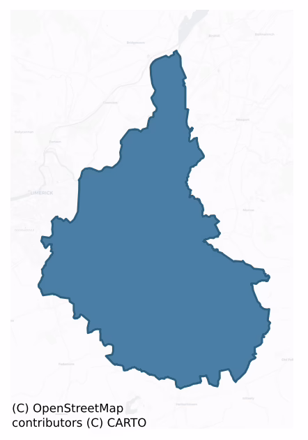
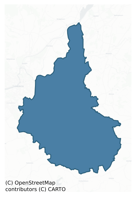
Clanwilliam is a barony of County Limerick, in the historical province of Munster (Irish: Clann Liam), covering 221 km² of land. The barony records 830 NMS archaeological sites and 191 NIAH listed buildings, placing it at around the 90th percentile among 280 ROI baronies for sites per km². This means it is in the top tenth of all baronies for sites per km². Dated archaeological evidence runs from the Neolithic through to the Modern, spanning 8 of 9 archaeological periods, placing the barony in the 51st percentile among 280 ROI baronies for chronological depth. This means it is in the upper half of all baronies for chronological depth. The largest dated subset of recorded sites dates to the Iron Age. Logainm flags 51 placenames in the barony as carrying a recognised heritage root; the largest share — around 47% — are names associated with pre-christian defensive.
Heritage at a glance
Percentile rankings throughout this profile compare each barony only against the other 279 Republic of Ireland baronies.
The recorded heritage of Clanwilliam
The National Monuments Service Sites and Monuments Record (SMR) is the statutory inventory of archaeological sites for the Republic of Ireland, maintained by the Department of Tourism, Culture, Arts, Gaeltacht, Sport and Media. Sites recorded here include earthworks, ringforts, megalithic tombs, ecclesiastical remains, and post-medieval features; not every record is legally protected, but each is registered as a monument of archaeological interest.
The National Monuments Service records 830 archaeological sites in Clanwilliam, putting it at the 90th percentile among 280 ROI baronies for sites per km². This means it is in the top tenth of all baronies for sites per km². Protection coverage is near-universal — 752 sites (91%) fall within a recorded monument protection zone, indicating an extensively surveyed landscape. The record is dominated by defensive sites — ringforts, enclosures, hillforts, and stone forts (388 sites, 47% of the total), with burial and ritual monuments forming a substantial secondary presence (165 sites, 20%). The most diagnostically specific type is Ringfort – rath (130 records, 16% of the barony's NMS total) — compared to an ROI average of 20% across all baronies where this type occurs. Ringfort – rath is an earthen ringfort enclosed by a bank and external ditch — the most common Early Medieval farmstead, broadly dated 500–1000 AD. The broader 'Enclosure' classification — which catches unclassified ringforts and field enclosures — accounts for a further 183 records (22%) and reflects the difficulty of sub-classifying degraded earthworks from surface evidence alone. Other significant types include Barrow – ring-barrow (99) — a Bronze/Iron Age burial monument: a low circular area enclosed by ditch and outer bank. Across the barony's 221 km², this gives a recorded density of 3.76 sites per km².
Most common monument types
Hover or tap a monument type to see its definition.
| Type | Count |
|---|---|
| Enclosure a banked or ditched feature of uncertain type, used as a catch-all where the original function cannot be determined from surface evidence | 183 |
| Ringfort – rath an earthen ringfort enclosed by a bank and external ditch — the most common Early Medieval farmstead, broadly dated 500–1000 AD | 130 |
| Barrow – ring-barrow a Bronze/Iron Age burial monument: a low circular area enclosed by ditch and outer bank | 99 |
| Standing stone a deliberately set upright stone, used variously as a Bronze/Iron Age burial marker, route marker or commemorative monument | 37 |
| Fulacht fia a horseshoe-shaped Bronze Age burnt mound built around a sunken trough beside a water source, traditionally interpreted as a cooking site | 28 |
| Barrow – unclassified a prehistoric burial mound where the specific barrow type cannot be determined from surface evidence | 26 |
| Excavation – miscellaneous | 25 |
| Church a building used for public Christian worship, of any date from c. 500 AD onwards | 22 |
Chronological distribution
The dated archaeological record for Clanwilliam spans from the Neolithic through to the Modern, with activity attested across 8 of 9 archaeological periods. Every period from earliest to latest is represented in the record — an unbroken sequence of dated activity across the full chronological span. Activity concentrates most heavily in the Iron Age (568 sites, 39% of dated material), with the Early Bronze Age forming a secondary peak (504 sites, 35%). A further 159 recorded sites (10% of the overall NMS register for the barony) carry no period attribution — appearing as 'Unknown' in the bar chart below. This typically reflects either records that pre-date the standardised period vocabulary or sites awaiting specialist dating review, rather than a genuine absence of chronological evidence.
Sample of recorded monuments
Show 25 sample monuments (of 830 total)
A representative sample of 25 recorded monuments drawn from the barony’s 830 total NMS entries. Sites within a recorded monument protection zone and rarer site types are prioritised so the list shows a meaningful cross-section rather than only the most common type. Each entry shows the official Sites and Monuments Record reference number and the description published by the National Monuments Service.
Weir – fish
The Archaeological Survey of Ireland (ASI) is in the process of providing information on all monuments on The Historic Environment Viewer (HEV). Currently the information for this record has not been uploaded. To…
The Archaeological Survey of Ireland (ASI) is in the process of providing information on all monuments on The Historic Environment Viewer (HEV). Currently the information for this record has not been uploaded. To access available information for research purposes please make an appointment in advance with the Archive Unit (open Fridays 10.00 am – 5.00 pm), Department of Culture, Heritage and the Gaeltacht, The Custom House, Dublin 1 D01W6XO or email nmarchive@chg.gov.ie.
Ford
The place-name 'Ess Danainne' (Dunass Rapids) on the River Shannon that is annotated on the 1938 ed. OS 6-inch map refers to a waterfall and is one of three waterfalls mentioned in the Triads of Ireland (Meyer 1906). …
The place-name 'Ess Danainne' (Dunass Rapids) on the River Shannon that is annotated on the 1938 ed. OS 6-inch map refers to a waterfall and is one of three waterfalls mentioned in the Triads of Ireland (Meyer 1906). This waterfall is located on the River Shannon between the townland of Hermitage and Doonass, Co. Clare. This waterfall may have been located beside or in the vicinity of a fording point on the River Shannon (Collins and Coyne 2003, 26-7). Archaeological features were uncovered by McCutcheon (2001) during testing of a portion of a wayleave for the Castleconnell rising main, which lay within the zone of archaeological potential for the possible fording point of the Shannon (Collins and Hayes 2001, 4).
Compiled by: Caimin O'Brien
Date of upload: 7 February
Water mill – vertical-wheeled
A watermill mill is depicted on the 17th-century Down Survey parish map of Kilmurry (NLI, Ms 718) in this vicinity but an archaeological excavation by Tracy Collins (98E0607) revealed that the 'Ballysimon Mills'…
A watermill mill is depicted on the 17th-century Down Survey parish map of Kilmurry (NLI, Ms 718) in this vicinity but an archaeological excavation by Tracy Collins (98E0607) revealed that the 'Ballysimon Mills' depicted on the OS map is 19th-century in date with no evidence of the medieval mill. The excavation results were summarised as following; 'This site is marked as a mill on the 17th-century Down Survey Map of the area. There is a small building c. 5m x 7m) at this location, of undressed limestone of roughly coursed rubble construction. The building was investigated to see whether this was the 17th-century structure or there had been an earlier building at this site. Owing to the recent usage of the site as a creamery and later a farmyard the only available position for a trench was in the interior of the extant structure. Because of the unstable condition of much of the remains, a trench, 1.5m x 3.5m, was hand-excavated in the south-east corner of the building. The mill had been filled with a large amount of modern debris, such as household refuse and loose masonry (no architectural features were noted). The original floor surface was of rough cobbles and a reused limestone flag. The floor was set in a bed of gritty, white mortar with a brick, stone and mortar mix below as a foundation. The walls of the structure rested on the underlying red boulder clay material, with the east wall being partially strengthened by the addition of a plinth, 0.1m wide, along its b…
Enclosure – large enclosure
Monument survives as an oval-shaped field in grassland 160m W of a local road and approx. 170m SW of a stream that forms the townland boundary with Coolnahila. The tree-covered perimeter is intersected by field…
Monument survives as an oval-shaped field in grassland 160m W of a local road and approx. 170m SW of a stream that forms the townland boundary with Coolnahila. The tree-covered perimeter is intersected by field boundaries at SW, NW, NE and SE. Depicted as a large oval-shaped area enclosed by a bank on the 1840 OS 6-inch map. The 1897 OS 25-inch map depicts a roughly oval shaped area (approx. int. dims. 82m NE-SW x 55m NW-SE) defined by a scarp with spring well 25m to the SE. Google Earth orthoimage taken 2018 shows the monument as an oval-shaped field enclosed by a tree-covered a gap in SE that could be a modern livestock entrance. An external ditch is visible on this image from SE through S to SW.
See attached Google Earth orthoimage taken 28/06/2018
Compiled by: Fiona Rooney and Martin Fitzpatrick
Date of upload: 10 June 2020
Settlement deserted – medieval
Situated on high ground adjacent to a tower house (LI013-101006-) and bawn (LI013-101006-), and c. 50m W of a medieval church and graveyard (LI013-101004/-005-). The bawn of the tower house may have been an earlier…
Situated on high ground adjacent to a tower house (LI013-101006-) and bawn (LI013-101006-), and c. 50m W of a medieval church and graveyard (LI013-101004/-005-). The bawn of the tower house may have been an earlier ringfort or Anglo-Norman ringwork (LI013-101002-). Several banks and walls are visible to N and S of the tower house and bawn. Fanning and O' Brien (1973-74, 31) suggested that these earthworks may represent 'medieval rural settlement of Anglo-Norman character'. The earthworks are confined to a single field in the area immediately N and S of the castle. However the area to the S of the tower house and bawn appears to be an area of rock outcrop which has been partially quarried with no evidence of any house sites in this area of outcrop. In the area immediately N of the castle there are the remains of a sunken earthwork (approx. dims. L 27m; Wth 4m) running NW-SE which appears to be the remains of a medieval roadway running towards the castle and church. The hollow way is clearly visible on Digital Globe aerial photograph where it is shown 25m N of the castle and bawn. Immediately S of this possible roadway are the remains of a rectangular area defined by an earthen bank which may represent the remains of a small medieval field or paddock possibly associated with medieval settlement. In this area rock outcrop protrudes above the surface of the ground with evidence of some quarrying in this area as well. No clear evidence for any house sites in this area…
Settlement cluster
Situated on the summit and along the S-facing slope of Knockea (Cnoc Aodha/Hill of Hugh), in rolling pasture with good views in all directions. Folklore collected from Knockea School, Ballysheedy recorded the following…
Situated on the summit and along the S-facing slope of Knockea (Cnoc Aodha/Hill of Hugh), in rolling pasture with good views in all directions. Folklore collected from Knockea School, Ballysheedy recorded the following tradition about this hill; 'The Hill of Knockea or Cnoc Aodha or Cnoc Cae or Mullach Cae [Cé]. This is the hill from which the Parish gets its name. Said to have been visited by St. Patrick and where a feast had been prepared for him by Lomán the King of the district [Knockea]: Where he is said to have met Nessan whom he afterwards made Abbot of Mungret. The site of the original Church of Knockea is still pointed out – at the foot of the north eastern side of the hill. N.B. Cnoc Aodha or the Hill of Hugh is the present version. Cnoc Cae or Mullach Cae [Cáe], the older name is said by some to mean the "Hill of fire" (The Schools’ Collection, Volume 0525, Page 064; https://www.duchas.ie/en/cbes/4922103/4852432/4948482).
In the ninth or tenth century text of the Tripartite Life of Patrick, the baptising and ordination of St Nessán of Mungret (LI013-009002-) by St Patrick on Mullach-Cáe was described as follows; ‘he went to Húi Fidgente [Uí Fidgenti], and Lommán [Lomán], son of Mace Eirc, made a feast for Patrick in Mullach-Cae, to the south of Carn-Feradaig [Carn Fhearaígh/cairn of Fearaíoch/Cahernarry/LI013-061—-]; and a man of Patrick‘s household, namely deacon Mantán, was preparing the feast at the king’s. A train of jugglers came to Patrick to ask for…
Castle – motte and bailey
In pasture 150m W of Mulkear River that marks the townland boundary with Eyon, 100m SW of Brittas Castle (LI015-009—-). No surface remains visible of levelled motte castle identified by O’Dwyer (1964, 95) who…
In pasture 150m W of Mulkear River that marks the townland boundary with Eyon, 100m SW of Brittas Castle (LI015-009—-). No surface remains visible of levelled motte castle identified by O’Dwyer (1964, 95) who described the earthwork as ‘a large earthen mound now much disturbed, 210 feet [64m] in diameter and rising 20 feet [6m] above the level of the field. An apparently artificial cutting runs from this mound to the river about 450 feet [137m] distant. Not marked on the OS map. It is about 450 feet [137m] SW of Brittas Castle and appears to be an Anglo Norman motte; the bretasche (wooden tower) which originally crowned this mound is probably that which gave the townland its name’. No surface remains visible today on Digital Globe orthoimage 2011-2013.
See attached Google Earth orthoimages taken 28/06/2018 and 05/04/2006
Compiled by: Martin Fitzpatrick
Date upload: 6 July 2020
Bullaun stone
Situated on a gentle E-facing slope in rolling pasture with good views to E, S and W, c. 50m S of Inch church (LI014-070001-). Horizontal conglomerate stone (H 1.2m; Wth 2.55m; Th. 0.6m), oriented NW-SE, with an oval…
Situated on a gentle E-facing slope in rolling pasture with good views to E, S and W, c. 50m S of Inch church (LI014-070001-). Horizontal conglomerate stone (H 1.2m; Wth 2.55m; Th. 0.6m), oriented NW-SE, with an oval depression (0.48m E-W; 0.4m N-S; D 0.4m), half filled with water, on the upper surface of the stone.
Compiled by: Denis Power
Date of upload: 24 June 2013
Historic town
The historic town of Caherconlish was described in the Urban Survey of County Limerick as following; "Caherconlish is located in east Limerick just off the Limerick to Clonmel road. The placename suggests that there was…
The historic town of Caherconlish was described in the Urban Survey of County Limerick as following; "Caherconlish is located in east Limerick just off the Limerick to Clonmel road. The placename suggests that there was a pre-Norman settlement here but there is no actual documentary evidence for its existence. It is not until the coming of the Anglo-Normans that the settlement is first mentioned. It formed part of the lands of Owney which were granted to Theobald Walter, ancestor of the Butler family. It is fortunate, perhaps, that it was to the Butlers that Caherconlish belonged because as a result an informative extent of the manor, prepared in the year 1300, survives (White 1932, 154-8). This extent makes it clear that Caherconlish was a borough settlement at the heart of a manor on which free tenants, cotters and betaghs also lived. Unfortunately the extent provides no knowledge of the size of the settlement or its appearance but it is clear from a grant of murage in 1358 that Caherconlish was defended, probably by earthen ramparts (Ir Rec Comm 1829, 61). The settlement was exposed to attacks by the native Irish, particularly the O'Briens and the "Wars of Turlough" recount the capture and burning of the castle in the 1280s. The borough appears to have declined in the later middle ages and it seems to have been already deserted at the time of Dinely's visit in the 1680s. The medieval borough was probably centred on the present village which has an L-shaped pattern bound…
House – 16th/17th century
In low-lying level wet pasture with moderate views in all directions, 17m N and 40m W of townland boundary with Rockstown. Enclosure (LI022-242—-) lies 48m to the NW. Rockstown Castle (LI022-108—-) and church…
In low-lying level wet pasture with moderate views in all directions, 17m N and 40m W of townland boundary with Rockstown. Enclosure (LI022-242—-) lies 48m to the NW. Rockstown Castle (LI022-108—-) and church (LI022-109001-) located 257m to NE and 270m to ESE respectively. A substantial house depicted in the townland of 'Ballinloghane' on the Down Survey Barony map of Clanwilliam (Hib. Reg.). The terrier of the Down Survey map of Caheravally Parish recorded that in 1641 Thomas Bourke was the owner of the lands of Ballinloghane on which there 'Standes an House' (NLI, MS 718).
The outline of a dwelling is depicted only on the revised 1923 ed. OS 6-inch map and the SMR suggested that this may be the site of the house shown on the Down Survey barony map. No surface remains visible of this structure depicted on the OS 6-inch map. This building is not depicted on the 1840 ed. OS 6-inch map or the 1897 ed. OS 25-inch map and is likely to be the remains of a post-1700 building. However the location of this dwelling matches closely the location indicated on the Down Survey map.
See attached Down Survey map of Clanwilliam Barony showing the house in 'Ballinloghhane' (Loughanstown) with Rockstown Castle to E.
Compiled by: Fiona Rooney
Date of upload: 7 August 2020
Kerb circle
In pasture, on highest point of a rocky crag (long axis N-S) affording excellent views all around. Circular area (12.5m N-S; 12m E-W) defined by gentle scarped edge (Wth 5.2m; H 0.3m) with embedded kerb stones. Kerb…
In pasture, on highest point of a rocky crag (long axis N-S) affording excellent views all around. Circular area (12.5m N-S; 12m E-W) defined by gentle scarped edge (Wth 5.2m; H 0.3m) with embedded kerb stones. Kerb best preserved around southern arc, with four stones at WNW-NW and two at NW. Other more widely spaced stones around northern arc. Upright stone (LI023-010—-) is off-centre to ESE in interior. Shallow hollow, with remnants of mortar and loose stone, is off-centre to N in interior. This is probable location of the 'turret' (Barry 1896) a large fragment of which lies at NNW edge of monument . This was erected in 1829 'to commemmorate Catholic Emancipation' but fell in 1897 (ibid.).
Compiled by: Denis Power
Date of upload: 31 October 2013
Religious house – unclassified
In pasture, on a SE-facing slope. No visible surface trace of monument marked on 1928 OS 6-inch map as 'Friary (site of)'; nothing is shown here on the 1840 OS map. According to Gwynn and Hadcock (1988, 276) 'possibly a…
In pasture, on a SE-facing slope. No visible surface trace of monument marked on 1928 OS 6-inch map as 'Friary (site of)'; nothing is shown here on the 1840 OS map. According to Gwynn and Hadcock (1988, 276) 'possibly a place of refuge in the seventeenth century.'
Compiled by: Denis Power
Date of upload: 15 November 2013
Crannog
In improved, level pasture, in flood plain of the Camoge River. Low, oval mound (21m NE-SW; 12m NW-SE) defined by remains of levelled bank (Wth 4.5m; int. H 0.15m; ext. H 0.2m) NNE-NE and scarp (Wth 3.5m; H 0.35m)…
In improved, level pasture, in flood plain of the Camoge River. Low, oval mound (21m NE-SW; 12m NW-SE) defined by remains of levelled bank (Wth 4.5m; int. H 0.15m; ext. H 0.2m) NNE-NE and scarp (Wth 3.5m; H 0.35m) NE-NNE. Interior uneven on surface with shallow circular depression (c. diam. 5m; Dth 0.15m) at SW. Well and pump house to ENE and wide land-drain to S. This monument was excavated by Ó Riordain (1946-7) in 1946; he found 'an artificial island made by laying down a stone layer over a foundation of peat, brushwood and timbers … the foundation layer being about eleven meters and the stone layer eight meters in diameter … a fragment of Beaker pottery found in a hearth shows the date of the crannóg cannot be later than Early Bronze Age times' (Ó Riordain 1965, 51).
Compiled by: Denis Power
Date of upload: 19 November 2013
Burial mound
On a slight NE-facing slope, in improved pasture, with excellent views in all directions and 180m E of a townland boundary with Ardroe. Not depicted on OSi historic maps. The location of the 'Long Stone'…
On a slight NE-facing slope, in improved pasture, with excellent views in all directions and 180m E of a townland boundary with Ardroe. Not depicted on OSi historic maps. The location of the 'Long Stone' (LI024-030002-) which stood inside a hilltop enclosure and burial mound (LI024-030001-) is shown at three different locations on the various editions of the OSi maps. On the 1840 ed. OSi 6-inch map the standing stone annotated 'Long Stone' is shown standing near NE corner of large rectangular field immediately S of an old gravel pit and field boundary with farm building in adjoining field to E. The revised OSi 6-inch map depicts the standing stone 35m to WSW of earlier map while the 1897 ed. OSi 25-inch map shows the stone 55m to S of the 1840 map location.
Monument described by the Ordnance Survey as 'a stone (LI024-030002-) which stands nearly erect (leaning a little to the east) in the centre of a large earthen fort in this Townland and which is called by the people "the Long Stone'. This stone is nine and a half feet [2.9m] in height but as some of the earth seems to have been removed at its bottom, originally it may not have been so high above ground. Its breadth below is three feet [0.9m] at the middle and at top two and a half feet [0.76m] and its average thickness is about one foot ten inches [0.55m]. The fort consists of an external rampart about sixty paces in breadth all round, slightly elevated above the bottom of the ditch, though in some places it i…
Barrow – pond barrow
In gently undulating, improved pasture, 30m W of a stream which also marks the townland boundary with Boherroe. Depicted on the 1897 ed. OS 25-inch map as a subcircular-shaped earthwork. Described by O’Dwyer (1959, 78)…
In gently undulating, improved pasture, 30m W of a stream which also marks the townland boundary with Boherroe. Depicted on the 1897 ed. OS 25-inch map as a subcircular-shaped earthwork. Described by O’Dwyer (1959, 78) as a small circular-shaped earthwork (diam. 30ft/9m) enclosed by a broad bank (basal Wth 24ft/7.3m) with a gently sloping outer face and an almost vertical inner face (H 10ft/3m). A gap (Wth 6ft/1.8m) in the bank at E may have been the original entrance. The interior is below external ground level and is waterlogged.
Possible pond barrow surveyed by the ASI in 2008 and described as a raised circular-shaped area (approx. diam. 10m) enclosed by a bank (Wth at top 5.25-6.0m; ext. H 1.6m). The bank (ext. H 0.85m) is lower from SSE-S-SSW where it is eroded and modified by a cattle path. Pond-like interior is sunken and waterlogged and the edges are covered in dense overgrowth, restricting access. A report from Sarah McCutcheon, Limerick County Archaeologist in 2001 describes recent damage to the monument whereby the height of bank has been reduced at SE, the outer slope of the bank has been straightened from N-E-S and material removed at the base exposing the underlying material from N-E-S. Monument is visible as a roughly oval-shaped tree-planted earthwork on OSi orthoimage taken 2005-2012, on Digital Globe orthoimage taken 2011-2013 and on Google Earth orthoimage taken 28/06/2018.
See attached a profile of monument drawn by O’Dwyer in 1959, a sketch plan a…
Penitential station
At a road junction known locally today as ‘Guerin’s Cross’, in the townland of Ballyphilip, 100m S of Ballyphilip House. Annotated 'Crossalaghta' on the 1840 ed. OS 6-inch map and depicted as a semicircular-shaped area…
At a road junction known locally today as ‘Guerin’s Cross’, in the townland of Ballyphilip, 100m S of Ballyphilip House. Annotated 'Crossalaghta' on the 1840 ed. OS 6-inch map and depicted as a semicircular-shaped area (27m NE-SW; 17m NW-SE) on the NW side of the road. Today, this crossroads is formed by a T-junction and the entrance to Ballyphilip House stands 100m to N. In 1840 the Ordnance Survey recorded the following details; 'Cros a' Leachta, the cross-roads of the sepulchral monument. It takes its name from some large stones there, called in Irish as "Leacht", signifying "a sepulchral monument" (OSNB Aglishcormick Parish, 82). Area of monument on NW side of crossroads is visible as a semicircular-shaped tree-planted area on Digital Globe orthophotos taken 2011-13 and on Google Earth orthoimages taken 28/06/2018.
See attached Google Earth orthoimage
Compiled by: Alison McQueen and Vera Rahilly
Date of upload: 21 July 2020
Gateway
In 1991 an archaeological survey carried out by Celie O’Rahilly as part of an environmental impact report recorded the possible presence of a gateway belonging to levelled bawn (LI006-017002-) defending the castle…
In 1991 an archaeological survey carried out by Celie O’Rahilly as part of an environmental impact report recorded the possible presence of a gateway belonging to levelled bawn (LI006-017002-) defending the castle (LI006-017001-) at Castletroy. The levelled bawn and gateway was described by O'Rahilly as following; 'Immediately around the structure [Castle Troy] is raised ground, to the east, south and west, which may be the remains of the bawn. In the adjoining north-south running field boundary, to the east of the bawn is an elaborate gate feature which may relate to an entrance feature although its axis, east-west is at variance with an access to the bawn (Which should be north-south). This consists of two arched wall on either side of the modern gate with rebates into which the gate is fixed by spud stones' (SMR File). This gateway may be related to Castletroy House located 70m to W.
Compiled by: Caimin O'Brien
Date of upload: 11 May 2020
Megalithic structure
Identified by archaeologist Celie O Rahilly in 1995 while preparing an EIS for a quarry extension. She noted "some large erratic boulders on the surface. It was not possible to examine these closely as they were…
Identified by archaeologist Celie O Rahilly in 1995 while preparing an EIS for a quarry extension. She noted "some large erratic boulders on the surface. It was not possible to examine these closely as they were separated by a boundary. They may be a natural formation or they may form an alignment of archaeological significance". In a further report in 1999, she wrote "it would now not be possible to examine this area as it is now backfilled". Extensive land clearance has taken place in this area and the feature described by O Rahilly is no longer evident.
Compiled by: Denis Power
Date of upload: 23 October 2013
Wall monument
17th century wall monument of Theobald Bourke and his wife Slaney Brien located against the E face of the chancel arch in the SE corner of the the chancel of the medieval church ruins (LI014-079005-) of Caherconlish. …
17th century wall monument of Theobald Bourke and his wife Slaney Brien located against the E face of the chancel arch in the SE corner of the the chancel of the medieval church ruins (LI014-079005-) of Caherconlish.
Described in the Urban Survey of County Limerick as following; "Limestone wall memorial (dims. 1.35m x 1.46m) in two sections; the lower one consists of a panel flanked by pilasters with architectural designs in false relief and is inscribed in Roman lettering:
hVNC TVMVLVM THEObALdS.BoVRK SIbI Et vXORIS sVae / slaNi BRiEN fIeRe FF.CIT../BOVRKIAna SOBOLES caROl sang/ VINE
TINCTA ATQVE BRYANNORum/ HIC THEOBALDI lACES TECVM
PERlre( ISSIM. FIRMA FIDE MARTIS GLORIA PACls/ IONOS MACTE TAMEN NON TOTVS ABIS TVa FAMA SVPERSTES MAT S/ ET
TENVMEROS APHALANX SPIRITVS AD SVPERAS VOL…/ RTHEVS ORA SVRNAE SITO I N ERK OM PIACITVRA TVO ANNO DOM
The upper sub-rectangular panel has a crucifixion flanked by depictions of the virgin and John and the symbols of the passion are incised beside Christ' (Bradley et. al. 1989, 91-2; Lenihan 1866, 727; Mems Dead vi (1904-6), 114; Westropp 1904-5, 440).
This monument was described in 1681 by Thomas Dineley as a mural monument on the south side of the chancel of the church. The inscription on the mural monument read ; 'HVNC TVMVLVM THEOBALDVS BOVRK SIBI ET VXORI SVI SLANIE BRIEN FIERI FECIT BVRKIARVM SOBOLES CAROLINO SANGINE TINCTE ATQVE BRIANORVM NOBILITATA TRIBV HIC THEOBALDE IACES TECVM' (Mems. Dead 1904-06, 114). Thom…
Mill – unclassified
Situated immediately S of a stream, on an E-facing slope down to poorly-drained pasture. A drop in the stream bed at this location creates a small waterfall. Rectangular area (c. 30m E-W; 11m N-S) enclosed by a bank…
Situated immediately S of a stream, on an E-facing slope down to poorly-drained pasture. A drop in the stream bed at this location creates a small waterfall. Rectangular area (c. 30m E-W; 11m N-S) enclosed by a bank (int. H 0.1m; Wth. 3.1m; ext. H 0.4m) to S and E, and by a field boundary to W and the stream to N. Local information suggests there was a mill at this location.
Anomalous stone group
On the external bank in the W of a possible enclosure, on a NW-facing slope in rolling pasture. Sub-circular area (c. 2.1m) defined by at least 6 upright stones from N to SE and by a taller standing stone in the W.
Linear earthwork
This is the record for a monument identified by The Discovery Programme, from medium-altitude aerial photographs taken in 1986 [see Doody, M. (2008) The Ballyhoura Hills Project, Discovery Programme Monograph No 7,…
This is the record for a monument identified by The Discovery Programme, from medium-altitude aerial photographs taken in 1986 [see Doody, M. (2008) The Ballyhoura Hills Project, Discovery Programme Monograph No 7, Wordwell, pp 65-100]. The reference for this monument is LI022: Bruff 70: AP 4/3704..
Hilltop enclosure
Around the summit of a low hill (101.5m OD) surrounded by flat pasture (77m OD), with excellent views in all directions. The E edge of the site was located along the old townland boundary with Garryduff. Enclosure…
Around the summit of a low hill (101.5m OD) surrounded by flat pasture (77m OD), with excellent views in all directions. The E edge of the site was located along the old townland boundary with Garryduff. Enclosure (LI023-134—-) located 200m to NE. The site is not depicted on historic OSi maps but is visible on both the OSi orthoimage taken 2005-12 and Digital Globe orthophotos taken 2011-2013. Identified by ASI aerial photographic survey 2002 (ASIAP (330) 7, 8, 9 and 10) as an enclosure (ext. dims. c. 150m N-S; 125m E-W). Two relic N-S field boundaries are located within the enclosure and a further E-W field boundary is also present inside the monument. The N end of the enclosure is defined by a sharp break in slope above the hillside, the E side is located along an old road that is now disused. The SE edge of the site is defined by steeply sloping rock outcrop. The enclosure is visible on the most recent Google Earth orthoimage taken 28/06/2018 and on other Google Earth orthoimages.
See attached ASI survey image showing the enclosure, Google Street View 2011 and Google Earth orthoimage
Compiled by: Edmond O’Donovan
Date of upload: 3 September 2020
Standing stone – pair
In improved pasture, at N edge of low hill with extensive views to W, N and E. Mound (LI023-004001-) lies 5m to N. Not depicted on OSi historic maps. Described by Barry as ‘two liagan stones, one prostrate’ (Barry…
In improved pasture, at N edge of low hill with extensive views to W, N and E. Mound (LI023-004001-) lies 5m to N. Not depicted on OSi historic maps. Described by Barry as ‘two liagan stones, one prostrate’ (Barry 1916-19, 11). Described in 2000 by John McInerney of Raheen, Co. Limerick as a pillar stone (L 10’/3.05m; T 2’/0.61m) which had recently been moved to a nearby field boundary. Photograph provided shows a long pillar type stone with a narrow rectangular-shaped elevation, lying prostrate at its present location. Monument is not visible on OSi orthoimage taken 2005-2012, on Digital Globe orthophoto taken 2011-2013 or on Google Earth orthoimage taken 28/06/2018.
See attached Google Earth orthoimage 28/06/2018
Compiled by: Alison McQueen and Vera Rahilly
Date of upload: 14 September 2020
Enclosure
In the north west corner of a field of rough pasture which slopes from south to north, adjacent to the Annacotty roundabout junction R445 and L1165. Remains consist of an oval-shaped enclosure defined by a ditch was…
In the north west corner of a field of rough pasture which slopes from south to north, adjacent to the Annacotty roundabout junction R445 and L1165. Remains consist of an oval-shaped enclosure defined by a ditch was identified by Celie O'Rahilly from examination of OSi 1:10,000 aerial photographs (OS 3/9195 taken 13/09/1985) prior to the construction of the Limerick ring road. This monument is not indicated on any edition of the OS maps. No surface remains visible of this extant enclosure site the precise location of which has now been identified by archaeological test trenching (Tobin 2018).
Test excavations in 2005 by Cia McConway and Niall Gregory under Licence No. 05E1251 revealed the remains of a possible fulacht fiadh (LI006-094001—-), possible kiln corn-drying (LI006-094002—-) and other miscellaneous features (LI006-094003—-), in the NW quadrant of this field but the trenches failed to locate the presence of the enclosure (www.excavations.ie 2005:952; McConway 2008, 237). The excavator suggested that the site of the possible enclosure may have been severely impacted or possibly destroyed by the construction of the roadworks (McConway and Gregory 2008, 237).
However an archaeological assessment and test excavations carried out in 2017 by Red Tobin under Licence No. 17E0450, identified the precise location of the extant enclosure and he summarised his findings as following; ‘These trenches confirmed the location of the Enclosure (diam. 50.17m N-S x 33….
Listed buildings
The National Inventory of Architectural Heritage (NIAH) is a state survey appraising buildings of architectural, historical, archaeological, artistic, cultural, scientific, social, or technical interest. Each surveyed structure receives a rating from International (the highest, for buildings of European importance) through National, Regional, Local, and Record-Only.
The NIAH records 191 listed buildings in Clanwilliam, the 77th percentile across ROI baronies for listed-building density. All recorded buildings carry Regional or lower grading; the barony does not contain any structures appraised as being of National or International architectural importance. Construction dates concentrate most heavily in the Late Georgian (1800-1830) period. The most-recorded building type is house (86 examples, 45% of the listed stock).
Terrain and environment
Mean elevation across the barony is 130m — the 78th percentile among 280 ROI baronies for elevation. This means it is in the top third of all baronies for elevation. This is a relatively elevated landscape by ROI standards. Elevation matters for heritage because higher-altitude baronies typically favour defensive monuments — ringforts and hilltop forts placed on prominent ground — while lowland baronies are more likely to carry the dense settlement and church networks of intensive agricultural landscapes. The barony reaches 914m at its highest point — a vertical span of more than 784m within its boundary, indicating significant topographic diversity. Mean slope is 4.3° — the 64th percentile among 280 ROI baronies for slope. This means it is in the upper half of all baronies for slope. Slope is a key control on both land use and archaeological preservation: steep ground resists ploughing and tends to preserve earthworks intact, while gentle slopes favour intensive cultivation that damages or destroys surface archaeology over time. The Topographic Wetness Index averages 10.8, the 46th percentile among 280 ROI baronies for wetness. This means it is in the lower half of all baronies for wetness. Drainage matters for heritage because poorly-drained ground preserves organic archaeology (wooden trackways, leather, textiles, and on rare occasions human remains) far better than free-draining soil; well-drained ground favours arable use but destroys organic material rapidly. The land cover is dominated by improved grassland (80%) and woodland (16%). In overall character, this is elevated but relatively gentle terrain — typical of plateau country, with land use dominated by improved grassland.
Terrain measurements
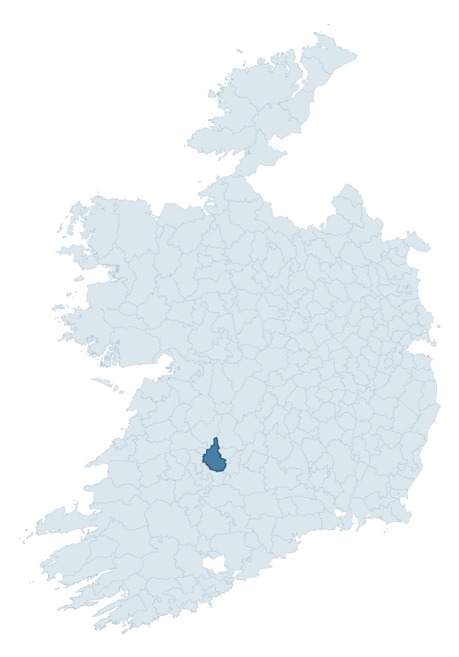
Where this barony sits in the Republic of Ireland
Geology and preservation
Bedrock geology shapes the landscape long before any settlement begins — controlling soil drainage, agricultural potential, the survival of upstanding monuments, and the preservation of buried archaeology. The figures below come from the Geological Survey Ireland 1:100,000 bedrock map.
The bedrock underlying Clanwilliam is predominantly limestone (61% of the barony by area), laid down during the Carboniferous period (98% by area, around 359 to 299 million years ago). Limestone is the most heritage-rich bedrock in Ireland. It supports fertile, well-drained soils that favoured dense Early Medieval settlement and Norman manorial agriculture, and it weathers into karst features — sinkholes, caves, swallow holes, and souterrains — that frequently carry archaeology. Where peat overlies limestone, organic preservation can be exceptional. The single largest mapped unit is the Waulsortian Limestones (25% of the barony's bedrock). With 12 distinct rock types mapped, the barony sits in the top third of ROI baronies for geological diversity (95th percentile) — typically a sign of complex tectonic history or coastal mosaics of differing rock units.
Rock type composition
Largest mapped unit: Waulsortian Limestones (25% of the barony)
Placename evidence
Logainm records 51 heritage-diagnostic placenames for Clanwilliam, drawn from townland and civil-parish names across the barony. The dominant stratum is pre-Christian and Early Medieval defensive — ráth-, lios-, dún-, and caiseal-prefixed names that mark Iron Age and early historic settlement. The leading diagnostic roots are cill- (11 — church), ráth- (8 — earthen ringfort), and cathair- (8 — stone fort). This is above the ROI average of 30.7 heritage placenames per barony. The presence of multiple heritage strata side by side indicates layered occupation of the landscape across successive prehistoric and historic periods. Logainm records 277 placenames for Clanwilliam (predominantly townland names). Of these, 51 (18%) carry one of the diagnostic Gaelic roots tracked above; the remainder draw on more generic landscape vocabulary that does not encode a heritage period.
Pre-Christian / Early Medieval Defensive
| Root | Count | Meaning |
|---|---|---|
| ráth- | 8 | earthen ringfort |
| cathair- | 8 | stone fort |
| dún- | 5 | hilltop or promontory fort |
| lios- | 3 | ringfort or enclosure |
Early Christian Ecclesiastical
| Root | Count | Meaning |
|---|---|---|
| cill- | 11 | church (early) |
| gráinseach- | 5 | monastic farm / grange |
| tobar- | 2 | holy well |
| teampall- | 1 | church (later medieval) |
| domhnach- | 1 | pre-Patrician or earliest Patrician church |
| cillín- | 1 | unconsecrated burial ground |
Burial, Ritual, and Norse-Contact
| Root | Count | Meaning |
|---|---|---|
| carn- | 3 | cairn |
| leacht- | 2 | grave monument |
| leaba- | 1 | megalithic tomb |
| gall- | 1 | foreigner — Norse settlement marker |
Other baronies in Limerick
- Coshma
- Kilmallock
- Glenquin
- Connello Upper
- North Liberties
- Owneybeg
- Coshlea
- Ibrickan — Clare
- Carbery West (west Division) — Cork
- Carbery West (east Division) — Cork
See all 280 baronies in the Republic of Ireland Heritage Tool.

Explore further
Grounding History: 10 Maps of Northern Ireland’s Past
If you’re interested in Irish heritage more widely, the companion report for Northern Ireland brings together the analysis of all 462 NI wards into one place through 10 high-quality maps — covering monument density, archaeological periods, placename heritage, terrain, wetland, and the historic landscape at first survey. Take a look.
About this profile
Click any section below to expand.
What is a barony?
A barony is a historic administrative unit in Ireland, broadly equivalent to an English hundred. The 280 baronies used here are from the OSi 2019 National Statutory Boundaries (generalised 20m), covering the 26 counties of the Republic of Ireland. Baronies derive from the Norman period, were formalised in the 17th century, and have not been redrawn for statistical purposes. They vary enormously in area, from compact urban baronies in Dublin to vast upland baronies in Connacht, and should not be compared by raw site count without accounting for area differences.
What counts as a site?
This profile combines three distinct heritage registers, each with its own definition of what constitutes a recordable site:
- Archaeological sites (NMS). The National Monuments Service Sites and Monuments Record (SMR) catalogues every known archaeological monument or site of archaeological interest in the Republic, from prehistoric burial mounds and ringforts to medieval churches and post-medieval defensive works. Inclusion does not require legal protection — only that the site has been identified, surveyed, and assessed as having archaeological value. A separate subset of these sites lies within a recorded protection zone, which gives them statutory protection under the National Monuments Acts.
- Listed buildings (NIAH). The National Inventory of Architectural Heritage records buildings of architectural, historical, archaeological, artistic, cultural, scientific, social, or technical interest. Each surveyed structure is appraised on a five-tier scale: International, National, Regional, Local, and Record-Only. The NIAH appraisal is informational rather than strictly statutory, but it underpins local-authority Record of Protected Structures (RPS) listings.
- Heritage placenames (Logainm). Logainm is the authoritative database of Irish placenames maintained by the Placenames Branch. This profile applies a heritage-diagnostic classifier to the Irish-language form of each townland name, flagging roots that signal defensive sites (ráth-, lios-, dún-, caiseal-, cathair-), ecclesiastical foundations (cill-, teampall-, domhnach-, mainistir-), prehistoric burial-ritual features (tuaim-, carn-, leaba-), or Norse-contact settlement (gall-). Townlands without one of these diagnostic roots are not flagged here — they may still carry historical significance, but that significance is not encoded in the name itself.
Editorial principles
The narrative sections of this profile follow several explicit principles:
- Evidential. Every claim about this barony’s heritage character is anchored in the underlying register data. Where a site count, a placename count, or a percentile rank is cited, it is computed from the source datasets at export time, not estimated.
- Comparative. Counts and metrics are reported alongside their percentile rank against the other 279 ROI baronies. A barony with 50 ringforts in absolute terms could be unusually high or unusually low depending on its size and regional context; percentile ranking removes that ambiguity.
- Transparent on limits. Where a register has known coverage gaps, survey biases, or data-quality issues that affect this barony’s figures, the profile flags them rather than presenting the numbers as definitive.
- No interpretation beyond what the data supports. The narrative does not speculate about historical events, social dynamics, or cultural meaning beyond what the recorded heritage and placename evidence directly attests.
Data caveats and limits
- NMS Sites and Monuments Record is the product of survey campaigns conducted at different intensities across different counties and decades. Some baronies have been surveyed more thoroughly than others, and absolute counts should be read in that light. Sites destroyed by development before survey are typically not represented; sites in heavily forested or upland terrain are sometimes under-recorded.
- NIAH coverage is broadly complete for the Republic of Ireland but the survey was conducted on a rolling county-by-county basis, and the most recent appraisal date varies. Buildings demolished or substantially altered after their original survey may still appear in the register; conversely, recent buildings of merit may not yet have been appraised.
- Logainm classification applies a deliberately conservative pattern-matching approach to the Irish-language townland forms. The classifier prioritises true positives over recall: a townland may carry a heritage signal that the classifier doesn’t recognise, particularly where the diagnostic root has been heavily anglicised or where the townland name draws on a less common term. The 60,000+ townland records and ~9,800 classified placenames give a substantial signal at barony scale, but individual townland names should be checked against Logainm directly for definitive interpretation.
- Period attribution. The chronological distribution reflects only those NMS sites that carry a recognised period attribution in the source data. Sites listed as “Unknown” period are excluded from the dated subset.
- Boundary changes. Some baronies have undergone minor boundary adjustments since their 19th-century definition; the OSi 2019 generalised boundaries used here are the current statutory definition and may differ slightly from historical maps in border areas.
- Bedrock geology is mapped at 1:100,000 scale, which means local variation within a barony — small pockets of different rock type, mineral veins, alluvium overlying bedrock — is generalised. The dominant-system and rocktype figures are area-weighted, so a barony reading “70% Carboniferous limestone” may still contain small but archaeologically important pockets of older or younger rock. Around 3% of GSI polygons do not match the lexicon and contribute no rocktype or system attribution.
Data sources
- National Monuments Service — Sites and Monuments Record (SMR) https://data.gov.ie/dataset/national-monuments-service-archaeological-survey-of-ireland
- National Inventory of Architectural Heritage (NIAH) https://data.gov.ie/dataset/national-inventory-of-architectural-heritage-niah-national-dataset
- Logainm — Placenames Database of Ireland https://www.logainm.ie/
- Ordnance Survey Ireland — National Statutory Barony Boundaries 2019 https://data-osi.opendata.arcgis.com/
- EURODEM — European Digital Elevation Model https://www.mapsforeurope.org/datasets/euro-dem
- ESA WorldCover https://esa-worldcover.org/en
- Geological Survey Ireland — 1:100,000 Bedrock Geology https://www.gsi.ie/en-ie/data-and-maps/Pages/Bedrock.aspx
Explore more: Search any of the 280 ROI baronies, browse by historical province, or read the methodology and data sources for the full Republic of Ireland Heritage Tool.