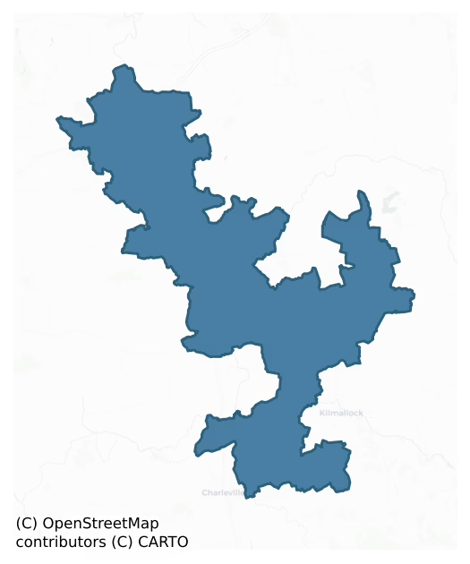
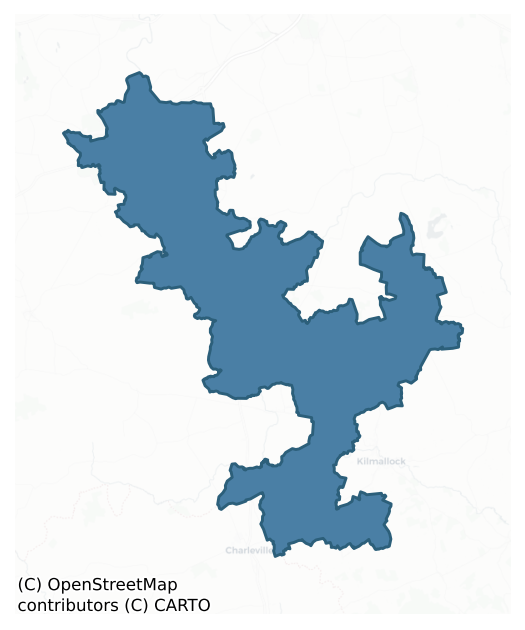
Coshma is a barony of County Limerick, in the historical province of Munster (Irish: Cois Máighe), covering 198 km² of land. The barony records 663 NMS archaeological sites and 194 NIAH listed buildings, placing it at around the 88th percentile among 280 ROI baronies for sites per km². This means it is in the top fifth of all baronies for sites per km². Dated archaeological evidence runs from the Neolithic through to the Modern, spanning 8 of 9 archaeological periods, placing the barony in the 48th percentile among 280 ROI baronies for chronological depth. This means it is in the lower half of all baronies for chronological depth. The largest dated subset of recorded sites dates to the Iron Age. Logainm flags 25 placenames in the barony as carrying a recognised heritage root; the largest share — around 60% — are names associated with early Christian church and monastic foundations.
Heritage at a glance
Percentile rankings throughout this profile compare each barony only against the other 279 Republic of Ireland baronies.
The recorded heritage of Coshma
The National Monuments Service Sites and Monuments Record (SMR) is the statutory inventory of archaeological sites for the Republic of Ireland, maintained by the Department of Tourism, Culture, Arts, Gaeltacht, Sport and Media. Sites recorded here include earthworks, ringforts, megalithic tombs, ecclesiastical remains, and post-medieval features; not every record is legally protected, but each is registered as a monument of archaeological interest.
The National Monuments Service records 663 archaeological sites in Coshma, putting it at the 88th percentile among 280 ROI baronies for sites per km². This means it is in the top fifth of all baronies for sites per km². Protection coverage is near-universal — 608 sites (92%) fall within a recorded monument protection zone, indicating an extensively surveyed landscape. The dominant category is defensive sites — ringforts, enclosures, hillforts, and stone forts (342 sites, 52% of the record). Ringfort – rath is the most prevalent type, making up 17% of the barony's recorded sites (115 records), broadly in line with the ROI average of 20% across all baronies where this type occurs. Ringfort – rath is an earthen ringfort enclosed by a bank and external ditch — the most common Early Medieval farmstead, broadly dated 500–1000 AD. Other significant types include Enclosure (97) and Earthwork (61). Enclosure is a banked or ditched feature of uncertain type, used as a catch-all where the original function cannot be determined from surface evidence; Earthwork is an unclassified earthen structure with no diagnostic features that allow a more specific classification. Across the barony's 198 km², this gives a recorded density of 3.34 sites per km².
Most common monument types
Hover or tap a monument type to see its definition.
| Type | Count |
|---|---|
| Ringfort – rath an earthen ringfort enclosed by a bank and external ditch — the most common Early Medieval farmstead, broadly dated 500–1000 AD | 115 |
| Enclosure a banked or ditched feature of uncertain type, used as a catch-all where the original function cannot be determined from surface evidence | 97 |
| Earthwork an unclassified earthen structure with no diagnostic features that allow a more specific classification | 61 |
| Excavation – miscellaneous | 30 |
| Barrow – unclassified a prehistoric burial mound where the specific barrow type cannot be determined from surface evidence | 26 |
| Church a building used for public Christian worship, of any date from c. 500 AD onwards | 24 |
| Graveyard a burial area associated with a church, in use from the medieval period onwards | 19 |
Chronological distribution
The dated archaeological record for Coshma spans from the Neolithic through to the Modern, with activity attested across 8 of 9 archaeological periods. Every period from earliest to latest is represented in the record — an unbroken sequence of dated activity across the full chronological span. Activity concentrates most heavily in the Iron Age (214 sites, 41% of dated material), with the Early Medieval forming a secondary peak (109 sites, 21%). A further 135 recorded sites (20% of the overall NMS register for the barony) carry no period attribution — appearing as 'Unknown' in the bar chart below. This typically reflects either records that pre-date the standardised period vocabulary or sites awaiting specialist dating review, rather than a genuine absence of chronological evidence.
Sample of recorded monuments
Show 25 sample monuments (of 663 total)
A representative sample of 25 recorded monuments drawn from the barony’s 663 total NMS entries. Sites within a recorded monument protection zone and rarer site types are prioritised so the list shows a meaningful cross-section rather than only the most common type. Each entry shows the official Sites and Monuments Record reference number and the description published by the National Monuments Service.
Architectural fragment
Castleroberts Bridge crossing the River Maigue was built in the late 18th century with fabric from a medieval church (LI021-132—-) and castle (LI021-037—-) located 330m to E. In 1865 it was recorded that 'The ruins…
Castleroberts Bridge crossing the River Maigue was built in the late 18th century with fabric from a medieval church (LI021-132—-) and castle (LI021-037—-) located 330m to E. In 1865 it was recorded that 'The ruins of this [Castleroberts] church, and of part of the old castle, were pulled down for materials to build a bridge over the Maigue at Castle Roberts, about seventy or eighty years ago (c. 1785-95)' (Dunraven 1865, 270). In 1840 the Ordnance Survey described the bridge as consisting of '8 arches, built in 1795' (OSNB, 57).
Compiled by: Caimin O'Brien
Date of upload: 02 January 2019
Fish-pond
In level pasture at the base of a slight E-facing slope, with moderate views to the S and E and poor views to the N and W. A woodland plantation annotated 'Morrisey Wood' lies 40m to E, which is associated with the…
In level pasture at the base of a slight E-facing slope, with moderate views to the S and E and poor views to the N and W. A woodland plantation annotated 'Morrisey Wood' lies 40m to E, which is associated with the landscaping of the demesne of Caherass Court located 850m to S. Ringfort (LI021-085—-) lies 110m to W and and enclosure (LI021-087—-) is 360m to S. The site is not depicted on the 1840 ed. OSi 6-inch map. Shown on the 1897 ed. OSi 25-inch map as a D-shaped enclosure (ext. diam. 135m N-S; 115m E-W) with straight side (L. 100m) at S surrounding a small raised platform (ext. diam. 27m N-S; 23m E-W) or island defined by a scarped edge that is annotated 'Old Fish Pond'.
Inspected by the ASI in 2000 and described as a D-shaped area enclosed by a flat-topped earthen bank (Wth 7.2m; int. H 0.6m, ext. H 0.3m) visible from W, N and E and intersected at S by a modern road, a small circular-shaped platform (int. diam. 12.2m) in the centre of the drained pond. The road was built along the line of the S bank of the fishpond. The platform is level with the external field surface. The interior of the drained pond is level, clear of scrub vegetation, waterlogged and only slightly lower than the surrounding field surface (D 0.4-0.6m). A concrete square pump house (diam. 3m) is visible in the NW corner of the pond. The omission of the fish-pond on the 1840 OSi 6-inch map and its inclusion on the 1897 map suggests a mid to late 19th century date for its construction. Pos…
Round tower
National monument No. 83. Dysert Aenghusa (Diseart Aonghasa) was a monastery belonging to the 'Céile Dé' or 'Client of God' (Ó Carragáin 2010, 308). The monastery was dedicated to St. Aonghas who is also associated…
National monument No. 83. Dysert Aenghusa (Diseart Aonghasa) was a monastery belonging to the 'Céile Dé' or 'Client of God' (Ó Carragáin 2010, 308). The monastery was dedicated to St. Aonghas who is also associated with Dyasrtenos (LA013-059001-), Co. Laois (Gwynn and Hadcock 1970, 383). In the year 1033 the Annals of the Four Masters recorded the death of ‘Conn, son of Maelpadraig, airchinnech [erenagh] of Mungairit [Mungret] and Disert-Oenghusa [Aonghasa]’ (O’Donovan 1856, 827). This reference links the monastery of Mungret (LI013-009001-), Co. Limerick located 13km to the NNE with Dysert-Aonghasa. This Aonghas appears to have been the Aonghas of Tallaght monastery (DU021-037002-) who wrote the metrical martyrology known as Féilire Aonghasa (Ó Riain 2011, 79). The preface added to the Féilire Aonghasa in the late twelfth century recorded details in his life which bring him from a church named after him at Dysert (Diseart Aonghasa), to Coolbanagher (Cúil Bheannchair) (LA008-014001-), a little north of Dysartenos (Diseart Aonghasa), in Laois, where he allegedly began his metrical martyrology, and finally to Tallaght, where he finished the Féilire Aonghasa (ibid.). Aonghas was reputedly buried at Clonenagh (LA017-003001-), Co. Laois, after his death some time between 815-830, his feast day was the 11th of March (Stokes 1905, xxvi).
Present remains consist of a multi-period church (LI030018002-), round tower immediately to N with graveyard (LI030-018003-) to S of…
Cliff-edge fort
On reclaimed flat pasture adjacent to the S bank of the River Maigue. Depicted as a D-shaped field enclosure on the 1840 ed. OSi 6-inch map. Shown on the 1897 ed. OS 25-inch map as an embanked D-shaped fort (ext. diam.…
On reclaimed flat pasture adjacent to the S bank of the River Maigue. Depicted as a D-shaped field enclosure on the 1840 ed. OSi 6-inch map. Shown on the 1897 ed. OS 25-inch map as an embanked D-shaped fort (ext. diam. c. 26m NE-SW; 29m NW-SE) backing onto the River Maigue with a curving ditch and external bank (Wth. 8m; L. 45m) to the SW. The site is not visible on either the OSi orthoimage taken 2005-12 or on Digital Globe orthoimages taken 2011-2013. The monument is partially visible on Google Earth orthoimage taken 16/03/2016; 28/06/2018 and 14/02/2020. The siting is not typical for ringfort in County Limerick and has parallels with LI006-001—-.
See attached Google Earth orthoimages
Compiled by: Edmond O’Donovan
Date of upload: 1 October 2020
Gateway
Annotated 'Gattawheerie (Site of)' on the Cassini ed. OSi 6-inch map. No antiquity depicted at this location on the 1840 ed. OSi 6-inch map. Lynch (1897, 351) recorded the following details about this monument; 'The…
Annotated 'Gattawheerie (Site of)' on the Cassini ed. OSi 6-inch map. No antiquity depicted at this location on the 1840 ed. OSi 6-inch map. Lynch (1897, 351) recorded the following details about this monument; 'The little gate at the opposite side of the road, and fronting the entrance to Rockbarton, is called Gattawheerie, or Power's Gate. Power was a celebrated robber who preserved this road in the good old times'.
Compiled by: Caimin O'Brien
Date of upload: 10 December 2020
Ford
In gently undulating low-lying pasture, 115m W of Monaster Bridge (LI031-009001-) and 315m SE of the Cistercian Abbey of Monasteranenagh (LI031-050004-). Crossing point over the Camoge River which forms a townland…
In gently undulating low-lying pasture, 115m W of Monaster Bridge (LI031-009001-) and 315m SE of the Cistercian Abbey of Monasteranenagh (LI031-050004-). Crossing point over the Camoge River which forms a townland boundary between Ballymacsradeen East and Monaster North. Annotated ‘Weir’ on the 1840 ed. OSi 6-inch map, changed to ‘Ford of the Chariot of Fergus’ on the Cassini ed. OSi 6-inch map. Described by Westropp (1920, 372, 373 & 375) as; ‘An ancient roadway’ (LI031-010001-) leads from a fording point on the Camoge River, to a pair of conjoined ringforts (LI031-010002-), the latter which he refers to as the assembly place of the Óenach Cairbre. According to Westropp (1920, 373) the ford marks an earlier crossing point known as ‘The Ford of the Chariots of Fergus’. Fording point over the Camoge River named after Fergus Mac Roig, a hero of the Red Branch (Westropp 1919, 18). Westropp (1919, 19) described this site as follows; 'Driving eastward and southward, we reach the ford on the Cammoge to the S.E. of Tory Hill. The ford is too wide to be defended even by a single hero, unlike the ford held by Cu Chulaind in the Tain bo Cualnge. The place where Fergus stood back from the direct road commanded the stretch of the ford from the slightly rising ground at the conjoined cairns. The Abbey bridge and old mill mark the shallow on the Cammoge. Whether the conjoined rings[LI031-010002-] formed the Ceann duin Asail, or Head-fort of Asail, is probable but uncertain. Asal an…
Religious house – Cistercian monks
National monument No. 171. Cistercian Abbey described by Stalley (1987), as following: 'The rather dour ruins of Monasteranenagh lie in flat countryside beside the River Camoge, two and a half miles east of Croom and…
National monument No. 171. Cistercian Abbey described by Stalley (1987), as following: 'The rather dour ruins of Monasteranenagh lie in flat countryside beside the River Camoge, two and a half miles east of Croom and ten and a half miles south of Limerick. The monastery was founded in 1148 by Turlough O'Brien, king of Thomond, as a daughter house of Mellifont. It subsequently established three daughter houses of its own in Munster (Abbeydorney 1154, Midleton 1180 and Holycross 1180). With its O'Brien patrons, the monastery was the focus of resistance to Anglo-Norman influence and it played a major role in the conspiracy of Mellifont, having 'drunk from the chalice of Babylon' in the words of Stephen of Lexington. In 1228 the community attempted to thwart Stephen's visitation by turning the abbey buildings into a minor fortress. Later in the century the monastery fell heavily into debt, owing £209.6.8 to the Ricardi of Lucca in 1302. It was suppressed in 1539—40, but some form of religious life may have survived until 1580, when the abbey was the scene of a battle during the Desmond rebellion. The tale of forty monks being massacred after the battle by the victorious soldiers of Sir Nicholas Malby is not supported by reliable evidence.
The ruins consist principally of the church (C. 1170—1220) and early Gothic chapter house. The church was planned on a grand scale with three chapels opening off each transept, but these have been almost completely destroyed. Fragment…
Battlefield
Battle of Monasternenagh, 1370 – summary by Dr Gavin Hughes. Uploaded 22/02/2021 Olive Alcock
This engagement occurred against the backdrop of decreasing Anglo-Norman control and authority over its English lordships…
Battle of Monasternenagh, 1370 – summary by Dr Gavin Hughes. Uploaded 22/02/2021 Olive Alcock
This engagement occurred against the backdrop of decreasing Anglo-Norman control and authority over its English lordships and it was fought between Gerald FitzMaurice FitzGerald, 3rd earl of Desmond and Brian Ó Briain, king of Thomond. The annalistic evidence for the battle, although lacking in detail, is found in the Annals of Connacht (Freeman 1944, 337-9), the Annals of Ulster (Mac Carthy 1893, vol. 2, 537-9, 541), the Annals of Loch Cé (Murphy 1871, vol. 2, 43), the Chartularies of St. Mary’s Abbey, Dublin (Gilbert 1884, 2, 397), the Cistercian establishments in Ireland (Gilbert 1884, 2, 235) and the Annales Hiberniae (Grace 1842, 155-7).
Throughout the fourteenth century, the Anglo-Irish lordship in Ireland faced serious pressures as a result of the Bruce invasion (1315-18), a disastrous famine and the arrival of the 'Black Death' in 1349. Although it affected the Gaelic lordships as well, the plague was particularly devastating for the Anglo-Norman Irish towns. The downward trajectory continued and the strength of the Gaelic lordships began to return. In 1369, a newly appointed justiciar, William of Windsor, was determined to re-stamp English authority on an increasingly defiant Gaelic Irish population. Initially tackling Leinster, the Justiciar imprisoned and subsequently beheaded one of the main agitators, Diarmait Mac Murchadha Caomhánach but, at the same time, a re…
Megalithic tomb – unclassified
In woodland on the former demesne of Cahir Guillamore House, 150m SE of the townland boundary with Caherguillamore. Rockbarton House 500m to S. Located in the NE boundary of a field system (LI031-206—-), 160m NW of a…
In woodland on the former demesne of Cahir Guillamore House, 150m SE of the townland boundary with Caherguillamore. Rockbarton House 500m to S. Located in the NE boundary of a field system (LI031-206—-), 160m NW of a cashel (LI031-075—-). Upstanding monument labelled Site 5 and described by Ó Ríordáin and Hunt (1942, 42) as consisting of the ‘remains of a ruined megalith here, but it is not clear what type of tomb is represented, it appears to have been a " gallery grave," the present length of which is 16’ [4.8m] approximately’. Recorded by Grogan (1989, Vol. 2, 24) as a 'possible wedge-tomb'. The monument is not visible on the OSi orthophotograph taken between 2005-12 or Google Earth orthoimages.
See attached location map with tomb labelled 5 and Google Earth orthoimages
Compiled by: Fiona Rooney
Date of upload: 22 March 2021
Watercourse
In wet pasture 96m W of the River Maigue which forms townland boundary with Inchinclare and 30m NE of townland boundary with Ballyphillips, a burial ground (LI031-124—-) lies 250m to NE. Depicted on the OSi 25-inch…
In wet pasture 96m W of the River Maigue which forms townland boundary with Inchinclare and 30m NE of townland boundary with Ballyphillips, a burial ground (LI031-124—-) lies 250m to NE. Depicted on the OSi 25-inch map as a hollow-way (dims. L 56m) running NW-SE, flanked on either side by an earthen bank intersected at NW and SE by post-1700 field boundaries. A field boundary (L c. 250m) running NW-SE indicated on the 1840 ed. OSi 6-inch map and not depicted on 1897 ed. OSi 25-inch map which suggests that it was levelled between these dates. Traces of this field boundary are visible on the OSi orthophotograph taken between 2005-2012 and on Google Earth orthoimage dated 16/03/2016. Earthwork is visible as a meandering linear cropmark on the OSi orthophotograph taken between 2005-2012 and on Google Earth orthoimage dated 28/06/2018. The aerial imagery suggests that the meandering remains of this earthwork may be the remains of a watercourse rather than that a sunken road. Earthwork is not visible on Google Earth orthoimage dated 28/06/2018.
See attached Google Earth orthoimages
Compiled by: Fiona Rooney
Date of upload: 24 March 2021
Burial ground
In wet pasture 40m W of the River Maigue and 250m NE of a road (LI031-082—-). Annotated ‘Burial Ground’ on 1840 ed. OSi 6-inch map where it is depicted as a raised roughly circular-shaped area (diam. c. 28m) in W…
In wet pasture 40m W of the River Maigue and 250m NE of a road (LI031-082—-). Annotated ‘Burial Ground’ on 1840 ed. OSi 6-inch map where it is depicted as a raised roughly circular-shaped area (diam. c. 28m) in W corner of small field with ‘Connor’s Well’ 50m to S. Not depicted on the 1897 ed. OSi 25-inch map indicating that the burial ground was levelled between these map dates. Described in 1904-05 as ‘a burial ground’ (Westropp 1904-05, 412). No surface remains visible on OSi orthophoto taken between 2005-2012 or on any Google Earth orthoimages.
Compiled by: Martin Fitzpatrick
Date of upload: 16 March 2021
Building
No surface remains visible of 'Watch Ho.' associated with eel weir (LI031-050003-) on the Camoge River 115m N of the Cistercian abbey (LI031-050004-) of Monasteranenagh. Annotated 'Watch Ho.' on 1840 ed. OSi 6-inch map…
No surface remains visible of 'Watch Ho.' associated with eel weir (LI031-050003-) on the Camoge River 115m N of the Cistercian abbey (LI031-050004-) of Monasteranenagh. Annotated 'Watch Ho.' on 1840 ed. OSi 6-inch map where it is shown standing on an island in the centre of the Camoge River adjacent to an eel weir (LI031-050003-). Described by Westropp (1889, 238) as follows; 'There are some remains of a detached building near the Cammogue, perhaps a mill, though the country people say that a rope from a net in the river rang a bell in it when a salmon was captured. The neglected state of the ruins defies description, and calls for remedy'. No surface remains visible of this building or island standing in the centre of the Camoge River.
See attached Google Earth orthoimage
Compiled by: Martin Fitzpatrick
Date of upload: 2 April 2021
Cave
Site of cave described by Lynch (1913, 20) as following; 'Just outside Mr. Leahy's yard wall is a fine conglomerate, which many years ago, Mr. Leahy was informed, was used as a Mass Rock. About sixty yards [55m] north…
Site of cave described by Lynch (1913, 20) as following; 'Just outside Mr. Leahy's yard wall is a fine conglomerate, which many years ago, Mr. Leahy was informed, was used as a Mass Rock. About sixty yards [55m] north of this Mr. Kelly pointed out the exact spot where the cave was discovered. Mr. Leahy Jnr., heard old men from Bruff say that the entrance to the cave was formed of cut stone. It is about 100 yards [91m] due east of the cromleac [LI032-120—-]. Near the cave are two large flagstones where an old gateway was'.
Compiled by: Caimin O'Brien
Date of upload: 06 August 2019
Bullaun stone
In wet pasture, liable to floods, 85m N of a townland boundary with Ballydaheen and 90m W of a townland boundary with Kilballyowen. Ring-barrows (LI032-217/216—-) lie 250m to E and 300m to W respectively. Annotated…
In wet pasture, liable to floods, 85m N of a townland boundary with Ballydaheen and 90m W of a townland boundary with Kilballyowen. Ring-barrows (LI032-217/216—-) lie 250m to E and 300m to W respectively. Annotated ‘Bullaun’ on the current edition OSi 6-inch map. Monument described by Lynch (1913, 21) as: ‘At the south-east extremity [of a drained swamp between Greallach and Ardnaboula, Knockderk and Ballydaheen], we found the Rock well, or Bullaun; it is 22 inches (56cm) deep by 14 inches (36cm) in diameter, and perfect in form as the exterior of an egg shell, and exactly similar to the one [ LI032-038—-] near Bourchier’s Castle [LI032-022034-]’. Monument is not visible on OSi orthoimages taken 2005-2012, on Digital Globe orthoimages taken 2011-2013 or on Google Earth orthoimage taken 28/06/2018, although a small, brown worn patch of grass near this spot, may indicate the precise location.
See attached Google Earth orthoimage
Compiled by: Alison McQueen and Vera Rahilly
Date of upload: 8 November 2020
Road – hollow-way
In flat pasture, 315m S of Kilbroney Church (LI039-102001-) and St. Broney's Well (LI039-012002-). Not marked on the 1840 ed. OSi 6-inch sheet. Depicted on the 1897 ed. OSi 25-inch sheet as a linear earthwork (L. c.…
In flat pasture, 315m S of Kilbroney Church (LI039-102001-) and St. Broney's Well (LI039-012002-). Not marked on the 1840 ed. OSi 6-inch sheet. Depicted on the 1897 ed. OSi 25-inch sheet as a linear earthwork (L. c. 53m) running N-S, where it is shown as a possible sunken or hollow way flanked by a bank on either side. Upstanding monument visible as a linear feature overgrown with trees (L. c. 69m) on OSi orthophotograph taken between 2005-12 where traces of the levelled road are visible as a linear cropmark running NW-SE (L. c. 74m) to N of upstanding section. Possible roadway leading N towards Kilbroney Church, or could be the remains of a watercourse such as a mill-race. Paleochannel or old watercourse visible running into linear earthwork at NE visible on Google Earth orthoimage dated 05/04/2006.
See attached Google Earth orthoimages
Compiled by: Fiona Rooney
Date of upload: 12 April 2021
House – Neolithic
The house had eight main structural posts. Six of these were set into the foundation trench, one at each corner, and one midway along each of the long sides of the trench. The latter were set on a line with a pair of…
The house had eight main structural posts. Six of these were set into the foundation trench, one at each corner, and one midway along each of the long sides of the trench. The latter were set on a line with a pair of interior post holes. Thus, the four central, structural posts ran mid-way across the short axis of the house. Only one other internal post hole was noted in the northeast corner of the house. This may have been associated with the entrance or subsidiary roof support in this corner of the house. The archaeological remains showed that the house had been destroyed by fire. This was indicated by heavy oxidation of the trench sides and the presence in the fill of the trench and post holes of a high concentration of charred material, much of it disturbed. During excavation, concentrations of charcoal displaying a vertical grain were noted and sampled. Three of these have been identified as Quercus. This appears to indicate that the house may have been built of split oak planks. Identification of further samples of charcoal removed from the trench fill is to be carried out.
One of the two main internal post holes yielded a cache of charred grain, some of which has been identified as emmer wheat. Evidence for the position of a possible hearth site occurred as a concentration of slightly oxidised clay in the centre of the house between the two main interior posts.
The entrance appeared to be placed at the north side of the house and was only indicated by a deposit in…
Religious house – Augustinian friars
14th century Augustinian Friary described in the Urban Survey of County Limerick (Bradley et. al. 1989, 16-31) as following; 'This was founded by John FitzThomas FitzGerald, 1st earl of Kildare, before 1316 (Gwynn and…
14th century Augustinian Friary described in the Urban Survey of County Limerick (Bradley et. al. 1989, 16-31) as following; 'This was founded by John FitzThomas FitzGerald, 1st earl of Kildare, before 1316 (Gwynn and Hadcock 1970, 295), and it was endowed with properties in the town. The monastery was suppressed in 1539-40 but there are indications that the friars managed to stay on until c. 1581 (ibid.). The friary is situated on low-lying ground on the south bank of the river Maigue just below Adare bridge and it is now used as the Church of Ireland parish church. The monastic complex was restored by the earl of Dunraven in the last century and consequently the buildings are very well preserved. The complex consists of a church of early fourteenth century date, with a later south aisle and crossing tower. To the north of the church are cloisters with surrounding buildings of which the north range is intact but much of the east and west ranges are missing. At the north-east is the gatehouse, and further north again are remains of the extended east range.
The Church
This consists of a nave and chancel with a later crossing tower and a south aisle which is probably a late medieval building. The east and west gables of the nave and choir are c. 10.5m high; the east and west gables of the aisle are c. 6.5m high. A low (c. 50cms) basal batter occurs on the north wall of the nave and chancel and on the south walls of the chancel and aisle while the east walls of the chance…
Religious house – Franciscan friars
15th century Franciscan Friary described in the Urban Survey of County Limerick (Bradley et. al. 1989, 32-6) as following; 'The friary of St Michael the Archangel was founded by Thomas FitzGerald, earl of Kildare in…
15th century Franciscan Friary described in the Urban Survey of County Limerick (Bradley et. al. 1989, 32-6) as following; 'The friary of St Michael the Archangel was founded by Thomas FitzGerald, earl of Kildare in 1464 (Gwynn and Hadcock 1970, 242). It was suppressed in 1539-40 although the friars appear to have stayed on until c. 1580 (ibid.). In 1595 it was granted to Sir Henry Wallop. The friary is located to the east of Desmond Castle (LI021-032003-), on the present Adare Manor Golf Course, overlooking the river Maigue to the south. It consists of a nave and chancel church with crossing tower, a south transept with western aisle, the east, west and north range of the cloister, and some auxiliary buildings to the north.
The Church
This consists of a long narrow nave and chancel divided by a tower of contemporary date, and with a south transept, also apparently contemporary, opening off the nave. The walls of the CHANCEL are intact. The east gable is 9m high and it has a four-light pointed window with switch-line tracery, having chamfered jambs, grooves for glass and bar-holes, with a hollow chamfered hood moulding and pointed rear arch with chamfered jambs and pyramidal stops. Above a ledge over this window is a small rectangular window. Externally there are stepped angle buttresses, and a batter c. 2m high. To the north of the window internally is a large, tapering chamfered corbel shaft, presumably the base for a statue. The south wall is 5.25m high, and battered…
Religious house – Trinitarians
Trinitarian abbey in the town of Adare described in the Urban Survey of Limerick (Bradley et. al. 1989, 36-9) as following: 'This monastery appears to have been founded by Geoffrey de Marisco before 1226 (Gwynn and…
Trinitarian abbey in the town of Adare described in the Urban Survey of Limerick (Bradley et. al. 1989, 36-9) as following: 'This monastery appears to have been founded by Geoffrey de Marisco before 1226 (Gwynn and Hadcock 1970, 217). In the taxation of 1302-6 it was valued at 40s. It was dissolved in 1539 and in 1595 it was granted to Sir Henry Wallop (ibid.). In 1811 it was reconstructed by the earl of Dunraven for use as the Roman Catholic parish church. The surviving remains consist of parts of the south wall of the church, a crossing tower and parts of the N range of claustral buildings. These have been greatly modified; most of the doors and windows are modern and the masonry is generally roughly coursed limestone rubble. There is a refurbished dovecot at the extreme north west corner of the church grounds.
The Church
This may have been a cruciform building with crossing tower although the existence of a south transept is not certain (Hewson 1897-1900, 30). The north wall has been removed and the modern Catholic church has been built onto the north side of the medieval nave and chancel. The latter now serve as a south aisle for the modern church. Part of the south wall appears to be the only original part of the medieval building and this contains the only original window which is a cusped twin-light pointed window with elongated quatrefoil above the lights. Below the window there is a contemporary ogee-headed piscina. Three other recesses in this wall hold a rou…
Gatehouse
Medieval gatehouse known as 'Kilmallock Gatehouse' described in the Urban Survey of County Limerick (Bradley et. al. 1989, 39-40) as following;
"A single wall of roughly coursed limestone rubble, 6.55m long, 1.55m…
Medieval gatehouse known as 'Kilmallock Gatehouse' described in the Urban Survey of County Limerick (Bradley et. al. 1989, 39-40) as following;
"A single wall of roughly coursed limestone rubble, 6.55m long, 1.55m thick and 3.5m high running north-south is situated on Adare Manor Golf course directly north of and
overlooking the Desmond castle (LI021-032003-) and west of St. Nicholas' Church (LI021-032004-). There is a basal batter c. 50cms high at the north and south ends. On the internal west face which is mostly covered in ivy there are traces of a barrell vault c. 3m high and the wall face is set back by 32cms 1.60m from the north end. According to Harbison it was adorned with the Geraldine arms (1970, 145). If this building was a gatehouse it is possible that it may have formed part of the town defences. In the absence of excavation, however, and of any knowledge of the actual outline of the town defences, it is impossible to be definite about this'.
Compiled by: Caimin O'Brien
Date of upload: 04 November 2019
Chapel
Medieval chapel described in the Urban Archaeological Survey of County Limerick (Bradley et. al. 1989, 41) as following; 'A small rectangular chapel, 12.20m by 6.60m, is situated c. 20m north of St Nicholas's parish…
Medieval chapel described in the Urban Archaeological Survey of County Limerick (Bradley et. al. 1989, 41) as following; 'A small rectangular chapel, 12.20m by 6.60m, is situated c. 20m north of St Nicholas's parish church. The masonry is roughly coursed rubble limestone with dressed limestone quoins and jambs and it has a gallery at the west end and a vault below the ground floor. The walls are practically intact c. 4.5m high and the gables 8m high. There is a basal batter of 2m on all walls. The east wall has a tall single light cusped pointed window with chamfered and rebated jambs and pointed rear arch. Just above ground level externally is a large segmental arched opening and a drawing in the Memorials of Adare show a similar arch in the north wall -presumably entrances to the underground vault. The south wall has a cusped and pointed arched piscina near the east end and the east splay of a window similar to that in the east wall. Towards the west end there is a pointed door 2m high with chamfered jambs and segmental rear arch, with chamfered soffit and pyramidal stops. Above the door internally there are three corbels with five putlog holes above and a similar arrangement in the opposite wall for supporting a gallery. The west and north walls have single light cusped pointed window similar to the east window although the arch of the west window is missing'.
Compiled by: Caimin O'Brien
Date of upload: 04 November 2019
Dovecote
According to the Urban Survey of Limerick (Bradley et. al. 1989, 37) 'There is a refurbished dovecot at the extreme north west corner of the church (LI021-032008-) grounds'.
Compiled by: Caimin O'Brien
Date of…
According to the Urban Survey of Limerick (Bradley et. al. 1989, 37) 'There is a refurbished dovecot at the extreme north west corner of the church (LI021-032008-) grounds'.
Compiled by: Caimin O'Brien
Date of upload: 04 November 2019
See attached ASI aerial photograph ASIAP – taken on 04/03/2006.
Font (present location)
The medieval font belonging to the parish church of Croom was described in the Urban Survey of Limerick as following; 'A rectangular deeply chamfered sandstone font of medieval date is placed in the rockery at the rear…
The medieval font belonging to the parish church of Croom was described in the Urban Survey of Limerick as following; 'A rectangular deeply chamfered sandstone font of medieval date is placed in the rockery at the rear of the modern St Mary's R.C. church. It is damaged on three sides where iron bars have been affixed and because it is filled with clay it is unknown whether a drainage hole is present. The rim is also damaged and the pedestal is modern. It is decorated with two rows of moulding one of which is beaded. Dims: H. 45cm W. 65cm' (Bradley et. al. 1989, 121-2).
Field boundary
On a steep, W-facing slope, in pasture, 105m to W of a townland boundary with Dollas. Not depicted on OS historic mapping. Identified as a feature (BGE 3/67/5) during topsoil-stripping on the Bord Gáis Éireann Pipeline…
On a steep, W-facing slope, in pasture, 105m to W of a townland boundary with Dollas. Not depicted on OS historic mapping. Identified as a feature (BGE 3/67/5) during topsoil-stripping on the Bord Gáis Éireann Pipeline to the West (Grogan et. al. 2007). Excavated in 2002 by Kate Taylor under Licence No. 02E0632 and described as ‘A large north–south-aligned ditch was visible for a length of 14m, although it probably extended beyond the excavated area in both directions. Four slots were excavated, measuring 6.85m in combined length. For most of its length the ditch was c. 2m wide; however, a short stretch toward the southern end measured 2.75m. The sides were generally steeply concave, although the wider section to the south had a more gently concave profile. The base was roughly flat, and the ditch was 0.65–0.86m deep.
The stratigraphy of the fills was fairly consistent along the length of the ditch, although not all deposits were seen in all slots. The primary and secondary fills were silty clays, probably the result of natural silting. A dark grey/brown layer containing charcoal overlay the silting; this was overlain by a deposit of large stones. Finally, a thin deposit of mid-orange silty clay, similar to the lower fills, overlay the stones in places.
Eight artefacts were recovered, almost all from the dark layer or the upper fill. Three ceramic items consisted of a sherd of green-glazed pottery that appears to be medieval and two fragments of coarse pottery, fired c…
Ringfort – rath
In pasture on slight E-facing slope, moderate views in all directions, 8m N of the townland boundary with Gortaganniff, ringfort (LI021-011002—-) to the immediate N. Westropp described the conjoined ringforts as…
In pasture on slight E-facing slope, moderate views in all directions, 8m N of the townland boundary with Gortaganniff, ringfort (LI021-011002—-) to the immediate N. Westropp described the conjoined ringforts as following “Mondellihy Rings…They lie north and south and consist of two earthen rings, one stone-faced and capped with dry stone walls’ (Westropp 1921, 183). Present remains consist of a slightly raised circular-shaped area (dims. 24m N-S; 22m E-W) defined by an earth and stone bank mainly reduced to a scarp (Wth 1.8m; H 0.4m) that has been levelled from N to E and a ramp (Wth. 4m) across scarp at S. Poorly preserved monument visible on Google Earth image taken 2018.
See attached Google Earth orthoimages
Compiled by: Fiona Rooney
Date of upload: 9 July 20202
Listed buildings
The National Inventory of Architectural Heritage (NIAH) is a state survey appraising buildings of architectural, historical, archaeological, artistic, cultural, scientific, social, or technical interest. Each surveyed structure receives a rating from International (the highest, for buildings of European importance) through National, Regional, Local, and Record-Only.
The NIAH records 194 listed buildings in Coshma, the 77th percentile across ROI baronies for listed-building density. The highest-graded structures include 4 of National significance. The Republic holds 937 National-graded buildings in total, so this barony accounts for around 0% of the national total. Construction dates concentrate most heavily in the Victorian (1830-1900) period. The most-recorded building type is house (72 examples, 37% of the listed stock).
Terrain and environment
Mean elevation across the barony is 51m — the 16th percentile among 280 ROI baronies for elevation. This means it is in the bottom fifth of all baronies for elevation. This is a relatively low-lying landscape by ROI standards. Elevation matters for heritage because higher-altitude baronies typically favour defensive monuments — ringforts and hilltop forts placed on prominent ground — while lowland baronies are more likely to carry the dense settlement and church networks of intensive agricultural landscapes. Mean slope is 2.0° — the 6th percentile among 280 ROI baronies for slope. This means it is in the bottom tenth of all baronies for slope. This is broadly flat terrain, the kind of landscape best suited to intensive agriculture. Slope is a key control on both land use and archaeological preservation: steep ground resists ploughing and tends to preserve earthworks intact, while gentle slopes favour intensive cultivation that damages or destroys surface archaeology over time. The Topographic Wetness Index averages 11.8, the 91st percentile among 280 ROI baronies for wetness. This means it is in the top tenth of all baronies for wetness. This is wet, slow-draining ground by ROI standards — the kind of landscape that may carry waterlogged archaeological sites of unusual preservation value. Drainage matters for heritage because poorly-drained ground preserves organic archaeology (wooden trackways, leather, textiles, and on rare occasions human remains) far better than free-draining soil; well-drained ground favours arable use but destroys organic material rapidly. The land cover is dominated by improved grassland (91%) and woodland (6%). In overall character, this is low-lying, gently-sloping terrain — characteristic of Ireland's central plain and coastal lowlands, with land use dominated by improved grassland.
Terrain measurements
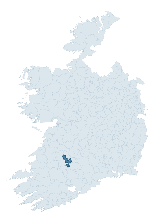
Where this barony sits in the Republic of Ireland
Geology and preservation
Bedrock geology shapes the landscape long before any settlement begins — controlling soil drainage, agricultural potential, the survival of upstanding monuments, and the preservation of buried archaeology. The figures below come from the Geological Survey Ireland 1:100,000 bedrock map.
The bedrock underlying Coshma is predominantly limestone (60% of the barony by area), laid down during the Carboniferous period (92% by area, around 359 to 299 million years ago). Limestone is the most heritage-rich bedrock in Ireland. It supports fertile, well-drained soils that favoured dense Early Medieval settlement and Norman manorial agriculture, and it weathers into karst features — sinkholes, caves, swallow holes, and souterrains — that frequently carry archaeology. Where peat overlies limestone, organic preservation can be exceptional. A substantial secondary geology of limestones (21%) adds further variety to the underlying landscape. The single largest mapped unit is the Ballysteen Formation (32% of the barony's bedrock).
Rock type composition
Largest mapped unit: Ballysteen Formation (32% of the barony)
Placename evidence
Logainm records 25 heritage-diagnostic placenames for Coshma, drawn from townland and civil-parish names across the barony. The dominant stratum is Early Christian ecclesiastical — cill-, teampall-, and domhnach-prefixed names that record the dense network of early church foundations established between the fifth and tenth centuries. The leading diagnostic roots are cill- (6 — church), tobar- (4 — holy well), and ráth- (3 — earthen ringfort). This is broadly in line with the ROI average of 30.7 heritage placenames per barony. The presence of multiple heritage strata side by side indicates layered occupation of the landscape across successive prehistoric and historic periods. Logainm records 163 placenames for Coshma (predominantly townland names). Of these, 25 (15%) carry one of the diagnostic Gaelic roots tracked above; the remainder draw on more generic landscape vocabulary that does not encode a heritage period.
Pre-Christian / Early Medieval Defensive
| Root | Count | Meaning |
|---|---|---|
| ráth- | 3 | earthen ringfort |
| lios- | 2 | ringfort or enclosure |
| dún- | 2 | hilltop or promontory fort |
| cathair- | 2 | stone fort |
Early Christian Ecclesiastical
| Root | Count | Meaning |
|---|---|---|
| cill- | 6 | church (early) |
| tobar- | 4 | holy well |
| teampall- | 2 | church (later medieval) |
| mainistir- | 1 | monastery |
| díseart- | 1 | hermitage |
| cillín- | 1 | unconsecrated burial ground |
Burial, Ritual, and Norse-Contact
| Root | Count | Meaning |
|---|---|---|
| dumha- | 1 | mound |
| gall- | 1 | foreigner — Norse settlement marker |
Other baronies in Limerick
- Kilmallock
- Kenry
- Coshlea
- Connello Lower
- Clanwilliam
- Coonagh
- Pubblebrien
- Bunratty Upper — Clare
- Kinsale — Cork
- Bantry — Cork
See all 280 baronies in the Republic of Ireland Heritage Tool.

Explore further
Grounding History: 10 Maps of Northern Ireland’s Past
If you’re interested in Irish heritage more widely, the companion report for Northern Ireland brings together the analysis of all 462 NI wards into one place through 10 high-quality maps — covering monument density, archaeological periods, placename heritage, terrain, wetland, and the historic landscape at first survey. Take a look.
About this profile
Click any section below to expand.
What is a barony?
A barony is a historic administrative unit in Ireland, broadly equivalent to an English hundred. The 280 baronies used here are from the OSi 2019 National Statutory Boundaries (generalised 20m), covering the 26 counties of the Republic of Ireland. Baronies derive from the Norman period, were formalised in the 17th century, and have not been redrawn for statistical purposes. They vary enormously in area, from compact urban baronies in Dublin to vast upland baronies in Connacht, and should not be compared by raw site count without accounting for area differences.
What counts as a site?
This profile combines three distinct heritage registers, each with its own definition of what constitutes a recordable site:
- Archaeological sites (NMS). The National Monuments Service Sites and Monuments Record (SMR) catalogues every known archaeological monument or site of archaeological interest in the Republic, from prehistoric burial mounds and ringforts to medieval churches and post-medieval defensive works. Inclusion does not require legal protection — only that the site has been identified, surveyed, and assessed as having archaeological value. A separate subset of these sites lies within a recorded protection zone, which gives them statutory protection under the National Monuments Acts.
- Listed buildings (NIAH). The National Inventory of Architectural Heritage records buildings of architectural, historical, archaeological, artistic, cultural, scientific, social, or technical interest. Each surveyed structure is appraised on a five-tier scale: International, National, Regional, Local, and Record-Only. The NIAH appraisal is informational rather than strictly statutory, but it underpins local-authority Record of Protected Structures (RPS) listings.
- Heritage placenames (Logainm). Logainm is the authoritative database of Irish placenames maintained by the Placenames Branch. This profile applies a heritage-diagnostic classifier to the Irish-language form of each townland name, flagging roots that signal defensive sites (ráth-, lios-, dún-, caiseal-, cathair-), ecclesiastical foundations (cill-, teampall-, domhnach-, mainistir-), prehistoric burial-ritual features (tuaim-, carn-, leaba-), or Norse-contact settlement (gall-). Townlands without one of these diagnostic roots are not flagged here — they may still carry historical significance, but that significance is not encoded in the name itself.
Editorial principles
The narrative sections of this profile follow several explicit principles:
- Evidential. Every claim about this barony’s heritage character is anchored in the underlying register data. Where a site count, a placename count, or a percentile rank is cited, it is computed from the source datasets at export time, not estimated.
- Comparative. Counts and metrics are reported alongside their percentile rank against the other 279 ROI baronies. A barony with 50 ringforts in absolute terms could be unusually high or unusually low depending on its size and regional context; percentile ranking removes that ambiguity.
- Transparent on limits. Where a register has known coverage gaps, survey biases, or data-quality issues that affect this barony’s figures, the profile flags them rather than presenting the numbers as definitive.
- No interpretation beyond what the data supports. The narrative does not speculate about historical events, social dynamics, or cultural meaning beyond what the recorded heritage and placename evidence directly attests.
Data caveats and limits
- NMS Sites and Monuments Record is the product of survey campaigns conducted at different intensities across different counties and decades. Some baronies have been surveyed more thoroughly than others, and absolute counts should be read in that light. Sites destroyed by development before survey are typically not represented; sites in heavily forested or upland terrain are sometimes under-recorded.
- NIAH coverage is broadly complete for the Republic of Ireland but the survey was conducted on a rolling county-by-county basis, and the most recent appraisal date varies. Buildings demolished or substantially altered after their original survey may still appear in the register; conversely, recent buildings of merit may not yet have been appraised.
- Logainm classification applies a deliberately conservative pattern-matching approach to the Irish-language townland forms. The classifier prioritises true positives over recall: a townland may carry a heritage signal that the classifier doesn’t recognise, particularly where the diagnostic root has been heavily anglicised or where the townland name draws on a less common term. The 60,000+ townland records and ~9,800 classified placenames give a substantial signal at barony scale, but individual townland names should be checked against Logainm directly for definitive interpretation.
- Period attribution. The chronological distribution reflects only those NMS sites that carry a recognised period attribution in the source data. Sites listed as “Unknown” period are excluded from the dated subset.
- Boundary changes. Some baronies have undergone minor boundary adjustments since their 19th-century definition; the OSi 2019 generalised boundaries used here are the current statutory definition and may differ slightly from historical maps in border areas.
- Bedrock geology is mapped at 1:100,000 scale, which means local variation within a barony — small pockets of different rock type, mineral veins, alluvium overlying bedrock — is generalised. The dominant-system and rocktype figures are area-weighted, so a barony reading “70% Carboniferous limestone” may still contain small but archaeologically important pockets of older or younger rock. Around 3% of GSI polygons do not match the lexicon and contribute no rocktype or system attribution.
Data sources
- National Monuments Service — Sites and Monuments Record (SMR) https://data.gov.ie/dataset/national-monuments-service-archaeological-survey-of-ireland
- National Inventory of Architectural Heritage (NIAH) https://data.gov.ie/dataset/national-inventory-of-architectural-heritage-niah-national-dataset
- Logainm — Placenames Database of Ireland https://www.logainm.ie/
- Ordnance Survey Ireland — National Statutory Barony Boundaries 2019 https://data-osi.opendata.arcgis.com/
- EURODEM — European Digital Elevation Model https://www.mapsforeurope.org/datasets/euro-dem
- ESA WorldCover https://esa-worldcover.org/en
- Geological Survey Ireland — 1:100,000 Bedrock Geology https://www.gsi.ie/en-ie/data-and-maps/Pages/Bedrock.aspx
Explore more: Search any of the 280 ROI baronies, browse by historical province, or read the methodology and data sources for the full Republic of Ireland Heritage Tool.