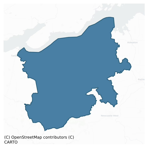
Shanid is a barony of County Limerick, in the historical province of Munster (Irish: Seanaid), covering 375 km² of land. The barony records 654 NMS archaeological sites and 139 NIAH listed buildings, placing it at around the 44th percentile among 280 ROI baronies for sites per km². This means it is in the lower half of all baronies for sites per km². Dated archaeological evidence runs from the Neolithic through to the Modern, spanning 8 of 9 archaeological periods, placing the barony in the 55th percentile among 280 ROI baronies for chronological depth. This means it is in the upper half of all baronies for chronological depth. The largest dated subset of recorded sites dates to the Early Medieval. Logainm flags 41 placenames in the barony as carrying a recognised heritage root; the largest share — around 59% — are names associated with early Christian church and monastic foundations.
Heritage at a glance
Percentile rankings throughout this profile compare each barony only against the other 279 Republic of Ireland baronies.
The recorded heritage of Shanid
The National Monuments Service Sites and Monuments Record (SMR) is the statutory inventory of archaeological sites for the Republic of Ireland, maintained by the Department of Tourism, Culture, Arts, Gaeltacht, Sport and Media. Sites recorded here include earthworks, ringforts, megalithic tombs, ecclesiastical remains, and post-medieval features; not every record is legally protected, but each is registered as a monument of archaeological interest.
The National Monuments Service records 654 archaeological sites in Shanid, putting it at the 44th percentile among 280 ROI baronies for sites per km². This means it is in the lower half of all baronies for sites per km². Protection coverage is near-universal — 617 sites (94%) fall within a recorded monument protection zone, indicating an extensively surveyed landscape. The dominant category is defensive sites — ringforts, enclosures, hillforts, and stone forts (446 sites, 68% of the record). Ringfort – rath is the most prevalent type, making up 52% of the barony's recorded sites (337 records) — well above the ROI average of 20% across all baronies where this type occurs. Ringfort – rath is an earthen ringfort enclosed by a bank and external ditch — the most common Early Medieval farmstead, broadly dated 500–1000 AD. Other significant types include Enclosure (65) and Fulacht fia (37). Enclosure is a banked or ditched feature of uncertain type, used as a catch-all where the original function cannot be determined from surface evidence; Fulacht fia is a horseshoe-shaped Bronze Age burnt mound built around a sunken trough beside a water source, traditionally interpreted as a cooking site. Across the barony's 375 km², this gives a recorded density of 1.75 sites per km².
Most common monument types
Hover or tap a monument type to see its definition.
| Type | Count |
|---|---|
| Ringfort – rath an earthen ringfort enclosed by a bank and external ditch — the most common Early Medieval farmstead, broadly dated 500–1000 AD | 337 |
| Enclosure a banked or ditched feature of uncertain type, used as a catch-all where the original function cannot be determined from surface evidence | 65 |
| Fulacht fia a horseshoe-shaped Bronze Age burnt mound built around a sunken trough beside a water source, traditionally interpreted as a cooking site | 37 |
| Standing stone a deliberately set upright stone, used variously as a Bronze/Iron Age burial marker, route marker or commemorative monument | 19 |
| Church a building used for public Christian worship, of any date from c. 500 AD onwards | 15 |
| Ringfort – cashel the stone-walled equivalent of the rath, found mainly in upland or western areas, broadly dated 500–1000 AD | 15 |
| Ritual site – holy well a well or spring traditionally associated with a saint, often credited with healing properties; many trace earlier ritual origins but devotion is documented from the medieval period onwards | 14 |
| Mound an artificial earthen elevation of unknown date and function that cannot be classified as another known monument type | 14 |
Chronological distribution
The dated archaeological record for Shanid spans from the Neolithic through to the Modern, with activity attested across 8 of 9 archaeological periods. Every period from earliest to latest is represented in the record — an unbroken sequence of dated activity across the full chronological span. Activity concentrates most heavily in the Early Medieval (232 sites, 40% of dated material), with the Iron Age forming a secondary peak (226 sites, 39%). A further 80 recorded sites (12% of the overall NMS register for the barony) carry no period attribution — appearing as 'Unknown' in the bar chart below. This typically reflects either records that pre-date the standardised period vocabulary or sites awaiting specialist dating review, rather than a genuine absence of chronological evidence.
Sample of recorded monuments
Show 25 sample monuments (of 654 total)
A representative sample of 25 recorded monuments drawn from the barony’s 654 total NMS entries. Sites within a recorded monument protection zone and rarer site types are prioritised so the list shows a meaningful cross-section rather than only the most common type. Each entry shows the official Sites and Monuments Record reference number and the description published by the National Monuments Service.
Battery
According to Kerrigan (1995, 204-214) this battery was under construction between 1794 and 1795. He describes it as 'an earthwork battery for six 24-pounders, which would have been capable of commanding the full width…
According to Kerrigan (1995, 204-214) this battery was under construction between 1794 and 1795. He describes it as 'an earthwork battery for six 24-pounders, which would have been capable of commanding the full width of the river, which is a mile wide from Battery Point across to the Co. Clare shore to the north-west.' The area of this battery is now covered by dense vegetation overgrowth.
Compiled by: Denis Power
Date of Upload: 2 August 2012
Ritual site – holy/saint's stone
This monument now takes the form of a rectangular area (3.5m N-S; 3.3m E-W) enclosed by a concrete wall. The floor of this enclosed area is covered by concrete save for the tops of five stones which protrude through it.…
This monument now takes the form of a rectangular area (3.5m N-S; 3.3m E-W) enclosed by a concrete wall. The floor of this enclosed area is covered by concrete save for the tops of five stones which protrude through it. It is not possible to say how large these stones are or of what form they take. Standing within the enclosure is a large wooden cross of recent erection. According to tradition 'the traditional religious practice at Knockpatrick involved reciting three Rosaries: one around the wall of the burial grounds, one while moving clockwise around St Patrick's Well (LI010-056—-) and the third at Suíochán Pádraig' (this description is posted on the web at the following internet address (accessed 3 August 2012): http://www.limerickdioceseheritage.org.
Between November 1937 and December 1938, Michael Mulvihill a pupil of Shanagolden School collected a story called 'The stone from which St Patrick blessed Clare', from his grandfather John Mulvihill of Shanagolden Demesne then aged 70 years old; 'It is said locally that while staying at Knockpatrick St Patrick blessed Co. Clare. He knelt down at the highest point of the hill, gazed northward across the Shannon at the County, stretched out his hands and said "My blessing over to you." He did this because he intended going to the north of Ireland as soon as possible and therefore would not have an opportunity of visiting Clare.
There was a flat stone to be seen at the summit of Knockpatrick until about twenty years ag…
Bridge
Single-span, segmental-arched road bridge over Glenborbry River. No bridge shown here in drawing of 1600 siege of Glin castle but a bridge is shown here in Down Survey map. This was probably the 'ancient bridge'…
Single-span, segmental-arched road bridge over Glenborbry River. No bridge shown here in drawing of 1600 siege of Glin castle but a bridge is shown here in Down Survey map. This was probably the 'ancient bridge' mentioned by Lewis (1837, 73). Present structure of mid-19th century appearance and must have replaced latter bridge.
Compiled by: Denis Power
Date of upload: 26 August 2011
Bullaun stone
Built into gatepost alongside roadside. Roughly triangular-shaped stone (0.44m x 0.32m x 0.15m) on upper surface of which is smooth roughly-circular depression (0.27m x 0.28m; D 0.06m).
Compiled by: Denis…
Built into gatepost alongside roadside. Roughly triangular-shaped stone (0.44m x 0.32m x 0.15m) on upper surface of which is smooth roughly-circular depression (0.27m x 0.28m; D 0.06m).
Compiled by: Denis Power
Date of upload: 26 August 2011
Settlement deserted – medieval
Possible medieval settlement earthworks associated with 13th century Augustinian nunnery (LI019-026009-) which are visible on oblique aerial photographs taken 20/07/1968 (CUCAP AVS097-8). A series of linear earthworks…
Possible medieval settlement earthworks associated with 13th century Augustinian nunnery (LI019-026009-) which are visible on oblique aerial photographs taken 20/07/1968 (CUCAP AVS097-8). A series of linear earthworks forming a series of terraces indicative of strip lynchets running across the fields are visible to the N and NW of the nunnery on Digital Globe orthoimages taken 2011-13. Possible medieval settlement and cultivation earthworks associated with medieval settlement and farming belonging to the Augustinian Nunnery.
See attached aerial photographs taken 1968 showing earthworks in field to the N and NW of the Augustinian nunnery.
Compiled by: Martin Fitzpatrick
Date of upload: 14 July 2020
Gateway
In pasture 170m SW of the Augustinian nunnery of Monasternagalliaghduff (LI019-026009-) and 40m SE of an enclosure (LI019-026002-), in the grounds of the former Old Abbey House which survives 200m to N, dovecote…
In pasture 170m SW of the Augustinian nunnery of Monasternagalliaghduff (LI019-026009-) and 40m SE of an enclosure (LI019-026002-), in the grounds of the former Old Abbey House which survives 200m to N, dovecote (LI019-026004-) orchard and fish pond (LI019-026006-) in field to N. Standing stone (LI019-026011-) 65m to NE. Not depicted on any OS Maps. The gateway was described by Westropp as ‘An ancient south gate remains built up in the modern wall. It has roughly built gateway 10 feet [3m] wide on the opening, with a very rude pointed arch and strong piers projecting inwards. To it, says tradition, The Earl of Desmond brought his dying wife, wounded in their escape from Shanid castle, which rises proudly to the south-west on the moated summit of the ridge (Wardell 1904, 63). The overgrown boundary wall in which the gateway is located is visible on Google Earth Orthoimage taken 08/04/2015.
See attached location map showing Gate taken from Wardell 1904
Compiled by: Martin Fitzpatrick
Date of upload: 14 July 2020
Dovecote
In pasture, 100m SW of the Augustinian nunnery of Monasternagalliaghduff (LI019-026009-) and 45m W of a megalithic structure (LI019-026011-), with stream immediately to N. On the grounds of the former Old Abbey House…
In pasture, 100m SW of the Augustinian nunnery of Monasternagalliaghduff (LI019-026009-) and 45m W of a megalithic structure (LI019-026011-), with stream immediately to N. On the grounds of the former Old Abbey House which stands 140m to N, orchard and fish ponds (LI019-026006-) in field to N of dovecote. Ringfort (LI019-028—-) 145m to S. Annotated ‘Tower’ on both the 1840 OS 6-inch map and the 1897 OS 25-inch map, where it is depicted as a circular structure (approx. diam. 7m). The dovecote was described by Westropp as ‘the convent pigeon-house. It is an interesting little building, like the base of a round tower. It is circular, and 13 feet 6 inches [4.1m] in internal diameter, shelf to shelf, or 17 feet [5.2m] from wall to wall; the walls 2 feet 8 inches [0.8m] thick and 10 feet [3m] high to the spring of the domed roof, which is formed by corbelling, with a large circular ope and two external cornices. There is a low square door to the west, 3 feet 7 inches [1.1m] high and 2 feet 10 inches [0.86m] wide. The outer face destroyed. Inside were eight rows of stone recesses for the doves; they are 13 inches [0.33m] deep, and about twenty-eight [0.7m] to each ring. The greater number are now destroyed, probably by cattle, which can enter the structure through a large break in the east. It is 18 feet [5.5m] high in all' (Wardell 1904, 64). The dovecote is clearly visible on Google Earth Orthoimage taken 08/04/2015.
See attached section of building and Goog…
Designed landscape – tea house
In pasture 40m W of the Augustinian nunnery of Monasternagalliaghduff (LI019-026009-) and immediately W of the Fish-pond (LI019-026006-). Post-1700 summer-house built with medieval fabric of the nunnery standing on SW…
In pasture 40m W of the Augustinian nunnery of Monasternagalliaghduff (LI019-026009-) and immediately W of the Fish-pond (LI019-026006-). Post-1700 summer-house built with medieval fabric of the nunnery standing on SW corner of the walled garden of the Old Abbey House which stands 60m to N. Depicted on the 1840 OS 6-inch map as a rectangular-shaped structure located at the S end of the formal garden of Old Abbey House. Identified by T. J. Westropp as the Summer House [B], he describes significant alteration to the building with a tenant having ‘inserted a doorway removed from the western door of the church, and a tall (but now curtailed) window from the refectory. A third window in the north face was brought from some uncertain location, possibly the “readers recess” in the refectory’(1904, 62). Westropp described the window as having ‘a trefoil head and refers to an ogee-headed light from the domicile that also is inserted into the ‘Summer House’ (ibid.). Google Earth Orthoimage taken 08/04/2015 shows a line of mature trees in the area of structure.
See attached location map and photo taken by T. J. Westropp
Compiled by: Martin Fitzpatrick
Date of upload: 13 July 2020
Fish-pond
In pasture 40m W of the Augustinian nunnery of Monasternagalliaghduff (LI019-026009-) and immediately E of the 'Summer House' (LI019-026005-). Depicted on the 1840 OS 6-inch map as a rectangular-shaped pond (approx. L…
In pasture 40m W of the Augustinian nunnery of Monasternagalliaghduff (LI019-026009-) and immediately E of the 'Summer House' (LI019-026005-). Depicted on the 1840 OS 6-inch map as a rectangular-shaped pond (approx. L 40m; Wth 10m) located at the S end of the formal garden of Old Abbey House. Described by T. J. Westropp as, ‘A most picturesque old fish-pond, shadowed by fine yews and lime trees, extends along the foot of the modern garden from near the “cellars”. It possibly dates from monastic times’ (Wardell 1904, 64). Google Earth Orthoimage taken 08/04/2015 shows the area heavily overgrown.
See attached location map showing fish-pond labelled C and Google Earth orthoimages
Compiled by: Martin Fitzpatrick
Date of upload: 13 July 2020
Religious house – Augustinian nuns
The 13th century Augustinian nunnery of St. Catherine de O'Conyl or ‘Manisternagalliaghduff’, known locally as Old Abbey, stands in the parish of Robertstown, in the medieval barony of Connelloe [O’Conyll] (Gwynn and…
The 13th century Augustinian nunnery of St. Catherine de O'Conyl or ‘Manisternagalliaghduff’, known locally as Old Abbey, stands in the parish of Robertstown, in the medieval barony of Connelloe [O’Conyll] (Gwynn and Hadcock 1970, 323). The village of Shanagolden lies 2.4km to the W, Shanid Castle (LI019-081001-) lies 4.1km to the SW. Knockpatrick and its church (LI010-058001-) stands 4km to the NW.
Monasternagalliaghduff was mistakenly identified with a nunnery (LI032-043002-) in Lough Gur (Fitzgerald and McGregor 1826, 315, 363, 577). The monastery of the Black Nuns was dedicated to St. Catherine for the Canonesses of St. Augustine (Ware 1705, 103; Croker 1833, 103; Dowd 1896, 79). It was founded in the 13th century on lands belonging to John FitzThomas of Connelloe (O'Konyl) who was killed at Callan in 1261. The abbey buildings stand on the S side of the walled garden of the ruins of Oldabbey House in a hollow overlooking a stream to S, with good views of open countryside to E, and views of undulating countryside to S and W. Earthworks of a possible medieval settlement (LI019-026001-) lie in fields to N and W. Fish-pond (LI019-026006-) 20m to WSW, dovecote (LI019-026004-) and gateway (LI019-026003-) of possible monastic precinct wall 100m and 155m to SW respectively. An Inquisition into the lands of the Manor of Shanid which belonged to Thomas FitzMaurice who died in 1298 recorded that ‘wherefrom are subtracted 8s. paid yearly to the Bishop of Limerick for l…
Castle – Anglo-Norman masonry castle
On summit of Shanid motte (LI019-081002-). Circular keep (int. diam. 7.5m) whose wall stands to near full height, but only SE->WNW (H c. 9m; T c. 3m). Built of uncoursed limestone facing with pinnings, with rubble core…
On summit of Shanid motte (LI019-081002-). Circular keep (int. diam. 7.5m) whose wall stands to near full height, but only SE->WNW (H c. 9m; T c. 3m). Built of uncoursed limestone facing with pinnings, with rubble core in a lime mortar. Internal face is smooth but external face is built is short straight sections of which seven survive. The external base of the wall was battered but this has been entirely removed so that lower face of wall (H c. 3.5m) is now rough vertical face. Ground level inside tower lower than outer surface (c. 1.5m) suggesting it may have contained semi-basement below first floor. One joist hole survives, near SE end of wall, showing level of wooden floor. Part of only one embrasure survives: side of large window ope evident where wall breaks off at WNW end; this at first-floor level. This is tall square-set ingoing covered by segmental arch, the springing of which survives. Just above and below level of this window ope are straight horizontal courses, indication that tower built in three stages.
Wall walk now sod covered but lower part of parapet survives. In centre of each straight section is narrow vertical opening, flanked on outside face by two square joist holes; these indicate presence of wooden hourd around top of keep. Just below this level is narrow vertical slit opening on the angle of the straight faces; these probably simple arrow slits.
Tower occupies SW corner of mound summit; otherwise top of mound enclosed by curtain wall but o…
Castle – motte and bailey
At NE end of hill on E fringe of upland area, with extensive view NE over Shannon estuary and E over plain of Limerick. Large ringfort (LI019-082—) occupies opposite end of ridge c. 60m to SW. Conical earthen mound…
At NE end of hill on E fringe of upland area, with extensive view NE over Shannon estuary and E over plain of Limerick. Large ringfort (LI019-082—) occupies opposite end of ridge c. 60m to SW. Conical earthen mound (75m SW-NE; 70m NW-SE) with flat top (25.5m SW-NE; 20m NW-SE) enclosed by earthen bank (ext. H 7.5m; int. H 6.5m) (see Sweetman 1999, fig. 16). Attached to NE side is trapezoidal area (int.: 30m SW-NE; 45m NW-SE) enclosed by earthen bank (int. H 0.5m; ext. H 4.5m) with external fosse (Wth 4.5m) and counterscarp bank (int. H 1.5m; ext. H 2m). Interior slopes down steeply to NE (fall of c. 7.5m) but has terrace at its upper and lower ends. Enclosing element of bailey overgrown with bushes as, partially, is bank surrounding mound, but otherwise site under grass. Steep-sides of mound stepped due to soil slippage; cattle accessing summit have worn path ascending on E side of mound; base of path corresponds with gap in enclosing bank. Atop mound are remains of shell keep (LI019-08101-).
Shanid was originally occupied by William de Burgh c. 1198 but had become a Geralding possession by mid-13th century (Empey 1981, 12) and remained so until late 16th century (Westropp 1906-7, 243). The earthwork element of Shanid was probably built in the initial stage of conquest c. 1198.
Compiled by: Denis Power
Date of upload: 26 August 2011
LI019-081002_01.jpg Aerial view taken in 1985 of Shannid Castle, motte and bailey (LI019-081002-) and ringfort (LI019-082—-) (Photo…
Hilltop enclosure
On a low limestone hill, known as Kilbradran Hill, which dominates a generally flat low-lying terrain. The enclosure is located at the N end of the hill's summit (see plan Westropp 1916-1917, 29). It is formed of two…
On a low limestone hill, known as Kilbradran Hill, which dominates a generally flat low-lying terrain. The enclosure is located at the N end of the hill's summit (see plan Westropp 1916-1917, 29). It is formed of two roughly concentric lines of defence: the inner earth-and-stone bank encloses an oval area (29m N-S; 25m E-W), whilst the outer earthen bank also encloses an oval area (70m N-S; 58m E-W). The banks are closest at ENE (c. 15m apart) and furthest apart at S (c. 22m apart). The outer bank is downhill of the inner bank except SE->SW where both are roughly at the same altitude. According to Westropp (ibid.) the inner bank was 'stone-faced inside and out', but it now survives as a sod-covered earth-and-stone bank (int. H 0.4m; ext. H 1.65m) best preserved NNW->ENE and largely free of vegetation overgrowth. There are openings through the bank at E (Wth 3.5m) and S (Wth 3.6m). Along the external base of the bank is a shallow fosse (D 0.3m; Wth 1.1m) partially infilled with rubble derived from the bank. The enclosed area slopes down sharply to the E and is under pasture with limestone bedrock exposed in places.
The outer earthen bank (int. H 0.25m; ext. H 2.6m) is best preserved SW->NW, and is partially covered by bushes and overgrowth. There are openings in the bank at NNE (Wth 8m) and ESE (Wth 6.1m). A shallow external fosse (D 0.1m; Wth 1.25m) is evident SSE->NNW. From NNW to the opening in the bank at NNE a narrow terrace (Wth c. 4m) runs along the external face of…
Ringfort – unclassified
In pasture 90m W of public road. Depicted on the 1840 OS 6-inch map as a circular enclosure in an area of rock outcrop. The monument is depicted as a non-antiquity on the 1897 OS 25-inch map where the outline of a…
In pasture 90m W of public road. Depicted on the 1840 OS 6-inch map as a circular enclosure in an area of rock outcrop. The monument is depicted as a non-antiquity on the 1897 OS 25-inch map where the outline of a sub-circular shaped area (30m N-S; 28m E-W) is indicated with a solid line in the same fashion as the surrounding field boundaries. On this map a field boundary intersects the enclosure at S. Outline of scrub covered monument visible on Google Earth orthoimage taken 08/04/2015.
See attached Google Earth orthoimages
Compiled by: Martin Fitzpatrick
Date of upload: 15 July 2020
Burial mound
In rough ground dominated by gorse and bracken on the E slope of Ballylin Hill with views to the NE, E and SE. The external rampart of a hillfort (LI028-085—-) lies 200m tp W. The site is not depicted on the 1840 ed.…
In rough ground dominated by gorse and bracken on the E slope of Ballylin Hill with views to the NE, E and SE. The external rampart of a hillfort (LI028-085—-) lies 200m tp W. The site is not depicted on the 1840 ed. OSi 6-inch map and is not depicted on the 1897 ed. OSi 25-inch map. The site is not visible on the OSi orthoimage taken 2005-12. Not visible on Digital Globe orthoimages taken 2011-2013. Identified by Jerry McMahon of Ardagh (member of the Newcastle Historical Society) in 1986 when the mound was described having been discovered after a gorse fire on the hillside (pers. comm.). Subsequently inspected by the ASI in 1986 and described as ‘burial mound or barrow’. The location of the site is visible on Google Earth orthoimages taken 20/10/2010 and 08/04/2015.
See attached location map prepared by Jerry McMahon and Google Earth orthoimages
Compiled by: Edmond O’Donovan
Date of upload: 24 September 2020
Barrow – ring-barrow
In pasture, on ESE-facing slope. Oval grass-covered mound (H 0.65m; 17.3m N-S; 20.7m E-W) with external fosse (Wth 2m; D 0.8m); the barrow has been truncated on its SE side by a field boundary.
Compiled by: Denis…
In pasture, on ESE-facing slope. Oval grass-covered mound (H 0.65m; 17.3m N-S; 20.7m E-W) with external fosse (Wth 2m; D 0.8m); the barrow has been truncated on its SE side by a field boundary.
Compiled by: Denis Power
Date of upload: 26 August 2011
Slab-lined burial
Discovered in 1952 when enclosure (LI019-093—-) was being levelled. Described as 'cist with skeleton … 130cm by 50cm and 40cm deep' (NMI). According to local information the enclosure was known locally as "the…
Discovered in 1952 when enclosure (LI019-093—-) was being levelled. Described as 'cist with skeleton … 130cm by 50cm and 40cm deep' (NMI). According to local information the enclosure was known locally as "the killeen" and used as a famine burial ground.
An account of this monument has been published in: Cahill, M. & Sikora, M. (2011) Breaking ground, finding graves- reports on the excavations of burials by the National Museum of Ireland, 1927-2006. vol. 2, 100-102.
Compiled by: Denis Power
Date of upload: 15 August 2012
Hillfort
On the summit of Ballylin Hill, the site commands an extensive prospect NE->S over the Limerick plain. The flattish summit of the hill and its upper slopes are covered by heather-clad blanket bog, whilst the steeper…
On the summit of Ballylin Hill, the site commands an extensive prospect NE->S over the Limerick plain. The flattish summit of the hill and its upper slopes are covered by heather-clad blanket bog, whilst the steeper lower slopes are covered by heather and gorse. Two roughly concentric rings of embankment enclose the upper part of the hill (Cody 1981, fig. 14). The inner ring encloses a roughly circular area (300m N-S; 315m E-W), whilst the outer ring runs from 80m to 120m outside it. The total area enclosed is 20.5ha (ibid., 71). The inner ring consists of an internal fosse (Wth c. 2.5m; D c. 0.75m) with an external bank (Wth c. 2.5m; H c. 0.75m), both covered by c. 0.3m of bog (ibid., fig. 15). At W is a short stretch of internal bank (Wth c. 2m; H c. 0.3m). There is a causeway entrance (Wth 8m) at ESE. The outer ring has a similar profile 'though of slighter dimensions' (ibid., 71). The outer ring is not evident on the ground for c. 120m W->N, and at N a part of the enclosing element was recently disturbed by deep ploughing. According to Cody (ibid., 75) this site 'falls into Rafterty's Class IIa group of multivallate hill-forts' and is 'undoubtedly one of the largest Irish hill-forts'.
The hillfort was recently described in the Atlas of Hillforts of Britain and Ireland as following; 'Widely spaced multiple enclosure in commanding position on Ballylin Hill. The hilltop is positioned on partial spur in a N – S running escarpment. This provides Ballylin with panoramic vie…
Font
Medieval limestone font within Shanagolden church (LI019-012001-) and graveyard (LI019-012002-) described in the Urban Archaeological Survey of County Limerick (Bradley et. al. 1989, 228-30) as following; 'Westropp…
Medieval limestone font within Shanagolden church (LI019-012001-) and graveyard (LI019-012002-) described in the Urban Archaeological Survey of County Limerick (Bradley et. al. 1989, 228-30) as following; 'Westropp (1904-5, 396) described the font as lying inside the nave of the church as following: 'The nave had arcades with four plain pointed arches to each side, and a curiously fretted font'. The church is now destroyed. The early 19th century three-floored tower survives, however. The font was not located".
Medieval square shaped font (H 0.32m x 0.34m x 0.33m) with conical basin (diam. 0.24m) now housed in the W porch of St. Mary's Church of Ireland church in Askeaton. One face of the font is decorated with a tracery pattern consisting of four square panels each containing an eight-pointed star. The font was possibly designed to be set into the angle of the church with two decorated faces visible to the parishioners of the church. The carving on the font is similar to a font (TS043-034010-) from Kilcooly Abbey (TS043-034001-), Co. Tipperary. The Shanagolden church font was drawn by William Frazer based on original drawings made by John Windele in the mid 19th century (NLI PD 1975 TX 12 (8); NLI Sketch books of Irish antiquities). Cross referenced with LI011-092017-.
Compiled and revised by: Caimin O'Brien
Date of revised upload: 19 November 2018
Water mill – unclassified
On the E bank of the White River, in woodland. Annotated 'Old Mills' on the 1840 ed. OS 6-inch map where three rectangular-shaped structures are depicted standing beside a water channel cut into the White river. The…
On the E bank of the White River, in woodland. Annotated 'Old Mills' on the 1840 ed. OS 6-inch map where three rectangular-shaped structures are depicted standing beside a water channel cut into the White river. The designation 'Old Mills' on the 1840 map suggests that this may be a mill site of pre-1700 date and may have been a mill site associated with a possible settlement site (LI009-015—-) depicted at this location on the Down Survey Barony map of Connello (Hib. Reg.).
Compiled by: Alison McQueen, Vera Rahilly and Caimin O'Brien
Date of upload: 3 July 2020
Cairn – unclassified
In gently undulating pasture. Cairn of stones visible on aerial photograph (St Joseph AVQ 72) has been removed. A slight rise in ground level is only possible evident trace of this feature.
Compiled by: Denis…
In gently undulating pasture. Cairn of stones visible on aerial photograph (St Joseph AVQ 72) has been removed. A slight rise in ground level is only possible evident trace of this feature.
Compiled by: Denis Power
Date of upload: 26 August 2011
Water mill – unclassified
'Old Mill' now levelled which stood on E side of stream 60m W of Robertstown church and graveyard with Robertstown Castle (LI010-013—-) 130m to N. A single arched bridge with flat heading opening for tail race of…
'Old Mill' now levelled which stood on E side of stream 60m W of Robertstown church and graveyard with Robertstown Castle (LI010-013—-) 130m to N. A single arched bridge with flat heading opening for tail race of 'Old Mill' stands 20m to N. The 1840 OS six-inch map shows a rectangular structure in this location that is named 'Old Mill'. No structure is shown in this location on later editions of the OS map and there is no evident trace of such a structure on the ground. The 'Old Mill' stood on the E side of a stream which marked the townland boundary between Sroolane North and Robertstown.
Westropp (1906-7, 242) gives the following details about Robertstown mill; '1608 Ballyrobert C[astle] conveyed by Jas. Wakeman to Sir Ric. Wingfield, of Smithstown, with a water mill, Carricke O'Ruderi, Ardenere, and part of estate of Teige mac Clansie, slain in rebellion (Rev. Exch., 1613-18, p. 1; 1623, p. 17; Inq. Chan., 6b), who held it with Cragg, 1638 (Inq. Chan., C.S., p. 94, &c). 1655 C[astle]. of Robertstown, Carrigenrudderi, mill, &c.'
The 1654-56 Civil Survey of Limerick recorded that Sir Edward Wingfield was the owner of the lands of Robertstown and Garrintober which contained 'a ruined castle [LI010-013—-] with two Mill seates' (Simington 1938, 327). The 'Old Mill' may have been one of the two mill sites described in the Civil Survey.
Compiled by: Denis Power
Revised by: Caimin O'Brien
Date of revised upload: 13 May 2020
Megalithic structure
In a plantation of coniferous trees. There is now no evident surface trace of the 'dolmen' excavated in 1935 by T.F. Riley on behalf of National Museum of Ireland after a polished stone axe was found 'inside the dolmen'…
In a plantation of coniferous trees. There is now no evident surface trace of the 'dolmen' excavated in 1935 by T.F. Riley on behalf of National Museum of Ireland after a polished stone axe was found 'inside the dolmen' by local school children. According to the excavator 'the most careful searching failed to reveal any trace of either artefact or skeletal material' (NMI). The sketch accompanying this report shows a capstone (gable-shaped in plan: c. 1.5m x c. 1.7m) supported along its edge by seven irregularly placed uprights. The report also mentions another 'dolmen' (LI017-034—), a 'mound' (LI017-035—) and a 'pillar stone' (LI017-036—) in the vicinity. According to local information these structures removed when the area was planted with trees in the 1970s.
Compiled by: Denis Power
Date of upload: 26 August 2011
Megalithic structure
In a plantation of coniferous trees. There is now no evident surface trace of the 'second overturned dolmen' mentioned by T.F. Riley in his report on the excavation of a 'dolmen' in 1935 (NMI). The site is located on an…
In a plantation of coniferous trees. There is now no evident surface trace of the 'second overturned dolmen' mentioned by T.F. Riley in his report on the excavation of a 'dolmen' in 1935 (NMI). The site is located on an accompanying sketch map 50m E of the excavated 'dolmen' (LI017-032—). According to local information the two structures were removed when trees were planted here in the 1970s.
Compiled by: Denis Power
Date of upload: 26 August 2011
Ringfort – rath
Atop slight rise, in otherwise level terrain. Site is completely covered by dense overgrowth but as far as can be ascertained consists of circular area (diam. c. 25m) enclosed by earthen bank (int. H 0.5m; ext. H 0.6m)…
Atop slight rise, in otherwise level terrain. Site is completely covered by dense overgrowth but as far as can be ascertained consists of circular area (diam. c. 25m) enclosed by earthen bank (int. H 0.5m; ext. H 0.6m) with external fosse (D 0.4m; Wth c. 2m).
Compiled by: Denis Power
Date of upload: 26 August 2011
See attached ASI aerial photographs ASIAP – taken on 04/03/2006.
Listed buildings
The National Inventory of Architectural Heritage (NIAH) is a state survey appraising buildings of architectural, historical, archaeological, artistic, cultural, scientific, social, or technical interest. Each surveyed structure receives a rating from International (the highest, for buildings of European importance) through National, Regional, Local, and Record-Only.
The NIAH records 139 listed buildings in Shanid (63rd percentile across ROI baronies). The highest-graded structure include 1 of National significance. The Republic holds 937 National-graded buildings in total, so this barony accounts for around 0% of the national total. Construction dates concentrate most heavily in the Victorian (1830-1900) period. The most-recorded building type is house (49 examples, 35% of the listed stock).
Terrain and environment
Mean elevation across the barony is 106m — the 64th percentile among 280 ROI baronies for elevation. This means it is in the upper half of all baronies for elevation. Elevation matters for heritage because higher-altitude baronies typically favour defensive monuments — ringforts and hilltop forts placed on prominent ground — while lowland baronies are more likely to carry the dense settlement and church networks of intensive agricultural landscapes. The barony reaches 348m at its highest point — a vertical span of more than 241m within its boundary, indicating significant topographic diversity. Mean slope is 3.7° — the 50th percentile among 280 ROI baronies for slope. This means it is in the upper half of all baronies for slope. Slope is a key control on both land use and archaeological preservation: steep ground resists ploughing and tends to preserve earthworks intact, while gentle slopes favour intensive cultivation that damages or destroys surface archaeology over time. The Topographic Wetness Index averages 10.8, the 48th percentile among 280 ROI baronies for wetness. This means it is in the lower half of all baronies for wetness. Drainage matters for heritage because poorly-drained ground preserves organic archaeology (wooden trackways, leather, textiles, and on rare occasions human remains) far better than free-draining soil; well-drained ground favours arable use but destroys organic material rapidly. The land-cover mosaic combines improved grassland (64%), woodland (26%), and open water (9%), giving a mixed agricultural and semi-natural landscape.
Terrain measurements
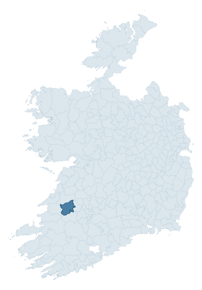
Where this barony sits in the Republic of Ireland
Geology and preservation
Bedrock geology shapes the landscape long before any settlement begins — controlling soil drainage, agricultural potential, the survival of upstanding monuments, and the preservation of buried archaeology. The figures below come from the Geological Survey Ireland 1:100,000 bedrock map.
The bedrock underlying Shanid is predominantly mudstone, siltstone, sandstone (45% of the barony by area), laid down during the Carboniferous period (100% by area, around 359 to 299 million years ago). A substantial secondary geology of mudstone, sandstone, siltstone (22%) and limestone (13%) adds further variety to the underlying landscape. The single largest mapped unit is the Central Clare Group (45% of the barony's bedrock). With 7 distinct rock types mapped, the barony sits in the top third of ROI baronies for geological diversity (68th percentile) — typically a sign of complex tectonic history or coastal mosaics of differing rock units.
Rock type composition
Largest mapped unit: Central Clare Group (45% of the barony)
Placename evidence
Logainm records 41 heritage-diagnostic placenames for Shanid, drawn from townland and civil-parish names across the barony. The dominant stratum is Early Christian ecclesiastical — cill-, teampall-, and domhnach-prefixed names that record the dense network of early church foundations established between the fifth and tenth centuries. The leading diagnostic roots are cill- (18 — church), ráth- (5 — earthen ringfort), and lios- (5 — ringfort or enclosure). This is above the ROI average of 30.7 heritage placenames per barony. The presence of multiple heritage strata side by side indicates layered occupation of the landscape across successive prehistoric and historic periods. Logainm records 215 placenames for Shanid (predominantly townland names). Of these, 41 (19%) carry one of the diagnostic Gaelic roots tracked above; the remainder draw on more generic landscape vocabulary that does not encode a heritage period.
Pre-Christian / Early Medieval Defensive
| Root | Count | Meaning |
|---|---|---|
| ráth- | 5 | earthen ringfort |
| lios- | 5 | ringfort or enclosure |
| dún- | 4 | hilltop or promontory fort |
| caiseal- | 2 | stone ringfort |
| cathair- | 1 | stone fort |
Early Christian Ecclesiastical
| Root | Count | Meaning |
|---|---|---|
| cill- | 18 | church (early) |
| teampall- | 2 | church (later medieval) |
| cillín- | 2 | unconsecrated burial ground |
| mainistir- | 1 | monastery |
| díseart- | 1 | hermitage |
Burial, Ritual, and Norse-Contact
| Root | Count | Meaning |
|---|---|---|
| gall- | 1 | foreigner — Norse settlement marker |
Other baronies in Limerick
- Clanwilliam
- Connello Upper
- Coshlea
- Pubblebrien
- Kilmallock
- Smallcounty
- Kenry
- Corkaguiny — Kerry
- Islands — Clare
- Coshma
See all 280 baronies in the Republic of Ireland Heritage Tool.

Explore further
Grounding History: 10 Maps of Northern Ireland’s Past
If you’re interested in Irish heritage more widely, the companion report for Northern Ireland brings together the analysis of all 462 NI wards into one place through 10 high-quality maps — covering monument density, archaeological periods, placename heritage, terrain, wetland, and the historic landscape at first survey. Take a look.
About this profile
Click any section below to expand.
What is a barony?
A barony is a historic administrative unit in Ireland, broadly equivalent to an English hundred. The 280 baronies used here are from the OSi 2019 National Statutory Boundaries (generalised 20m), covering the 26 counties of the Republic of Ireland. Baronies derive from the Norman period, were formalised in the 17th century, and have not been redrawn for statistical purposes. They vary enormously in area, from compact urban baronies in Dublin to vast upland baronies in Connacht, and should not be compared by raw site count without accounting for area differences.
What counts as a site?
This profile combines three distinct heritage registers, each with its own definition of what constitutes a recordable site:
- Archaeological sites (NMS). The National Monuments Service Sites and Monuments Record (SMR) catalogues every known archaeological monument or site of archaeological interest in the Republic, from prehistoric burial mounds and ringforts to medieval churches and post-medieval defensive works. Inclusion does not require legal protection — only that the site has been identified, surveyed, and assessed as having archaeological value. A separate subset of these sites lies within a recorded protection zone, which gives them statutory protection under the National Monuments Acts.
- Listed buildings (NIAH). The National Inventory of Architectural Heritage records buildings of architectural, historical, archaeological, artistic, cultural, scientific, social, or technical interest. Each surveyed structure is appraised on a five-tier scale: International, National, Regional, Local, and Record-Only. The NIAH appraisal is informational rather than strictly statutory, but it underpins local-authority Record of Protected Structures (RPS) listings.
- Heritage placenames (Logainm). Logainm is the authoritative database of Irish placenames maintained by the Placenames Branch. This profile applies a heritage-diagnostic classifier to the Irish-language form of each townland name, flagging roots that signal defensive sites (ráth-, lios-, dún-, caiseal-, cathair-), ecclesiastical foundations (cill-, teampall-, domhnach-, mainistir-), prehistoric burial-ritual features (tuaim-, carn-, leaba-), or Norse-contact settlement (gall-). Townlands without one of these diagnostic roots are not flagged here — they may still carry historical significance, but that significance is not encoded in the name itself.
Editorial principles
The narrative sections of this profile follow several explicit principles:
- Evidential. Every claim about this barony’s heritage character is anchored in the underlying register data. Where a site count, a placename count, or a percentile rank is cited, it is computed from the source datasets at export time, not estimated.
- Comparative. Counts and metrics are reported alongside their percentile rank against the other 279 ROI baronies. A barony with 50 ringforts in absolute terms could be unusually high or unusually low depending on its size and regional context; percentile ranking removes that ambiguity.
- Transparent on limits. Where a register has known coverage gaps, survey biases, or data-quality issues that affect this barony’s figures, the profile flags them rather than presenting the numbers as definitive.
- No interpretation beyond what the data supports. The narrative does not speculate about historical events, social dynamics, or cultural meaning beyond what the recorded heritage and placename evidence directly attests.
Data caveats and limits
- NMS Sites and Monuments Record is the product of survey campaigns conducted at different intensities across different counties and decades. Some baronies have been surveyed more thoroughly than others, and absolute counts should be read in that light. Sites destroyed by development before survey are typically not represented; sites in heavily forested or upland terrain are sometimes under-recorded.
- NIAH coverage is broadly complete for the Republic of Ireland but the survey was conducted on a rolling county-by-county basis, and the most recent appraisal date varies. Buildings demolished or substantially altered after their original survey may still appear in the register; conversely, recent buildings of merit may not yet have been appraised.
- Logainm classification applies a deliberately conservative pattern-matching approach to the Irish-language townland forms. The classifier prioritises true positives over recall: a townland may carry a heritage signal that the classifier doesn’t recognise, particularly where the diagnostic root has been heavily anglicised or where the townland name draws on a less common term. The 60,000+ townland records and ~9,800 classified placenames give a substantial signal at barony scale, but individual townland names should be checked against Logainm directly for definitive interpretation.
- Period attribution. The chronological distribution reflects only those NMS sites that carry a recognised period attribution in the source data. Sites listed as “Unknown” period are excluded from the dated subset.
- Boundary changes. Some baronies have undergone minor boundary adjustments since their 19th-century definition; the OSi 2019 generalised boundaries used here are the current statutory definition and may differ slightly from historical maps in border areas.
- Bedrock geology is mapped at 1:100,000 scale, which means local variation within a barony — small pockets of different rock type, mineral veins, alluvium overlying bedrock — is generalised. The dominant-system and rocktype figures are area-weighted, so a barony reading “70% Carboniferous limestone” may still contain small but archaeologically important pockets of older or younger rock. Around 3% of GSI polygons do not match the lexicon and contribute no rocktype or system attribution.
Data sources
- National Monuments Service — Sites and Monuments Record (SMR) https://data.gov.ie/dataset/national-monuments-service-archaeological-survey-of-ireland
- National Inventory of Architectural Heritage (NIAH) https://data.gov.ie/dataset/national-inventory-of-architectural-heritage-niah-national-dataset
- Logainm — Placenames Database of Ireland https://www.logainm.ie/
- Ordnance Survey Ireland — National Statutory Barony Boundaries 2019 https://data-osi.opendata.arcgis.com/
- EURODEM — European Digital Elevation Model https://www.mapsforeurope.org/datasets/euro-dem
- ESA WorldCover https://esa-worldcover.org/en
- Geological Survey Ireland — 1:100,000 Bedrock Geology https://www.gsi.ie/en-ie/data-and-maps/Pages/Bedrock.aspx
Explore more: Search any of the 280 ROI baronies, browse by historical province, or read the methodology and data sources for the full Republic of Ireland Heritage Tool.