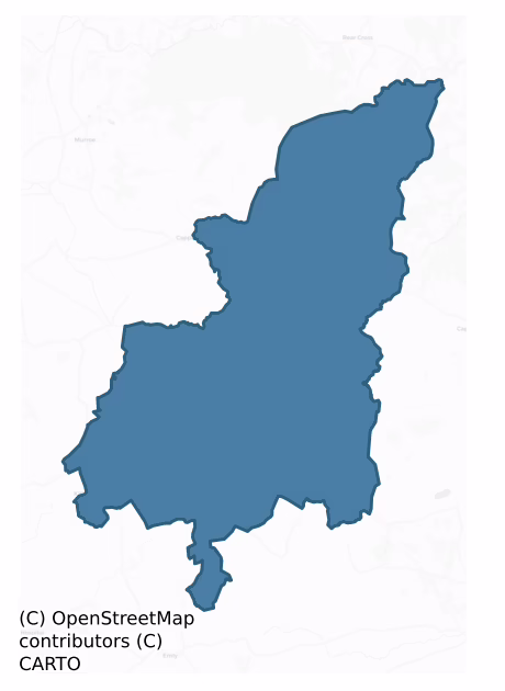
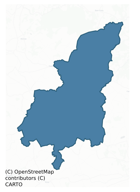
Coonagh is a barony of County Limerick, in the historical province of Munster (Irish: Uí Chuanach), covering 147 km² of land. The barony records 608 NMS archaeological sites and 81 NIAH listed buildings, placing it at around the 93rd percentile among 280 ROI baronies for sites per km². This means it is in the top tenth of all baronies for sites per km². Dated archaeological evidence runs from the Neolithic through to the Modern, spanning 8 of 9 archaeological periods, placing the barony in the 61st percentile among 280 ROI baronies for chronological depth. This means it is in the upper half of all baronies for chronological depth. The largest dated subset of recorded sites dates to the Early Bronze Age. Logainm flags 20 placenames in the barony as carrying a recognised heritage root; the largest share — around 45% — are names associated with pre-christian defensive.
Heritage at a glance
Percentile rankings throughout this profile compare each barony only against the other 279 Republic of Ireland baronies.
The recorded heritage of Coonagh
The National Monuments Service Sites and Monuments Record (SMR) is the statutory inventory of archaeological sites for the Republic of Ireland, maintained by the Department of Tourism, Culture, Arts, Gaeltacht, Sport and Media. Sites recorded here include earthworks, ringforts, megalithic tombs, ecclesiastical remains, and post-medieval features; not every record is legally protected, but each is registered as a monument of archaeological interest.
The National Monuments Service records 608 archaeological sites in Coonagh, putting it at the 93rd percentile among 280 ROI baronies for sites per km². This means it is in the top tenth of all baronies for sites per km². Protection coverage is near-universal — 603 sites (99%) fall within a recorded monument protection zone, indicating an extensively surveyed landscape. The record is dominated by defensive sites — ringforts, enclosures, hillforts, and stone forts (258 sites, 42% of the total), with burial and ritual monuments forming a substantial secondary presence (201 sites, 33%). The most diagnostically specific type is Barrow – ring-barrow (132 records, 22% of the barony's NMS total) — compared to an ROI average of 3% across all baronies where this type occurs. Barrow – ring-barrow is a Bronze/Iron Age burial monument: a low circular area enclosed by ditch and outer bank. The broader 'Enclosure' classification — which catches unclassified ringforts and field enclosures — accounts for a further 137 records (23%) and reflects the difficulty of sub-classifying degraded earthworks from surface evidence alone. Other significant types include Barrow – unclassified (57) — a prehistoric burial mound where the specific barrow type cannot be determined from surface evidence. Across the barony's 147 km², this gives a recorded density of 4.14 sites per km².
Most common monument types
Hover or tap a monument type to see its definition.
| Type | Count |
|---|---|
| Enclosure a banked or ditched feature of uncertain type, used as a catch-all where the original function cannot be determined from surface evidence | 137 |
| Barrow – ring-barrow a Bronze/Iron Age burial monument: a low circular area enclosed by ditch and outer bank | 132 |
| Barrow – unclassified a prehistoric burial mound where the specific barrow type cannot be determined from surface evidence | 57 |
| Ringfort – rath an earthen ringfort enclosed by a bank and external ditch — the most common Early Medieval farmstead, broadly dated 500–1000 AD | 53 |
| Earthwork an unclassified earthen structure with no diagnostic features that allow a more specific classification | 43 |
| Field system a group of related fields forming a coherent agricultural landscape, of any date from the Neolithic onwards | 12 |
| Church a building used for public Christian worship, of any date from c. 500 AD onwards | 11 |
Chronological distribution
The dated archaeological record for Coonagh spans from the Neolithic through to the Modern, with activity attested across 8 of 9 archaeological periods. Every period from earliest to latest is represented in the record — an unbroken sequence of dated activity across the full chronological span. Activity concentrates most heavily in the Early Bronze Age (303 sites, 56% of dated material), with the Iron Age forming a secondary peak (143 sites, 26%). A further 68 recorded sites (11% of the overall NMS register for the barony) carry no period attribution — appearing as 'Unknown' in the bar chart below. This typically reflects either records that pre-date the standardised period vocabulary or sites awaiting specialist dating review, rather than a genuine absence of chronological evidence.
Sample of recorded monuments
Show 25 sample monuments (of 608 total)
A representative sample of 25 recorded monuments drawn from the barony’s 608 total NMS entries. Sites within a recorded monument protection zone and rarer site types are prioritised so the list shows a meaningful cross-section rather than only the most common type. Each entry shows the official Sites and Monuments Record reference number and the description published by the National Monuments Service.
Country house
Bilboa Court described in 1840 as following; 'This was once the seat of the Rev.d Dean Story, by whom it was built between the years 1690 and 1700. He was also a Colonel under King William,. and after his death was…
Bilboa Court described in 1840 as following; 'This was once the seat of the Rev.d Dean Story, by whom it was built between the years 1690 and 1700. He was also a Colonel under King William,. and after his death was interred in the same townland. After him the place was occupied by two other colonels successively, the last of whom was Col. Wilson in 1769. Since then it gradually decayed to its present state. Its ruin is now 3 story high in a square form, about 60 feet [18.3m] each side, and chiefly brick work, except the corners, doors, windows, etc., which are of cut stone. It has about 40 windows, besides numerous and spacious vaults & cellars, with the remains of orchards and other works' (OSNB, Doon parish).
Compiled by: Caimin O'Brien
Date of upload: 31 October 2018
Stone row
On a small plateau on the W-facing slope of a hillock, in pasture, overlooking the valley of the Aughvaria River to N and the Gortnageragh River to S. A barrow (LI016-002002-) lies c. 25m to SE. Not depicted on OS…
On a small plateau on the W-facing slope of a hillock, in pasture, overlooking the valley of the Aughvaria River to N and the Gortnageragh River to S. A barrow (LI016-002002-) lies c. 25m to SE. Not depicted on OS historic mapping. Described as three single upright stones set 1m apart and orientated on a N-S axis. The stones are boulder-like in shape and have milky quartz inclusions. The N stone (H 2m) is the tallest, the middle stone (H 1.5m) leans to W and the S stone (H 1.7m) is the second tallest. There are small boulders around the base of the stone row. A single standing stone (LI016-002003-) lies out of alignment, approx. 10m to SE. Its purpose is unclear but it may be an outlier that is associated with the alignment. According to local information, the row is known as ‘The Three Stones’ and may be aligned toward Mother Mountain ‘Mauherslieve’ and the Slieve Felim Mountains to N. Monument is visible on Digital Globe orthophotos taken 2011-13 and on Google Earth orthoimages taken 11/03/2014.
See attached Google Earth orthoimages
Compiled by: Alison McQueen and Vera Rahilly
Date of upload: 10 July 2020
Religious house – Carmelite friars
In pasture, on gentle S-facing slope, overlooking the Glenatrahaun Stream 50m to S which forms townland boundary with Ballyvouden and Dromin. The townland boundary with Ballynagally lies 270m to E. Aglishcormick…
In pasture, on gentle S-facing slope, overlooking the Glenatrahaun Stream 50m to S which forms townland boundary with Ballyvouden and Dromin. The townland boundary with Ballynagally lies 270m to E. Aglishcormick graveyard (LI024-063001-) lies 660m to NE. No monument depicted at this location on the 1840 ed. OS 6-inch map. Annotated ‘Milltown Abbey (Site of)’ on the 1897 ed. OS 25-inch map. No surface remains visible of 15th century Carmelite Friary also known as Ballinegall (Ballinagally) (Gwynn and Hadcock 1970, 291). In 1840 the Ordnance Survey recorded that 'a spot of untilled ground surrounded by cultivated fields in the Townland of Milltown (Hib. Baile Mhuilinn) on the north side of the road from Kilteely to Limerick, is pointed out by people as the site of an old Abbey. I spoke to a man who remembered to have seen a portion of the walls standing, but not a vestige now remains. There are some very slight elevations in the ground, which may be the site of the foundations, but no measurement can now be taken. The walls of this Abbey fell upwards of forty years ago and the stones have been used in building the wall which separated its site from the road, as also in building several of the neighbouring houses' (OSL Aglishcormick Parish; O'Flanagan 1929, 42). The location of the abbey in the townland of Milltown was described by Gwynn and Hadcock (1970, 291) as following; 'In 1459—60, when Thomas Wallse was provincial, Kennedy Macbriayn and Torieleus, brothers…
Historic town
The historic town of Pallas Grean was described in the Urban Survey of Limerick as following; 'Pallas Grean (old) is situated in the east of the county about thirteen miles from Limerick city on the Tipperary road. The…
The historic town of Pallas Grean was described in the Urban Survey of Limerick as following; 'Pallas Grean (old) is situated in the east of the county about thirteen miles from Limerick city on the Tipperary road. The name is derived from Palis Greine, "the mansion of Grian", which is probably an allusion to the sun and to pre-Christian sun worship. It is referred to as Grian in the Vita Tripartita, written c. 900, and an annalistic entry for 914 (AFM). After the coming of the Normans Pallas Grean was for a time a manor of the bishops of Emly (Sweetman 1875-86, i, no. 715) before being granted in 1233 to Maurice FitzGerald (ibid., no. 2045). The following year FitzGerald was granted the right to hold an annual fair at his manor of "Gren" (ibid., no. 2182). An extent of the manor was made in 1331 and this sheds some interesting light on the nature of the Anglo-Norman settlement there. It states that the earl of Kildare held twenty burgages at Gren which were normally worth £4 4d per annum but which were now wasted and destroyed by the Irish (Mac Niocaill 1964b, p.120). The extent adds that there were no buildings left at that time except for the motte (ibid.).
From these references it is clear that a borough had existed at Pallas Grean in the twelfth and thirteenth centuries but since its existence is not documented after 1331 it may be assumed that it was abandoned about this time. There is no surface evidence for settlement here but it is likely that the medieval borou…
Designed landscape – avenue
In slightly undulating pasture. Depicted on current edition OS 6-inch map as L-shaped earthwork (L c. 70m N-S) with a return (long-axis WNW-ESE) to W (L c. 60m) at N-end. Remains consist of levelled earthwork defined by…
In slightly undulating pasture. Depicted on current edition OS 6-inch map as L-shaped earthwork (L c. 70m N-S) with a return (long-axis WNW-ESE) to W (L c. 60m) at N-end. Remains consist of levelled earthwork defined by slight scarped edge (L c. 75m; Wth 3.5m; H 0.3m) (long-axis E-W) which formed N arm of earthwork. This feature would seem to be the remains of a raised avenue shown on the 1840 OS map leading to the country house Castle Lloyd; this house does not survive.
Compiled by: Denis Power
Date of upload: 5 September 2013
Castle – Anglo-Norman masonry castle
Anglo Norman castle possibly built c. 1225 by William and Matilda de Marisco as the caput manor of the medieval cantred of Okonagh/Okonach/Oconoagh (Uí Chuanach) (O'Keeffe 2011, 91, 95, 96). The Archbishop of Dublin…
Anglo Norman castle possibly built c. 1225 by William and Matilda de Marisco as the caput manor of the medieval cantred of Okonagh/Okonach/Oconoagh (Uí Chuanach) (O'Keeffe 2011, 91, 95, 96). The Archbishop of Dublin granted the cantred of Okonach as a wedding gift to William de Marisco when he married Matilda in 1225 (Cal Doc. Ire. 1171-1251, 409-10). Now standing in a farmyard on a rocky escarpment overlooking Cahernahallia River with Castletown church (LI025-004001-) 200m to E. O'Keeffe (29011, 95) has suggested that a curving brake in the slope of the ground on the S side may indicated the presence of an earlier earth-and-timber castle enclosure (approx. diam. 50m) possibly built by William de Braose. In 1251 the castle became a royal castle in the possession of Henry III who then granted custody of the castle to Walter Maunsell. chief serjeant of Munster (O'Keeffe 2011, 100). In 1281 the king granted Otho de Grandison, the 'castle, cantred, and land of Hokonagh [Coonagh], the vill of Tipperary, the castle and vill of Kilfecle, the land of Muskerry, the manor of Kilsylan, and the vill of Clonmel, all belonging to the K.' (Cal Doc. Ire. 1252-1284, 397).
On the 1657 Down Survey map of Coonagh barony the castle is depicted standing beside a medieval road and fording point over the Cahernahallia River (NLI, MS 718) with Castletown Church (LI025-004001-) and possible medieval clustered settlement (LI025-002001-) in fields to the E of the river. In 1655 the Civil Su…
Designed landscape feature
In flat pasture 115m W of stream that marks the townland boundary with Carrickittle. Cool House 200m to N. Not depicted as an antiquity but shown as an oval-shaped area (dims. c. 70m NE-SW; 45m NW-SE) indicated with a…
In flat pasture 115m W of stream that marks the townland boundary with Carrickittle. Cool House 200m to N. Not depicted as an antiquity but shown as an oval-shaped area (dims. c. 70m NE-SW; 45m NW-SE) indicated with a dotted line on 1840 ed. OSi 6-inch map with a trackway to immediate E. It is not depicted on subsequent OSi maps. Outline of shallow depression with traces of possible surrounding bank visible on Google Earth orthoimage dated 18/11/2018 may be remains of an estate feature associated with Cool House.
See attached Google Earth orthoimages
Compiled by: Martin Fitzpatrick
Date of upload: 3 April 2021
Fulacht fia
In reclaimed pasture immediately N of a field boundary running NW-SE and 110m SW of the townland boundary with Knockderk. Depicted on OSi 25-inch map as a horseshoe-shaped area (dims. 18m NE-SW, 15m NW-SE) enclosed by…
In reclaimed pasture immediately N of a field boundary running NW-SE and 110m SW of the townland boundary with Knockderk. Depicted on OSi 25-inch map as a horseshoe-shaped area (dims. 18m NE-SW, 15m NW-SE) enclosed by a bank from E-S-W-N and open at NE. Not depicted on 1840 ed. OSi 6-inch map. Surveyed by the ASI in 2007 and described as no surface remains visible. Not visible on OSi orthophotos taken 2005-2012 or on Google Earth orthoimages dated 18/11/2018 or 20/09/2020.
See attached Google Earth orthoimages
Compiled by: Martin Fitzpatrick
Date of upload: 22 March 2021
Settlement deserted – medieval
In pasture on the lower E facing slope of Oola Hill, 430m ESE of the summit and 80m NW and N of Oola Castle (LI033A008002-) standing 1km W of the county border with Tipperary. The site has excellent views to the N, E…
In pasture on the lower E facing slope of Oola Hill, 430m ESE of the summit and 80m NW and N of Oola Castle (LI033A008002-) standing 1km W of the county border with Tipperary. The site has excellent views to the N, E and S. A land grant of 1282 records that Ullish (Oola) was granted by the Citizens of Limerick to J. Fitz Thomas (Westropp 1906, 103). Oola Castle, a tower house, is reputed to have been built by a branch of the O’Brien’s of Thomond, Tirrelagh mac Brien held a castle at Knockowlow (Oola Hills) in 1572 (ibid., 103).
The earthworks were first identified on oblique aerial photographs taken 20/07/1968 and 10/07/1969 (CUCAP AVT043/044; AYO037) appear to be the remains of medieval settlement contemporary or earlier associated with Oola Castle. The field systems and earthworks are not depicted on the 1840 ed. OSi 6-inch map or on the 1897 ed. OSi 25-inch map. The field systems, sunken way and house platforms are visible on OSi orthoimage taken 2005-12 and on Digital Globe orthoimages taken 2011-2013. A clear rectangular platform (ext. dims. 23m NNE-SSW; 19m ENE-WSW) defined by a fosse located at the E side of the field system. A covered way or sunken road (L. 125m) orientated NW-SE is located 14m SW of the rectangular platform. A series of irregular relic fields are located to the SW of the sunken road where cultivation ridges survives on the ground surface. The aerial Google Earth orthoimages taken 11/03/2014 and 18/11/2018 best illustrate the cultivation ridges…
Castle – motte
This steep sided motte is c. 8m high with a surrounding ditch 2m wide and 2.5m deep. There are good views to the north-east and east but it is overlooked by higher ground to the north-west and south. The top of the…
This steep sided motte is c. 8m high with a surrounding ditch 2m wide and 2.5m deep. There are good views to the north-east and east but it is overlooked by higher ground to the north-west and south. The top of the motte is sub-rectangular in shape and c. 20m in width. O'Dwyer (1958-61, 74-5) mentions a rectangular structure in the north-east quadrant 8.2m by 7.3m but this is not visible at present. There is a possible bailey to the west separated from the motte now by a modern lane but it is extremely overgrown and inaccessible. It also appears to have had an enclosing ditch.
The above description of this monument is taken from 'The Urban Archaeological Survey of County Limerick' compiled by John Bradley, Andrew Halpin and Heather A. King (Office of Public Works, 1985).
Date of upload: 09 June 2016
Mass-rock
Just below the summit of Knockseefin, immediately N of townland boundary with Gortnanuv and 100m SW of burial mound (LI024-012—-) standing on top of Knockseefin. Annotated ‘Carriganaffrin’ on the 1840 ed. OS 6-inch…
Just below the summit of Knockseefin, immediately N of townland boundary with Gortnanuv and 100m SW of burial mound (LI024-012—-) standing on top of Knockseefin. Annotated ‘Carriganaffrin’ on the 1840 ed. OS 6-inch map. Depicted as a cliff-edge face of an old quarry on the 1897 ed. OS 25-inch map. Visible on Google Earth orthoimage dated 18/11/2018 now partially covered with scrub vegetation.
Compiled by: Martin Fitzpatrick
Date of upload: 21 July 2020
Cultivation ridges
In low-lying, wet pasture 130m N of a watercourse that marks the townland boundary with Scart. Possible Not depicted on OSi historic maps. Identified by Bruff aerial photographic survey in 1986 (Bruff 40.4; AP 4/3666)…
In low-lying, wet pasture 130m N of a watercourse that marks the townland boundary with Scart. Possible Not depicted on OSi historic maps. Identified by Bruff aerial photographic survey in 1986 (Bruff 40.4; AP 4/3666) as a possible field system. Faint linear cropmarks running N-S visible on OSi orthophoto taken between 2005-12 and on Google Earth orthoimages. Cultivation ridges running E-W visible on Google Earth orthoimage 18/11/2018 are not contained within the linear N-S cropmarks. The linear cropmarks running N-S possibly represents the remains of drainage ditches rather than the remains of a pre-1700 field system. The dating of the cultivation ridges remains uncertain.
See attached photocopy of Bruff aerial image labelled Bruff 4.04 and Google Earth orthoimage
Compiled by: Martin Fitzpatrick
Date of upload: 8 April 2021
Megalithic tomb – unclassified
In poorly drained land with stream which forms townland boundary with Ballyvalode, immediately to N. Not depicted on OSi historic maps. Situated within centre of earthwork (LI024-087—-). Monument surveyed by the ASI…
In poorly drained land with stream which forms townland boundary with Ballyvalode, immediately to N. Not depicted on OSi historic maps. Situated within centre of earthwork (LI024-087—-). Monument surveyed by the ASI in 2008 and described as the collapsed remains of a structure comprising of three large limestone megaliths. Megalith 1 (1.1m N-S; 2.7m E-W; approx. H 1.45m), which appears embedded into the ground has megalith 2 (min. 2m NE-SW; 1.5m NW-SE; H c. 1.6m) resting against its SE-side and may represent a fallen capstone. Megalith 3 (0.65m N-S; 1.4m E-W; approx. H 0.6m) is embedded in the ground to immediate N. A smaller stone 4 (1.5m N-S; 0.6m E-W; approx. H 0.6m) and another smaller stone 5 (0.7m N-S; 1m E-W; approx. H 0.5m) lie to N and NW respectively. There are numerous small rocks (approx. L 0.4m) on the N-side of the monument and it is completely moss covered and obscured by vegetation along the S and SE-side. Monument is obscured by trees and is not visible on OSi orthophoto taken 2005-2012, or on Digital Globe orthoimage taken 2011-2013 or on Google Earth orthoimage taken 18/11/2018.
See attached Google Earth orthoimage taken 18/11/2018.
Compiled by: Alison McQueen and Vera Rahilly
Date of upload: 14 October 2020
Battlefield
In N-facing pasture, to north of Ballyneety Castle (LI033-040002-) on 'Sarsfield's Rock'. Good views WNW-WSW. No visible surface trace. Plaque commemorates battle of 1690 which took place in fields around the castle…
In N-facing pasture, to north of Ballyneety Castle (LI033-040002-) on 'Sarsfield's Rock'. Good views WNW-WSW. No visible surface trace. Plaque commemorates battle of 1690 which took place in fields around the castle rock. Battle fought between Patrick Sarsfield, cavalry commander of the Irish army of James II against William of Orange. It is believed that this decisive battle allowed the Irish army to hold Limerick for another year and sign the treaty in 1691.
Barrow – stepped barrow
On top of a low rise (343ft/105m OD), in pasture, with excellent views from SW-W-NW. Depicted as a raised circular shaped are enclosed by a wide berm on the 1840 ed. OS 6-inch map. An OS trig. station marking 345 ft.…
On top of a low rise (343ft/105m OD), in pasture, with excellent views from SW-W-NW. Depicted as a raised circular shaped are enclosed by a wide berm on the 1840 ed. OS 6-inch map. An OS trig. station marking 345 ft. OD is shown standing on N side of enclosure on Cassini 6-inch map. Monument surveyed by the ASI in 1999 and described as a raised circular-shaped area (33m E-W; 31m N-S) defined by a scarp, berm and the remains of a low outer bank with entrance gap (Wth 5m) at E and a corresponding entrance gap (Wth 2m) in the outer bank. The intervening berm is level and present from NW-N-E-S-SW and a steep natural slope falls from the outer edge of the monument from SW-W-NW. The outer edge of the berm is defined by a low earthen bank from NNE-E-SE and by a scarp from SE-S-SW. The interior is slightly dome-shaped. Monument is visible as a circular-shaped, tree-planted enclosure on Digital Globe orthophotos taken 2011-13 and on Google Earth orthoimages taken 18/11/2018.
See attached Google Earth orthoimage
Compiled by: Alison McQueen and Vera Rahilly
Date of upload: 12 July 2020
Designed landscape – tree-ring
On the summit of a hill, with slight SSW-facing slope, overlooking the Cahernahallia River valley to SE. Ringfort (LI016-018—-) lies 105m to SE. On the demesne lands of Toomaline House located 365m to S. Depicted as…
On the summit of a hill, with slight SSW-facing slope, overlooking the Cahernahallia River valley to SE. Ringfort (LI016-018—-) lies 105m to SE. On the demesne lands of Toomaline House located 365m to S. Depicted as a circular grove of trees and not as an antiquity on the 1840 ed. OS 6-inch map. Depicted on the OS 25-inch map as a circular-shaped enclosure, with field boundaries radiating from NNW, NE, SE and WSW. Monument surveyed by the ASI in 1999 and described as a circular-shaped area (diam. 51m) defined by an earthen bank (int. H 1.1m; ext. H 1.2m; Wth 3.8m). There are numerous small cattle breaks in the bank, although there is no obvious entrance. The bank resembles a field boundary rather than being an original feature. The interior has a SSW-facing slope, is very slightly dome-shaped and has been planted with regular rows of coniferous trees. Monument visible as a circular-shaped tree-planted area on ASI aerial photos (ASIAP 354, 17) taken 2003, on Digital Globe orthophotos taken 2011-13 and on Google Earth orthoimages taken 20/01/2020. Possibly the site of a tree-ring or a ringfort that has been modified and reused as a tree-ring in the post-1700 period.
See attached plan and cross sections surveyed and drawn by the ASI and Google Earth orthoimages
Compiled by: Alison McQueen and Vera Rahilly
Date of upload: 13 July 2020
Barrow – stepped barrow
In improved, gently undulating pasture and 115m E of the Reask River which also forms a townland boundary with Coolnapisha. Depicted on the 1897 ed. OS 25-inch map as a roughly circular-shaped earthwork (overall 40m…
In improved, gently undulating pasture and 115m E of the Reask River which also forms a townland boundary with Coolnapisha. Depicted on the 1897 ed. OS 25-inch map as a roughly circular-shaped earthwork (overall 40m E-W; 37m N-S). Described by O’Dwyer (1959, 77) as a platform (int. diam. 70ft/21.3m; overall diam. 135ft/41m) defined by a broad berm (Wth 27ft/8.2m) and a shallow fosse. Possible stepped barrow surveyed by the ASI in 2008 and described as an oval-shaped area covered in impenetrable overgrowth. Where visible, the raised area appears to be defined by a scarp (Wth 3.0m; H 1.15m), an intervening berm (Wth 6.0m; H 0.3m) and an outer scarp (Wth 2.1m; H 0.35m). An outer fosse (overall Wth 5.0m; basal Wth 1.4m; D 0.25m) is evident from NW-N-NE may have been widened by a natural water course and is now used as a drive line. There are possible traces of an outer bank (Wth 4.8m; int. H 0.25m; ext. H 0.2m) NE-ENE. Monument is truncated by a field boundary running E-W across the extreme S arc. Monument is visible as a roughly oval-shaped tree-planted earthwork on OSi orthoimage taken 2005-2012, on Digital Globe orthoimage taken 2011-2013 and on Google Earth orthoimage taken 28/06/2018.
See attached a profile of monument drawn by O’Dwyer in 1959, a sketch plan and partial cross-section which was measured and drawn by the ASI in 2008 and a Google Earth orthoimage taken 28/06/2018.
Compiled by: Alison McQueen and Vera Rahilly
Date of upload: 27 September 2020
Burial mound
On SE-facing slope of Knockgrean, in coniferous forestry, 60m SE of a townland boundary with Glen. Not depicted on OSi historic maps. Monument described by O’Dwyer (1959, 78) as following; 'As this monument now stands,…
On SE-facing slope of Knockgrean, in coniferous forestry, 60m SE of a townland boundary with Glen. Not depicted on OSi historic maps. Monument described by O’Dwyer (1959, 78) as following; 'As this monument now stands, it is a low mound about 70' [21m] in diameter and about 3' [0.9m] high. It may be a severely destroyed platform earthwork or some form of barrow or burial mound. No stones show through the turf and there is no evidence of a surrounding ditch'. Monument visited by the ASI in 2008 but were unable to gain access to monument due to impenetrable forest plantation. Monument is visible as an oval-shaped area (35m NW-SE; 30m NE-SW) situated within a forestry exclusion zone as seen on OSi orthoimage taken 2005-2012, on Digital Globe orthoimage taken 2011-201, and on Google Earth orthoimage taken 28/06/2018.
See attached profile drawn by O’Dwyer in 1959 and Google Earth orthoimage taken 28/06/2018.
Compiled by: Alison McQueen and Vera Rahilly
Date of upload: 29 September 2020
Designed landscape – tree-ring
On a small hillock, on an E-facing slope, in improved pasture and 12m to E of a townland boundary with Pallashill. Depicted as a circular shaped tree-plantation and not as an antiquity on the 1840 ed. OSi 6-inch map. …
On a small hillock, on an E-facing slope, in improved pasture and 12m to E of a townland boundary with Pallashill. Depicted as a circular shaped tree-plantation and not as an antiquity on the 1840 ed. OSi 6-inch map. Shown on the revised 1897 ed. OS 25-inch map as a circular-shaped tree-planted enclosure. Monument described by O’Dwyer (1959, 77) as following; ‘This site has suffered some interference and denudation, but it appears to be a platform structure with some evidence of a bank at its edge. The ditch probably was continuous but is now filled up on the western side of the site. The platform is 54’ (16.5m) in diameter and on its NE quadrant has a low mound about 18’ (5.5m) in diameter – probably a hut-site’.
Monument surveyed by the ASI in 2008 and described as a low profile circular-shaped area (diam. 14m) defined by a scarp, an intervening fosse and the remains of an outer bank. The scarp (Wth 0.9m; H 0.15m) has a possible entrance (Wth 4.5m) where the scarp is absent from WSW-W. An intervening fosse (Wth 3.1m; D 0.1m) is present from N-NNE-ENE and from SSW-SW. The remains of a possible outer bank (Wth 4.4m; int. H 0.15m; ext. H 0.05m) are visible from SSW-SW. The interior is grass covered and uneven. There is a steep drop on the exterior from NE-NNE-ENE and a moderately steep slope from ENE-SE-S. Possible monument is visible as a circular-shaped cropmark (overall diam. 19m) in the NW corner of a roadside field as seen on OSi orthoimage taken 2005-2012, on Digit…
Barrow – embanked barrow
On SE-facing slope, in pasture. A barrow (LI024-197—-) lies 150m to SW and two barrows (LI024-219-/-220—-) lie 170m to SE. Surveyed by the ASI in 2008 and described as a circular-shaped area (19m N-S x 17m E-W)…
On SE-facing slope, in pasture. A barrow (LI024-197—-) lies 150m to SW and two barrows (LI024-219-/-220—-) lie 170m to SE. Surveyed by the ASI in 2008 and described as a circular-shaped area (19m N-S x 17m E-W) defined by the intermittent remains of a bank (Wth 3.4m; int. H 0.35m; ext. H 0.55m) visible from NW-NNW-N, from ENE-E-S-SSW and at WSW, elsewhere reduced to a scarp. Monument is visible as a circular-shaped partially scrub covered earthwork on ASI aerial photograph (ASIAP 310, 37) taken 13/09/2002. Outline of degraded monument visible on Google Earth orthoimages taken 28/06/2018.
See attached sketch plan and cross-sections surveyed and drawn by the ASI.
See attached Google Earth orthoimages
Compiled by: Alison McQueen and Vera Rahilly
Date of upload: 19 July 2020
Designed landscape – folly
On steep NNE-facing slope, on the demesne lands of Derk House which stands 360m to SSW. A circular tower or folly (LI024-075—-) stands 100m to SSW. Not depicted as an antiquity on any edition of the OS 6-inch maps. …
On steep NNE-facing slope, on the demesne lands of Derk House which stands 360m to SSW. A circular tower or folly (LI024-075—-) stands 100m to SSW. Not depicted as an antiquity on any edition of the OS 6-inch maps. Depicted on the 1897 ed. OS 25-inch map as a subcircular-shaped tree-planted enclosure. Surveyed by the ASI in 2008 and described as a circular-shaped area (diam. 12m) enclosed by intermittent traces of a low earthen bank (Wth 2m; int. H 0.75m; ext. H 0.17m) from ESE-S-W reduced to a scarp (H 1.35m) visible from W-N-E-ESE with traces of a possible fosse at SW. The interior has a steep NNE-facing slope and there is a large conglomerate boulder (H 3m) in the N quadrant. The interior and bank are planted with Beech trees. Probable tree-ring of Derk House demesne. Monument is visible as a roughly circular-shaped tree-planted earthwork Google Earth orthoimage taken 28/06/2018.
See attached sketch plan and cross-sections surveyed and drawn by the ASI.
Compiled by: Alison McQueen and Vera Rahilly
Date of upload: 19 July 2020
Designed landscape – folly
In a small coppice of mature Beech trees, on the demesne lands of Derk House which stands 275m to SW, with excellent views from NNW-N-E-S. Tree-ring (LI024-074—-) lies 100m to NNE. Annotated 'Tower' and depicted on…
In a small coppice of mature Beech trees, on the demesne lands of Derk House which stands 275m to SW, with excellent views from NNW-N-E-S. Tree-ring (LI024-074—-) lies 100m to NNE. Annotated 'Tower' and depicted on the 1897 ed. OS 25-inch map as a circular-shaped building. Surveyed by the ASI in 2008 and described as a three-storey, circular-shaped, roofless tower constructed of rubble stone. The ground floor has a base batter and the brick around the top may have formed crenellations. The ground floor door opening has a segmental arch of brick and this style is carried through to the window openings. The walls are rendered on the interior and on the exterior. The interior is hollow, however it has a fireplace opening and a flue in the rear wall, opposite the ground floor entrance. Multiple window openings would suggest that this tower was built as a folly on the demesne lands of Derk House. Monument is obscured by mature trees on Google Earth orthoimage taken 28/06/2018.
See attached Google Earth orthoimage.
Compiled by: Alison McQueen and Vera Rahilly
Date of upload: 19 July 2020
Ringfort – unclassified
In level pasture with a stream immediately to SW, which forms the townland boundary with Newtown North. Annotated ‘Rathnagallee’ and depicted on the 1897 ed. OS 25-inch map as a circular-shaped enclosure (approx. diam.…
In level pasture with a stream immediately to SW, which forms the townland boundary with Newtown North. Annotated ‘Rathnagallee’ and depicted on the 1897 ed. OS 25-inch map as a circular-shaped enclosure (approx. diam. 35m) standing immediately N of a stream which marks the meeting point of two townland boundaries. Surveyed by the ASI in 2008 and described as no surface remains visible. Spoil has been dumped in this area, possibly from building of sheds to ESE. Levelled monument not visible on Digital Globe orthophoto taken 2011-13 or on Google Earth orthoimage taken 18/11/2018.
See attached Google Earth orthoimage
Compiled by: Alison McQueen and Vera Rahilly
Date of upload: 19 July 2020
Water mill – unclassified
In rough wet pasture, on the E bank of the Reask River, which forms the townland boundary with Knockballyfookeen. Annotated ‘Cross Tuck Mills’ and depicted on the 1840 ed. OS 6-inch map as four rectangular-shaped…
In rough wet pasture, on the E bank of the Reask River, which forms the townland boundary with Knockballyfookeen. Annotated ‘Cross Tuck Mills’ and depicted on the 1840 ed. OS 6-inch map as four rectangular-shaped buildings. This mill may have been built on the site of a watermill depicted on the 1657 Down Survey map of Coonagh Barony (Hib. Reg.). The 1654-56 Civil Survey of Limerick recorded that there stood in 'Both Crosses half a plowl[and] with a Mill in repaire thereunto belonginge whereof Sr Morish Hurllie of Killduffe is proprietor' (Simington 1938, 22).
Surveyed by the ASI in 2008 and described as a cluster of four rectangular-shaped buildings on the E bank of the river. A small, poorly preserved rubble stone structure with a lean-to corrugated roof is similar in size and plan form to the N most building depicted on OS maps. Other existing buildings consist of an outhouse (long-axis NW-SE) directly to SE. A two-storey farmhouse (long-axis NW-SE) is visible to ESE and represents the long E most structure depicted ont he OS map. A small, almost square-shaped structure between the outhouse and farmhouse is a single-storey rubble stone building covered in ivy. It has a lean-to style corrugated roof with a door opening to NW. A second, standalone outhouse is visible to SW of the farmhouse. According to local information, a building known as ‘Chucky’s Mill’ was demolished at least 70 years ago. Area of watermill is obscured by tree cover on Google Earth orthoimages…
Enclosure
In wet pasture, on a gentle N-facing slope, to the immediate E of a watercourse and to the immediate NE of a townland boundary with Moymore. Not indicated on the 1840 ed. OSi 6-inch map. Depicted as a…
In wet pasture, on a gentle N-facing slope, to the immediate E of a watercourse and to the immediate NE of a townland boundary with Moymore. Not indicated on the 1840 ed. OSi 6-inch map. Depicted as a subrectangular-shaped field and not as an antiquity on the 1897 ed. OSi 25-inch map. Described by O’Dwyer (1959, 96) as a ‘low platform’. Monument surveyed by the ASI in 2008 and described as a raised subrectangular-shaped area (dims. 51m NNE-SSW; 32m ESE-WNW) defined by a scarp (Wth 0.7-1.95m; H 1-1.7m) from SW-W-N-E, truncated by a concrete wall (long-axis N-S) from E-ESE-SE and truncated by a public road (long-axis E-W) across the S quadrant. An outer fosse (overall Wth 4.05m; basal Wth 1.4m; Dth 0.45m) is present from W-N-E and is truncated by a linear drain (long-axis N-S) from SW-WSW-W. A raised circular-shaped area (diam. 10m) defined by a scarp (Wth 3.5m; H 0.4m) is visible within the SE-quadrant and has been truncated to E by the concrete wall mentioned above. Possible monument is visible as a subrectangular-shaped area on OSi orthoimage taken 2005-2012, on Digital Globe orthoimage 2011-2013 and on Google Earth orthoimage taken 28/06/2018.
See attached Google Earth orthoimage 28/06/2018 and a sketch plan which was measured and drawn by the ASI in 2008.
Compiled by: Alison McQueen and Vera Rahilly
Date of upload: 26 September 2020
Listed buildings
The National Inventory of Architectural Heritage (NIAH) is a state survey appraising buildings of architectural, historical, archaeological, artistic, cultural, scientific, social, or technical interest. Each surveyed structure receives a rating from International (the highest, for buildings of European importance) through National, Regional, Local, and Record-Only.
The NIAH records 81 listed buildings in Coonagh (42nd percentile across ROI baronies). All recorded buildings carry Regional or lower grading; the barony does not contain any structures appraised as being of National or International architectural importance. Construction dates concentrate most heavily in the Victorian (1830-1900) period. The most-recorded building type is house (36 examples, 44% of the listed stock).
Terrain and environment
Mean elevation across the barony is 110m — the 67th percentile among 280 ROI baronies for elevation. This means it is in the top third of all baronies for elevation. Elevation matters for heritage because higher-altitude baronies typically favour defensive monuments — ringforts and hilltop forts placed on prominent ground — while lowland baronies are more likely to carry the dense settlement and church networks of intensive agricultural landscapes. The barony reaches 442m at its highest point — a vertical span of more than 332m within its boundary, indicating significant topographic diversity. Mean slope is 4.0° — the 58th percentile among 280 ROI baronies for slope. This means it is in the upper half of all baronies for slope. Slope is a key control on both land use and archaeological preservation: steep ground resists ploughing and tends to preserve earthworks intact, while gentle slopes favour intensive cultivation that damages or destroys surface archaeology over time. The Topographic Wetness Index averages 10.8, the 48th percentile among 280 ROI baronies for wetness. This means it is in the lower half of all baronies for wetness. Drainage matters for heritage because poorly-drained ground preserves organic archaeology (wooden trackways, leather, textiles, and on rare occasions human remains) far better than free-draining soil; well-drained ground favours arable use but destroys organic material rapidly. The land cover is dominated by improved grassland (82%) and woodland (17%).
Terrain measurements
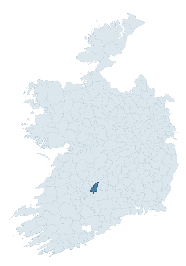
Where this barony sits in the Republic of Ireland
Geology and preservation
Bedrock geology shapes the landscape long before any settlement begins — controlling soil drainage, agricultural potential, the survival of upstanding monuments, and the preservation of buried archaeology. The figures below come from the Geological Survey Ireland 1:100,000 bedrock map.
The bedrock underlying Coonagh is predominantly limestone (51% of the barony by area), laid down during the Carboniferous period (73% by area, around 359 to 299 million years ago). Limestone is the most heritage-rich bedrock in Ireland. It supports fertile, well-drained soils that favoured dense Early Medieval settlement and Norman manorial agriculture, and it weathers into karst features — sinkholes, caves, swallow holes, and souterrains — that frequently carry archaeology. Where peat overlies limestone, organic preservation can be exceptional. A substantial secondary geology of greywack, siltstone and grit (16%) adds further variety to the underlying landscape. With 11 distinct rock types mapped, the barony sits in the top third of ROI baronies for geological diversity (92nd percentile) — typically a sign of complex tectonic history or coastal mosaics of differing rock units.
Rock type composition
Largest mapped unit: Waulsortian Limestones (18% of the barony)
Placename evidence
Logainm records 20 heritage-diagnostic placenames for Coonagh, drawn from townland and civil-parish names across the barony. The dominant stratum is pre-Christian and Early Medieval defensive — ráth-, lios-, dún-, and caiseal-prefixed names that mark Iron Age and early historic settlement. The leading diagnostic roots are cill- (6 — church), lios- (4 — ringfort or enclosure), and dún- (3 — hilltop fort or promontory fort). This is below the ROI average of 30.7 heritage placenames per barony, suggesting either lighter survey coverage or a townland-naming tradition that draws more on generic landscape vocabulary. The presence of multiple heritage strata side by side indicates layered occupation of the landscape across successive prehistoric and historic periods. Logainm records 169 placenames for Coonagh (predominantly townland names). Of these, 20 (12%) carry one of the diagnostic Gaelic roots tracked above; the remainder draw on more generic landscape vocabulary that does not encode a heritage period.
Pre-Christian / Early Medieval Defensive
| Root | Count | Meaning |
|---|---|---|
| lios- | 4 | ringfort or enclosure |
| dún- | 3 | hilltop or promontory fort |
| ráth- | 1 | earthen ringfort |
Early Christian Ecclesiastical
| Root | Count | Meaning |
|---|---|---|
| cill- | 6 | church (early) |
| teampall- | 2 | church (later medieval) |
| cillín- | 1 | unconsecrated burial ground |
Burial, Ritual, and Norse-Contact
| Root | Count | Meaning |
|---|---|---|
| tuaim- | 2 | burial mound |
| gall- | 1 | foreigner — Norse settlement marker |
Other baronies in Limerick
- North Liberties
- Pubblebrien
- Connello Lower
- Smallcounty
- Clanwilliam
- Connello Upper
- Owneybeg
- Connello Lower
- Slievardagh — Tipperary
- Fermoy — Cork
See all 280 baronies in the Republic of Ireland Heritage Tool.

Explore further
Grounding History: 10 Maps of Northern Ireland’s Past
If you’re interested in Irish heritage more widely, the companion report for Northern Ireland brings together the analysis of all 462 NI wards into one place through 10 high-quality maps — covering monument density, archaeological periods, placename heritage, terrain, wetland, and the historic landscape at first survey. Take a look.
About this profile
Click any section below to expand.
What is a barony?
A barony is a historic administrative unit in Ireland, broadly equivalent to an English hundred. The 280 baronies used here are from the OSi 2019 National Statutory Boundaries (generalised 20m), covering the 26 counties of the Republic of Ireland. Baronies derive from the Norman period, were formalised in the 17th century, and have not been redrawn for statistical purposes. They vary enormously in area, from compact urban baronies in Dublin to vast upland baronies in Connacht, and should not be compared by raw site count without accounting for area differences.
What counts as a site?
This profile combines three distinct heritage registers, each with its own definition of what constitutes a recordable site:
- Archaeological sites (NMS). The National Monuments Service Sites and Monuments Record (SMR) catalogues every known archaeological monument or site of archaeological interest in the Republic, from prehistoric burial mounds and ringforts to medieval churches and post-medieval defensive works. Inclusion does not require legal protection — only that the site has been identified, surveyed, and assessed as having archaeological value. A separate subset of these sites lies within a recorded protection zone, which gives them statutory protection under the National Monuments Acts.
- Listed buildings (NIAH). The National Inventory of Architectural Heritage records buildings of architectural, historical, archaeological, artistic, cultural, scientific, social, or technical interest. Each surveyed structure is appraised on a five-tier scale: International, National, Regional, Local, and Record-Only. The NIAH appraisal is informational rather than strictly statutory, but it underpins local-authority Record of Protected Structures (RPS) listings.
- Heritage placenames (Logainm). Logainm is the authoritative database of Irish placenames maintained by the Placenames Branch. This profile applies a heritage-diagnostic classifier to the Irish-language form of each townland name, flagging roots that signal defensive sites (ráth-, lios-, dún-, caiseal-, cathair-), ecclesiastical foundations (cill-, teampall-, domhnach-, mainistir-), prehistoric burial-ritual features (tuaim-, carn-, leaba-), or Norse-contact settlement (gall-). Townlands without one of these diagnostic roots are not flagged here — they may still carry historical significance, but that significance is not encoded in the name itself.
Editorial principles
The narrative sections of this profile follow several explicit principles:
- Evidential. Every claim about this barony’s heritage character is anchored in the underlying register data. Where a site count, a placename count, or a percentile rank is cited, it is computed from the source datasets at export time, not estimated.
- Comparative. Counts and metrics are reported alongside their percentile rank against the other 279 ROI baronies. A barony with 50 ringforts in absolute terms could be unusually high or unusually low depending on its size and regional context; percentile ranking removes that ambiguity.
- Transparent on limits. Where a register has known coverage gaps, survey biases, or data-quality issues that affect this barony’s figures, the profile flags them rather than presenting the numbers as definitive.
- No interpretation beyond what the data supports. The narrative does not speculate about historical events, social dynamics, or cultural meaning beyond what the recorded heritage and placename evidence directly attests.
Data caveats and limits
- NMS Sites and Monuments Record is the product of survey campaigns conducted at different intensities across different counties and decades. Some baronies have been surveyed more thoroughly than others, and absolute counts should be read in that light. Sites destroyed by development before survey are typically not represented; sites in heavily forested or upland terrain are sometimes under-recorded.
- NIAH coverage is broadly complete for the Republic of Ireland but the survey was conducted on a rolling county-by-county basis, and the most recent appraisal date varies. Buildings demolished or substantially altered after their original survey may still appear in the register; conversely, recent buildings of merit may not yet have been appraised.
- Logainm classification applies a deliberately conservative pattern-matching approach to the Irish-language townland forms. The classifier prioritises true positives over recall: a townland may carry a heritage signal that the classifier doesn’t recognise, particularly where the diagnostic root has been heavily anglicised or where the townland name draws on a less common term. The 60,000+ townland records and ~9,800 classified placenames give a substantial signal at barony scale, but individual townland names should be checked against Logainm directly for definitive interpretation.
- Period attribution. The chronological distribution reflects only those NMS sites that carry a recognised period attribution in the source data. Sites listed as “Unknown” period are excluded from the dated subset.
- Boundary changes. Some baronies have undergone minor boundary adjustments since their 19th-century definition; the OSi 2019 generalised boundaries used here are the current statutory definition and may differ slightly from historical maps in border areas.
- Bedrock geology is mapped at 1:100,000 scale, which means local variation within a barony — small pockets of different rock type, mineral veins, alluvium overlying bedrock — is generalised. The dominant-system and rocktype figures are area-weighted, so a barony reading “70% Carboniferous limestone” may still contain small but archaeologically important pockets of older or younger rock. Around 3% of GSI polygons do not match the lexicon and contribute no rocktype or system attribution.
Data sources
- National Monuments Service — Sites and Monuments Record (SMR) https://data.gov.ie/dataset/national-monuments-service-archaeological-survey-of-ireland
- National Inventory of Architectural Heritage (NIAH) https://data.gov.ie/dataset/national-inventory-of-architectural-heritage-niah-national-dataset
- Logainm — Placenames Database of Ireland https://www.logainm.ie/
- Ordnance Survey Ireland — National Statutory Barony Boundaries 2019 https://data-osi.opendata.arcgis.com/
- EURODEM — European Digital Elevation Model https://www.mapsforeurope.org/datasets/euro-dem
- ESA WorldCover https://esa-worldcover.org/en
- Geological Survey Ireland — 1:100,000 Bedrock Geology https://www.gsi.ie/en-ie/data-and-maps/Pages/Bedrock.aspx
Explore more: Search any of the 280 ROI baronies, browse by historical province, or read the methodology and data sources for the full Republic of Ireland Heritage Tool.