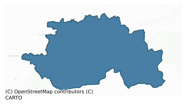
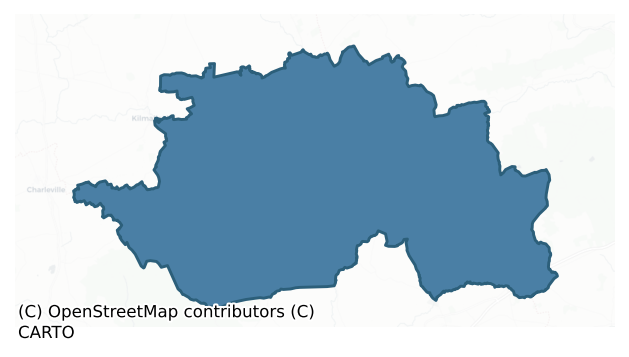
Coshlea is a barony of County Limerick, in the historical province of Munster (Irish: Cois Sléibhe), covering 385 km² of land. The barony records 1,127 NMS archaeological sites and 149 NIAH listed buildings, placing it at around the 80th percentile among 280 ROI baronies for sites per km². This means it is in the top fifth of all baronies for sites per km². Dated archaeological evidence runs from the Neolithic through to the Modern, spanning 8 of 9 archaeological periods, placing the barony in the 80th percentile among 280 ROI baronies for chronological depth. This means it is in the top fifth of all baronies for chronological depth. The largest dated subset of recorded sites dates to the Early Bronze Age. Logainm flags 29 placenames in the barony as carrying a recognised heritage root; the largest share — around 72% — are names associated with early Christian church and monastic foundations.
Heritage at a glance
Percentile rankings throughout this profile compare each barony only against the other 279 Republic of Ireland baronies.
The recorded heritage of Coshlea
The National Monuments Service Sites and Monuments Record (SMR) is the statutory inventory of archaeological sites for the Republic of Ireland, maintained by the Department of Tourism, Culture, Arts, Gaeltacht, Sport and Media. Sites recorded here include earthworks, ringforts, megalithic tombs, ecclesiastical remains, and post-medieval features; not every record is legally protected, but each is registered as a monument of archaeological interest.
The National Monuments Service records 1,127 archaeological sites in Coshlea, putting it at the 80th percentile among 280 ROI baronies for sites per km². This means it is in the top fifth of all baronies for sites per km². Protection coverage is near-universal — 1,105 sites (98%) fall within a recorded monument protection zone, indicating an extensively surveyed landscape. The dominant category is defensive sites — ringforts, enclosures, hillforts, and stone forts (489 sites, 43% of the record). Earthwork is the most prevalent type, making up 21% of the barony's recorded sites (239 records) — well above the ROI average of 3% across all baronies where this type occurs. Earthwork is an unclassified earthen structure with no diagnostic features that allow a more specific classification. Other significant types include Barrow – unclassified (122) and Ringfort – rath (92). Barrow – unclassified is a prehistoric burial mound where the specific barrow type cannot be determined from surface evidence; Ringfort – rath is an earthen ringfort enclosed by a bank and external ditch — the most common Early Medieval farmstead, broadly dated 500–1000 AD. Across the barony's 385 km², this gives a recorded density of 2.93 sites per km².
Most common monument types
Hover or tap a monument type to see its definition.
| Type | Count |
|---|---|
| Earthwork an unclassified earthen structure with no diagnostic features that allow a more specific classification | 239 |
| Barrow – unclassified a prehistoric burial mound where the specific barrow type cannot be determined from surface evidence | 122 |
| Ringfort – rath an earthen ringfort enclosed by a bank and external ditch — the most common Early Medieval farmstead, broadly dated 500–1000 AD | 92 |
| Enclosure a banked or ditched feature of uncertain type, used as a catch-all where the original function cannot be determined from surface evidence | 84 |
| Standing stone a deliberately set upright stone, used variously as a Bronze/Iron Age burial marker, route marker or commemorative monument | 40 |
| Ritual site – holy well a well or spring traditionally associated with a saint, often credited with healing properties; many trace earlier ritual origins but devotion is documented from the medieval period onwards | 37 |
| Moated site | 28 |
Chronological distribution
The dated archaeological record for Coshlea spans from the Neolithic through to the Modern, with activity attested across 8 of 9 archaeological periods. This is the 80th percentile across ROI baronies for chronological depth — an above-average span. Every period from earliest to latest is represented in the record — an unbroken sequence of dated activity across the full chronological span. Activity concentrates most heavily in the Early Bronze Age (419 sites, 46% of dated material), with the Iron Age forming a secondary peak (211 sites, 23%). A further 222 recorded sites (20% of the overall NMS register for the barony) carry no period attribution — appearing as 'Unknown' in the bar chart below. This typically reflects either records that pre-date the standardised period vocabulary or sites awaiting specialist dating review, rather than a genuine absence of chronological evidence.
Sample of recorded monuments
Show 25 sample monuments (of 1,127 total)
A representative sample of 25 recorded monuments drawn from the barony’s 1,127 total NMS entries. Sites within a recorded monument protection zone and rarer site types are prioritised so the list shows a meaningful cross-section rather than only the most common type. Each entry shows the official Sites and Monuments Record reference number and the description published by the National Monuments Service.
Ringfort – unclassified
In pasture, 125m E of Morningstar River that forms townland boundary with Ballinvana. Adjacent to old road from Knocklong to Kilmallock with crossing point over the river annotated 'Doon Ford' on 1840 ed. OSi 6-inch…
In pasture, 125m E of Morningstar River that forms townland boundary with Ballinvana. Adjacent to old road from Knocklong to Kilmallock with crossing point over the river annotated 'Doon Ford' on 1840 ed. OSi 6-inch map lies 140m to W. Knocktoran (Cnoc Teorann/Hill of the boundary) House stands 110m to SE. Annotated ‘Ahadoon’ on the 1840 ed. OSi 6-inch map where it is depicted as a circular shaped platform defined by a scarp, interior planted with trees, intersected at NNE by post-1700 field boundary running roughly E-W. Shown on the 1897 ed. OSi 25-inch map as a raised sub-circular shaped area (dims. c. 24m N-S x 26m E-W) defined by a scarp, incorporated into a post-1700 field boundary from SW-W-N- NE with outbuildngs of Knocktoran House to E. In 1840 the Ordnance Survey described this monument as Ahadoon meaning ‘Áth a’ Dúin, ford of the fort’, a fort in the townland of Knocktoran (OSNB Abbeyfeale to Bruree, 1232; OSL Vol. 2, 270).
Possible platform ringfort or motte castle described by Westropp (1917-19, 176) as follows; ‘It is 16 feet [4.8m] to 18 feet [5.4m] high, the top girt by a low ring, 8 feet [2.4m] to 10 feet [3m] thick, and rarely 3 feet [0.9m] high. The platform inside this measures 60 feet [18.2m] across, or 123 [37.5m] feet at the base. There are traces of a fosse, but too defaced to be measured. The old road runs from it to the ford, westward down the slope'. Monument visible as a tree-covered earthwork on Digital Globe orthoimage taken between…
Barrow – pond barrow
In pasture, a ringfort (LI041-013011-) lies 15m to the NE and standing stone (LI041-013009-) lies 45m to the SW. Not depicted on the OSi historic maps. Earthwork described as a 'hollow' by Westropp (1919, 14) as located…
In pasture, a ringfort (LI041-013011-) lies 15m to the NE and standing stone (LI041-013009-) lies 45m to the SW. Not depicted on the OSi historic maps. Earthwork described as a 'hollow' by Westropp (1919, 14) as located ‘56 feet [17m] to the SW’ of a ringfort (LI041-013011-) which consisted of ‘a regular shallow, oval hollow, 3 feet [0.9m] deep and 18 feet [5.4m] to 25 feet [7.6m] across.’ Monument visible as a sunken circular-shaped area on OSi orthophotograph taken between 2005-12 and on Google Earth orthoimage dated 11/18/2018.
See attached plan taken from Westropp (1916-19), and Google Earth orthoimages.
Compiled by: Fiona Rooney
Date of upload: 28 July 2021
See attached ASI aerial photographs ASIAP – 318/16 taken on 05/10/2002. 343/20 on 05/01/2003.
Ritual site – holy/saint's stone
Situated on elevated pasture overlooking rock outcrop with the village of Emly 3.3km to the NNE. A recumbent stone barely visible protruding above the surface of the ground overlooking a cliff-face may be the monument…
Situated on elevated pasture overlooking rock outcrop with the village of Emly 3.3km to the NNE. A recumbent stone barely visible protruding above the surface of the ground overlooking a cliff-face may be the monument marked 'Lackelly Rock' on all editions of the OS 6-inch map. In 1920 (Lynch, 100-01).the following details were recorded about Lackelly Rock; 'Lackelly was the name given to the stone or rock mentioned in the legend of the birth of St. Ailbhe, patron saint of the Diocese of Emly. It derived its name Lackelly / Leac Ailbhe from a large flag stone which lay on the top of the cliff. The cliff must have been much higher when the legend was composed, as the level of the ground at the base has raised in time. When I first made inquiries about Lackelly I was informed by Mr. Healy, of Corbally, that the stone was there. He described it as about seven or eight feet [2.1/2.4m] long and four feet [1.2m] wide, and he believed it had some markings on it; but when I visited the place with him we found there was no stone. The local tradition is that St. Ailbhe was born at this rock, or under this stone it is not very clear; but old people were in the habit of visiting the rock and reciting prayers on the 12th of September, the feast of St. Ailbhe, up to forty years ago, and the water which lay in some natural cavities of the rock, was used as a cure'.
The legend of St. Ailbhe's birth recorded the following; 'He is said to have come from a portion of this district i…
House – early medieval
In reclaimed pasture, in W quadrant of an archaeological complex (LI048-034006/042-) located on the 'Supposed Site of Temaír Erann', which was the ancient cemetery of the Ernai tribe on Slievereagh (Sliabh Riabhach)…
In reclaimed pasture, in W quadrant of an archaeological complex (LI048-034006/042-) located on the 'Supposed Site of Temaír Erann', which was the ancient cemetery of the Ernai tribe on Slievereagh (Sliabh Riabhach) (Westropp 1919, 9; Westropp 1917-19, 179; Westropp 1918, 111). House Site 'f' located in N quadrant of western field, excavated cist (LI048-034015-) 15m to N, 3 bowl-barrows (LI048-034010-/012-) lie 40m to NE, group of ringforts (LI048-034025-/027-) in field to E. Early medieval circular-shaped 'house site f' excavated by Ó Ríordáin (1940, 121-124) between 1934-5 and described as following; ‘House f was similar to House a (located in ringfort LI048-034025-) in having a compacted clay and gravel floor but of a quality inferior to that in House a. The general construction of the two houses was similar, since each was evidently constructed in the main of a perishable material, the lower parts of the walls being of stone. There is a striking similarity in plan between House a and House f, the lower portion of the floor of the former house corresponding to the sunken area (referred to below) in the latter. House f was, however, approximately circular in plan while House a was more nearly rectangular. The diameter of the main part of House f was about 13 feet [3.96m]. Many of the stones around House f were thick slabs which either still stood upright (like the stones found around House a) or had fallen in such a way as to suggest that they had once been set on edg…
Designed landscape – ornamental lake
In wet pasture, in the SE corner of a coniferous plantation, 28m W of townland boundary with Mitchelstowndown North. An enclosure (LI048-023—-) lies 100m to the S. Depicted as a pond on 1840 ed. OSi 6-inch map and…
In wet pasture, in the SE corner of a coniferous plantation, 28m W of townland boundary with Mitchelstowndown North. An enclosure (LI048-023—-) lies 100m to the S. Depicted as a pond on 1840 ed. OSi 6-inch map and not as an antiquity. Indicated as a non-antiquity where it is shown as a D-shaped area (dims. c. 39m N-S; 33m E-W) indicated with a solid line in the same fashion as the surrounding field boundaries. Visible as a rush covered dried up pond on Digital Globe orthoimage taken 2011-13. Pond feature possibly a natural water feature or a designed landscape pond associated with nearby country houses.
See attached Google Earth orthoimages.
Compiled by: Fiona Rooney
Date of upload: 27 May 2021
Chapel
Situated on elevated pasture with good views in all directions. Possible ringwork (LI049-063004-) annotated 'Duntryleague' on OS 6-inch map in field immediately to NE. St. Patrick's holy well 330m to S. No surface…
Situated on elevated pasture with good views in all directions. Possible ringwork (LI049-063004-) annotated 'Duntryleague' on OS 6-inch map in field immediately to NE. St. Patrick's holy well 330m to S. No surface remains visible of medieval chapel in Duntryleague graveyard (LI049-063003-), W belltower of post-1700 C of I church in W quadrant of graveyard with Massy family mausoleum in S quadrant of graveyard. An inquisition into the lands of Christopher de Bermingham undertaken on the 15 November 1346 at Galbally recorded that the chapel of Dundirleleke [Duntryleague] was one of four chapels belonging to the parish church of Narlac [Galbally] (LI049-086002-) (Mills & McEnery 1916, 117). This chapel is depicted on the 17th century Down Survey map of the Barony of Coshlea where it is shown in the vicinity of the present Duntryleague graveyard (NLI MS 718).
Westropp (1904-5, 452) recorded the following details about Duntryleague; 'The fort [LI049-063004-] appears in the oldest records as Duntrileag, because three pillars surrounded the well in it. "The Colloquy" in the Book of Lismore ("Silva Gadelica", ii.,p. 129) mentions this legend, and calls it Dun tri liag, or Dun ar sleibh (see Joyce, "Irish Names of Places," i., p. 253). See also Dundirleke chapel, 1346 ("Gormanstown Register," p. 145d); Dontrileg and Dontrylege, 1615; Downtrilege (D.S.(A.), 52.
Site – The graveyard [LI049-063003-] exists near the ancient dun, and contains a large vault of the Massys. The w…
Castle – ringwork
This earthwork may be the remains of a possible earthwork castle or high status ringfort which gave its name to the townland of Duntryleague. Westropp (1906-07, 197-8) recorded the following details about this possible…
This earthwork may be the remains of a possible earthwork castle or high status ringfort which gave its name to the townland of Duntryleague. Westropp (1906-07, 197-8) recorded the following details about this possible castle site (LI041-048—*/LI049-261—-); 'Cormac Cass, King of Munster in the second century, says an early legend, was wounded in the head at the Battle of Knocksouna (see section 191, supra), where he defeated and slew Eochu Abhradruadh, King of Ulster. Cormac was brought to Duntriliag, where "a good dun" was constructed round a spring, with three pillars round his bed (whence the name "dun tri liag") ; and, despite skilled medical attendance, he died, and was buried in a "cave" in the fort (Book of Lismore, " Colloquy "). 1002 King Brian strengthened Duntriliag (Wars G. and G.). 1346 Dundirleke (Gormanstown Register, p. 145 d). 1540 Burke of Castleconnell claimed a mark from "the small quarter of Duntriliag, whereon Baile na mona, Garrdha an laugaigh (Garryenlanga), Baile an bhighigh, Caislean Criaidh (Burke Rental). 1655 Downeterleague, the estate of Jo. Cantwell, sold to Hugh Massy (B.D., p. 90), confirmed 1666. His son, Hugh Massy, junior, describes its partial burning by the Irish; but he saved the outbuildings and several turrets (History of the Massy Family, 1890, p. 238). 1701 Hugh Massy made his will "being in danger of death, occasioned by a wound received from Edw. Moore, of Knockhorden" (Prerog., Dublin)'.
According to Lynch (1920, 122-3…
Megalithic tomb – passage tomb
National monument No. 315. The monument has been described by Ó Nualláin and Cody (1987, 78-80) as follows: ‘The monument consists of a cruciform Passage Tomb set in a ruined cairn. The cairn, though difficult to…
National monument No. 315. The monument has been described by Ó Nualláin and Cody (1987, 78-80) as follows: ‘The monument consists of a cruciform Passage Tomb set in a ruined cairn. The cairn, though difficult to define, especially at the west, is clearly round and measures about 25m north-south mid 22m east-west. Largely grain-grown, it is uneven and stony underfoot. Trees have been planted lo within a couple of metres of the perimeter which has been raked by tree-planting machinery.
The passage and main chamber are aligned almost north-south with the entrance to the north. The overall length of the tomb is about 10m. The side-chambers arc located mid-way along it’s length and the end or main chamber, which is about equal in length to the passage, extends to or just beyond the centre off the cairn. Somewhat taller stones are used in the construction of the main chamber than in the rest of the tomb. The entrance to the passage is flanked on cither side by two kerbstones, the inner of which in each cane articulates with the passage entrance. These vary in height from 0.6m to 1.2m. There is a displaced stone alongside the outer or the eastern pair of kerbstones. The passage, 1.3m wide at the entrance, narrows sharply and over the greater part of its length varies from 0.4m to 0.7m in width. It is composed of eight orthostats, four on each side. The outermost orthostat at the east side of the passage is 0.2m high but the remainder range in height from 0.5m to 1.1m. Outsid…
Concentric enclosure
In reclaimed pasture, 140m NE of townland boundary with Spittle. Annotated 'Lisnagreeve' on the 1840 ed. OSi 6-inch map where it is depicted as a large circular-shaped earthwork, truncated at SE and S by a post-1700…
In reclaimed pasture, 140m NE of townland boundary with Spittle. Annotated 'Lisnagreeve' on the 1840 ed. OSi 6-inch map where it is depicted as a large circular-shaped earthwork, truncated at SE and S by a post-1700 field boundary running NE-SW. Shown on the 1897 ed. OSi 25-inch map as a raised sub-circular shaped platform (diam. c. 40m) enclosed by an external bank. Monument visible as circular area enclosed by a bank with fosse and external bank on Digital Globe orthoimage taken between 2011-13 and on the Google Earth orthoimages.
See attached oblique aerial photograph (ASIAP) and Google Earth orthoimages.
Compiled by: Fiona Rooney
Date of upload: 18 October 2021
Megalithic tomb – portal tomb
In pasture. Annotated ‘Cromlech’ on 1940 ed. OSi 6-inch map where it is depicted standing immediately NE of field boundary with farmhouse to NW. Recorded by Lynch (1910, 111-12) as follows; ‘Borlase states that in the…
In pasture. Annotated ‘Cromlech’ on 1940 ed. OSi 6-inch map where it is depicted standing immediately NE of field boundary with farmhouse to NW. Recorded by Lynch (1910, 111-12) as follows; ‘Borlase states that in the Barony of Coshlea, Townland of Barna and Parish of Galbally, a Cromleac is marked on Ord. Surv. Map No. 50. I had a search made for this Cromleac and find that it has disappeared. The covering stone would appear to have been the last to remain. My correspondent states that “up to about four years ago [c. 1906] it stood about 600 yards [550m] from the public road at the end of the passage to a farm house. It was a large stone, sufficient to afford shelter to ten men from the rain. About that time the sons of the farmer blasted it and used it for draining purposes”. Comment on this act of vandalism is needless’.
The Megalithic Survey of Ireland (De Valera and Ó Nualláin 1982, 79) recorded that; ‘It was not described in the earlier documents of the [OS] survey and its nature is uncertain. The O.S. name book for the 1901 edition records its destruction: “This has been blasted and has not the appearance of a cromlech. It stands on a fence and slightly inclines over the road. When this road was made this cromlech was disturbed and a portion of it broken up and used for metalling the road" '.
Described in 1999 as no surface remains visible of Cromlech and the road has been widened. In the field to the NE, the ASI described a possible collapsed standing s…
Megalithic tomb – wedge tomb
Wedge tomb known locally as 'Leaba Iscur' or 'Oscur's Grave' described in the Survey of the Megalithic Tombs of Ireland (de Valera and Ó Nualláin 1982) as follows; 'This monument lies about 9.5km south-east of…
Wedge tomb known locally as 'Leaba Iscur' or 'Oscur's Grave' described in the Survey of the Megalithic Tombs of Ireland (de Valera and Ó Nualláin 1982) as follows; 'This monument lies about 9.5km south-east of Charleville near the head of a broad valley on the northern side of the Ballyhoura Mountains. The tomb, known as "Leaba Iscur", looks northwards along the valley, across the fertile lowlands of Co. Limerick, to the River Shannon and beyond. The outlook elsewhere is confined by the mountains flanking the valley sides. The valley is covered with bog and this has encroached on the tomb, particularly towards the east where peat, up to 0.25m in thickness, lies above some of the stones.
The tomb, which is of unusual construction, is reasonably well preserved though most of the roofstones are missing. It consists of a narrow gallery with sidestones overlapped by corbels in several irregular tiers, which narrow the gap to be spanned by the roofstones. A single roofstone is in position across the middle of the gallery. Lynch's plan and sections show a second roofstone covering the eastern end of the gallery and beneath this an inset backstone but these stones are now missing or are concealed by peat and debris. The structure is surrounded by a low mound reaching little above the level of the enveloping bog.
The structure appears to have altered little since Lynch made his plan and sections and all of the sidestones on his drawings can be identified. The more westerly of the…
Round tower
Situated on the summit of Ardpatrick with commanding views of the surrounding countryside, accessed from a road to W known locally as the Rian Bó Phádraig (LI056-002002-). Hilltop monastery reputedly founded by St.…
Situated on the summit of Ardpatrick with commanding views of the surrounding countryside, accessed from a road to W known locally as the Rian Bó Phádraig (LI056-002002-). Hilltop monastery reputedly founded by St. Patrick and renamed Ardpatrick, hilltop formerly known as Tulach na Feinne [Hill of the Fianna] (Westropp 1922, 78). The poorly preserved remains of Ardpatrick round tower (H c. 3m; base diam. c. 5.3m) lie c. 7m W of the graveyard wall with church ruins (LI056-002008-) 14m to SE, surrounded by a field system with large ecclesiastical enclosure (LI056-002006-) associated with a monastery founded by St. Patrick. St Patrick’s Well (LI056-002007-) lies 35m to S. Ardpatrick church ruins depicted on the 17th century Down Survey map of Ballingaddy parish where it is shown standing beside a tower which is presumably the remains of the round tower in Ardpatrick (NLI, MS 718). The terrier of the Down Survey parish map recorded that in ‘Ardpatrick are the walls of a Church & a Watchtower’ (ibid.). Folklore collected from Ardpatrick National School recorded the following details about Ardpatrick Hill; ‘On the hill here stand the remains of an abbey with small church [LI056-002003-] attached & close to both are the remains of a round tower. St Patrick is said to have approached the hill from the west passing through the neighbouring parish of Effin. A trace of the old road was pointed out to me by an old man & referred to by some others. He called the old road 'Rian b…
Settlement cluster
In pasture. Associated with ecclesiastical enclosure (LI056-002002-), road (LI056-002002-) and Ardpatrick church and graveyard (LI056-002002-/009-) lie to immediate S. Not marked on the 1840 ed. or 1897 ed. OSi historic…
In pasture. Associated with ecclesiastical enclosure (LI056-002002-), road (LI056-002002-) and Ardpatrick church and graveyard (LI056-002002-/009-) lie to immediate S. Not marked on the 1840 ed. or 1897 ed. OSi historic maps. Depicted on the Cassini ed. OSi 6-inch map as circular depression defined by a scarp. In 1978 the earthworks were described as following; ‘There are old quarry depressions in the side of the hill to the NW of the graveyard.’ Numerous depressions visible on Digital Globe orthoimage taken between 2011-2013 and on Google Earth orthoimages some of which may have been the result of quarrying while other earthworks are related to a field system (LI056-002004-) and others may be related to clustered settlement surrounding Ardpatrick Church and graveyard. Extensive outline of possible settlement earthworks clearly visible surrounding Ardpatrick church and graveyard on oblique aerial photographs (CUCAP ATD049/061) taken 21/07/1967.
See attached Google Earth orthoimages
Compiled by: Fiona Rooney
Date of upload: 19 November 2021
Ecclesiastical enclosure
Hilltop monastery reputedly founded by St. Patrick and renamed Ardpatrick, hilltop formerly known as Tulach na Feinne [Hill of the Fianna] (Westropp 1922, 78). Folklore collected from Ardpatrick National School…
Hilltop monastery reputedly founded by St. Patrick and renamed Ardpatrick, hilltop formerly known as Tulach na Feinne [Hill of the Fianna] (Westropp 1922, 78). Folklore collected from Ardpatrick National School recorded the following details about Ardpatrick Hill; ‘On the hill here stand the remains of an abbey with small church [LI056-002008-] attached & close to both are the remains of a round tower [LI056-002003-]. St Patrick is said to have approached the hill from the west passing through the neighbouring parish of Effin. A trace of the old road was pointed out to me by an old man & referred to by some others. He called the old road 'Rian bo Padraig' [LI056-002002-]. I some years ago pointed this out to a surveyor from the Ordnance Survey Office & it is now marked on the Ordnance map. It runs up the hill from the west & its line can still be plainly seen. [Informant] Heard this from his father & from 'all the old people‘ (The Schools’ Collection, Volume 0509, Page 201; https://www.duchas.ie/en/cbes/4922041/4921283).
Gwynn and Hadcock (1970, 29) recorded that a monastery was founded at Ardpatrick by St. Patrick. The Tripartite Life of St. Patrick stated that Patrick 'desired an ecclesiastical establishment (congbail) in Ard-Pátraic; and Patrick's flagstone (lec) is there and the boundary of his church site (torainn achillí) [LI056-002006-]' (Ó Carragáin 2010, 131; Stokes 1887 vol. 1, 208-9).
The curving field boundary depicted to the NW-N-E-S of Ardpatrick church…
Castle – motte
In pasture on summit of hill, immediately S of Kilfinnane Town (LI048-127—-). Standing stone (LI056-022—-) immediately to SW. Depicted on the 1840 ed. OSi 6-inch map as a circular area enclosed by two banks with…
In pasture on summit of hill, immediately S of Kilfinnane Town (LI048-127—-). Standing stone (LI056-022—-) immediately to SW. Depicted on the 1840 ed. OSi 6-inch map as a circular area enclosed by two banks with OSi trig. station in centre marking 661 ft. OD. Annotated ‘The Moat’ on the 1897 ed. OSi 25-inch map and shown as a central mound, enclosed by 3 banks with intervening fosses from NE-S-W-NW. On this map the 'Fair Green is shown immediately to NE and the enclosing banks have been levelled on the N side of the earthwork. Annotated 'Treada na Ríogh (The Moat)' on the Cassini ed. OSi 6-inch map.
Described by Herity (1993, 146, 141) as following; ‘The earthwork occupies a commanding position at 661 ft OD overlooking the great plain of county Limerick. The central mound is roughly circular. c. 10.4m high above the level of the ground outside the outer vallum. The top of the mound is level, with a diameter of 16.2m. The inner vallum is 4.9m high over the outer ground, 7.8m wide at the base and 2.7m wide at the top. The next vallum is 3.2m high, 4.7m wide at the base and 1.8m wide at the top. The outer vallum is 1.6m high, 2.7m wide at the base and 0.9m wide at the top. The overall diameter of the monument was 101.1m north to south. The greater part of the outer vallum has been removed (measurements after Lynch 1911, converted to metric scale). In the list of royal forts in the Book of Rights (Leabhar na g Ceart) there is a poem attributed to St. Benean in th…
Designed landscape – folly
In pasture on the summit of Castle Hill (858 ft., 261m), 470m NE of the 19th century Castle Oliver House. Within enclosure (LI056-034001-). Annotated ‘Oliver’s Folly’ on the 1840 ed. OSi 6-inch map. Late 18th…
In pasture on the summit of Castle Hill (858 ft., 261m), 470m NE of the 19th century Castle Oliver House. Within enclosure (LI056-034001-). Annotated ‘Oliver’s Folly’ on the 1840 ed. OSi 6-inch map. Late 18th century folly associated with Castle Oliver which was the residence of Richard Oliver-Gascoigne (Fitzgerald 1826, 388).
Recorded in the National Inventory of Architectural Heritage (Reg. No. 21905615) as Oliver’s Folly and described as a; ‘Freestanding folly, built c. 1790, comprising three-stage pair of sham ruinous circular towers with connecting curtain wall. Rubble limestone walls. Loop windows to towers with pointed arch opening to curtain wall. Lancet openings to towers (www.buildingsofireland.ie)’. Folly is clearly visible on oblique aerial photograph (ASIAP (319) 17) taken 05-10-2002 and on Google Earth orthoimages Google Earth orthoimages. Folly standing in centre of enclosure is clearly visible on oblique aerial photograph (CUCAP ATD059) taken 21/07/1967
See attached oblique aerial photographs (ASIAP (319) 17/ CUCAP ATD059).
Compiled by: Martin Fitzpatrick
Date of upload: 18 November 2021
Religious house – Dominican friars
Dominican friary described by Westropp (1904-5, 428) as following; 'Founded by Roche in the fourteenth century for Dominicans. Donough O'Dorgan was its last prior, 1558. "Spitle in Kilfinan, on it are the walls of a…
Dominican friary described by Westropp (1904-5, 428) as following; 'Founded by Roche in the fourteenth century for Dominicans. Donough O'Dorgan was its last prior, 1558. "Spitle in Kilfinan, on it are the walls of a church or chapel; Abby Ballynegaule hath the walls of an old
abby," 1657 (D.S. (A), 59). Fabric – It was 71 feet 8 inches [21.8m] by 21 feet 8 inches [6.6m]; the wall, 3 feet thick [0.9m], and in fair preservation. The west door and two south ones had flat arches; the east window, a round-headed splay arch; the lights gone before 1840. The south and two north windows, round-arched lights and splays (O.S.L., 9, p. 199)'.
Compiled by: Caimin O'Brien
Date of upload: 01 November 2019
Well
In pasture 175m S of possible moated site (LI057-057—-) and 145m N of ‘Carheen fort’ (LI057-055—-). Not depicted on the 1840 ed. OSi 6-inch map. Annotated ‘Well’ on the 1897 ed. OSi 25-inch map and shown as a…
In pasture 175m S of possible moated site (LI057-057—-) and 145m N of ‘Carheen fort’ (LI057-055—-). Not depicted on the 1840 ed. OSi 6-inch map. Annotated ‘Well’ on the 1897 ed. OSi 25-inch map and shown as a circular-shaped hollow. No surface remains visible on Digital Globe orthoimage taken between 2011-13 or on Google Earth orthoimages.
See attached Google Earth orthoimage.
Compiled by: Martin Fitzpatrick
Date of upload: 5 November 2021
House – vernacular house
Building outlined at this location on 1840 ed. OSi 6-inch map (Gowen 1988, 179). In pasture on slight SE facing slope. Remains consist of a rectangular-shaped area (dims. 9.5m N-S x 16.6m E-W) defined by an earth and…
Building outlined at this location on 1840 ed. OSi 6-inch map (Gowen 1988, 179). In pasture on slight SE facing slope. Remains consist of a rectangular-shaped area (dims. 9.5m N-S x 16.6m E-W) defined by an earth and stone bank which represents the remains of a collapsed building aligned E-W that is depicted on the 1840 ed. OSi 6-inch map. A low earthen bank (L 18m) of similar form runs N from gap in E side of earthwork represents the remains of a boundary associated with this building that is depicted on the 1840 ed. OSi 6-inch map.
See attached sketch plan and Google Earth orthoimages
Compiled by: Caimin O'Brien
Date of upload: 26 October 2021
Millstone quarry
Site of millstone quarry recorded in 1975 by J. Borler and A. Lynch and described as located on W slope of Coolfree Mountain where millstones were produced (NMI Top. Files; Unpub. UCC Arch. Dept. Files).
Compiled…
Site of millstone quarry recorded in 1975 by J. Borler and A. Lynch and described as located on W slope of Coolfree Mountain where millstones were produced (NMI Top. Files; Unpub. UCC Arch. Dept. Files).
Compiled by: Caimin O'Brien
Date of upload: 26 October 2021
Cross-inscribed stone
One of two thin red sandstone slabs (dims. (0.52m H x 0.43m Wth x 0.03m T) inside Cloheen graveyard (LI040-115002-) which has a cross (dims. 0.11m H x 0.14m Wth) inscribed into the surface of the stone (pers.comm.…
One of two thin red sandstone slabs (dims. (0.52m H x 0.43m Wth x 0.03m T) inside Cloheen graveyard (LI040-115002-) which has a cross (dims. 0.11m H x 0.14m Wth) inscribed into the surface of the stone (pers.comm. 26/05/1986). Unable to locate cross-inscribed stone which was located in N quadrant of graveyard.
Compiled by: Caimin O'Brien
Date of upload: 18 June 2019
See attached ASI aerial photographs ASIAP – 344/12 on 05/01/2003. 370/3 on 10/05/2003.
Mill – unclassified
The Civil Survey of 1654-56 recorded that Sir Moris Hurly of Cnocklong an Irish Papist was in the possession of 'a ruined Castle (LI041-004005-) a Mill, with two Faires a Courte Leet & Court Baron' (Simington 1938,…
The Civil Survey of 1654-56 recorded that Sir Moris Hurly of Cnocklong an Irish Papist was in the possession of 'a ruined Castle (LI041-004005-) a Mill, with two Faires a Courte Leet & Court Baron' (Simington 1938, 233).
Situated on flat poorly drained grassland overlooked by O'Hurley's Castle (LI041-004005-) 130m to SW and Knocklong Church (LI041-004002-) and graveyard (LI041-004003-) 200m to SW. St. Patrick's and St. Paul's Well's (LI041-004006-/008-) located 35m to S. Square-shaped area (approx. dims. 40m N-S x 38m E-W) defined by a scarp and external ditch which appears to have been a water-filled moat before the field was reclaimed. A field drainage ditch intersects monument at NW angle and a second leat or water drainage channel intersects the SE corner. A series of linear drainage ditches are clearly in the field to the N of the square-shaped earthwork. It is possible that the earthwork was created during the land reclamation works visible in this poorly drained field rather than the remains of a medieval moated mill-site. Outline of monument is clearly visible on Digital Globe aerial photographs. No monument depicted at this location on any edition of the OS six-inch maps.
Compiled by: Caimin O'Brien
Date of upload: 20 June 2019
Mass-rock
In pasture, immediately E of a large upland forestry plantation and 1.3km SE of the summit (1531 ft. 566m), known as the Pinnacle, on Slievereagh. Not depicted on OSi historic maps. Identified by Peggy Barry,…
In pasture, immediately E of a large upland forestry plantation and 1.3km SE of the summit (1531 ft. 566m), known as the Pinnacle, on Slievereagh. Not depicted on OSi historic maps. Identified by Peggy Barry, Glenbrohane Heritage Group, in 1996 as a Mass Rock. A photograph shows an inscribed stone set into a large irregular shaped boulder. The mass rock is not visible on Google Earth orthoimages.
See attached photograph and location map of mass rock.
Compiled by: Martin Fitzpatrick
Date of upload: 5 October 2021
Sheela-na-gig
Sheela-na-gig on Fantstown Castle (LI048-004—-) described by Sherlock (2004, 15-16) as; 'located on the eastern face of a quoin stone on the north-eastern corner of the building and is therefore evident as one…
Sheela-na-gig on Fantstown Castle (LI048-004—-) described by Sherlock (2004, 15-16) as; 'located on the eastern face of a quoin stone on the north-eastern corner of the building and is therefore evident as one approaches the main doorway. The figure, which is carved in false relief, is positioned horizontally on the quoin with its head towards the arris and the quoin appears similar to the others nearby, suggesting the carving is an original feature of the structure. The figure has a rounded head and a long face with clear features that tapers to the chin and meets the shoulders with no apparent attempt to represent the neck. the arms, both of which are bent at the elbow, lie beside the thin torso and the hands rest on the upper thighs. It appears that the figure was carved with the breasts being represented, but the large vulva is quite apparent, even from ground level. The legs are slightly bent at the knees, the right leg more so that then left, and the feet are out-turned. The figure may either be represented as standing or as lying down with the legs splayed'.
See attached drawing of sheela-na-gig taken from Sherlock 2004
Compiled by: Caimin O'Brien
Date of upload: 23 August 2021
Earthwork
In pasture 170m SW of ringfort (LI040-081—-). Not depicted on historic OSi maps. Potential monument identified as a circular-shaped earthwork on oblique aerial photograph taken 20/07/1968 (CUCAP AVT028). No surface…
In pasture 170m SW of ringfort (LI040-081—-). Not depicted on historic OSi maps. Potential monument identified as a circular-shaped earthwork on oblique aerial photograph taken 20/07/1968 (CUCAP AVT028). No surface remains visible on OSi orthophoto taken between 2005-12 or on Google Earth orthoimages.
See attached CUCAP aerial image and Google Earth orthoimage.
Compiled by: Martin Fitzpatrick
Date of upload: 10 June 2021
See attached ASI aerial photograph ASIAP – 303/21 on 13/09/2002.
Listed buildings
The National Inventory of Architectural Heritage (NIAH) is a state survey appraising buildings of architectural, historical, archaeological, artistic, cultural, scientific, social, or technical interest. Each surveyed structure receives a rating from International (the highest, for buildings of European importance) through National, Regional, Local, and Record-Only.
The NIAH records 149 listed buildings in Coshlea (67th percentile across ROI baronies). The highest-graded structure include 1 of National significance. The Republic holds 937 National-graded buildings in total, so this barony accounts for around 0% of the national total. Construction dates concentrate most heavily in the Victorian (1830-1900) period. The most-recorded building type is house (49 examples, 33% of the listed stock).
Terrain and environment
Mean elevation across the barony is 198m — the 95th percentile among 280 ROI baronies for elevation. This means it is in the top tenth of all baronies for elevation. This is a relatively elevated landscape by ROI standards. Elevation matters for heritage because higher-altitude baronies typically favour defensive monuments — ringforts and hilltop forts placed on prominent ground — while lowland baronies are more likely to carry the dense settlement and church networks of intensive agricultural landscapes. The barony reaches 914m at its highest point — a vertical span of more than 716m within its boundary, indicating significant topographic diversity. Mean slope is 5.8° — the 81st percentile among 280 ROI baronies for slope. This means it is in the top fifth of all baronies for slope. This is consistently steep terrain by ROI standards, the kind of landscape that tends to preserve upstanding archaeological features well. Slope is a key control on both land use and archaeological preservation: steep ground resists ploughing and tends to preserve earthworks intact, while gentle slopes favour intensive cultivation that damages or destroys surface archaeology over time. Localised maximum slopes reach 18°, typical of stream-cut valleys, escarpments, or coastal bluffs within the wider landscape. The Topographic Wetness Index averages 10.1, the 25th percentile among 280 ROI baronies for wetness. This means it is in the bottom third of all baronies for wetness. Drainage matters for heritage because poorly-drained ground preserves organic archaeology (wooden trackways, leather, textiles, and on rare occasions human remains) far better than free-draining soil; well-drained ground favours arable use but destroys organic material rapidly. The land cover is dominated by improved grassland (80%) and woodland (20%). In overall character, this is an upland landscape of steep, elevated terrain, with land use dominated by improved grassland.
Terrain measurements
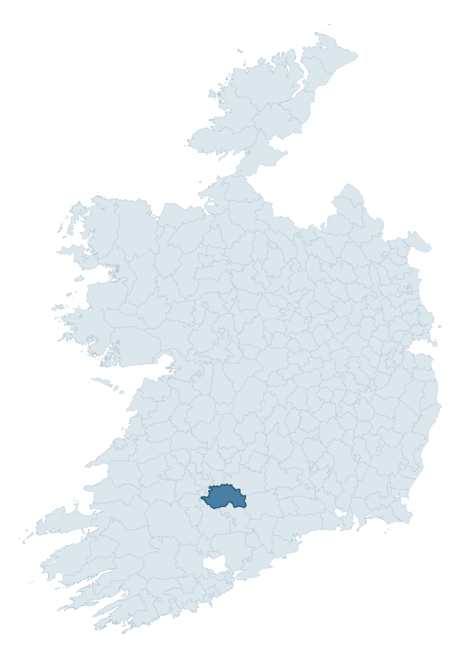
Where this barony sits in the Republic of Ireland
Geology and preservation
Bedrock geology shapes the landscape long before any settlement begins — controlling soil drainage, agricultural potential, the survival of upstanding monuments, and the preservation of buried archaeology. The figures below come from the Geological Survey Ireland 1:100,000 bedrock map.
The bedrock underlying Coshlea is predominantly greywacke (18% of the barony by area), with much of the rock dating to the Carboniferous period. Greywacke is a hard, dark, fine-grained sandstone that weathers to thin upland soils. Greywacke baronies typically carry sparser settlement archaeology but provide high-quality building stone visible in older field walls and farm buildings. A substantial secondary geology of sandstone (18%) and limestone (17%) adds further variety to the underlying landscape. With 10 distinct rock types mapped, the barony sits in the top third of ROI baronies for geological diversity (90th percentile) — typically a sign of complex tectonic history or coastal mosaics of differing rock units.
Rock type composition
Largest mapped unit: Inchacoomb Formation (18% of the barony)
Placename evidence
Logainm records 29 heritage-diagnostic placenames for Coshlea, drawn from townland and civil-parish names across the barony. The dominant stratum is Early Christian ecclesiastical — cill-, teampall-, and domhnach-prefixed names that record the dense network of early church foundations established between the fifth and tenth centuries. The leading diagnostic roots are cill- (17 — church), ráth- (3 — earthen ringfort), and lios- (3 — ringfort or enclosure). This is broadly in line with the ROI average of 30.7 heritage placenames per barony. The presence of multiple heritage strata side by side indicates layered occupation of the landscape across successive prehistoric and historic periods. Logainm records 227 placenames for Coshlea (predominantly townland names). Of these, 29 (13%) carry one of the diagnostic Gaelic roots tracked above; the remainder draw on more generic landscape vocabulary that does not encode a heritage period.
Pre-Christian / Early Medieval Defensive
| Root | Count | Meaning |
|---|---|---|
| ráth- | 3 | earthen ringfort |
| lios- | 3 | ringfort or enclosure |
| dún- | 2 | hilltop or promontory fort |
Early Christian Ecclesiastical
| Root | Count | Meaning |
|---|---|---|
| cill- | 17 | church (early) |
| cillín- | 2 | unconsecrated burial ground |
| mainistir- | 1 | monastery |
| gráinseach- | 1 | monastic farm / grange |
Burial, Ritual, and Norse-Contact
| Root | Count | Meaning |
|---|---|---|
| gall- | 2 | foreigner — Norse settlement marker |
Other baronies in Limerick
- Pubblebrien
- Connello Lower
- Coshma
- Kilmallock
- Kenry
- North Liberties
- Glenquin
- Slievardagh — Tipperary
- Barrymore — Cork
- Kilmallock
See all 280 baronies in the Republic of Ireland Heritage Tool.

Explore further
Grounding History: 10 Maps of Northern Ireland’s Past
If you’re interested in Irish heritage more widely, the companion report for Northern Ireland brings together the analysis of all 462 NI wards into one place through 10 high-quality maps — covering monument density, archaeological periods, placename heritage, terrain, wetland, and the historic landscape at first survey. Take a look.
About this profile
Click any section below to expand.
What is a barony?
A barony is a historic administrative unit in Ireland, broadly equivalent to an English hundred. The 280 baronies used here are from the OSi 2019 National Statutory Boundaries (generalised 20m), covering the 26 counties of the Republic of Ireland. Baronies derive from the Norman period, were formalised in the 17th century, and have not been redrawn for statistical purposes. They vary enormously in area, from compact urban baronies in Dublin to vast upland baronies in Connacht, and should not be compared by raw site count without accounting for area differences.
What counts as a site?
This profile combines three distinct heritage registers, each with its own definition of what constitutes a recordable site:
- Archaeological sites (NMS). The National Monuments Service Sites and Monuments Record (SMR) catalogues every known archaeological monument or site of archaeological interest in the Republic, from prehistoric burial mounds and ringforts to medieval churches and post-medieval defensive works. Inclusion does not require legal protection — only that the site has been identified, surveyed, and assessed as having archaeological value. A separate subset of these sites lies within a recorded protection zone, which gives them statutory protection under the National Monuments Acts.
- Listed buildings (NIAH). The National Inventory of Architectural Heritage records buildings of architectural, historical, archaeological, artistic, cultural, scientific, social, or technical interest. Each surveyed structure is appraised on a five-tier scale: International, National, Regional, Local, and Record-Only. The NIAH appraisal is informational rather than strictly statutory, but it underpins local-authority Record of Protected Structures (RPS) listings.
- Heritage placenames (Logainm). Logainm is the authoritative database of Irish placenames maintained by the Placenames Branch. This profile applies a heritage-diagnostic classifier to the Irish-language form of each townland name, flagging roots that signal defensive sites (ráth-, lios-, dún-, caiseal-, cathair-), ecclesiastical foundations (cill-, teampall-, domhnach-, mainistir-), prehistoric burial-ritual features (tuaim-, carn-, leaba-), or Norse-contact settlement (gall-). Townlands without one of these diagnostic roots are not flagged here — they may still carry historical significance, but that significance is not encoded in the name itself.
Editorial principles
The narrative sections of this profile follow several explicit principles:
- Evidential. Every claim about this barony’s heritage character is anchored in the underlying register data. Where a site count, a placename count, or a percentile rank is cited, it is computed from the source datasets at export time, not estimated.
- Comparative. Counts and metrics are reported alongside their percentile rank against the other 279 ROI baronies. A barony with 50 ringforts in absolute terms could be unusually high or unusually low depending on its size and regional context; percentile ranking removes that ambiguity.
- Transparent on limits. Where a register has known coverage gaps, survey biases, or data-quality issues that affect this barony’s figures, the profile flags them rather than presenting the numbers as definitive.
- No interpretation beyond what the data supports. The narrative does not speculate about historical events, social dynamics, or cultural meaning beyond what the recorded heritage and placename evidence directly attests.
Data caveats and limits
- NMS Sites and Monuments Record is the product of survey campaigns conducted at different intensities across different counties and decades. Some baronies have been surveyed more thoroughly than others, and absolute counts should be read in that light. Sites destroyed by development before survey are typically not represented; sites in heavily forested or upland terrain are sometimes under-recorded.
- NIAH coverage is broadly complete for the Republic of Ireland but the survey was conducted on a rolling county-by-county basis, and the most recent appraisal date varies. Buildings demolished or substantially altered after their original survey may still appear in the register; conversely, recent buildings of merit may not yet have been appraised.
- Logainm classification applies a deliberately conservative pattern-matching approach to the Irish-language townland forms. The classifier prioritises true positives over recall: a townland may carry a heritage signal that the classifier doesn’t recognise, particularly where the diagnostic root has been heavily anglicised or where the townland name draws on a less common term. The 60,000+ townland records and ~9,800 classified placenames give a substantial signal at barony scale, but individual townland names should be checked against Logainm directly for definitive interpretation.
- Period attribution. The chronological distribution reflects only those NMS sites that carry a recognised period attribution in the source data. Sites listed as “Unknown” period are excluded from the dated subset.
- Boundary changes. Some baronies have undergone minor boundary adjustments since their 19th-century definition; the OSi 2019 generalised boundaries used here are the current statutory definition and may differ slightly from historical maps in border areas.
- Bedrock geology is mapped at 1:100,000 scale, which means local variation within a barony — small pockets of different rock type, mineral veins, alluvium overlying bedrock — is generalised. The dominant-system and rocktype figures are area-weighted, so a barony reading “70% Carboniferous limestone” may still contain small but archaeologically important pockets of older or younger rock. Around 3% of GSI polygons do not match the lexicon and contribute no rocktype or system attribution.
Data sources
- National Monuments Service — Sites and Monuments Record (SMR) https://data.gov.ie/dataset/national-monuments-service-archaeological-survey-of-ireland
- National Inventory of Architectural Heritage (NIAH) https://data.gov.ie/dataset/national-inventory-of-architectural-heritage-niah-national-dataset
- Logainm — Placenames Database of Ireland https://www.logainm.ie/
- Ordnance Survey Ireland — National Statutory Barony Boundaries 2019 https://data-osi.opendata.arcgis.com/
- EURODEM — European Digital Elevation Model https://www.mapsforeurope.org/datasets/euro-dem
- ESA WorldCover https://esa-worldcover.org/en
- Geological Survey Ireland — 1:100,000 Bedrock Geology https://www.gsi.ie/en-ie/data-and-maps/Pages/Bedrock.aspx
Explore more: Search any of the 280 ROI baronies, browse by historical province, or read the methodology and data sources for the full Republic of Ireland Heritage Tool.