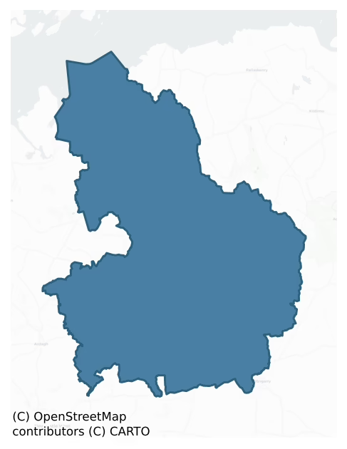
Connello Lower is a barony of County Limerick, in the historical province of Munster (Irish: Conallaigh Íochtaracha), covering 205 km² of land. The barony records 606 NMS archaeological sites and 125 NIAH listed buildings, placing it at around the 80th percentile among 280 ROI baronies for sites per km². This means it is in the top fifth of all baronies for sites per km². Dated archaeological evidence runs from the Neolithic through to the Modern, spanning 8 of 9 archaeological periods, placing the barony in the 82nd percentile among 280 ROI baronies for chronological depth. This means it is in the top fifth of all baronies for chronological depth. The largest dated subset of recorded sites dates to the Early Medieval. Logainm flags 31 placenames in the barony as carrying a recognised heritage root; the largest share — around 55% — are names associated with pre-christian defensive.

Heritage at a glance
Percentile rankings throughout this profile compare each barony only against the other 279 Republic of Ireland baronies.
The recorded heritage of Connello Lower
The National Monuments Service Sites and Monuments Record (SMR) is the statutory inventory of archaeological sites for the Republic of Ireland, maintained by the Department of Tourism, Culture, Arts, Gaeltacht, Sport and Media. Sites recorded here include earthworks, ringforts, megalithic tombs, ecclesiastical remains, and post-medieval features; not every record is legally protected, but each is registered as a monument of archaeological interest.
The National Monuments Service records 606 archaeological sites in Connello Lower, putting it at the 80th percentile among 280 ROI baronies for sites per km². This means it is in the top fifth of all baronies for sites per km². Protection coverage is near-universal — 580 sites (96%) fall within a recorded monument protection zone, indicating an extensively surveyed landscape. The dominant category is defensive sites — ringforts, enclosures, hillforts, and stone forts (444 sites, 73% of the record). Ringfort – rath is the most prevalent type, making up 52% of the barony's recorded sites (317 records) — well above the ROI average of 20% across all baronies where this type occurs. Ringfort – rath is an earthen ringfort enclosed by a bank and external ditch — the most common Early Medieval farmstead, broadly dated 500–1000 AD. Other significant types include Enclosure (60) and Ringfort – cashel (30). Enclosure is a banked or ditched feature of uncertain type, used as a catch-all where the original function cannot be determined from surface evidence; Ringfort – cashel is the stone-walled equivalent of the rath, found mainly in upland or western areas, broadly dated 500–1000 AD. Across the barony's 205 km², this gives a recorded density of 2.96 sites per km².
Most common monument types
Hover or tap a monument type to see its definition.
| Type | Count |
|---|---|
| Ringfort – rath an earthen ringfort enclosed by a bank and external ditch — the most common Early Medieval farmstead, broadly dated 500–1000 AD | 317 |
| Enclosure a banked or ditched feature of uncertain type, used as a catch-all where the original function cannot be determined from surface evidence | 60 |
| Ringfort – cashel the stone-walled equivalent of the rath, found mainly in upland or western areas, broadly dated 500–1000 AD | 30 |
| Fulacht fia a horseshoe-shaped Bronze Age burnt mound built around a sunken trough beside a water source, traditionally interpreted as a cooking site | 24 |
| Church a building used for public Christian worship, of any date from c. 500 AD onwards | 17 |
| Graveyard a burial area associated with a church, in use from the medieval period onwards | 15 |
| Castle – tower house a fortified residential tower of four or five storeys, mostly built by lords in the 15th and 16th centuries and often within a defended bawn | 14 |
| Ritual site – holy well a well or spring traditionally associated with a saint, often credited with healing properties; many trace earlier ritual origins but devotion is documented from the medieval period onwards | 7 |
Chronological distribution
The dated archaeological record for Connello Lower spans from the Neolithic through to the Modern, with activity attested across 8 of 9 archaeological periods. This is the 82nd percentile across ROI baronies for chronological depth — an above-average span. Every period from earliest to latest is represented in the record — an unbroken sequence of dated activity across the full chronological span. Activity concentrates most heavily in the Early Medieval (221 sites, 41% of dated material), with the Iron Age forming a secondary peak (216 sites, 40%). A further 72 recorded sites (12% of the overall NMS register for the barony) carry no period attribution — appearing as 'Unknown' in the bar chart below. This typically reflects either records that pre-date the standardised period vocabulary or sites awaiting specialist dating review, rather than a genuine absence of chronological evidence.
Sample of recorded monuments
Show 25 sample monuments (of 606 total)
A representative sample of 25 recorded monuments drawn from the barony’s 606 total NMS entries. Sites within a recorded monument protection zone and rarer site types are prioritised so the list shows a meaningful cross-section rather than only the most common type. Each entry shows the official Sites and Monuments Record reference number and the description published by the National Monuments Service.
Enclosure – large enclosure
On S side of Greenish Island, in pasture, near the confluence of the River Deel and the River Shannon. According to Lewis (1837, 76), ‘a very large temple erected on its [Greenish Island’s] highest point’. Depicted on…
On S side of Greenish Island, in pasture, near the confluence of the River Deel and the River Shannon. According to Lewis (1837, 76), ‘a very large temple erected on its [Greenish Island’s] highest point’. Depicted on the 1840 ed. OS 6-inch map as a substantial circular-shaped enclosure (diam. 115m). Levelled monument visible as a circular-shaped cropmark with a possible fosse from WSW-W-WNW on ASIAP taken 2005, on Digital Globe orthophotos taken 2011-13 and on Google Earth orthoimages taken 29/03/2012.
See attached Google Earth orthoimage
Compiled by: Alison McQueen and Vera Rahilly
Date of upload: 6 July 2020
Settlement deserted – medieval
In level pasture, on W side of Holly Island inlet on S shore of Shannon estuary. Surrounding ruin of Tomdeely hall house (LI010-04803-) and church (LI010-04801-) is roughly rectangular area (c. 150m N-S; c. 200m E-W)…
In level pasture, on W side of Holly Island inlet on S shore of Shannon estuary. Surrounding ruin of Tomdeely hall house (LI010-04803-) and church (LI010-04801-) is roughly rectangular area (c. 150m N-S; c. 200m E-W) defined on N and W sides by low earthen bank (H c. 0.5m; Wth c. 2m) but on N and E sides by more recent stone wall forming field boundary. Bank is straight on S side but changes direction to follow shoreline on W side. Low earthworks around church is presumably remains of precinct wall of graveyard (LI010-04802-); attached to NE side of this are low curvilinear earthen banks (H c. 0.5m; Wth c. 1m) truncated by field boundaries on N and E sides. Elsewhere within larger enclosure are low undulations too indistinct to reveal distinct patterns.
Tomdeely was a manor of the Bishop of Limerick from the early 13th century but had became Desmond property by the 14th century (Westropp 1904-5, 393; Westropp 1906-7, 206).
Compiled by: Denis Power
Date of upload: 26 August 2011
Stone row
On top of a hillock known locally as ‘Knockegan’, in low-lying yet undulating pasture, 300m to W of the River Deel, overlooking the Shannon Estuary to NW. Enclosure (LI010-050001-) lies c. 14m to N. Annotated 'Standing…
On top of a hillock known locally as ‘Knockegan’, in low-lying yet undulating pasture, 300m to W of the River Deel, overlooking the Shannon Estuary to NW. Enclosure (LI010-050001-) lies c. 14m to N. Annotated 'Standing Stones' and depicted on the OS 25-inch map as three stones aligned N-S. Monument surveyed by the ASI in 1996 and described as consisting of four limestone monoliths orientated roughly NE-SW (approx. overall L 7.8m; Wth 3.2m) and densely overgrown. The northern most stone (H 1.2m; L 1.5m; T 0.27m) is upright and is rectangular in elevation. The central stone (L 1.7m; Wth 1m; T 0.25-0.4m) is lying prostrate between the southern and northern stone. The southern stone (H 2m; Wth 1.3m; T 0.38m) is upright and is the most conspicuous in the row. The fourth stone (H 1.37m; Wth 0.92m; T 0.34m) is upright yet tilts heavily to N and is to the immediate W side of the S stone. It seems to have originally stood to S of the stone which is currently southern-most. The NE-SW long-axis of each stone is consistent with the orientation of the overall alignment of stones. A number of smaller stones are scattered around the base of the alignment and some of these are piled in and around the base of the two southern-most stones. Monument visible as a long, roughly rectangular-shaped area of overgrowth on Digital Globe orthophotos taken 2011-13 and on Google Earth orthoimages taken 29/03/2012.
See attached Google Earth orthoimages
Compiled by: Alison McQueen and Vera Rahi…
House – 17th century
17th century building annotated Morgan's House (NIAH Reg. No. 21901008) on OS 6-inch maps which stands on SW corner of medieval castle (LI010-030—-) and bawn (LI010-030001-). This house is a multi-phased two-storey…
17th century building annotated Morgan's House (NIAH Reg. No. 21901008) on OS 6-inch maps which stands on SW corner of medieval castle (LI010-030—-) and bawn (LI010-030001-). This house is a multi-phased two-storey high structure; Ffolliott (1972, fig. 12) considered the SE block the oldest, 'possibly c. 1650-70' (ibid.). This block is in two sections, the oldest to the NE has a central panelled chimney stack. The longer stem of the T extends to the NW and 'is only one room thick and has low ceilings, much worn staircase'; ffolliott (ibid.) dates this 'from the late 17th century'. This block has irregular fenestration, with larger windows at first-floor level. The house (or part of it) was built by Thomas Rose who was Sheriff of Limerick in 1674 (de Breffny and Ffolliott 1975, 80). Immediately NW of the house are ranges of ruined and semi-ruined farm-buildings of 18th/19th century appearance.
Compiled by: Denis Power
Revised by: Caimin O'Brien
Date of revised upload: 13 May 2020
House – fortified house
In pasture, atop hill with panoramic views over surrounding countryside. Courtbrown Castle let in 1615 and owned by P. Maunsell in 1642-52 (Westropp 1906-7, 205). Described in 1840 as 'a mere fragment, one conspicuous…
In pasture, atop hill with panoramic views over surrounding countryside. Courtbrown Castle let in 1615 and owned by P. Maunsell in 1642-52 (Westropp 1906-7, 205). Described in 1840 as 'a mere fragment, one conspicuous gable only remaining … it does not appear to be very ancient' (OSL vol. 1, 144). No visible surface trace now evident. Probably a fortified house of the early 17th century, these are often styled "Court".
Westropp (1906-7, 204-5) recorded the following details; '1581-3 Moriertagh mac Mortagh O'Sheehy held Brownescourt or Brownestown (Des. R., 23; Inq. Exch., 11, 54; Fi. 3842); part of estate of dissolved Abbey of Keynsham. It is shown as Courtbrowne C[astle]. (Peyton, p. 86; Hardiman Map 2). 1615 Maur. Berkeley let the C[astle]. to T. Martin, of Ballynash (Inq. Chan., 72b). 1642-52 Peter Maunsell held Courte Browne, Athskeaton (Dep. T.C.D., p. 302). 1655 Owned by Mrs. Crofton and Lord Broghill (C.S., p. 65). Fabric – Some fragments of the "Court" remain.
Compiled by: Denis Power
Date of upload: 26 August 2011
Crannog
In a low-lying area of marshy pasture, bounded by deep drainage dykes to the S and E and by the embankment of a disused railway line to the W. A roughly circular platform (26m N-S; 27.5m E-W) defined by a gradually…
In a low-lying area of marshy pasture, bounded by deep drainage dykes to the S and E and by the embankment of a disused railway line to the W. A roughly circular platform (26m N-S; 27.5m E-W) defined by a gradually sloping scarped edge (H 0.9m; Wth 6.7m). The surface of the platform is very uneven but generally slopes up towards the centre. Its surface is scattered with loose stones and the make-up of the platform appears to be a dump of stones. According to the landowner the mound formerly had a boat house standing on the top. The site is been subject to flooding (Anon 1901-4, 285-6).
Compiled by: Denis Power
Date of upload: 26 August 2011
Town
Historic settlement of Croagh described in the Urban Survey of Co. Limerick as following; 'Croagh is located to the south west of Limerick on the Limerick to Tralee road. The name appears to be derived from Crodhach,…
Historic settlement of Croagh described in the Urban Survey of Co. Limerick as following; 'Croagh is located to the south west of Limerick on the Limerick to Tralee road. The name appears to be derived from Crodhach, "a rounded hill". Little is known about the history of the Anglo-Norman settlement here. In 1289 Hugh Purcell appears to have been the owner of the manor because he granted woods and turf from the bog of "Moychro" or "Maynchro" to the bishop of Limerick (MacCaffrey 1907, 21-2). The manor remained in the hands of the Purcell's until the seventeenth century (Westropp 1906-7, 216-17). The only evidence for the existence of a borough here in the Middle Ages comes from a solitary reference in 1592 which states that there were burgages at Croaghneburgage, i.e. Croagh (16 Rep. DKPRI, 216: no. 5777; Westropp 1905-6, 217).
The history of the settlement is unknown but it is likely that the borough was established in the thirteenth century rather than in the sixteenth, when the procedure was effectively confined to the crown. It is likely that the medieval borough was centred on the church and castle site which lie to the south-west of a stepped cross-roads and to the north of Greanagh Stream. There is no evidence for burgage plots or houses in the area now although forty-six small houses were noted by Lewis in the last century (1837, i, 435)' (Bradley et. al., 1989, 111-12).
Westropp (1906-7, 216-7) recorded the following details about Croagh; '1289 Hugh Purcell gr…
Churchyard
This is the record for the churchyard of 'a small modern Protestant' church, which may be the site of an ancient church (see LI028-149001-).
Compiled by: Denis Power
Date of upload: 20 August 2012
Castle – Anglo-Norman masonry castle
National monument No. 201. Askeaton is located on the river Deel in west Limerick just inland from the Shannon estuary on the Limerick to Foynes road. According to Westropp (1903-4, 26-7) the placename is likely to…
National monument No. 201. Askeaton is located on the river Deel in west Limerick just inland from the Shannon estuary on the Limerick to Foynes road. According to Westropp (1903-4, 26-7) the placename is likely to derive from Eas Gephtine, Gephten’s
Cascade, a waterfall on the River Deel. The natural advantages offered by the site occupied by
Askeaton Castle, an easily defensible island, would suggest that this should have been a settlement site from early times. In 1199 the site was fortified by the Anglo-Normans under William de Burgo and the Annals of Inisfallen record the building of a castle there. Incidental
references in the thirteenth and fourteenth centuries indicate that Askeaton was a sizeable Anglo-Norman settlement (Westropp 1903-4, 30-1) and as the "town of Inskefty" contributed 40s to the military subsidy of 1300 in aid of Edward II’s wars in Scotland (Mills 1905, 304). This
reference suggests that it was an incorporated settlement by this time. It was only in the middle of the fourteenth century that Askeaton became part of the Desmond lands and they were to
hold it as one of their principal residences for two centuries. It was the strategic importance of the castle which signalled out Askeaton for special attention during the Elizabethan conquest of Munster. As early as 1569 it had been selected as the residence of the President of Munster. In
1579 and English army under Sir Nicholas Malbie sacked Askeaton and burned the Franciscan Friary but fai…
Religious house – Franciscan friars
National monument No. 185. Askeaton Friary described in the Urban Survey (Bradley et. al. 1989, 76-83) as following: 'The first documentary mention of this friary occurs in 1400 when it is referred to as Inysgebryny,…
National monument No. 185. Askeaton Friary described in the Urban Survey (Bradley et. al. 1989, 76-83) as following: 'The first documentary mention of this friary occurs in 1400 when it is referred to as Inysgebryny, i.e. Inis Geightine (Gwynn and Hadcock 1970, 242). Its founder was probably Gerald, the 4th earl of Desmond. The friary survived the Dissolution and a provincial chapter was held here in 1564. During the Desmond Wars the friary was captured by Nicholas Malby and the friars were expelled. The exact date for this expulsion is unclear but it is variously given as 1579 and 1581 (ibid.).
The friary is situated on the east bank of the Deel and it consists of a single aisled fourteenth/fifteenth century church with a fourteenth/fifteenth century cloister to the south flanked by an east and west range. Later fifteenth century additions include a sacristy to the north of the chancel, and a transept with western aisle to the north of the nave. On the south side of the cloister a two-storied refectory was added, oriented N-S, and a later barrel vaulted chamber was added to the west and extends beyond the west range. According to the 'Pacata Hibernia' drawing (Westropp 1903, 240) a large tower was also on the site but no trace of this remains. The insertion of carved stone doorways with Renaissance style decoration suggest repairs or refurbishments in the sixteenth century. The masonry is limestone throughout (Leask 1955-60, iii, 101-2).
The church is a a long undi…
Cairn – burial cairn
In low-lying, gently undulating pasture, overlooking the River Deel c. 0.9km to E and the Shannon Estuary to N. A second similar feature (LI010-125—-) lies approx. 90m to S. Not depicted on OS historic mapping.…
In low-lying, gently undulating pasture, overlooking the River Deel c. 0.9km to E and the Shannon Estuary to N. A second similar feature (LI010-125—-) lies approx. 90m to S. Not depicted on OS historic mapping. Identified is Site 2 in 1999 as a possible enclosure by Celie O’Rahilly when walking the route of a proposed ESB power line. Monument is visible as an irregular oval-shaped stony area on Digital Globe orthophotos taken 2011-13 and on Google Earth orthoimages taken 08/04/2015.
See attached Google Earth orthoimages
Compiled by: Alison McQueen and Vera Rahilly
Date of upload: 6 July 2020
Megalithic structure
In low-lying , gently undulating pasture, overlooking the River Deel c. 0.9km to E and the Shannon Estuary to N. Depicted on the 1924 ed. OS 25-inch map as an oblong-shaped feature (approx. 8m NE-SW; 4.5m NW-SE). Listed…
In low-lying , gently undulating pasture, overlooking the River Deel c. 0.9km to E and the Shannon Estuary to N. Depicted on the 1924 ed. OS 25-inch map as an oblong-shaped feature (approx. 8m NE-SW; 4.5m NW-SE). Listed as Site 3 in 1999 and classified as a megalithic structure by Celie O’Rahilly when walking the route of a proposed ESB power line. Described as a large flat-topped rock adjacent to a hawthorn tree. A public road lies c. 30m to N and a gallops track lies c. 85m to S. The description of a mound enclosed by a bank could suggest a classification of barrow or other type of burial mound. Monument is visible as an irregular oval-shaped stony area on Digital Globe orthophotos taken 2011-13 and on Google Earth orthoimages taken 08/04/2015.
See attached Google Earth orthoimage
Compiled by: Alison McQueen and Vera Rahilly
Date of upload: 6 July 2020
Religious house – Augustinian canons
The Urban Survey of Limerick recorded the following details about St. Mary's Augustinian Priory of Rathkeale (Bradley et. al. 1989, 222-4); 'This is said to have been founded by Gilbert Harvey in the early thirteenth…
The Urban Survey of Limerick recorded the following details about St. Mary's Augustinian Priory of Rathkeale (Bradley et. al. 1989, 222-4); 'This is said to have been founded by Gilbert Harvey in the early thirteenth century (Gwynn and Hadcock 1970, 190). In 1436 an indulgence was granted to penitents visiting and giving alms for the repair of the church (ibid., 191). The monastery was suppressed in 1542 but a small community may have remained until the Desmond Rebellion in the 1580s. Subsequently the monastery was granted to Sir Henry wallop (ibid.). This thirteenth century abbey with fifteenth and sixteenth century additions is located at the north-east end of the town. It was built of rubble masonry with sandstone jambs while later additions are in limestone. It was a single aisled nave and chancel church with evidence for a possible southern cloister in the form of a gable line for a two storied eastern range and a low roof line for a north ambulatory in the south wall. It had a vaulted north tower of uncertain height and a two to three floored building of the north side of the chancel. The west tower was possibly of four floors. The surviving remains consist of the south and east walls of the church, the chancel end of the north wall and the ground floor of the north tower. Part of the north wall of the west tower also survives.
Church
The east stepped gable is almost intact although the coping stones on the north side are missing. The thirteenth century window…
Tomb – unclassified
The following description of this monument is taken from 'The Urban Archaeological Survey of County Limerick' compiled by John Bradley, Andrew Halpin and Heather A. King (Office of Public Works, 1985).
"16th Century…
The following description of this monument is taken from 'The Urban Archaeological Survey of County Limerick' compiled by John Bradley, Andrew Halpin and Heather A. King (Office of Public Works, 1985).
"16th Century fragments of table tomb.
A limestone panel, mounted at the east end of the north wall of the chancel is carved in false relief with a bishop. A further two fragments in the chapter house belong to the same tomb. One depicts St Catherine and another saint while the second piece is the upper part of two panels.
Dims: A. H. 60cm W. 30cm
B. H. 60cm W. 43cm D. 18cm
(Hunt 1974, 199.)"
Compiled by: Denis Power
Date of upload: 26 August 2011
Burnt mound
According to Brian Halpin (02E0662) 'topsoil-stripping on Bord Gáis Éireann's Pipeline to the West uncovered a spread of burnt material in Ballingarrane townland, Co. Limerick. The site measured c. 9.5m north-south by…
According to Brian Halpin (02E0662) 'topsoil-stripping on Bord Gáis Éireann's Pipeline to the West uncovered a spread of burnt material in Ballingarrane townland, Co. Limerick. The site measured c. 9.5m north-south by 8.5m. The large spread of burnt material covered extremely compact, yellow/grey subsoil that contained a large amount of decaying limestone boulders and stones. The mound was relatively thin, with a maximum depth of 0.18m. It comprised a single fill of heat-shattered sandstone and limestone with frequent inclusions of charcoal and charred wood, indicative of fulacht fiadh activity. The entire mound was removed up to the limit of excavation, but no trough was encountered. It is possible that the remainder of the mound running past the limit of excavation contains a trough or other features.' This description is posted on the web at the following internet address (accessed 3 August 2012): http://www.excavations.ie/
Compiled by: Denis Power
Date of Upload: 7 August 2012
House – Bronze Age
This site was excavated by Kate Taylor (02E0667) as part of Bord Gáis Éireann's Pipeline to the West. It consisted of 'part of a possible prehistoric house was excavated in an area limited by pipeline works. It is…
This site was excavated by Kate Taylor (02E0667) as part of Bord Gáis Éireann's Pipeline to the West. It consisted of 'part of a possible prehistoric house was excavated in an area limited by pipeline works. It is certain that the site extended beyond the baulk into the adjacent field and possible that additional deposits were destroyed by the surrounding construction activities. The excavated features comprised two lengths of gully, 33 post-holes, 70 stake-holes, twelve pits and a hearth. Few stratigraphic relationships were seen between the features, and little artefactual material was recovered. The site is therefore discussed as a single phase of activity. Gully 37 probably represented part of either a rough foundation trench for the walls of the house or a drip gully surrounding an entirely post-built structure. The gully was curvilinear, 4.2m long, 0.98-1.6m wide and at most 0.2m deep, with an irregular, shallow profile. The southern end of the gully met a pit or large post-hole (233), which may have been related. The northern end was extremely ephemeral, and the gully may originally have continued farther to the north-west. A second length of gully was unrelated. Most of the 33 post-holes were 0.1-0.4m wide and 0.05-0.36m deep. Many were oval in plan; their profiles varied, but most had steep sides and flat bases. The exceptions were two large post-holes to the south of Gully 37. These measured 1.05m by 0.82m by 0.6m deep and 0.9m by 0.76m by 0.27m deep. It seems pl…
Armorial plaque
This armorial plaque was reported to ASI by Tom Cassidy, Conservation Officer with Limerick County Council on 27th September 2012. It is in the kitchen of Ballinvirick House, Co. Limerick. The arms are probably those of…
This armorial plaque was reported to ASI by Tom Cassidy, Conservation Officer with Limerick County Council on 27th September 2012. It is in the kitchen of Ballinvirick House, Co. Limerick. The arms are probably those of Sir Francis Berkeley who was granted nearby Askeaton Castle (LI011-092003-) in the Munster Plantation and was besieged there in 1598 (see Westropp, T.J. (1902) 'Sir Francis Berkeley of Askeaton' in Journal of Limerick Field Club 2, 118-132). This stone may have been the centre-piece of a fireplace mantle, probably in Askeaton Castle though there is no evidence for this.
Font (present location)
Medieval limestone square shaped font (H 0.32m x 0.34m x 0.33m) with conical basin (diam. 0.24m) originally located in Shanagolden Church (LI019-012001-) but now housed in the W porch of St. Mary's Church of Ireland…
Medieval limestone square shaped font (H 0.32m x 0.34m x 0.33m) with conical basin (diam. 0.24m) originally located in Shanagolden Church (LI019-012001-) but now housed in the W porch of St. Mary's Church of Ireland church in Askeaton. One face of the font is decorated with a tracery pattern consisting of four square panels each containing an eight-pointed star. The font was possibly designed to be set into the angle of the church with two decorated faces visible to the parishioners of the church. The carving on the font is similar to a font (TS043-034010-) from Kilcooly Abbey (TS043-034001-), Co. Tipperary. The Shanagolden church font was drawn by William Frazer based on original drawings made by John Windele in the mid 19th century (NLI PD 1975 TX 12 (8); NLI Sketch books of Irish antiquities). Cross reference with LI019-012004-.
Compiled by: Caimin O'Brien
Date of upload: 19 November 2018
Road – hollow-way
Roadway consisting of a sunken way (Wth 10m, approx. L. ) flanked on either side by a low earth and stone bank leading up to W entrance of early Christian ecclesiastical enclosure (LI028-066001-) containing the remains…
Roadway consisting of a sunken way (Wth 10m, approx. L. ) flanked on either side by a low earth and stone bank leading up to W entrance of early Christian ecclesiastical enclosure (LI028-066001-) containing the remains of Clonagh Church (LI028-066002-) and graveyard (LI028-066003-). The dating of this trackway is uncertain and the route of the roadway has been mapped out on the revised OS 6-inch map.
Compiled by: Caimin O'Brien
Date of upload: 04 march 2019
See attached ASI aerial photographs ASIAP – taken on 04/03/2006.
Ringfort – unclassified
Cropmark of circular-shaped enclosure (approx. diam. 31m) visible on Google earth aerial imagery.
See attached image taken from Google Earth aerial photographs taken 08/04/2015
Compiled by: Caimin O'Brien based…
Cropmark of circular-shaped enclosure (approx. diam. 31m) visible on Google earth aerial imagery.
See attached image taken from Google Earth aerial photographs taken 08/04/2015
Compiled by: Caimin O'Brien based on details provided by Jean-Charles Caillère
Date of upload: 10 September 2019
Sundial
National monument in state guardianship No. 185. Askeaton Friary described in the Urban Survey (Bradley et. al. 1989, 76-83) as following: 'The first documentary mention of this friary occurs in 1400 when it is…
National monument in state guardianship No. 185. Askeaton Friary described in the Urban Survey (Bradley et. al. 1989, 76-83) as following: 'The first documentary mention of this friary occurs in 1400 when it is referred to as Inysgebryny, i.e. Inis Geightine (Gwynn and Hadcock 1970, 242). Its founder was probably Gerald, the 4th earl of Desmond. The friary survived the Dissolution and a provincial chapter was held here in 1564. During the Desmond Wars the friary was captured by Nicholas Malby and the friars were expelled. The exact date for this expulsion is unclear but it is variously given as 1579 and 1581 (ibid.).
Medieval sundial identified by Brian Thomas McElherron who described this feature as; 'carved on the cill of one of the north range cloister openings at the Franciscan Friary [LI011-092006-] at Askeaton. It has a deep hole for a gnomon and 24 hour lines subdivided into half hours'.
See attached photograph taken by Brian T McElherron
Compiled by: Caimin O'Brien
Date of upload: 27 May 2022
Castle – hall-house
Tomdeely was a manor of the Bishop of Limerick from the early 13th century but had become Desmond property by the 14th century (Westropp 1904-5, 393; Westropp 1906-7, 206). The basic structure is probably 13th century…
Tomdeely was a manor of the Bishop of Limerick from the early 13th century but had become Desmond property by the 14th century (Westropp 1904-5, 393; Westropp 1906-7, 206). The basic structure is probably 13th century with the vaulting inserted in the 15th/16th century.
In level pasture, at W side of Holly Island inlet on S shore of Shannon estuary; within enclosure (LI010-048004-) which also includes ruined parish church of Tomdeely (LI010-048001-).
Rectangular two-storey structure (internally: 17.6m E-W; 8.15m N-S) built of uncoursed limestone covered by roughcast harling; walls now partially ivy-clad. The N, E and S walls end at same height but W wall stands slightly higher; W wall also slightly thicker (T 2.35m) than other three walls (T 1.8m); both factors explained by mural stairs contained within W wall (see below). Prominent base batter at ground-floor level, lower half almost entirely robbed out. All four external corners have chamfered profile down to top of batter; chamfer then narrowed to a point about half-way down battered face.
Covering most of ground floor are two parallel wicker-centred vaults (axis E-W) supported centrally by arcade of six open bays. Vaulting does not cover westernmost end (2.9m E-W) of ground floor which is separated from vaulted area by cross-wall (T 1.5m) which contains narrow linear mural stairs. Vaulting, arcade and cross wall are all secondary insertions.
Ground floor has seven original window embrasures: three in N wall, two i…
Bridge
The following description of this monument is taken from 'The Urban Archaeological Survey of County Limerick' compiled by John Bradley, Andrew Halpin and Heather A. King (Office of Public Works, 1985).
"A view of the…
The following description of this monument is taken from 'The Urban Archaeological Survey of County Limerick' compiled by John Bradley, Andrew Halpin and Heather A. King (Office of Public Works, 1985).
"A view of the bridge in Pacata Hibernia shows six round arches (Westropp 1901-2, 158; 173 and n. 3) and this appears to be substantially the bridge which still survives today crossing the river Deel. It is c. 5Om long and 7.5m wide with parapets (probably modern) c. 1.5m high. It is built of dressed and coursed limestone up to the level of the top of the arches and, above this, of rubble. At present only five arches can be seen on the north. The first, third and fifth from the east have broad segmental arches with dressed limestone voussoirs. The second may have been similar but now has a concrete arch, the fourth is a tall round arch. There are pointed balusters between the first and second and second and third arches on the south."
Compiled by: Denis Power
Date of upload: 26 August 2011
Field system
In gently undulating pasture immediately N of the townland boundary with Liffane. Not depicted on the 1840 OS 6-inch map or the 1897 OS 25-inch map, where rock outcrop is indicated in the area. Earthworks possibly of…
In gently undulating pasture immediately N of the townland boundary with Liffane. Not depicted on the 1840 OS 6-inch map or the 1897 OS 25-inch map, where rock outcrop is indicated in the area. Earthworks possibly of a field system of uncertain antiquity identified from oblique aerial photographs taken 20/07/1968 (CUCAP AVS094-096). On these aerial shots a series of linear terrracing is visible running across the fields which may be the remains of artificial terracing or could be the result of natural rock outcrop. Surveyed by the ASI in 2007 and described as general area covered in natural outcropping rock with no surface remains of any linear earthworks representative of a field system. Local tradition of circular features and linear banks levelled in the course of field clearance c. 1987 (SMR File). Faint cropmarks visible on Google Earth orthoimage taken 20/10/2010.
See attached CUCAP aerial images taken 20/07/1968 and Google Earth orthoimage taken 20/10/2010
Compiled by: Martin Fitzpatrick
Date of upload: 13 July 2020
Ringfort – rath
On low rise, in low-lying pasture. Circular area (diam. 36m) enclosed by earthen bank (int. H 0.65m; ext. H 1.3m), with external fosse (Wth 3.2m) W->SE; fosse is truncated along its outer edge by field boundary and is…
On low rise, in low-lying pasture. Circular area (diam. 36m) enclosed by earthen bank (int. H 0.65m; ext. H 1.3m), with external fosse (Wth 3.2m) W->SE; fosse is truncated along its outer edge by field boundary and is now used as trackway for farm animals. Bank has been levelled SE->W but is clearly visible on aerial photograph (CUCAP BGJ042). Surviving section of bank has been quarried in places and in places has spoil dumped onto it. Interior is level and under pasture, but with trees covering NW half.
Compiled by: Denis Power
Date of upload: 26 August 2011
Listed buildings
The National Inventory of Architectural Heritage (NIAH) is a state survey appraising buildings of architectural, historical, archaeological, artistic, cultural, scientific, social, or technical interest. Each surveyed structure receives a rating from International (the highest, for buildings of European importance) through National, Regional, Local, and Record-Only.
The NIAH records 125 listed buildings in Connello Lower (59th percentile across ROI baronies). The highest-graded structure include 1 of National significance. The Republic holds 937 National-graded buildings in total, so this barony accounts for around 0% of the national total. Construction dates concentrate most heavily in the Victorian (1830-1900) period. The most-recorded building type is house (44 examples, 35% of the listed stock).
Terrain and environment
Mean elevation across the barony is 33m — the 7th percentile among 280 ROI baronies for elevation. This means it is in the bottom tenth of all baronies for elevation. This is a relatively low-lying landscape by ROI standards. Elevation matters for heritage because higher-altitude baronies typically favour defensive monuments — ringforts and hilltop forts placed on prominent ground — while lowland baronies are more likely to carry the dense settlement and church networks of intensive agricultural landscapes. A maximum elevation of 211m gives the barony meaningful vertical relief. Mean slope is 2.2° — the 15th percentile among 280 ROI baronies for slope. This means it is in the bottom fifth of all baronies for slope. This is broadly flat terrain, the kind of landscape best suited to intensive agriculture. Slope is a key control on both land use and archaeological preservation: steep ground resists ploughing and tends to preserve earthworks intact, while gentle slopes favour intensive cultivation that damages or destroys surface archaeology over time. The Topographic Wetness Index averages 11.8, the 88th percentile among 280 ROI baronies for wetness. This means it is in the top fifth of all baronies for wetness. This is wet, slow-draining ground by ROI standards — the kind of landscape that may carry waterlogged archaeological sites of unusual preservation value. Drainage matters for heritage because poorly-drained ground preserves organic archaeology (wooden trackways, leather, textiles, and on rare occasions human remains) far better than free-draining soil; well-drained ground favours arable use but destroys organic material rapidly. The land cover is dominated by improved grassland (84%) and woodland (8%). In overall character, this is low-lying, gently-sloping terrain — characteristic of Ireland's central plain and coastal lowlands, with land use dominated by improved grassland.
Terrain measurements
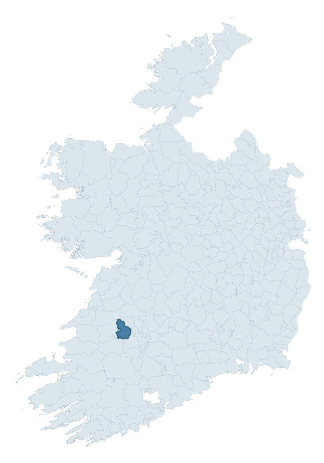
Where this barony sits in the Republic of Ireland
Geology and preservation
Bedrock geology shapes the landscape long before any settlement begins — controlling soil drainage, agricultural potential, the survival of upstanding monuments, and the preservation of buried archaeology. The figures below come from the Geological Survey Ireland 1:100,000 bedrock map.
The bedrock underlying Connello Lower is predominantly limestone (81% of the barony by area), laid down during the Carboniferous period (96% by area, around 359 to 299 million years ago). Limestone is the most heritage-rich bedrock in Ireland. It supports fertile, well-drained soils that favoured dense Early Medieval settlement and Norman manorial agriculture, and it weathers into karst features — sinkholes, caves, swallow holes, and souterrains — that frequently carry archaeology. Where peat overlies limestone, organic preservation can be exceptional. The single largest mapped unit is the Waulsortian Limestones (67% of the barony's bedrock).
Rock type composition
Largest mapped unit: Waulsortian Limestones (67% of the barony)
Placename evidence
Logainm records 31 heritage-diagnostic placenames for Connello Lower, drawn from townland and civil-parish names across the barony. The dominant stratum is pre-Christian and Early Medieval defensive — ráth-, lios-, dún-, and caiseal-prefixed names that mark Iron Age and early historic settlement. The leading diagnostic roots are cill- (11 — church), ráth- (9 — earthen ringfort), and lios- (5 — ringfort or enclosure). This is broadly in line with the ROI average of 30.7 heritage placenames per barony. The presence of multiple heritage strata side by side indicates layered occupation of the landscape across successive prehistoric and historic periods. Logainm records 183 placenames for Connello Lower (predominantly townland names). Of these, 31 (17%) carry one of the diagnostic Gaelic roots tracked above; the remainder draw on more generic landscape vocabulary that does not encode a heritage period.
Pre-Christian / Early Medieval Defensive
| Root | Count | Meaning |
|---|---|---|
| ráth- | 9 | earthen ringfort |
| lios- | 5 | ringfort or enclosure |
| dún- | 2 | hilltop or promontory fort |
| caiseal- | 1 | stone ringfort |
Early Christian Ecclesiastical
| Root | Count | Meaning |
|---|---|---|
| cill- | 11 | church (early) |
Burial, Ritual, and Norse-Contact
| Root | Count | Meaning |
|---|---|---|
| tuaim- | 3 | burial mound |
| gall- | 1 | foreigner — Norse settlement marker |
Other baronies in Limerick
- Clanwilliam
- North Liberties
- Coshlea
- Smallcounty
- Shanid
- Coonagh
- Pubblebrien
- North Liberties
- Slievardagh — Tipperary
- Shanid
See all 280 baronies in the Republic of Ireland Heritage Tool.

Explore further
Grounding History: 10 Maps of Northern Ireland’s Past
If you’re interested in Irish heritage more widely, the companion report for Northern Ireland brings together the analysis of all 462 NI wards into one place through 10 high-quality maps — covering monument density, archaeological periods, placename heritage, terrain, wetland, and the historic landscape at first survey. Take a look.
About this profile
Click any section below to expand.
What is a barony?
A barony is a historic administrative unit in Ireland, broadly equivalent to an English hundred. The 280 baronies used here are from the OSi 2019 National Statutory Boundaries (generalised 20m), covering the 26 counties of the Republic of Ireland. Baronies derive from the Norman period, were formalised in the 17th century, and have not been redrawn for statistical purposes. They vary enormously in area, from compact urban baronies in Dublin to vast upland baronies in Connacht, and should not be compared by raw site count without accounting for area differences.
What counts as a site?
This profile combines three distinct heritage registers, each with its own definition of what constitutes a recordable site:
- Archaeological sites (NMS). The National Monuments Service Sites and Monuments Record (SMR) catalogues every known archaeological monument or site of archaeological interest in the Republic, from prehistoric burial mounds and ringforts to medieval churches and post-medieval defensive works. Inclusion does not require legal protection — only that the site has been identified, surveyed, and assessed as having archaeological value. A separate subset of these sites lies within a recorded protection zone, which gives them statutory protection under the National Monuments Acts.
- Listed buildings (NIAH). The National Inventory of Architectural Heritage records buildings of architectural, historical, archaeological, artistic, cultural, scientific, social, or technical interest. Each surveyed structure is appraised on a five-tier scale: International, National, Regional, Local, and Record-Only. The NIAH appraisal is informational rather than strictly statutory, but it underpins local-authority Record of Protected Structures (RPS) listings.
- Heritage placenames (Logainm). Logainm is the authoritative database of Irish placenames maintained by the Placenames Branch. This profile applies a heritage-diagnostic classifier to the Irish-language form of each townland name, flagging roots that signal defensive sites (ráth-, lios-, dún-, caiseal-, cathair-), ecclesiastical foundations (cill-, teampall-, domhnach-, mainistir-), prehistoric burial-ritual features (tuaim-, carn-, leaba-), or Norse-contact settlement (gall-). Townlands without one of these diagnostic roots are not flagged here — they may still carry historical significance, but that significance is not encoded in the name itself.
Editorial principles
The narrative sections of this profile follow several explicit principles:
- Evidential. Every claim about this barony’s heritage character is anchored in the underlying register data. Where a site count, a placename count, or a percentile rank is cited, it is computed from the source datasets at export time, not estimated.
- Comparative. Counts and metrics are reported alongside their percentile rank against the other 279 ROI baronies. A barony with 50 ringforts in absolute terms could be unusually high or unusually low depending on its size and regional context; percentile ranking removes that ambiguity.
- Transparent on limits. Where a register has known coverage gaps, survey biases, or data-quality issues that affect this barony’s figures, the profile flags them rather than presenting the numbers as definitive.
- No interpretation beyond what the data supports. The narrative does not speculate about historical events, social dynamics, or cultural meaning beyond what the recorded heritage and placename evidence directly attests.
Data caveats and limits
- NMS Sites and Monuments Record is the product of survey campaigns conducted at different intensities across different counties and decades. Some baronies have been surveyed more thoroughly than others, and absolute counts should be read in that light. Sites destroyed by development before survey are typically not represented; sites in heavily forested or upland terrain are sometimes under-recorded.
- NIAH coverage is broadly complete for the Republic of Ireland but the survey was conducted on a rolling county-by-county basis, and the most recent appraisal date varies. Buildings demolished or substantially altered after their original survey may still appear in the register; conversely, recent buildings of merit may not yet have been appraised.
- Logainm classification applies a deliberately conservative pattern-matching approach to the Irish-language townland forms. The classifier prioritises true positives over recall: a townland may carry a heritage signal that the classifier doesn’t recognise, particularly where the diagnostic root has been heavily anglicised or where the townland name draws on a less common term. The 60,000+ townland records and ~9,800 classified placenames give a substantial signal at barony scale, but individual townland names should be checked against Logainm directly for definitive interpretation.
- Period attribution. The chronological distribution reflects only those NMS sites that carry a recognised period attribution in the source data. Sites listed as “Unknown” period are excluded from the dated subset.
- Boundary changes. Some baronies have undergone minor boundary adjustments since their 19th-century definition; the OSi 2019 generalised boundaries used here are the current statutory definition and may differ slightly from historical maps in border areas.
- Bedrock geology is mapped at 1:100,000 scale, which means local variation within a barony — small pockets of different rock type, mineral veins, alluvium overlying bedrock — is generalised. The dominant-system and rocktype figures are area-weighted, so a barony reading “70% Carboniferous limestone” may still contain small but archaeologically important pockets of older or younger rock. Around 3% of GSI polygons do not match the lexicon and contribute no rocktype or system attribution.
Data sources
- National Monuments Service — Sites and Monuments Record (SMR) https://data.gov.ie/dataset/national-monuments-service-archaeological-survey-of-ireland
- National Inventory of Architectural Heritage (NIAH) https://data.gov.ie/dataset/national-inventory-of-architectural-heritage-niah-national-dataset
- Logainm — Placenames Database of Ireland https://www.logainm.ie/
- Ordnance Survey Ireland — National Statutory Barony Boundaries 2019 https://data-osi.opendata.arcgis.com/
- EURODEM — European Digital Elevation Model https://www.mapsforeurope.org/datasets/euro-dem
- ESA WorldCover https://esa-worldcover.org/en
- Geological Survey Ireland — 1:100,000 Bedrock Geology https://www.gsi.ie/en-ie/data-and-maps/Pages/Bedrock.aspx
Explore more: Search any of the 280 ROI baronies, browse by historical province, or read the methodology and data sources for the full Republic of Ireland Heritage Tool.