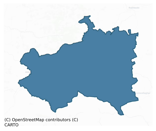
Glenquin is a barony of County Limerick, in the historical province of Munster (Irish: Gleann an Choim), covering 390 km² of land. The barony records 549 NMS archaeological sites and 143 NIAH listed buildings, placing it at around the 29th percentile among 280 ROI baronies for sites per km². This means it is in the bottom third of all baronies for sites per km². Dated archaeological evidence runs from the Early Bronze Age through to the Modern, spanning 7 of 9 archaeological periods, placing the barony in the 35th percentile among 280 ROI baronies for chronological depth. This means it is in the lower half of all baronies for chronological depth. The largest dated subset of recorded sites dates to the Early Medieval. Logainm flags 47 placenames in the barony as carrying a recognised heritage root; the largest share — around 53% — are names associated with early Christian church and monastic foundations.
Heritage at a glance
Percentile rankings throughout this profile compare each barony only against the other 279 Republic of Ireland baronies.
The recorded heritage of Glenquin
The National Monuments Service Sites and Monuments Record (SMR) is the statutory inventory of archaeological sites for the Republic of Ireland, maintained by the Department of Tourism, Culture, Arts, Gaeltacht, Sport and Media. Sites recorded here include earthworks, ringforts, megalithic tombs, ecclesiastical remains, and post-medieval features; not every record is legally protected, but each is registered as a monument of archaeological interest.
The National Monuments Service records 549 archaeological sites in Glenquin, putting it at the 29th percentile among 280 ROI baronies for sites per km². This means it is in the bottom third of all baronies for sites per km². Protection coverage is near-universal — 544 sites (99%) fall within a recorded monument protection zone, indicating an extensively surveyed landscape. The dominant category is defensive sites — ringforts, enclosures, hillforts, and stone forts (453 sites, 83% of the record). Ringfort – rath is the most prevalent type, making up 65% of the barony's recorded sites (358 records) — well above the ROI average of 20% across all baronies where this type occurs. Ringfort – rath is an earthen ringfort enclosed by a bank and external ditch — the most common Early Medieval farmstead, broadly dated 500–1000 AD. Other significant types include Enclosure (56) and Moated site (16). Enclosure is a banked or ditched feature of uncertain type, used as a catch-all where the original function cannot be determined from surface evidence. Across the barony's 390 km², this gives a recorded density of 1.41 sites per km².
Most common monument types
Hover or tap a monument type to see its definition.
| Type | Count |
|---|---|
| Ringfort – rath an earthen ringfort enclosed by a bank and external ditch — the most common Early Medieval farmstead, broadly dated 500–1000 AD | 358 |
| Enclosure a banked or ditched feature of uncertain type, used as a catch-all where the original function cannot be determined from surface evidence | 56 |
| Moated site | 16 |
| Church a building used for public Christian worship, of any date from c. 500 AD onwards | 13 |
| Ritual site – holy well a well or spring traditionally associated with a saint, often credited with healing properties; many trace earlier ritual origins but devotion is documented from the medieval period onwards | 13 |
| Graveyard a burial area associated with a church, in use from the medieval period onwards | 12 |
| Earthwork an unclassified earthen structure with no diagnostic features that allow a more specific classification | 11 |
| Fulacht fia a horseshoe-shaped Bronze Age burnt mound built around a sunken trough beside a water source, traditionally interpreted as a cooking site | 10 |
Chronological distribution
The dated archaeological record for Glenquin spans from the Early Bronze Age through to the Modern, with activity attested across 7 of 9 archaeological periods. Every period from earliest to latest is represented in the record — an unbroken sequence of dated activity across the full chronological span. Activity concentrates most heavily in the Early Medieval (251 sites, 50% of dated material), with the Iron Age forming a secondary peak (192 sites, 38%). A further 49 recorded sites (9% of the overall NMS register for the barony) carry no period attribution — appearing as 'Unknown' in the bar chart below. This typically reflects either records that pre-date the standardised period vocabulary or sites awaiting specialist dating review, rather than a genuine absence of chronological evidence.
Sample of recorded monuments
Show 25 sample monuments (of 549 total)
A representative sample of 25 recorded monuments drawn from the barony’s 549 total NMS entries. Sites within a recorded monument protection zone and rarer site types are prioritised so the list shows a meaningful cross-section rather than only the most common type. Each entry shows the official Sites and Monuments Record reference number and the description published by the National Monuments Service.
Historic town
The Urban Survey of Limerick (Bradley et. al. 1989, 199) recorded the following about the historic town of Newcastle; 'Newcastlewest is located on the Limerick to Tralee road beside the Arra river in the south west of…
The Urban Survey of Limerick (Bradley et. al. 1989, 199) recorded the following about the historic town of Newcastle; 'Newcastlewest is located on the Limerick to Tralee road beside the Arra river in the south west of the county. There is a tradition that it was the site of a house built by the Knights Templars in 1184 (Lewis 1837, ii, 425; Westropp 1906-7, 232) but since the Normans had not even succeeded in penetrating into Limerick at this stage it can be dismissed as unfounded (see Gwynn and Hadcock 1970, 330).
The founders of Newcastlewest appear to have been the Geraldines who were already established in this area by 1215 (Westropp 1909, 43) and who held the castle as one of their principal strongholds until the fall of the Desmonds in 1584. The extent of the settlement in the vicinity of the castle is unknown but a rental of 1297-8 indicates that there was a hundred court here, from which it has been inferred that it was the site of a medieval borough (38 RDKPRI, 40; Graham 1977). The evidence is not altogether clear, however, but the settlement has been included here for the sake of consistency with the borough lists prepared by Graham and Martin.
The south quay is mentioned in the sixteenth century when it was known as 'Shradegower' while another street was known as 'Shradenetona' (Westropp 1909, 57-8). Despite these references, however, the medieval street pattern is unknown. The present town plan with its centrally placed Square is evidentially of post-medie…
Castle – motte
In pasture, on S-facing upper slope of NW-SE running river valley; stream runs NW-SE c. 50m to S of site. Roughly circular raised platform (diam. 22.5m) defined by an earthen scarped edge (ext. H 3.6m) with an external…
In pasture, on S-facing upper slope of NW-SE running river valley; stream runs NW-SE c. 50m to S of site. Roughly circular raised platform (diam. 22.5m) defined by an earthen scarped edge (ext. H 3.6m) with an external fosse (Base Wth. 5.80m; D1.6m). Fosse encloses the platform N->SE; kink in field boundary to W of site seems to indicate previous extent of fosse SW->N. Platform quarried at edge SW->WSW and W->WNW. Interior level, dry and overgrown at margins.
Compiled by: Denis Power
Date of upload: 26 August 2011
Hilltop enclosure
In pasture, on crest of broad E-W rise. Monument, depicted as embanked circular enclosure (diam. c. 70m) on 1923 OS 6-inch map, has been levelled. No trace of monument evident when inspected. Area immediately N of site…
In pasture, on crest of broad E-W rise. Monument, depicted as embanked circular enclosure (diam. c. 70m) on 1923 OS 6-inch map, has been levelled. No trace of monument evident when inspected. Area immediately N of site is covered by coniferous plantation.
The monument was recently described in the Atlas of Hillforts of Britain and Ireland as following; 'Circular multiple enclosure with a total site footprint of approximately 0.5ha positioned at the crest of a broad E-W rise on SE facing slopes of hilltop and overlooking the interchange between two distinctive valleys running N-S and E-W. Bivallate on the W side, the enclosing elements probably originally formed two complete circuits. There are no obvious entrance features. No evidence for any internal activity on the surface. The fort has been completely levelled in recent times. Visible in aerial photographs prior to 1995 and in historic mapping, the enclosing elements comprised a complete outer rampart which survives well throughout the circuit and an inner, concentric bank. The E half of this enclosing element is not apparent in aerial photographs or in the historic mapping. The interior is covered in dense scrub. First map depiction in first edition Ordnance Survey mapping. More detailed earthwork survey in second edition Ordnance Survey mapping.' (http://hillforts.arch.ox.ac.uk/records/IR0917.html)
Compiled by: Denis Power
Revised by: Caimin O'Brien
Date of revised upload: 30 January 2020
Cist
Discovered in 1985 during the removal of a field boundary. Inspection by National Museum staff revealed 'a prehistoric grave containing cremated human bones' (Kelly 1987). The walls, floor and roof of the grave were…
Discovered in 1985 during the removal of a field boundary. Inspection by National Museum staff revealed 'a prehistoric grave containing cremated human bones' (Kelly 1987). The walls, floor and roof of the grave were formed of small slabs, and 'overall it measured 50cm in maximum length, 40cm in maximum width and 35cm in depth' (ibid.). A preliminary examination of the bones suggested they were the remains of 'two adult males, one of whom may have been of advanced age' (ibid.). An area of burning (diam. 1.5m; D 1m), 7m SW of the grave, was probably 'the site of the funeral pyre' (ibid.; NMI) (LI043-008002-). The stones were removed and the cist was reconstructed in Newcastle West Community Centre. (Cahill and Sikora 2011, vol. 1, 281-6)
An account of this monument has been published in: Cahill, M. & Sikora, M. (2011) Breaking ground, finding graves- reports on the excavations of burials by the National Museum of Ireland, 1927-2006. vol. 1, 281-286.
Compiled by: Denis Power
Date of upload: 16 August 2012
Designed landscape feature
For a description of this monument see LI044-002002-.
Mass-rock
On steeply sloping ground on the E slopes of Gortnaclohy Mountain, now covered with a large modern coniferous plantation. Not depicted on historic OSi maps. Visited by the ASI in 1997 when described as a concrete wall…
On steeply sloping ground on the E slopes of Gortnaclohy Mountain, now covered with a large modern coniferous plantation. Not depicted on historic OSi maps. Visited by the ASI in 1997 when described as a concrete wall surmounted by a cross-shrine with concrete altar in front of shrine. No surface remains of the mass rock were recorded. The area is visible on Google Earth orthoimages to the immediate E of a local road.
See attached Google Earth orthoimage.
Compiled by: Martin Fitzpatrick
Date of upload: 6 August 2021
Castle – unclassified
Westropp (1906-7, 235-6) recorded the following details about Mayne Castle; 'It was remembered recently, the modern house being on its site, and was a reputed templary. An appanage of Keynsham Abbey, surrendered 1227…
Westropp (1906-7, 235-6) recorded the following details about Mayne Castle; 'It was remembered recently, the modern house being on its site, and was a reputed templary. An appanage of Keynsham Abbey, surrendered 1227 (B.B.L., p. 75). 1255 Walter Wansell, the sheriff, accounts for ward of the C[astle]. of Mayn (Carew MSS. ; Book of Howth, p. 428). Thomas an Appagh granted Meine [Mayne] to Gibbon, son of J., of Callan, whence the MacGibbons, White Knights. 1307 Suit of the Prior of Bathkeale and Hugh Purcell as to dues off the manor of Mayen (Plea R., Cal., p. 205). 1309 Sybil, widow of H. de la Chapelle, claims one-third of Mayne (Repert. Plea R. p. 32). 1551 J., the White Knight, was compelled to transfer Meine [Mayne] to the Earl of Desmond. 1583 The Manor of Bean [Mayne], late perquisite of the White Knight from the Earl of Desmond, "one C[astle], which was an excellent and ample residence before the rebellion, in which it was totally wasted, so that at present (1583) nothing but the stone walls remain" (Des. R., 15b; Peyton, 50; Inq. Exch., 54). 1592 Grant to H. Oughtred of the C[astle]. of Meine [Mayne] alias Mahownagh and Treanmeane, and the house of Mahownagh (Fi. 6533). 1598 The C[astle], of Meane, Pallice, and Ballinwylly belonged to Sir H. Oughtred; he fled with his wife to Limerick, leaving sixteen men in the house, who fled after two days, and the Irish took it (C.S.P.L). 1600 Garrett Fitz Nicholas, the nearest rebel to Askeaton, was "haunted and hunted" by Sir…
Cliff-edge fort
In pasture, on an E-facing slope, just above a steep incline down to a stream. A D-shaped area (28.5m N-S; 38.2m E-W) defined on its straight SE side by the top edge of the steep incline, and enclosed SSW->ESE by two…
In pasture, on an E-facing slope, just above a steep incline down to a stream. A D-shaped area (28.5m N-S; 38.2m E-W) defined on its straight SE side by the top edge of the steep incline, and enclosed SSW->ESE by two concentric earthen banks, 3.25m apart, with an external fosse SSW->NW (D 0.65; Wth 2.6m). The inner bank (int. H 1m; ext. H 1.25m) is best preserved SSW->WNW but has been much denuded by cattle NNE->ENE, as similarly is the outer bank (int. H 1.45m; ext. H 0.95m). The enclosing element is masked by dense vegetation overgrowth. Breaks in the banks at NW and ENE appear to be the result of cattle accessing the interior. The interior slopes down gently to the SE and is covered by mature deciduous trees.
Compiled by: Denis Power
Date of upload: 26 August 2011
Linear earthwork
A section of the Cork-Limerick county boundary (L c. 1.5km) is termed the Cliadh Dubh' on the 1924 OS six-inch map, running between Vein Bridge and Glenagaphul. This consists of two parallel earthen banks (c. 12m apart)…
A section of the Cork-Limerick county boundary (L c. 1.5km) is termed the Cliadh Dubh' on the 1924 OS six-inch map, running between Vein Bridge and Glenagaphul. This consists of two parallel earthen banks (c. 12m apart) running along the N side of a public road. Both are constructed earth banks (H c. 1.1m; Wth 1.5m) similar to the surrounding field boundaries, overgrown with scrub, thorn and gorse. Sections of the roadside bank have been replaced in places by recent fencing, and both are interrupted by roads, farm passages and roadside dwellings. The area between the boundaries is largely under pasture, but shorter sections are covered by trees and bushes.
Compiled by: Denis Power
Date of upload: 29 August 2012
Castle – Anglo-Norman masonry castle
National monuments No. 636 & 582. Desmond Hall described in the Urban Survey (Bradley et. al. 1989, 201-08) as following; "An account of the castle in the Desmond Roll of 1583-6 gives a good description of it:
'One…
National monuments No. 636 & 582. Desmond Hall described in the Urban Survey (Bradley et. al. 1989, 201-08) as following; "An account of the castle in the Desmond Roll of 1583-6 gives a good description of it:
'One great castle, built of square plan, a chief house of the said late Earl of Desmond … having at each angle of the same a round tower, with various places and chambers in each tower. And there is at the south corner, on the western side of the said castle at the south part, a high square tower or peel, built for defence within the walls of the said castle. And also there were within the walls of the said castle many buildings – namely, a large hall, a large room and an excellent chamber; one garden, and in the same two fish ponds, all of which buildings are ruined and waste' (Westropp 1909, 56-7)
The castle, all sections of which are very ruined except the Desmond Hall, stands on a raised level area on the north side of the Arra river. It was built of roughly coursed rubble limestone and consisted of a large rectangular bawn with corner towers, a 'peel' tower, two two/three floored houses on the south, the great hall on the south east and the Desmond Hall on the north east. The enclosing bawn wall only survives in places along the south, where it is crennelated and has gun-loops, and along the east; elsewhere it is missing. At the extreme south-west there is a D-shaped turret, battered at the base and probably originally of two floors. It is now c. 4m high…
Country house
A test excavation by Kenneth Wiggins (00E0342) ‘was carried out on 24 May 2000 along the southern side of the Ballygowan Spring Water plant, where a large new extension was proposed. Four cuttings were opened by…
A test excavation by Kenneth Wiggins (00E0342) ‘was carried out on 24 May 2000 along the southern side of the Ballygowan Spring Water plant, where a large new extension was proposed. Four cuttings were opened by mechanical excavator. These did not reveal any archaeological material. The development proceeded, and all ground disturbance was monitored, between 12 June and 12 July 2000. No archaeological features were revealed, although a well was discovered, which would have been associated with Cullenagh House (now demolished), which may have been built at the end of the 17th century.’ The above description is posted on the web at the following internet address: http://www.excavations.ie/ (accessed 24 August 2012).
This is the record for the 17th century house.
Compiled by: Denis Power
Date of upload: 24 August 2012
Well
A test excavation by Kenneth Wiggins (00E0342) ‘was carried out on 24 May 2000 along the southern side of the Ballygowan Spring Water plant, where a large new extension was proposed. Four cuttings were opened by…
A test excavation by Kenneth Wiggins (00E0342) ‘was carried out on 24 May 2000 along the southern side of the Ballygowan Spring Water plant, where a large new extension was proposed. Four cuttings were opened by mechanical excavator. These did not reveal any archaeological material. The development proceeded, and all ground disturbance was monitored, between 12 June and 12 July 2000. No archaeological features were revealed, although a well was discovered, which would have been associated with Cullenagh House (now demolished), which may have been built at the end of the 17th century.’ The above description is posted on the web at the following internet address: http://www.excavations.ie/ (accessed 24 August 2012).
This is the record for the well.
Compiled by: Denis Power
Date of upload: 24 August 2012
Hut site
Test-trenching Graham Hull (07E0179) 'in advance of a proposed housing development located a cremation burial cemetery (21 pits) and a circular hut site (2m diameter). These features are very probably prehistoric in…
Test-trenching Graham Hull (07E0179) 'in advance of a proposed housing development located a cremation burial cemetery (21 pits) and a circular hut site (2m diameter). These features are very probably prehistoric in date. Linear features were also found and these may relate to early field systems.' The above description is posted on the web at the following internet address: http://www.excavations.ie/ (accessed 27 August 2012).
This is the record for the hut site.
Compiled by: Denis Power
Date of upload: 27 August 2012
Flat cemetery
Test-trenching Graham Hull (07E0179) 'in advance of a proposed housing development located a cremation burial cemetery (21 pits) and a circular hut site (2m diameter). These features are very probably prehistoric in…
Test-trenching Graham Hull (07E0179) 'in advance of a proposed housing development located a cremation burial cemetery (21 pits) and a circular hut site (2m diameter). These features are very probably prehistoric in date. Linear features were also found and these may relate to early field systems.' The above description is posted on the web at the following internet address: http://www.excavations.ie/ (accessed 27 August 2012).
This is the record for the flat cemetery (cremation burials)
Compiled by: Denis Power
Date of upload: 27 August 2012
Burnt mound
Pre-development testing was carried out by Laurence Dunne (08E0205) 'at a proposed development site, consisting of Phase 1 of a wind farm project. The site is located on a south-facing ridge of the Mullaghareirk…
Pre-development testing was carried out by Laurence Dunne (08E0205) 'at a proposed development site, consisting of Phase 1 of a wind farm project. The site is located on a south-facing ridge of the Mullaghareirk Mountains in Dromdeeveen townland, Ballagh, Co. Limerick. Phase 1 comprised seven wind turbines and associated service roads and substation situated in open fields in pasture. A total of fifteen test-trenches were excavated using a mechanical track machine utilising a 2m-wide flat grading bucket. The total length of trenching was 720m. The subsoil varied across the site from mid-orange/brown clayey silt with frequent pencil gravel (Trench 1) to mottled light-yellow/green/brown clay with frequent small to medium sub-angular sandstones (Trench 14). The topsoil depth varied across the site from 0.2m (Trench 2) to 0.45m (Trench 15).
A single trench (Trench 9) contained archaeological material in the form of a burnt mound. This west-north-west/east-south-east-orientated trench was situated to target the location of the proposed substation and access road. At the extreme east-south-east end of the trench a low mound of heat-shattered sandstones in a charcoal-enriched soil matrix extending for a maximum of 1.2m into the trench, was revealed. The mound is D-shaped in plan due to its truncation by an internal open drainage ditch for the field boundary where it is located. The mound has a maximum height of 0.3m and maximum dimensions of 10.5m west-north-west/east-south-east…
Ecclesiastical enclosure
In N quadrant of Clonelty (LI037-107—-) graveyard are the ruins of the Romanesque single cell church (LI037-051—-) possibly dedicated to the seventh century St. Íde of Killeedy (Lewis 1837, 51). The main fabric of…
In N quadrant of Clonelty (LI037-107—-) graveyard are the ruins of the Romanesque single cell church (LI037-051—-) possibly dedicated to the seventh century St. Íde of Killeedy (Lewis 1837, 51). The main fabric of this multi-period church and W doorway dates from the 11th/12th century and is pre-Norman in date. A curving field boundary in the field 70m to the SW of the graveyard boundary wall which continues as the curving arc of a filled in ditch visible as a differential vegetation mark to the SE and which intersects the curving bank of an enclosure (LI037-052—-) at ENE possibly represents the remains of an Early Christian ecclesiastical enclosure (approx. diam. 200m). There are no surface remains visible of the enclosing element from the SW-W-N-ENE. The monastery at Clonelty appears to have been enclosed by a multi-vallate enclosure that was described in the local folklore which recorded that 'adjacent to the church (LI037-051—–) is an ancient fort (LI037-052—), thickly hedged all round. This fort is surrounded by another bigger one and this by still by another larger one' (National Folklore Collection, UCD, The Schools' Collection, Volume 0488, 484).
Clonelty was described in 1840 as following; ‘The name of this Parish is not of ecclesiastical origin but derived from that of the Townland in which the original Church was placed, which Townland derived its name from Cluain, an insulated meadow or bog island, and Eilte, the genitive case of Eilit, a Doe…
Ogham stone
On slightly raised area in NE quadrant of graveyard (LI037-107—) area the remains of the parish church of Clonelty possibly dedicated to the seventh century St. Ita or Íde of Killeedy (Lewis 1837, 51). The church and…
On slightly raised area in NE quadrant of graveyard (LI037-107—) area the remains of the parish church of Clonelty possibly dedicated to the seventh century St. Ita or Íde of Killeedy (Lewis 1837, 51). The church and graveyard appear to have been enclosed by a multi-vallate Early Christian enclosure (LI037-051001-). The main fabric of the church and W doorway is Romanesque in character and pre-Norman in date. The arcade and S window appear to be late-medieval insertions, possibly date from the 16th-17th century. Local folklore recorded the presence of a possible ogham stone (LI037-051002-) that had been incorporated into the fabric of the pre-Norman church (The Schools’ Collection, Volume 0488, 450-1). The folklore recorded that a "poor scholar" 'went into the monastery, and as he gazed around, he noticed some writing on a stone in the wall. He examined it closely and found it to be an "ogham". He read the words aloud, which meant there is a hidden treasure behind this stone' (ibid.).
Compiled by: Caimin O'Brien
Date of upload: 14 March 2019
Anomalous stone group
In grassland, Lisgoura Fort (LI037-010—-) 220m to W. Anomalous stone group forming a semi-circular shaped pattern which appears to be made by humans rather than a natural geological feature visible on Digital Globe…
In grassland, Lisgoura Fort (LI037-010—-) 220m to W. Anomalous stone group forming a semi-circular shaped pattern which appears to be made by humans rather than a natural geological feature visible on Digital Globe orthoimage taken 2011-13 and on earlier OSi orthophotos.
Compiled by: Caimin O’Brien
Date of upload: 30 May 2020
Water mill – unclassified
The Corn & Tuck Mill depicted on the 1840 ed. OSi 6-inch map located 560m WNW of Castle Mahon may have been built on the site of or in close proximity to the medieval mill of Mahoonagh. The 1654-56 Civil Survey of…
The Corn & Tuck Mill depicted on the 1840 ed. OSi 6-inch map located 560m WNW of Castle Mahon may have been built on the site of or in close proximity to the medieval mill of Mahoonagh. The 1654-56 Civil Survey of Limerick recorded in 1640 Colonel Francis Courtnay was the owner of Mahownagh which contained 'a Castle (LI036-170—-) on it in good reparation, and a Mill seate' (Simington 1938, 259). The
Compiled by: Caimin O'Brien
Date of upload: 24 April 2021
Designed landscape – tree-ring
In pasture on slight NW-facing slope. Circular grove (diam. 12.3m) of mature deciduous trees. No enclosing element.
Compiled by: Denis Power
Date of upload: 26 August 2011
Designed landscape – tree-ring
In grounds of golf course, within small coniferous grove to N of golf green and on level ground. Roughly circular area (24.3m N-S; 23.4m E-W) enclosed by a scarped edge (H 0.45m; Wth 2.6m), with external fosse (D 0.35m;…
In grounds of golf course, within small coniferous grove to N of golf green and on level ground. Roughly circular area (24.3m N-S; 23.4m E-W) enclosed by a scarped edge (H 0.45m; Wth 2.6m), with external fosse (D 0.35m; Wth 1.85m) NE->SE. Interior level. Northern three-quarters of site is covered by coniferous trees, rest is under grass. Excavation by Lar Dunne (2003, 312) concluded that this feature is a tree-ring.
Compiled by: Denis Power
Date of upload: 26 August 2011
Bawn
In pasture overlooking a stream to S, with the ruins of Killeedy Castle (LI044-099002-) in the centre. The ruins of Killeedy Church (LI044-101001-), graveyard (LI044-101002-) and St Ida's Well (LI044-101003-) lie 120m…
In pasture overlooking a stream to S, with the ruins of Killeedy Castle (LI044-099002-) in the centre. The ruins of Killeedy Church (LI044-101001-), graveyard (LI044-101002-) and St Ida's Well (LI044-101003-) lie 120m to SSE. Depicted on the 1897 ed. OSi 25-inch map as a raised sub-rectangular-shaped area (dims. c. 23m NW-SE; 17m NE-SW) defined by a fosse. Visited by the ASI in 1997 and described as ‘a raised sub-rectangular-shaped mound (dims. 20m NW-SE; 13m NE-SW) enclosed by a bank (Wth 2.5m, H 2m) from W-N-E with the fallen masonry in W. The interior is hollow in the centre where the ruins of Killeedy castle (LI047-099002-) are located. A gap (Wth 2.6m) in the bank at ENE may be the result of livestock erosion’. Overgrown outline of monument is visible on Digital Globe orthoimage taken between 2011-13 and on Google Earth orthoimages. Could be the remains of a collapsed earth and stone bawn enclosing Killeedy Castle.
See attached Google Earth orthoimages.
Compiled by: Martin Fitzpatrick
Date of upload: 26 August 2021
Kiln – lime
In gently undulating wet pasture. The site is located on the NE side of a NW-SE running natural ridge facing a valley on the NE side of the ridge. All that remains is a horseshoe shaped depression (10m N-S; 11m E-W;…
In gently undulating wet pasture. The site is located on the NE side of a NW-SE running natural ridge facing a valley on the NE side of the ridge. All that remains is a horseshoe shaped depression (10m N-S; 11m E-W; Max. D 1.4m) with the flat side facing the valley. Small right angled portion of stonework (1m NE-SW; 0.4m NW-SE; Th. 0.4m) protrudes from crest of ridge to W of depression.
Compiled by: Denis Power
Date of upload: 26 August 2011
Kiln – lime
In rough pasture, on S-facing slope. Only N half of stone-lined funnel (diam. 1.4m; H c. 2.6m) survives of kiln structure which is otherwise reduced to rubble mounds. Earthen ramp (8.2m N-S; 7.5m E-W) survives to…
In rough pasture, on S-facing slope. Only N half of stone-lined funnel (diam. 1.4m; H c. 2.6m) survives of kiln structure which is otherwise reduced to rubble mounds. Earthen ramp (8.2m N-S; 7.5m E-W) survives to rear.
Compiled by: Denis Power
Date of upload: 26 August 2011
Ringfort – rath
In pasture, on gentle SSE-facing slope. Circular area (diam. c. 30m) enclosed by earthen bank (int. H 0.55m; ext. H 1.5m) with external fosse (D 1.05m; Wth 3m). Outer edge of fosse is truncated by field boundary and…
In pasture, on gentle SSE-facing slope. Circular area (diam. c. 30m) enclosed by earthen bank (int. H 0.55m; ext. H 1.5m) with external fosse (D 1.05m; Wth 3m). Outer edge of fosse is truncated by field boundary and drain NNW->NE; drain feeds water into fosse at NE and fosse is waterlogged except W->NNW. Much of enclosing element and all of interior covered by dense overgrowth.
Compiled by: Denis Power
Date of upload: 26 August 2011
Listed buildings
The National Inventory of Architectural Heritage (NIAH) is a state survey appraising buildings of architectural, historical, archaeological, artistic, cultural, scientific, social, or technical interest. Each surveyed structure receives a rating from International (the highest, for buildings of European importance) through National, Regional, Local, and Record-Only.
The NIAH records 143 listed buildings in Glenquin (65th percentile across ROI baronies). The highest-graded structures include 2 of National significance. The Republic holds 937 National-graded buildings in total, so this barony accounts for around 0% of the national total. Construction dates concentrate most heavily in the Victorian (1830-1900) period. The most-recorded building type is house (51 examples, 36% of the listed stock).
Terrain and environment
Mean elevation across the barony is 143m — the 83rd percentile among 280 ROI baronies for elevation. This means it is in the top fifth of all baronies for elevation. This is a relatively elevated landscape by ROI standards. Elevation matters for heritage because higher-altitude baronies typically favour defensive monuments — ringforts and hilltop forts placed on prominent ground — while lowland baronies are more likely to carry the dense settlement and church networks of intensive agricultural landscapes. The barony reaches 372m at its highest point — a vertical span of more than 228m within its boundary, indicating significant topographic diversity. Mean slope is 3.9° — the 55th percentile among 280 ROI baronies for slope. This means it is in the upper half of all baronies for slope. Slope is a key control on both land use and archaeological preservation: steep ground resists ploughing and tends to preserve earthworks intact, while gentle slopes favour intensive cultivation that damages or destroys surface archaeology over time. The Topographic Wetness Index averages 10.7, the 44th percentile among 280 ROI baronies for wetness. This means it is in the lower half of all baronies for wetness. Drainage matters for heritage because poorly-drained ground preserves organic archaeology (wooden trackways, leather, textiles, and on rare occasions human remains) far better than free-draining soil; well-drained ground favours arable use but destroys organic material rapidly. The land cover is dominated by improved grassland (82%) and woodland (17%). In overall character, this is elevated but relatively gentle terrain — typical of plateau country, with land use dominated by improved grassland.
Terrain measurements
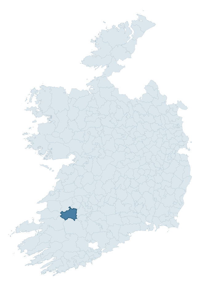
Where this barony sits in the Republic of Ireland
Geology and preservation
Bedrock geology shapes the landscape long before any settlement begins — controlling soil drainage, agricultural potential, the survival of upstanding monuments, and the preservation of buried archaeology. The figures below come from the Geological Survey Ireland 1:100,000 bedrock map.
The bedrock underlying Glenquin is predominantly limestones (20% of the barony by area), laid down during the Carboniferous period (99% by area, around 359 to 299 million years ago). Limestone is the most heritage-rich bedrock in Ireland. It supports fertile, well-drained soils that favoured dense Early Medieval settlement and Norman manorial agriculture, and it weathers into karst features — sinkholes, caves, swallow holes, and souterrains — that frequently carry archaeology. Where peat overlies limestone, organic preservation can be exceptional. A substantial secondary geology of limestone (19%) and mudstone, siltstone, sandstone (19%) adds further variety to the underlying landscape. With 9 distinct rock types mapped, the barony sits in the top third of ROI baronies for geological diversity (86th percentile) — typically a sign of complex tectonic history or coastal mosaics of differing rock units.
Rock type composition
Largest mapped unit: Visean Limestones (undifferentiated) (21% of the barony)
Placename evidence
Logainm records 47 heritage-diagnostic placenames for Glenquin, drawn from townland and civil-parish names across the barony. The dominant stratum is Early Christian ecclesiastical — cill-, teampall-, and domhnach-prefixed names that record the dense network of early church foundations established between the fifth and tenth centuries. The leading diagnostic roots are cill- (16 — church), ráth- (7 — earthen ringfort), and lios- (4 — ringfort or enclosure). This is above the ROI average of 30.7 heritage placenames per barony. The presence of multiple heritage strata side by side indicates layered occupation of the landscape across successive prehistoric and historic periods. Logainm records 203 placenames for Glenquin (predominantly townland names). Of these, 47 (23%) carry one of the diagnostic Gaelic roots tracked above; the remainder draw on more generic landscape vocabulary that does not encode a heritage period.
Pre-Christian / Early Medieval Defensive
| Root | Count | Meaning |
|---|---|---|
| ráth- | 7 | earthen ringfort |
| lios- | 4 | ringfort or enclosure |
| dún- | 4 | hilltop or promontory fort |
| caiseal- | 3 | stone ringfort |
| cathair- | 1 | stone fort |
Early Christian Ecclesiastical
| Root | Count | Meaning |
|---|---|---|
| cill- | 16 | church (early) |
| mainistir- | 3 | monastery |
| gráinseach- | 3 | monastic farm / grange |
| teampall- | 2 | church (later medieval) |
| cillín- | 1 | unconsecrated burial ground |
Burial, Ritual, and Norse-Contact
| Root | Count | Meaning |
|---|---|---|
| dumha- | 2 | mound |
| gall- | 1 | foreigner — Norse settlement marker |
Other baronies in Limerick
- Coshlea
- Owneybeg
- Coonagh
- Kenry
- Kilmallock
- Pubblebrien
- Shanid
- Iveragh — Kerry
- North Liberties
- Moyarta — Clare
See all 280 baronies in the Republic of Ireland Heritage Tool.

Explore further
Grounding History: 10 Maps of Northern Ireland’s Past
If you’re interested in Irish heritage more widely, the companion report for Northern Ireland brings together the analysis of all 462 NI wards into one place through 10 high-quality maps — covering monument density, archaeological periods, placename heritage, terrain, wetland, and the historic landscape at first survey. Take a look.
About this profile
Click any section below to expand.
What is a barony?
A barony is a historic administrative unit in Ireland, broadly equivalent to an English hundred. The 280 baronies used here are from the OSi 2019 National Statutory Boundaries (generalised 20m), covering the 26 counties of the Republic of Ireland. Baronies derive from the Norman period, were formalised in the 17th century, and have not been redrawn for statistical purposes. They vary enormously in area, from compact urban baronies in Dublin to vast upland baronies in Connacht, and should not be compared by raw site count without accounting for area differences.
What counts as a site?
This profile combines three distinct heritage registers, each with its own definition of what constitutes a recordable site:
- Archaeological sites (NMS). The National Monuments Service Sites and Monuments Record (SMR) catalogues every known archaeological monument or site of archaeological interest in the Republic, from prehistoric burial mounds and ringforts to medieval churches and post-medieval defensive works. Inclusion does not require legal protection — only that the site has been identified, surveyed, and assessed as having archaeological value. A separate subset of these sites lies within a recorded protection zone, which gives them statutory protection under the National Monuments Acts.
- Listed buildings (NIAH). The National Inventory of Architectural Heritage records buildings of architectural, historical, archaeological, artistic, cultural, scientific, social, or technical interest. Each surveyed structure is appraised on a five-tier scale: International, National, Regional, Local, and Record-Only. The NIAH appraisal is informational rather than strictly statutory, but it underpins local-authority Record of Protected Structures (RPS) listings.
- Heritage placenames (Logainm). Logainm is the authoritative database of Irish placenames maintained by the Placenames Branch. This profile applies a heritage-diagnostic classifier to the Irish-language form of each townland name, flagging roots that signal defensive sites (ráth-, lios-, dún-, caiseal-, cathair-), ecclesiastical foundations (cill-, teampall-, domhnach-, mainistir-), prehistoric burial-ritual features (tuaim-, carn-, leaba-), or Norse-contact settlement (gall-). Townlands without one of these diagnostic roots are not flagged here — they may still carry historical significance, but that significance is not encoded in the name itself.
Editorial principles
The narrative sections of this profile follow several explicit principles:
- Evidential. Every claim about this barony’s heritage character is anchored in the underlying register data. Where a site count, a placename count, or a percentile rank is cited, it is computed from the source datasets at export time, not estimated.
- Comparative. Counts and metrics are reported alongside their percentile rank against the other 279 ROI baronies. A barony with 50 ringforts in absolute terms could be unusually high or unusually low depending on its size and regional context; percentile ranking removes that ambiguity.
- Transparent on limits. Where a register has known coverage gaps, survey biases, or data-quality issues that affect this barony’s figures, the profile flags them rather than presenting the numbers as definitive.
- No interpretation beyond what the data supports. The narrative does not speculate about historical events, social dynamics, or cultural meaning beyond what the recorded heritage and placename evidence directly attests.
Data caveats and limits
- NMS Sites and Monuments Record is the product of survey campaigns conducted at different intensities across different counties and decades. Some baronies have been surveyed more thoroughly than others, and absolute counts should be read in that light. Sites destroyed by development before survey are typically not represented; sites in heavily forested or upland terrain are sometimes under-recorded.
- NIAH coverage is broadly complete for the Republic of Ireland but the survey was conducted on a rolling county-by-county basis, and the most recent appraisal date varies. Buildings demolished or substantially altered after their original survey may still appear in the register; conversely, recent buildings of merit may not yet have been appraised.
- Logainm classification applies a deliberately conservative pattern-matching approach to the Irish-language townland forms. The classifier prioritises true positives over recall: a townland may carry a heritage signal that the classifier doesn’t recognise, particularly where the diagnostic root has been heavily anglicised or where the townland name draws on a less common term. The 60,000+ townland records and ~9,800 classified placenames give a substantial signal at barony scale, but individual townland names should be checked against Logainm directly for definitive interpretation.
- Period attribution. The chronological distribution reflects only those NMS sites that carry a recognised period attribution in the source data. Sites listed as “Unknown” period are excluded from the dated subset.
- Boundary changes. Some baronies have undergone minor boundary adjustments since their 19th-century definition; the OSi 2019 generalised boundaries used here are the current statutory definition and may differ slightly from historical maps in border areas.
- Bedrock geology is mapped at 1:100,000 scale, which means local variation within a barony — small pockets of different rock type, mineral veins, alluvium overlying bedrock — is generalised. The dominant-system and rocktype figures are area-weighted, so a barony reading “70% Carboniferous limestone” may still contain small but archaeologically important pockets of older or younger rock. Around 3% of GSI polygons do not match the lexicon and contribute no rocktype or system attribution.
Data sources
- National Monuments Service — Sites and Monuments Record (SMR) https://data.gov.ie/dataset/national-monuments-service-archaeological-survey-of-ireland
- National Inventory of Architectural Heritage (NIAH) https://data.gov.ie/dataset/national-inventory-of-architectural-heritage-niah-national-dataset
- Logainm — Placenames Database of Ireland https://www.logainm.ie/
- Ordnance Survey Ireland — National Statutory Barony Boundaries 2019 https://data-osi.opendata.arcgis.com/
- EURODEM — European Digital Elevation Model https://www.mapsforeurope.org/datasets/euro-dem
- ESA WorldCover https://esa-worldcover.org/en
- Geological Survey Ireland — 1:100,000 Bedrock Geology https://www.gsi.ie/en-ie/data-and-maps/Pages/Bedrock.aspx
Explore more: Search any of the 280 ROI baronies, browse by historical province, or read the methodology and data sources for the full Republic of Ireland Heritage Tool.